
Mendip Hills
Encyclopedia
The Mendip Hills is a range of limestone
hills to the south of Bristol
and Bath in Somerset
, England. Running east to west between Weston-super-Mare
and Frome
, the hills overlook the Somerset Levels
to the south and the Avon Valley to the north. The hills give their name to the local government district of Mendip
, which administers most of the area.
The hills are largely formed from Carboniferous limestone
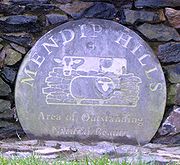
, which is quarried at several sites. The higher, western part of the hills has been designated an Area of Outstanding Natural Beauty
(AONB), which gives it a level of protection comparable to a national park
. The AONB is . The Mendip Hills AONB and Somerset County Council's outdoor education centre is at the Charterhouse
Centre near Blagdon
.
A wide range of outdoor sports and leisure activities take place in the Mendips, many based on the particular geology
of the area. The hills are recognised as a national centre for caving
and cave diving
, as well as being popular with climbers, hillwalkers and natural historians.
term "Myne-deepes". However, others suggest it derives from Celtic monith, meaning mountain or hill, with an uncertain second element, perhaps Old English yppe in the sense of upland or plateau.
An alternative explanation is that the name is cognate with Mened (Welsh mynydd), a Brythonic
term for upland moorland. The suffix may be a contraction of the Old English hop, meaning a valley. Possible further meanings have been identified. The first is 'the stone pit' from the Celtic
meyn and dyppa in reference to the collapsed cave systems of Cheddar
. The second is "Mighty and Awesome" from the Old English moen and deop.
Yet another explanation is that Mendip is cognate with the Basque
word mendi meaning mountain. This would support the theory of a Basque-like language in use in the British isles before the emergence of the Celtic languages. This is supported by DNA evidence that shows genetic links between the British Celtic people and the Basques
.
throughout the late Paleozoic
era, culminating in the final phases of the Variscan orogeny
near the end of the Carboniferous Period, 300 million years ago. This tectonic
activity produced a complex suite of mountain and hill ranges across what is now southern Ireland, south-western England, Brittany
, and elsewhere in western Europe.

 As a result of the Variscan mountain-building, the Mendip area now comprises at least four anticlinal
fold
structures, with an east-west trend, each with a core of older Devonian
sandstone and Silurian
volcanic rocks. The latter are quarried for use in road construction and as a concrete aggregate. The Mendips were considerably higher and steeper 200 to 300 million years ago, since when weathering has resulted in a range of surface features including gorges, dry valleys, scree
s and swallets
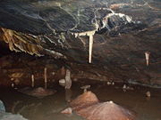
. These are complemented underground by a large number of caves
, including Wookey Hole
, both beneath the plateau and at the base of the southern escarpment
. There are also limestone pavement
s and other karst
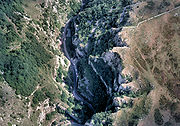
features. Karstic dissolution of the limestone produced many of the gorges including, most famously, Cheddar Gorge and Burrington Combe
. Springs, a number of which deposit tufa
, are a particular feature of the eastern part of the hills.
The Devonian and Silurian rocks are generally more resistant to weathering than the limestone, and form some of the highest points on the hills, including the highest at Beacon Batch
on Black Down
, 325 metres (1068 ft) above sea level. Black Down is a moorland
area, with its steeper slopes covered in bracken
(Pteridium) and its flatter summit
in heather
(Calluna) and grasses rather than the pasture which covers much of the plateau. The main body of the range is an extended plateau, 6–8 km (4–5 miles) wide and generally about 240 metres (800 ft) above sea level.
In some areas the Carboniferous Limestone and the dolomitic
conglomerate
have been mineralised with lead and zinc ores. From the time of Roman Britain
until 1908, the hills were an important source of lead. These areas were the centre of a major mining industry in the past and this is reflected in areas of contaminated rough ground known locally as "gruffy". The word "gruffy" is thought to derive from the grooves that were formed where the lead ore was extracted from veins near the surface. Other commodities obtained included calamine
, manganese
, iron, copper and baryte. The eastern area reaches into parts of the Somerset Coalfield
.
North and east of the Mendips, the same Carboniferous Limestone layers are found in the subsurface and are exposed in Avon Gorge
, but younger strata overlie the Carboniferous limestone in Dundry Hill and the Cotswolds
, where oolitic limestone
of Jurassic
age is found at the surface. West of the main Mendip plateau the Carboniferous limestone continues in Bleadon Hill
and Brean Down
, and on the islands of Steep Holm
and Flat Holm
.
, the Mendip Hills have a temperate climate generally wetter and milder than the rest of England. The annual mean temperature is about 10 °C (50 °F) with seasonal and diurnal
variations, but the modifying effect of the sea, restricts the range to less than that in most other parts of the United Kingdom. January is the coldest month with mean minimum temperatures between 1 °C (34 °F) and 2 °C (36 °F). July and August are the warmest, with mean daily maxima around 21 °C (70 °F). In general, December is the dullest month and June the sunniest. The south-west of England enjoys a favoured location, particularly in summer, when the Azores High
extends its influence north-eastwards towards the UK.
Cumulus cloud
often forms inland, especially near hills, and reduces exposure to sunshine. The average annual sunshine is about 1,600 hours. Rainfall tends to be associated with Atlantic depressions or with convection. In summer, convection caused by solar surface heating sometimes forms shower clouds and a large proportion of the annual precipitation falls from showers and thunderstorms at this time of year. Average rainfall is around 800–900 mm (31–35 in). About 8–15 days of snowfall
is typical. November to March have the highest mean wind speeds, with June to August having the lightest; the prevailing wind direction is from the south-west.
A combination of the rainfall and geology leads to an estimated average daily runoff from springs and boreholes of some 330,000 m3 (72 million imperial gallons). Bristol Waterworks Company (now Bristol Water
) recognised the value of this resource and between 1846 and 1853 created a series of underground tunnels, pipes, and aqueduct
s called the "Line of Works", which still carry approximately 18,200 m3 (4 million imperial gallons) of water a day to Barrow Gurney Reservoirs
for filtration
and then on to Bristol and the surrounding areas. This collection and conveyance of water from the Chewton Mendip
and East
and West Harptree
areas is accomplished by the effect of gravity on the runoff. Water from the Mendips is also collected in Cheddar Reservoir
, which was constructed in the 1930s and takes water from the springs in Cheddar Gorge.
woodland (Fraxinus spp. and Acer spp.) often with abundant small-leaved lime
(Tilia cordata), calcareous grassland
and mesotrophic grassland
.
Much of the Mendips is open calcareous grassland, supporting a wide variety
of flowering plants and insect
s. Parts are deciduous
ancient woodland
and some has been used intensively for arable agriculture, particularly since World War I. As the demand for arable land in Britain declined, some areas were returned to grassland, but the use of fertilisers and herbicides has reduced its biodiversity. Grazing by rabbits (Oryctolagus cuniculus), sheep (Ovis aries) and cattle (Bos taurus) maintains the grassland habitat.
Of the many bird species found in the Mendips the Peregrine Falcon
(Falco peregrinus), which has gradually recolonised the area since the 1980s, is particularly significant. It breeds on sea and inland cliffs and on the faces of active and disused quarries. The upland heaths of the west Mendips have recently increased in ornithological importance, due to colonisation by the Dartford Warbler
(Sylvia undata), which can be found at Black Down
and Crook Peak
. In Britain, this species is usually associated with lowland heath. The woodlands at Stock Hill
are a breeding site for Nightjars
(Caprimulgus europaeus) and Long-eared Owl
s (Asio otus). The Waldegrave Pool, part of Priddy Mineries
, is an important site for dragonflies
, including Downy Emerald
(Cordulia aenea) and Four-spotted Chaser
(Libellula quadrimaculata). Waldegrave Pool is the only Mendip breeding site for Downy Emerald dragonflies. In 2007 the first confirmed sighting of a Red Kite
(Milvus milvus) on the Mendips was made at Charterhouse.
A range of important small mammals are found in the area, including the Hazel Dormouse
(Muscardinus avellanarius) and bats. The hazel dormouse is restricted largely to coppice
woodland and scrub, while the bats, including the nationally rare lesser
(Rhinolophus hipposideros) and Greater Horseshoe Bat
s (Rhinolophus ferrumequinum), have a number of colonies in buildings, caves, and mines in the area. A rare and endangered species, the Greater Horseshoe bat is protected under the Wildlife and Countryside Act 1981
and is listed in Annex II of the 1992 European Community Habitats Directive.
Amphibians such as the Great Crested Newt
(Triturus cristatus) have a wide distribution across the Mendips and are often found in flooded disused quarries.
Several rare butterflies are indigenous to the area, including the nationally scarce Pearl-bordered Fritillary
(Boloria euphrosyne), Duke of Burgandy
(Hamearis lucina), and White-letter Hairstreak
(Satyrium w-album). The Large blue butterfly (Maculinea arion) became extinct in the hills in the late 1970s, since when a research project has been undertaken into its ecology and reintroduction. The White-clawed crayfish
is also nationally rare and is a declining species with small populations in a tributary of the Mells River
and the River Chew
.
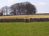
The dry stone walls
that divide the pasture into fields are a well-known feature of the Mendips. Constructed from local limestone in an "A frame" design, the walls are strong yet contain no mortar, although many have been neglected and allowed to disintegrate, replaced or contained by a mix of barbed wire and sheep fencing. These dry-stone walls are of botanical importance, as they support important populations of the nationally scarce Wall Whitlowgrass (Draba muralis). Amongst the plants which occur in the area are the Cheddar pink
(Dianthus), Purple gromwell
(Lithospermum purpurocaeruleum), White rock-rose
(Helianthemum apenninum), Somerset hair-grass (Koeleria vallesiana), and Starved Wood-sedge
(Carex depauperata).
 Twenty Palaeolithic
sites have been identified in the Mendips, of which eleven represent faunal remains and lithic
artefacts recovered from caves. The remaining eight sites refer to surface lithic discoveries, and the artefacts found include points, scrapers, and handaxes. Twenty-seven Mesolithic
finds are represented by flint and chert lithics. Large numbers of artefacts have been found near Neolithic
, Iron Age
, and Bronze Age
features, such as the barrows
and forts around Priddy
and at Dolebury Warren
. The caves of Cheddar Gorge have yielded many archaeological remains, as flood waters have washed artefacts and bones into the caves and preserved them in silt. The Cheddar Man
, Britain's oldest complete skeleton, was found in Gough's Cave
, part of the Cheddar Complex
.
Within the Mendip Hills AONB, good evidence exists for 286 definite examples of round barrows. The National Monuments Record (NMR) holds over 1,200 entries for the area, and there are over 600 listed buildings, in addition to over 200 scheduled ancient monuments. These protected monuments range from prehistoric barrows and hillforts to the Black Down bombing decoy from the Second World War.
Settlement on the Mendip Hills appears to fall into two types. The first, apparent in the Neolithic and Bronze Age periods, and repeated on a small scale in the medieval
and post-medieval era, comprised occupation by self-sufficient groups in small communities or isolated farms. The second was represented in the Iron Age and Roman
periods by large sites with specialist functions, existing by virtue of their ability to exert power over lowland producers. From the Iron Age onward the ownership of land took on increasing importance, with large landholdings based on the mines or on stock grazing, denying settlers access to the plateau or forcing them off the hills.
There is evidence of mining dating back to the late Bronze Age, when there were technological changes in metal-working indicating the use of lead. The Roman invasion, and possibly the preceding period of involvement in the internal affairs of the south of England, was inspired, in part, by the mineral wealth of the Mendips. Much of the attraction of the lead mines may have been the potential for the extraction of silver
;
the Latin "EX ARG VEB" stamps on the Mendip lead pigs specify a de-silvering process and cast silver ingots have been found. The silver coin
age of the Dobunni
and Durotriges
is also likely to reflect the availability of silver from the mines.
By the end of the medieval period a complex body of customary law had come into existence dealing with the four "Mendip mineries". That the medieval control was in the hands of the monastic
foundations may indicate some continuity of tenure of large scale holdings, focused on the mines, from the Roman period.
William Wilberforce
's visit to Cheddar in 1789, during which he saw the poor circumstances of the locals, inspired Hannah More
to begin her work improving the conditions of the Mendip miners and agricultural workers. Under her influence, schools were built and children were formally instructed in reading and Christian doctrine. Between 1770 and 1813 some of land on the hills were enclosed, mainly with dry stone walls
that today form a key part of the landscape. In 2006 funding was obtained to maintain and improve the walls, which had steadily deteriorated over the years.
 Over 300 "Mendip Motor Cars" were built by an engineering works based in Chewton Mendip
in the years immediately before and after World War I.
In World War II a bombing decoy was constructed on top of Black Down at Beacon Batch
in an attempt to confuse bombers aiming to damage the city of Bristol, and piles of stones (known as cairn
s) were created to prevent enemy aircraft using the hilltop as a landing site.
In the 1960s, the tallest mast in the region at 293 metres (961.3 ft) above ground level, the Mendip UHF television transmitter, was installed on Pen Hill
near Wells
, one of the highest points of the Mendips. The transmitter's antenna rises to almost 589 metres (1,932 ft) above sea level. Since 2003, arguments have raged over plans to erect a wind turbine
near Chewton Mendip. The proposal was initially rejected by Mendip District Council, which enjoyed the support of a range of local groups and organisations, on the grounds that the environmental impact on the edge of the AONB outweighed the nominal amount of electricity which would be generated. In April 2006, however, a planning enquiry gave Ecotricity
permission to build a 102 m (335 ft) turbine during the following year.
The Mendip Power Group
are installing micro-hydroelectric turbines
in a number of historic former watermill
s. The first to start electricity generation
was Tellisford Mill
, on the River Frome
, which began operating in 2006 and produces 50–55kW
. Other mills in the Group, together with initial assessments of their capacity, include: Stowford Mill (37 kW) and Shawford Mill (31 kW), Jackdaws Iron Works (10 kW), Glencot House (5.8 kW), Burcott Mill (5.2 kW), Bleadney Mill (5.4 kW), Coleford Mill (6.6 kW), Old Mill (5.2 kW) and Farrants Mill (9.9 kW).
 The western end of the Mendip Hills has, since 1972, been designated an Area of Outstanding Natural Beauty
(AONB) under the National Parks and Access to the Countryside Act 1949
. The Mendip Society, which was formed in 1965, helps to raise awareness of this designation and protect the area. The society now has 700 members and runs a programme of guided walks and educational presentations. The society also has a small grants fund to assist communities with the conservation and enhancement of the landscape and to encourage its enjoyment and celebration.
As their landscapes have similar scenic qualities, AONBs may be compared to the national parks of England and Wales
. AONBs are created under the same legislation as the national park
s, the National Parks and Access to the Countryside Act 1949. Unlike AONBs, national parks have their own authorities and have legal power to prevent unsympathetic development. By contrast, there are very limited statutory duties imposed on local authorities within an AONB. However, further regulation and protection of AONBs was added by the Countryside and Rights of Way Act 2000
.
In 2009 proposals were being prepared by the Mendip AONB in an attempt to get the Mendips designated as a Geopark
which is defined by the United Nations Educational, Scientific and Cultural Organization
(UNESCO) in its UNESCO Geoparks International Network of Geoparks programme as A territory encompassing one or more sites of scientific importance, not only for geological reasons but also by virtue of its archaeological, ecological or cultural value.
The Mendip Hills Partnership, which performs an administrative role, includes the five local authorities that cover the AONB, statutory bodies such as the Countryside Agency
and English Nature
, together with parish councils and other organisations and groups that have an interest in the conservation and care of the area. The Mendip Hills AONB staff unit of the partnership is based at the Charterhouse
Centre in the heart of the AONB. The AONB Unit consists of 4 staff, a manager, project officer, support officer and part time planning officer. They are supported by 20 volunteer rangers.
In 2005 a proposal was submitted to the Countryside Agency
to extend the Area of Outstanding Natural Beauty to Steep Holm
and Brean Down
in the west and towards Frome
in the east.
Many of the villages on the Mendips have their own parish councils, which have some responsibility for local issues. Local people also elect councillors to district councils or to unitary authorities. The 198 sqkm of the AONB are split across four districts: Mendip District Council
87.67 sqkm,
Sedgemoor District Council
34.03 sqkm,
Bath and North East Somerset Council
36.95 sqkm, and
North Somerset Council
39.35 sqkm.
Each of the villages is also part of a parliamentary constituency: Wells
, Weston-super-Mare
or North East Somerset
. The area is also part of the South West England European Parliament constituency
. Avon and Somerset Constabulary
provides police services to the area.
which had a population of 598 people at the time of the 2001 census
along with the smaller hamlet of Charterhouse
. The larger villages and towns are on the lower slopes of the western hills, often in river valleys. Axbridge
with a population of 2,024, Cheddar (population 5,724), which are both within the Sedgemoor
district and the Mendip town of Shepton Mallet
(9,700) and the city of Wells
(10,406) are along the southern border of the hills. The North Somerset
parishes of Blagdon
(1,172) and the parishes of Compton Martin
(508), and East Harptree
(608) and West Harptree
(459) lie along the northern edge.
Further east are the towns of Midsomer Norton
and Radstock
and the village of Paulton
(population 4,896) within the unitary authority
of Bath and North East Somerset.
 In the middle of the 1st century, ancient tracks across the hills were superseded by the Roman Fosse Way
, from Bath to Ilchester
, a branch of which served the Charterhouse
lead mines. Stratton-on-the-Fosse
and Lydford-on-Fosse
, two villages of the Mendips, reflect the arrival of this new road. Much of the high plateau, however, remained uncultivated and unenclosed until the 18th century, resulting in many roads remaining as narrow winding lanes between high banks and hedges or stone walls. Where the tracks had their origins as drovers roads, they typically become open roads with wide verges. The roads tend to follow the line of gorges and valleys, as at Cheddar Gorge.
The more major of the current roads often started as turnpikes
in the 16th century. These avoid the highest areas of the hills. To the north of the western part of the Mendips, the A368
separates the hills from the Chew Valley
, while on the southern edge the A371
similarly runs along the bottom of the scarp slope between the hills and the Somerset Levels
. The western end of the hills is crossed by the M5 motorway
and A38
. Further east, and running almost north to south, are the A37
and A39
.
During the late 19th and early 20th century, the Bristol and North Somerset Railway
ran roughly parallel to the A37. Further south and west, the Cheddar Valley Line
and Wrington Vale Light Railway
, branches of the Bristol and Exeter Railway
, served towns and villages from Cheddar
to Wells
. In the east, the Somerset and Dorset Joint Railway
ran south from Bath into Dorset
, and also served Wells
. These have all now closed, although Mendip Rail
has freight lines to carry limestone from the quarries of the Mendip Hills
. The Somerset Coal Canal
reached some of the pits of the Somerset Coalfield
in the eastern end of the Mendips.
 In recent centuries the Mendips, like the Cotswolds
to the north, have been quarried for stone to build the cities of Bath and Bristol, as well as smaller towns in Somerset. The quarries are now major suppliers of road stone to southern England, among them producing around twelve million tonnes of limestone every year, employing over two thousand people, and turning over approximately £150 million per annum.
 There are two main rock types on the Mendips: the Devonian
sandstones visible around Blackdown
and Downhead
and the carboniferous limestones, which dominate the hills and surround the older rock formations. There are nine active quarries and a host of disused sites, several of which have been designated as geological Sites of Special Scientific Interest
by English Nature
. Because of the effect quarrying has on the environment and local communities, a campaign has been started to halt the creation of any new quarries and to restrict the activities and expansion of the existing ones.
, caving, climbing, and abseiling
. The rich variety of fauna and flora also makes it attractive for hillwalking and those interested in natural history.
 Large areas of limestone on the Mendips have been worn away by water, making the hills a national centre for caving. Some of the caves have been known about since the establishment of the Mendip lead mining industry in Roman times. However, many have been discovered or explored only in the 20th century. Specialist equipment and knowledge is required to visit the vast majority of the caves, but Cheddar Gorge and Wookey Hole Caves are two caves which are easily accessible to the public. The active Mendip Caving Group and other local caving organisations organise trips and continue to discover new caverns.
The Hills conceal the largest underground river system in Britain; attempts to move from one cave to another through the underground rivers led to the development of cave diving
in Britain. The first cave dive was attempted at Swildon's Hole
in 1934, and the first successful dive was achieved the following year at Wookey Hole Caves, which has the deepest sump
in Britain at 76 m (250 ft). The cave complexes at St. Dunstan's Well Catchment
, Lamb Leer
, and Priddy Caves
have been identified as Sites of Special Scientific Interest
.
The deepest cave in the Mendip Hills is Charterhouse Cave
with a vertical range of 220 m (722 ft).
Many caves in the Mendip area were expertly photographed by caver Harry Savory early in the 20th century using huge cameras
, glass plates
and flash powder
.
 Several sites on the Mendips are designated as open access land
, and there are many footpaths
and bridleways, which are generally clearly marked.
The Limestone Link
is a 36 miles (58 km) long-distance footpath
from the Mendips to the Cotswolds
and the Mendip Way
covers 80 km (49.7 mi) from Weston-super-Mare
to Frome
. The western section runs from the Bristol Channel
at Uphill Cliff
, affording views over the Somerset Levels, crosses the central Mendip plateau leading down to Cheddar Gorge, and then continues to Wells and Frome. The much longer Monarch's Way
runs for 990 km (615.2 mi), from Worcester
to Shoreham-by-Sea
in West Sussex
. It closely follows the route taken by Charles II
after his defeat at the Battle of Worcester
in 1651. The route enters Somerset near Chewton Mendip and crosses the Mendip Hills heading for Wells. A shorter local path, the 45 miles (72 km) long Mendip Pub Trail, connects six pubs owned by Butcombe Brewery. The trail runs from Hinton Blewett through Priddy
, Axbridge
, Bleadon
, Rowberrow
, and Compton Martin
.
described the Mendips as "a range of limestone rocks stretching from the shores of the Bristol Channel into the middle of Somersetshire", and several of his books refer to the Mendips or sites on the hills. According to legend, Augustus Montague Toplady was inspired to write the words of the hymn "Rock of Ages" while sheltering under a rock in Burrington Combe
during a thunderstorm
in 1763; there is a metal plaque marking the site.
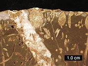
Limestone
Limestone is a sedimentary rock composed largely of the minerals calcite and aragonite, which are different crystal forms of calcium carbonate . Many limestones are composed from skeletal fragments of marine organisms such as coral or foraminifera....
hills to the south of Bristol
Bristol
Bristol is a city, unitary authority area and ceremonial county in South West England, with an estimated population of 433,100 for the unitary authority in 2009, and a surrounding Larger Urban Zone with an estimated 1,070,000 residents in 2007...
and Bath in Somerset
Somerset
The ceremonial and non-metropolitan county of Somerset in South West England borders Bristol and Gloucestershire to the north, Wiltshire to the east, Dorset to the south-east, and Devon to the south-west. It is partly bounded to the north and west by the Bristol Channel and the estuary of the...
, England. Running east to west between Weston-super-Mare
Weston-super-Mare
Weston-super-Mare is a seaside resort, town and civil parish in the unitary authority of North Somerset, which is within the ceremonial county of Somerset, England. It is located on the Bristol Channel coast, south west of Bristol, spanning the coast between the bounding high ground of Worlebury...
and Frome
Frome
Frome is a town and civil parish in northeast Somerset, England. Located at the eastern end of the Mendip Hills, the town is built on uneven high ground, and centres around the River Frome. The town is approximately south of Bath, east of the county town, Taunton and west of London. In the 2001...
, the hills overlook the Somerset Levels
Somerset Levels
The Somerset Levels, or the Somerset Levels and Moors as they are less commonly but more correctly known, is a sparsely populated coastal plain and wetland area of central Somerset, South West England, between the Quantock and Mendip Hills...
to the south and the Avon Valley to the north. The hills give their name to the local government district of Mendip
Mendip
Mendip is a local government district of Somerset in England. The Mendip district covers a largely rural area of ranging from the Mendip Hills through on to the Somerset Levels. It has a population of approximately 110,000...
, which administers most of the area.
The hills are largely formed from Carboniferous limestone
Carboniferous limestone
Carboniferous Limestone is a term used to describe a variety of different types of limestone occurring widely across Great Britain and Ireland which were deposited during the Dinantian epoch of the Carboniferous period. They were formed between 363 and 325 million years ago...
, which is quarried at several sites. The higher, western part of the hills has been designated an Area of Outstanding Natural Beauty
Area of Outstanding Natural Beauty
An Area of Outstanding Natural Beauty is an area of countryside considered to have significant landscape value in England, Wales or Northern Ireland, that has been specially designated by the Countryside Agency on behalf of the United Kingdom government; the Countryside Council for Wales on...
(AONB), which gives it a level of protection comparable to a national park
National park
A national park is a reserve of natural, semi-natural, or developed land that a sovereign state declares or owns. Although individual nations designate their own national parks differently A national park is a reserve of natural, semi-natural, or developed land that a sovereign state declares or...
. The AONB is . The Mendip Hills AONB and Somerset County Council's outdoor education centre is at the Charterhouse
Charterhouse, Somerset
Charterhouse, also known as Charterhouse-on-Mendip, is a hamlet in the Mendip Hills Area of Outstanding Natural Beauty in the English county of Somerset...
Centre near Blagdon
Blagdon
Blagdon is a village and civil parish in the ceremonial county of Somerset, within the unitary authority of North Somerset, in England. It is located in the Mendip Hills, a recognised Area of Outstanding Natural Beauty. According to the 2001 census it has a population of 1,172...
.
A wide range of outdoor sports and leisure activities take place in the Mendips, many based on the particular geology
Geology
Geology is the science comprising the study of solid Earth, the rocks of which it is composed, and the processes by which it evolves. Geology gives insight into the history of the Earth, as it provides the primary evidence for plate tectonics, the evolutionary history of life, and past climates...
of the area. The hills are recognised as a national centre for caving
Caving
Caving—also occasionally known as spelunking in the United States and potholing in the United Kingdom—is the recreational pastime of exploring wild cave systems...
and cave diving
Cave diving
Cave diving is a type of technical diving in which specialized equipment is used to enable the exploration of caves which are at least partially filled with water. In the United Kingdom it is an extension of the more common sport of caving, and in the United States an extension of the more common...
, as well as being popular with climbers, hillwalkers and natural historians.
Toponymy
Several explanations for the name "Mendip" have been suggested. Its earliest known form is Mendepe in 1185. One suggestion is that it is derived from the medievalMiddle Ages
The Middle Ages is a periodization of European history from the 5th century to the 15th century. The Middle Ages follows the fall of the Western Roman Empire in 476 and precedes the Early Modern Era. It is the middle period of a three-period division of Western history: Classic, Medieval and Modern...
term "Myne-deepes". However, others suggest it derives from Celtic monith, meaning mountain or hill, with an uncertain second element, perhaps Old English yppe in the sense of upland or plateau.
An alternative explanation is that the name is cognate with Mened (Welsh mynydd), a Brythonic
British language
The British language was an ancient Celtic language spoken in Britain.British language may also refer to:* Any of the Languages of the United Kingdom.*The Welsh language or the Brythonic languages more generally* British English...
term for upland moorland. The suffix may be a contraction of the Old English hop, meaning a valley. Possible further meanings have been identified. The first is 'the stone pit' from the Celtic
Celtic languages
The Celtic languages are descended from Proto-Celtic, or "Common Celtic"; a branch of the greater Indo-European language family...
meyn and dyppa in reference to the collapsed cave systems of Cheddar
Cheddar
Cheddar is a large village and civil parish in the Sedgemoor district of the English county of Somerset. It is situated on the southern edge of the Mendip Hills, north-west of Wells. The civil parish includes the hamlets of Nyland and Bradley Cross...
. The second is "Mighty and Awesome" from the Old English moen and deop.
Yet another explanation is that Mendip is cognate with the Basque
Basque language
Basque is the ancestral language of the Basque people, who inhabit the Basque Country, a region spanning an area in northeastern Spain and southwestern France. It is spoken by 25.7% of Basques in all territories...
word mendi meaning mountain. This would support the theory of a Basque-like language in use in the British isles before the emergence of the Celtic languages. This is supported by DNA evidence that shows genetic links between the British Celtic people and the Basques
Basque people
The Basques as an ethnic group, primarily inhabit an area traditionally known as the Basque Country , a region that is located around the western end of the Pyrenees on the coast of the Bay of Biscay and straddles parts of north-central Spain and south-western France.The Basques are known in the...
.
Geology
The Mendip Hills are the most southerly Carboniferous Limestone upland in Britain. The rock strata known as the Carboniferous Limestone were laid down during the Early Carboniferous Period, about 320–350 million years ago. Subsequently, much of northwestern Europe underwent continental collisionContinental collision
Continental collision is a phenomenon of the plate tectonics of Earth that occurs at convergent boundaries. Continental collision is a variation on the fundamental process of subduction, whereby the subduction zone is destroyed, mountains produced, and two continents sutured together...
throughout the late Paleozoic
Paleozoic
The Paleozoic era is the earliest of three geologic eras of the Phanerozoic eon, spanning from roughly...
era, culminating in the final phases of the Variscan orogeny
Variscan orogeny
The Variscan orogeny is a geologic mountain-building event caused by Late Paleozoic continental collision between Euramerica and Gondwana to form the supercontinent of Pangaea.-Naming:...
near the end of the Carboniferous Period, 300 million years ago. This tectonic
Tectonics
Tectonics is a field of study within geology concerned generally with the structures within the lithosphere of the Earth and particularly with the forces and movements that have operated in a region to create these structures.Tectonics is concerned with the orogenies and tectonic development of...
activity produced a complex suite of mountain and hill ranges across what is now southern Ireland, south-western England, Brittany
Brittany
Brittany is a cultural and administrative region in the north-west of France. Previously a kingdom and then a duchy, Brittany was united to the Kingdom of France in 1532 as a province. Brittany has also been referred to as Less, Lesser or Little Britain...
, and elsewhere in western Europe.
Anticline
In structural geology, an anticline is a fold that is convex up and has its oldest beds at its core. The term is not to be confused with antiform, which is a purely descriptive term for any fold that is convex up. Therefore if age relationships In structural geology, an anticline is a fold that is...
fold
Fold (geology)
The term fold is used in geology when one or a stack of originally flat and planar surfaces, such as sedimentary strata, are bent or curved as a result of permanent deformation. Synsedimentary folds are those due to slumping of sedimentary material before it is lithified. Folds in rocks vary in...
structures, with an east-west trend, each with a core of older Devonian
Devonian
The Devonian is a geologic period and system of the Paleozoic Era spanning from the end of the Silurian Period, about 416.0 ± 2.8 Mya , to the beginning of the Carboniferous Period, about 359.2 ± 2.5 Mya...
sandstone and Silurian
Silurian
The Silurian is a geologic period and system that extends from the end of the Ordovician Period, about 443.7 ± 1.5 Mya , to the beginning of the Devonian Period, about 416.0 ± 2.8 Mya . As with other geologic periods, the rock beds that define the period's start and end are well identified, but the...
volcanic rocks. The latter are quarried for use in road construction and as a concrete aggregate. The Mendips were considerably higher and steeper 200 to 300 million years ago, since when weathering has resulted in a range of surface features including gorges, dry valleys, scree
Scree
Scree, also called talus, is a term given to an accumulation of broken rock fragments at the base of crags, mountain cliffs, or valley shoulders. Landforms associated with these materials are sometimes called scree slopes or talus piles...
s and swallets
Sinkhole
A sinkhole, also known as a sink, shake hole, swallow hole, swallet, doline or cenote, is a natural depression or hole in the Earth's surface caused by karst processes — the chemical dissolution of carbonate rocks or suffosion processes for example in sandstone...
. These are complemented underground by a large number of caves
Caves of the Mendip Hills
The Caves of the Mendip Hills are formed by the particular geology of the Mendip Hills, with large areas of limestone worn away by water makes it a national centre for caving. The hills conceal the largest underground river system in Britain.- Geology :...
, including Wookey Hole
Wookey Hole
Wookey Hole Caves is a show cave and tourist attraction in the village of Wookey Hole on the southern edge of the Mendip Hills near Wells in Somerset, England.Wookey Hole cave was formed through erosion of the limestone hills by the River Axe...
, both beneath the plateau and at the base of the southern escarpment
Escarpment
An escarpment is a steep slope or long cliff that occurs from erosion or faulting and separates two relatively level areas of differing elevations.-Description and variants:...
. There are also limestone pavement
Limestone pavement
A limestone pavement is a natural karst landform consisting of a flat, incised surface of exposed limestone that resembles an artificial pavement. The term is mainly used in the UK where many of these landforms have developed distinctive surface patterning resembling block of paving...
s and other karst
KARST
Kilometer-square Area Radio Synthesis Telescope is a Chinese telescope project to which FAST is a forerunner. KARST is a set of large spherical reflectors on karst landforms, which are bowlshaped limestone sinkholes named after the Kras region in Slovenia and Northern Italy. It will consist of...
features. Karstic dissolution of the limestone produced many of the gorges including, most famously, Cheddar Gorge and Burrington Combe
Burrington Combe
Burrington Combe is a carboniferous limestone gorge near the village of Burrington, on the north side of the Mendip Hills Area of Outstanding Natural Beauty, in North Somerset, England....
. Springs, a number of which deposit tufa
Tufa
Tufa is a variety of limestone, formed by the precipitation of carbonate minerals from ambient temperature water bodies. Geothermally heated hot-springs sometimes produce similar carbonate deposits known as travertine...
, are a particular feature of the eastern part of the hills.
The Devonian and Silurian rocks are generally more resistant to weathering than the limestone, and form some of the highest points on the hills, including the highest at Beacon Batch
Black Down, Somerset
Black Down is the highest hill in the Mendip Hills, Somerset, in south-western England. Black Down lies just a few miles eastward of the Bristol Channel at Weston-super-Mare, and provides a view over the Chew Valley...
on Black Down
Black Down, Somerset
Black Down is the highest hill in the Mendip Hills, Somerset, in south-western England. Black Down lies just a few miles eastward of the Bristol Channel at Weston-super-Mare, and provides a view over the Chew Valley...
, 325 metres (1068 ft) above sea level. Black Down is a moorland
Moorland
Moorland or moor is a type of habitat, in the temperate grasslands, savannas, and shrublands biome, found in upland areas, characterised by low-growing vegetation on acidic soils and heavy fog...
area, with its steeper slopes covered in bracken
Bracken
Bracken are several species of large, coarse ferns of the genus Pteridium. Ferns are vascular plants that have alternating generations, large plants that produce spores and small plants that produce sex cells . Brackens are in the family Dennstaedtiaceae, which are noted for their large, highly...
(Pteridium) and its flatter summit
Summit (topography)
In topography, a summit is a point on a surface that is higher in elevation than all points immediately adjacent to it. Mathematically, a summit is a local maximum in elevation...
in heather
Calluna
Calluna vulgaris is the sole species in the genus Calluna in the family Ericaceae. It is a low-growing perennial shrub growing to tall, or rarely to and taller, and is found widely in Europe and Asia Minor on acidic soils in open sunny situations and in moderate shade...
(Calluna) and grasses rather than the pasture which covers much of the plateau. The main body of the range is an extended plateau, 6–8 km (4–5 miles) wide and generally about 240 metres (800 ft) above sea level.
In some areas the Carboniferous Limestone and the dolomitic
Dolomite
Dolomite is a carbonate mineral composed of calcium magnesium carbonate CaMg2. The term is also used to describe the sedimentary carbonate rock dolostone....
conglomerate
Conglomerate (geology)
A conglomerate is a rock consisting of individual clasts within a finer-grained matrix that have become cemented together. Conglomerates are sedimentary rocks consisting of rounded fragments and are thus differentiated from breccias, which consist of angular clasts...
have been mineralised with lead and zinc ores. From the time of Roman Britain
Roman Britain
Roman Britain was the part of the island of Great Britain controlled by the Roman Empire from AD 43 until ca. AD 410.The Romans referred to the imperial province as Britannia, which eventually comprised all of the island of Great Britain south of the fluid frontier with Caledonia...
until 1908, the hills were an important source of lead. These areas were the centre of a major mining industry in the past and this is reflected in areas of contaminated rough ground known locally as "gruffy". The word "gruffy" is thought to derive from the grooves that were formed where the lead ore was extracted from veins near the surface. Other commodities obtained included calamine
Calamine (mineral)
Calamine is a historic name for an ore of zinc. The name calamine was derived from the Belgian town of Kelmis, whose French name is "La Calamine", which is home to a zinc mine...
, manganese
Manganese
Manganese is a chemical element, designated by the symbol Mn. It has the atomic number 25. It is found as a free element in nature , and in many minerals...
, iron, copper and baryte. The eastern area reaches into parts of the Somerset Coalfield
Somerset coalfield
The Somerset Coalfield included pits in the North Somerset, England, area where coal was mined from the 15th century until 1973.It is part of a wider coalfield which covered northern Somerset and southern Gloucestershire. It stretched from Cromhall in the north to the Mendip Hills in the south, and...
.
North and east of the Mendips, the same Carboniferous Limestone layers are found in the subsurface and are exposed in Avon Gorge
Avon Gorge
The Avon Gorge is a 1.5-mile long gorge on the River Avon in Bristol, England. The gorge runs south to north through a limestone ridge west of Bristol city centre, and about 3 miles from the mouth of the river at Avonmouth. The gorge forms the boundary between the unitary authorities of...
, but younger strata overlie the Carboniferous limestone in Dundry Hill and the Cotswolds
Cotswolds
The Cotswolds are a range of hills in west-central England, sometimes called the Heart of England, an area across and long. The area has been designated as the Cotswold Area of Outstanding Natural Beauty...
, where oolitic limestone
Oolite
Oolite is a sedimentary rock formed from ooids, spherical grains composed of concentric layers. The name derives from the Hellenic word òoion for egg. Strictly, oolites consist of ooids of diameter 0.25–2 mm; rocks composed of ooids larger than 2 mm are called pisolites...
of Jurassic
Jurassic
The Jurassic is a geologic period and system that extends from about Mya to Mya, that is, from the end of the Triassic to the beginning of the Cretaceous. The Jurassic constitutes the middle period of the Mesozoic era, also known as the age of reptiles. The start of the period is marked by...
age is found at the surface. West of the main Mendip plateau the Carboniferous limestone continues in Bleadon Hill
Bleadon Hill
Bleadon Hill is a 13.52 hectare geological Site of Special Scientific Interest just north of the village of Bleadon, North Somerset, notified in 1999....
and Brean Down
Brean Down
Brean Down is a promontory off the coast of Somerset standing high and extending into the Bristol Channel at the eastern end of Bridgwater Bay between Weston-super-Mare and Burnham-on-Sea....
, and on the islands of Steep Holm
Steep Holm
Steep Holm is an English island lying in the Bristol Channel. The island covers at high tide, expanding to at mean low water. At its highest point it is above mean sea level. It lies within the historic boundaries of Somerset and administratively, it forms part of North Somerset...
and Flat Holm
Flat Holm
Flat Holm is a limestone island lying in the Bristol Channel approximately from Lavernock Point in the Vale of Glamorgan, but in the City and County of Cardiff. It includes the most southerly point of Wales....
.
Climate
Along with the rest of South West EnglandClimate of south-west England
The climate of south-west England is classed as oceanic according to the Köppen climate classification. The oceanic climate is typified by cool winters with warmer summers and precipitation all year round, with more experienced in winter. Annual rainfall is about and up to on higher ground...
, the Mendip Hills have a temperate climate generally wetter and milder than the rest of England. The annual mean temperature is about 10 °C (50 °F) with seasonal and diurnal
Diurnal motion
Diurnal motion is an astronomical term referring to the apparent daily motion of stars around the Earth, or more precisely around the two celestial poles. It is caused by the Earth's rotation on its axis, so every star apparently moves on a circle, that is called the diurnal circle. The time for...
variations, but the modifying effect of the sea, restricts the range to less than that in most other parts of the United Kingdom. January is the coldest month with mean minimum temperatures between 1 °C (34 °F) and 2 °C (36 °F). July and August are the warmest, with mean daily maxima around 21 °C (70 °F). In general, December is the dullest month and June the sunniest. The south-west of England enjoys a favoured location, particularly in summer, when the Azores High
Azores High
The Azores High is a large subtropical semi-permanent centre of high atmospheric pressure found near the Azores in the Atlantic Ocean, at the Horse latitudes...
extends its influence north-eastwards towards the UK.
Cumulus cloud
Cumulus cloud
Cumulus clouds are a type of cloud with noticeable vertical development and clearly defined edges. Cumulus means "heap" or "pile" in Latin. They are often described as "puffy" or "cotton-like" in appearance. Cumulus clouds may appear alone, in lines, or in clusters...
often forms inland, especially near hills, and reduces exposure to sunshine. The average annual sunshine is about 1,600 hours. Rainfall tends to be associated with Atlantic depressions or with convection. In summer, convection caused by solar surface heating sometimes forms shower clouds and a large proportion of the annual precipitation falls from showers and thunderstorms at this time of year. Average rainfall is around 800–900 mm (31–35 in). About 8–15 days of snowfall
Snow
Snow is a form of precipitation within the Earth's atmosphere in the form of crystalline water ice, consisting of a multitude of snowflakes that fall from clouds. Since snow is composed of small ice particles, it is a granular material. It has an open and therefore soft structure, unless packed by...
is typical. November to March have the highest mean wind speeds, with June to August having the lightest; the prevailing wind direction is from the south-west.
A combination of the rainfall and geology leads to an estimated average daily runoff from springs and boreholes of some 330,000 m3 (72 million imperial gallons). Bristol Waterworks Company (now Bristol Water
Bristol Water
Bristol Water supplies 300 million litres of drinking water to over 1 million customers in a area centred on Bristol, England. It is regulated under the Water Industry Act 1991...
) recognised the value of this resource and between 1846 and 1853 created a series of underground tunnels, pipes, and aqueduct
Aqueduct
An aqueduct is a water supply or navigable channel constructed to convey water. In modern engineering, the term is used for any system of pipes, ditches, canals, tunnels, and other structures used for this purpose....
s called the "Line of Works", which still carry approximately 18,200 m3 (4 million imperial gallons) of water a day to Barrow Gurney Reservoirs
Barrow Gurney Reservoirs
Barrow Gurney Reservoirs are three artificial reservoirs for drinking water near the village of Barrow Gurney, which lies southwest of Bristol, England. They are known by their numbers rather than names....
for filtration
Filtration
Filtration is commonly the mechanical or physical operation which is used for the separation of solids from fluids by interposing a medium through which only the fluid can pass...
and then on to Bristol and the surrounding areas. This collection and conveyance of water from the Chewton Mendip
Chewton Mendip
Chewton Mendip is a village and civil parish in the Mendip District of Somerset, England. It is situated north of Wells, south of Bristol on the Mendip Hills and is the source of the River Chew. The parish includes the hamlet of Bathway.- History :...
and East
East Harptree
East Harptree is a village and civil parish in Somerset, England. It is situated north of Wells and south of Bristol, on the northern slope of the Mendip Hills overlooking the Chew Valley. The parish has a population of 680...
and West Harptree
West Harptree
West Harptree is a small village and civil parish within the Chew Valley, Somerset in the unitary district of Bath and North East Somerset. The parish has a population of 459....
areas is accomplished by the effect of gravity on the runoff. Water from the Mendips is also collected in Cheddar Reservoir
Cheddar Reservoir
Cheddar Reservoir is an artificial reservoir in Somerset, England, operated by Bristol Water. Dating from the 1930s it has a capacity of 135 million gallons . The reservoir is supplied with water taken from the Cheddar Yeo river in Cheddar Gorge...
, which was constructed in the 1930s and takes water from the springs in Cheddar Gorge.
Ecology
Three nationally important semi-natural habitats are characteristic of the area: ash–mapleMaple
Acer is a genus of trees or shrubs commonly known as maple.Maples are variously classified in a family of their own, the Aceraceae, or together with the Hippocastanaceae included in the family Sapindaceae. Modern classifications, including the Angiosperm Phylogeny Group system, favour inclusion in...
woodland (Fraxinus spp. and Acer spp.) often with abundant small-leaved lime
Tilia cordata
Tilia cordata is a species of Tilia native to much of Europe and western Asia, north to southern Great Britain , central Scandinavia, east to central Russia, and south to central Spain, Italy, Bulgaria, Turkey, and the Caucasus; in the south of its range it is restricted to...
(Tilia cordata), calcareous grassland
Calcareous grassland
Calcareous grassland is an ecosystem associated with thin basic soil, such as that on chalk and limestone downland. Plants on calcareous grassland are typically short and hardy, and include grasses and herbs such as clover...
and mesotrophic grassland
Mesotrophic grasslands in the British National Vegetation Classification system
This article gives an overview of the mesotrophic grassland communities in the British National Vegetation Classification system.-Introduction:The mesotrophic grassland communities of the NVC were described in Volume 3 of British Plant Communities, first published in 1992, along with the...
.
Much of the Mendips is open calcareous grassland, supporting a wide variety
Biodiversity
Biodiversity is the degree of variation of life forms within a given ecosystem, biome, or an entire planet. Biodiversity is a measure of the health of ecosystems. Biodiversity is in part a function of climate. In terrestrial habitats, tropical regions are typically rich whereas polar regions...
of flowering plants and insect
Insect
Insects are a class of living creatures within the arthropods that have a chitinous exoskeleton, a three-part body , three pairs of jointed legs, compound eyes, and two antennae...
s. Parts are deciduous
Deciduous
Deciduous means "falling off at maturity" or "tending to fall off", and is typically used in reference to trees or shrubs that lose their leaves seasonally, and to the shedding of other plant structures such as petals after flowering or fruit when ripe...
ancient woodland
Ancient woodland
Ancient woodland is a term used in the United Kingdom to refer specifically to woodland that has existed continuously since 1600 or before in England and Wales . Before those dates, planting of new woodland was uncommon, so a wood present in 1600 was likely to have developed naturally...
and some has been used intensively for arable agriculture, particularly since World War I. As the demand for arable land in Britain declined, some areas were returned to grassland, but the use of fertilisers and herbicides has reduced its biodiversity. Grazing by rabbits (Oryctolagus cuniculus), sheep (Ovis aries) and cattle (Bos taurus) maintains the grassland habitat.
Of the many bird species found in the Mendips the Peregrine Falcon
Peregrine Falcon
The Peregrine Falcon , also known as the Peregrine, and historically as the Duck Hawk in North America, is a widespread bird of prey in the family Falconidae. A large, crow-sized falcon, it has a blue-gray back, barred white underparts, and a black head and "moustache"...
(Falco peregrinus), which has gradually recolonised the area since the 1980s, is particularly significant. It breeds on sea and inland cliffs and on the faces of active and disused quarries. The upland heaths of the west Mendips have recently increased in ornithological importance, due to colonisation by the Dartford Warbler
Dartford Warbler
The Dartford Warbler, Sylvia undata, is a typical warbler from the warmer parts of western Europe, and northwestern Africa. Its breeding range lies west of a line from southern England to the heel of Italy...
(Sylvia undata), which can be found at Black Down
Black Down, Somerset
Black Down is the highest hill in the Mendip Hills, Somerset, in south-western England. Black Down lies just a few miles eastward of the Bristol Channel at Weston-super-Mare, and provides a view over the Chew Valley...
and Crook Peak
Crook Peak to Shute Shelve Hill
Crook Peak to Shute Shelve Hill to is a 332.2 hectare geological and biological Site of Special Scientific Interest near the western end of the Mendip Hills, Somerset, notified in 1952.-The site:...
. In Britain, this species is usually associated with lowland heath. The woodlands at Stock Hill
Stock Hill
Stock Hill is a Forestry Commission plantation on the Mendip Hills, Somerset, England.It lies to the south of the B3135 which runs from Cheddar Gorge to Green Ore and is the largest woodland on the Mendip plateau. A number of wide rides run through the forest...
are a breeding site for Nightjars
European Nightjar
The European Nightjar, or just Nightjar, Caprimulgus europaeus, is the only representative of the nightjar family of birds in most of Europe and temperate Asia.- Habitat and distribution :...
(Caprimulgus europaeus) and Long-eared Owl
Long-eared Owl
The Long-eared Owl - Asio otus is a species of owl which breeds in Europe, Asia, and North America. This species is a part of the larger grouping of owls known as typical owls, family Strigidae, which contains most species of owl...
s (Asio otus). The Waldegrave Pool, part of Priddy Mineries
Priddy Mineries
Priddy Mineries is a nature reserve previously run by the Somerset Wildlife Trust. It is in the village of Priddy, on the Mendip Hills in Somerset....
, is an important site for dragonflies
Dragonfly
A dragonfly is a winged insect belonging to the order Odonata, the suborder Epiprocta or, in the strict sense, the infraorder Anisoptera . It is characterized by large multifaceted eyes, two pairs of strong transparent wings, and an elongated body...
, including Downy Emerald
Downy Emerald
The downy emerald is a species of dragonfly. It is metallic green and bronze in color, and its thorax is coated with fine hairs, hence its name. Like most other emeralds, the downy emerald has bright shiny green eyes...
(Cordulia aenea) and Four-spotted Chaser
Four-spotted Chaser
The Four-spotted Chaser , known in North America as the Four-spotted Skimmer, is a dragonfly of the family Libellulidae found frequently throughout Europe, Asia, and North America....
(Libellula quadrimaculata). Waldegrave Pool is the only Mendip breeding site for Downy Emerald dragonflies. In 2007 the first confirmed sighting of a Red Kite
Red Kite
The Red Kite is a medium-large bird of prey in the family Accipitridae, which also includes many other diurnal raptors such as eagles, buzzards, and harriers. The species is currently endemic to the Western Palearctic region in Europe and northwest Africa, though formerly also occurred just...
(Milvus milvus) on the Mendips was made at Charterhouse.
A range of important small mammals are found in the area, including the Hazel Dormouse
Hazel Dormouse
The Hazel Dormouse or Common Dormouse is a small mammal and the only living species in the genus Muscardinus....
(Muscardinus avellanarius) and bats. The hazel dormouse is restricted largely to coppice
Coppicing
Coppicing is a traditional method of woodland management which takes advantage of the fact that many trees make new growth from the stump or roots if cut down. In a coppiced wood, young tree stems are repeatedly cut down to near ground level...
woodland and scrub, while the bats, including the nationally rare lesser
Lesser horseshoe bat
The Lesser Horseshoe Bat , is a type of European bat related to but smaller than its cousin, the Greater Horseshoe Bat...
(Rhinolophus hipposideros) and Greater Horseshoe Bat
Greater Horseshoe Bat
The Greater Horseshoe Bat is a European bat of the Rhinolophus genus. Its distribution covers Europe, Africa, South Asia and Australia. It is the largest of the European Horseshoe Bats and is thus easily distinguished from other species...
s (Rhinolophus ferrumequinum), have a number of colonies in buildings, caves, and mines in the area. A rare and endangered species, the Greater Horseshoe bat is protected under the Wildlife and Countryside Act 1981
Wildlife and Countryside Act 1981
The Wildlife and Countryside Act 1981 is an Act of Parliament in the United Kingdom and was implemented to comply with the Directive 2009/147/EC on the conservation of wild birds...
and is listed in Annex II of the 1992 European Community Habitats Directive.
Amphibians such as the Great Crested Newt
Great Crested Newt
The Great Crested Newt, also called Northern Crested Newt or Warty Newt is a newt in the family Salamandridae, found across Europe and parts of Asia.-Distribution:...
(Triturus cristatus) have a wide distribution across the Mendips and are often found in flooded disused quarries.
Several rare butterflies are indigenous to the area, including the nationally scarce Pearl-bordered Fritillary
Pearl-bordered Fritillary
The Pearl-bordered Fritillary is a butterfly of the Nymphalidae family.It is orange with black spots on the upperside of its wing and has a wingspan of 38–46 mm. On the underside of the wings there is a row of silver pearly markings along the edge, which give the species its name...
(Boloria euphrosyne), Duke of Burgandy
Hamearis lucina
Hamearis lucina, known as the Duke of Burgundy, is a European butterfly in the family Riodinidae. For many years, it was known as the "Duke of Burgundy Fritillary", because of the adult's similar markings to "true" fritillaries of the family Nymphalidae.-Description:The male has a wingspan of , and...
(Hamearis lucina), and White-letter Hairstreak
White-letter Hairstreak
The White-letter Hairstreak is a butterfly in the family Lycaenidae.-Appearance, behaviour and distribution:A dark little butterfly that spends the majority of its life in the tree tops, feeding on honeydew, making it best observed through binoculars. The uppersides are a dark brown with a small...
(Satyrium w-album). The Large blue butterfly (Maculinea arion) became extinct in the hills in the late 1970s, since when a research project has been undertaken into its ecology and reintroduction. The White-clawed crayfish
Austropotamobius pallipes
Austropotamobius pallipes is an endangered European freshwater crayfish, and the only species of crayfish native to the British Isles. Its common names include white-clawed crayfish and Atlantic stream crayfish.-Distribution and ecology:...
is also nationally rare and is a declining species with small populations in a tributary of the Mells River
Mells River
The Mells River flows through the eastern Mendip Hills in Somerset, England. It rises at Gurney Slade and flows east joining the River Frome at Frome.The river forms one of the boundaries of Mells Manor a country house estate in Mells....
and the River Chew
River Chew
The River Chew is a small river in England. It merges with the River Avon after forming the Chew Valley.The spring from which the Chew rises is just upstream from Chewton Mendip. The river flows North West from Chewton Mendip through Litton, Chew Valley Lake, Chew Stoke, Chew Magna and Stanton Drew...
.
The dry stone walls
Dry stone
Dry stone is a building method by which structures are constructed from stones without any mortar to bind them together. Dry stone structures are stable because of their unique construction method, which is characterized by the presence of a load-bearing facade of carefully selected interlocking...
that divide the pasture into fields are a well-known feature of the Mendips. Constructed from local limestone in an "A frame" design, the walls are strong yet contain no mortar, although many have been neglected and allowed to disintegrate, replaced or contained by a mix of barbed wire and sheep fencing. These dry-stone walls are of botanical importance, as they support important populations of the nationally scarce Wall Whitlowgrass (Draba muralis). Amongst the plants which occur in the area are the Cheddar pink
Dianthus
Dianthus is a genus of about 300 species of flowering plants in the family Caryophyllaceae, native mainly to Europe and Asia, with a few species extending south to north Africa, and one species in arctic North America. Common names include carnation , pink and sweet William Dianthus is a genus of...
(Dianthus), Purple gromwell
Lithospermum purpurocaeruleum
Lithospermum purpurocaerula or Purple Gromwell is a herbaceous perennial rhizomatous plant of the genus Lithospermum, belonging to the family Boraginaceae.-Etymology:...
(Lithospermum purpurocaeruleum), White rock-rose
Helianthemum apenninum
Helianthemum apenninum, the white rock-rose, is a white-flowering rock rose found in dry grassy and rocky places across large parts of Europe....
(Helianthemum apenninum), Somerset hair-grass (Koeleria vallesiana), and Starved Wood-sedge
Carex depauperata
Carex depauperata is a rare species of sedge native to parts of Europe. The plant has been virtually extinct in the United Kingdom since the 1940s....
(Carex depauperata).
History
Paleolithic
The Paleolithic Age, Era or Period, is a prehistoric period of human history distinguished by the development of the most primitive stone tools discovered , and covers roughly 99% of human technological prehistory...
sites have been identified in the Mendips, of which eleven represent faunal remains and lithic
Lithic stage
In the sequence of North American prehistoric cultural stages first proposed by Gordon Willey and Philip Phillips in 1958, the Lithic stage was the earliest period of human occupation in the Americas, accruing during the Late Pleistocene period, to time before 8,000 B.C....
artefacts recovered from caves. The remaining eight sites refer to surface lithic discoveries, and the artefacts found include points, scrapers, and handaxes. Twenty-seven Mesolithic
Mesolithic
The Mesolithic is an archaeological concept used to refer to certain groups of archaeological cultures defined as falling between the Paleolithic and the Neolithic....
finds are represented by flint and chert lithics. Large numbers of artefacts have been found near Neolithic
Neolithic
The Neolithic Age, Era, or Period, or New Stone Age, was a period in the development of human technology, beginning about 9500 BC in some parts of the Middle East, and later in other parts of the world. It is traditionally considered as the last part of the Stone Age...
, Iron Age
Iron Age
The Iron Age is the archaeological period generally occurring after the Bronze Age, marked by the prevalent use of iron. The early period of the age is characterized by the widespread use of iron or steel. The adoption of such material coincided with other changes in society, including differing...
, and Bronze Age
Bronze Age
The Bronze Age is a period characterized by the use of copper and its alloy bronze as the chief hard materials in the manufacture of some implements and weapons. Chronologically, it stands between the Stone Age and Iron Age...
features, such as the barrows
Tumulus
A tumulus is a mound of earth and stones raised over a grave or graves. Tumuli are also known as barrows, burial mounds, Hügelgrab or kurgans, and can be found throughout much of the world. A tumulus composed largely or entirely of stones is usually referred to as a cairn...
and forts around Priddy
Priddy
Priddy is a village in Somerset, England in the Mendip Hills, close to East Harptree and north-west of Wells. It is in the local government district of Mendip....
and at Dolebury Warren
Dolebury Warren
Dolebury Warren is a 90.6 hectare biological Site of Special Scientific Interest near the village of Churchill in North Somerset, notified in 1952...
. The caves of Cheddar Gorge have yielded many archaeological remains, as flood waters have washed artefacts and bones into the caves and preserved them in silt. The Cheddar Man
Cheddar Man
Cheddar Man is the name given to the remains of a human male found in Gough's Cave in Cheddar Gorge, Somerset, England. The remains date to approximately 7150 BC, and it appears that he died a violent death. It is Britain’s oldest complete human skeleton....
, Britain's oldest complete skeleton, was found in Gough's Cave
Gough's Cave
Gough's Cave is located in Cheddar Gorge on the Mendip Hills, in Cheddar, Somerset, England. The cave is deep and is long,and contains a variety of large chambers and rock formations. It contains the Cheddar Yeo, the largest underground river system in Britain.- History :The initial sections of...
, part of the Cheddar Complex
Cheddar Complex
The Cheddar Complex is a 441.3 hectare biological Site of Special Scientific Interest near Cheddar around the Cheddar Gorge and north east to Charterhouse in the Mendip Hills, Somerset, notified in 1952....
.
Within the Mendip Hills AONB, good evidence exists for 286 definite examples of round barrows. The National Monuments Record (NMR) holds over 1,200 entries for the area, and there are over 600 listed buildings, in addition to over 200 scheduled ancient monuments. These protected monuments range from prehistoric barrows and hillforts to the Black Down bombing decoy from the Second World War.
Settlement on the Mendip Hills appears to fall into two types. The first, apparent in the Neolithic and Bronze Age periods, and repeated on a small scale in the medieval
Middle Ages
The Middle Ages is a periodization of European history from the 5th century to the 15th century. The Middle Ages follows the fall of the Western Roman Empire in 476 and precedes the Early Modern Era. It is the middle period of a three-period division of Western history: Classic, Medieval and Modern...
and post-medieval era, comprised occupation by self-sufficient groups in small communities or isolated farms. The second was represented in the Iron Age and Roman
Roman Empire
The Roman Empire was the post-Republican period of the ancient Roman civilization, characterised by an autocratic form of government and large territorial holdings in Europe and around the Mediterranean....
periods by large sites with specialist functions, existing by virtue of their ability to exert power over lowland producers. From the Iron Age onward the ownership of land took on increasing importance, with large landholdings based on the mines or on stock grazing, denying settlers access to the plateau or forcing them off the hills.
There is evidence of mining dating back to the late Bronze Age, when there were technological changes in metal-working indicating the use of lead. The Roman invasion, and possibly the preceding period of involvement in the internal affairs of the south of England, was inspired, in part, by the mineral wealth of the Mendips. Much of the attraction of the lead mines may have been the potential for the extraction of silver
Silver
Silver is a metallic chemical element with the chemical symbol Ag and atomic number 47. A soft, white, lustrous transition metal, it has the highest electrical conductivity of any element and the highest thermal conductivity of any metal...
;
the Latin "EX ARG VEB" stamps on the Mendip lead pigs specify a de-silvering process and cast silver ingots have been found. The silver coin
Coin
A coin is a piece of hard material that is standardized in weight, is produced in large quantities in order to facilitate trade, and primarily can be used as a legal tender token for commerce in the designated country, region, or territory....
age of the Dobunni
Dobunni
The Dobunni were one of the Celtic tribes living in the British Isles prior to the Roman invasion of Britain. There are seven known references to the tribe in Roman histories and inscriptions. The latter part of the name possibly derives from Bune, a cup or vessel...
and Durotriges
Durotriges
The Durotriges were one of the Celtic tribes living in Britain prior to the Roman invasion. The tribe lived in modern Dorset, south Wiltshire and south Somerset...
is also likely to reflect the availability of silver from the mines.
By the end of the medieval period a complex body of customary law had come into existence dealing with the four "Mendip mineries". That the medieval control was in the hands of the monastic
Monasticism
Monasticism is a religious way of life characterized by the practice of renouncing worldly pursuits to fully devote one's self to spiritual work...
foundations may indicate some continuity of tenure of large scale holdings, focused on the mines, from the Roman period.
William Wilberforce
William Wilberforce
William Wilberforce was a British politician, a philanthropist and a leader of the movement to abolish the slave trade. A native of Kingston upon Hull, Yorkshire, he began his political career in 1780, eventually becoming the independent Member of Parliament for Yorkshire...
's visit to Cheddar in 1789, during which he saw the poor circumstances of the locals, inspired Hannah More
Hannah More
Hannah More was an English religious writer, and philanthropist. She can be said to have made three reputations in the course of her long life: as a poet and playwright in the circle of Johnson, Reynolds and Garrick, as a writer on moral and religious subjects, and as a practical...
to begin her work improving the conditions of the Mendip miners and agricultural workers. Under her influence, schools were built and children were formally instructed in reading and Christian doctrine. Between 1770 and 1813 some of land on the hills were enclosed, mainly with dry stone walls
Dry stone
Dry stone is a building method by which structures are constructed from stones without any mortar to bind them together. Dry stone structures are stable because of their unique construction method, which is characterized by the presence of a load-bearing facade of carefully selected interlocking...
that today form a key part of the landscape. In 2006 funding was obtained to maintain and improve the walls, which had steadily deteriorated over the years.
Chewton Mendip
Chewton Mendip is a village and civil parish in the Mendip District of Somerset, England. It is situated north of Wells, south of Bristol on the Mendip Hills and is the source of the River Chew. The parish includes the hamlet of Bathway.- History :...
in the years immediately before and after World War I.
In World War II a bombing decoy was constructed on top of Black Down at Beacon Batch
Black Down, Somerset
Black Down is the highest hill in the Mendip Hills, Somerset, in south-western England. Black Down lies just a few miles eastward of the Bristol Channel at Weston-super-Mare, and provides a view over the Chew Valley...
in an attempt to confuse bombers aiming to damage the city of Bristol, and piles of stones (known as cairn
Cairn
Cairn is a term used mainly in the English-speaking world for a man-made pile of stones. It comes from the or . Cairns are found all over the world in uplands, on moorland, on mountaintops, near waterways and on sea cliffs, and also in barren desert and tundra areas...
s) were created to prevent enemy aircraft using the hilltop as a landing site.
In the 1960s, the tallest mast in the region at 293 metres (961.3 ft) above ground level, the Mendip UHF television transmitter, was installed on Pen Hill
Pen Hill
Pen Hill forms part of the Mendip Hills plateau in Somerset, England. The hill is located in St Cuthbert Out civil parish in Mendip district.The name Pen is believed to be Celtic for hill or tor....
near Wells
Wells
Wells is a cathedral city and civil parish in the Mendip district of Somerset, England, on the southern edge of the Mendip Hills. Although the population recorded in the 2001 census is 10,406, it has had city status since 1205...
, one of the highest points of the Mendips. The transmitter's antenna rises to almost 589 metres (1,932 ft) above sea level. Since 2003, arguments have raged over plans to erect a wind turbine
Wind turbine
A wind turbine is a device that converts kinetic energy from the wind into mechanical energy. If the mechanical energy is used to produce electricity, the device may be called a wind generator or wind charger. If the mechanical energy is used to drive machinery, such as for grinding grain or...
near Chewton Mendip. The proposal was initially rejected by Mendip District Council, which enjoyed the support of a range of local groups and organisations, on the grounds that the environmental impact on the edge of the AONB outweighed the nominal amount of electricity which would be generated. In April 2006, however, a planning enquiry gave Ecotricity
Ecotricity
Ecotricity is a green energy company based in Stroud, Gloucestershire, England specialising in selling and generating wind power. It is built on the principle of heavily reinvesting its profit in building more of its own windfarms.-History:...
permission to build a 102 m (335 ft) turbine during the following year.
The Mendip Power Group
Mendip Power Group
The Mendip Power Group is a group of owners installing micro-hydroelectric turbines in a number of historic former watermills in the Mendip area of Somerset, England...
are installing micro-hydroelectric turbines
Micro hydro
Micro hydro is a term used for hydroelectric power installations that typically produce up to 100 kW of electricity. These installations can provide power to an isolated home or small community, or are sometimes connected to electric power networks....
in a number of historic former watermill
Watermill
A watermill is a structure that uses a water wheel or turbine to drive a mechanical process such as flour, lumber or textile production, or metal shaping .- History :...
s. The first to start electricity generation
Electricity generation
Electricity generation is the process of generating electric energy from other forms of energy.The fundamental principles of electricity generation were discovered during the 1820s and early 1830s by the British scientist Michael Faraday...
was Tellisford Mill
Tellisford Mill
Tellisford Mill is a watermill at Tellisford on the River Frome in the Mendip district of Somerset, England. The mill is situated north-west from the town of Frome and from the hamlet of Spring Gardens....
, on the River Frome
River Frome, Somerset
The River Frome is a river in Somerset. It rises near Witham Friary, flows north through the town of Frome and joins the River Avon at Freshford, south of Bath....
, which began operating in 2006 and produces 50–55kW
Watt
The watt is a derived unit of power in the International System of Units , named after the Scottish engineer James Watt . The unit, defined as one joule per second, measures the rate of energy conversion.-Definition:...
. Other mills in the Group, together with initial assessments of their capacity, include: Stowford Mill (37 kW) and Shawford Mill (31 kW), Jackdaws Iron Works (10 kW), Glencot House (5.8 kW), Burcott Mill (5.2 kW), Bleadney Mill (5.4 kW), Coleford Mill (6.6 kW), Old Mill (5.2 kW) and Farrants Mill (9.9 kW).
Government and politics
Area of Outstanding Natural Beauty
An Area of Outstanding Natural Beauty is an area of countryside considered to have significant landscape value in England, Wales or Northern Ireland, that has been specially designated by the Countryside Agency on behalf of the United Kingdom government; the Countryside Council for Wales on...
(AONB) under the National Parks and Access to the Countryside Act 1949
National Parks and Access to the Countryside Act 1949
The National Parks and Access to the Countryside Act 1949 is an Act of the Parliament of the United Kingdom which created the National Parks Commission which later became the Countryside Commission and then the Countryside Agency, which became Natural England when it merged with English Nature in...
. The Mendip Society, which was formed in 1965, helps to raise awareness of this designation and protect the area. The society now has 700 members and runs a programme of guided walks and educational presentations. The society also has a small grants fund to assist communities with the conservation and enhancement of the landscape and to encourage its enjoyment and celebration.
As their landscapes have similar scenic qualities, AONBs may be compared to the national parks of England and Wales
National parks of England and Wales
The national parks of England and Wales are areas of relatively undeveloped and scenic landscape that are designated under the National Parks and Access to the Countryside Act 1949...
. AONBs are created under the same legislation as the national park
National park
A national park is a reserve of natural, semi-natural, or developed land that a sovereign state declares or owns. Although individual nations designate their own national parks differently A national park is a reserve of natural, semi-natural, or developed land that a sovereign state declares or...
s, the National Parks and Access to the Countryside Act 1949. Unlike AONBs, national parks have their own authorities and have legal power to prevent unsympathetic development. By contrast, there are very limited statutory duties imposed on local authorities within an AONB. However, further regulation and protection of AONBs was added by the Countryside and Rights of Way Act 2000
Countryside and Rights of Way Act 2000
The Countryside and Rights of Way Act 2000 is a UK Act of Parliament which came into force on 30 November 2000.As of September 2007, not all sections of the Countryside and Rights of Way Act have yet come into force...
.
In 2009 proposals were being prepared by the Mendip AONB in an attempt to get the Mendips designated as a Geopark
Geopark
A Geopark is defined by the United Nations Educational, Scientific and Cultural Organization in its UNESCO Geoparks International Network of Geoparks programme as follows:...
which is defined by the United Nations Educational, Scientific and Cultural Organization
UNESCO
The United Nations Educational, Scientific and Cultural Organization is a specialized agency of the United Nations...
(UNESCO) in its UNESCO Geoparks International Network of Geoparks programme as A territory encompassing one or more sites of scientific importance, not only for geological reasons but also by virtue of its archaeological, ecological or cultural value.
The Mendip Hills Partnership, which performs an administrative role, includes the five local authorities that cover the AONB, statutory bodies such as the Countryside Agency
Countryside Agency
The Countryside Agency in England was a statutory body set up in 1999 with the task of improving the quality of the rural environment and the lives of those living in it. The Agency was formed by merging the Countryside Commission and the Rural Development Commission...
and English Nature
English Nature
English Nature was the United Kingdom government agency that promoted the conservation of wildlife, geology and wild places throughout England between 1990 and 2006...
, together with parish councils and other organisations and groups that have an interest in the conservation and care of the area. The Mendip Hills AONB staff unit of the partnership is based at the Charterhouse
Charterhouse, Somerset
Charterhouse, also known as Charterhouse-on-Mendip, is a hamlet in the Mendip Hills Area of Outstanding Natural Beauty in the English county of Somerset...
Centre in the heart of the AONB. The AONB Unit consists of 4 staff, a manager, project officer, support officer and part time planning officer. They are supported by 20 volunteer rangers.
In 2005 a proposal was submitted to the Countryside Agency
Countryside Agency
The Countryside Agency in England was a statutory body set up in 1999 with the task of improving the quality of the rural environment and the lives of those living in it. The Agency was formed by merging the Countryside Commission and the Rural Development Commission...
to extend the Area of Outstanding Natural Beauty to Steep Holm
Steep Holm
Steep Holm is an English island lying in the Bristol Channel. The island covers at high tide, expanding to at mean low water. At its highest point it is above mean sea level. It lies within the historic boundaries of Somerset and administratively, it forms part of North Somerset...
and Brean Down
Brean Down
Brean Down is a promontory off the coast of Somerset standing high and extending into the Bristol Channel at the eastern end of Bridgwater Bay between Weston-super-Mare and Burnham-on-Sea....
in the west and towards Frome
Frome
Frome is a town and civil parish in northeast Somerset, England. Located at the eastern end of the Mendip Hills, the town is built on uneven high ground, and centres around the River Frome. The town is approximately south of Bath, east of the county town, Taunton and west of London. In the 2001...
in the east.
Many of the villages on the Mendips have their own parish councils, which have some responsibility for local issues. Local people also elect councillors to district councils or to unitary authorities. The 198 sqkm of the AONB are split across four districts: Mendip District Council
Mendip
Mendip is a local government district of Somerset in England. The Mendip district covers a largely rural area of ranging from the Mendip Hills through on to the Somerset Levels. It has a population of approximately 110,000...
87.67 sqkm,
Sedgemoor District Council
Sedgemoor
Sedgemoor is a low lying area of land in Somerset, England. It lies close to sea level south of the Polden Hills, historically largely marsh . The eastern part is known as King's Sedgemoor, and the western part West Sedgemoor. Sedgemoor is part of the area now known as the Somerset Levels...
34.03 sqkm,
Bath and North East Somerset Council
Bath and North East Somerset
Bath and North East Somerset is a unitary authority that was created on 1 April 1996 following the abolition of the County of Avon. It is part of the Ceremonial county of Somerset...
36.95 sqkm, and
North Somerset Council
North Somerset
North Somerset is a unitary authority in England. Its area covers part of the ceremonial county of Somerset but it is administered independently of the non-metropolitan county. Its administrative headquarters is in the town hall in Weston-super-Mare....
39.35 sqkm.
Each of the villages is also part of a parliamentary constituency: Wells
Wells (UK Parliament constituency)
Wells is a county constituency centred on the city of Wells in Somerset. It elects one Member of Parliament to the House of Commons of the Parliament of the United Kingdom, by the first past the post voting system...
, Weston-super-Mare
Weston-super-Mare (UK Parliament constituency)
Weston-super-Mare is a constituency represented in the House of Commons of the Parliament of the United Kingdom. It elects one Member of Parliament by the first past the post system of election.-Boundaries:...
or North East Somerset
North East Somerset (UK Parliament constituency)
North East Somerset is a county constituency created by the Boundary Commission for England as the successor seat to the Wansdyke Parliamentary Seat. It came into being at the 2010 general election.- Boundaries :...
. The area is also part of the South West England European Parliament constituency
South West England (European Parliament constituency)
South West England is a constituency of the European Parliament. For 2009 it elects 6 MEPs using the d'Hondt method of party-list proportional representation, reduced from 7 in 2004.-Boundaries:...
. Avon and Somerset Constabulary
Avon and Somerset Constabulary
Avon & Somerset Constabulary is the territorial police force in England responsible for policing the non-metropolitan county of Somerset, the city & county of Bristol and the unitary authorities of South Gloucestershire, North Somerset and Bath and North East Somerset; before 1996 these districts...
provides police services to the area.
Demographics
The population on the higher plateau is widely dispersed in small farms and hamlets, although most people now commute to employment in surrounding cities and towns instead of working in agriculture or forestry. The largest village on the plateau on the western Mendips is PriddyPriddy
Priddy is a village in Somerset, England in the Mendip Hills, close to East Harptree and north-west of Wells. It is in the local government district of Mendip....
which had a population of 598 people at the time of the 2001 census
United Kingdom Census 2001
A nationwide census, known as Census 2001, was conducted in the United Kingdom on Sunday, 29 April 2001. This was the 20th UK Census and recorded a resident population of 58,789,194....
along with the smaller hamlet of Charterhouse
Charterhouse, Somerset
Charterhouse, also known as Charterhouse-on-Mendip, is a hamlet in the Mendip Hills Area of Outstanding Natural Beauty in the English county of Somerset...
. The larger villages and towns are on the lower slopes of the western hills, often in river valleys. Axbridge
Axbridge
Axbridge is a town in Somerset, England, situated in the Sedgemoor district on the River Axe, near the southern edge of the Mendip Hills. The town population according to the 2001 census was 2,024.-History:...
with a population of 2,024, Cheddar (population 5,724), which are both within the Sedgemoor
Sedgemoor
Sedgemoor is a low lying area of land in Somerset, England. It lies close to sea level south of the Polden Hills, historically largely marsh . The eastern part is known as King's Sedgemoor, and the western part West Sedgemoor. Sedgemoor is part of the area now known as the Somerset Levels...
district and the Mendip town of Shepton Mallet
Shepton Mallet
Shepton Mallet is a small rural town and civil parish in the Mendip district of Somerset in South West England. Situated approximately south of Bristol and east of Wells, the town is estimated to have a population of 9,700. It contains the administrative headquarters of Mendip District Council...
(9,700) and the city of Wells
Wells
Wells is a cathedral city and civil parish in the Mendip district of Somerset, England, on the southern edge of the Mendip Hills. Although the population recorded in the 2001 census is 10,406, it has had city status since 1205...
(10,406) are along the southern border of the hills. The North Somerset
North Somerset
North Somerset is a unitary authority in England. Its area covers part of the ceremonial county of Somerset but it is administered independently of the non-metropolitan county. Its administrative headquarters is in the town hall in Weston-super-Mare....
parishes of Blagdon
Blagdon
Blagdon is a village and civil parish in the ceremonial county of Somerset, within the unitary authority of North Somerset, in England. It is located in the Mendip Hills, a recognised Area of Outstanding Natural Beauty. According to the 2001 census it has a population of 1,172...
(1,172) and the parishes of Compton Martin
Compton Martin
Compton Martin is a small village and civil parish within the Chew Valley in Somerset and civil parish in the Bath and North East Somerset unitary authority in England. The parish has a population of 508...
(508), and East Harptree
East Harptree
East Harptree is a village and civil parish in Somerset, England. It is situated north of Wells and south of Bristol, on the northern slope of the Mendip Hills overlooking the Chew Valley. The parish has a population of 680...
(608) and West Harptree
West Harptree
West Harptree is a small village and civil parish within the Chew Valley, Somerset in the unitary district of Bath and North East Somerset. The parish has a population of 459....
(459) lie along the northern edge.
Further east are the towns of Midsomer Norton
Midsomer Norton
Midsomer Norton is a town near the Mendip Hills in Somerset, England, south-west of Bath, north-east of Wells, north-west of Frome, and south-east of Bristol. It has a population of 10,458. Along with Radstock and Westfield it used to be part of the conurbation and large civil parish of Norton...
and Radstock
Radstock
Radstock is a town in Somerset, England, south west of Bath, and north west of Frome. It is within the unitary authority of Bath and North East Somerset and had a population of 5,275 according to the 2001 Census...
and the village of Paulton
Paulton
Paulton is a large village and civil parish, with a population of 4,896, located to the north of the Mendip Hills, in the unitary authority of Bath and North East Somerset , England....
(population 4,896) within the unitary authority
Unitary authority
A unitary authority is a type of local authority that has a single tier and is responsible for all local government functions within its area or performs additional functions which elsewhere in the relevant country are usually performed by national government or a higher level of sub-national...
of Bath and North East Somerset.
Transport and communications
Fosse Way
The Fosse Way was a Roman road in England that linked Exeter in South West England to Lincoln in Lincolnshire, via Ilchester , Bath , Cirencester and Leicester .It joined Akeman Street and Ermin Way at Cirencester, crossed Watling Street at Venonis south...
, from Bath to Ilchester
Ilchester
Ilchester is a village and civil parish, situated on the River Yeo or Ivel, five miles north of Yeovil, in the English county of Somerset. The parish, which includes the village of Sock Dennis and the old parish of Northover, has a population of 2,021...
, a branch of which served the Charterhouse
Charterhouse, Somerset
Charterhouse, also known as Charterhouse-on-Mendip, is a hamlet in the Mendip Hills Area of Outstanding Natural Beauty in the English county of Somerset...
lead mines. Stratton-on-the-Fosse
Stratton-on-the-Fosse
Stratton-on-the-Fosse is a village and civil parish located on the edge of the Mendip Hills, south-west of Westfield, north-east of Shepton Mallet, and from Frome, in Somerset, England. It has a population 1,045, and has a rural agricultural landscape, although it was part of the once-thriving...
and Lydford-on-Fosse
Lydford-on-Fosse
Lydford-on-Fosse is a village and civil parish in the Mendip district of Somerset, England. The parish includes the hamlet of East Lydford.-History:...
, two villages of the Mendips, reflect the arrival of this new road. Much of the high plateau, however, remained uncultivated and unenclosed until the 18th century, resulting in many roads remaining as narrow winding lanes between high banks and hedges or stone walls. Where the tracks had their origins as drovers roads, they typically become open roads with wide verges. The roads tend to follow the line of gorges and valleys, as at Cheddar Gorge.
The more major of the current roads often started as turnpikes
Toll road
A toll road is a privately or publicly built road for which a driver pays a toll for use. Structures for which tolls are charged include toll bridges and toll tunnels. Non-toll roads are financed using other sources of revenue, most typically fuel tax or general tax funds...
in the 16th century. These avoid the highest areas of the hills. To the north of the western part of the Mendips, the A368
A368 road
The A368 is a part primary status A road in North Somerset, England. It runs from Marksbury to Banwell along the northern edge of the Mendip Hills and past the reservoir at Chew Valley Lake....
separates the hills from the Chew Valley
Chew Valley
The Chew Valley is an area in North Somerset, England, named after the River Chew, which rises at Chewton Mendip, and joins the River Avon at Keynsham...
, while on the southern edge the A371
A371 road
The A371 is a primary road in England running from Wincanton in Somerset, to Weston-super-Mare in North Somerset.The A371 starts at the A303, then passes Castle Cary, Ansford, Cannard's Grave , Shepton Mallet, Croscombe, Wells, Easton, Somerset, Westbury-sub-Mendip, Rodney Stoke, Draycott, Cheddar,...
similarly runs along the bottom of the scarp slope between the hills and the Somerset Levels
Somerset Levels
The Somerset Levels, or the Somerset Levels and Moors as they are less commonly but more correctly known, is a sparsely populated coastal plain and wetland area of central Somerset, South West England, between the Quantock and Mendip Hills...
. The western end of the hills is crossed by the M5 motorway
M5 motorway
The M5 is a motorway in England. It runs from a junction with the M6 at West Bromwich near Birmingham to Exeter in Devon. Heading south-west, the M5 runs east of West Bromwich and west of Birmingham through Sandwell Valley...
and A38
A38 road
The A38, part of which is also known as the Devon Expressway, is a major A-class trunk road in England.The road runs from Bodmin in Cornwall to Mansfield in Nottinghamshire. It is long, making it one of the longest A-roads in England. It was formerly known as the Leeds — Exeter Trunk Road,...
. Further east, and running almost north to south, are the A37
A37 road
The A37 is a major road in southern England. It runs north from the A35 at Dorchester in Dorset into Somerset through Yeovil and Shepton Mallet before terminating at the Three Lamps junction with the A4 in central Bristol...
and A39
A39 road
The A39 is an A road in south west England. It runs south-west from Bath in Somerset through Wells, Glastonbury, Street and Bridgwater. It then follows the north coast of Somerset and Devon through Williton, Minehead, Porlock, Lynmouth, Barnstaple, Bideford, Stratton, Camelford, Wadebridge and St...
.
During the late 19th and early 20th century, the Bristol and North Somerset Railway
Bristol and North Somerset Railway
The Bristol and North Somerset Railway was a railway line in the West of England that connected Bristol with towns in the Somerset coalfield. The line ran almost due south from Bristol and was 16 miles long.-The main railway:...
ran roughly parallel to the A37. Further south and west, the Cheddar Valley Line
Cheddar Valley line
The Cheddar Valley line was a railway line in Somerset, England, opened in 1869 and closed in 1963. It became known as The Strawberry Line because of the volume of locally-grown strawberries that it carried....
and Wrington Vale Light Railway
Wrington Vale Light Railway
The Wrington Vale Light Railway was a railway from Congresbury on the Cheddar Valley line to Blagdon, and serving villages in the Yeo Valley, North Somerset...
, branches of the Bristol and Exeter Railway
Bristol and Exeter Railway
The Bristol & Exeter Railway was a railway company formed to connect Bristol and Exeter.The company's head office was situated outside their Bristol station...
, served towns and villages from Cheddar
Cheddar
Cheddar is a large village and civil parish in the Sedgemoor district of the English county of Somerset. It is situated on the southern edge of the Mendip Hills, north-west of Wells. The civil parish includes the hamlets of Nyland and Bradley Cross...
to Wells
Wells
Wells is a cathedral city and civil parish in the Mendip district of Somerset, England, on the southern edge of the Mendip Hills. Although the population recorded in the 2001 census is 10,406, it has had city status since 1205...
. In the east, the Somerset and Dorset Joint Railway
Somerset and Dorset Joint Railway
The Somerset & Dorset Joint Railway – almost always referred to as "the S&D" – was an English railway line connecting Bath in north east Somerset and Bournemouth now in south east Dorset but then in Hampshire...
ran south from Bath into Dorset
Dorset
Dorset , is a county in South West England on the English Channel coast. The county town is Dorchester which is situated in the south. The Hampshire towns of Bournemouth and Christchurch joined the county with the reorganisation of local government in 1974...
, and also served Wells
Wells
Wells is a cathedral city and civil parish in the Mendip district of Somerset, England, on the southern edge of the Mendip Hills. Although the population recorded in the 2001 census is 10,406, it has had city status since 1205...
. These have all now closed, although Mendip Rail
Mendip Rail
Mendip Rail Ltd is an independent freight operating railway company in Great Britain. It is composed of the rail-operation divisions of Aggregate Industries and Hanson Aggregates ....
has freight lines to carry limestone from the quarries of the Mendip Hills
Quarries of the Mendip Hills
The Mendip Hills are the most southerly Carboniferous Limestone Upland in Britain and are found in northern Somerset.They are composed of three major anticlinal structures, each with a core of older Devonian sandstone and Silurian volcanic rocks...
. The Somerset Coal Canal
Somerset Coal Canal
The Somerset Coal Canal was a narrow canal in England, built around 1800 from basins at Paulton and Timsbury via Camerton, an aqueduct at Dunkerton, Combe Hay, Midford and Monkton Combe to Limpley Stoke where it joined the Kennet and Avon Canal...
reached some of the pits of the Somerset Coalfield
Somerset coalfield
The Somerset Coalfield included pits in the North Somerset, England, area where coal was mined from the 15th century until 1973.It is part of a wider coalfield which covered northern Somerset and southern Gloucestershire. It stretched from Cromhall in the north to the Mendip Hills in the south, and...
in the eastern end of the Mendips.
Quarrying
Cotswolds
The Cotswolds are a range of hills in west-central England, sometimes called the Heart of England, an area across and long. The area has been designated as the Cotswold Area of Outstanding Natural Beauty...
to the north, have been quarried for stone to build the cities of Bath and Bristol, as well as smaller towns in Somerset. The quarries are now major suppliers of road stone to southern England, among them producing around twelve million tonnes of limestone every year, employing over two thousand people, and turning over approximately £150 million per annum.
Devonian
The Devonian is a geologic period and system of the Paleozoic Era spanning from the end of the Silurian Period, about 416.0 ± 2.8 Mya , to the beginning of the Carboniferous Period, about 359.2 ± 2.5 Mya...
sandstones visible around Blackdown
Black Down, Somerset
Black Down is the highest hill in the Mendip Hills, Somerset, in south-western England. Black Down lies just a few miles eastward of the Bristol Channel at Weston-super-Mare, and provides a view over the Chew Valley...
and Downhead
Downhead
Downhead is a village and civil parish close to Leigh-on-Mendip and north east of Shepton Mallet, in the Mendip district of Somerset, England. The parish includes the medieval settlement of Tadhill.-History:...
and the carboniferous limestones, which dominate the hills and surround the older rock formations. There are nine active quarries and a host of disused sites, several of which have been designated as geological Sites of Special Scientific Interest
Site of Special Scientific Interest
A Site of Special Scientific Interest is a conservation designation denoting a protected area in the United Kingdom. SSSIs are the basic building block of site-based nature conservation legislation and most other legal nature/geological conservation designations in Great Britain are based upon...
by English Nature
English Nature
English Nature was the United Kingdom government agency that promoted the conservation of wildlife, geology and wild places throughout England between 1990 and 2006...
. Because of the effect quarrying has on the environment and local communities, a campaign has been started to halt the creation of any new quarries and to restrict the activities and expansion of the existing ones.
Sport, leisure, and tourism
The Mendips are home to a wide range of outdoor sports and leisure activities, including huntingFox hunting
Fox hunting is an activity involving the tracking, chase, and sometimes killing of a fox, traditionally a red fox, by trained foxhounds or other scent hounds, and a group of followers led by a master of foxhounds, who follow the hounds on foot or on horseback.Fox hunting originated in its current...
, caving, climbing, and abseiling
Abseiling
Abseiling , rappelling in American English, is the controlled descent down a rock face using a rope; climbers use this technique when a cliff or slope is too steep and/or dangerous to descend without protection.- Slang terms :...
. The rich variety of fauna and flora also makes it attractive for hillwalking and those interested in natural history.
Caving and cave diving
The Hills conceal the largest underground river system in Britain; attempts to move from one cave to another through the underground rivers led to the development of cave diving
Cave diving
Cave diving is a type of technical diving in which specialized equipment is used to enable the exploration of caves which are at least partially filled with water. In the United Kingdom it is an extension of the more common sport of caving, and in the United States an extension of the more common...
in Britain. The first cave dive was attempted at Swildon's Hole
Swildon's Hole
Swildon's Hole is an extensive cave in Priddy, Somerset. At in length, it is the longest cave on the Mendip Hills. It has been found to be connected to Priddy Green Sink and forms part of the Priddy Caves Site of Special Scientific Interest ....
in 1934, and the first successful dive was achieved the following year at Wookey Hole Caves, which has the deepest sump
Sump
A sump is a low space that collects any often-undesirable liquids such as water or chemicals. A sump can also be an infiltration basin used to manage surface runoff water and recharge underground aquifers....
in Britain at 76 m (250 ft). The cave complexes at St. Dunstan's Well Catchment
St. Dunstan's Well Catchment
St. Dunstan's Well Catchment is a geological Site of Special Scientific Interest, covering near Stoke St Michael in the Mendip Hills, Somerset, notified in 1967.Formerly known as Stoke St Michael Slocker.- Geological :...
, Lamb Leer
Lamb Leer
Lamb Leer is a 14.59 hectare geological Site of Special Scientific Interest between East Harptree and Priddy in the Mendip Hills, Somerset, notified in 1983. The cavern is a fragment of a very ancient major cave system which now contains one of the largest chambers on Mendip.- History :Several...
, and Priddy Caves
Priddy Caves
Priddy Caves is an Area: 67.6 hectare geological Site of Special Scientific Interest at Priddy in the Mendip Hills, Somerset, notified in 1965.The entrance to St Cuthbert's Swallet is incorporated in the adjacent Priddy Pools SSSI....
have been identified as Sites of Special Scientific Interest
Site of Special Scientific Interest
A Site of Special Scientific Interest is a conservation designation denoting a protected area in the United Kingdom. SSSIs are the basic building block of site-based nature conservation legislation and most other legal nature/geological conservation designations in Great Britain are based upon...
.
The deepest cave in the Mendip Hills is Charterhouse Cave
Charterhouse Cave
Charterhouse Cave,on the Mendip Hills in Somerset, is the deepest cave in southern England.- History :Charterhouse Cave was first excavated in 1972...
with a vertical range of 220 m (722 ft).
Many caves in the Mendip area were expertly photographed by caver Harry Savory early in the 20th century using huge cameras
View camera
The view camera is a type of camera first developed in the era of the Daguerreotype and still in use today, though with many refinements. It comprises a flexible bellows which forms a light-tight seal between two adjustable standards, one of which holds a lens, and the other a viewfinder or a...
, glass plates
Photographic plate
Photographic plates preceded photographic film as a means of photography. A light-sensitive emulsion of silver salts was applied to a glass plate. This form of photographic material largely faded from the consumer market in the early years of the 20th century, as more convenient and less fragile...
and flash powder
Flash powder
Flash powder is a pyrotechnic composition, a mixture of oxidizer and metallic fuel, which burns quickly and if confined produces a loud report. It is widely used in theatrical pyrotechnics and fireworks and was once used for flashes in photography.Different varieties of flash powder are made from...
.
Walking
Open Country
Open Country is a designation used for some UK access land.It was first defined under the 1949 National Parks Act , and was land over which an appropriate access agreement had been made...
, and there are many footpaths
Trail
A trail is a path with a rough beaten or dirt/stone surface used for travel. Trails may be for use only by walkers and in some places are the main access route to remote settlements...
and bridleways, which are generally clearly marked.
The Limestone Link
Limestone Link
The Limestone Link is a long-distance footpath from the Mendip Hills in Somerset to Cold Ashton in Gloucestershire. It is marked by an Ammonite waymarker....
is a 36 miles (58 km) long-distance footpath
Long-distance footpaths in the United Kingdom
-England and Wales: National Trails:National Trails are distinguished by being maintained by the National Trails organization . , there are fifteen such trails, one of which is not yet complete....
from the Mendips to the Cotswolds
Cotswolds
The Cotswolds are a range of hills in west-central England, sometimes called the Heart of England, an area across and long. The area has been designated as the Cotswold Area of Outstanding Natural Beauty...
and the Mendip Way
Mendip Way
The Mendip Way is an long-distance footpath across the Mendip Hills from Weston-super-Mare to Frome. It is divided into two sections.The West Mendip Way was opened in 1979 and starts at the Bristol Channel at Uphill Cliff. It climbs the Mendip escarpment affording views over the Somerset Levels....
covers 80 km (49.7 mi) from Weston-super-Mare
Weston-super-Mare
Weston-super-Mare is a seaside resort, town and civil parish in the unitary authority of North Somerset, which is within the ceremonial county of Somerset, England. It is located on the Bristol Channel coast, south west of Bristol, spanning the coast between the bounding high ground of Worlebury...
to Frome
Frome
Frome is a town and civil parish in northeast Somerset, England. Located at the eastern end of the Mendip Hills, the town is built on uneven high ground, and centres around the River Frome. The town is approximately south of Bath, east of the county town, Taunton and west of London. In the 2001...
. The western section runs from the Bristol Channel
Bristol Channel
The Bristol Channel is a major inlet in the island of Great Britain, separating South Wales from Devon and Somerset in South West England. It extends from the lower estuary of the River Severn to the North Atlantic Ocean...
at Uphill Cliff
Uphill Cliff
Uphill Cliff is a 19.8 hectare biological Site of Special Scientific Interest near the village of Uphill, North Somerset, although it is in the Avon Area of Search used by English Nature which is based on the 1974-1996 county system....
, affording views over the Somerset Levels, crosses the central Mendip plateau leading down to Cheddar Gorge, and then continues to Wells and Frome. The much longer Monarch's Way
Monarch's Way
The Monarch's Way is a long-distance footpath in England that approximates the escape route taken by King Charles II in 1651 after being defeated in the Battle of Worcester.Most of the footpath is waymarked...
runs for 990 km (615.2 mi), from Worcester
Worcester
The City of Worcester, commonly known as Worcester, , is a city and county town of Worcestershire in the West Midlands of England. Worcester is situated some southwest of Birmingham and north of Gloucester, and has an approximate population of 94,000 people. The River Severn runs through the...
to Shoreham-by-Sea
Shoreham-by-Sea
Shoreham-by-Sea is a small town, port and seaside resort in West Sussex, England. Shoreham-by-Sea railway station is located less than a mile from the town centre and London Gatwick Airport is away...
in West Sussex
West Sussex
West Sussex is a county in the south of England, bordering onto East Sussex , Hampshire and Surrey. The county of Sussex has been divided into East and West since the 12th century, and obtained separate county councils in 1888, but it remained a single ceremonial county until 1974 and the coming...
. It closely follows the route taken by Charles II
Charles II of England
Charles II was monarch of the three kingdoms of England, Scotland, and Ireland.Charles II's father, King Charles I, was executed at Whitehall on 30 January 1649, at the climax of the English Civil War...
after his defeat at the Battle of Worcester
Battle of Worcester
The Battle of Worcester took place on 3 September 1651 at Worcester, England and was the final battle of the English Civil War. Oliver Cromwell and the Parliamentarians defeated the Royalist, predominantly Scottish, forces of King Charles II...
in 1651. The route enters Somerset near Chewton Mendip and crosses the Mendip Hills heading for Wells. A shorter local path, the 45 miles (72 km) long Mendip Pub Trail, connects six pubs owned by Butcombe Brewery. The trail runs from Hinton Blewett through Priddy
Priddy
Priddy is a village in Somerset, England in the Mendip Hills, close to East Harptree and north-west of Wells. It is in the local government district of Mendip....
, Axbridge
Axbridge
Axbridge is a town in Somerset, England, situated in the Sedgemoor district on the River Axe, near the southern edge of the Mendip Hills. The town population according to the 2001 census was 2,024.-History:...
, Bleadon
Bleadon
Bleadon is a village and civil parish in the historic countyof Somerset, England. It is about south of Weston-super-Mare and, according to the 2001 census, has a population of 1,068.-History:...
, Rowberrow
Rowberrow
Rowberrow is a small village, within the parish of Shipham, near Churchill and Shipham in Somerset, England.Rowberrow is close to the Dolebury Warren iron age hill fort....
, and Compton Martin
Compton Martin
Compton Martin is a small village and civil parish within the Chew Valley in Somerset and civil parish in the Bath and North East Somerset unitary authority in England. The parish has a population of 508...
.
Mendips in the arts
Thomas HardyThomas Hardy
Thomas Hardy, OM was an English novelist and poet. While his works typically belong to the Naturalism movement, several poems display elements of the previous Romantic and Enlightenment periods of literature, such as his fascination with the supernatural.While he regarded himself primarily as a...
described the Mendips as "a range of limestone rocks stretching from the shores of the Bristol Channel into the middle of Somersetshire", and several of his books refer to the Mendips or sites on the hills. According to legend, Augustus Montague Toplady was inspired to write the words of the hymn "Rock of Ages" while sheltering under a rock in Burrington Combe
Burrington Combe
Burrington Combe is a carboniferous limestone gorge near the village of Burrington, on the north side of the Mendip Hills Area of Outstanding Natural Beauty, in North Somerset, England....
during a thunderstorm
Thunderstorm
A thunderstorm, also known as an electrical storm, a lightning storm, thundershower or simply a storm is a form of weather characterized by the presence of lightning and its acoustic effect on the Earth's atmosphere known as thunder. The meteorologically assigned cloud type associated with the...
in 1763; there is a metal plaque marking the site.
See also
- Geography of the United Kingdom#Geology
- Geology of SomersetGeology of SomersetSomerset is a rural county in the southwest of England, covering . It is bounded on the north-west by the Bristol Channel, on the north by Bristol and Gloucestershire, on the north-east by Wiltshire, on the south-east by Dorset, and on the south west and west by Devon. It has broad central plains...
- List of Sites of Special Scientific Interest in Somerset