

McPherson Ridge
Encyclopedia
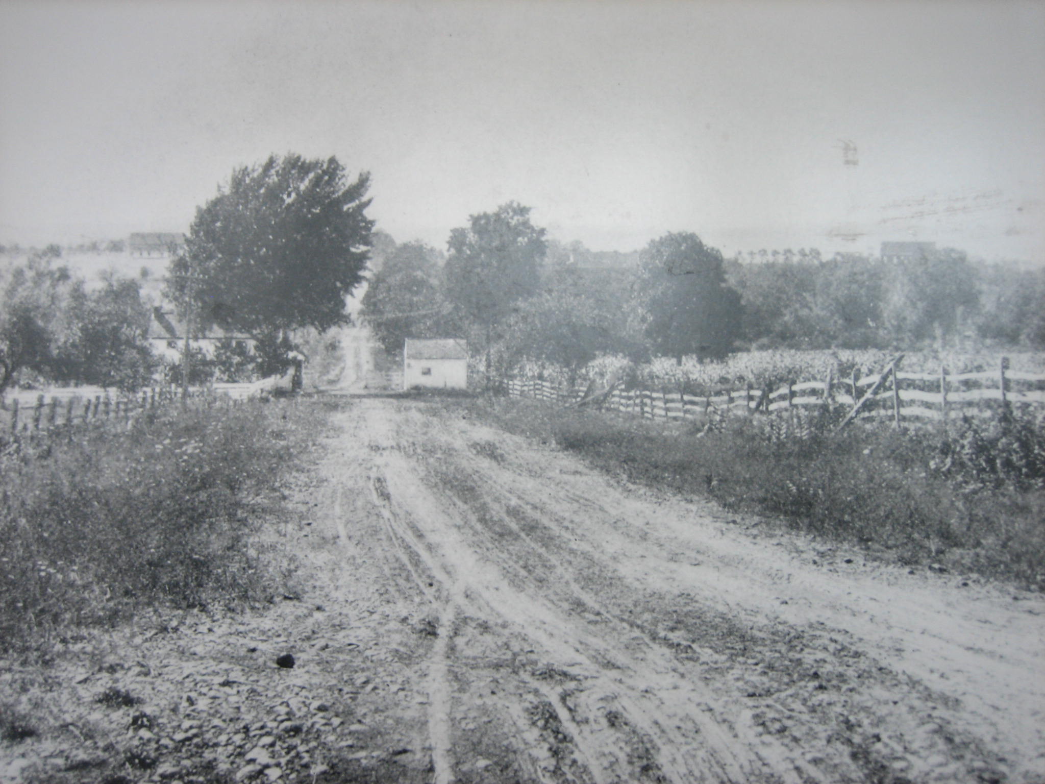
McPherson Ridge is a landform used for military engagements during the 1863 Battle of Gettysburg, First Day
, when the I Corps (Union Army) had a headquarters on the ridge and was defeated by the Confederate division of Major General Henry Heth
. The ridge has terrain above ~530 ft (161.5 m) and is almost entirely a federally-protected area except for township portions at the southern end and along Pennsylvania Route 116
, including a PennDOT facility. The northern end is a slight topographic saddle point
on the west edge of Oak Ridge
, and summit areas above 560 ft (170.7 m) include 4 on/near the Lincoln Highway, a broader summit south of the Fairfield
Road, and the larger plateau at the northern saddle.
Roadhttp://books.google.com/books?id=VcjXkmLN324C&pg=PA12&lpg=PA12&dq=%22Nichol's+Gap%22&source=bl&ots=cUSWPNsH7H&sig=CNgDTKi4Tlr0Jgitd9OLrT0hbGU&hl=en&ei=U2G0Tt7PK47TiALT75mWBg&sa=X&oi=book_result&ct=result&resnum=10&ved=0CEgQ6AEwCQ#v=onepage&q=%22Nichol's%20Gap%22&f=false (later "Hagerstown Road", now Fairfield Road) was built over the ridge, followed by the road on the north that became the 1809 turnpike from Gettysburg to Black's Gap (extended to Chambersburg
in 1810). In 1835, Middle Ridge had the middle of three 1835 railway cut
s (cf.
Herr Ridge & Seminary Ridge
) excavated for the Tapeworm Railroad
. In the 1850s, the Old Mill Road
across the ridge had been established northwest from the Hagerstown Road past the J. Herbst farm along Willoughby Run. During the 1858 Hopkins survey, the "H. Dustman" farm was on the ridge along the turnpike's south side and east of the "Toll Gate", while along Willoughby Run on the ridge's west slope and north of the railway bed were the farms of "Heirs of Wm McPherson" & "J. B. McPherson". After moving back to Gettysburg in 1856, attorney Edward McPherson
inherited a farm in 1858 which had 66.5 acre (26.9 ha) by 1863.http://www.gdg.org/Research/BattlefieldHistories/farmap1.html On June 30, 1863, John Buford
's Union
cavalry
camped 400 yards east of the ridge prior to the Battle of Gettysburg
.
Battle of Gettysburg
: On July 1, 1863, at ~8 am, Buford's 3,200 dismounted cavalrymen held the ridge until 10:30 am against 7,000 Confederates
until the arrival of the 1 Corps infantry.http://www.hmdb.org/Marker.asp?Marker=6325 After the Union forces retreated to Seminary Ridge, 2 companies of the 55th Virginia Infantry attacked the "large barn in which many of the Yankees took refuge. … An officer standing in the door of the barn, when ordered to surrender by Major Lauson, refused"; and after the barn was captured it was used as a field hospital.http://www.google.com/#sclient=psy-ab&hl=en&source=hp&q=McPherson+barn+site:nps.gov&pbx=1&oq=McPherson+barn+site:nps.gov&aq=f&aqi=&aql=1&gs_sm=e&gs_upl=873l9344l0l10109l27l22l0l0l0l0l609l7117l2-9.4.4.3l20l0&bav=on.2,or.r_gc.r_pw.,cf.osb&fp=1c82949ca002f577&biw=1600&bih=737
In 1869, a "Horse Railway
" was built over the ridge from the borough station
,http://contentdm.baylor.edu/19wor/19wor_atlas_v2_095/ and in 1884 the steamtrain railroad
was extended westward through the railway cut (a 1902 plan to extend the electric trolley
over the ridge was not implemented.)http://news.google.com/newspapers?id=_EgmAAAAIBAJ&sjid=Qv8FAAAAIBAJ&pg=1889,1265904&dq=springs-hotel+gettysburg&hl=en A Pennsylvania bill passed in 1885 for the 1886 John F. Reynolds
monument in Herbst Woods erected by "Post No. 9, G.A.R.
" In 1887, Gettysburg Battlefield Memorial Association
Director Edward McPherson acted as the agent for Samuel A. Whitney, who sold 17 acre (6.9 ha) on the ridge for a GBMA avenue, and the 1887 "Iron Platt Truss Bridge" over the railway cut was built by the Gilbert and Smith Foundry
for the "First Day's Avenue". The ridge's modern name was used as early as 1892--in Minnigh's What They Did Here ("West Reynolds Avenue, McPherson Ridge")http://books.google.com/books?id=EdPTAAAAMAAJ&printsec=frontcover&dq=Minnigh+%22What+They+Did+Here%22&hl=en&ei=T8OxTs3XOceriAKapaTjDw&sa=X&oi=book_result&ct=result&resnum=1&ved=0CC4Q6AEwAA#v=onepage&q=mcpherson&f=false--and in a newspaper by The Sun for a 1913 Gettysburg reunion report.http://www.google.com/search?q=%22McPherson's+Ridge%22+gettysburg&tbs=nws:1,ar:1&source=newspapers#sclient=psy-ab&hl=en&tbs=cdr:1%2Ccd_max%3A1950&tbm=nws&source=hp&q=%22McPherson+Ridge%22+gettysburg&pbx=1&oq=%22McPherson+Ridge%22+gettysburg&aq=f&aqi=&aql=&gs_sm=e&gs_upl=25553l25693l0l26270l2l1l0l0l0l0l0l0ll0l0&bav=on.2,or.r_gc.r_pw.,cf.osb&fp=73496de4a996d4bd&biw=1600&bih=737
decree of United States v. Five Tracts of Land on October 2, 1900, seized 3 "Reynolds Woods" tracts totalling 40.47 acre (16.4 ha). Stone Avenue was constructed in 1902, and by 1904 Meredith Avenue was on part of the "Springs Hotel Avenue and [former] Horse Railroad". On December 24, 1904, the Gettysburg National Military Park
acquired 36.56 acre (14.8 ha) on/near the ridge for $3,626 and in 1906, part of Pennsylvania's Camp Henderson
was on the ridge.
In 1913, the Chambersburg Turnpike was designated part of the original Lincoln Highway, and in 1927 the Hagerstown Road became Pennsylvania Route 51
(Pennsylvania Route 116
in 1928).http://www.pahighways.com/state/PA101-150.html The National Park Service
replaced the commemorative era guide station on the pike with a Gettysburg Parkitecture
entrance station ("Lincolnway
station" of Gettysburg Granite) which opened on June 5, 1937; and the 1903 bridge over the railway cuthttp://www4.ncsu.edu/~tmdannin/history.htm was replaced in 1958 for Mission 66
. A Battlefield America Guide about the ridge was published in 2002, and monuments on the ridge were designated historic district contributing structures in 2004.
Battle of Gettysburg, First Day
The First Day of the Battle of Gettysburg during the American Civil War took place on July 1, 1863, and began as an engagement between isolated units of the Army of Northern Virginia under Confederate General Robert E. Lee and the Army of the Potomac under Union Maj. Gen. George G. Meade...
, when the I Corps (Union Army) had a headquarters on the ridge and was defeated by the Confederate division of Major General Henry Heth
Henry Heth
Henry "Harry" Heth was a career United States Army officer and a Confederate general in the American Civil War. He is best remembered for inadvertently precipitating the Battle of Gettysburg, when he sent some of his troops of the Army of Northern Virginia to the small Pennsylvania village,...
. The ridge has terrain above ~530 ft (161.5 m) and is almost entirely a federally-protected area except for township portions at the southern end and along Pennsylvania Route 116
Pennsylvania Route 116
Pennsylvania Route 116 is an east–west route located in southern Pennsylvania. The route begins at Pennsylvania Route 16 in Carroll Valley north of the Pennsylvania-Maryland state line. It passes through the historic Civil War town of Gettysburg, Pennsylvania in Adams County, intersecting U.S...
, including a PennDOT facility. The northern end is a slight topographic saddle point
Saddle point
In mathematics, a saddle point is a point in the domain of a function that is a stationary point but not a local extremum. The name derives from the fact that in two dimensions the surface resembles a saddle that curves up in one direction, and curves down in a different direction...
on the west edge of Oak Ridge
Oak Ridge, Adams County, Pennsylvania
Oak Ridge is the landform of the Gettysburg Battlefield where the Eternal Light Peace Memorial was dedicated by President Franklin D. Roosevelt during the 1938 Gettysburg reunion. 1863 Battle of Gettysburg, Whitworth rifled cannon fired from Oak Hill at Culp's Hill and Cemetery Hill. The ridge...
, and summit areas above 560 ft (170.7 m) include 4 on/near the Lincoln Highway, a broader summit south of the Fairfield
Fairfield, Pennsylvania
Fairfield is a borough in Adams County, Pennsylvania, United States. The population was 486 at the 2000 census.-History:During the Gettysburg Campaign in the American Civil War, the Battle of Fairfield played an important role in securing the Fairfield pass and the Hagerstown Road, enabling Robert E...
Road, and the larger plateau at the northern saddle.
History
In 1747, the Nichol's GapMonterey pass
Monterey Pass is a mountain pass near Blue Ridge Summit, Pennsylvania, and the Mason-Dixon Line. The saddle area lies near between Monterey Peak and . It was the site of the July 1863 Fight at Monterey Pass during the Retreat from Gettysburg.-Gettysburg Campaign:The first military engagement at...
Roadhttp://books.google.com/books?id=VcjXkmLN324C&pg=PA12&lpg=PA12&dq=%22Nichol's+Gap%22&source=bl&ots=cUSWPNsH7H&sig=CNgDTKi4Tlr0Jgitd9OLrT0hbGU&hl=en&ei=U2G0Tt7PK47TiALT75mWBg&sa=X&oi=book_result&ct=result&resnum=10&ved=0CEgQ6AEwCQ#v=onepage&q=%22Nichol's%20Gap%22&f=false (later "Hagerstown Road", now Fairfield Road) was built over the ridge, followed by the road on the north that became the 1809 turnpike from Gettysburg to Black's Gap (extended to Chambersburg
Chambersburg, Pennsylvania
Chambersburg is a borough in the South Central region of Pennsylvania, United States. It is miles north of Maryland and the Mason-Dixon line and southwest of Harrisburg in the Cumberland Valley, which is part of the Great Appalachian Valley. Chambersburg is the county seat of Franklin County...
in 1810). In 1835, Middle Ridge had the middle of three 1835 railway cut
Railway cut of the Gettysburg Battlefield
The railway cut of the Gettysburg Battlefield was the place of an 1863 military engagement of the Battle of Gettysburg, First Day, near the Edward McPherson farmhouse in which railroad tracks had not yet been placed, but which provided a deep entrenchment....
s (cf.
Cf.
cf., an abbreviation for the Latin word confer , literally meaning "bring together", is used to refer to other material or ideas which may provide similar or different information or arguments. It is mainly used in scholarly contexts, such as in academic or legal texts...
Herr Ridge & Seminary Ridge
Seminary Ridge
Seminary Ridge is a dendritic ridge which was an area of Battle of Gettysburg engagements during the American Civil War and of military installations during World War II.-Geography:...
) excavated for the Tapeworm Railroad
Tapeworm Railroad
The Tapeworm Railroad was a railway line planned by Thaddeus Stevens and nicknamed by opponents ridiculing a lengthy serpentine section around the Green Ridge of South Mountain...
. In the 1850s, the Old Mill Road
Old Mill Road
Old Mill Road is a current dead-end street in Richmondtown, Staten Island, that formerly stretched approximately from Richmond Hill Road , to the original alignment of Forest Hill Road. The section of roadway currently opened to vehicular traffic only stretches for about 184 feet. The rest of the...
across the ridge had been established northwest from the Hagerstown Road past the J. Herbst farm along Willoughby Run. During the 1858 Hopkins survey, the "H. Dustman" farm was on the ridge along the turnpike's south side and east of the "Toll Gate", while along Willoughby Run on the ridge's west slope and north of the railway bed were the farms of "Heirs of Wm McPherson" & "J. B. McPherson". After moving back to Gettysburg in 1856, attorney Edward McPherson
Edward McPherson
Edward McPherson was a prominent Pennsylvania newspaperman, attorney, and United States Congressman. As a director of the Gettysburg Battlefield Memorial Association, he effected efforts to protect portions of the Gettysburg Battlefield.-Early life and career:McPherson was born in Gettysburg,...
inherited a farm in 1858 which had 66.5 acre (26.9 ha) by 1863.http://www.gdg.org/Research/BattlefieldHistories/farmap1.html On June 30, 1863, John Buford
John Buford
John Buford, Jr. was a Union cavalry officer during the American Civil War, with a prominent role at the start of the Battle of Gettysburg.-Early years:...
's Union
Union Army
The Union Army was the land force that fought for the Union during the American Civil War. It was also known as the Federal Army, the U.S. Army, the Northern Army and the National Army...
cavalry
Cavalry
Cavalry or horsemen were soldiers or warriors who fought mounted on horseback. Cavalry were historically the third oldest and the most mobile of the combat arms...
camped 400 yards east of the ridge prior to the Battle of Gettysburg
Battle of Gettysburg
The Battle of Gettysburg , was fought July 1–3, 1863, in and around the town of Gettysburg, Pennsylvania. The battle with the largest number of casualties in the American Civil War, it is often described as the war's turning point. Union Maj. Gen. George Gordon Meade's Army of the Potomac...
.
Battle of Gettysburg
Battle of Gettysburg
The Battle of Gettysburg , was fought July 1–3, 1863, in and around the town of Gettysburg, Pennsylvania. The battle with the largest number of casualties in the American Civil War, it is often described as the war's turning point. Union Maj. Gen. George Gordon Meade's Army of the Potomac...
: On July 1, 1863, at ~8 am, Buford's 3,200 dismounted cavalrymen held the ridge until 10:30 am against 7,000 Confederates
Confederate States Army
The Confederate States Army was the army of the Confederate States of America while the Confederacy existed during the American Civil War. On February 8, 1861, delegates from the seven Deep South states which had already declared their secession from the United States of America adopted the...
until the arrival of the 1 Corps infantry.http://www.hmdb.org/Marker.asp?Marker=6325 After the Union forces retreated to Seminary Ridge, 2 companies of the 55th Virginia Infantry attacked the "large barn in which many of the Yankees took refuge. … An officer standing in the door of the barn, when ordered to surrender by Major Lauson, refused"; and after the barn was captured it was used as a field hospital.http://www.google.com/#sclient=psy-ab&hl=en&source=hp&q=McPherson+barn+site:nps.gov&pbx=1&oq=McPherson+barn+site:nps.gov&aq=f&aqi=&aql=1&gs_sm=e&gs_upl=873l9344l0l10109l27l22l0l0l0l0l609l7117l2-9.4.4.3l20l0&bav=on.2,or.r_gc.r_pw.,cf.osb&fp=1c82949ca002f577&biw=1600&bih=737
In 1869, a "Horse Railway
Horse drawn railway
Horse drawn railways were used before the advent of steam locomotive traction, which gradually superseded them in most instances.- Examples :Examples include :...
" was built over the ridge from the borough station
Gettysburg Railroad Station
-American Civil War:Train service to the depot was stopped when Jubal Early's Confederates burned the Rock Creek trestle on June 27, 1863. The depot's telegrapher, a young daughter of "Mr...
,http://contentdm.baylor.edu/19wor/19wor_atlas_v2_095/ and in 1884 the steamtrain railroad
Hanover Junction, Hanover and Gettysburg Railroad
The Hanover Junction, Hanover and Gettysburg Railroad was a railroad line in Pennsylvania in the 19th century. The 38 mile main line ran from Orrtanna to Hanover Junction where it connected with the Northern Central Railway...
was extended westward through the railway cut (a 1902 plan to extend the electric trolley
Gettysburg Electric Railway
The Gettysburg Electric Railway was a borough trolley that provided summer access to Gettysburg Battlefield visitor attractions such as military engagement areas, monuments, postbellum camps, and recreation areas...
over the ridge was not implemented.)http://news.google.com/newspapers?id=_EgmAAAAIBAJ&sjid=Qv8FAAAAIBAJ&pg=1889,1265904&dq=springs-hotel+gettysburg&hl=en A Pennsylvania bill passed in 1885 for the 1886 John F. Reynolds
John F. Reynolds
John Fulton Reynolds was a career United States Army officer and a general in the American Civil War. One of the Union Army's most respected senior commanders, he played a key role in committing the Army of the Potomac to the Battle of Gettysburg and was killed at the start of the battle.-Early...
monument in Herbst Woods erected by "Post No. 9, G.A.R.
Grand Army of the Republic
The Grand Army of the Republic was a fraternal organization composed of veterans of the Union Army, US Navy, US Marines and US Revenue Cutter Service who served in the American Civil War. Founded in 1866 in Decatur, Illinois, it was dissolved in 1956 when its last member died...
" In 1887, Gettysburg Battlefield Memorial Association
Gettysburg Battlefield Memorial Association
The Gettysburg Battlefield Memorial Association was an historic preservation membership organization and is the eponym for the battlefield's memorial association era...
Director Edward McPherson acted as the agent for Samuel A. Whitney, who sold 17 acre (6.9 ha) on the ridge for a GBMA avenue, and the 1887 "Iron Platt Truss Bridge" over the railway cut was built by the Gilbert and Smith Foundry
Industrial history of Gettysburg, Pennsylvania
The Industrial history of Gettysburg, Pennsylvania, includes shoemaking and coachbuilding in the 19th century, a copper mine on High Street, furniture making in the early 20th century, and the tourism industry following the July 1863 Battle of Gettysburg...
for the "First Day's Avenue". The ridge's modern name was used as early as 1892--in Minnigh's What They Did Here ("West Reynolds Avenue, McPherson Ridge")http://books.google.com/books?id=EdPTAAAAMAAJ&printsec=frontcover&dq=Minnigh+%22What+They+Did+Here%22&hl=en&ei=T8OxTs3XOceriAKapaTjDw&sa=X&oi=book_result&ct=result&resnum=1&ved=0CC4Q6AEwAA#v=onepage&q=mcpherson&f=false--and in a newspaper by The Sun for a 1913 Gettysburg reunion report.http://www.google.com/search?q=%22McPherson's+Ridge%22+gettysburg&tbs=nws:1,ar:1&source=newspapers#sclient=psy-ab&hl=en&tbs=cdr:1%2Ccd_max%3A1950&tbm=nws&source=hp&q=%22McPherson+Ridge%22+gettysburg&pbx=1&oq=%22McPherson+Ridge%22+gettysburg&aq=f&aqi=&aql=&gs_sm=e&gs_upl=25553l25693l0l26270l2l1l0l0l0l0l0l0ll0l0&bav=on.2,or.r_gc.r_pw.,cf.osb&fp=73496de4a996d4bd&biw=1600&bih=737
Gettysburg National Military Park
After the February 1895 "Sickles Gettysburg Park Bill" (28 Stat. 651) passed, John B. McPherson deeded 58.18 acre (23.5 ha) to the United States in April, and the eminent domainEminent domain
Eminent domain , compulsory purchase , resumption/compulsory acquisition , or expropriation is an action of the state to seize a citizen's private property, expropriate property, or seize a citizen's rights in property with due monetary compensation, but without the owner's consent...
decree of United States v. Five Tracts of Land on October 2, 1900, seized 3 "Reynolds Woods" tracts totalling 40.47 acre (16.4 ha). Stone Avenue was constructed in 1902, and by 1904 Meredith Avenue was on part of the "Springs Hotel Avenue and [former] Horse Railroad". On December 24, 1904, the Gettysburg National Military Park
Gettysburg National Military Park
The Gettysburg National Military Park is an administrative unit of the National Park Service's northeast region and a subunit of federal properties of Adams County, Pennsylvania, with the same name, including the Gettysburg National Cemetery...
acquired 36.56 acre (14.8 ha) on/near the ridge for $3,626 and in 1906, part of Pennsylvania's Camp Henderson
Gettysburg Battlefield camps after the American Civil War
Gettysburg Battlefield camps after the American Civil War were used by the Pennsylvania National Guard, Civil War veterans, the United States Marine Corps, the Civilian Conservation Corps, the United States Army, and the Youth Conservation Corps....
was on the ridge.
In 1913, the Chambersburg Turnpike was designated part of the original Lincoln Highway, and in 1927 the Hagerstown Road became Pennsylvania Route 51
Pennsylvania Route 51
Pennsylvania Route 51 is a major state highway in Western Pennsylvania. It runs for from Uniontown to the Ohio state line near Darlington, where it connects with Ohio State Route 14. Route 51 is the termination point for Pennsylvania Route 43, Pennsylvania Route 48 and Pennsylvania Route 88. ...
(Pennsylvania Route 116
Pennsylvania Route 116
Pennsylvania Route 116 is an east–west route located in southern Pennsylvania. The route begins at Pennsylvania Route 16 in Carroll Valley north of the Pennsylvania-Maryland state line. It passes through the historic Civil War town of Gettysburg, Pennsylvania in Adams County, intersecting U.S...
in 1928).http://www.pahighways.com/state/PA101-150.html The National Park Service
National Park Service
The National Park Service is the U.S. federal agency that manages all national parks, many national monuments, and other conservation and historical properties with various title designations...
replaced the commemorative era guide station on the pike with a Gettysburg Parkitecture
Gettysburg National Military Park
The Gettysburg National Military Park is an administrative unit of the National Park Service's northeast region and a subunit of federal properties of Adams County, Pennsylvania, with the same name, including the Gettysburg National Cemetery...
entrance station ("Lincolnway
Lincoln Highway
The Lincoln Highway was the first road across the United States of America.Conceived and promoted by entrepreneur Carl G. Fisher, the Lincoln Highway spanned coast-to-coast from Times Square in New York City to Lincoln Park in San Francisco, originally through 13 states: New York, New Jersey,...
station" of Gettysburg Granite) which opened on June 5, 1937; and the 1903 bridge over the railway cuthttp://www4.ncsu.edu/~tmdannin/history.htm was replaced in 1958 for Mission 66
Mission 66
Mission 66 was a US National Park Service ten-year program that was intended to dramatically expand Park Service visitor services by 1966, in time for the 50th anniversary of the establishment of the Park Service....
. A Battlefield America Guide about the ridge was published in 2002, and monuments on the ridge were designated historic district contributing structures in 2004.