
Maelor Way
Encyclopedia
Maelor Way is a key long distance footpath, running 38 kilometres / 24 miles from the Offa's Dyke Path
National Trail at Bronygarth
to the Shropshire Way
, Sandstone Trail
, Llangollen Canal
, South Cheshire Way
, and the Marches Way
all at Grindley Brook
near Whitchurch
.
of Wrexham
in Wales
, but partly in Cheshire
and Shropshire
in England
.
Many parts of the walk follow waterways: Grindley Brook
, the Llangollen Canal
, the River Dee
, and the river Ceiriog in the Ceiriog Valley
.
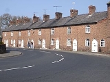
The way also passes through towns and villages: Overton-on-Dee
with its ancient yew
trees, one of the Seven Wonders of Wales
; Penley
, where the wartime Polish Army Hospital once boosted the population threefold, Hanmer
, situated on the peaceful mere which gave the village and its local aristocracy, the Hanmer family, their name, Chirk
featuring Chirk Castle
and Thomas Telford
s Chirk Aqueduct
.
Offa's Dyke Path
Offa's Dyke Path is a long distance footpath along the Welsh-English border. Opened in 1971, it is one of Britain's premier National Trails and draws walkers from throughout the world...
National Trail at Bronygarth
Bronygarth
Bronygarth is a small village in the Ceiriog Valley near Oswestry in Shropshire, England at .- History :Bronygarth lies on Offa's Dyke, the massive earthwork constructed in the late 8th century by Offa, King of Mercia, as a boundary between Saxon Mercia and Celtic Wales. The section of the dyke...
to the Shropshire Way
Shropshire Way
The Shropshire Way is a waymarked long distance footpath running through the English county of Shropshire. It runs 224 kilometres / 139 miles around the interior of the county in a large loop.- The Waymarked Route :...
, Sandstone Trail
Sandstone Trail
The Sandstone Trail is a long-distance walkers' path, following sandstone ridges running north–south from Frodsham in central Cheshire to Whitchurch just over the Shropshire border. The path was created in 1974 and extended in the 1990s...
, Llangollen Canal
Llangollen Canal
The Llangollen Canal is a navigable canal crossing the border between England and Wales. The waterway links Llangollen in Denbighshire, north Wales, with Hurleston in south Cheshire, via the town of Ellesmere, Shropshire....
, South Cheshire Way
South Cheshire Way
The South Cheshire Way is a long-distance footpath running east–west mainly through Cheshire, England, though parts lie in Shropshire and Staffordshire. The western section from Grindley Brook, near Whitchurch, runs through farmland; the eastern section from Mow Cop, near Biddulph, runs through...
, and the Marches Way
Marches Way
The Marches Way is a partially waymarked long distance footpath in the United Kingdom. It runs 351 kilometres / 218 miles through the Welsh–English borderlands, traditionally known as the Welsh Marches and links the cities of Chester in the north and Cardiff in the south.-The route:The route...
all at Grindley Brook
Grindley Brook
Grindley Brook is a small village in Shropshire, England, on the A41 trunk road around 1.5 miles north west of the market town of Whitchurch. It is the most northerly settlement in Shropshire and borders directly onto Cheshire, and is within the civil parish of Whitchurch Rural.It is also the name...
near Whitchurch
Whitchurch, Shropshire
Whitchurch is a market town in Shropshire, England on the border between England and Wales. It is the oldest continuously inhabited town in Shropshire. According to the 2001 Census, the population of the town is 8,673, with a more recent estimate putting the population of the town at 8,934...
.
The route
Most of the way is easy walking across pleasant meadows and through woodlands, mostly in the county boroughCounty borough
County borough is a term introduced in 1889 in the United Kingdom of Great Britain and Ireland , to refer to a borough or a city independent of county council control. They were abolished by the Local Government Act 1972 in England and Wales, but continue in use for lieutenancy and shrievalty in...
of Wrexham
Wrexham (county borough)
Wrexham is a county borough centred on the town of Wrexham in north-east Wales. The county borough has a population of 130,200 inhabitants. Just under half of the population live either within the town of Wrexham or its surrounding conurbation of urban villages. The remainder living to the south...
in Wales
Wales
Wales is a country that is part of the United Kingdom and the island of Great Britain, bordered by England to its east and the Atlantic Ocean and Irish Sea to its west. It has a population of three million, and a total area of 20,779 km²...
, but partly in Cheshire
Cheshire
Cheshire is a ceremonial county in North West England. Cheshire's county town is the city of Chester, although its largest town is Warrington. Other major towns include Widnes, Congleton, Crewe, Ellesmere Port, Runcorn, Macclesfield, Winsford, Northwich, and Wilmslow...
and Shropshire
Shropshire
Shropshire is a county in the West Midlands region of England. For Eurostat purposes, the county is a NUTS 3 region and is one of four counties or unitary districts that comprise the "Shropshire and Staffordshire" NUTS 2 region. It borders Wales to the west...
in England
England
England is a country that is part of the United Kingdom. It shares land borders with Scotland to the north and Wales to the west; the Irish Sea is to the north west, the Celtic Sea to the south west, with the North Sea to the east and the English Channel to the south separating it from continental...
.
Many parts of the walk follow waterways: Grindley Brook
Grindley Brook
Grindley Brook is a small village in Shropshire, England, on the A41 trunk road around 1.5 miles north west of the market town of Whitchurch. It is the most northerly settlement in Shropshire and borders directly onto Cheshire, and is within the civil parish of Whitchurch Rural.It is also the name...
, the Llangollen Canal
Llangollen Canal
The Llangollen Canal is a navigable canal crossing the border between England and Wales. The waterway links Llangollen in Denbighshire, north Wales, with Hurleston in south Cheshire, via the town of Ellesmere, Shropshire....
, the River Dee
River Dee, Wales
The River Dee is a long river in the United Kingdom. It travels through Wales and England and also forms part of the border between the two countries....
, and the river Ceiriog in the Ceiriog Valley
Ceiriog Valley
The Ceiriog Valley or Dyffryn Ceiriog is the valley of the River Ceiriog in north-east Wales. It is also the name of a ward of the County Borough of Wrexham Until 1974 the valley was part of the traditional county of Denbighshire; then it became part of the short-lived county of Clwyd, which was...
.
The way also passes through towns and villages: Overton-on-Dee
Overton-on-Dee
Overton-on-Dee is a small rural town and a local government community, the lowest tier of local government, part of Wrexham County Borough in Wales....
with its ancient yew
Taxus
Taxus is a genus of yews, small coniferous trees or shrubs in the yew family Taxaceae. They are relatively slow-growing and can be very long-lived, and reach heights of 1-40 m, with trunk diameters of up to 4 m...
trees, one of the Seven Wonders of Wales
Seven Wonders of Wales
The Seven Wonders of Wales is a traditional list of notable landmarks in North Wales, commemorated in an anonymously written rhyme:The seven wonders comprise:...
; Penley
Penley
Penley is a village in the County Borough of Wrexham, in Wales close to the border with Shropshire, EnglandThe village was, until 1974, in an exclave of the ancient county of Flintshire known as Maelor Saesneg. , sometimes called "Flintshire Detached", which was administered from Overton-on-Dee...
, where the wartime Polish Army Hospital once boosted the population threefold, Hanmer
Hanmer
Hanmer is a village and a local government community, the lowest tier of local government, part of Wrexham County Borough in Wales. At the 2001 Census the population of the Hanmer community area, which includes Hanmer village itself, Horseman's Green and Arowry along with a number of small hamlets,...
, situated on the peaceful mere which gave the village and its local aristocracy, the Hanmer family, their name, Chirk
Chirk
Chirk is a small town and local government community, the lowest tier of local government, part of Wrexham County Borough in Wales. It has a population of over 4,000....
featuring Chirk Castle
Chirk Castle
Chirk Castle is a castle located at Chirk, Wrexham, Wales.The castle was built in 1295 by Roger Mortimer de Chirk, uncle of Roger Mortimer, 1st Earl of March as part of King Edward I's chain of fortresses across the north of Wales. It guards the entrance to the Ceiriog Valley...
and Thomas Telford
Thomas Telford
Thomas Telford FRS, FRSE was a Scottish civil engineer, architect and stonemason, and a noted road, bridge and canal builder.-Early career:...
s Chirk Aqueduct
Chirk Aqueduct
Chirk Aqueduct is a high and long navigable aqueduct that carries what is now the Llangollen Canal across the Ceiriog Valley near Chirk, on the England-Wales border....
.