

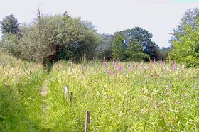
South Cheshire Way
Encyclopedia
Cheshire
Cheshire is a ceremonial county in North West England. Cheshire's county town is the city of Chester, although its largest town is Warrington. Other major towns include Widnes, Congleton, Crewe, Ellesmere Port, Runcorn, Macclesfield, Winsford, Northwich, and Wilmslow...
, England, though parts lie in Shropshire
Shropshire
Shropshire is a county in the West Midlands region of England. For Eurostat purposes, the county is a NUTS 3 region and is one of four counties or unitary districts that comprise the "Shropshire and Staffordshire" NUTS 2 region. It borders Wales to the west...
and Staffordshire
Staffordshire
Staffordshire is a landlocked county in the West Midlands region of England. For Eurostat purposes, the county is a NUTS 3 region and is one of four counties or unitary districts that comprise the "Shropshire and Staffordshire" NUTS 2 region. Part of the National Forest lies within its borders...
. The western section from Grindley Brook
Grindley Brook
Grindley Brook is a small village in Shropshire, England, on the A41 trunk road around 1.5 miles north west of the market town of Whitchurch. It is the most northerly settlement in Shropshire and borders directly onto Cheshire, and is within the civil parish of Whitchurch Rural.It is also the name...
, near Whitchurch
Whitchurch, Shropshire
Whitchurch is a market town in Shropshire, England on the border between England and Wales. It is the oldest continuously inhabited town in Shropshire. According to the 2001 Census, the population of the town is 8,673, with a more recent estimate putting the population of the town at 8,934...
, runs through farmland; the eastern section from Mow Cop
Mow Cop
Mow Cop is an isolated village which straddles the Cheshire–Staffordshire border, and is thus divided between the North West and West Midlands regions of England...
, near Biddulph
Biddulph
Biddulph is a town in Staffordshire, England, north of Stoke-on-Trent and south east of Congleton, Cheshire.-Origin of the name:Biddulph's name may come from Anglo-Saxon bī dylfe = "beside the pit or quarry"...
, runs through low hills. The footpath is waymarked with black and yellow discs inscribed 'SCW'.
The path connects with several other long-distance paths, including the Maelor Way
Maelor Way
Maelor Way is a key long distance footpath, running 38 kilometres / 24 miles from the Offa's Dyke Path National Trail at Bronygarth to the Shropshire Way, Sandstone Trail, Llangollen Canal, South Cheshire Way, and the Marches Way all at Grindley Brook near Whitchurch.- The route :Most of the way is...
, the Staffordshire Way
Staffordshire Way
The Staffordshire Way is a long distance walk in Staffordshire, England. The path links with the Cheshire Gritstone Trail, the Heart of England Way and the North Worcestershire Path.- The route :...
and the Sandstone
Sandstone Trail
The Sandstone Trail is a long-distance walkers' path, following sandstone ridges running north–south from Frodsham in central Cheshire to Whitchurch just over the Shropshire border. The path was created in 1974 and extended in the 1990s...
and Gritstone Trails
Cheshire Gritstone Trail
The Cheshire Gritstone Trail is a long-distance footpath in England split into three stages. The first stage, in length, leads from Disley to Tegg's Nose; the second, of length , from Tegg's Nose to Timbersbrook, is the best for obtaining a close look at gritstone scenery...
.
Further reading
- Grindley Brook to Mow Cop and Mow Cop to Grindley Brook guides, Mid-Cheshire Footpath Society