
London Buses route 34
Encyclopedia
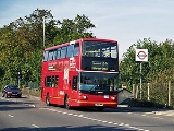
London Buses route 34 is a Transport for London
contracted bus route in London
, United Kingdom
. The service is currently contracted to Arriva London
.
, which had been responsible for London's buses since 1 July 1933, revised its route numbering system. The 34, which was actually a re-numbering of route 604, ran daily between Whetstone
and Stratford
via Palmers Green, Walthamstow and Leyton
. This was the second time that the route number 34 had been used on a London bus route.
Also introduced on 3 October 1934 was a 34A, a daily service which ran between Stratford and Chingford Mount with an irregular Monday - Saturday extension to Chingford (Royal Forest Hotel). This route was a re-numbering of route 511.
Lastly the 34B, also introduced on 3 October 1934 was a Monday - Saturday peak hours route between Lower Edmonton Station
and Walthamstow (Crooked Billet) via Lea Valley Viaduct
and North Circular Road. This route was previously numbered 167 and was historically part of the 76 group of routes. It remained closely linked to the 76 throughout its lifetime.
In 1936 the route ran from Whetstone through to Walthamstow
and Stratford at an impressive 5 minute frequency most of the way (every 3¾ minutes on Saturdays!).
As from 17 February 1937, route 34 was withdrawn between Leyton Green and Stratford. The route 34B journeys to Stratford, which had been introduced in 1936, were also withdrawn at this time.
As a wartime economy measure
, the 34A was withdrawn after service on 31 October 1939. At the same time, the 34B was extended from Lower Edmonton Station to Brimsdown
(Power Station) via Ponders End
, replacing journeys on route 69.
After the war, buses were running from New Barnet
via what is now the 326 to Whetstone, and the section between the Crooked Billet and Stratford had been given over to the trolleybuses. Later, the route was extended into Barnet
and to Chesterfield Road (present 184 routeing) and by the 1970s the present direct route into Barnet via Barnet Hill had been adopted, the route via New Barnet then covered by part of the 260. At the other end, buses had been restored to Walthamstow and Leyton, reaching Leytonstone
(Harrow Green) as from 16 June 1973. Later the route was curtailed to Walthamstow Central
.
Major rebuilding of the North Circular Road in the mid 1990s had quite an effect on the 34. As well as the building of the Woodford-Barking link, most of the road between Hanger Lane and north Walthamstow has now been upgraded. Just a few bottlenecks around Neasden
, Finchley
(Henly's Corner, where it crosses the A1) and New Southgate-Palmers Green remain to be done - if the government allows. The result is a very good road, with lots of new flyovers and underpasses constructed. The 34 does not stick to the fast road, but, as buses do, dives off onto every possible service road and access way. There are still some fast bits though!
However, during the construction, traffic congestion was very heavy, and it was decided to split the route into sections. It had been every 15 minutes Barnet to Walthamstow, but the new sections were Barnet to Edmonton and Arnos Grove to Walthamstow, every 20 minutes each giving a 10 minute service on the overlap. Some of the worst congestion was around Edmonton, where a huge underpass under Silver Street station
and Fore Street was built. Once the NCR works were completed, the 34 was retendered, with quite a big improvement in that buses would run every 10 minutes throughout - i.e. the overlap frequency throughout the route.
The 34 is another amazingly well-established route, and also unusually low-numbered for a route that does not serve central London
. However in this case there has been a fair amount of fiddling at the ends, even if buses have always linked Whetstone
with the Crooked Billet north of Walthamstow
via a substantial portion of the North Circular Road
.
Transport for London
Transport for London is the local government body responsible for most aspects of the transport system in Greater London in England. Its role is to implement the transport strategy and to manage transport services across London...
contracted bus route in London
London
London is the capital city of :England and the :United Kingdom, the largest metropolitan area in the United Kingdom, and the largest urban zone in the European Union by most measures. Located on the River Thames, London has been a major settlement for two millennia, its history going back to its...
, United Kingdom
United Kingdom
The United Kingdom of Great Britain and Northern IrelandIn the United Kingdom and Dependencies, other languages have been officially recognised as legitimate autochthonous languages under the European Charter for Regional or Minority Languages...
. The service is currently contracted to Arriva London
Arriva London
Arriva London is a division of Arriva which operates bus services in London, UK. It is made up of many previous bus operators including previously independent Grey Green...
.
History
Today's route 34 commenced operation on 3 October 1934, when the London Passenger Transport BoardLondon Passenger Transport Board
The London Passenger Transport Board was the organisation responsible for public transport in London, UK, and its environs from 1933 to 1948...
, which had been responsible for London's buses since 1 July 1933, revised its route numbering system. The 34, which was actually a re-numbering of route 604, ran daily between Whetstone
Whetstone, London
-Buses:* 34 - Barnet Church to Walthamstow Central bus/tube/railway station* 125 - Winchmore Hill to Finchley Central* 234 - Barnet to Highgate Wood * 251 - Edgware bus/tube station to Arnos Grove tube station...
and Stratford
Stratford, London
Stratford is a place in the London Borough of Newham, England. It is located east northeast of Charing Cross and is one of the major centres identified in the London Plan. It was historically an agrarian settlement in the ancient parish of West Ham, which transformed into an industrial suburb...
via Palmers Green, Walthamstow and Leyton
Leyton
Leyton is an area of north-east London and part of the London Borough of Waltham Forest, located north east of Charing Cross. It borders Walthamstow and Leytonstone; Stratford in Newham; and Homerton and Lower Clapton in the London Borough of Hackney....
. This was the second time that the route number 34 had been used on a London bus route.
Also introduced on 3 October 1934 was a 34A, a daily service which ran between Stratford and Chingford Mount with an irregular Monday - Saturday extension to Chingford (Royal Forest Hotel). This route was a re-numbering of route 511.
Lastly the 34B, also introduced on 3 October 1934 was a Monday - Saturday peak hours route between Lower Edmonton Station
Edmonton Green railway station
Edmonton Green railway station is a station in the London Borough of Enfield in north east London on the White Hart Lane branch of the Lea Valley Lines. The station and all trains serving it are operated by National Express East Anglia...
and Walthamstow (Crooked Billet) via Lea Valley Viaduct
Lea Valley
The Lea Valley, the valley of the River Lea, has been used as a transport corridor, a source of sand and gravel, an industrial area, a water supply for London, and a recreational area...
and North Circular Road. This route was previously numbered 167 and was historically part of the 76 group of routes. It remained closely linked to the 76 throughout its lifetime.
In 1936 the route ran from Whetstone through to Walthamstow
Walthamstow
Walthamstow is a district of northeast London, England, located in the London Borough of Waltham Forest. It is situated north-east of Charing Cross...
and Stratford at an impressive 5 minute frequency most of the way (every 3¾ minutes on Saturdays!).
As from 17 February 1937, route 34 was withdrawn between Leyton Green and Stratford. The route 34B journeys to Stratford, which had been introduced in 1936, were also withdrawn at this time.
As a wartime economy measure
World War II
World War II, or the Second World War , was a global conflict lasting from 1939 to 1945, involving most of the world's nations—including all of the great powers—eventually forming two opposing military alliances: the Allies and the Axis...
, the 34A was withdrawn after service on 31 October 1939. At the same time, the 34B was extended from Lower Edmonton Station to Brimsdown
Brimsdown
Brimsdown is a place in the London Borough of Enfield, North London generally known as the Lea Valley. The Brimsdown area is roughly located in the area either side of Mollison Avenue, to Bilton Way, just south of Ordnance Road, extending as far south as the Mollison Avenue/Jeffreys Road roundabout...
(Power Station) via Ponders End
Ponders End
Ponders End is a place in the London Borough of Enfield, North London located in an area generally known as the Lea Valley. It is roughly located in the area either side of Hertford Road between The Ride and the Boundary Public House and Wharf Road and the Southbury railway station/Kingsway...
, replacing journeys on route 69.
After the war, buses were running from New Barnet
New Barnet
New Barnet is an area within the London Borough of Barnet. It is a largely residential North London suburb, close to the M25, A1 and M1.-History:...
via what is now the 326 to Whetstone, and the section between the Crooked Billet and Stratford had been given over to the trolleybuses. Later, the route was extended into Barnet
Barnet
High Barnet or Chipping Barnet is a place in the London Borough of Barnet, North London, England. It is a suburban development built around a twelfth-century settlement and is located north north-west of Charing Cross. Its name is often abbreviated to Barnet, which is also the name of the London...
and to Chesterfield Road (present 184 routeing) and by the 1970s the present direct route into Barnet via Barnet Hill had been adopted, the route via New Barnet then covered by part of the 260. At the other end, buses had been restored to Walthamstow and Leyton, reaching Leytonstone
Leytonstone
Leytonstone is an area of east London and part of the London Borough of Waltham Forest. It is a high density suburban area, located seven miles north east of Charing Cross in the ceremonial county of Greater London and the historic county of Essex...
(Harrow Green) as from 16 June 1973. Later the route was curtailed to Walthamstow Central
Walthamstow Central station
Walthamstow Central is a London Underground and commuter rail station. It is the terminus of the Victoria line, and is on the branch of the London commuter rail network operated by National Express East Anglia...
.
Major rebuilding of the North Circular Road in the mid 1990s had quite an effect on the 34. As well as the building of the Woodford-Barking link, most of the road between Hanger Lane and north Walthamstow has now been upgraded. Just a few bottlenecks around Neasden
Neasden
Neasden is an area in northwest London, UK. It forms part of the London Borough of Brent.-History:The area was recorded as Neasdun in 939 AD and the name is derived from the Old English nēos = 'nose' and dūn = 'hill'. It means 'the nose-shaped hill' referring to a well-defined landmark of this area...
, Finchley
Finchley
Finchley is a district in Barnet in north London, England. Finchley is on high ground, about north of Charing Cross. It formed an ancient parish in the county of Middlesex, becoming a municipal borough in 1933, and has formed part of Greater London since 1965...
(Henly's Corner, where it crosses the A1) and New Southgate-Palmers Green remain to be done - if the government allows. The result is a very good road, with lots of new flyovers and underpasses constructed. The 34 does not stick to the fast road, but, as buses do, dives off onto every possible service road and access way. There are still some fast bits though!
However, during the construction, traffic congestion was very heavy, and it was decided to split the route into sections. It had been every 15 minutes Barnet to Walthamstow, but the new sections were Barnet to Edmonton and Arnos Grove to Walthamstow, every 20 minutes each giving a 10 minute service on the overlap. Some of the worst congestion was around Edmonton, where a huge underpass under Silver Street station
Silver Street railway station
Silver Street is a railway station located in Sterling Way, Edmonton in North London, close to Fore Street.The next station away from London is Edmonton Green and the next towards London is White Hart Lane. Trains terminate at Liverpool Street station in the City of London.Several changes were made...
and Fore Street was built. Once the NCR works were completed, the 34 was retendered, with quite a big improvement in that buses would run every 10 minutes throughout - i.e. the overlap frequency throughout the route.
The 34 is another amazingly well-established route, and also unusually low-numbered for a route that does not serve central London
Central London
Central London is the innermost part of London, England. There is no official or commonly accepted definition of its area, but its characteristics are understood to include a high density built environment, high land values, an elevated daytime population and a concentration of regionally,...
. However in this case there has been a fair amount of fiddling at the ends, even if buses have always linked Whetstone
Whetstone, London
-Buses:* 34 - Barnet Church to Walthamstow Central bus/tube/railway station* 125 - Winchmore Hill to Finchley Central* 234 - Barnet to Highgate Wood * 251 - Edgware bus/tube station to Arnos Grove tube station...
with the Crooked Billet north of Walthamstow
Walthamstow
Walthamstow is a district of northeast London, England, located in the London Borough of Waltham Forest. It is situated north-east of Charing Cross...
via a substantial portion of the North Circular Road
A406 road
The A406 or the North Circular Road is a road which crosses North London, UK, linking West and East London. It, together with the South Circular Road, forms a ring road through the inner part of Outer London...
.
Current route
- BarnetBarnetHigh Barnet or Chipping Barnet is a place in the London Borough of Barnet, North London, England. It is a suburban development built around a twelfth-century settlement and is located north north-west of Charing Cross. Its name is often abbreviated to Barnet, which is also the name of the London...
Church - BarnetBarnetHigh Barnet or Chipping Barnet is a place in the London Borough of Barnet, North London, England. It is a suburban development built around a twelfth-century settlement and is located north north-west of Charing Cross. Its name is often abbreviated to Barnet, which is also the name of the London...
High Street - Barnet Hill
- High Barnet StationHigh Barnet tube stationHigh Barnet tube station is a London Underground station located in High Barnet in North London. The station is the terminus of the High Barnet branch of the Northern line and is in Travelcard Zone 5. It is the northernmost station on the Northern line and is situated 10.2 miles north north-west...
- Barnet Hill
- Great North RoadGreat North Road (Great Britain)The Great North Road was a coaching route used by mail coaches between London, York and Edinburgh. The modern A1 mainly follows the Great North Road. The inns on the road, many of which survive, were staging posts on the coach routes, providing accommodation, stabling for the horses and...
- WhetstoneWhetstone, London-Buses:* 34 - Barnet Church to Walthamstow Central bus/tube/railway station* 125 - Winchmore Hill to Finchley Central* 234 - Barnet to Highgate Wood * 251 - Edgware bus/tube station to Arnos Grove tube station...
High Road - Oakleigh Road North
- Brunswick Avenue
- Oakleigh Road South
- New SouthgateNew SouthgateNew Southgate is a residential suburb in the south-east corner of the London Borough of Barnet and the south-west corner of the London Borough of Enfield in North London, England....
Betstyle Circus - Bowes Road
- Arnos Grove StationArnos Grove tube stationArnos Grove is a London Underground station on the Piccadilly line between Bounds Green and Southgate. It is in Travelcard Zone 4 and is located in Arnos Grove, near Arnos Park on Bowes Road, London. The station and surrounding neighbourhood of Arnos Grove take their names from the Arnos Grove...
Forecourt - Bowes Road
- Palmers GreenPalmers GreenPalmers Green is a place in the London Borough of Enfield. It is a suburban area situated 7.6 miles north of Charing Cross. Postally, it is in London N13...
- North Circular RoadA406 roadThe A406 or the North Circular Road is a road which crosses North London, UK, linking West and East London. It, together with the South Circular Road, forms a ring road through the inner part of Outer London...
- EdmontonEdmontonEdmonton is the capital of the Canadian province of Alberta and is the province's second-largest city. Edmonton is located on the North Saskatchewan River and is the centre of the Edmonton Capital Region, which is surrounded by the central region of the province.The city and its census...
Cambridge Roundabout - West Way
- Silver StreetSilver StreetSilver Street was a radio soap opera, the first such to be aimed at the British South Asian community, and was broadcast on the BBC Asian Network. It was introduced in 2004 as part of the Sonia Deol show, which was replaced from 24 April 2006 by the Anita Rani show, and until 12 May 2006 each...
- North Middlesex HospitalNorth Middlesex HospitalThe North Middlesex University Hospital, known locally as North Mid, is a District General Hospital in Edmonton, in the London Borough of Enfield, within the area served by the Enfield Primary Care NHS Trust.- History :...
- Silver StreetSilver StreetSilver Street was a radio soap opera, the first such to be aimed at the British South Asian community, and was broadcast on the BBC Asian Network. It was introduced in 2004 as part of the Sonia Deol show, which was replaced from 24 April 2006 by the Anita Rani show, and until 12 May 2006 each...
- Silver Street StationSilver Street railway stationSilver Street is a railway station located in Sterling Way, Edmonton in North London, close to Fore Street.The next station away from London is Edmonton Green and the next towards London is White Hart Lane. Trains terminate at Liverpool Street station in the City of London.Several changes were made...
- Silver StreetSilver StreetSilver Street was a radio soap opera, the first such to be aimed at the British South Asian community, and was broadcast on the BBC Asian Network. It was introduced in 2004 as part of the Sonia Deol show, which was replaced from 24 April 2006 by the Anita Rani show, and until 12 May 2006 each...
- Upper EdmontonUpper EdmontonUpper Edmonton is a part of Edmonton, which is located in the eastern part of the London Borough of Enfield, England. The main shopping area of Upper Edmonton is often referred to as "The Angel" by locals and is...
- Angel Road
- Angel Road StationAngel Road railway stationAngel Road railway station is in the London Borough of Enfield at Edmonton in north east London, and is in Travelcard Zone 4, on the Tottenham Hale branch of the Lea Valley Lines. The station, and all trains serving it, is operated by National Express East Anglia. It is partially located beneath...
- Angel Road
- Lea Valley Viaduct
- Hall Lane
- Southend Road
- North Circular RoadA406 roadThe A406 or the North Circular Road is a road which crosses North London, UK, linking West and East London. It, together with the South Circular Road, forms a ring road through the inner part of Outer London...
- Crooked Billet Roundabout
- Chingford Road
- Hoe Street
- Selborne Road
- Walthamstow Central Station Bus Station