

List of mountains of the Alleghenies
Encyclopedia
Allegheny Mountains
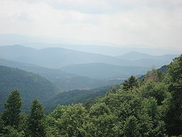
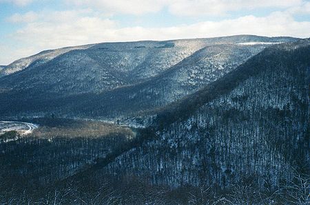
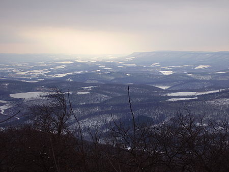
The Allegheny Mountain Range , also spelled Alleghany, Allegany and, informally, the Alleghenies, is part of the vast Appalachian Mountain Range of the eastern United States and Canada...
identifies geographic elevations for about 500 miles (800 km) from north central Pennsylvania
Pennsylvania
The Commonwealth of Pennsylvania is a U.S. state that is located in the Northeastern and Mid-Atlantic regions of the United States. The state borders Delaware and Maryland to the south, West Virginia to the southwest, Ohio to the west, New York and Ontario, Canada, to the north, and New Jersey to...
, through West Virginia
West Virginia
West Virginia is a state in the Appalachian and Southeastern regions of the United States, bordered by Virginia to the southeast, Kentucky to the southwest, Ohio to the northwest, Pennsylvania to the northeast and Maryland to the east...
and Maryland
Maryland
Maryland is a U.S. state located in the Mid Atlantic region of the United States, bordering Virginia, West Virginia, and the District of Columbia to its south and west; Pennsylvania to its north; and Delaware to its east...
, to western Virginia
Virginia
The Commonwealth of Virginia , is a U.S. state on the Atlantic Coast of the Southern United States. Virginia is nicknamed the "Old Dominion" and sometimes the "Mother of Presidents" after the eight U.S. presidents born there...
in the USA. The range of Allegheny Mountains
Allegheny Mountains
The Allegheny Mountain Range , also spelled Alleghany, Allegany and, informally, the Alleghenies, is part of the vast Appalachian Mountain Range of the eastern United States and Canada...
is part of the Appalachian Mountain range.
From northeast to southwest, with ridges and summits of the Eastern Continental Divide
Eastern Continental Divide
The Eastern Continental Divide, in conjunction with other continental divides of North America, demarcates two watersheds of the Atlantic Ocean: the Gulf of Mexico watershed and the Atlantic Seaboard watershed. Prior to 1760, the divide represented the boundary between British and French colonial...
in italics:
- Wopsononock Mountain, Pennsylvania
- Tussey MountainTussey Mountain]Tussey Mountain is a stratigraphic ridge in central Pennsylvania, United States, trending east of the Bald Eagle, Brush, Dunning and Evitts Mountain ridges...
, Pennsylvania - Blue Knob, Pennsylvania
- Pine KnobPine Knob (Pennsylvania)Pine Knob is a peak in the Allegheny Mountains of Pennsylvania. This mountain is a satellite peak of its larger neighbor Blue Knob. At above sea level it is the lesser in elevation when compared to Schaefer Head , Round Knob , Cattle Knob and Ritchey Knob...
, Pennsylvania - Cattle Knob, Pennsylvania
- Round Knob, Pennsylvania
- Ritchey KnobRitchey KnobRitchey Knob is a summit located on the Blue Knob massif. This mountain is connected to Pine Knob and forms the northern most summits of the massif....
, Pennsylvania - Schaefer HeadSchaefer HeadSchaefer Head is a mountain in the Allegheny Mountains of Pennsylvania. It is one of the peaks that make up the Blue Knob massif an isolated group of mountains that stand apart from the Allegheny Front. Schaefer Head is the third highest of these peaks behind Blue Knob 3,146 feet ,and...
, Pennsylvania - Herman PointHerman PointHerman Point is a satellite of Blue Knob mountain in Pennsylvania and one of the few summits in the state which exceed feet. This summit is located in the Blue Knob State Park and serves as the trailhead for the "Lost Turkey Trail". Herman Point is also the site of FAA towers and the old fire...
, Pennsylvania - Laurel HighlandsLaurel HighlandsThe Laurel Highlands is a region in southwestern Pennsylvania made up of Fayette County, Somerset County and Westmoreland County. It has a population of about 600,000 people....
region (3 counties), Pennsylvania- Laurel HillLaurel Hill (Pennsylvania)Laurel Hill, also known as Laurel Ridge or Laurel Mountain, is a long mountain in Pennsylvania's Allegheny Mountains. This ridge is flanked by Negro Mountain to its east and Chestnut Ridge to its west. The mountain is home to six State Parks; Laurel Ridge State Park, Laurel Mountain State Park,...
- Chestnut Ridge
- Laurel Hill
- Wills MountainWills MountainWills Mountain is a quartzite-capped ridge in the Ridge and Valley physiographic province of the Appalachian Mountains in Pennsylvania and Maryland, USA, extending from near Bedford, Pennsylvania to near Cumberland, Maryland...
, Pennsylvania, Maryland - Laurel Mountain, Pennsylvania, Maryland
- Sleepy Creek MountainSleepy Creek MountainSleepy Creek Mountain forms the border between Morgan and Berkeley Counties. Together with Third Hill Mountain, the two mountains contain between them Sleepy Creek Lake and the Sleepy Creek Wildlife Management Area...
, West Virginia - Sideling HillSideling HillSideling Hill is a long, steep, narrow mountain ridge in the Ridge-and-Valley physiographic province of the Appalachian Mountains, located in Washington County in western Maryland and adjacent West Virginia and Pennsylvania, USA...
, West Virginia, Pennsylvania, Maryland - Negro MountainNegro MountainNegro Mountain is a long ridge of the Allegheny Mountains extending from Deep Creek Lake in Maryland, north to the Casselman River in Pennsylvania, USA. The summit, Mount Davis, is the highest point in Pennsylvania...
, Pennsylvania, Maryland- Mount DavisMount Davis (Pennsylvania)Mount Davis is the highest point in Pennsylvania. Located in the 5,685 acre Forbes State Forest in Elk Lick Township, Somerset County, it rises to 3,213 ft...
, Pennsylvania
- Mount Davis
- Allegheny Mountain (Pennsylvania)Allegheny Mountain (Pennsylvania)Allegheny Mountain is a stratigraphic ridge that extends northeast to southwest from south of Blue Knob to a saddle point at the Savage Mountain anticline...
stratigraphic ridge, Pennsylvania- Savage MountainSavage MountainThe two Big Savage Mountain summits are part of Savage Mountain.The two Big Savage Mountain summits are part of Savage Mountain....
(Pennsylvania): 2667 feet (813 m)39°53′11"N 78°44′10"W
- Savage Mountain
- Savage MountainSavage MountainThe two Big Savage Mountain summits are part of Savage Mountain.The two Big Savage Mountain summits are part of Savage Mountain....
stratigraphic ridge, Pennsylvania, Maryland- Big Savage Mountain summit, Pennsylvania: 2566 feet (782.1 m)39°47′40"N 78°49′47"W
- Big Savage Mountain summit, Maryland: 2982 feet (908.9 m)39°32′39"N 79°05′46"W
- Elbow Mountain, Pennsylvania, Maryland
- Allegheny FrontAllegheny FrontThe Allegheny Front is the major southeast- or east-facing escarpment in the Allegheny Mountains in southern Pennsylvania, western Maryland, and eastern West Virginia, USA. The Allegheny Front delineates the Ridge-and-Valley Appalachians to its east from the Appalachian Plateau to its west...
(includes Dans Mountain) - Little Allegheny Mountain, Pennsylvania, Maryland
- Dan's Mountain, Maryland: 2898 feet (883 m)39°34′54"N 78°53′52"W
- Backbone MountainBackbone MountainBackbone Mountain is a ridge of the Allegheny Mountains of the central Appalachian Mountain Range. It is situated in the U.S. states of West Virginia and Maryland and forms a portion of the Eastern Continental Divide...
, West Virginia, Maryland - North MountainNorth Mountain (Virginia-West Virginia)North Mountain is a mountain ridge within the Ridge-and-valley Appalachians in the U.S. states of Virginia and West Virginia.-Geography:North Mountain spans from the Potomac River in the north to the community of Green Spring in Frederick County, Virginia in the south. The ridge is divided into...
, Virginia, West Virginia - Great North MountainGreat North MountainGreat North Mountain is a long mountain range within the Ridge-and-valley Appalachians in the U.S. states of Virginia and West Virginia. The range is located west of the Shenandoah Valley and Massanutten Mountain in Virginia, and east of the Allegheny Mountains and Cacapon River in West...
, Virginia, West Virginia - Tonoloway RidgeTonoloway RidgeTonoloway Ridge is a stratigraphic ridge that runs southwest northeast through the U.S. states of Pennsylvania, Maryland, and West Virginia. It reaches its highest elevation above mean sea level of 1,292 feet at a knob on its southern end in Morgan County, West Virginia...
, Pennsylvania, Maryland, West Virginia - Cacapon MountainCacapon MountainCacapon Mountain runs northwest through Morgan and Hampshire counties in West Virginia's Eastern Panhandle, rising to its greatest elevation of 2,618 feet above sea-level at High Point. Cacapon Mountain is a folded mountain ridge, belonging to the Appalachian Ridge and Valley Province. Cacapon...
, West Virginia - Third Hill MountainThird Hill MountainThird Hill Mountain is located in Berkeley County, West Virginia in the Eastern Panhandle. Third Hill Mountain reaches its highest elevation of 2,172 feet above sea-level southeast of the "Locks-of-the-Mountain" where it "locks" with Sleepy Creek Mountain.-Adjacent area:Together with Sleepy Creek...
, West Virginia - Sleepy Creek MountainSleepy Creek MountainSleepy Creek Mountain forms the border between Morgan and Berkeley Counties. Together with Third Hill Mountain, the two mountains contain between them Sleepy Creek Lake and the Sleepy Creek Wildlife Management Area...
, West Virginia - Patterson Creek MountainPatterson Creek MountainPatterson Creek Mountain is a mountain ridge that forms the border between Mineral and Hampshire counties and Grant and Hardy Counties in West Virginia's Eastern Panhandle. The mountain's namesake, Patterson Creek, parallels its western flank...
, West Virginia - South Branch MountainSouth Branch MountainSouth Branch Mountain is a mountain ridge that runs southwest to northeast through Hampshire and Hardy counties in the Eastern Panhandle of the U.S. state of West Virginia, rising to its greatest elevation of 3,028 feet above sea-level in the Nathaniel Mountain Wildlife Management Area...
, West Virginia - Ice MountainIce MountainIce Mountain is a mountain ridge and algific talus slope that is part of a preserve near the community of North River Mills in Hampshire County, West Virginia, United States....
, West Virginia - Knobly MountainKnobly MountainKnobly Mountain is a part of the Ridge-and-Valley Appalachians, located east of New Creek Mountain in Mineral and Grant counties, West Virginia, in the United States....
, West Virginia - Briery Mountains, West Virginia
- Laurel MountainLaurel Mountain (West Virginia)For other "Laurel Mountains", see Laurel Mountain .Laurel Mountain, also called Laurel Hill, is a long ridge in north-central West Virginia, USA...
, West Virginia - Rich Mountain, West Virginia
- Mount Porte CrayonMount Porte CrayonMount Porte Crayon is a mountain in the Roaring Plains Wilderness of the Monongahela National Forest. It is situated in the extreme northeastern corner of Randolph County, West Virginia, USA, and rises to an elevation of , the elevational climax of the Allegheny Front...
, West Virginia - Canaan Mountain, West Virginia
- Cabin Mountain, West Virginia
- Brown Mountain, West Virginia
- North Fork MountainNorth Fork MountainNorth Fork Mountain is a quartzite-capped mountain ridge in the Ridge and Valley physiographic province of the Allegheny Mountains of eastern West Virginia, USA...
, West Virginia - River KnobsRiver Knobs (West Virginia)For other "River Knobs", see River Knobs .The River Knobs — formerly known as East Seneca Ridge — are a ridge and series of knobs in western Pendleton County, West Virginia, USA, along a stretch of the North Fork South Branch Potomac River...
, West Virginia - Shenandoah Mountain, West Virginia, Virginia
- ElleberElleberElleber Ridge is the name of a ridge in the Allegheny Mountains of West Virginia and it is also the name of the mountain's summit, Elleber Knob . It is located in the eastern portion of Pocahontas County near the Virginia state line. The ridge and summit are located entirely in the Monongahela...
Ridge, West Virginia - Spruce MountainSpruce Mountain (West Virginia)Spruce Mountain, in eastern West Virginia, USA, is the highest ridge of the Allegheny Mountains. The "whale-backed" ridge extends for only about , from northeast to southwest, but several of its peaks exceed in elevation...
, West Virginia- Spruce KnobSpruce KnobSpruce Knob, at , is the highest point in the state of West Virginia and the summit of Spruce Mountain, the tallest mountain in the Alleghenies.-Overview:...
, West Virginia
- Spruce Knob
- Little Middle Mountain, West Virginia
- Allegheny Mountain, West Virginia, Virginia
- Middle Mountain, West Virginia
- Little Beech Mountain, West Virginia
- Beech Mountain, West Virginia
- Little Mountain, West Virginia
- Shaver's Fork Mountain ComplexShaver's Fork Mountain ComplexShavers Fork Mountain Complex is the name given to the mountains on either side of Shavers Fork in the highlands portions of Randolph County, Pocahontas County, and Tucker County in West Virginia, USA...
, West Virginia- Cheat MountainCheat MountainCheat Mountain is an exceptionally high and rugged ridge situated in the Allegheny Mountains of eastern West Virginia, USA. It is about long and more than five miles wide at its widest. Its highest point is at its southernmost end at Thorny Flat, which has an elevation of...
- Barton KnobBarton KnobBarton Knob is a mountain summit located on Cheat Mountain in southeastern Randolph County, West Virginia. Easily accessible during warm-weather months, Bickle Knob is also home to one of the few remaining fire towers in Monongahela National Forest....
- White TopWhite TopWhite Top is a knob and spur of Cheat Mountain in southeastern Randolph County, West Virginia, USA. Sitting at an elevation of , it is located just west of the Shavers Fork of Cheat River and Cheat Bridge. While White Top was originally crossed by the Staunton-Parkersburg Turnpike, modern-day U.S...
- Barton Knob
- Back Allegheny MountainBack Allegheny MountainBack Allegheny Mountain is a long mountain ridge in eastern West Virginia. It is part of the Shavers Fork Mountain Complex in the Allegheny Range of the Appalachians.- Geography :...
- Bald KnobBald KnobBald Knob is the highest summit of Back Allegheny Mountain in Pocahontas County, West Virginia and is part of Cass Scenic Railroad State Park...
- Bald Knob
- Shavers MountainShavers MountainShavers Mountain, is a high and rugged ridge situated in the Allegheny Mountains of eastern West Virginia. It is about long, north to south, and several of its peaks exceed in elevation...
- Gaudineer KnobGaudineer KnobGaudineer Knob is a mountain summit on the Randolph/Pocahontas County line in eastern West Virginia, USA. It is the highest elevation of Shavers Mountain, a ridge of the Alleghenies, and is located about east of the town of Cheat Bridge...
- Gaudineer Knob
- Bickle KnobBickle KnobBickle Knob is a mountain summit located east of Elkins in Randolph County, West Virginia. Easily accessible during warm-weather months, Bickle Knob is also home to one of the few remaining observation towers in Monongahela National Forest....
- McGowan Mountain
- Elk Mountain
- Middle Mountain
- Green Mountain
- Cheat Mountain
- Black Mountain, West Virginia
- Gauley Mountain, West Virginia
- Yew Mountains, West Virginia
- Back Creek Mountain, Virginia
- Peters MountainPeters MountainPeters Mountain is a mountain in the Allegheny ridge, which makes it the longest mountain in the Appalachian Mountain Chain. It is located on the border between Alleghany County, VA, Monroe County, WV, Giles Co.,VA, and Craig Co.,VA. Its elevation ranges from on the mountaintop to a low of...
, West Virginia, Virginia