
Cheat Mountain
Encyclopedia
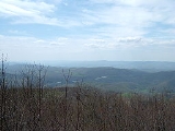
Cheat Mountain is an exceptionally high and rugged ridge situated in the Allegheny Mountains
of eastern West Virginia
, USA. It is about 50 miles (80.5 km) long (north to south) and more than five miles (8 km) wide at its widest. Its highest point is at its southernmost end at Thorny Flat, which has an elevation of 4848 feet (1,477.7 m). Several other knobs rise above 4000 feet (1,219.2 m) along its length.
The mountain was once home to the largest red spruce
forest south of Maine
and a large portion of it now lies within the Monongahela National Forest
.
, from (in the north) a point just west of Parsons
to (in the south) a point, about 5.5 miles (8.9 km) south of the Randolph/Pocahontas
County line, near the community of Stony Bottom
, where it impinges upon Back Allegheny Mountain
. All but the northernmost 4 miles (6.4 km) and the southernmost 5.5 miles (8.9 km) are within Randolph County. The western flank of Cheat Mountain is skirted by U.S. Route 219
which connects a string of communities in the Tygart River Valley
(notably, from north to south, Montrose
, Kerens
, Elkins
, Beverly
, Huttonsville
and Valley Head
). The eastern flank, overlooking the valley of Shavers Fork, is more remote. However, all but the northernmost 15 miles (24.1 km) or so of it is skirted by the Western Maryland Railroad, connecting (from north to south) the communities of Bowden
, Bemis
and Cheat Bridge
. Cheat Mountain is crossed (east/west) by two federal highways: U.S. Route 33
in its northern third and U.S. Route 250
in its southern third.
The Cheat River
, a tributary of the Monongahela
, is formed at Parsons
, just east of the northern tip of Cheat Mountain, by the confluence of Shavers Fork and Black Fork
.
. One engagement — the Battle of Cheat Mountain
— took place here September 12–15, 1861.
Gen. Robert E. Lee
directed his first offensive of the Civil War against Brig. Gen. Joseph Reynolds
’s entrenchments on the summit of Cheat Mountain. The Confederate attacks were uncoordinated, however, and the Federal defense was so stubborn that Col. Albert Rust
(who led the attacks) was convinced that he confronted an overwhelming force, when he actually faced only about 300 determined Federals. Lee called off the attack and, after maneuvering in the vicinity, withdrew to Valley Head on September 17, 1861. During the night of October 2-3, Reynolds with two brigades advanced from Cheat Mountain to reconnoiter the Confederate position at Camp Bartow
on the Greenbrier River
. He drove in the Confederate pickets and opened fire with his artillery. After sporadic fighting and an abortive attempt to turn his enemy’s right flank, Reynolds withdrew to Cheat Mountain. Also in October, Lee renewed operations against Laurel Mountain
with the troops of Floyd
and Loring
, but the operation was called off because of poor communication and lack of supplies. Lee was recalled to Richmond on October 30 after achieving little in western Virginia.
In December, Confederate forces under Col. Edward Johnson
occupied the summit of nearby Allegheny Mountain to defend the Staunton-Parkersburg Turnpike. A Union force under Brig. Gen. Robert Milroy attacked Johnson on December 13. Fighting continued for much of the morning as each side maneuvered to gain the advantage. Finally, Milroy’s troops were repulsed, and he retreated to his camps near Cheat Mountain. At the end of 1861, Johnson remained at Camp Allegheny with five regiments, with Henry Heth
at Lewisburg
with two regiments.
The highest Union
camp of the War was located at Cheat Summit, also known as White Top, at the southern end of Cheat Mountain. This commanding stronghold controlled the Staunton-Parkersburg Turnpike as it passed west into the Tygart River Valley. Cheat Summit Fort (Fort Milroy) was occupied from July 16, 1861 until April 1862 when it was abandoned due to extremes of weather as well as strategic developments.
, opened in 1960 and takes visitors up the side of Cheat Mountain to Bald Knob
via the same route the logging railroad used in the 1900s. (Contrary to popular belief, Cass Railroad does not take visitors to the summit of Cheat Mountain, but rather the summit of the connected Back Allegheny Mountain
.)
In 1974, the Snowshoe Mountain
ski resort opened on the southern tip of Cheat Mountain near Thorny Flat.
Allegheny Mountains
The Allegheny Mountain Range , also spelled Alleghany, Allegany and, informally, the Alleghenies, is part of the vast Appalachian Mountain Range of the eastern United States and Canada...
of eastern West Virginia
West Virginia
West Virginia is a state in the Appalachian and Southeastern regions of the United States, bordered by Virginia to the southeast, Kentucky to the southwest, Ohio to the northwest, Pennsylvania to the northeast and Maryland to the east...
, USA. It is about 50 miles (80.5 km) long (north to south) and more than five miles (8 km) wide at its widest. Its highest point is at its southernmost end at Thorny Flat, which has an elevation of 4848 feet (1,477.7 m). Several other knobs rise above 4000 feet (1,219.2 m) along its length.
The mountain was once home to the largest red spruce
Red Spruce
Picea rubens is a species of spruce native to eastern North America, ranging from eastern Quebec to Nova Scotia, and from New England south in the Adirondack Mountains and Appalachians to western North Carolina.-Physical description:...
forest south of Maine
Maine
Maine is a state in the New England region of the northeastern United States, bordered by the Atlantic Ocean to the east and south, New Hampshire to the west, and the Canadian provinces of Quebec to the northwest and New Brunswick to the northeast. Maine is both the northernmost and easternmost...
and a large portion of it now lies within the Monongahela National Forest
Monongahela National Forest
The Monongahela National Forest is a national forest located in the Allegheny Mountains of eastern West Virginia, USA. It protects over of federally-owned land within a proclamation boundary that includes much of the Potomac Highlands Region and portions of 10 counties.The MNF includes some...
.
Geography
Cheat Mountain traverses the entire length of central Randolph County, West VirginiaRandolph County, West Virginia
As of the census of 2000, there were 28,262 people, 11,072 households, and 7,661 families residing in the county. The population density was 27 people per square mile . There were 13,478 housing units at an average density of 13 per square mile...
, from (in the north) a point just west of Parsons
Parsons, West Virginia
The town of Parsons is the county seat of Tucker County, West Virginia, in the United States. The population was 1,463 at the 2000 census. The mayor of Parsons is Dorothy Judy and the city administrator is Jason Myers...
to (in the south) a point, about 5.5 miles (8.9 km) south of the Randolph/Pocahontas
Pocahontas County, West Virginia
As of the census of 2000, there were 9,131 people, 835 households, and 527 families residing in the county. The population density was 10 people per square mile . There were 7,594 housing units at an average density of 8 per square mile...
County line, near the community of Stony Bottom
Stony Bottom, West Virginia
Stony Bottom is an unincorporated community located in Pocahontas County, West Virginia, USA. In the early 19th century, the town was known as Seldom Seen. At some point, this was changed to Driftwood by loggers who would drift logs by on the Greenbrier River. By 1908, it took its present name...
, where it impinges upon Back Allegheny Mountain
Back Allegheny Mountain
Back Allegheny Mountain is a long mountain ridge in eastern West Virginia. It is part of the Shavers Fork Mountain Complex in the Allegheny Range of the Appalachians.- Geography :...
. All but the northernmost 4 miles (6.4 km) and the southernmost 5.5 miles (8.9 km) are within Randolph County. The western flank of Cheat Mountain is skirted by U.S. Route 219
U.S. Route 219
U.S. Route 219 is a spur of U.S. Route 19. It runs for from West Seneca, New York at an interchange with Interstate 90, to Rich Creek, Virginia, intersecting at U.S. Route 460. U.S. 219 is found in New York, Pennsylvania, Maryland, West Virginia, and Virginia...
which connects a string of communities in the Tygart River Valley
Tygart Valley River
The Tygart Valley River — also known as the Tygart River — is a principal tributary of the Monongahela River, approximately long, in east-central West Virginia, USA...
(notably, from north to south, Montrose
Montrose, West Virginia
Montrose is a town in Randolph County, West Virginia, United States. The population was 156 at the 2000 census.-Geography:Montrose is located at , along Leading Creek....
, Kerens
Kerens, West Virginia
Kerens is an unincorporated community in Randolph County, West Virginia, United States. Kerens is north-northeast of Elkins, along Leading Creek. Kerens has a post office with ZIP code 26276....
, Elkins
Elkins, West Virginia
Elkins is a city in Randolph County, West Virginia, United States. The community was incorporated in 1890 and named in honor of Stephen Benton Elkins , a U.S. Senator from West Virginia. The population was 7,032 at the 2000 census. It is the county seat of Randolph County...
, Beverly
Beverly, West Virginia
Beverly is a small town in Randolph County, West Virginia, USA. It is situated along the Tygart Valley River and had a population of 651 at the 2000 census.-Geography:Beverly is located at ....
, Huttonsville
Huttonsville, West Virginia
Huttonsville is a town in Randolph County, West Virginia, United States, along the Tygart Valley River. The population was 217 at the 2000 census.-History:...
and Valley Head
Valley Head, West Virginia
Valley Head is an unincorporated census-designated place in Randolph County, West Virginia, United States. Valley Head is located on U.S. Route 219 south-southwest of Huttonsville. Valley Head has a post office with ZIP code 26294. As of the 2010 census, its population was 267.-Notable...
). The eastern flank, overlooking the valley of Shavers Fork, is more remote. However, all but the northernmost 15 miles (24.1 km) or so of it is skirted by the Western Maryland Railroad, connecting (from north to south) the communities of Bowden
Bowden, West Virginia
Bowden is an unincorporated census-designated place in Randolph County, West Virginia, USA. Bowden is located on U.S. Route 33 east of Elkins. Bowden has a post office with ZIP code 26254. According to the 2010 Census, there were nine people residing at this location....
, Bemis
Bemis, West Virginia
Bemis is an unincorporated community in Randolph County, West Virginia, United States. Bemis is located on Shavers Fork and County Route 22 southeast of Elkins....
and Cheat Bridge
Cheat Bridge, West Virginia
Cheat Bridge is an unincorporated community in southeastern Randolph County, West Virginia, United States. It is located near U.S. Route 250's crossing of Shavers Fork.-The bridge:...
. Cheat Mountain is crossed (east/west) by two federal highways: U.S. Route 33
U.S. Route 33
U.S. Route 33 is a United States federal highway that runs northwest-southeast for 709 miles from northern Indiana to Richmond, Virginia, passing through Ohio and West Virginia en route. Although most odd-numbered U.S...
in its northern third and U.S. Route 250
U.S. Route 250
U.S. Route 250 is a route of the United States Numbered Highway System, and is a spur of U.S. Route 50. It currently runs for from Sandusky, Ohio to Richmond, Virginia. It passes through the states of Virginia, West Virginia, and Ohio. It goes through the cities of Richmond, Virginia,...
in its southern third.
The Cheat River
Cheat River
The Cheat River is a tributary of the Monongahela River in eastern West Virginia and southwestern Pennsylvania in the United States. Via the Monongahela and Ohio rivers, it is part of the Mississippi River watershed, ultimately draining into the Gulf of Mexico.-Geography:The Cheat is formed at...
, a tributary of the Monongahela
Monongahela River
The Monongahela River is a river on the Allegheny Plateau in north-central West Virginia and southwestern Pennsylvania in the United States...
, is formed at Parsons
Parsons, West Virginia
The town of Parsons is the county seat of Tucker County, West Virginia, in the United States. The population was 1,463 at the 2000 census. The mayor of Parsons is Dorothy Judy and the city administrator is Jason Myers...
, just east of the northern tip of Cheat Mountain, by the confluence of Shavers Fork and Black Fork
Black Fork (Cheat River)
The Black Fork is a principal tributary of the Cheat River in eastern West Virginia in the United States. It is a short stream, about four miles in length,The American Rivers Outstanding Rivers List, Second Edition, May 1991. Compiled and edited by Matthew H. Huntington and John D. Echeverria. ...
.
Civil War
Cheat Mountain was strategically important during the early Operations in Western Virginia campaign of the American Civil WarAmerican Civil War
The American Civil War was a civil war fought in the United States of America. In response to the election of Abraham Lincoln as President of the United States, 11 southern slave states declared their secession from the United States and formed the Confederate States of America ; the other 25...
. One engagement — the Battle of Cheat Mountain
Battle of Cheat Mountain
The Battle of Cheat Mountain, also known as the Battle of Cheat Summit Fort, took place from September 12 to 15, 1861, in Pocahontas County and Randolph County, Virginia as part of the Western Virginia Campaign during the American Civil War. It was the first battle of the Civil War in which Robert...
— took place here September 12–15, 1861.
Gen. Robert E. Lee
Robert E. Lee
Robert Edward Lee was a career military officer who is best known for having commanded the Confederate Army of Northern Virginia in the American Civil War....
directed his first offensive of the Civil War against Brig. Gen. Joseph Reynolds
Joseph Reynolds
Joseph Reynolds was a U.S. Representative from New York and a brigadier general of state militia troops during the War of 1812....
’s entrenchments on the summit of Cheat Mountain. The Confederate attacks were uncoordinated, however, and the Federal defense was so stubborn that Col. Albert Rust
Albert Rust
Albert Rust was a member of the United States House of Representatives from Arkansas, and a delegate to the Provisional Confederate Congress...
(who led the attacks) was convinced that he confronted an overwhelming force, when he actually faced only about 300 determined Federals. Lee called off the attack and, after maneuvering in the vicinity, withdrew to Valley Head on September 17, 1861. During the night of October 2-3, Reynolds with two brigades advanced from Cheat Mountain to reconnoiter the Confederate position at Camp Bartow
Bartow, West Virginia
Bartow is an unincorporated census-designated place in Pocahontas County, West Virginia, USA. As of the 2010 census, its population was 111.Bartow is situated along U.S. Route 250 and West Virginia Route 92 and on the East Fork Greenbrier River about east of Durbin. It has a post office with ZIP...
on the Greenbrier River
Greenbrier River
The Greenbrier River is a tributary of the New River, long, in southeastern West Virginia, USA. Via the New, Kanawha and Ohio Rivers, it is part of the watershed of the Mississippi River, draining an area of...
. He drove in the Confederate pickets and opened fire with his artillery. After sporadic fighting and an abortive attempt to turn his enemy’s right flank, Reynolds withdrew to Cheat Mountain. Also in October, Lee renewed operations against Laurel Mountain
Laurel Mountain (West Virginia)
For other "Laurel Mountains", see Laurel Mountain .Laurel Mountain, also called Laurel Hill, is a long ridge in north-central West Virginia, USA...
with the troops of Floyd
John B. Floyd
John Buchanan Floyd was the 31st Governor of Virginia, U.S. Secretary of War, and the Confederate general in the American Civil War who lost the crucial Battle of Fort Donelson.-Early life:...
and Loring
William W. Loring
William Wing Loring was a soldier from North Carolina who served in the armies of the United States, the Confederacy, and Egypt.-Early life:...
, but the operation was called off because of poor communication and lack of supplies. Lee was recalled to Richmond on October 30 after achieving little in western Virginia.
In December, Confederate forces under Col. Edward Johnson
Edward Johnson (general)
Edward Johnson , also known as Allegheny Johnson , was a United States Army officer and a Confederate general in the American Civil War.-Early life:...
occupied the summit of nearby Allegheny Mountain to defend the Staunton-Parkersburg Turnpike. A Union force under Brig. Gen. Robert Milroy attacked Johnson on December 13. Fighting continued for much of the morning as each side maneuvered to gain the advantage. Finally, Milroy’s troops were repulsed, and he retreated to his camps near Cheat Mountain. At the end of 1861, Johnson remained at Camp Allegheny with five regiments, with Henry Heth
Henry Heth
Henry "Harry" Heth was a career United States Army officer and a Confederate general in the American Civil War. He is best remembered for inadvertently precipitating the Battle of Gettysburg, when he sent some of his troops of the Army of Northern Virginia to the small Pennsylvania village,...
at Lewisburg
Lewisburg, West Virginia
Lewisburg is a city in Greenbrier County, West Virginia, United States. The population was 3,830 at the 2010 census. It is the county seat of Greenbrier County.-Geography:Lewisburg is located at ....
with two regiments.
The highest Union
Union Army
The Union Army was the land force that fought for the Union during the American Civil War. It was also known as the Federal Army, the U.S. Army, the Northern Army and the National Army...
camp of the War was located at Cheat Summit, also known as White Top, at the southern end of Cheat Mountain. This commanding stronghold controlled the Staunton-Parkersburg Turnpike as it passed west into the Tygart River Valley. Cheat Summit Fort (Fort Milroy) was occupied from July 16, 1861 until April 1862 when it was abandoned due to extremes of weather as well as strategic developments.
Logging era
The West Virginia timber industry grew rapidly towards the turn of the 20th Century. In the early 1900s, Cheat was extensively timbered by the West Virginia Pulp and Paper Company and their Cass operation, West Virginia Spruce Lumber Company. By 1905, the summit had been reached by loggers and by 1960 the mountain was virtually barren. The timbering of Cheat has been chronicled in many books. Notable is W. E. Blackhurst's Of Men and A Mighty Mountain (1965) which details how difficult life was on the mountain for the mostly immigrant workers of the lumber operation.Tourist era
A state park and tourist service, Cass Scenic Railroad State ParkCass Scenic Railroad State Park
Cass Scenic Railroad State Park is a State Park located in Cass, Pocahontas County, West Virginia.It consists of the Cass Scenic Railroad, an long heritage railroad that is owned by the state of West Virginia...
, opened in 1960 and takes visitors up the side of Cheat Mountain to Bald Knob
Bald Knob
Bald Knob is the highest summit of Back Allegheny Mountain in Pocahontas County, West Virginia and is part of Cass Scenic Railroad State Park...
via the same route the logging railroad used in the 1900s. (Contrary to popular belief, Cass Railroad does not take visitors to the summit of Cheat Mountain, but rather the summit of the connected Back Allegheny Mountain
Back Allegheny Mountain
Back Allegheny Mountain is a long mountain ridge in eastern West Virginia. It is part of the Shavers Fork Mountain Complex in the Allegheny Range of the Appalachians.- Geography :...
.)
In 1974, the Snowshoe Mountain
Snowshoe Mountain
Snowshoe Mountain is a ski resort in Snowshoe, West Virginia. The resort has skiable terrain across and covers a total area of in the Allegheny Mountains, which are a part of the vast Appalachian Mountain Range. It is positioned in the bowl shaped convergence of two mountains, Cheat and Back...
ski resort opened on the southern tip of Cheat Mountain near Thorny Flat.