

List of conservation areas in the West Midlands
Encyclopedia
This is a list of conservation area
s in the West Midlands
, England. There are a total of 137 conservation areas throughout the West Midlands.
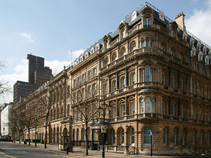

 Birmingham
has 27 conservation area
s. The first conservation areas in Birmingham were designated in 1969. Birmingham City Council have designed 31 conservation areas, of which one, St Peter's Place, have been de-designated in 1976 following the demolition of the church in its centre. The Castle Bromwich
Conservation Area was transferred to Solihull
following a boundary amendment from 1 April 1988. The former Key Hill and St Paul's Conservation Areas were incorporated into the Jewellery Quarter Conservation Area on 27 September 2000.
 Coventry
has 15 conservation areas. The first conservation areas were designated in 1968.
.
 There are 20 conservation areas in Solihull
.
. The first were designated in 1977.
, more than any other metropolitan borough in the West Midlands. The first conservation area was designated in 1972.
Conservation area
A conservation areas is a tract of land that has been awarded protected status in order to ensure that natural features, cultural heritage or biota are safeguarded...
s in the West Midlands
West Midlands (county)
The West Midlands is a metropolitan county in western central England with a 2009 estimated population of 2,638,700. It came into existence as a metropolitan county in 1974 after the passage of the Local Government Act 1972, formed from parts of Staffordshire, Worcestershire and Warwickshire. The...
, England. There are a total of 137 conservation areas throughout the West Midlands.
Birmingham
Birmingham
Birmingham is a city and metropolitan borough in the West Midlands of England. It is the most populous British city outside the capital London, with a population of 1,036,900 , and lies at the heart of the West Midlands conurbation, the second most populous urban area in the United Kingdom with a...
has 27 conservation area
Conservation area
A conservation areas is a tract of land that has been awarded protected status in order to ensure that natural features, cultural heritage or biota are safeguarded...
s. The first conservation areas in Birmingham were designated in 1969. Birmingham City Council have designed 31 conservation areas, of which one, St Peter's Place, have been de-designated in 1976 following the demolition of the church in its centre. The Castle Bromwich
Castle Bromwich
Castle Bromwich is a suburb situated within the northern part of the Metropolitan Borough of Solihull in the English county of West Midlands. It is bordered by the rest of the borough to the south east, North Warwickshire to the east and north east; also Shard End to the south west, Castle Vale,...
Conservation Area was transferred to Solihull
Solihull
Solihull is a town in the West Midlands of England with a population of 94,753. It is a part of the West Midlands conurbation and is located 9 miles southeast of Birmingham city centre...
following a boundary amendment from 1 April 1988. The former Key Hill and St Paul's Conservation Areas were incorporated into the Jewellery Quarter Conservation Area on 27 September 2000.
| Name | Area (ha Hectare The hectare is a metric unit of area defined as 10,000 square metres , and primarily used in the measurement of land. In 1795, when the metric system was introduced, the are was defined as being 100 square metres and the hectare was thus 100 ares or 1/100 km2... ) |
Date designated | Additional designations or notes |
References | |
|---|---|---|---|---|---|
| Anchorage Road, Sutton Coldfield Sutton Coldfield Sutton Coldfield is a suburb of Birmingham, in the West Midlands of England. Sutton is located about from central Birmingham but has borders with Erdington and Kingstanding. Sutton is in the northeast of Birmingham, with a population of 105,000 recorded in the 2001 census... |
17.57 | 15 October 1992 | None. | 52.569°N 1.824°W | |
| Aston Hall Aston Hall Aston Hall is a municipally owned Jacobean-style mansion in Aston, Birmingham, England. Washington Irving used it as the model for Bracebridge Hall in his stories in The Sketch Book of Geoffrey Crayon.-History:... and Church Church of Saints Peter and Paul, Aston The Parish Church of St Peter and St Paul in Witton Lane, Aston, Birmingham, England is a parish church in the Church of England.-Background:Aston and Northfield are the only churches within the City of Birmingham mentioned in Domesday Book... |
24.98 | 27 January 1972 | Extended 6 February 1975 and 17 November 1977. | 52.506°N 1.884°W | |
| Austin Village Austin Village Austin Village is a World War I housing estate of prefabs between Longbridge and Northfield, Birmingham, England.Herbert Austin, who created the Austin Motor Company at Longbridge in 1905, had to take on more workers during the First World War when his factory became involved in making tanks and... , Northfield Northfield -Places:Australia*Northfield, South AustraliaCanada*Northfield, Nova Scotia England* Northfield, BirminghamScotland* Northfield, EdinburghUnited States* Northfield, Connecticut* Northfield, Illinois* Northfield, Indiana... / Longbridge Longbridge Longbridge is an area of Birmingham, England. For local government purposes it is a ward within the district of Northfield.Since 1905, the area has been dominated by the Longbridge plant, which produced Austin, Nash Metropolitan, Morris, British Leyland, and most recently MG Rover cars... |
13.26 | 17 July 1997 | Covered by Article 4(2) Direction. | 52.401°N 1.972°W | |
| Barnsley Road, Edgbaston Edgbaston Edgbaston is an area in the city of Birmingham in England. It is also a formal district, managed by its own district committee. The constituency includes the smaller Edgbaston ward and the wards of Bartley Green, Harborne and Quinton.... |
12.07 | 19 May 1988 | None. | 52.474°N 1.963°W | |
| Bournville Tenants Bournville Bournville is a model village on the south side of Birmingham, England, best known for its connections with the Cadbury family and chocolate – including a dark chocolate bar branded "Bournville". It is also a ward within the council constituency of Selly Oak and home to the Bournville Centre... |
9.147 | 17 June 1971 | Extended 6 February 1975. | 52.417°N 1.947°W | |
| Bournville Village Bournville Village Trust Bournville Village Trust is an organisation that was created to maintain and improve the suburb of Bournville, located in Birmingham. However, during the 20th century it expanded its geographical coverage to include developments in Shenley Green, Lightmoor in Telford, Bloomsbury in Nechells and... |
76.86 | 17 June 1971 | Covered by Article 4(2) Direction. Extended 7 October 1971, 18 June 1981 and 14 July 1994. | 52.431°N 1.934°W | |
| Colmore Row Colmore Row Colmore Row is a street in the centre of Birmingham, England, running from Victoria Square to just beyond Snow Hill station. It is traditionally the city's most prestigious business address.... and Environs, City Centre |
21.70 | 7 October 1971 | Extended 21 March 1985 and 5 July 1985. | 52.481°N 1.900°W | |
| Digbeth Digbeth Digbeth is an area of Birmingham, England. Following the destruction of the Inner Ring Road, Digbeth is now considered a district within Birmingham City Centre. As part of the Big City Plan, Digbeth is undergoing a large redevelopment scheme that will regenerate the old industrial buildings into... , Deritend Deritend Deritend is an historic area of Birmingham, England, built around a crossing point of the River Rea. It is first mentioned in 1276. Today Deritend is usually considered to be part of Digbeth.-History:... , and Bordesley Bordesley, West Midlands Bordesley is an area of Birmingham, England and is part of the City's Nechells Ward.It is served by Bordesley railway station.It should not be confused with nearby Bordesley Green.-Notable residents :... High Streets |
28.68 | 31 May 2000 | None. | 52.476°N 1.884°W | |
| Edgbaston Edgbaston Edgbaston is an area in the city of Birmingham in England. It is also a formal district, managed by its own district committee. The constituency includes the smaller Edgbaston ward and the wards of Bartley Green, Harborne and Quinton.... |
395.4 | 4 September 1975 | Extended 13 December 1984, 17 September 1992 and 10 October 1992. | 52.461°N 1.919°W | |
| Four Oaks, Sutton Coldfield Sutton Coldfield Sutton Coldfield is a suburb of Birmingham, in the West Midlands of England. Sutton is located about from central Birmingham but has borders with Erdington and Kingstanding. Sutton is in the northeast of Birmingham, with a population of 105,000 recorded in the 2001 census... |
114 | 10 July 1986 | None. | 52.576°N 1.832°W | |
| Harborne Old Village Harborne Harborne is an area three miles southwest from Birmingham city centre, England. It is a Birmingham City Council ward in the formal district and in the parliamentary constituency of Birmingham Edgbaston.- Geography :... |
24.79 | 17 July 1969 | None. | 52.453°N 1.957°W | |
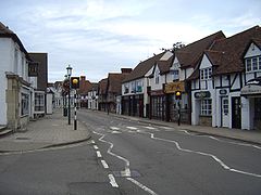
| High Street, Sutton Coldfield Sutton Coldfield Sutton Coldfield is a suburb of Birmingham, in the West Midlands of England. Sutton is located about from central Birmingham but has borders with Erdington and Kingstanding. Sutton is in the northeast of Birmingham, with a population of 105,000 recorded in the 2001 census... |
16.95 | 28 November 1973 | Partly covered by Article 4(1) Direction. Extended 6 February 1975, 14 August 1980 and 16 July 1992. | 52.566°N 1.823°W | |
| Ideal Village, Bordesley Green Bordesley Green Bordesley Green is an inner-city area of Birmingham, England about two miles south-east from the city centre. It also contains a road of the same name. It is also a ward in the formal district of Hodge Hill. Neighbouring areas include, Alum Rock, Saltley, Small Heath and Yardley.Heartlands Hospital... |
17.57 | 18 October 1990 | Covered by Article 4(2) Direction. | 52.478°N 1.836°W | |
| Jewellery Quarter Jewellery Quarter The Jewellery Quarter is an area of Birmingham City Centre, England, situated in the south of the Hockley area. It is covered by the Ladywood district. There is a population of around 3,000 people in a area.... |
94.43 | 10 January 1980 | Extended 18 January 1996 and 27 September 2000. | 52.488°N 1.911°W | |
| Kings Norton Kings Norton Kings Norton is an area of Birmingham, England. It is also a Birmingham City Council ward within the formal district of Northfield.-History:... |
14.28 | 17 July 1969 | None. | 52.408°N 1.930°W | |
| Lee Crescent, Edgbaston Edgbaston Edgbaston is an area in the city of Birmingham in England. It is also a formal district, managed by its own district committee. The constituency includes the smaller Edgbaston ward and the wards of Bartley Green, Harborne and Quinton.... |
2.342 | 6 June 1974 | None. | 52.469°N 1.908°W | |
| Lozells Lozells Lozells is a loosely-defined inner-city area in the West of Birmingham, England. It is centred on Lozells Road, and is known for its multi-racial population. It is part of the ward of Lozells and East Handsworth and lies between the districts of Handsworth and Aston.Lozells has a high population... and Soho Hill Soho, Birmingham Soho is an area in north west Birmingham, approximately 2 miles from the City Centre on the A41, which until 1911 formed part of Handsworth District. Soho is also a ward within the council constituency of Ladywood... |
34.44 | 19 July 1979 | None. | 52.501°N 1.919°W | |
| Moor Pool, Harborne Harborne Harborne is an area three miles southwest from Birmingham city centre, England. It is a Birmingham City Council ward in the formal district and in the parliamentary constituency of Birmingham Edgbaston.- Geography :... |
22.32 | 30 July 1970 | Covered by Article 4(2) Direction. | 52.463°N 1.957°W | |
| Moseley Moseley Moseley is a suburb of Birmingham, England, two miles south of the city centre. The area is a popular cosmopolitan residential location and leisure destination, with a number of bars and restaurants... |
95.06 | 17 March 1983 | Extended 12 November 1987 and 14 March 2005. | 52.449°N 1.893°W | |
| Northfield Old Village Northfield -Places:Australia*Northfield, South AustraliaCanada*Northfield, Nova Scotia England* Northfield, BirminghamScotland* Northfield, EdinburghUnited States* Northfield, Connecticut* Northfield, Illinois* Northfield, Indiana... |
4.076 | 17 July 1969 | None. | 52.411°N 1.964°W | |
| Old Yardley Yardley, Birmingham Yardley is an area in east Birmingham, England. It is also a council constituency, managed by its own district committee.Birmingham Yardley is a constituency and its Member of Parliament is John Hemming.-Features:... |
11.47 | 17 July 1969 | Covered by Article 4(1) Direction). Extended 15 August 1974. | 52.474°N 1.803°W | |
| Ryland Road, Edgbaston Edgbaston Edgbaston is an area in the city of Birmingham in England. It is also a formal district, managed by its own district committee. The constituency includes the smaller Edgbaston ward and the wards of Bartley Green, Harborne and Quinton.... |
2.759 | 13 March 1969 | None. | 52.468°N 1.909°W | |
| St Agnes, Moseley Moseley Moseley is a suburb of Birmingham, England, two miles south of the city centre. The area is a popular cosmopolitan residential location and leisure destination, with a number of bars and restaurants... |
27.59 | 25 June 1987 | None. | 52.442°N 1.877°W | |
| St Augustines, Edgbaston Edgbaston Edgbaston is an area in the city of Birmingham in England. It is also a formal district, managed by its own district committee. The constituency includes the smaller Edgbaston ward and the wards of Bartley Green, Harborne and Quinton.... |
13.46 | 18 February 1988 | None. | 52.473°N 1.944°W | |
| School Road, Hall Green Hall Green Not to be confused with Hall Green, Wolverhampton or Hall Green, SandwellHall Green is an area and ward in south Birmingham, England. It is also a council constituency, managed by its own district committee... |
6.380 | 17 November 1988 | First designation of speculative semi-detached suburbia. | 52.433°N 1.837°W | |
| Steelhouse, City Centre | 11.07 | 4 October 1993 | None. | 52.484°N 1.893°W | |
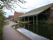
| Warwick Bar Warwick Bar The Warwick Bar conservation area is a conservation area in Birmingham, England which was home to many canalside factories during the Industrial Revolution of the eighteenth and nineteenth centuries.... , Digbeth Digbeth Digbeth is an area of Birmingham, England. Following the destruction of the Inner Ring Road, Digbeth is now considered a district within Birmingham City Centre. As part of the Big City Plan, Digbeth is undergoing a large redevelopment scheme that will regenerate the old industrial buildings into... |
16.19 | 25 June 1987 | None. | 52.479°N 1.884°W |
Coventry
Coventry
Coventry is a city and metropolitan borough in the county of West Midlands in England. Coventry is the 9th largest city in England and the 11th largest in the United Kingdom. It is also the second largest city in the English Midlands, after Birmingham, with a population of 300,848, although...
has 15 conservation areas. The first conservation areas were designated in 1968.
| Name | Date designated | Additional designations or notes |
|
|---|---|---|---|
| Allesley Village Allesley Allesley is a civil parish on the northwestern edge of the City of Coventry, West Midlands, England, about 3 miles west of Coventry city centre. According to the 2001 census. the parish had a population of 805. Until recently it contained to a factory belonging to the car maker, Jaguar... |
20 December 1968 | Extended 29 November 1994. | 52.423°N 1.558°W |
| Kenilworth Road, Earlsdon Earlsdon, Coventry Earlsdon is a suburb and electoral ward of Coventry. It lies approximately one mile to the southwest of Coventry City Centre. It is the birth place of aviation pioneer Frank Whittle There are shops and several restaurants on Earlsdon Street, the main street through Earlsdon. There is also... |
20 December 1968 | Extensions agreed 6 September 1978 with effect from 10 October 1978. Minor boundary adjustments approved 6 January 2004. | 52.384°N 1.536°W |
| Stoke Green | 20 December 1968 | Extension and other minor boundary adjustments approved 6 January 2004. | 52.406°N 1.481°W |
| Greyfriars Green, City Centre | 8 August 1969 | Extended 6 April 1977. | 52.404°N 1.513°W |
| Hill Top, City Centre | 8 August 1969 | "Outstanding" status given 14 December 1976 (since discontinued). Minor boundary adjustment approved 6 January 2004. | 52.408°N 1.507°W |
| Lady Herbert's Garden, City Centre | 8 August 1969 | Extended 6 April 1977. Minor boundary adjustment approved 6 January 2004. | 52.411°N 1.508°W |
| Spon Street, City Centre | 8 August 1969 | Extension to north and other minor boundary adjustments approved 6 January 2004. | 52.408°N 1.517°W |
| Hawkesbury Junction Hawkesbury Junction Hawkesbury Junction or Sutton Stop is a canal junction at the northern limit of the Oxford Canal where it meets the Coventry Canal, near Hawkesbury Village, Warwickshire, on the West Midlands county border, England... |
14 September 1976 | Designated jointly with Nuneaton & Bedworth Borough Council and ratified by the West Midlands County Council West Midlands County Council The West Midlands County Council was, from 1974 to 1986, the upper-tier administrative body for the West Midlands county, a metropolitan county in England.... in October 1976. |
52.457°N 1.469°W |
| Chapelfields Chapelfields, Coventry Chapelfields is a suburb of Coventry, West Midlands, England. It is situated about 1.5 miles to the west of Coventry City Centre; bordering Coundon to the north, Earlsdon to the south, Spon End to the east and Whoberley to the west... |
9 November 1976 | None. | 52.407°N 1.533°W |
| London Road, north of Whitley Whitley, Coventry Whitley is a suburb of southern Coventry in the West Midlands of England.-Industry and commerce:Whitley is the home of the Whitley plant, which is the Engineering Centre and Headquarters of Jaguar Cars Limited... |
5 April 1977 | Given "outstanding" status 7 October 1977 (since discontinued). The Cemetery is now on the English Heritage English Heritage English Heritage . is an executive non-departmental public body of the British Government sponsored by the Department for Culture, Media and Sport... Parks & Gardens register. |
52.399°N 1.496°W |
| High Street, City Centre | 12 October 1982 | None. | 52.407°N 1.509°W |
| Ivy Farm Lane, Canley Canley Canley is a suburban neighbourhood located in southwest Coventry, England. Canley became part of Coventry as a result of successive encroachment of the latter's boundaries between 1928 and 1932, having historically been part of the Stoneleigh parish.... |
16 November 1989 | Minor boundary adjustments approved 6 January 2004. | 52.387°N 1.547°W |
| Far Gosford Street, adjacent to the A460 | 21 October 1992 | None. | 52.407°N 1.494°W |
| Naul's Mill Spon End Spon End is a suburb of Coventry, England. It is situated west of Coventry City Centre. The Butts Park Arena and the Butts Centre are situated on the main road through Spon End. The Butts Park Arena, which was opened in 2004, is the home of Coventry Rugby Football club... |
10 September 2003 | None. | 52.413°N 1.515°W |
| Spon End Spon End Spon End is a suburb of Coventry, England. It is situated west of Coventry City Centre. The Butts Park Arena and the Butts Centre are situated on the main road through Spon End. The Butts Park Arena, which was opened in 2004, is the home of Coventry Rugby Football club... |
10 September 2003 | None. | 52.411°N 1.522°W |
Dudley
There are 21 conservation areas in DudleyMetropolitan Borough of Dudley
The Metropolitan Borough of Dudley is a metropolitan borough in the West Midlands of England. It was created in 1974, and is made up of the towns of Dudley , Stourbridge , Halesowen, Brierley Hill, Amblecote, Sedgley and Coseley...
.
| Name | Additional designations or notes |
|
|---|---|---|
| All Saints, Sedgley Sedgley Sedgley is an urban village within the West Midlands county of England. Historically a part of Staffordshire, Sedgley was formerly an ancient manor composed of several smaller villages, including Gornal, Gospel End, Woodsetton, Ettingshall, Coseley and Brierley... |
None. | 52.540°N 2.123°W |
| Bumble Hole, Netherton Netherton, West Midlands Netherton is a town in the West Midlands within the Metropolitan Borough of Dudley. It lies around south of the town of Dudley and north of Cradley Heath... |
None. | 52.492°N 2.072°W |
| Castle Hill, Dudley Dudley Dudley is a large town in the West Midlands county of England. At the 2001 census , the Dudley Urban Sub Area had a population of 194,919, making it the 26th largest settlement in England, the second largest town in the United Kingdom behind Reading, and the largest settlement in the UK without... |
None. | 52.515°N 2.079°W |
| Church Road, Oldswinford Oldswinford The name Oldswinford is now used for a small area of Stourbridge, close to the parish church.-History:Originally, it was an extensive ancient parish, covering the whole of the former Municipal Borough of Stourbridge, except Pedmore... |
None. | 52.447°N 2.136°W |
| The Coppice, Coseley Coseley Coseley is a town located mostly within the Metropolitan Borough of Dudley in the English West Midlands. Part of the Black Country, it lies south east of Wolverhampton and north of Dudley.... |
None. | 52.541°N 2.103°W |
| Delph 'Nine' Locks, Brierley Hill Brierley Hill Brierley Hill is a town and electoral ward of the Metropolitan Borough of Dudley, West Midlands, England. It is one of the larger Black Country towns with a population of 9,631 and is heavily industrialised, best known for glass and steel manufacturing, although the industry has declined... |
None. | 52.477°N 2.120°W |
| Dudley Town Centre | None. | 52.509°N 2.084°W |
| High Street, Stourbridge Stourbridge Stourbridge is a town within the Metropolitan Borough of Dudley, in the West Midlands of England. Historically part of Worcestershire, Stourbridge was a centre of glass making, and today includes the suburbs of Amblecote, Lye, Norton, Oldswinford, Pedmore, Wollaston, Wollescote and Wordsley The... |
None. | 52.457°N 2.146°W |
| The Leasowes, Halesowen Halesowen Halesowen is a town in the Metropolitan Borough of Dudley, in the West Midlands, England.The population, as measured by the United Kingdom Census 2001, was 55,273... |
Article Four. | 52.469°N 2.065°W |
| Love Lane, Oldswinford Oldswinford The name Oldswinford is now used for a small area of Stourbridge, close to the parish church.-History:Originally, it was an extensive ancient parish, covering the whole of the former Municipal Borough of Stourbridge, except Pedmore... |
Article Four. | 52.448°N 2.146°W |
| Lutley Mill, Lutley | None. | 52.450°N 2.077°W |
| Mushroom Green | Article Four. | 52.476°N 2.093°W |
| Oak Street, Coseley Coseley Coseley is a town located mostly within the Metropolitan Borough of Dudley in the English West Midlands. Part of the Black Country, it lies south east of Wolverhampton and north of Dudley.... |
None. | 52.536°N 2.090°W |
| Parkhead Locks, Dudley | None. | 52.498°N 2.099°W |
| Stourbridge Branch Canal Stourbridge Canal The Stourbridge Canal is a canal in the West Midlands of England. It links the Staffordshire and Worcestershire Canal with the Dudley Canal, and hence, via the Birmingham Canal Navigations, to Birmingham and the Black Country.-History:The Stourbridge and Dudley canals were originally proposed as a... (Amblecote) |
None. | 52.467°N 2.155°W |
| Stourbridge Canal Stourbridge Canal The Stourbridge Canal is a canal in the West Midlands of England. It links the Staffordshire and Worcestershire Canal with the Dudley Canal, and hence, via the Birmingham Canal Navigations, to Birmingham and the Black Country.-History:The Stourbridge and Dudley canals were originally proposed as a... (Canal Street) |
None. | 52.461°N 2.152°W |
| Stourbridge 16 Locks, Wordsley Wordsley Wordsley with Buckpool is a village south of Kingswinford although is the most northern suburb of Stourbridge in the West Midlands, England. Wordsley still retains its rural character because it abuts open countryside... |
None. | 52.478°N 2.151°W |
| The Village, Kingswinford Kingswinford Kingswinford is a suburban area in the West Midlands.Historically within Staffordshire, the area is mentioned in the Domesday Book its name relates to a ford for the King's swine - Latin Swinford Regis. The current significance is probably in tourism, education and housing... |
Partly covered by Article Four. | 52.501°N 2.157°W |
| Wollaston Wollaston, West Midlands Wollaston is a village and suburb of Stourbridge, in West Midlands, England. It is within Dudley Metropolitan Borough. It is situated on the border between Dudley Metropolitan Borough and Staffordshire County , and until 1974 was in Worcestershire. Wollaston is one mile from Stourbridge town... |
None. | 52.460°N 2.163°W |
| Wordsley Church | None. | 52.479°N 2.160°W |
| Wordsley Hospital | None. | 52.485°N 2.160°W |
Sandwell
There are six conservation areas in Sandwell.| Name | Area (ha Hectare The hectare is a metric unit of area defined as 10,000 square metres , and primarily used in the measurement of land. In 1795, when the metric system was introduced, the are was defined as being 100 square metres and the hectare was thus 100 ares or 1/100 km2... ) |
Date designated | Additional designations or notes |
|
|---|---|---|---|---|
| Church Square, Oldbury Oldbury, West Midlands Oldbury is a town in the West Midlands in England. It is a part of the Black Country and the administrative centre of the borough of Sandwell.-Local government:... |
1.34 | 1974 | None. | 52.503°N 2.014°W |
| Market Place, Wednesbury Wednesbury Wednesbury is a market town in England's Black Country, part of the Sandwell metropolitan borough in West Midlands, near the source of the River Tame. Similarly to the word Wednesday, it is pronounced .-Pre-Medieval and Medieval times:... |
3.11 | 1980 | None. | 52.552°N 2.018°W |
| Smethwick Smethwick Smethwick is a town in the Metropolitan Borough of Sandwell, in the West Midlands of England. It is situated on the edge of the city of Birmingham, within the historic boundaries of Staffordshire, Worcestershire and Warwickshire.... Summit (Galton Valley) |
47.48 | 1985 | None. | 52.497°N 1.972°W |
| Factory Locks, Tipton Tipton Tipton is a town in the Sandwell borough of the West Midlands, England, with a population of around 47,000. Tipton is located about halfway between Birmingham and Wolverhampton. It is a part of the West Midlands conurbation and is a part of the Black Country.... |
2.62 | 1986 | None. | 52.531°N 2.071°W |
| High Street, West Bromwich West Bromwich West Bromwich is a town within the Metropolitan Borough of Sandwell, in the West Midlands, England. It is north west of Birmingham lying on the A41 London-to-Birkenhead road. West Bromwich is part of the Black Country... |
11.80 | 1990 | Extended 1995 and 1997. | 52.520°N 1.997°W |
| Warrens Hall | 33.98 | 1994 | None. | 52.494°N 2.065°W |
Solihull
Solihull
Solihull is a town in the West Midlands of England with a population of 94,753. It is a part of the West Midlands conurbation and is located 9 miles southeast of Birmingham city centre...
.
| Name | |
|---|---|
| Ashleigh Road | 52.417°N 1.787°W |
| Barston Barston Barston is a village and civil parish in Metropolitan Borough of Solihull in the West Midlands of England. It is about six km east of Solihull and is located inside a large meander of the River Blythe. The nearest large city is Birmingham. According to the 2001 UK Census, the parish had a... |
52.400°N 1.696°W |
| Berkswell Berkswell Berkswell is a village and civil parish in the Metropolitan Borough of Solihull, county of West Midlands, England.- Geography:It is in the east of the borough, borders Coventry and is about west of Coventry city centre.- History and places of interest :... |
52.409°N 1.641°W |
| Bickenhill Bickenhill Bickenhill is a village, civil parish and ward in the Metropolitan Borough of Solihull, West Midlands, England, on the fringes of the West Midlands conurbation.-History:... |
52.437°N 1.724°W |
| Castle Bromwich Castle Bromwich Castle Bromwich is a suburb situated within the northern part of the Metropolitan Borough of Solihull in the English county of West Midlands. It is bordered by the rest of the borough to the south east, North Warwickshire to the east and north east; also Shard End to the south west, Castle Vale,... |
52.507°N 1.788°W |
| Granville Road, Dorridge Dorridge Dorridge is a village in the West Midlands borough of Solihull, England, with a population of 7800.-Location:Dorridge is to the East of the M40 and the South of the M42 which, along with a small but important green belt area, separates Dorridge and its neighbours of Knowle and Bentley Heath from... |
52.370°N 1.747°W |
| Grove Avenue | Unknown |
| Hampton-in-Arden Hampton-in-Arden Hampton-in-Arden is a village and civil parish located within the Metropolitan Borough of Solihull, in the West Midlands of England. The village was previously located within the county of Warwickshire, until the 1974 county boundary changes. It lies in the countryside between Birmingham and Coventry... |
52.427°N 1.701°W |
| Knowle Knowle Knowle is a large village a few miles southeast of the town of Solihull, UK. Knowle lies within the historic county boundaries of Warwickshire, and since 1974 it has been part of the Metropolitan Borough of Solihull within the West Midlands... |
52.388°N 1.734°W |
| Malvern Hall and Brueton Avenue | 52.412°N 1.769°W |
| Malvern Park Farm | 52.399°N 1.771°W |
| Meriden Green | 52.437°N 1.649°W |
| Meriden Hill | 52.436°N 1.652°W |
| Olton Olton Olton is an area of the Metropolitan Borough of Solihull in the West Midlands, England. In the 13th century the Lords of the Manor moved their seat and formed a new settlement, in the junction of two major roads, that village has now grown into a big town called Solihull... |
52.428°N 1.811°W |
| Solihull | 52.412°N 1.776°W |
| Station Approach, Dorridge Dorridge Dorridge is a village in the West Midlands borough of Solihull, England, with a population of 7800.-Location:Dorridge is to the East of the M40 and the South of the M42 which, along with a small but important green belt area, separates Dorridge and its neighbours of Knowle and Bentley Heath from... |
52.372°N 1.753°W |
| Temple Balsall Temple Balsall Temple Balsall is a hamlet within the Metropolitan Borough of Solihull in the English West Midlands, situated between the large villages of Knowle and Balsall Common. It was formerly in Warwickshire. It is on a notoriously bad bend on the B4101 Kenilworth Road.It is one of the oldest and most... |
52.381°N 1.699°W |
| Walsal End | 52.412°N 1.704°W |
| Warwick Road | 52.417°N 1.781°W |
| Whitehouse Green | 52.411°N 1.795°W |
Walsall
There are 18 conservation areas in WalsallWalsall
Walsall is a large industrial town in the West Midlands of England. It is located northwest of Birmingham and east of Wolverhampton. Historically a part of Staffordshire, Walsall is a component area of the West Midlands conurbation and part of the Black Country.Walsall is the administrative...
. The first were designated in 1977.
| Name | Area (ha Hectare The hectare is a metric unit of area defined as 10,000 square metres , and primarily used in the measurement of land. In 1795, when the metric system was introduced, the are was defined as being 100 square metres and the hectare was thus 100 ares or 1/100 km2... ) |
Date designated | |
|---|---|---|---|
| Aldridge Aldridge Aldridge is a town within the Metropolitan Borough of Walsall, in the West Midlands, England. Historically it was part of the county of Staffordshire, but in 1974 it was incorporated into the Walsall borough as well as the West Midlands county.- History :... |
38 | 25 March 1980 | 52.605°N 1.913°W |
| Walsall Arboretum Walsall Arboretum Walsall Arboretum is a Victorian public park located very close to Walsall town centre in the West Midlands. Part of the park and surrounding housing are covered by the Arboretum conservation area.-17th-19th centuries:... |
31.32 | 19 April 1989 | 52.590°N 1.972°W |
| Bloxwich High Street Bloxwich Bloxwich is a town in the Metropolitan Borough of Walsall, West Midlands, England, with a population of around 40,000 people.-Early history:Bloxwich has its origins at least as early as the Anglo-Saxon period, when the place name evidence suggests it was a small Mercian settlement named after the... |
Unknown. | 18 October 2002 | 52.617°N 2.004°W |
| Bloxwich Park | 9.41 | 13 December 1989 | 52.619°N 2.005°W |
| Bradford Street | 6.05 | 17 April 1991 | 52.580°N 1.985°W |
| Bridge Street | 5.5 | 13 July 1983 | 52.584°N 1.981°W |
| Caldmore Green Caldmore Caldmore is one of the villages that make up the town of Walsall. The name is pronounced "Kar-ma" by the local populace.-History:The area was an important junction of roads which created a triangular shaped green called Caldmore Green... |
1.5 | 18 March 1987 | 52.583°N 1.981°W |
| Church Hill | 20.5 | 9 March 1979 | 52.581°N 1.977°W |
| Darlaston Darlaston Darlaston is a town in the Metropolitan Borough of Walsall in the West Midlands of England.-History:Archaeological evidence of the history of Darlaston has been destroyed by The de Darlaston family owned Darlaston and lived in the manor between the 12th century and 15th century. When the de... |
6.5 | 7 February 1977 | 52.568°N 2.033°W |
| Elmore Green, Bloxwich Bloxwich Bloxwich is a town in the Metropolitan Borough of Walsall, West Midlands, England, with a population of around 40,000 people.-Early history:Bloxwich has its origins at least as early as the Anglo-Saxon period, when the place name evidence suggests it was a small Mercian settlement named after the... |
7.73 | 19 April 1990 | 52.614°N 2.004°W |
| Great Barr Great Barr Great Barr is a large and loosely-defined area which straddles the boundaries of Birmingham, West Bromwich and Walsall , West Midlands, England... |
764 | 12 January 1996 | 52.569°N 1.917°W |
| Highgate Highgate, West Midlands Highgate is a small village located within the Walsall Ring Road. The village was constructed in the Victorian era for the wealthy, and has developed a reputation as one of the most expensive neighbourhoods in Walsall for house prices.-Geography:... |
10.2 | 12 October 1994 | 52.576°N 1.975°W |
| Lichfield Street | 6.9 | 6 July 1988 | 52.586°N 1.978°W |
| Old Pelsall Pelsall Pelsall is an area of Walsall in the West Midlands, England. It is part of the Parliamentary Constituency of Aldridge-Brownhills.- History :Pelsall was first mentioned in a charter of 994, when it was amongst various lands given to the monastery at Heantune by Wulfrun, a Mercian noblewoman... |
3.9 | 20 August 1986 | 52.626°N 1.978°W |
| Old Rushall Rushall, West Midlands Rushall is a residential area of Walsall in the West Midlands of England. It is centred around the main road between Walsall and Lichfield, and was mostly developed after 1920... |
7.07 | 26 October 1983 | 52.597°N 1.964°W |
| Pelsall Common Pelsall Pelsall is an area of Walsall in the West Midlands, England. It is part of the Parliamentary Constituency of Aldridge-Brownhills.- History :Pelsall was first mentioned in a charter of 994, when it was amongst various lands given to the monastery at Heantune by Wulfrun, a Mercian noblewoman... |
57.5 | 2 March 1979 | 52.626°N 1.967°W |
| Walsall Locks | 5.5 | 18 March 1987 | 52.588°N 1.993°W |
| Willenhall Willenhall Willenhall is a town in the Black Country area of the West Midlands of England, with a population of approximately 40,000. It is situated between Wolverhampton and Walsall, historically in the county of Staffordshire... |
7.7 | 28 January 1977 | 52.584°N 2.055°W |
Wolverhampton
There are 30 conservation areas in WolverhamptonWolverhampton
Wolverhampton is a city and metropolitan borough in the West Midlands, England. For Eurostat purposes Walsall and Wolverhampton is a NUTS 3 region and is one of five boroughs or unitary districts that comprise the "West Midlands" NUTS 2 region...
, more than any other metropolitan borough in the West Midlands. The first conservation area was designated in 1972.
| Name | Date designated | Additional designations or notes |
|
|---|---|---|---|
| Ash Hill | 13 October 1994 | None. | 52.585°N 2.165°W |
| Bantock House | 12 October 1989 | None. | 52.579°N 2.154°W |
| Bilston Town Centre Bilston Bilston is a town in the English county of West Midlands, situated in the southeastern corner of the City of Wolverhampton. Three wards of Wolverhampton City Council cover the town: Bilston East and Bilston North, which almost entirely comprise parts of the historic Borough of Bilston, and... |
1975 | Boundaries were adjusted 30 September 2002. | 52.566°N 2.074°W |
| Bushbury Hill Bushbury Bushbury is a suburb of Wolverhampton, West Midlands, England. It lies two miles north-east of Wolverhampton city centre, divided between the Bushbury North and Bushbury South and Low Hill wards.- Place name and history :... |
1972 | Boundaries were adjusted 25 June 1974. | 52.625°N 2.105°W |
| Castlecroft Gardens | 28 July 1988 | None. | 52.577°N 2.176°W |
| Cedar Way | 22 April 1999 | None. | 52.607°N 2.088°W |
| Chapel Ash | 11 April 1991 | None. | 52.584°N 2.137°W |
| Cleveland Road, City Centre | 13 June 1996 | None. | 52.581°N 2.120°W |
| Copthorne Road | 2001 | Boundaries were adjusted 4 March 2002. | 52.571°N 2.141°W |
| Fellows Street, Blakenhall Blakenhall Blakenhall is a ward in Wolverhampton, England.-Toponymy and history:Blakenhall's name, according to topynmists comes from the Old English 'blæc', meaning 'black' or dark coloured, & 'halh' meaning 'nook' or 'corner'... |
26 November 2001 | None. | 52.575°N 2.130°W |
| Old Hall Street, City Centre | 26 October 1995 | None. | 52.583°N 2.124°W |
| Park | 1975 | Boundaries were adjusted 12 October 1995. | 52.590°N 2.140°W |
| Penn Fields Penn Fields Penn Fields is an area of the city of Wolverhampton, West Midlands, situated about one mile to the south-west of the city centre within the Graiseley ward. It lies on Penn Road, the A449 trunk road to Kidderminster. The housing stock varies from modest terraced homes to large detached residences.... |
14 April 1994 | None. | 52.567°N 2.147°W |
| Penn Road, Graiseley Graiseley Graiseley is both an inner-city area of Wolverhampton, situated immediately to the south-west of the city centre, and the name of a ward of Wolverhampton City Council.-Place-name:... |
24 July 1997 | None. | 52.573°N 2.138°W |
| Springfield Brewery | 3 October 2003 | None. | 52.592°N 2.121°W |
| St John's Square | 1972 | Boundaries were adjusted in 1986 and on 12 October 1989. | 52.581°N 2.128°W |
| St Philips, Penn Fields Penn Fields Penn Fields is an area of the city of Wolverhampton, West Midlands, situated about one mile to the south-west of the city centre within the Graiseley ward. It lies on Penn Road, the A449 trunk road to Kidderminster. The housing stock varies from modest terraced homes to large detached residences.... |
10 October 1991 | None. | 52.566°N 2.159°W |
| Staffordshire and Worcestershire Staffordshire and Worcestershire Canal The Staffordshire and Worcestershire Canal is a narrow navigable canal in the English Midlands, passing through the counties of Staffordshire and Worcestershire.... & Shropshire Union Canal Shropshire Union Canal The Shropshire Union Canal is a navigable canal in England; the Llangollen and Montgomery canals are the modern names of branches of the Shropshire Union system and lie partially in Wales.... |
14 October 1993 | None. | 52.615°N 2.146°W |
| Tettenhall Greens Tettenhall Tettenhall is a historic part of the city of Wolverhampton, England. The name Tettenhall is probably derived from Teotta's Halh, Teotta being a person's name and Halh being a sheltered position... |
1972 | Boundaries were adjusted 14 July 2003. | 52.600°N 2.172°W |
| Tettenhall Road | 1 December 2004 | None. | 52.592°N 2.153°W |
| Tettenhall Wood | 6 November 1975 | None. | 52.594°N 2.188°W |
| The Oaks, Merridale Merridale Merridale is an area of Wolverhampton, West Midlands, England. It is situated to the south-west of the city centre, on the border of the city council's Graiseley and Park wards.- Origins and history :... |
1 December 2004 | None. | 52.584°N 2.143°W |
| The Woodlands | 17 June 1976 | None. | 52.562°N 2.155°W |
| Union Mill | 1985 | Boundaries were adjusted 14 March 2007. | 52.588°N 2.117°W |
| Vicarage Road, Penn Penn, West Midlands Penn is an area now divided between Wolverhampton in the West Midlands and South Staffordshire. Originally, it was a village in the historic county of Staffordshire. There is considerable confusion about exactly which areas fall within Penn... |
1972 | Boundaries were adjusted 17 June 1976. | 52.556°N 2.160°W |
| Wednesfield Wednesfield Wednesfield lies at , and is located to the northeast of Wolverhampton city centre on the northern fringe of the West Midlands conurbation... |
1988 | Boundaries were adjusted 13 January 1994. | 52.599°N 2.083°W |
| Wightwick Bank Wightwick Manor Wightwick Manor is a Victorian manor house located on Wightwick Bank, Wolverhampton, West Midlands, England, and one of only a few surviving examples of a house built and furnished under the influence of the Arts and Crafts movement... |
12 October 1989 | None. | 52.582°N 2.193°W |
| Wolverhampton Locks | 1975 | Boundaries were adjusted 14 March 2007. | 52.606°N 2.141°W |
| Wolverhampton City Centre | 1972 | Boundaries were adjusted in 1974, 1975, 1976, 1991, 2005 and on 14 March 2007. | 52.587°N 2.128°W |
| Worcester Street, City Centre | 26 October 1995 | None. | 52.582°N 2.130°W |