
Netherton, West Midlands
Encyclopedia
Netherton is a town in the West Midlands
within the Metropolitan Borough of Dudley
. It lies around 1.5 miles (2 km) south of the town of Dudley
and 1.5 miles (2 km) north of Cradley Heath
. Despite the growth of neighbouring urban centres in the Black Country
in the 20th century, Netherton remains a distinct locality, bordered by nature reserves to the east and west, whilst to the north an industrial area and the Dudley Southern By-Pass
largely separates Netherton from Dudley Town. The southern border, which is also the boundary with the Metropolitan Borough of Sandwell is formed by the Mousesweet Brook.
. Netherton is shown in Joseph Browne's 1682 map of Staffordshire
, although like its larger neighbour Dudley, it lay in a small enclave of Worcestershire
completely surrounded by Staffordshire
. Netherton is mentioned in legal records dating from 1420 and the first mention of a Netherton nailor, an occupation that became very important locally in later years, is dated 1559. The village is called 'Nederton' in the earliest available documents. The village was included in the Manor of Dudley, which was a Lordship of the Barons of Dudley who once owned a manor house in Netherton. This property is mentioned in documents dating from the 15th-17th centuries. In 1684, King Charles II of England
granted a charter to Netherton allowing the village to hold an annual market fair. The fair was held in Netherton's market place in the last week of October until 1848. Although records of local government in the early years of Netherton are rather scarce, records exist of the procedures of the Court Leet of the barons of Dudley from the year 1701. Two juries were sworn in: one to deal with the town of Dudley and one to oversee the 'foreign' which is the name given to areas of the manor
outside of Dudley town. Netherton was part of the foreign. In 1729 the court ordered the construction of a pair of stocks
at Netherton to 'punish such as the Law directs'.
Following the Enclosure Acts of the late 18th century, allowing building in Pensnett Chase, the present town centre took shape further up the hill than its original site. Netherton expanded rapidly in the industrial age and the thick seams of coal underlying the region were extensively mined. Blast furnaces were constructed in Netherton for steel making and the area became home to many industries including chain and anchor making, nail making, brick making, enamelling, and the construction of boilers.
In 1874, Dr. Ballard, sent by the Local Government Board to inspect the sanitary conditions of the Borough of Dudley, described Netherton as: 'a village of such size it almost deserves to be termed a town'.
In the mid-19th century, the area was notorious for its bad sanitary conditions. In 1852 an inquiry into the sewerage, drainage and supply of water was carried out, reporting to the General Board of Health. Its conclusions were very damning for Netherton. A typical comment was: Old Netherton Town, Mr. Thomas Woodall's buildings.- Drainage very horrible, with privies and piggeries as usual, and no pavement. Procure water from a horse-pit nearly half a mile, and it has to be carried up hill, mostly by girls, in little pails of about three gallons, on their heads. This was a bad place for cholera'.
In 1844, Netherton became an ecclesiastical parish. It was made an Electoral ward of the Municipal Borough of Dudley in 1865, thereafter following the same pattern of local government reorganisations as the town of Dudley itself.
The 20th century saw the gradual decline of mining and the heavily polluting industries such as iron-making. At the same time, Dudley Council sought to redevelop areas of Netherton for housing either by demolishing existing older housing (as occurred in areas adjacent to the Halesowen Road in the town centre) and rebuilding or by reclaiming abandoned industrial areas (for example in the Dudley Wood and Saltwells area to the south of the town). Other former industrial sites were transfomed into parkland (Netherton Park) or nature reserves (eg. Bumble Hole).
Some of the first council houses in the Dudley borough were constructed around Netherton Park in the early 1920s, around the same time as the Yew Tree Hills area, to rehouse families from older and dilapidated houses around Dudley and Netherton.
that struck Dudley in 1831 and 1832. Netherton's most notable public building is probably the Victorian era
Netherton Arts Centre and Library at the top of Northfield Road. A fire station and a number of police houses were constructed at the same time on an adjacent site. These buildings are being transformed for commercial and community use.
Another local landmark is a pub on the A459 Dudley-Halesowen Road called the Old Swan. The current building dates from the 1860s but there has been a pub on the site since at least 1835. It has been known as Ma Pardoe's since the interwar years, as its long-term landlady was Doris Clare Pardoe (born 1899) who owned it until her death in 1984, when she was 85 years old. Such was its fame among the lovers of real ale, that when the pub came up for sale in 1985, a company was set up by CAMRA to purchase and run the pub. Although this company was short-lived, the pub and brewery survived and it is now one of only a handful of pubs in the West Midlands that still brews beer on its own premises. As well as for its beer, the pub is also known for its decor including a ceiling decorated with vitreous enamel tiles. The pub has been designated a Grade II listed building.
Two old landmarks of Netherton can now be viewed only in the Black Country Living Museum
. These include Harold Emile Doo's chemist shop and Providence Church.
establishment built in 1836 at the corner of Halesowen Road and Church Road, providing education for children aged 5 to 11 years. The school was rebuilt in 1907 following problems with subsidence and remained in use until December 1988, by which time it was an 8-12 middle school and merged with a nearby 5-8 first school to form a new primary school. The old school building is still in existence and currently it is a furniture store.
The town has a postwar comprehensive school
, Hillcrest School and Community College
, which was one of the worst secondary schools in the West Midlands during the 1990s but improved dramatically following the arrival of head teacher Maureen Brennan
. She became Dame Maureen Brennan DBE in 2005 for her outstanding efforts which saw Hillcrest School become one of the most successful schools in the borough just five years after an OFSTED
report had slammed its weak management and placed it in special measures. In 2002, it was mentioned in parliament for its substantial turn-around. Other schools in Netherton include Netherton CE Primary School on Highbridge Road, Northfield Road Primary School on Northfield Road and Netherbrook Primary School on Chester Road.
In 2010, Hillcrest achieved its best results yet - 55% of the GCSE students left the school with 5 or more grades at C or above, placing it 10th out of 21 secondary schools in the borough.
Netherton is also home to Saltwells Education Development Centre, the Dudley EDC which was Saltwells Secondary School until 1986.
border, next to Netherton Reservoir
. It takes its name from Saltwells Wood, now just part of the reserve, named for its saline springs where people came to bathe in the nineteenth and early 20th centuries. Doulton's Claypit
, a Geological Site of Special Scientific Interest, lies within the reserve.
Netherton Park is located near the town centre and was laid out in about 1900 on an area that had once been colliery waste. Another old industrial area that has been reclaimed for public recreation is the Bumble Hole Local Nature Reserve. This region lies to the east of the town adjacent to the boundary with the Metropolitan Borough of Sandwell. The Dudley No. 2 canal runs through the reserve and is the site for an annual narrowboat
festival. A canalside visitor centre provides information on the reserve and on the adjacent Warrens Hall Local Nature Reserve, which is in Sandwell. A rare Timber Gallows crane, a Scheduled Ancient Monument, stood in the reserve but is currently (2008) undergoing restoration.
Netherton Cricket Club was founded in 1866. It is situated on Highbridge Road and celebrated its 140th anniversary in 2006.
Netherton Reservoir
stands approximately one mile to the south-west of the town centre, and is a popular resort for speedboat enthusiasts as well as scuba divers
. Dudley Water Ski Club meet regularly at the reservoir.
, a Costcutter
and a Premier. There are two medium-sized supermarkets to the south of the town centre (an Aldi
and a Lidl
). A post office and a Lloyds TSB
bank also lie on the Halesowen Road. The most unusual shop in Netherton is probably one selling Western (i.e. cowboy) outfits.
Netherton's former triangular-shaped marketplace was situated in the fork of the junction of the Halesowen Road and Northfield Road. Old photographs show it to be still in use at the beginning of the 20th century. The area is now a small public garden.
There are no proper restaurants in Netherton but there are cafés, fish and chip shops, Chinese take-aways and an Indian take-away.
There are a number of pubs in Netherton although far fewer now than in former days. The Old Swan (Ma Pardoe's) has already been mentioned above in notable buildings. Not far away from the Old Swan, at the junction of Cinder Bank and Swan Street, is the Hope Tavern. At the other end of Swan Street one can find the White Swan pub. One unusual pub (which is currently (2010) closed) is the Little Dry Dock in Windmill End, which has a bar made from a canal barge. Inside Saltwells Woods one can find the Saltwells Inn and a short distance from the woods is the Bunch of Bluebells pub. Darby End has two pubs: the Gate Hangs Well and the Red Lion.
Netherton is well supplied with hairdressers and barbers, there being several such shops along the main shopping street.
Netherton Health Centre, a clinic, is situated on the Halesowen Road. The Savoy Centre (named after Netherton's demolished cinema which used to occupy the site), which lies next to the Arts Centre on Northfield Road, provides training, adult education and conference facilities.
There is a small Police Station on Church Road.
Age Concern
, a charity that helps elderly people, has a prominent office and drop-in centre in the former pub, The Junction Inn, on the corner of Cradley Road and the Halesowen Road. Netherton's Conservatives have their club house (including a bowling green) on Halton Street, whilst the local Liberals are based at their club in St. Thomas Street.
churches in Netherton are St Peter's, Darby End and St John the Evangelist, Dudley Wood.
Perhaps more characteristic of Netherton are the nonconformist chapels of which there are several. In St Andrews Street, near the town centre, can be found the Ebenezer Baptist Church. In St Giles Street, the former Sweet Turf Baptist chapel has had its frontage altered and is now named the Champions Church. More evidence for Baptist activity in Netherton can be found on Cinder Bank where the burial ground for the Messiah Baptist church can be found (the church itself has been demolished). The Methodists have a church, The Trinity Methodist Church, on Church Road and another one, the Cole Street Methodist Church at Darby End. A former Methodist chapel, the Noah's Ark on Cradley road is presently (2008) being converted into apartments. On Chapel Street in the Primrose Hill locality one can find the Primrose Hill Congregational Church. The People's Mission have a chapel on Swan Street. The Champions Church have built a new church (opened January 2010) just off Cinder Bank near the junction with Simms Lane.
In 1868 a Sunday School Union was arranged between several of the churches in Netherton and a hymn composed to commemorate the event was sung on Netherton market place. The hymn mentions some of the above chapels. Part of it went:
May Sweet Turf join with Cinder Bank,
And Ebenezer join the rank;
And may St. John's and Primrose Hill,
With Noah's Ark their stations fill.
And may Church Road, and Darby Hand,
All join in one harmonious band;
To spread the triumph of our King,
Who did for all salvation bring.
Frequent buses link Netherton directly with Dudley
, Cradley Heath
, Merry Hill Shopping Centre
, Wolverhampton
, Old Hill
, Halesowen
, West Bromwich
, Bilston
and Brierley Hill
.
The Dudley No. 2 Canal runs through Netherton, linking the Dudley No. 1 canal at Parkhead Junction with the south entrance of the Netherton Tunnel
. When first constructed in 1798 it ran as far as Selly Oak where it connected with the Worcester and Birmingham Canal
.
Netherton has had no rail service since the 1960s when the line, sometimes called the Bumble Hole Line, which linked the town with Dudley and Old Hill was taken out of service. The line had stops at Baptist End
, Windmill End
and Darby End
. A small branch line from Baptist End led to Withymoor Goods Station
, which was near where the Dudley No. 2 canal crosses the Halesowen Road.
There were once many industrial and mineral rail lines running through the Netherton area but these have been long closed. For example, the steel firm Grazebrook's had a line running from their factory on Pear Tree Lane to an interchange on the Great Western Railway
mainline near the former Blowers Green railway station
to the south of Dudley. A branch of the Earl of Dudley's extensive private railway network, which is usually known as the Pensnett Railway, ran through the Saltwells locality.
The town centre encompasses the main shopping street where Cinder Bank meets the Halesowen Road and the residential area on the roads leading up Netherton Hill from the shops.
Other localities in Netherton include Darby End which, according to local legend, was named after the nailmakers from Derbyshire who settled there but is more likely to have taken its name from the Darby family, who were prominent in the early days of the settlement. This area, which has a few shops of its own, is to the south east of the town centre. In the 19th century this area was also commonly referred to as 'Darby Hand'. Nearby, and bordering the Bumble Hole Local Nature Reserve is Windmill End.
Primrose Hill, despite its name, is an industrial area immediately to the south of the town centre.
Dudley Wood and Bowling Green are two residential areas at the south end of the town. The now demolished Dudley Wood Stadium
, sited in the former locality, hosted the Cradley Heathens speedway team until the mid 1990s.
The Lodge Farm Estate lies near Saltwells woods. It is named after the farm which was here before the housing estate was built. In medieval times, the lodge was where the forester (a person responsible for managing the hunting within a wood) lived and it is likely that this is the ultimate origin of the name of this locality, which is sited in what once was Pensnett Chase.
Finally, Mushroom Green is a former industrial hamlet to the south west of the town. It is now a Conservation Area.
and a number of other ocean liners. Hingleys' success in international markets and their use of the Netherton name for their trademarked wrought iron products (e.g. Netherton Crown Special Best Best Iron) caused the name of Netherton to be known more widely both in the UK and overseas. A sculpture of an anchor stands at the junction of Castleton Street and Halesowen Road commemorating the local anchor and chain industry and the anchor motif can be found in a number of places around Netherton (e.g. on the metal park benches in Netherton Park). Immediately adjacent to the works of N. Hingley & Sons on the Dudley No. 2 canal was Lloyds Proving House where chain was subjected to a variety of tests to show it was of suitable quality.

and Bathams
have Netherton links. Edwin Alfred Holden and Lucy Blanche Holden, founders of the Holdens brewing concern, had their first pub in Netherton, whilst Daniel Batham, son of Daniel and Charlotte Batham who had started the family beer production, brewed at the King William in Cole Street, Netherton before moving the brewery to its present location at the Vine on the Delph.
as part of the Dudley Enterprise Zone that stretched beyond Netherton's borders into Brierley Hill
and covered the land which became the Merry Hill Shopping Centre
.
Another notable resident of Netherton was England footballer Joe Smith
(1890–1956). He was born in Darby End and played for local teams until he signed for West Bromwich Albion in 1910. He put in 470 appearances for Albion, was a member of the 1920 side that won the First Division and was capped two times for England. Other Netherton-born footballers include Tom Grosvenor
(1908–1972) who played for Birmingham City and was capped 3 times for England and Billy Wooldridge
(1878–1945) who played for Wolverhampton Wanderers and represented the English Football League in two games against the Irish League.
Sammy 'Pigiron' Whitehouse was a strongman from Darby End, who worked unloading canal boats and in a foundry in the earlier part of the 20th century. He became well known locally for his feats of strength. His nickname 'Pigiron' was earned in 1921 when he won a 4 mile race from Dudley Top church through Netherton following the Halesowen Road carrying a hundredweight (112 lb) of pigiron.
Theophillus Dunn, also from Darby End, was a notable 19th century character, known locally as the 'Dudley Devil'. He was an astrologer and claimed magical healing abilities, charging a shilling for a charm to cure toothache. He also claimed to be able locate stolen property by using charms. He prophesised the downfall of William Perry
(the boxer known as the 'Tipton Slasher')at the hands of Tom Sayers.
West Midlands (county)
The West Midlands is a metropolitan county in western central England with a 2009 estimated population of 2,638,700. It came into existence as a metropolitan county in 1974 after the passage of the Local Government Act 1972, formed from parts of Staffordshire, Worcestershire and Warwickshire. The...
within the Metropolitan Borough of Dudley
Metropolitan Borough of Dudley
The Metropolitan Borough of Dudley is a metropolitan borough in the West Midlands of England. It was created in 1974, and is made up of the towns of Dudley , Stourbridge , Halesowen, Brierley Hill, Amblecote, Sedgley and Coseley...
. It lies around 1.5 miles (2 km) south of the town of Dudley
Dudley
Dudley is a large town in the West Midlands county of England. At the 2001 census , the Dudley Urban Sub Area had a population of 194,919, making it the 26th largest settlement in England, the second largest town in the United Kingdom behind Reading, and the largest settlement in the UK without...
and 1.5 miles (2 km) north of Cradley Heath
Cradley Heath
Cradley Heath is a town in the Black Country, located in Sandwell metropolitan borough, England. The name is usually pronounced "Craid-ley", not "Crad-ley", but in the Black Country accent, it may even sound like "Craig-ley Aith"...
. Despite the growth of neighbouring urban centres in the Black Country
Black Country
The Black Country is a loosely defined area of the English West Midlands conurbation, to the north and west of Birmingham, and to the south and east of Wolverhampton. During the industrial revolution in the 19th century this area had become one of the most intensely industrialised in the nation...
in the 20th century, Netherton remains a distinct locality, bordered by nature reserves to the east and west, whilst to the north an industrial area and the Dudley Southern By-Pass
Dudley Southern By-Pass
The Dudley Southern By-Pass is a major road located in Dudley, a large town in the West Midlands of England.It was first proposed in 1987 due to growing traffic congestion in Dudley town centre, but the go-ahead was not given until 1993, with preliminary work beginning in 1994 with the clearance of...
largely separates Netherton from Dudley Town. The southern border, which is also the boundary with the Metropolitan Borough of Sandwell is formed by the Mousesweet Brook.
History
The town's probable Anglo Saxon origins can be deduced from the fact that Netherton means 'lower farm' in Old English (the corresponding 'upper farm' may have been the original settlement in present-day Dudley). For most of its history, Netherton was a small village centred around the point where a brook crossed the Baptist End Road, near the boundary of Pensnett Chase, a partially wooded commonCommon land
Common land is land owned collectively or by one person, but over which other people have certain traditional rights, such as to allow their livestock to graze upon it, to collect firewood, or to cut turf for fuel...
. Netherton is shown in Joseph Browne's 1682 map of Staffordshire
Staffordshire
Staffordshire is a landlocked county in the West Midlands region of England. For Eurostat purposes, the county is a NUTS 3 region and is one of four counties or unitary districts that comprise the "Shropshire and Staffordshire" NUTS 2 region. Part of the National Forest lies within its borders...
, although like its larger neighbour Dudley, it lay in a small enclave of Worcestershire
Worcestershire
Worcestershire is a non-metropolitan county, established in antiquity, located in the West Midlands region of England. For Eurostat purposes it is a NUTS 3 region and is one of three counties that comprise the "Herefordshire, Worcestershire and Warwickshire" NUTS 2 region...
completely surrounded by Staffordshire
Staffordshire
Staffordshire is a landlocked county in the West Midlands region of England. For Eurostat purposes, the county is a NUTS 3 region and is one of four counties or unitary districts that comprise the "Shropshire and Staffordshire" NUTS 2 region. Part of the National Forest lies within its borders...
. Netherton is mentioned in legal records dating from 1420 and the first mention of a Netherton nailor, an occupation that became very important locally in later years, is dated 1559. The village is called 'Nederton' in the earliest available documents. The village was included in the Manor of Dudley, which was a Lordship of the Barons of Dudley who once owned a manor house in Netherton. This property is mentioned in documents dating from the 15th-17th centuries. In 1684, King Charles II of England
Charles II of England
Charles II was monarch of the three kingdoms of England, Scotland, and Ireland.Charles II's father, King Charles I, was executed at Whitehall on 30 January 1649, at the climax of the English Civil War...
granted a charter to Netherton allowing the village to hold an annual market fair. The fair was held in Netherton's market place in the last week of October until 1848. Although records of local government in the early years of Netherton are rather scarce, records exist of the procedures of the Court Leet of the barons of Dudley from the year 1701. Two juries were sworn in: one to deal with the town of Dudley and one to oversee the 'foreign' which is the name given to areas of the manor
Manorialism
Manorialism, an essential element of feudal society, was the organizing principle of rural economy that originated in the villa system of the Late Roman Empire, was widely practiced in medieval western and parts of central Europe, and was slowly replaced by the advent of a money-based market...
outside of Dudley town. Netherton was part of the foreign. In 1729 the court ordered the construction of a pair of stocks
Stocks
Stocks are devices used in the medieval and colonial American times as a form of physical punishment involving public humiliation. The stocks partially immobilized its victims and they were often exposed in a public place such as the site of a market to the scorn of those who passed by...
at Netherton to 'punish such as the Law directs'.
Following the Enclosure Acts of the late 18th century, allowing building in Pensnett Chase, the present town centre took shape further up the hill than its original site. Netherton expanded rapidly in the industrial age and the thick seams of coal underlying the region were extensively mined. Blast furnaces were constructed in Netherton for steel making and the area became home to many industries including chain and anchor making, nail making, brick making, enamelling, and the construction of boilers.
In 1874, Dr. Ballard, sent by the Local Government Board to inspect the sanitary conditions of the Borough of Dudley, described Netherton as: 'a village of such size it almost deserves to be termed a town'.
In the mid-19th century, the area was notorious for its bad sanitary conditions. In 1852 an inquiry into the sewerage, drainage and supply of water was carried out, reporting to the General Board of Health. Its conclusions were very damning for Netherton. A typical comment was: Old Netherton Town, Mr. Thomas Woodall's buildings.- Drainage very horrible, with privies and piggeries as usual, and no pavement. Procure water from a horse-pit nearly half a mile, and it has to be carried up hill, mostly by girls, in little pails of about three gallons, on their heads. This was a bad place for cholera'.
In 1844, Netherton became an ecclesiastical parish. It was made an Electoral ward of the Municipal Borough of Dudley in 1865, thereafter following the same pattern of local government reorganisations as the town of Dudley itself.
The 20th century saw the gradual decline of mining and the heavily polluting industries such as iron-making. At the same time, Dudley Council sought to redevelop areas of Netherton for housing either by demolishing existing older housing (as occurred in areas adjacent to the Halesowen Road in the town centre) and rebuilding or by reclaiming abandoned industrial areas (for example in the Dudley Wood and Saltwells area to the south of the town). Other former industrial sites were transfomed into parkland (Netherton Park) or nature reserves (eg. Bumble Hole).
Some of the first council houses in the Dudley borough were constructed around Netherton Park in the early 1920s, around the same time as the Yew Tree Hills area, to rehouse families from older and dilapidated houses around Dudley and Netherton.
Notable buildings
Netherton's parish church, St Andrew's, consecrated in 1830, is situated on Netherton Hill at the highest point in Netherton. It was originally just a chapel-at-ease to St Thomas's of Dudley, only becoming Netherton's parish church in 1844. The church is surrounded by the gravestones of many of the former residents of the area. The churchyard also contains the mass unmarked graves of the victims of choleraCholera
Cholera is an infection of the small intestine that is caused by the bacterium Vibrio cholerae. The main symptoms are profuse watery diarrhea and vomiting. Transmission occurs primarily by drinking or eating water or food that has been contaminated by the diarrhea of an infected person or the feces...
that struck Dudley in 1831 and 1832. Netherton's most notable public building is probably the Victorian era
Victorian era
The Victorian era of British history was the period of Queen Victoria's reign from 20 June 1837 until her death on 22 January 1901. It was a long period of peace, prosperity, refined sensibilities and national self-confidence...
Netherton Arts Centre and Library at the top of Northfield Road. A fire station and a number of police houses were constructed at the same time on an adjacent site. These buildings are being transformed for commercial and community use.
Another local landmark is a pub on the A459 Dudley-Halesowen Road called the Old Swan. The current building dates from the 1860s but there has been a pub on the site since at least 1835. It has been known as Ma Pardoe's since the interwar years, as its long-term landlady was Doris Clare Pardoe (born 1899) who owned it until her death in 1984, when she was 85 years old. Such was its fame among the lovers of real ale, that when the pub came up for sale in 1985, a company was set up by CAMRA to purchase and run the pub. Although this company was short-lived, the pub and brewery survived and it is now one of only a handful of pubs in the West Midlands that still brews beer on its own premises. As well as for its beer, the pub is also known for its decor including a ceiling decorated with vitreous enamel tiles. The pub has been designated a Grade II listed building.
Two old landmarks of Netherton can now be viewed only in the Black Country Living Museum
Black Country Living Museum
The Black Country Living Museum is an open-air museum of rebuilt historic buildings, located in Dudley in the West Midlands of England. The museum occupies a urban heritage park in the shadow of Dudley Castle in the centre of the Black Country conurbation...
. These include Harold Emile Doo's chemist shop and Providence Church.
Schools and education
The first school in Netherton was a Church of EnglandChurch of England
The Church of England is the officially established Christian church in England and the Mother Church of the worldwide Anglican Communion. The church considers itself within the tradition of Western Christianity and dates its formal establishment principally to the mission to England by St...
establishment built in 1836 at the corner of Halesowen Road and Church Road, providing education for children aged 5 to 11 years. The school was rebuilt in 1907 following problems with subsidence and remained in use until December 1988, by which time it was an 8-12 middle school and merged with a nearby 5-8 first school to form a new primary school. The old school building is still in existence and currently it is a furniture store.
The town has a postwar comprehensive school
Comprehensive school
A comprehensive school is a state school that does not select its intake on the basis of academic achievement or aptitude. This is in contrast to the selective school system, where admission is restricted on the basis of a selection criteria. The term is commonly used in relation to the United...
, Hillcrest School and Community College
The Hillcrest School
The Hillcrest School and Community College is a secondary school located in Netherton, near Dudley, England.The school was opened in about 1960 as one of two new secondary schools built in the expanding town. The other was Saltwells Secondary School. Both of these schools replaced a smaller...
, which was one of the worst secondary schools in the West Midlands during the 1990s but improved dramatically following the arrival of head teacher Maureen Brennan
Maureen Brennan
Dame Maureen Brennan is headteacher at Barr Beacon Language College in Walsall, West Midlands. She took over leadership of this school in Easter 2007 after spending several years as the Principal of Hillcrest School and Community College in Netherton, West Midlands...
. She became Dame Maureen Brennan DBE in 2005 for her outstanding efforts which saw Hillcrest School become one of the most successful schools in the borough just five years after an OFSTED
Ofsted
The Office for Standards in Education, Children's Services and Skills is the non-ministerial government department of Her Majesty's Chief Inspector of Schools In England ....
report had slammed its weak management and placed it in special measures. In 2002, it was mentioned in parliament for its substantial turn-around. Other schools in Netherton include Netherton CE Primary School on Highbridge Road, Northfield Road Primary School on Northfield Road and Netherbrook Primary School on Chester Road.
In 2010, Hillcrest achieved its best results yet - 55% of the GCSE students left the school with 5 or more grades at C or above, placing it 10th out of 21 secondary schools in the borough.
Netherton is also home to Saltwells Education Development Centre, the Dudley EDC which was Saltwells Secondary School until 1986.
Parks and recreation
Saltwells Nature Reserve stands on the Netherton - Brierley HillBrierley Hill
Brierley Hill is a town and electoral ward of the Metropolitan Borough of Dudley, West Midlands, England. It is one of the larger Black Country towns with a population of 9,631 and is heavily industrialised, best known for glass and steel manufacturing, although the industry has declined...
border, next to Netherton Reservoir
Netherton Reservoir
Netherton Reservoir - otherwise known as Lodge Farm Reservoir - is a canal feeder reservoir in the Netherton district of Dudley, England....
. It takes its name from Saltwells Wood, now just part of the reserve, named for its saline springs where people came to bathe in the nineteenth and early 20th centuries. Doulton's Claypit
Doulton's Claypit
Doulton's Claypit is a 3.3 hectare geological site of Special Scientific Interest in the West Midlands. The site was notified in 1986 under the Wildlife and Countryside Act 1981 and is currently managed by the Country Trust.-References:...
, a Geological Site of Special Scientific Interest, lies within the reserve.
Netherton Park is located near the town centre and was laid out in about 1900 on an area that had once been colliery waste. Another old industrial area that has been reclaimed for public recreation is the Bumble Hole Local Nature Reserve. This region lies to the east of the town adjacent to the boundary with the Metropolitan Borough of Sandwell. The Dudley No. 2 canal runs through the reserve and is the site for an annual narrowboat
Narrowboat
A narrowboat or narrow boat is a boat of a distinctive design, made to fit the narrow canals of Great Britain.In the context of British Inland Waterways, "narrow boat" refers to the original working boats built in the 18th, 19th, and 20th centuries for carrying goods on the narrow canals...
festival. A canalside visitor centre provides information on the reserve and on the adjacent Warrens Hall Local Nature Reserve, which is in Sandwell. A rare Timber Gallows crane, a Scheduled Ancient Monument, stood in the reserve but is currently (2008) undergoing restoration.
Netherton Cricket Club was founded in 1866. It is situated on Highbridge Road and celebrated its 140th anniversary in 2006.
Netherton Reservoir
Reservoir
A reservoir , artificial lake or dam is used to store water.Reservoirs may be created in river valleys by the construction of a dam or may be built by excavation in the ground or by conventional construction techniques such as brickwork or cast concrete.The term reservoir may also be used to...
stands approximately one mile to the south-west of the town centre, and is a popular resort for speedboat enthusiasts as well as scuba divers
Scuba diving
Scuba diving is a form of underwater diving in which a diver uses a scuba set to breathe underwater....
. Dudley Water Ski Club meet regularly at the reservoir.
Facilities
The majority of Netherton's shops lie along or just off the A459 Halesowen Road. Most of the shops in the centre of Netherton are fairly small including a bakery and a butchers shop. There are also three convenience stores in the town centre: a SPARSPAR
Spar , trades from approximately 12400 stores in 34 countries worldwide and is the world's largest independent voluntary retail trading chain. Spar was founded in the Netherlands in 1932 by retailer Adriaan Van Well and now, through its affiliate organisations, operates through most European...
, a Costcutter
Costcutter
Costcutter is based in the United Kingdom, Ireland and Poland under which there are supermarkets and local and urban convenience stores. The banner also has its own brand of goods and products which are sold alongside Nisa Today own-brand products and branded products.As of December 2006,...
and a Premier. There are two medium-sized supermarkets to the south of the town centre (an Aldi
ALDI
ALDI Einkauf GmbH & Co. oHG, doing business as ', short for "Albrecht Discount", is a discount supermarket chain based in Germany...
and a Lidl
Lidl
Lidl is a discount supermarket chain based in Germany that operates over 7,200 stores across Europe. The company's full name is Lidl Stiftung & Co. KG...
). A post office and a Lloyds TSB
Lloyds TSB
Lloyds TSB Bank Plc is a retail bank in the United Kingdom. It was established in 1995 by the merger of Lloyds Bank, established in Birmingham, England in 1765 and traditionally considered one of the Big Four clearing banks, with the TSB Group which traces its origins to 1810...
bank also lie on the Halesowen Road. The most unusual shop in Netherton is probably one selling Western (i.e. cowboy) outfits.
Netherton's former triangular-shaped marketplace was situated in the fork of the junction of the Halesowen Road and Northfield Road. Old photographs show it to be still in use at the beginning of the 20th century. The area is now a small public garden.
There are no proper restaurants in Netherton but there are cafés, fish and chip shops, Chinese take-aways and an Indian take-away.
There are a number of pubs in Netherton although far fewer now than in former days. The Old Swan (Ma Pardoe's) has already been mentioned above in notable buildings. Not far away from the Old Swan, at the junction of Cinder Bank and Swan Street, is the Hope Tavern. At the other end of Swan Street one can find the White Swan pub. One unusual pub (which is currently (2010) closed) is the Little Dry Dock in Windmill End, which has a bar made from a canal barge. Inside Saltwells Woods one can find the Saltwells Inn and a short distance from the woods is the Bunch of Bluebells pub. Darby End has two pubs: the Gate Hangs Well and the Red Lion.
Netherton is well supplied with hairdressers and barbers, there being several such shops along the main shopping street.
Netherton Health Centre, a clinic, is situated on the Halesowen Road. The Savoy Centre (named after Netherton's demolished cinema which used to occupy the site), which lies next to the Arts Centre on Northfield Road, provides training, adult education and conference facilities.
There is a small Police Station on Church Road.
Age Concern
Age Concern
Age Concern was the banner title used by a number of charitable organisations specifically concerned with the needs and interests of all older people based chiefly in the four countries of the United Kingdom....
, a charity that helps elderly people, has a prominent office and drop-in centre in the former pub, The Junction Inn, on the corner of Cradley Road and the Halesowen Road. Netherton's Conservatives have their club house (including a bowling green) on Halton Street, whilst the local Liberals are based at their club in St. Thomas Street.
Churches and chapels
Netherton contains a number of churches and chapels. The most prominent, St Andrew's, an Anglican church has been described above. The other Church of EnglandChurch of England
The Church of England is the officially established Christian church in England and the Mother Church of the worldwide Anglican Communion. The church considers itself within the tradition of Western Christianity and dates its formal establishment principally to the mission to England by St...
churches in Netherton are St Peter's, Darby End and St John the Evangelist, Dudley Wood.
Perhaps more characteristic of Netherton are the nonconformist chapels of which there are several. In St Andrews Street, near the town centre, can be found the Ebenezer Baptist Church. In St Giles Street, the former Sweet Turf Baptist chapel has had its frontage altered and is now named the Champions Church. More evidence for Baptist activity in Netherton can be found on Cinder Bank where the burial ground for the Messiah Baptist church can be found (the church itself has been demolished). The Methodists have a church, The Trinity Methodist Church, on Church Road and another one, the Cole Street Methodist Church at Darby End. A former Methodist chapel, the Noah's Ark on Cradley road is presently (2008) being converted into apartments. On Chapel Street in the Primrose Hill locality one can find the Primrose Hill Congregational Church. The People's Mission have a chapel on Swan Street. The Champions Church have built a new church (opened January 2010) just off Cinder Bank near the junction with Simms Lane.
In 1868 a Sunday School Union was arranged between several of the churches in Netherton and a hymn composed to commemorate the event was sung on Netherton market place. The hymn mentions some of the above chapels. Part of it went:
May Sweet Turf join with Cinder Bank,
And Ebenezer join the rank;
And may St. John's and Primrose Hill,
With Noah's Ark their stations fill.
And may Church Road, and Darby Hand,
All join in one harmonious band;
To spread the triumph of our King,
Who did for all salvation bring.
Transport
With the exception of the occasional canal boat, transport in Netherton today is exclusively by road. The major road link for the town is the A459 running from Dudley to Halesowen. This route was once a turnpike road, the Netherton toll gate being situated near to the junction with Swan Street.Frequent buses link Netherton directly with Dudley
Dudley
Dudley is a large town in the West Midlands county of England. At the 2001 census , the Dudley Urban Sub Area had a population of 194,919, making it the 26th largest settlement in England, the second largest town in the United Kingdom behind Reading, and the largest settlement in the UK without...
, Cradley Heath
Cradley Heath
Cradley Heath is a town in the Black Country, located in Sandwell metropolitan borough, England. The name is usually pronounced "Craid-ley", not "Crad-ley", but in the Black Country accent, it may even sound like "Craig-ley Aith"...
, Merry Hill Shopping Centre
Merry Hill Shopping Centre
Westfield Merry Hill is a shopping centre in Brierley Hill near Dudley, West Midlands, England. It was developed between 1985 and 1990, with several expansion and renovation projects taking place since. The original developers and owners were Richardson Developments but the Centre has had a number...
, Wolverhampton
Wolverhampton
Wolverhampton is a city and metropolitan borough in the West Midlands, England. For Eurostat purposes Walsall and Wolverhampton is a NUTS 3 region and is one of five boroughs or unitary districts that comprise the "West Midlands" NUTS 2 region...
, Old Hill
Old Hill
Old Hill is a locality in the metropolitan borough of Sandwell in West Midlands, England. It is a district of Cradley Heath.-General description:...
, Halesowen
Halesowen
Halesowen is a town in the Metropolitan Borough of Dudley, in the West Midlands, England.The population, as measured by the United Kingdom Census 2001, was 55,273...
, West Bromwich
West Bromwich
West Bromwich is a town within the Metropolitan Borough of Sandwell, in the West Midlands, England. It is north west of Birmingham lying on the A41 London-to-Birkenhead road. West Bromwich is part of the Black Country...
, Bilston
Bilston
Bilston is a town in the English county of West Midlands, situated in the southeastern corner of the City of Wolverhampton. Three wards of Wolverhampton City Council cover the town: Bilston East and Bilston North, which almost entirely comprise parts of the historic Borough of Bilston, and...
and Brierley Hill
Brierley Hill
Brierley Hill is a town and electoral ward of the Metropolitan Borough of Dudley, West Midlands, England. It is one of the larger Black Country towns with a population of 9,631 and is heavily industrialised, best known for glass and steel manufacturing, although the industry has declined...
.
The Dudley No. 2 Canal runs through Netherton, linking the Dudley No. 1 canal at Parkhead Junction with the south entrance of the Netherton Tunnel
Netherton Tunnel Branch Canal
Netherton Tunnel Branch Canal, in the English West Midlands, is part of the Birmingham Canal Navigations, . It was constructed at a 453–foot elevation, the Wednesbury or Birmingham level; it has no locks. The total length of the branch canal is and the canal tunnel is long.Netherton Tunnel was...
. When first constructed in 1798 it ran as far as Selly Oak where it connected with the Worcester and Birmingham Canal
Worcester and Birmingham Canal
The Worcester and Birmingham Canal is a canal linking Birmingham and Worcester in England. It starts in Worcester, as an 'offshoot' of the River Severn and ends in Gas Street Basin in Birmingham. It is long....
.
Netherton has had no rail service since the 1960s when the line, sometimes called the Bumble Hole Line, which linked the town with Dudley and Old Hill was taken out of service. The line had stops at Baptist End
Baptist End railway station
Baptist End railway station was a station on the former Great Western Railway's Bumble Hole Line between and .It opened in 1905 and closed in 1964 as part of the Beeching Axe. The railway which passed through the site had closed completely within four years of the station's closure, and the track...
, Windmill End
Windmill End railway station
Windmill End railway station was a station on the former Great Western Railway's Bumble Hole Line between Blowers Green and Old Hill.It opened in 1878, was destaffed in 1952 and closed in 1964. It was immortalised in that year as the closing words of the song "Slow Train" by Flanders and Swann...
and Darby End
Darby End railway station
Darby End railway station was a station on the former Great Western Railway's Bumble Hole Line between and .It opened in 1905 and closed in 1964 as part of the Beeching Axe.-External links:* *...
. A small branch line from Baptist End led to Withymoor Goods Station
Withymoor Goods Yard
Withymoor Goods Yard was a railway goods terminal situated in Netherton, West Midlands, England. It opened in 1879 at the termination of a branch line which connected it with the newly-opened Bumble Hole Line....
, which was near where the Dudley No. 2 canal crosses the Halesowen Road.
There were once many industrial and mineral rail lines running through the Netherton area but these have been long closed. For example, the steel firm Grazebrook's had a line running from their factory on Pear Tree Lane to an interchange on the Great Western Railway
Great Western Railway
The Great Western Railway was a British railway company that linked London with the south-west and west of England and most of Wales. It was founded in 1833, received its enabling Act of Parliament in 1835 and ran its first trains in 1838...
mainline near the former Blowers Green railway station
Blowers Green railway station
-History:It was opened in 1862 by the Great Western Railway intending to serve the communities of Woodside and Netherton. It was then upgraded and renamed Dudley Southside & Netherton in 1878....
to the south of Dudley. A branch of the Earl of Dudley's extensive private railway network, which is usually known as the Pensnett Railway, ran through the Saltwells locality.
Localities
To the north of the town centre lies the locality of Baptist End. This area is thought to encompass the site of medieval Netherton. The Messiah Baptist Church was built here in 1654 (probably near the junction of Baptist End Road with Swan Street) and it is thought that the locality was so named because of its association with Baptist activities. The church itself was destroyed during riots in 1715 and a new church was built on the nearby Cinder Bank.The town centre encompasses the main shopping street where Cinder Bank meets the Halesowen Road and the residential area on the roads leading up Netherton Hill from the shops.
Other localities in Netherton include Darby End which, according to local legend, was named after the nailmakers from Derbyshire who settled there but is more likely to have taken its name from the Darby family, who were prominent in the early days of the settlement. This area, which has a few shops of its own, is to the south east of the town centre. In the 19th century this area was also commonly referred to as 'Darby Hand'. Nearby, and bordering the Bumble Hole Local Nature Reserve is Windmill End.
Primrose Hill, despite its name, is an industrial area immediately to the south of the town centre.
Dudley Wood and Bowling Green are two residential areas at the south end of the town. The now demolished Dudley Wood Stadium
Dudley Wood Stadium
Dudley Wood Stadium on Dudley Wood Road in Dudley, West Midlands, England was opened in 1947 and was mainly used for greyhound racing and speedway. The stadium was demolished in 1998 by the new owners , despite not receiving planning permission for their home development project.-Speedway:Cradley...
, sited in the former locality, hosted the Cradley Heathens speedway team until the mid 1990s.
The Lodge Farm Estate lies near Saltwells woods. It is named after the farm which was here before the housing estate was built. In medieval times, the lodge was where the forester (a person responsible for managing the hunting within a wood) lived and it is likely that this is the ultimate origin of the name of this locality, which is sited in what once was Pensnett Chase.
Finally, Mushroom Green is a former industrial hamlet to the south west of the town. It is now a Conservation Area.
Industry
Sited as it was on top of what was later called the South Staffordshire coal field with its numerous coal seams interspersed with layers of iron ore, fire clay and brick clay, Netherton was probably always destined to become an area dominated by industry.Mining
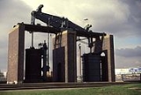
Mining in the Netherton area has taken place since at least the 14th century. According to the Rent Rolls of Lord Dudley and Ward, the income from coal mining on Knowle Hill (the former name for Netherton Hill) formed a large fraction of the total income of the Dudley Estate in 1701. In the 19th century, mining in the Netherton area was particularly extensive. Some of the collieries were: the Baptist End, Dudley Wood, Netherton, Netherton Old, Saltwell and Yew Tree Hill. Coal mining was still being carried out in the 1970s when coal was removed from Netherton Hill by the open cast method.Nailmaking
Nailmaking in Netherton has been recorded since the 16th century. Netherton became one of the centres in the Black Country of the hand-made nail trade which reached its peak around 1830. As the hand-made nail trade went into decline, mainly due to the availability of cheaper machine-made nails, wages for nailmakers were decreased leading to industrial unrest such as the events known as the 'Blackcountry Nailer's Riots' of 1842, and the Nailmakers' Strike of 1852. The last type of nail to be made by hand were those used to shoe horses. The Midland Counties Express reported in 1904: 'a few horse-nailers at Netherton and about a dozen female workers at Cawney Hill are the only remaining representatives of the nail trade'. Some nail-makers in the area turned to chain-making. A working chainshop is preserved in the Mushroom Green locality of Netherton.Chain and anchor making
Once located in Netherton, was a firm of chainmakers called N. Hingley & Sons, which was famous for making the anchors for the Titanic ocean liner. The works were set up by Noah Hingley in 1852 on the banks of the Dudley No. 2 canal. The main anchor for the Titanic weighed fifteen and a half tons and, on completion, was hauled from the factory to the rail head at Dudley Port by 20 shire horses. Hingleys also produced anchors for the LusitaniaRMS Lusitania
RMS Lusitania was a British ocean liner designed by Leonard Peskett and built by John Brown and Company of Clydebank, Scotland. The ship entered passenger service with the Cunard Line on 26 August 1907 and continued on the line's heavily-traveled passenger service between Liverpool, England and New...
and a number of other ocean liners. Hingleys' success in international markets and their use of the Netherton name for their trademarked wrought iron products (e.g. Netherton Crown Special Best Best Iron) caused the name of Netherton to be known more widely both in the UK and overseas. A sculpture of an anchor stands at the junction of Castleton Street and Halesowen Road commemorating the local anchor and chain industry and the anchor motif can be found in a number of places around Netherton (e.g. on the metal park benches in Netherton Park). Immediately adjacent to the works of N. Hingley & Sons on the Dudley No. 2 canal was Lloyds Proving House where chain was subjected to a variety of tests to show it was of suitable quality.
Brewing
Brewing was a major industry in 19th century Netherton. Some of the large scale brewers were: William Hotchkiss at Castle Street, William Smith at Simms Lane, John Rollinson of St Andrew's Street, and Samuel Bagley at Cole Street. The largest brewery belonged to Thomas Plant and was known as the Netherton Steam Brewery. Plant's malthouse was on Raybould's Fold and the brewery in St John's Street. The only brewing today in Netherton takes place at the Old Swan pub mentioned in 'Notable Buildings' above. However, two of the remaining Black Country brewers, namely, HoldensHoldens Brewery
Holdens Brewery is a family-run brewery which was founded in 1915 in the Park Inn at Woodsetton, Sedgley, Staffordshire, , England.-Brief Details:...
and Bathams
Daniel Batham and Son Ltd
Daniel Batham is a brewer, established in 1877 and based in Brierley Hill, West Midlands, England. It is described by the CAMRA Good Beer Guide as "A classic Black country small brewery"....
have Netherton links. Edwin Alfred Holden and Lucy Blanche Holden, founders of the Holdens brewing concern, had their first pub in Netherton, whilst Daniel Batham, son of Daniel and Charlotte Batham who had started the family beer production, brewed at the King William in Cole Street, Netherton before moving the brewery to its present location at the Vine on the Delph.
Other industries
One of the earliest manufacturing firms established in Netherton was Samuel Lewis & Co Ltd which was set up in 1750. Other notable firms were: Danks, which made boilers; John Barnsley and Co., specialists in cranes and hoists; and Grazebrook's, which had furnaces for iron-making. The latter firm was established at Netherton in 1800 by Michael Grazebrook.Industry today
Although not of the scale of previous times, industrial firms can still be found in Netherton; for example, in the Washington Centre between the Halesowen Road and Cradley Road or in the Blackbrook Business Park, Narrowboat Way, the latter of which was developed in the 1980s1980s
File:1980s decade montage.png|thumb|400px|From left, clockwise: The first Space Shuttle, Columbia, lifted off in 1981; American President Ronald Reagan and Soviet leader Mikhail Gorbachev eased tensions between the two superpowers, leading to the end of the Cold War; The Fall of the Berlin Wall in...
as part of the Dudley Enterprise Zone that stretched beyond Netherton's borders into Brierley Hill
Brierley Hill
Brierley Hill is a town and electoral ward of the Metropolitan Borough of Dudley, West Midlands, England. It is one of the larger Black Country towns with a population of 9,631 and is heavily industrialised, best known for glass and steel manufacturing, although the industry has declined...
and covered the land which became the Merry Hill Shopping Centre
Merry Hill Shopping Centre
Westfield Merry Hill is a shopping centre in Brierley Hill near Dudley, West Midlands, England. It was developed between 1985 and 1990, with several expansion and renovation projects taking place since. The original developers and owners were Richardson Developments but the Centre has had a number...
.
Notable residents
Netherton was the birthplace of spring-jumping champion Joe Darby, born at Windmill End in 1861. Not only was he a superb athlete but a showman as well, appearing before King Edward VII in Covent Garden, London. In 1887 he defeated W.G Hamlington, then the World Champion spring-jumper. A statue showing the athlete in a crouched position, about to leap, stands on the junction of the Halesowen Road and Church Road. Some of his more famous exploits are written on plaques on the plinth of the statue.Another notable resident of Netherton was England footballer Joe Smith
Joe Smith (footballer born 1890)
Joseph "Joe" Smith was an English professional footballer who played as a right back. He played nearly 500 games in the Football League for West Bromwich Albion and Birmingham, most of which were in the First Division, and won two caps for England.-Playing career:Smith was born in Darby End,...
(1890–1956). He was born in Darby End and played for local teams until he signed for West Bromwich Albion in 1910. He put in 470 appearances for Albion, was a member of the 1920 side that won the First Division and was capped two times for England. Other Netherton-born footballers include Tom Grosvenor
Tom Grosvenor
Arthur Thomas "Tom" Grosvenor was an English professional footballer who played as an inside right. He played more than 100 games for Birmingham in the Football League First Division and won three full caps for England...
(1908–1972) who played for Birmingham City and was capped 3 times for England and Billy Wooldridge
Billy Wooldridge
William Thomas Wooldridge was an English footballer who spent his career with Wolverhampton Wanderers.-Career:Wooldridge played for Wednesbury Old Athletic during its successful 1899-1900 campaign, and was a key member of the side that won the Walsall & District League championship, the...
(1878–1945) who played for Wolverhampton Wanderers and represented the English Football League in two games against the Irish League.
Sammy 'Pigiron' Whitehouse was a strongman from Darby End, who worked unloading canal boats and in a foundry in the earlier part of the 20th century. He became well known locally for his feats of strength. His nickname 'Pigiron' was earned in 1921 when he won a 4 mile race from Dudley Top church through Netherton following the Halesowen Road carrying a hundredweight (112 lb) of pigiron.
Theophillus Dunn, also from Darby End, was a notable 19th century character, known locally as the 'Dudley Devil'. He was an astrologer and claimed magical healing abilities, charging a shilling for a charm to cure toothache. He also claimed to be able locate stolen property by using charms. He prophesised the downfall of William Perry
William Perry (boxer)
William Perry was a British prize fighter of the 19th century.A statue stands in the town of Tipton, yards away from the Fountain Inn public house, which was once his headquarters...
(the boxer known as the 'Tipton Slasher')at the hands of Tom Sayers.
External links
- Netherton Images from the Dudley CD-ROM