

New York State Route 25A
Encyclopedia
New York State Route 25A (NY 25A) is a state highway
on Long Island
in New York
in the United States
. It serves as the main east–west route for most of the North Shore
of Long Island
, running from the Queens Midtown Tunnel
in the New York City borough
of Queens
at its western terminus to Calverton
in Suffolk County
at its eastern end.
Known for its scenic route through decidedly lesser-developed areas such as Brookville
, Fort Salonga
, Centerport
, and the Roslyn
Viaduct, 25A begins as 21st Street in Long Island City
. As you go farther through 25A, it is then known as Jackson Avenue for a short period and is variously named Northern Boulevard east of Queens Plaza (NY 25
), North Hempstead Turnpike, Main Street, Fort Salonga Road, and North Country Road. It merges with NY 25 for approximately 1.5 miles (2.4 km) in Smithtown
.
(the Long Island Expressway) at Long Island City in the New York City
borough of Queens
. Route 25A is known in this area as 21st Street. As you follow 25A, it becomes Jackson Avenue and is a 4-lane road (and remains a 4-lane road well into Nassau County
). Just past the intersection with Queens Boulevard
(State Route 25), at the foot of the Queensboro Bridge
, 25A becomes Northern Boulevard.
, Jackson Heights
, Corona
, Flushing
, Bayside
, Douglaston
and Little Neck
.
The Brooklyn-Queens Expressway (Interstate 278) intersects with Northern Boulevard at the Woodside/Jackson Heights border. 25A intersects with the Grand Central Parkway
at the Corona/Flushing Meadows border, where it becomes a limited-access roadway. This was a former segment of the Belt Parkway system, that was intended to be part of the formerly proposed Astoria Expressway.
As the roadway continues east, past Citi Field in Flushing Meadows-Corona Park
, it intersects with Interstate 678. Northern Boulevard continues through Flushing
towards Bayside. In Flushing, Northern Boulevard was formerly known as Broadway. In Bayside, Northern Boulevard intersects with the Clearview Expressway (Interstate 295
). Further east toward, it crosses over the Cross Island Parkway at Alley Pond Park
, then goes through Douglaston and Little Neck, and crosses the city line into Nassau County
.
hamlet known as University Gardens
. It winds its way around a steep curve in the Great Neck area and descends into Manhasset
and the "Miracle Mile
" shopping area. It intersects with NY 101
just south of Port Washington
and then splits. Old Northern Boulevard (which once carried the 25A designation) is the old route which passes through the village of Roslyn
. Northern Boulevard itself bypasses the village and carries 25A over the Roslyn Viaduct into Greenvale and then to Brookville
, where the route passes the New York Institute of Technology
and the C.W. Post Campus
of Long Island University
before intersecting with NY 107
.
After Route 107, 25A intersects with NY 106
and quickly loses 2 lanes and becomes a simple 2-lane country road. Just past Cold Spring Road, it returns to a 4-lane road and then crosses the Suffolk County line and intersects with NY 108
.
that show the designation is still Northern Boulevard. The last sign for Northern Boulevard is just before Cold Spring Road, near the Nassau/Suffolk
line, so a case can be made that Northern Boulevard extends from Queens, all the way across Nassau, and on to the Suffolk line. The only problem with this is that, while the Old Brookville Police Department and Martin Viette Nursery show their street addresses as on Northern Boulevard, the correct legal street addresses for the Hunter's Hook horse farm and the Muttontown Unitarian Universalist Fellowship are 6080 and 6090 North Hempstead Turnpike, respectively. Thus, the Turnpike clearly extends west of Route 106. On an old, undated Hagstrom's map (#2560A, of Westchester) ca. 1948, the Turnpike extends westerly at least to the Queens line.
. It travels through Cold Spring Harbor
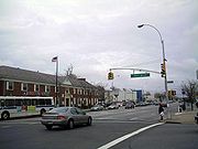
before turing somewhat south and into downtown Huntington
, where it regains 4-lane status through the village and is known as Main Street. At the intersection of County Road 35 on the east side of Huntington, 25A (designated as East Main Street) becomes a 2-lane road and heads toward Centerport
, where it becomes Fort Salonga Road through Centerport, Northport
and Fort Salonga
. 25A intersects with its first limited-access highway since the Cross Island Parkway back in Queens when it encounters the Sunken Meadow State Parkway
. It also changes names from Fort Salonga Road to Main Street as it enters Kings Park
, home to the now-closed Kings Park Psychiatric Center
. East of this area it is shared with New York State Bicycle Route 25A.
25A makes a right turn at an intersection in San Remo (just east of Kings Park) and becomes St. Johnland Road. It heads further south towards Smithtown
, where it intersects with NY 25
(Jericho Turnpike), at the Smithtown Bull, where NY Bike Route 25A ends. State Route 25 and 25A run concurrently
through the village of Smithtown. Just past Edgewood Avenue in Smithtown, 25/25A loses the Jericho Turnpike name and the road is known as Main Street. On the east end of the village, at the intersection of 25/25A and the northern terminus of NY 111
, the roads split. Route 111 heads to the South Shore
of Long Island, 25 continues east and 25A heads on a north east path towards St. James
and Stony Brook
.
 From Smithtown to Stony Brook, 25A is known as North Country Road. It also runs along much of New York State Bicycle Route 25 with occasional diversions. NY 25A passes the Stony Brook Museum and Carriage House before making a right to head due east towards SUNY Stony Brook
. It intersects with County Road 97
(Nicoll's Road) and then passes through Setauket and into Port Jefferson
(where it is known as West Broadway). Once 25A reaches the harbor, it makes a right turn and passes through the village of Port Jefferson (known again as Main Street.) Further south, at the intersection with NY 112
, 25A makes a sharp left turn and heads along Hallock Avenue towards its intersection with NY 347
(Nesconset Highway). 25A almost literally "takes over" 347 at this point, becoming a wide highway (wider than at any other point) before intersecting with County Road 83 (Patchogue-Mount Sinai Road) and passing through Mount Sinai
and Miller Place
before splitting again and bypassing Rocky Point
(as it did back in Roslyn.) The old section (without state designation) passes through the village while 25A continues towards Shoreham
and intersecting with County Road 46
(William Floyd Parkway) before coming to a fork. 25A veers right and heads southeast, while Sound Avenue, the other end of the fork, heads due east towards the North Fork
of Long Island. It is not long after this split (about 1.5 miles) that 25A ends at Route 25, in Calverton
, just west of Riverhead
.
limits was originally designated as part of NY 25
in the mid-1920s. At the time, the section of Jericho Turnpike between New York City and Smithtown
was state-maintained but unnumbered. It gained a designation ca. 1927 when it was designated as NY 25A. By 1930, NY 25 was shifted southward onto its modern alignment between Smithtown and Riverhead
while NY 25A was extended east over its former routing via Port Jefferson
. In the 1930 renumbering of state highways in New York, the alignments of NY 25 and NY 25A west of Smithtown were flipped, placing NY 25 on Jericho Turnpike and NY 25A on the more northerly route via Roslyn
and Huntington
.
NY 25A was one of several routes that was extended west into New York City in mid-December 1934 when the city signed routes within its limits for the first time. The route followed Northern Boulevard west across northern Queens
to Queens Boulevard
, which at the time carried NY 24
and NY 25
. Here, NY 25A joined NY 24 and NY 25 across the Queensboro Bridge
into Manhattan
, where it followed 2nd Avenue and 57th Street
for five blocks to meet NY 22
and NY 100
at Park Avenue
. The extension into Manhattan was eliminated by 1952 when NY 25A was truncated to the intersection of Northern and Queens Boulevards. In the 1960s, NY 25A was extended southwestward along Jackson Avenue to meet the Long Island Expressway (Interstate 495
) just east of where it enters the Queens–Midtown Tunnel.
Ca. 1931, the east end of NY 25A was reconfigured to follow Sound Avenue across the north shore of Long Island
from Wading River
to Mattituck
, where it rejoined NY 25. The former routing of NY 25A between Sound Avenue and NY 25 west of Riverhead went unnumbered until the early 1940s when it was redesignated as NY 254. NY 25A was moved back onto its original routing through the town of Riverhead
in the early 1950s, supplanting NY 254 in the process.
. There are segments of local streets that were part of the original Route 25A. These streets consist of local village downtown blocks and even residential streets. Segments like the Roslyn Viaduct, for example allow traffic to flow more freely over Hempstead Harbor, while the historic community below
is preserved intact. The towns listed below contain the following former Route 25A segments.
. However public opposition thwarted these projects, out of fear that they would lower property values, and bring more traffic jams and rampant development. The proposed bypasses include:
State highway
State highway, state road or state route can refer to one of three related concepts, two of them related to a state or provincial government in a country that is divided into states or provinces :#A...
on Long Island
Long Island
Long Island is an island located in the southeast part of the U.S. state of New York, just east of Manhattan. Stretching northeast into the Atlantic Ocean, Long Island contains four counties, two of which are boroughs of New York City , and two of which are mainly suburban...
in New York
New York
New York is a state in the Northeastern region of the United States. It is the nation's third most populous state. New York is bordered by New Jersey and Pennsylvania to the south, and by Connecticut, Massachusetts and Vermont to the east...
in the United States
United States
The United States of America is a federal constitutional republic comprising fifty states and a federal district...
. It serves as the main east–west route for most of the North Shore
North Shore (Long Island)
The North Shore of Long Island is the area along Long Island's northern coast, bordering Long Island Sound. The region has long been the most affluent on Long Island, as well as the most affluent in the New York metropolitan area, which has earned it the nickname "the Gold Coast." Though some...
of Long Island
Long Island
Long Island is an island located in the southeast part of the U.S. state of New York, just east of Manhattan. Stretching northeast into the Atlantic Ocean, Long Island contains four counties, two of which are boroughs of New York City , and two of which are mainly suburban...
, running from the Queens Midtown Tunnel
Queens Midtown Tunnel
The Queens–Midtown Tunnel is a highway tunnel and toll road in New York City. It crosses under the East River and connects the Borough of Queens on Long Island with the Borough of Manhattan The Queens–Midtown Tunnel (sometimes simply known as the Midtown Tunnel) is a highway tunnel and toll road...
in the New York City borough
Borough (New York City)
New York City, one of the largest cities in the world, is composed of five boroughs. Each borough now has the same boundaries as the county it is in. County governments were dissolved when the city consolidated in 1898, along with all city, town, and village governments within each county...
of Queens
Queens
Queens is the easternmost of the five boroughs of New York City. The largest borough in area and the second-largest in population, it is coextensive with Queens County, an administrative division of New York state, in the United States....
at its western terminus to Calverton
Calverton, New York
Calverton is a hamlet in Suffolk County, New York, United States. The population was 5,704 at the 2000 census.The community is on the border of the Town of Riverhead and the Town of Brookhaven.-History:...
in Suffolk County
Suffolk County, New York
Suffolk County is a county located in the U.S. state of New York on the eastern portion of Long Island. As of the 2010 census, the population was 1,493,350. It was named for the county of Suffolk in England, from which its earliest settlers came...
at its eastern end.
Known for its scenic route through decidedly lesser-developed areas such as Brookville
Brookville, New York
The Village of Brookville is a village located within the town of Oyster Bay in Nassau County, New York. As of the 2010 United States Census, the village population was 3,465....
, Fort Salonga
Fort Salonga, New York
Fort Salonga is a hamlet in Suffolk County, New York on the North Shore of Long Island. As of the United States 2000 Census, the CDP population was 9,634...
, Centerport
Centerport, New York
Centerport is a hamlet in Suffolk County, New York on the notably affluent North Shore of Long Island. Formerly known as Little Cow Harbor about 1700, Centreport in 1836, and then the present Centerport after 1895...
, and the Roslyn
Roslyn, New York
Roslyn is a village in Nassau County, New York, on the North Shore of Long Island. As of the United States 2010 Census, the village population was 2,770...
Viaduct, 25A begins as 21st Street in Long Island City
Long Island City, Queens
Long Island City is the westernmost neighborhood of the borough of Queens in New York City. L.I.C. is notable for its rapid and ongoing gentrification, its waterfront parks, and its thriving arts community. L.I.C. has among the highest concentration of art galleries, art institutions, and studio...
. As you go farther through 25A, it is then known as Jackson Avenue for a short period and is variously named Northern Boulevard east of Queens Plaza (NY 25
New York State Route 25
New York State Route 25 is an east–west state highway in downstate New York in the United States. The route extends for just over from east midtown Manhattan in New York City to the Cross Sound Ferry terminal at Orient Point on the end of Long Island's North Fork...
), North Hempstead Turnpike, Main Street, Fort Salonga Road, and North Country Road. It merges with NY 25 for approximately 1.5 miles (2.4 km) in Smithtown
Smithtown, New York
As of the census of 2000, there were 115,715 people, 38,487 households, and 31,482 families residing in the town. The population density was 2,159.9 people per square mile . There were 39,357 housing units at an average density of 734.6 per square mile...
.
Route description
NY Route 25A begins at its western terminus at exit 13 (which is the first exit) off Interstate 495Interstate 495 (New York)
Interstate 495 is an auxiliary Interstate Highway on Long Island in New York in the United States. The route extends for from the western portal of the Queens-Midtown Tunnel in the New York City borough of Manhattan to County Route 58 in Riverhead, Suffolk County...
(the Long Island Expressway) at Long Island City in the New York City
New York City
New York is the most populous city in the United States and the center of the New York Metropolitan Area, one of the most populous metropolitan areas in the world. New York exerts a significant impact upon global commerce, finance, media, art, fashion, research, technology, education, and...
borough of Queens
Queens
Queens is the easternmost of the five boroughs of New York City. The largest borough in area and the second-largest in population, it is coextensive with Queens County, an administrative division of New York state, in the United States....
. Route 25A is known in this area as 21st Street. As you follow 25A, it becomes Jackson Avenue and is a 4-lane road (and remains a 4-lane road well into Nassau County
Nassau County, New York
Nassau County is a suburban county on Long Island, east of New York City in the U.S. state of New York, within the New York Metropolitan Area. As of the 2010 census, the population was 1,339,532...
). Just past the intersection with Queens Boulevard
Queens Boulevard
Queens Boulevard is a major thoroughfare in the New York City boroughs of Manhattan and Queens connecting communities from Midtown Manhattan to Jamaica...
(State Route 25), at the foot of the Queensboro Bridge
Queensboro Bridge
The Ed Koch Queensboro Bridge, also known as the 59th Street Bridge – because its Manhattan end is located between 59th and 60th Streets – or simply the Queensboro Bridge, is a cantilever bridge over the East River in New York City that was completed in 1909...
, 25A becomes Northern Boulevard.
New York City: Borough of Queens
Route 25A carries the Northern Boulevard name through WoodsideWoodside, Queens
Woodside is a neighborhood in the western portion of the New York City borough of Queens. It is bordered on the south by Maspeth, on the north by Astoria, on the west by Sunnyside and on the east by Elmhurst and Jackson Heights. Some areas are widely residential and very quiet, while others are...
, Jackson Heights
Jackson Heights, Queens
Jackson Heights is a neighborhood in the Northwestern portion of the borough of Queens in New York, New York, United States. The neighborhood is part of Queens Community Board 3...
, Corona
Corona, Queens
Corona is a densely-populated neighborhood in the former Township of Newtown in the borough of Queens in New York City, New York, United States...
, Flushing
Flushing, Queens
Flushing, founded in 1645, is a neighborhood in the north central part of the City of New York borough of Queens, east of Manhattan.Flushing was one of the first Dutch settlements on Long Island. Today, it is one of the largest and most diverse neighborhoods in New York City...
, Bayside
Bayside, Queens
Bayside is a suburban neighborhood in the borough of Queens in New York, New York in the United States. Bayside is known as one of the most expensive areas to live in Queens, with well kept homes and landscaping...
, Douglaston
Douglaston, Queens
Douglaston, population 14,168 , is a community in the New York City borough of Queens. Douglaston comprises six distinct neighborhoods: Doug Bay, Douglas Manor, and Douglaston Hill, all located north of Northern Boulevard on the peninsula abutting Little Neck Bay; Douglaston Park, located between...
and Little Neck
Little Neck, Queens
Little Neck is a community in the northeast corner of Queens County, bordered on the north by Little Neck Bay and on the east by Great Neck in Nassau County. Due to this proximity to Nassau, Little Neck remains one of the most suburban-looking areas in New York City. The southern border is the...
.
The Brooklyn-Queens Expressway (Interstate 278) intersects with Northern Boulevard at the Woodside/Jackson Heights border. 25A intersects with the Grand Central Parkway
Grand Central Parkway
The Grand Central Parkway is a parkway that stretches from the RFK-Triborough Bridge in New York City to Nassau County on Long Island. At the Queens-Nassau border, it becomes the Northern State Parkway, which runs across the northern part of Long Island through Nassau County and into Suffolk...
at the Corona/Flushing Meadows border, where it becomes a limited-access roadway. This was a former segment of the Belt Parkway system, that was intended to be part of the formerly proposed Astoria Expressway.
As the roadway continues east, past Citi Field in Flushing Meadows-Corona Park
Flushing Meadows-Corona Park
Flushing Meadows-Corona Park, often referred to as Flushing Meadow Park, Flushing Meadows Park or Flushing Meadows, is a public park in New York City. It contains the USTA Billie Jean King National Tennis Center, the current venue for the U.S...
, it intersects with Interstate 678. Northern Boulevard continues through Flushing
Flushing, Queens
Flushing, founded in 1645, is a neighborhood in the north central part of the City of New York borough of Queens, east of Manhattan.Flushing was one of the first Dutch settlements on Long Island. Today, it is one of the largest and most diverse neighborhoods in New York City...
towards Bayside. In Flushing, Northern Boulevard was formerly known as Broadway. In Bayside, Northern Boulevard intersects with the Clearview Expressway (Interstate 295
Interstate 295 (New York)
Interstate 295 is a connector route within New York City. Measuring 9.10 miles in length, I-295 travels from the Bruckner Interchange, a junction with I-95/I-278/I-678 in The Bronx, across the toll Throgs Neck Bridge to the Grand Central Parkway in Queens...
). Further east toward, it crosses over the Cross Island Parkway at Alley Pond Park
Alley Pond Park
Alley Pond Park is the second-largest public park in Queens, New York. It occupies , most of it acquired and cleared by the city in 1929, as authorized by a resolution of the New York City Board of Estimate in 1927. The park is bordered to the east by Douglaston, to the west by Bayside, to the...
, then goes through Douglaston and Little Neck, and crosses the city line into Nassau County
Nassau County, New York
Nassau County is a suburban county on Long Island, east of New York City in the U.S. state of New York, within the New York Metropolitan Area. As of the 2010 census, the population was 1,339,532...
.
Nassau County
25A, still carrying the Northern Boulevard name, crosses into Nassau County at the Great NeckGreat Neck, New York
The term Great Neck is commonly applied to a peninsula on the North Shore of Long Island, which includes the village of Great Neck, the village of Great Neck Estates, the village of Great Neck Plaza, and others, as well as an area south of the peninsula near Lake Success and the border of Queens...
hamlet known as University Gardens
University Gardens, New York
University Gardens is a hamlet in Nassau County, New York, United States. The population was 4,226 at the 2010 census.University Gardens is a community in the western part of the Town of North Hempstead.-Geography:...
. It winds its way around a steep curve in the Great Neck area and descends into Manhasset
Manhasset, New York
Manhasset is a hamlet and neighborhood in Nassau County, New York, on the North Shore of Long Island. As of the United States 2010 Census, the population was 8,080....
and the "Miracle Mile
Miracle Mile (Manhasset)
The Miracle Mile is a prominent shopping district in Manhasset on the North Shore of Long Island in Nassau County, New York. The area along Northern Boulevard is well-known for its high-end premium open-air shopping center, the Americana Manhasset....
" shopping area. It intersects with NY 101
New York State Route 101
New York State Route 101 is a long state highway in northwestern Nassau County, New York, United States. It runs north–south as Port Washington Boulevard from NY 25A in Flower Hill, west of Roslyn and north of Manhasset, to Astor Lane in Sands Point...
just south of Port Washington
Port Washington, New York
Port Washington is a hamlet and census-designated place in Nassau County, New York on the North Shore of Long Island. As of the United States 2010 Census, the community population was 15,846....
and then splits. Old Northern Boulevard (which once carried the 25A designation) is the old route which passes through the village of Roslyn
Roslyn, New York
Roslyn is a village in Nassau County, New York, on the North Shore of Long Island. As of the United States 2010 Census, the village population was 2,770...
. Northern Boulevard itself bypasses the village and carries 25A over the Roslyn Viaduct into Greenvale and then to Brookville
Brookville, New York
The Village of Brookville is a village located within the town of Oyster Bay in Nassau County, New York. As of the 2010 United States Census, the village population was 3,465....
, where the route passes the New York Institute of Technology
New York Institute of Technology
New York Institute of Technology is a private, non-sectarian, co-educational research university in New York City. NYIT has five schools and two colleges, all with a strong emphasis on technology and applied scientific research...
and the C.W. Post Campus
Long Island University C.W. Post Campus
The C.W. Post Campus of Long Island University is a private institution of higher education located in Brookville in Nassau County, New York, United States...
of Long Island University
Long Island University
Long Island University is a private, coeducational, nonsectarian institution of higher education in the U.S. state of New York.-History:...
before intersecting with NY 107
New York State Route 107
New York State Route 107 is a state highway located entirely within Nassau County, New York, in the United States. It runs from Merrick Road in Massapequa to Mill Street and Brewster Avenue in the city of Glen Cove near City Hall...
.
After Route 107, 25A intersects with NY 106
New York State Route 106
New York State Route 106 is a state highway in New York, running from NY 105 in North Bellmore to Oyster Bay. It runs through the Towns of Hempstead and Oyster Bay, including the hamlets of East Meadow, Levittown, Hicksville, Jericho, and East Norwich and the Villages of Brookville and...
and quickly loses 2 lanes and becomes a simple 2-lane country road. Just past Cold Spring Road, it returns to a 4-lane road and then crosses the Suffolk County line and intersects with NY 108
New York State Route 108
New York State Route 108 is a long north–south state highway located on the Suffolk County side of the Suffolk-Nassau county line on Long Island, New York, United States. It is a spur route connecting NY 25A in Cold Spring Harbor to the Cold Spring Harbor station on the Long Island Rail...
.
Northern Boulevard, or North Hempstead Turnpike
At its intersection with State Route 106, some feel Northern Boulevard becomes North Hempstead Turnpike (and there are in fact one or two North Hempstead Turnpike signs along the route east of Route 106.) However, there are signs as far east as Cove Road in Oyster Bay CoveOyster Bay Cove, New York
The Village of Oyster Bay Cove is a village located within the Town of Oyster Bay in Nassau County, New York, United States. The population was 2,197 at the 2010 census...
that show the designation is still Northern Boulevard. The last sign for Northern Boulevard is just before Cold Spring Road, near the Nassau/Suffolk
Suffolk County, New York
Suffolk County is a county located in the U.S. state of New York on the eastern portion of Long Island. As of the 2010 census, the population was 1,493,350. It was named for the county of Suffolk in England, from which its earliest settlers came...
line, so a case can be made that Northern Boulevard extends from Queens, all the way across Nassau, and on to the Suffolk line. The only problem with this is that, while the Old Brookville Police Department and Martin Viette Nursery show their street addresses as on Northern Boulevard, the correct legal street addresses for the Hunter's Hook horse farm and the Muttontown Unitarian Universalist Fellowship are 6080 and 6090 North Hempstead Turnpike, respectively. Thus, the Turnpike clearly extends west of Route 106. On an old, undated Hagstrom's map (#2560A, of Westchester) ca. 1948, the Turnpike extends westerly at least to the Queens line.
Suffolk County
25A makes a sharp left turn just at its intersection with NY 108New York State Route 108
New York State Route 108 is a long north–south state highway located on the Suffolk County side of the Suffolk-Nassau county line on Long Island, New York, United States. It is a spur route connecting NY 25A in Cold Spring Harbor to the Cold Spring Harbor station on the Long Island Rail...
. It travels through Cold Spring Harbor
Cold Spring Harbor, New York
Cold Spring Harbor is a hamlet in Suffolk County, New York on the North Shore of Long Island. As of the United States 2000 Census, the CDP population was 4,975.Cold Spring Harbor is in the Town of Huntington.-History:...
before turing somewhat south and into downtown Huntington
Huntington, New York
The Town of Huntington is one of ten towns in Suffolk County, New York, USA. Founded in 1653, it is located on the north shore of Long Island in northwestern Suffolk County, with Long Island Sound to its north and Nassau County adjacent to the west. Huntington is part of the New York metropolitan...
, where it regains 4-lane status through the village and is known as Main Street. At the intersection of County Road 35 on the east side of Huntington, 25A (designated as East Main Street) becomes a 2-lane road and heads toward Centerport
Centerport, New York
Centerport is a hamlet in Suffolk County, New York on the notably affluent North Shore of Long Island. Formerly known as Little Cow Harbor about 1700, Centreport in 1836, and then the present Centerport after 1895...
, where it becomes Fort Salonga Road through Centerport, Northport
Northport, New York
Northport is a village in Suffolk County, New York on the North Shore of Long Island. As of the United States 2000 Census, the village population was 7,606. Students attend the Northport-East Northport Union Free School District....
and Fort Salonga
Fort Salonga, New York
Fort Salonga is a hamlet in Suffolk County, New York on the North Shore of Long Island. As of the United States 2000 Census, the CDP population was 9,634...
. 25A intersects with its first limited-access highway since the Cross Island Parkway back in Queens when it encounters the Sunken Meadow State Parkway
Sunken Meadow State Parkway
The Sunken Meadow State Parkway is a long north–south parkway on Long Island in New York. All six miles of the parkway are located in the Suffolk County town of Smithtown. The southern terminus of the route is at the Northern State Parkway, where it continues southward as the Sagtikos...
. It also changes names from Fort Salonga Road to Main Street as it enters Kings Park
Kings Park, New York
Kings Park is a census-designated place in the town Smithtown, Suffolk County, New York, United States, on Long Island. The population was 17,282 as of the 2010 census....
, home to the now-closed Kings Park Psychiatric Center
Kings Park Psychiatric Center
The Kings Park Psychiatric Center, known by Kings Park locals simply as 'The Psych Center', is a former state-run psychiatric hospital located in Kings Park, New York...
. East of this area it is shared with New York State Bicycle Route 25A.
25A makes a right turn at an intersection in San Remo (just east of Kings Park) and becomes St. Johnland Road. It heads further south towards Smithtown
Smithtown, New York
As of the census of 2000, there were 115,715 people, 38,487 households, and 31,482 families residing in the town. The population density was 2,159.9 people per square mile . There were 39,357 housing units at an average density of 734.6 per square mile...
, where it intersects with NY 25
New York State Route 25
New York State Route 25 is an east–west state highway in downstate New York in the United States. The route extends for just over from east midtown Manhattan in New York City to the Cross Sound Ferry terminal at Orient Point on the end of Long Island's North Fork...
(Jericho Turnpike), at the Smithtown Bull, where NY Bike Route 25A ends. State Route 25 and 25A run concurrently
Concurrency (road)
A concurrency, overlap, or coincidence in a road network is an instance of one physical road bearing two or more different highway, motorway, or other route numbers...
through the village of Smithtown. Just past Edgewood Avenue in Smithtown, 25/25A loses the Jericho Turnpike name and the road is known as Main Street. On the east end of the village, at the intersection of 25/25A and the northern terminus of NY 111
New York State Route 111
New York State Route 111 is a state highway located in Suffolk County, New York, in the United States. It runs north and south through the towns of Islip and Smithtown between NY 27A in the town seat of Islip and the east end of the NY 25 and NY 25A concurrency in Smithtown's...
, the roads split. Route 111 heads to the South Shore
South Shore (Long Island)
The South Shore of Long Island, in the U.S. state of New York, is the area along Long Island's Atlantic Ocean shoreline. Though some consider the South Shore to include parts of Queens, particularly the beach communities in the Rockaways such as Belle Harbor, the term is generally used to refer to...
of Long Island, 25 continues east and 25A heads on a north east path towards St. James
St. James, New York
St. James is a census-designated place in Suffolk County, New York, United States. The population was 13,268 at the 2000 census. St. James is part of the Town of Smithtown, New York, located on the North Shore of Long Island. The zip code is 11780....
and Stony Brook
Stony Brook, New York
Stony Brook is a hamlet located in the Town of Brookhaven in Suffolk County, New York, which is on the North Shore of Long Island...
.
State University of New York at Stony Brook
The State University of New York at Stony Brook, also known as Stony Brook University, is a public research university located in Stony Brook, New York, on the North Shore of Long Island, about east of Manhattan....
. It intersects with County Road 97
County Route 97 (Suffolk County, New York)
Suffolk County Road 97, also known as Nicolls Road , is a major county road in Suffolk County, New York...
(Nicoll's Road) and then passes through Setauket and into Port Jefferson
Port Jefferson, New York
The Incorporated Village of Port Jefferson is located in the town of Brookhaven in Suffolk County, New York on the North Shore of Long Island. As of the 2000 United States Census, the village population was 7,837...
(where it is known as West Broadway). Once 25A reaches the harbor, it makes a right turn and passes through the village of Port Jefferson (known again as Main Street.) Further south, at the intersection with NY 112
New York State Route 112
New York State Route 112 is a New York state highway, entirely within the Town of Brookhaven in Suffolk County. It runs from Montauk Highway, formerly part of NY 27A, in the village of Patchogue to NY 25A in Port Jefferson Station. It is known locally as Medford Ave in Patchogue...
, 25A makes a sharp left turn and heads along Hallock Avenue towards its intersection with NY 347
New York State Route 347
New York State Route 347 is an east–west state highway located in Suffolk County, New York, in the United States. It connects the Northern State Parkway in Hauppauge to NY 25A in Mount Sinai. The route serves as a southern bypass of Smithtown and as a direct link between Nesconset and...
(Nesconset Highway). 25A almost literally "takes over" 347 at this point, becoming a wide highway (wider than at any other point) before intersecting with County Road 83 (Patchogue-Mount Sinai Road) and passing through Mount Sinai
Mount Sinai, New York
Mount Sinai is a hamlet and census-designated place in Suffolk County, New York, USA. The population was 8,734 at the 2000 census.-Geography:...
and Miller Place
Miller Place, New York
Miller Place is a hamlet and census-designated place in Suffolk County, New York, United States, on the North Shore of Long Island. The population was 10,580 at the 2000 census.-Geography:Miller Place is located at ....
before splitting again and bypassing Rocky Point
Rocky Point, New York
Rocky Point is a hamlet in Suffolk County, New York on the North Shore of Long Island. As of the United States 2000 Census, the CDP population was 10,185.Rocky Point is a community in the town of Brookhaven.-Geography:...
(as it did back in Roslyn.) The old section (without state designation) passes through the village while 25A continues towards Shoreham
Shoreham, New York
Shoreham is an incorporated village in Suffolk County, New York, United States. The population was 417 at the 2000 census.The Incorporated Village of Shoreham is inside the Town of Brookhaven.-Geography:Shoreham is located at ....
and intersecting with County Road 46
County Route 46 (Suffolk County, New York)
Suffolk County Road 46 is a major county road in eastern Suffolk County, New York. It runs north and south from County Route 75 in Smith Point County Park to New York State Route 25A near the border of Shoreham and Wading River...
(William Floyd Parkway) before coming to a fork. 25A veers right and heads southeast, while Sound Avenue, the other end of the fork, heads due east towards the North Fork
North Fork, Suffolk County, New York
The North Fork is a 30-mile-long peninsula in the northeast part of Suffolk County, New York, roughly parallel with an even longer peninsula known as the South Fork...
of Long Island. It is not long after this split (about 1.5 miles) that 25A ends at Route 25, in Calverton
Calverton, New York
Calverton is a hamlet in Suffolk County, New York, United States. The population was 5,704 at the 2000 census.The community is on the border of the Town of Riverhead and the Town of Brookhaven.-History:...
, just west of Riverhead
Riverhead (CDP), New York
Riverhead is a census-designated place roughly corresponding to the hamlet by the same name located in the town of Riverhead in Suffolk County, New York on Long Island...
.
History
All of modern NY 25A east of the New York CityNew York City
New York is the most populous city in the United States and the center of the New York Metropolitan Area, one of the most populous metropolitan areas in the world. New York exerts a significant impact upon global commerce, finance, media, art, fashion, research, technology, education, and...
limits was originally designated as part of NY 25
New York State Route 25
New York State Route 25 is an east–west state highway in downstate New York in the United States. The route extends for just over from east midtown Manhattan in New York City to the Cross Sound Ferry terminal at Orient Point on the end of Long Island's North Fork...
in the mid-1920s. At the time, the section of Jericho Turnpike between New York City and Smithtown
Smithtown, New York
As of the census of 2000, there were 115,715 people, 38,487 households, and 31,482 families residing in the town. The population density was 2,159.9 people per square mile . There were 39,357 housing units at an average density of 734.6 per square mile...
was state-maintained but unnumbered. It gained a designation ca. 1927 when it was designated as NY 25A. By 1930, NY 25 was shifted southward onto its modern alignment between Smithtown and Riverhead
Riverhead (CDP), New York
Riverhead is a census-designated place roughly corresponding to the hamlet by the same name located in the town of Riverhead in Suffolk County, New York on Long Island...
while NY 25A was extended east over its former routing via Port Jefferson
Port Jefferson, New York
The Incorporated Village of Port Jefferson is located in the town of Brookhaven in Suffolk County, New York on the North Shore of Long Island. As of the 2000 United States Census, the village population was 7,837...
. In the 1930 renumbering of state highways in New York, the alignments of NY 25 and NY 25A west of Smithtown were flipped, placing NY 25 on Jericho Turnpike and NY 25A on the more northerly route via Roslyn
Roslyn, New York
Roslyn is a village in Nassau County, New York, on the North Shore of Long Island. As of the United States 2010 Census, the village population was 2,770...
and Huntington
Huntington, New York
The Town of Huntington is one of ten towns in Suffolk County, New York, USA. Founded in 1653, it is located on the north shore of Long Island in northwestern Suffolk County, with Long Island Sound to its north and Nassau County adjacent to the west. Huntington is part of the New York metropolitan...
.
NY 25A was one of several routes that was extended west into New York City in mid-December 1934 when the city signed routes within its limits for the first time. The route followed Northern Boulevard west across northern Queens
Queens
Queens is the easternmost of the five boroughs of New York City. The largest borough in area and the second-largest in population, it is coextensive with Queens County, an administrative division of New York state, in the United States....
to Queens Boulevard
Queens Boulevard
Queens Boulevard is a major thoroughfare in the New York City boroughs of Manhattan and Queens connecting communities from Midtown Manhattan to Jamaica...
, which at the time carried NY 24
New York State Route 24
New York State Route 24 is an east–west state highway on Long Island in New York in the United States. The route is split into two segments, with the longest and westernmost of the two extending from Interstate 295 and NY 25 in the Queens Village section of the New York City...
and NY 25
New York State Route 25
New York State Route 25 is an east–west state highway in downstate New York in the United States. The route extends for just over from east midtown Manhattan in New York City to the Cross Sound Ferry terminal at Orient Point on the end of Long Island's North Fork...
. Here, NY 25A joined NY 24 and NY 25 across the Queensboro Bridge
Queensboro Bridge
The Ed Koch Queensboro Bridge, also known as the 59th Street Bridge – because its Manhattan end is located between 59th and 60th Streets – or simply the Queensboro Bridge, is a cantilever bridge over the East River in New York City that was completed in 1909...
into Manhattan
Manhattan
Manhattan is the oldest and the most densely populated of the five boroughs of New York City. Located primarily on the island of Manhattan at the mouth of the Hudson River, the boundaries of the borough are identical to those of New York County, an original county of the state of New York...
, where it followed 2nd Avenue and 57th Street
57th Street (Manhattan)
57th Street is one of New York City's major east-west thoroughfares, which runs east-west in the Midtown section of the borough of Manhattan, from the New York City Department of Sanitation's dock on the Hudson River at the West Side Highway to a small park overlooking the East River built on a...
for five blocks to meet NY 22
New York State Route 22
New York State Route 22 is a north–south state highway in eastern New York in the United States. It runs parallel to the state's eastern edge from the outskirts of New York City to a short distance south of the Canadian border. At , it is the state's longest north–south route and...
and NY 100
New York State Route 100
New York State Route 100 is a major north–south state highway in Westchester County, New York, in the United States. It begins parallel to Interstate 87 at a junction with the Cross County Parkway in the city of Yonkers and runs through most of the length of the county via the city of...
at Park Avenue
Park Avenue (Manhattan)
Park Avenue is a wide boulevard that carries north and southbound traffic in New York City borough of Manhattan. Through most of its length, it runs parallel to Madison Avenue to the west and Lexington Avenue to the east....
. The extension into Manhattan was eliminated by 1952 when NY 25A was truncated to the intersection of Northern and Queens Boulevards. In the 1960s, NY 25A was extended southwestward along Jackson Avenue to meet the Long Island Expressway (Interstate 495
Interstate 495 (New York)
Interstate 495 is an auxiliary Interstate Highway on Long Island in New York in the United States. The route extends for from the western portal of the Queens-Midtown Tunnel in the New York City borough of Manhattan to County Route 58 in Riverhead, Suffolk County...
) just east of where it enters the Queens–Midtown Tunnel.
Ca. 1931, the east end of NY 25A was reconfigured to follow Sound Avenue across the north shore of Long Island
Long Island
Long Island is an island located in the southeast part of the U.S. state of New York, just east of Manhattan. Stretching northeast into the Atlantic Ocean, Long Island contains four counties, two of which are boroughs of New York City , and two of which are mainly suburban...
from Wading River
Wading River, New York
Wading River is a hamlet in Suffolk County, New York, USA, on the North Shore of Long Island. As of the 2010 census, the CDP population was 7,719....
to Mattituck
Mattituck, New York
Mattituck is a census-designated place in Suffolk County, New York, United States. The population was 4,198 at the 2000 census.Mattituck CDP roughly corresponds to the hamlet by the same name in the town of Southold.- History :...
, where it rejoined NY 25. The former routing of NY 25A between Sound Avenue and NY 25 west of Riverhead went unnumbered until the early 1940s when it was redesignated as NY 254. NY 25A was moved back onto its original routing through the town of Riverhead
Riverhead (town), New York
The town of Riverhead is in Suffolk County, New York, on the north shore of Long Island. The population was 33,506 at the 2010 census. The name signifies that the mouth of the Peconic River is in this town...
in the early 1950s, supplanting NY 254 in the process.
Former sections
The route was originally an east–west Indian trail used to get from the current North Hempstead Township to FlushingFlushing, Queens
Flushing, founded in 1645, is a neighborhood in the north central part of the City of New York borough of Queens, east of Manhattan.Flushing was one of the first Dutch settlements on Long Island. Today, it is one of the largest and most diverse neighborhoods in New York City...
. There are segments of local streets that were part of the original Route 25A. These streets consist of local village downtown blocks and even residential streets. Segments like the Roslyn Viaduct, for example allow traffic to flow more freely over Hempstead Harbor, while the historic community below
Roslyn Village Historic District
The Roslyn Village Historic District encompasses the center of that village in the U.S. state of New York. It includes within its boundaries the earlier Main Street Historic District, although that is considered a separate district by the National Park Service, which added the Roslyn Village...
is preserved intact. The towns listed below contain the following former Route 25A segments.
- RoslynRoslyn, New YorkRoslyn is a village in Nassau County, New York, on the North Shore of Long Island. As of the United States 2010 Census, the village population was 2,770...
:- Old Northern Boulevard.
- East Broadway, from Old Northern Boulevard to School Street (Eastbound On-Ramp), and Witte Lane (Westbound Off-Ramp).
- Main Street, between two parts of Old Northern BoulevardMain Street Historic District (Roslyn, New York)The Main Street Historic District is one of two such districts in the village of Roslyn, New York. It is, as its name suggests, located along Main Street between North Hempstead Turnpike and East Broadway, incorporating Tower Street and portions of Glen Avenue and Paper Mill Road.It is mostly...
. - School Street.
- Witte Lane.
- HuntingtonHuntington, New YorkThe Town of Huntington is one of ten towns in Suffolk County, New York, USA. Founded in 1653, it is located on the north shore of Long Island in northwestern Suffolk County, with Long Island Sound to its north and Nassau County adjacent to the west. Huntington is part of the New York metropolitan...
- Cold Spring HarborCold Spring Harbor, New YorkCold Spring Harbor is a hamlet in Suffolk County, New York on the North Shore of Long Island. As of the United States 2000 Census, the CDP population was 4,975.Cold Spring Harbor is in the Town of Huntington.-History:...
:- Lawrence Hill Road between Harbor Road (New York State Routes 25A & 108), & North Hempstead Turnpike (Route 25A) to West Main Street (New York State Route 25A) & Hillside Avenue.
- HuntingtonHuntington, New YorkThe Town of Huntington is one of ten towns in Suffolk County, New York, USA. Founded in 1653, it is located on the north shore of Long Island in northwestern Suffolk County, with Long Island Sound to its north and Nassau County adjacent to the west. Huntington is part of the New York metropolitan...
:- Old Northport Road between Woodruff Court & Huntington Crescent Club.
- CenterportCenterport, New YorkCenterport is a hamlet in Suffolk County, New York on the notably affluent North Shore of Long Island. Formerly known as Little Cow Harbor about 1700, Centreport in 1836, and then the present Centerport after 1895...
:- Between Little Neck Road (former Suffolk CR 86) & Centershore Road.
- NorthportNorthport, New YorkNorthport is a village in Suffolk County, New York on the North Shore of Long Island. As of the United States 2000 Census, the village population was 7,606. Students attend the Northport-East Northport Union Free School District....
:- Main Street from Fort Salonga Road to Woodbine Avenue & Bayview Avenue.
- Woodbine Avenue from Fort Salonga Road to Main Street & Bayview Avenue.
- Fort SalongaFort Salonga, New YorkFort Salonga is a hamlet in Suffolk County, New York on the North Shore of Long Island. As of the United States 2000 Census, the CDP population was 9,634...
:- Between Tanyard Place & east of Sunken Meadow Road. Just east of the intersection of Route 25A & Sunken Meadow Road is a side street that parallels 25A for approximately 1/4 mile named Old 25A.
- Kings ParkKings Park, New YorkKings Park is a census-designated place in the town Smithtown, Suffolk County, New York, United States, on Long Island. The population was 17,282 as of the 2010 census....
:- Unknown, however according to some old maps, Main Street between Pulaski Road and St. Johnsland Road is called "New Highway." More research is needed.
- SmithtownSmithtown, New YorkAs of the census of 2000, there were 115,715 people, 38,487 households, and 31,482 families residing in the town. The population density was 2,159.9 people per square mile . There were 39,357 housing units at an average density of 734.6 per square mile...
- Saint JamesSt. James, New YorkSt. James is a census-designated place in Suffolk County, New York, United States. The population was 13,268 at the 2000 census. St. James is part of the Town of Smithtown, New York, located on the North Shore of Long Island. The zip code is 11780....
:- Edgewood Avenue (former Suffolk CR 87).
- Setauket:
- North Country Road from Bennet's Road to Ridgeway Avenue & Main Street, then Ridgeway Avenue, from North Country Road & Main Street, to current Route 25A.
- Main Street, from Ridgeway Avenue & North Country Road to Old Town Road & current Route 25A.
- Port JeffersonPort Jefferson, New YorkThe Incorporated Village of Port Jefferson is located in the town of Brookhaven in Suffolk County, New York on the North Shore of Long Island. As of the 2000 United States Census, the village population was 7,837...
:- East Broadway from Main Street & West Broadway to East Main Street, then south along East Main Street, between East Broadway and the current Main Street.
- Port-Jefferson StationPort Jefferson Station, New YorkPort Jefferson Station is a hamlet in Suffolk County, New York, United States. The population was 7,527 at the 2000 census.-History:...
-Sound BeachSound Beach, New YorkSound Beach was established in 1929 and is a census-designated place in Suffolk County, New York, United States. The population was 9,807 at the 2000 census.Sound Beach is a community in the north part of the Town of Brookhaven.-Geography:...
:- North Country Road (Suffolk CR 20), from Main Street & Sheep Pasture Road to a baseball field west of Westchester Avenue, on current Route 25A.
- ShorehamShoreham, New YorkShoreham is an incorporated village in Suffolk County, New York, United States. The population was 417 at the 2000 census.The Incorporated Village of Shoreham is inside the Town of Brookhaven.-Geography:Shoreham is located at ....
- Wading RiverWading River, New YorkWading River is a hamlet in Suffolk County, New York, USA, on the North Shore of Long Island. As of the 2010 census, the CDP population was 7,719....
:- North Country Road.
- Wading RiverWading River, New YorkWading River is a hamlet in Suffolk County, New York, USA, on the North Shore of Long Island. As of the 2010 census, the CDP population was 7,719....
- MattituckMattituck, New YorkMattituck is a census-designated place in Suffolk County, New York, United States. The population was 4,198 at the 2000 census.Mattituck CDP roughly corresponds to the hamlet by the same name in the town of Southold.- History :...
:- Sound Avenue from Current Route 25A to Main Road (NY 25New York State Route 25New York State Route 25 is an east–west state highway in downstate New York in the United States. The route extends for just over from east midtown Manhattan in New York City to the Cross Sound Ferry terminal at Orient Point on the end of Long Island's North Fork...
).
- Sound Avenue from Current Route 25A to Main Road (NY 25
Bypasses
Besides the Roslyn Viaduct and the Rocky Point Bypass, other attempts to realign Route 25A were planned by the New York State Department of TransportationNew York State Department of Transportation
The New York State Department of Transportation is responsible for the development and operation of highways, railroads, mass transit systems, ports, waterways and aviation facilities in the U.S...
. However public opposition thwarted these projects, out of fear that they would lower property values, and bring more traffic jams and rampant development. The proposed bypasses include:
- North Shore Expressway (Lloyd Harbor-Kings Park): From Syosset-Cold Spring Road to Main Street running mostly along Pulaski Road (Suffolk CR 11County Route 11 (Suffolk County, New York)Suffolk County Road 11, mostly known as Pulaski Road is a county road in northwestern Suffolk County, New York. It runs east and west between Cold Spring Harbor and Kings Park, New York...
).
- Smithtown Bypass North (San Remo-Saint James): Beginning at East Main Street, St. Johnland Road, and Rose Street, and ending somewhere in the vicinity of Edgewood Avenue (eastern intersection). Upon completion of this segment, NY 111New York State Route 111New York State Route 111 is a state highway located in Suffolk County, New York, in the United States. It runs north and south through the towns of Islip and Smithtown between NY 27A in the town seat of Islip and the east end of the NY 25 and NY 25A concurrency in Smithtown's...
would have been extended to Saint James.
- Setauket-Port Jefferson Station Bypass: Beginning between North Country Road & Ridgeway Drive, and ending at NY 112New York State Route 112New York State Route 112 is a New York state highway, entirely within the Town of Brookhaven in Suffolk County. It runs from Montauk Highway, formerly part of NY 27A, in the village of Patchogue to NY 25A in Port Jefferson Station. It is known locally as Medford Ave in Patchogue...
at Hallock Avenue. Upon completion of this segment, NY 112New York State Route 112New York State Route 112 is a New York state highway, entirely within the Town of Brookhaven in Suffolk County. It runs from Montauk Highway, formerly part of NY 27A, in the village of Patchogue to NY 25A in Port Jefferson Station. It is known locally as Medford Ave in Patchogue...
was to be extended along Main Street into the Port Jefferson-Bridgeport Ferry. Instead, much of the right-of-way is the site of a bicycle trail today.
- Nugent Drive ExtensionCounty Route 94 (Suffolk County, New York)Suffolk County Road 94 is a county-maintained segment of New York State Route 24 between Calverton, and Riverhead, New York. It runs from the Long Island Expressway at exit 71 and the traffic circle at Suffolk County Road 104...
: Beginning at the intersection of NY 25A & Sound Avenue, it would have veered right before Hulse Landing Road (CR 54) then turned south crossing NY 25New York State Route 25New York State Route 25 is an east–west state highway in downstate New York in the United States. The route extends for just over from east midtown Manhattan in New York City to the Cross Sound Ferry terminal at Orient Point on the end of Long Island's North Fork...
east of the current terminus finally reaching Edwards Avenue in Calverton north of the former railroad station. From there it would have replaced Edwards Avenue and connected with the existing section southeast of exit 71 at the Long Island ExpresswayInterstate 495 (New York)Interstate 495 is an auxiliary Interstate Highway on Long Island in New York in the United States. The route extends for from the western portal of the Queens-Midtown Tunnel in the New York City borough of Manhattan to County Route 58 in Riverhead, Suffolk County...
. Like the existing section of Nugent Drive, it was to be designated Suffolk CR 94, and would have been concurrent with NY 25A from Wading River to CR 94A (Center Drive Spur) terminating at Main Street(NY 25New York State Route 25New York State Route 25 is an east–west state highway in downstate New York in the United States. The route extends for just over from east midtown Manhattan in New York City to the Cross Sound Ferry terminal at Orient Point on the end of Long Island's North Fork...
) in Riverhead, as well as NY 24New York State Route 24New York State Route 24 is an east–west state highway on Long Island in New York in the United States. The route is split into two segments, with the longest and westernmost of the two extending from Interstate 295 and NY 25 in the Queens Village section of the New York City...
.