

List of bus routes in Manhattan
Encyclopedia
The Metropolitan Transportation Authority
operates a number of bus
routes in Manhattan
, New York
, United States
. Many of them are the direct descendants of streetcar lines (see list of streetcar lines in Manhattan).
and its subsidiary Manhattan and Bronx Surface Transit Operating Authority
operate most local buses in Manhattan. The Roosevelt Island Operating Corporation
operates the Roosevelt Island Red Bus Service on Roosevelt Island
.
The first bus company in Manhattan was the Fifth Avenue Coach Company, which began operating the Fifth Avenue Line (now the M1 route) in 1886. When New York Railways
began abandoning several streetcar lines in 1919, the replacement bus routes (including the current M21 and M22 routes) were picked up by the New York City Department of Plant and Structures (DP&S). The DP&S began operating several other buses (including the current M79 and M96 routes) in 1921. All of these but the M21 were acquired by Green Bus Lines
in 1933; Green transferred several of these to the Comprehensive Omnibus Corporation in 1935.
The New York City Omnibus Corporation
began operating replacement routes for New York Railways lines abandoned in 1936, and acquired the remaining Green routes. They also acquired the Madison Avenue Coach Company (former New York and Harlem Railroad
lines), Eighth Avenue Coach Corporation (former Eighth and Ninth Avenue Railways lines), and in 1942 the Triangle Bus Corporation (current M21 route).
In 1936, the NYCO and Fifth Avenue were placed under common ownership. The two were merged directly by 1956, when the NYCO acquired the Surface Transportation Corporation
(operated former Third Avenue Railway
routes since 1941), and changed its name to Fifth Avenue Coach Lines. After a strike in 1962, the entire Fifth Avenue system was transferred to the newly-formed Manhattan and Bronx Surface Transit Operating Authority
.
In 1933, two related companies began to operate routes: the Comprehensive Omnibus Corporation gained several Green Bus Lines
routes (including the current M22, M27, and M50 routes), and the East Side Omnibus Corporation started operating former Second Avenue Railroad
routes (including the current M15 and M31 routes). The Comprehensive also started the current M66 route that year, and in 1948 the New York City Board of Transportation acquired the Comprehensive and East Side routes, transferred to the New York City Transit Authority
in 1953. The M9 route came from the Avenue B and East Broadway Transit Company in 1980, which had begun operating replacement routes for the Dry Dock, East Broadway and Battery Railroad lines in 1932.
routes with similar names originating from Manhattan.
. Service is free.
All routes operate as clockwise loops.
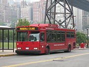 This route is operated by Roosevelt Island Operating Corporation
(RIOC) and is the lone unsubsidized route operating in Manhattan. The Red Bus route operates an on-island shuttle bus service from apartment buildings to the subway and tramway lines.
, and 10¢
for seniors and disabilities.
MetroCard is not accepted.
, all routes were assigned a franchise
by the city, numbered in order from M1 to at least M47 and M100 to M106. Most companies used these numbers, but the New York Omnibus Corporation gave its routes numbers from 1 to 22, and the Fifth Avenue Coach Company used numbers from 1 to 20. The public designations were not changed to avoid conflicts until July 1974.
New York City Omnibus Corporation
M102 only operated from June 29 to July 1, 1947.
Metropolitan Transportation Authority (New York)
The Metropolitan Transportation Authority of the State of New York is a public benefit corporation responsible for public transportation in the U.S...
operates a number of bus
Bus
A bus is a road vehicle designed to carry passengers. Buses can have a capacity as high as 300 passengers. The most common type of bus is the single-decker bus, with larger loads carried by double-decker buses and articulated buses, and smaller loads carried by midibuses and minibuses; coaches are...
routes in Manhattan
Manhattan
Manhattan is the oldest and the most densely populated of the five boroughs of New York City. Located primarily on the island of Manhattan at the mouth of the Hudson River, the boundaries of the borough are identical to those of New York County, an original county of the state of New York...
, New York
New York
New York is a state in the Northeastern region of the United States. It is the nation's third most populous state. New York is bordered by New Jersey and Pennsylvania to the south, and by Connecticut, Massachusetts and Vermont to the east...
, United States
United States
The United States of America is a federal constitutional republic comprising fifty states and a federal district...
. Many of them are the direct descendants of streetcar lines (see list of streetcar lines in Manhattan).
Companies
Presently, the New York City Transit AuthorityNew York City Transit Authority
The New York City Transit Authority is a public authority in the U.S. state of New York that operates public transportation in New York City...
and its subsidiary Manhattan and Bronx Surface Transit Operating Authority
Manhattan and Bronx Surface Transit Operating Authority
The Manhattan and Bronx Surface Transit Operating Authority is a subsidiary of the New York City Transit Authority that was created in 1962 to take over bus services from the bankrupt Fifth Avenue Coach Company and Surface Transit, Inc...
operate most local buses in Manhattan. The Roosevelt Island Operating Corporation
Roosevelt Island Operating Corporation
The Roosevelt Island Operating Corporation is a public-benefit corporation responsible for developing Roosevelt Island, a small strip of land in the East River, part of the borough of Manhattan....
operates the Roosevelt Island Red Bus Service on Roosevelt Island
Roosevelt Island
Roosevelt Island, known as Welfare Island from 1921 to 1973, and before that Blackwell's Island, is a narrow island in the East River of New York City. It lies between the island of Manhattan to its west and the borough of Queens to its east...
.
The first bus company in Manhattan was the Fifth Avenue Coach Company, which began operating the Fifth Avenue Line (now the M1 route) in 1886. When New York Railways
New York Railways
New York State Railways was a grouping of several large city streetcar and electric interurban systems in upstate New York. It included the city transit systems in Rochester, Syracuse, Utica, Oneida and Rome, plus various interurban lines connecting those cities.The company was formed in 1909 when...
began abandoning several streetcar lines in 1919, the replacement bus routes (including the current M21 and M22 routes) were picked up by the New York City Department of Plant and Structures (DP&S). The DP&S began operating several other buses (including the current M79 and M96 routes) in 1921. All of these but the M21 were acquired by Green Bus Lines
Green Bus Lines
Green Bus Lines was a bus company in New York City, United States, managed most recently by Jerome Cooper , operating local service in Queens and express service to Manhattan until January 9, 2006, when the MTA Bus Company took over its routes.The company was incorporated on April 3, 1925 to...
in 1933; Green transferred several of these to the Comprehensive Omnibus Corporation in 1935.
The New York City Omnibus Corporation
New York City Omnibus Corporation
The New York City Omnibus Corporation was formed in 1926. It ran new bus services that replaced the New York Railways Corporation streetcars when they were dismantled in 1935/36. It purchased the Fifth Avenue Coach Company from The Omnibus Corporation in 1954 and renamed itself the 'Fifth Avenue...
began operating replacement routes for New York Railways lines abandoned in 1936, and acquired the remaining Green routes. They also acquired the Madison Avenue Coach Company (former New York and Harlem Railroad
New York and Harlem Railroad
The New York and Harlem Railroad was one of the first railroads in the United States, and possibly also the world's first street railway. Designed by John Stephenson, it was opened in stages between 1832 and 1852 between Lower Manhattan to and beyond Harlem...
lines), Eighth Avenue Coach Corporation (former Eighth and Ninth Avenue Railways lines), and in 1942 the Triangle Bus Corporation (current M21 route).
In 1936, the NYCO and Fifth Avenue were placed under common ownership. The two were merged directly by 1956, when the NYCO acquired the Surface Transportation Corporation
Surface Transportation Corporation
The Surface Transportation Corporation was the bus-operating subsidiary of the Third Avenue Railway in New York City, United States....
(operated former Third Avenue Railway
Third Avenue Railway
The Third Avenue Railway System was a street railroad system in New York City in the 19th and early 20th century.-History:The principal company was the Third Avenue Railroad Company from 1853 to 1910, when it was succeeded in reorganization by the Third Avenue Railway Company...
routes since 1941), and changed its name to Fifth Avenue Coach Lines. After a strike in 1962, the entire Fifth Avenue system was transferred to the newly-formed Manhattan and Bronx Surface Transit Operating Authority
Manhattan and Bronx Surface Transit Operating Authority
The Manhattan and Bronx Surface Transit Operating Authority is a subsidiary of the New York City Transit Authority that was created in 1962 to take over bus services from the bankrupt Fifth Avenue Coach Company and Surface Transit, Inc...
.
In 1933, two related companies began to operate routes: the Comprehensive Omnibus Corporation gained several Green Bus Lines
Green Bus Lines
Green Bus Lines was a bus company in New York City, United States, managed most recently by Jerome Cooper , operating local service in Queens and express service to Manhattan until January 9, 2006, when the MTA Bus Company took over its routes.The company was incorporated on April 3, 1925 to...
routes (including the current M22, M27, and M50 routes), and the East Side Omnibus Corporation started operating former Second Avenue Railroad
Second Avenue Railroad
The Second Avenue Railroad was a street railway company in Manhattan, New York City, United States. Its lines included the Second Avenue Line....
routes (including the current M15 and M31 routes). The Comprehensive also started the current M66 route that year, and in 1948 the New York City Board of Transportation acquired the Comprehensive and East Side routes, transferred to the New York City Transit Authority
New York City Transit Authority
The New York City Transit Authority is a public authority in the U.S. state of New York that operates public transportation in New York City...
in 1953. The M9 route came from the Avenue B and East Broadway Transit Company in 1980, which had begun operating replacement routes for the Dry Dock, East Broadway and Battery Railroad lines in 1932.
Routes
This table gives details for the routes prefixed with "M" - in other words, those considered to run primarily in Manhattan by the MTA. For details on routes with other prefixes, see the following articles:- List of bus routes in the Bronx: Bx3, Bx6, Bx7, Bx9 (through Marble HillMarble Hill, ManhattanMarble Hill is the neighborhood which makes up the northernmost part of the Borough of Manhattan in New York City, United States. Although it is politically part of Manhattan and New York County, because of the re-routing of the Harlem River, it is located on the North American mainland contiguous...
), Bx11, Bx12, Bx12 +Select Bus Service+, Bx13, Bx15, Bx19, Bx20, Bx33, Bx35, and Bx36 - List of bus routes in Queens: Q32, Q60, Q101, and Q102 (in Roosevelt Island).
- List of express bus routes in New York City: all routes.
- List of bus routes in Westchester County, New York: BxM4C.
New York City Bus
Routes M2, M7, M14A/D, M15, M23, M42, M60, M79, M86, M96, M101, M102, M103 and, M104 run 24 hours a day. Other bus routes do not operate overnight hours, usually defined as midnight to 5AM. The Manhattan bus routes should not be confused with MegabusMegabus (United States)
Megabus, branded on buses as megabus.com, is an intercity bus service of Coach USA/Coach Canada and DATTCO providing discount travel services since 2006, operating throughout the Northeast, parts of the Southeast, and Midwestern United States, and in southern Canada...
routes with similar names originating from Manhattan.
Routes M1 to M20
| Route | Terminals | Streets traveled | Service notes | ||
|---|---|---|---|---|---|
| Local service | |||||
| Harlem West 147 Street and Adam Clayton Powell Boulevard |
↔ | East Village East Village, Manhattan The East Village is a neighborhood in the borough of Manhattan in New York City, lying east of Greenwich Village, south of Gramercy and Stuyvesant Town, and north of the Lower East Side... East 8 Street and 4 Avenue at Astor Place Astor Place (IRT Lexington Avenue Line) Astor Place, also called Astor Place – Cooper Union on signs, is a local station on the IRT Lexington Avenue Line of the New York City Subway. Completed in 1904, it is one of the original twenty-eight stations in the system... ( trains) |
|
|
|
| ↔ | Spanish Harlem Spanish Harlem East Harlem, also known as Spanish Harlem and El Barrio, is a section of Harlem in the northeastern part of the New York City borough of Manhattan. East Harlem is one of the largest predominantly Latino communities in New York City. It includes the area formerly known as Italian Harlem, in which... East 106 Street and 5 Avenue |
|
|||
| Limited-stop service | |||||
| Harlem West 147 Street and Adam Clayton Powell Boulevard |
→ AM ← PM |
East Village East Village, Manhattan The East Village is a neighborhood in the borough of Manhattan in New York City, lying east of Greenwich Village, south of Gramercy and Stuyvesant Town, and north of the Lower East Side... East 8 Street and 4 Avenue at Astor Place Astor Place (IRT Lexington Avenue Line) Astor Place, also called Astor Place – Cooper Union on signs, is a local station on the IRT Lexington Avenue Line of the New York City Subway. Completed in 1904, it is one of the original twenty-eight stations in the system... ( trains) |
(See M1 Local service Harlem ↔ East Village above) |
|
|
| Local service | |||||
| Washington Heights Washington Heights, Manhattan Washington Heights is a New York City neighborhood in the northern reaches of the borough of Manhattan. It is named for Fort Washington, a fortification constructed at the highest point on Manhattan island by Continental Army troops during the American Revolutionary War, to defend the area from the... West 168 Street and Broadway at 168th Street 168th Street (New York City Subway) 168th Street , is an underground station complex on the New York City Subway shared by the IRT Broadway – Seventh Avenue Line and IND Eighth Avenue Line... ( trains) |
↔ | East Village East Village, Manhattan The East Village is a neighborhood in the borough of Manhattan in New York City, lying east of Greenwich Village, south of Gramercy and Stuyvesant Town, and north of the Lower East Side... East 8 Street and Fourth Avenue at Astor Place Astor Place (IRT Lexington Avenue Line) Astor Place, also called Astor Place – Cooper Union on signs, is a local station on the IRT Lexington Avenue Line of the New York City Subway. Completed in 1904, it is one of the original twenty-eight stations in the system... ( trains) |
Edgecombe Avenue, Adam Clayton Powell Boulevard, Central Park North, ...
|
and early morning hours and do not operate while limited-stop buses run. |
|
| Limited-stop service | |||||
| Washington Heights Washington Heights, Manhattan Washington Heights is a New York City neighborhood in the northern reaches of the borough of Manhattan. It is named for Fort Washington, a fortification constructed at the highest point on Manhattan island by Continental Army troops during the American Revolutionary War, to defend the area from the... West 168 Street and Broadway at 168th Street 168th Street (New York City Subway) 168th Street , is an underground station complex on the New York City Subway shared by the IRT Broadway – Seventh Avenue Line and IND Eighth Avenue Line... ( trains) |
↔ | East Village East Village, Manhattan The East Village is a neighborhood in the borough of Manhattan in New York City, lying east of Greenwich Village, south of Gramercy and Stuyvesant Town, and north of the Lower East Side... East 8 Street and Fourth Avenue at Astor Place Astor Place (IRT Lexington Avenue Line) Astor Place, also called Astor Place – Cooper Union on signs, is a local station on the IRT Lexington Avenue Line of the New York City Subway. Completed in 1904, it is one of the original twenty-eight stations in the system... ( trains) |
(See M2 Local routing above) |
morning and overnight hours. |
|
Local |
Fort George West 193rd Street and Saint Nicholas Avenue |
↔ | East Village East Village, Manhattan The East Village is a neighborhood in the borough of Manhattan in New York City, lying east of Greenwich Village, south of Gramercy and Stuyvesant Town, and north of the Lower East Side... East 8 Street and Fourth Avenue at Astor Place Astor Place (IRT Lexington Avenue Line) Astor Place, also called Astor Place – Cooper Union on signs, is a local station on the IRT Lexington Avenue Line of the New York City Subway. Completed in 1904, it is one of the original twenty-eight stations in the system... ( trains) |
Saint Nicholas Avenue, Manhattan Avenue, Central Park North, ...
|
|
| Local service | |||||
| Penn Station West 32nd Street and Seventh Avenue |
↔ | The Cloisters Museum |
Fort Washington Avenue, Broadway, Cathedral Parkway/Central Park North, ...
|
Fort Tryon Park Fort Tryon Park is a public park located in the Washington Heights section of the borough of Manhattan in New York City, USA. It is situated on a 67 acre ridge in Upper Manhattan, with a commanding view of the Hudson River, the George Washington Bridge, the New Jersey Palisades and the Harlem River... . |
|
| Limited-stop service | |||||
| Penn Station West 32nd Street and Seventh Avenue |
↔ | The Cloisters Museum | (See M4 Local routing above) |
|
|
| Local service | |||||
| Washington Heights Washington Heights, Manhattan Washington Heights is a New York City neighborhood in the northern reaches of the borough of Manhattan. It is named for Fort Washington, a fortification constructed at the highest point on Manhattan island by Continental Army troops during the American Revolutionary War, to defend the area from the... West 178th Street and Broadway |
↔ | South Ferry Whitehall Street and South Street at South Ferry – Whitehall Street South Ferry – Whitehall Street (New York City Subway) South Ferry – Whitehall Street is a New York City Subway station complex in the Manhattan neighborhood of Battery Park, shared by the IRT Broadway – Seventh Avenue Line and the BMT Broadway Line... ( trains) |
Broadway, Riverside Drive, West 72 Street, Central Park South, ...
|
limited-stop buses run. New York University New York University is a private, nonsectarian research university based in New York City. NYU's main campus is situated in the Greenwich Village section of Manhattan... . |
|
| Limited-stop service | |||||
| Washington Heights Washington Heights, Manhattan Washington Heights is a New York City neighborhood in the northern reaches of the borough of Manhattan. It is named for Fort Washington, a fortification constructed at the highest point on Manhattan island by Continental Army troops during the American Revolutionary War, to defend the area from the... West 178th St and Broadway |
↔ | South Ferry Whitehall Street and South Street at South Ferry – Whitehall Street South Ferry – Whitehall Street (New York City Subway) South Ferry – Whitehall Street is a New York City Subway station complex in the Manhattan neighborhood of Battery Park, shared by the IRT Broadway – Seventh Avenue Line and the BMT Broadway Line... ( trains) |
(See M5 Local routing above) |
|
|
Local |
Harlem West 147 Street and Adam Clayton Powell Boulevard |
↔ | Chelsea Chelsea, Manhattan Chelsea is a neighborhood on the West Side of the borough of Manhattan in New York City. The district's boundaries are roughly 14th Street to the south, 30th Street to the north, the western boundary of the Ladies' Mile Historic District – which lies between the Avenue of the Americas and... 14th Street and 6 Avenue at Sixth Avenue Sixth Avenue (BMT Canarsie Line) Sixth Avenue is a station on the BMT Canarsie Line of the New York City Subway. Located at the intersection of Sixth Avenue and 14th Street in the Manhattan neighborhood of Chelsea, it is served by the L train at all times.... / 14th Street 14th Street (IND Sixth Avenue Line) 14th Street is a local station on the IND Sixth Avenue Line of the New York City Subway. Located at the intersection of Sixth Avenue and 14th Street in Manhattan, it is served by the F train at all times, and the M train on weekdays except late nights.This underground station opened on December 15,... ( trains) |
Lenox Avenue, West 116 Street, Manhattan Avenue, Duke Ellington Boulevard, ...
|
|
Local |
West Village West Village, Manhattan The West Village is the western portion of the Greenwich Village neighborhood in the New York City borough of Manhattan. The area is usually defined as bounded by the Hudson River on the west and either Sixth Avenue or Seventh Avenue on the east, extending from 14th Street down to Houston Street... West St and Christopher St |
↔ | East Village East Village, Manhattan The East Village is a neighborhood in the borough of Manhattan in New York City, lying east of Greenwich Village, south of Gramercy and Stuyvesant Town, and north of the Lower East Side... Avenue D and Tenth St |
|
|
Local |
City Hall Park Row and Beekman Street |
↔ | Kips Bay East 23 Street and 1 Avenue at Bellevue Hospital |
East Broadway, Essex Street, Avenue C |
|
Local |
Harlem Fredrick Douglass Boulevard and West 159 Street |
↔ | Columbus Circle Columbus Circle Columbus Circle, named for Christopher Columbus, is a major landmark and point of attraction in the New York City borough of Manhattan, located at the intersection of Eighth Avenue, Broadway, Central Park South , and Central Park West, at the southwest corner of Central Park. It is the point from... West 57 Street and 8 Avenue |
Central Park West, Fredrick Douglas Boulevard |
|
Local |
West Village West Village, Manhattan The West Village is the western portion of the Greenwich Village neighborhood in the New York City borough of Manhattan. The area is usually defined as bounded by the Hudson River on the west and either Sixth Avenue or Seventh Avenue on the east, extending from 14th Street down to Houston Street... Bethune Street and Hudson Street at Abingdon Square |
↔ | Riverbank State Park Riverbank State Park Riverbank State Park is a park built on the top of a sewage treatment facility on the Hudson River, in the New York City borough of Manhattan.... |
|
|
| ↔ | Harlem West 133rd St and Broadway |
||||
Local |
Lower East Side Lower East Side, Manhattan The Lower East Side, LES, is a neighborhood in the southeastern part of the New York City borough of Manhattan. It is roughly bounded by Allen Street, East Houston Street, Essex Street, Canal Street, Eldridge Street, East Broadway, and Grand Street.... Grand Street and FDR Drive Franklin D. Roosevelt East River Drive The Franklin D. Roosevelt East River Drive is a freeway-standard parkway on the east side of the New York City borough of Manhattan... |
↔ | West Village West Village, Manhattan The West Village is the western portion of the Greenwich Village neighborhood in the New York City borough of Manhattan. The area is usually defined as bounded by the Hudson River on the west and either Sixth Avenue or Seventh Avenue on the east, extending from 14th Street down to Houston Street... Bethune Street and Hudson Street at Abingdon Square |
14 Street, Avenue A/Essex Street, Grand Street |
|
| ↔ | Chelsea Piers West 18 Street and 11 Avenue |
||||
Local |
Lower East Side Lower East Side, Manhattan The Lower East Side, LES, is a neighborhood in the southeastern part of the New York City borough of Manhattan. It is roughly bounded by Allen Street, East Houston Street, Essex Street, Canal Street, Eldridge Street, East Broadway, and Grand Street.... Delancey Street and Columbia Street |
↔ | 14 Street, Avenue D | ||
| Local service | |||||
| East Harlem East 126th St and Second Av |
↔ | South Ferry Whitehall Street and South Street at South Ferry – Whitehall Street South Ferry – Whitehall Street (New York City Subway) South Ferry – Whitehall Street is a New York City Subway station complex in the Manhattan neighborhood of Battery Park, shared by the IRT Broadway – Seventh Avenue Line and the BMT Broadway Line... ( trains) |
Water Street, Allen Street, 1 Avenue (NB)/2 Avenue (SB) | ||
| Select Bus Service | |||||
| East Harlem East 126th St and Second Av |
↔ | South Ferry South Ferry – Whitehall Street South Ferry – Whitehall Street (New York City Subway) South Ferry – Whitehall Street is a New York City Subway station complex in the Manhattan neighborhood of Battery Park, shared by the IRT Broadway – Seventh Avenue Line and the BMT Broadway Line... ( trains) Bus loop |
(See M15 Local routing above) |
|
|
Local |
South Ferry Whitehall Street and South Street at South Ferry – Whitehall Street South Ferry – Whitehall Street (New York City Subway) South Ferry – Whitehall Street is a New York City Subway station complex in the Manhattan neighborhood of Battery Park, shared by the IRT Broadway – Seventh Avenue Line and the BMT Broadway Line... ( trains) |
↔ | Lincoln Center West 63 Street and Broadway |
|
|
| Notes: | NB: Northbound; SB: Southbound; EB: Eastbound; WB: Westbound | ||||
Routes M21 to M79
All routes in this section are local service.| Route | Terminals | Streets traveled | Service notes | ||
|---|---|---|---|---|---|
| West Village West Village, Manhattan The West Village is the western portion of the Greenwich Village neighborhood in the New York City borough of Manhattan. The area is usually defined as bounded by the Hudson River on the west and either Sixth Avenue or Seventh Avenue on the east, extending from 14th Street down to Houston Street... Washington Street and Spring Street |
↔ | Lower East Side Lower East Side The Lower East Side, LES, is a neighborhood in the southeastern part of the New York City borough of Manhattan. It is roughly bounded by Allen Street, East Houston Street, Essex Street, Canal Street, Eldridge Street, East Broadway, and Grand Street.... Grand Street and FDR Drive |
Houston St |
|
|
| Battery Park City Battery Park City, Manhattan Battery Park City is a planned community at the southwestern tip of lower Manhattan in New York City, United States. The land upon which it stands was created by land reclamation on the Hudson River using 1.2 million cubic yards of soil and rocks excavated during the construction of the World... North End St and Vesey St |
↔ | Lower East Side Lower East Side, Manhattan The Lower East Side, LES, is a neighborhood in the southeastern part of the New York City borough of Manhattan. It is roughly bounded by Allen Street, East Houston Street, Essex Street, Canal Street, Eldridge Street, East Broadway, and Grand Street.... Grand St and FDR Drive Franklin D. Roosevelt East River Drive The Franklin D. Roosevelt East River Drive is a freeway-standard parkway on the east side of the New York City borough of Manhattan... |
|
|
|
| Chelsea Piers 12 Avenue near West 23 Street |
↔ | Peter Cooper Village— Stuyvesant Town Peter Cooper Village—Stuyvesant Town Stuyvesant Town—Peter Cooper Village is a large private residential development on the East Side of the borough of Manhattan in New York City, and one of the most iconic and successful post-World War II private housing communities... Avenue C and East 20 Street |
23 Street | ||
| Clinton West 54th St and 11th Av |
↔ | Yorkville Yorkville, Manhattan Yorkville is a neighborhood in the greater Upper East Side, in the Borough of Manhattan in New York City. Yorkville's boundaries include: the East River on the east, 96th Street on the north, Third Avenue on the west and 72nd Street to the south. However, its southern boundary is a subject of... East 92nd St and York Av |
57th St and York Av. |
|
|
| Select Bus Service | |||||
| Chelsea Chelsea, Manhattan Chelsea is a neighborhood on the West Side of the borough of Manhattan in New York City. The district's boundaries are roughly 14th Street to the south, 30th Street to the north, the western boundary of the Ladies' Mile Historic District – which lies between the Avenue of the Americas and... 12 Avenue and West 34 Street |
↔ | East Side FDR Drive Franklin D. Roosevelt East River Drive The Franklin D. Roosevelt East River Drive is a freeway-standard parkway on the east side of the New York City borough of Manhattan... and East 34 Street |
34 Street |
|
|
| Select Bus Service | |||||
| Port Authority Bus Terminal Port Authority Bus Terminal The Port Authority Bus Terminal is the main gateway for interstate buses into Manhattan in New York City... West 42 Street and 9 Avenue |
↔ | Waterside Plaza Waterside Plaza Waterside Plaza, formerly a Mitchell-Lama Housing Program-funded rental apartment complex, is located on the East River in the Kips Bay section of Manhattan, New York City.- Overview :... |
|
|
|
| Harlem East 125 Street and Lexington Avenue at 125th Street 125th Street (IRT Lexington Avenue Line) 125th Street is an express station that has four tracks and two island platforms. It is the northernmost Manhattan station on the IRT Lexington Avenue Line of the New York City Subway. Located at Lexington Avenue and East 125th Street 125th Street is an express station that has four tracks and two... ( trains) |
↔ | Randall's Island Randall's Island Randall's Island is situated in the East River in New York City, part of the borough of Manhattan. It is separated from Manhattan island on the west by the river's main channel, from Queens on the east by the Hell Gate, and from the Bronx on the north by the Bronx Kill. It is joined to Wards... and Wards Island |
Robert F. Kennedy Bridge |
|
|
| United Nations United Nations The United Nations is an international organization whose stated aims are facilitating cooperation in international law, international security, economic development, social progress, human rights, and achievement of world peace... 1 Avenue and East 42 Street |
↔ | Circle Line 12 Avenue and Pier 83 |
42 Street | ||
| East Midtown East 49 Street and 1 Avenue |
↔ | Circle Line Sightseeing Cruises 12 Avenue and Pier 83 |
|
|
|
| Upper West Side West 72 Street and Broadway at 72nd Street ( trains) |
↔ | East Midtown York Av and East 60 Street |
West End Avenue and 57 Street |
|
|
| Morningside Heights Morningside Heights, Manhattan Morningside Heights is a neighborhood of the Borough of Manhattan in New York City and is chiefly known as the home of institutions such as Columbia University, Teachers College, Barnard College, the Manhattan School of Music, Bank Street College of Education, the Cathedral of Saint John the... West 106 Street and Broadway |
↔ | LaGuardia Airport LaGuardia Airport LaGuardia Airport is an airport located in the northern part of Queens County on Long Island in the City of New York. The airport is located on the waterfront of Flushing Bay and Bowery Bay, and borders the neighborhoods of Astoria, Jackson Heights and East Elmhurst. The airport was originally... , Queens All terminals |
Broadway, 125 Street, Robert F. Kennedy Bridge, Astoria Boulevard | ||
| Upper West Side West 66 Street and West End Avenue |
↔ | Upper East Side York Avenue and East 67 Street |
|
|
|
| Upper West Side Freedom Place and West 68 Street |
↔ | Upper East Side York Av and East 72 Street |
72 Street, 66 Street Transverse |
|
|
| Upper West Side Riverside Drive and West 79 Street |
↔ | Upper East Side East End Avenue and East 79 Street |
79 Street | ||
| Notes: | NB: Northbound; SB: Southbound; EB: Eastbound; WB: Westbound | ||||
Routes M86 to M116
| Route | Terminals | Streets traveled | Service notes | ||
|---|---|---|---|---|---|
Local |
Upper West Side West End Avenue and West 86 Street |
↔ | Yorkville Yorkville, Manhattan Yorkville is a neighborhood in the greater Upper East Side, in the Borough of Manhattan in New York City. Yorkville's boundaries include: the East River on the east, 96th Street on the north, Third Avenue on the west and 72nd Street to the south. However, its southern boundary is a subject of... East 92 Street and York Avenue |
86 Street, York Avenue | |
Local |
Upper West Side West End Avenue and West 96 Street |
↔ | Yorkville Yorkville, Manhattan Yorkville is a neighborhood in the greater Upper East Side, in the Borough of Manhattan in New York City. Yorkville's boundaries include: the East River on the east, 96th Street on the north, Third Avenue on the west and 72nd Street to the south. However, its southern boundary is a subject of... 1 Avenue and East 97 Street |
96 Street | |
| Limited-stop service | |||||
| Upper East Side Upper East Side The Upper East Side is a neighborhood in the borough of Manhattan in New York City, between Central Park and the East River. The Upper East Side lies within an area bounded by 59th Street to 96th Street, and the East River to Fifth Avenue-Central Park... East 68 Street and Lexington Avenue at Hunter College Hunter College Hunter College, established in 1870, is a public university and one of the constituent colleges of the City University of New York, located on Manhattan's Upper East Side. Hunter grants undergraduate, graduate, and post-graduate degrees in more than one hundred fields of study, and is recognized... |
↔ | Washington Heights Washington Heights, Manhattan Washington Heights is a New York City neighborhood in the northern reaches of the borough of Manhattan. It is named for Fort Washington, a fortification constructed at the highest point on Manhattan island by Continental Army troops during the American Revolutionary War, to defend the area from the... West 193 Street and Fort Washington Avenue at 190th Street 190th Street (IND Eighth Avenue Line) 190th Street is a station on the IND Eighth Avenue Line of the New York City Subway, served by the A train at all times. It is located on Fort Washington Avenue about 240 meters north of 190th Street. The station is near Fort Tryon Park and Mother Cabrini Shrine in the Hudson Heights neighborhood... ( train) |
Fort Washington Avenue, Harlem River Drive Harlem River Drive The Harlem River Drive is a north–south parkway in the New York City borough of Manhattan. It runs along the west bank of the Harlem River from the Triborough Bridge in East Harlem to 10th Avenue in Inwood, where the parkway continues north as Dyckman Street. The portion of the Harlem River Drive... , ...
|
|
|
Local |
Inwood Inwood, Manhattan Inwood is the northernmost neighborhood on Manhattan Island in the New York City borough of Manhattan.-Geography:Inwood is physically bounded by the Harlem River to the north and east, and the Hudson River to the west. It extends southward to Fort Tryon Park and alternatively Dyckman Street or... West 220 Street and Broadway |
↔ | East Harlem East 125 Street and 2 Avenue |
Broadway, Amsterdam Avenue, 125 Street |
|
| Local service | |||||
| Washington Heights Washington Heights, Manhattan Washington Heights is a New York City neighborhood in the northern reaches of the borough of Manhattan. It is named for Fort Washington, a fortification constructed at the highest point on Manhattan island by Continental Army troops during the American Revolutionary War, to defend the area from the... West 193 Street and St. Nicholas Avenue |
↔ | East Village East Village, Manhattan The East Village is a neighborhood in the borough of Manhattan in New York City, lying east of Greenwich Village, south of Gramercy and Stuyvesant Town, and north of the Lower East Side... East 8 Street and 3 Avenue at Astor Place Astor Place (IRT Lexington Avenue Line) Astor Place, also called Astor Place – Cooper Union on signs, is a local station on the IRT Lexington Avenue Line of the New York City Subway. Completed in 1904, it is one of the original twenty-eight stations in the system... ( trains) |
Amsterdam Avenue, 125 Street...
(from 24 to 125 Street) (from 125 to 24 Street) 3 Avenue |
|
|
| Limited-stop service | |||||
| Washington Heights Washington Heights, Manhattan Washington Heights is a New York City neighborhood in the northern reaches of the borough of Manhattan. It is named for Fort Washington, a fortification constructed at the highest point on Manhattan island by Continental Army troops during the American Revolutionary War, to defend the area from the... West 193 Street and St. Nicholas Avenue |
↔ | East Village East Village, Manhattan The East Village is a neighborhood in the borough of Manhattan in New York City, lying east of Greenwich Village, south of Gramercy and Stuyvesant Town, and north of the Lower East Side... East 8 Street and 3 Avenue at Astor Place Astor Place (IRT Lexington Avenue Line) Astor Place, also called Astor Place – Cooper Union on signs, is a local station on the IRT Lexington Avenue Line of the New York City Subway. Completed in 1904, it is one of the original twenty-eight stations in the system... ( trains) |
(See M101 Local routing above) |
except overnights. |
|
Local |
Harlem West 147th St and Adam Clayton Powell Blvd |
↔ | East Village East Village, Manhattan The East Village is a neighborhood in the borough of Manhattan in New York City, lying east of Greenwich Village, south of Gramercy and Stuyvesant Town, and north of the Lower East Side... East 8 Street and 3 Avenue at Astor Place Astor Place (IRT Lexington Avenue Line) Astor Place, also called Astor Place – Cooper Union on signs, is a local station on the IRT Lexington Avenue Line of the New York City Subway. Completed in 1904, it is one of the original twenty-eight stations in the system... ( trains) |
Lenox Avenue, 116 Street
(from 24 to 116 Street) (from 116 to 24 Street) 3 Avenue |
|
Local |
East Harlem East 125th St and Lexington Av |
↔ | City Hall Park Row and Broadway |
Bowery, 3 Avenue...
|
|
Local |
Harlem West 129th St and Amsterdam Av |
↔ | Times Square Times Square Times Square is a major commercial intersection in the borough of Manhattan in New York City, at the junction of Broadway and Seventh Avenue and stretching from West 42nd to West 47th Streets... Times Square - 42nd Street ( trains) |
|
|
Local |
East Harlem East 106 Street and FDR Drive Franklin D. Roosevelt East River Drive The Franklin D. Roosevelt East River Drive is a freeway-standard parkway on the east side of the New York City borough of Manhattan... |
↔ | Upper West Side West 96 Street and West End Avenue |
West 96 Street, Madison Avenue (NB), 5 Avenue (SB), East 106 Street |
|
Local |
East Harlem East 120 Street and Pleasant Avenue |
↔ | Upper West Side West 106 Street and Broadway |
Duke Ellington Boulevard, Manhattan Avenue, 116 Street |
|
| Notes: | NB: Northbound; SB: Southbound; EB: Eastbound; WB: Westbound | ||||
Hudson River
New York Waterway operates shuttle bus routes to/from its West Midtown Ferry TerminalWest Midtown Ferry Terminal
The West Midtown Ferry Terminal is a passenger ferry terminal serving ferries along the Hudson River in New York City and northeastern New Jersey. It is located at Piers 78 and 79 in Hudson River Park adjacent to the West Side Highway at West 39th Street in Midtown Manhattan...
. Service is free.
Peak service
| Terminal | Streets traveled |
|---|---|
| Midtown Midtown Manhattan Midtown Manhattan, or simply Midtown, is an area of Manhattan, New York City home to world-famous commercial zones such as Rockefeller Center, Broadway, and Times Square... 3 Avenue and 57 Street |
57th Street |
| Midtown Midtown Manhattan Midtown Manhattan, or simply Midtown, is an area of Manhattan, New York City home to world-famous commercial zones such as Rockefeller Center, Broadway, and Times Square... Lexington Avenue and 50 Street |
Eastbound: 50 Street Westbound: 49 Street |
| Midtown Midtown Manhattan Midtown Manhattan, or simply Midtown, is an area of Manhattan, New York City home to world-famous commercial zones such as Rockefeller Center, Broadway, and Times Square... 3 Avenue and 42 Street |
42nd Street |
| Murray Hill Murray Hill, Manhattan Murray Hill is a Midtown Manhattan neighborhood in New York City, USA. Around 1987 many real estate promoters of the neighborhood and newer residents described the boundaries as within East 34th Street, East 42nd Street, Madison Avenue, and the East River; in 1999, Frank P... 3 Avenue and 34 Street |
34th Street |
| Downtown Loop | AM: 23 Street, Broadway, Houston Street, West Street (clockwise) PM: West Street, Clarkson Street, Sixth Avenue, 23 Street (counterclockwise) |
Off-peak service
All routes operate as clockwise loops.
| Streets traveled | Notes |
|---|---|
| 50 Street, 10 Avenue, 65th Street, Broadway, 42nd Street |
|
| 44 Street, 8 Avenue, 57 Street, 5 Avenue, 49 Street | |
| 50 Street, 6 Avenue, 57 St, 8 Avenue, 49 Street |
|
| 42 Street, 5 Av, 34 Street | |
| 23 Street, Varick Street, W Broadway, Murray Street, West Street |
East River
A counterclockwise shuttle bus via 34 St, 6 Av, 48 St, and Lexington Av operates during peak hours only to connect with the East River Ferry.Roosevelt Island Operating Corporation
Roosevelt Island Operating Corporation
The Roosevelt Island Operating Corporation is a public-benefit corporation responsible for developing Roosevelt Island, a small strip of land in the East River, part of the borough of Manhattan....
(RIOC) and is the lone unsubsidized route operating in Manhattan. The Red Bus route operates an on-island shuttle bus service from apartment buildings to the subway and tramway lines.
Route and fare structure
The one-way cash fare is 25¢Cent (currency)
In many national currencies, the cent is a monetary unit that equals 1⁄100 of the basic monetary unit. Etymologically, the word cent derives from the Latin word "centum" meaning hundred. Cent also refers to a coin which is worth one cent....
, and 10¢
Cent (currency)
In many national currencies, the cent is a monetary unit that equals 1⁄100 of the basic monetary unit. Etymologically, the word cent derives from the Latin word "centum" meaning hundred. Cent also refers to a coin which is worth one cent....
for seniors and disabilities.
MetroCard is not accepted.
| Route | Terminals | Streets traveled | ||
|---|---|---|---|---|
| Red Bus |
Octagon Apartments | ↔ | Roosevelt Island Tramway Roosevelt Island Tramway The Roosevelt Island Tramway is an aerial tramway in New York City that spans the East River and connects Roosevelt Island to Manhattan. Prior to the completion of the Mississippi Aerial River Transit in May 1984 and the Portland Aerial Tram in December 2006, it was the only commuter aerial tramway... station |
Main Street, East and West Service Drive |
Downtown Connection
In Lower Manhattan area, a free shuttle service operates daily from 10:00 AM until 7:00 PM, sponsored by the Lower Manhattan Business Improvement District (BID), using minibuses.| Route | Terminals | Streets traveled | ||
|---|---|---|---|---|
| Downtown Connection |
City Hall Broadway and Murray Street |
↔ | South Street Seaport South Street Seaport The South Street Seaport is a historic area in the New York City borough of Manhattan, located where Fulton Street meets the East River, and adjacent to the Financial District. The Seaport is a designated historic district, distinct from the neighboring Financial District... Water Street and Fulton Street |
Warren/Murray Streets, South End Avenue, Battery Place, Water Street |
Routes M1 to M20
| Route | History |
|---|---|
| M1 |
|
| M2 |
|
| M3 |
|
| M4 |
|
| M5 |
|
| M7 |
New York Railways New York State Railways was a grouping of several large city streetcar and electric interurban systems in upstate New York. It included the city transit systems in Rochester, Syracuse, Utica, Oneida and Rome, plus various interurban lines connecting those cities.The company was formed in 1909 when... ' Columbus Avenue Line Columbus Avenue Line The Columbus Avenue Line is a public transit line in Manhattan, New York City, United States, running mostly along Columbus Avenue, 116th Street, and Lenox Avenue from Lower Manhattan to Harlem. Originally a streetcar line, it is now the M7 bus route, operated by the New York City Transit Authority... streetcar on March 25, 1936. |
| M8 |
New York Railways New York State Railways was a grouping of several large city streetcar and electric interurban systems in upstate New York. It included the city transit systems in Rochester, Syracuse, Utica, Oneida and Rome, plus various interurban lines connecting those cities.The company was formed in 1909 when... ' Eighth Street Crosstown Line Eighth Street Crosstown Line The Eighth Street Crosstown Line is a public transit line in Manhattan, New York City, United States, running mostly along Eighth Street, Ninth Street, Tenth Street, and Christopher Street through the West Village, Greenwich Village, and East Village... streetcar on March 3, 1936. |
| M9 |
|
| M10 |
Eighth Avenue Line (Manhattan surface) The Eighth Avenue Line is a public transit line in Manhattan, New York City, United States, running mostly along Eighth Avenue from Lower Manhattan to Harlem. Originally a streetcar line, it is now the M10 bus route and the M20 bus route, operated by the New York City Transit Authority... streetcar on November 12, 1935. New York Railways New York State Railways was a grouping of several large city streetcar and electric interurban systems in upstate New York. It included the city transit systems in Rochester, Syracuse, Utica, Oneida and Rome, plus various interurban lines connecting those cities.The company was formed in 1909 when... ' Seventh Avenue Line Seventh Avenue Line (Manhattan surface) The Seventh Avenue Line is a surface public transit line in Manhattan, New York City, United States, connecting Lower Manhattan with Central Park along Seventh Avenue... streetcar on March 6, 1936. One-way pair A one-way pair, one-way couple, or just couplet is a pair of parallel, usually one-way streets that carry opposite directions of a signed route or major traffic flow, or sometimes opposite directions of a bus or streetcar route.... on June 6, 1954 and kept the number 10 continued south to Abingdon Square, Spring Street and Battery Park City Battery Park City, Manhattan Battery Park City is a planned community at the southwestern tip of lower Manhattan in New York City, United States. The land upon which it stands was created by land reclamation on the Hudson River using 1.2 million cubic yards of soil and rocks excavated during the construction of the World... until 1999. |
| M11 |
Ninth Avenue Line streetcar on November 12, 1935. |
| M14A M14D |
New York Railways New York State Railways was a grouping of several large city streetcar and electric interurban systems in upstate New York. It included the city transit systems in Rochester, Syracuse, Utica, Oneida and Rome, plus various interurban lines connecting those cities.The company was formed in 1909 when... ' 14th Street Crosstown Line 14th Street Crosstown Line (surface) The 14th Street Crosstown Line is a public transit line in Manhattan, New York City, United States, running mostly along 14th Street from Chelsea to the Lower East Side. Originally a streetcar line, it is now the M14 bus route, operated by the New York City Transit Authority... streetcar on April 20, 1936. and returning on Cannon Street and Houston Street. |
| M15 |
Second Avenue Railroad The Second Avenue Railroad was a street railway company in Manhattan, New York City, United States. Its lines included the Second Avenue Line.... 's Second Avenue Line Second Avenue Line (Manhattan surface) The Second Avenue Line is a bus line in Manhattan, New York City, United States, running mostly along Second Avenue from Lower Manhattan to East Harlem. Originally a streetcar line, it is now the southbound direction of the M15 bus route, the second-busiest bus route in the U.S... streetcar and began running route (M13) on First Avenue on June 26, 1933. One-way pair A one-way pair, one-way couple, or just couplet is a pair of parallel, usually one-way streets that carry opposite directions of a signed route or major traffic flow, or sometimes opposite directions of a bus or streetcar route.... on June 4, 1951 and kept the number M15. |
| M20 |
|
Routes M21 to M79
| Route | History |
|---|---|
| M21 |
|
| M22 |
New York Railways New York State Railways was a grouping of several large city streetcar and electric interurban systems in upstate New York. It included the city transit systems in Rochester, Syracuse, Utica, Oneida and Rome, plus various interurban lines connecting those cities.The company was formed in 1909 when... ' Chambers and Madison Streets Line streetcar on September 21, 1919. |
| M23 |
New York Railways New York State Railways was a grouping of several large city streetcar and electric interurban systems in upstate New York. It included the city transit systems in Rochester, Syracuse, Utica, Oneida and Rome, plus various interurban lines connecting those cities.The company was formed in 1909 when... ' 23rd Street Crosstown Line streetcar on April 8, 1936. |
| M31 |
|
| M34 M34A |
New York Railways New York State Railways was a grouping of several large city streetcar and electric interurban systems in upstate New York. It included the city transit systems in Rochester, Syracuse, Utica, Oneida and Rome, plus various interurban lines connecting those cities.The company was formed in 1909 when... ' 34th Street Crosstown Line streetcar on April 1, 1936. Select Bus Service Select Bus Service , marked on the buses as +selectbusservice, is a brand used by MTA Regional Bus Operations for bus rapid transit service.-History:... route in 2011. |
| M35 |
Astoria, Queens Astoria is a neighborhood in the northwestern corner of the borough of Queens in New York City. Located in Community Board 1, Astoria is bounded by the East River and is adjacent to three other Queens neighborhoods: Long Island City, Sunnyside , and Woodside... ), and Bx21 in July 1974; combined as the M35 in the 1980s, when M34 was applied to the 34th Street Crosstown. Astoria, Queens Astoria is a neighborhood in the northwestern corner of the borough of Queens in New York City. Located in Community Board 1, Astoria is bounded by the East River and is adjacent to three other Queens neighborhoods: Long Island City, Sunnyside , and Woodside... until September 10, 1995. |
| M42 |
Surface Transportation Corporation The Surface Transportation Corporation was the bus-operating subsidiary of the Third Avenue Railway in New York City, United States.... bus route (M106) replaced Third Avenue Railway Third Avenue Railway The Third Avenue Railway System was a street railroad system in New York City in the 19th and early 20th century.-History:The principal company was the Third Avenue Railroad Company from 1853 to 1910, when it was succeeded in reorganization by the Third Avenue Railway Company... 's 42nd Street Crosstown Line (Manhattan surface) streetcar on November 17, 1946. |
| M50 |
|
| M57 |
|
| M60 |
|
| M66 |
|
| M79 |
|
Routes M86 to M116
| Route | History |
|---|---|
| M86 |
|
| M96 |
|
| M98 |
|
| M100 |
Surface Transportation Corporation The Surface Transportation Corporation was the bus-operating subsidiary of the Third Avenue Railway in New York City, United States.... bus (Route M100) replaced Third Avenue Railway Third Avenue Railway The Third Avenue Railway System was a street railroad system in New York City in the 19th and early 20th century.-History:The principal company was the Third Avenue Railroad Company from 1853 to 1910, when it was succeeded in reorganization by the Third Avenue Railway Company... 's Broadway-Kingsbridge Line streetcar on June 22, 1947. |
| M101 |
New York Railways New York State Railways was a grouping of several large city streetcar and electric interurban systems in upstate New York. It included the city transit systems in Rochester, Syracuse, Utica, Oneida and Rome, plus various interurban lines connecting those cities.The company was formed in 1909 when... ' Lexington Avenue Line streetcar on March 25, 1936. Surface Transportation Corporation The Surface Transportation Corporation was the bus-operating subsidiary of the Third Avenue Railway in New York City, United States.... bus (M101) replaced Third Avenue Railway Third Avenue Railway The Third Avenue Railway System was a street railroad system in New York City in the 19th and early 20th century.-History:The principal company was the Third Avenue Railroad Company from 1853 to 1910, when it was succeeded in reorganization by the Third Avenue Railway Company... 's Third and Amsterdam Avenues Line Third and Amsterdam Avenues Line The Third and Amsterdam Avenues Line, also known as the Third Avenue Line, is a public transit line in Manhattan, New York City, United States, running from Lower Manhattan to Fort George in Washington Heights. Originally a streetcar line, it is now the M98, M101, M102, and M103 bus routes,... streetcar on May 28, 1947. One-way pair A one-way pair, one-way couple, or just couplet is a pair of parallel, usually one-way streets that carry opposite directions of a signed route or major traffic flow, or sometimes opposite directions of a bus or streetcar route.... on July 17, 1960 and kept the route number M101. |
| M102 |
|
| M103 |
|
| M104 |
Surface Transportation Corporation The Surface Transportation Corporation was the bus-operating subsidiary of the Third Avenue Railway in New York City, United States.... bus (M104) replaced Third Avenue Railway Third Avenue Railway The Third Avenue Railway System was a street railroad system in New York City in the 19th and early 20th century.-History:The principal company was the Third Avenue Railroad Company from 1853 to 1910, when it was succeeded in reorganization by the Third Avenue Railway Company... 's Broadway Line Broadway Line (Midtown Manhattan surface) The Broadway Line or Broadway Branch Line is a surface transit line in Manhattan, New York City, United States, running mainly along 42nd Street and Broadway from Murray Hill to Harlem... streetcar on December 15, 1946. |
| M106 |
Manhattan and Bronx Surface Transit Operating Authority The Manhattan and Bronx Surface Transit Operating Authority is a subsidiary of the New York City Transit Authority that was created in 1962 to take over bus services from the bankrupt Fifth Avenue Coach Company and Surface Transit, Inc... began operating bus in 1962 as the M107. |
| M116 |
New York Railways New York State Railways was a grouping of several large city streetcar and electric interurban systems in upstate New York. It included the city transit systems in Rochester, Syracuse, Utica, Oneida and Rome, plus various interurban lines connecting those cities.The company was formed in 1909 when... ' 116th Street Crosstown Line streetcar on April 1, 1936. |
Former routes
Except for early Fifth Avenue Coach Company routes, which were approved by the New York LegislatureNew York Legislature
The New York State Legislature is the term often used to refer to the two houses that act as the state legislature of the U.S. state of New York. The New York Constitution does not designate an official term for the two houses together...
, all routes were assigned a franchise
Government-granted monopoly
In economics, a government-granted monopoly is a form of coercive monopoly by which a government grants exclusive privilege to a private individual or firm to be the sole provider of a good or service; potential competitors are excluded from the market by law, regulation, or other mechanisms of...
by the city, numbered in order from M1 to at least M47 and M100 to M106. Most companies used these numbers, but the New York Omnibus Corporation gave its routes numbers from 1 to 22, and the Fifth Avenue Coach Company used numbers from 1 to 20. The public designations were not changed to avoid conflicts until July 1974.
Fifth Avenue Coach Company
| Designation | Route | ||
|---|---|---|---|
| Public | 1974 | Current | |
| 1 | M1 | Fifth Avenue | |
| 2 | M2 | Fifth and Seventh Avenues | |
| 3 | M3 | Fifth, St. Nicholas, and Convent Avenues | |
| 4 | M4 | Fifth Avenue and Fort Washington Avenues | |
| 5 | M5 | Fifth Avenue, Riverside Drive, and Broadway | |
| 6 | M30 | M72 | 72nd Street Crosstown |
| 15 | M32 | Q32 | Fifth Avenue-Queensboro Bridge Queensboro Bridge The Ed Koch Queensboro Bridge, also known as the 59th Street Bridge – because its Manhattan end is located between 59th and 60th Streets – or simply the Queensboro Bridge, is a cantilever bridge over the East River in New York City that was completed in 1909... -Jackson Heights Jackson Heights, Queens Jackson Heights is a neighborhood in the Northwestern portion of the borough of Queens in New York, New York, United States. The neighborhood is part of Queens Community Board 3... |
| 16 | Q89 | N/A | Elmhurst Elmhurst, Queens Elmhurst is a neighborhood in the New York City borough of Queens. It is bounded by Roosevelt Avenue on the north; Corona to the northeast; Junction Boulevard on the east; Rego Park to the southeast; the Long Island Expressway on the south; Middle Village to the south and southwest; and Maspeth... Crosstown |
| 19 | M5 | Fifth Avenue and Riverside Drive | |
| 20 | M28 | M57 | 57th Street Crosstown |
New York City Omnibus CorporationNew York City Omnibus CorporationThe New York City Omnibus Corporation was formed in 1926. It ran new bus services that replaced the New York Railways Corporation streetcars when they were dismantled in 1935/36. It purchased the Fifth Avenue Coach Company from The Omnibus Corporation in 1954 and renamed itself the 'Fifth Avenue...
| Designation | Route | |||
|---|---|---|---|---|
| Franchise | Public | 1974 | Current | |
| M25 | 1/2 | M1 | Fourth and Madison Avenues | |
| M21 | 3/4 | (M101) | Lexington and Lenox Avenues | |
| M23 | 5 | (M6/M7) | Sixth Avenue | |
| M22 | 6/7 | M6/M7 | Broadway and Columbus and Lenox Avenues | |
| M24 | 8/9 | (M10) | Seventh Avenue | |
| M41 | 10 | M10 | M10/M20 | Eighth Avenue and Central Park West |
| M42 | 11 | M11 | Ninth and Amsterdam Avenues | |
| M2 | 12 | M12 | N/A | Spring and Delancey Streets Crosstown |
| M16 | 13 | M13 | M8 | Eighth Street Crosstown |
| M17 | 14 | M14 | 14th Street Crosstown | |
| M18 | 15 | M26 | M23 | 23rd Street Crosstown |
| M19 | 16 | M16 | M16/M34 | 34th Street Crosstown |
| M4 | 17 | M17 | M79 | 79th Street Crosstown |
| M5 | 18 | M18 | M86 | 86th Street Crosstown |
| M6 | 19 | M19 | M96 | 96th Street Crosstown |
| M20 | 20 | M20 | M116 | 116th Street Crosstown |
| M40 | 21 | M21 | Houston Street and Avenue C Crosstown | |
| M45 | 22 | N/A | Pitt and Ridge Streets | |
| M62 | TB | M34 | M35 | Manhattan-Wards Island via Robert F. Kennedy Bridge |
| MQ25 | TB | M35 | N/A | Manhattan-Queens via Robert F. Kennedy Bridge |
| BxQ19 | TB | Bx21 | N/A | Bronx-Queens via Robert F. Kennedy Bridge |
Other companies
| Designation | Company | Route | |||
|---|---|---|---|---|---|
| Franchise | Public | 1974 | Current | ||
| M1 | M22 | M22 | Comprehensive | Madison and Chambers Streets Crosstown | |
| M3 | M27 | M50 | Comprehensive | 49th and 50th Streets Crosstown | |
| M7 | M29 | M66 | Comprehensive | 65th Street Crosstown | |
| M8 | N/A | East Broadway | Grand Street Crosstown | ||
| M9 | East Broadway | Avenue B | |||
| M10 | see M40 | Hamilton Bus Corporation | Houston Street and Avenue C | ||
| M11 | M31 | East Side | York Avenue | ||
| M12 | N/A | East Side | 86th Street and York Avenue | ||
| M13 | N/A | East Side | First Avenue | ||
| M14 | N/A | East Side | First and Second Avenues | ||
| M15 | East Side | First and Second Avenues | |||
| M100 | Surface Surface Transportation Corporation The Surface Transportation Corporation was the bus-operating subsidiary of the Third Avenue Railway in New York City, United States.... |
Broadway-Kingsbridge | |||
| M101 | Surface Surface Transportation Corporation The Surface Transportation Corporation was the bus-operating subsidiary of the Third Avenue Railway in New York City, United States.... |
Third Avenue-Amsterdam Avenue | |||
| M102 | N/A | Surface Surface Transportation Corporation The Surface Transportation Corporation was the bus-operating subsidiary of the Third Avenue Railway in New York City, United States.... |
125th Street Crosstown | ||
| M103 | N/A | Surface Surface Transportation Corporation The Surface Transportation Corporation was the bus-operating subsidiary of the Third Avenue Railway in New York City, United States.... |
59th Street Crosstown | ||
| M104 | Surface Surface Transportation Corporation The Surface Transportation Corporation was the bus-operating subsidiary of the Third Avenue Railway in New York City, United States.... |
Broadway | |||
| M105 | N/A | Surface Surface Transportation Corporation The Surface Transportation Corporation was the bus-operating subsidiary of the Third Avenue Railway in New York City, United States.... |
Tenth Avenue | ||
| M106 | M42 | Surface Surface Transportation Corporation The Surface Transportation Corporation was the bus-operating subsidiary of the Third Avenue Railway in New York City, United States.... |
42nd Street Crosstown | ||
M102 only operated from June 29 to July 1, 1947.
Listed below are routes that were renumbered or eliminated in or after 1962.
| Route | Major streets | History |
|---|---|---|
| M6 | Broadway and 6 Avenue | Merged into M5 on June 27, 2010 due to budget crisis |
| M8 | Grand Street and Broome Street | |
| M12 | Spring Street, Prince Street, Delancey Street, and Williamsburg Bridge Williamsburg Bridge The Williamsburg Bridge is a suspension bridge in New York City across the East River connecting the Lower East Side of Manhattan at Delancey Street with the Williamsburg neighborhood of Brooklyn at Broadway near the Brooklyn-Queens Expressway... to Williamsburg, Brooklyn Williamsburg, Brooklyn Williamsburg is a neighborhood in the New York City borough of Brooklyn, bordering Greenpoint to the north, Bedford-Stuyvesant to the south, Bushwick to the east and the East River to the west. The neighborhood is part of Brooklyn Community Board 1. The neighborhood is served by the NYPD's 90th ... |
|
| M13 | see M8 | |
| M14C | 14 Street and Avenue C | Eliminated in 2002. |
| M16 | 34th Street | Renumbered M34A when Select Bus Service Select Bus Service Select Bus Service , marked on the buses as +selectbusservice, is a brand used by MTA Regional Bus Operations for bus rapid transit service.-History:... on the M34 began in November 2011 |
| M17 | see M79 | |
| M18 (first use) |
see M86 | |
| M18 (second use) |
Convent Avenue | Former Convent Avenue branch of M3. Truncated to Harlem in 1995. Discontinued June 27, 2010 due to budget crisis |
| M19 | see M96 and M106 | |
| M20 | see M116 | |
| M26 | see M23 | |
| 49/50 Streets | Discontinued June 27, 2010 due to budget crisis | |
| M28 | see M57 | |
| M29 | see M66 | |
| East 72 Street, 57 Street |
|
|
| M32 | see Q32 | |
| M34 | see M35 | |
| M41 | "Culture Bus Loop I" | |
| M58 | 57th Street | Replaced the M103 on September 1, 1989; merged with the M31 in 1994. |
| M101A | see M102 | |
| M103 | West End Avenue and 59th Street |
Surface Transportation Corporation The Surface Transportation Corporation was the bus-operating subsidiary of the Third Avenue Railway in New York City, United States.... bus (M103) replaced Third Avenue Railway Third Avenue Railway The Third Avenue Railway System was a street railroad system in New York City in the 19th and early 20th century.-History:The principal company was the Third Avenue Railroad Company from 1853 to 1910, when it was succeeded in reorganization by the Third Avenue Railway Company... 's 59th Street Crosstown Line streetcar on November 11, 1946. |
| M105 | Tenth Avenue and Broadway |
Surface Transportation Corporation The Surface Transportation Corporation was the bus-operating subsidiary of the Third Avenue Railway in New York City, United States.... bus (M105) replaced Third Avenue Railway Third Avenue Railway The Third Avenue Railway System was a street railroad system in New York City in the 19th and early 20th century.-History:The principal company was the Third Avenue Railroad Company from 1853 to 1910, when it was succeeded in reorganization by the Third Avenue Railway Company... 's Tenth Avenue Line (Manhattan surface) streetcar on November 17, 1946. |
| M106 | see M42 | |
| M107 | see M96 and M106 | |
| Grand Street Shuttle bus |
Service between Canal Street Canal Street (New York City Subway) Canal Street is a New York City Subway station complex in the Manhattan neighborhoods of Chinatown and SoHo, shared by the IRT Lexington Avenue Line, the BMT Nassau Street Line, and the BMT Broadway Line... and Grand Street Grand Street (IND Sixth Avenue Line) Grand Street is a station in Manhattan on the IND Sixth Avenue Line of the New York City Subway. It was one of two stations added in 1967–68 as part of the Chrystie Street Connection . It is served by the D at all times and the B on weekdays.The station has two tracks and two narrow side platforms... |
|
| shuttle bus | Service between 135th Street 135th Street (IRT Lenox Avenue Line) 135th Street is a station on the IRT Lenox Avenue Line of the New York City Subway. Located at the intersection of 135th Street and Lenox Avenue in Harlem, it is served by the 2 and 3 trains at all times.... and Harlem – 148th Street |
Operated late nights only as a replacement for IRT Lenox Avenue Line IRT Lenox Avenue Line The Lenox Avenue Line is one of the IRT lines in the New York City Subway, mostly built as part of the first subway system. It is a rather short line, only serving upper Manhattan.-Extent and service:... subway service from 1995 to July 2008. |