
List of South Dakota numbered highways
Encyclopedia
South Dakota's state highways were assigned in a numbering pattern that followed that of the U.S. Highways followed upon their inception. East-west highways carried even numbers and increased from north to south – while north-south highways carried odd numbers and increased from east to west. This holds true only for 2-digit highways. 3-digit highways follow the odd-even routing, but do not sequentially remain near a "parent" route as a spur or alternate route, instead being more independent of any parent 2d route.
The Bureau of Indian Affairs
maintains a set of routes within the reservations of western South Dakota – using the standard BIA shield on green background.
Decommissioned highway
numbers are listed in italics.
The Bureau of Indian Affairs
Bureau of Indian Affairs
The Bureau of Indian Affairs is an agency of the federal government of the United States within the US Department of the Interior. It is responsible for the administration and management of of land held in trust by the United States for Native Americans in the United States, Native American...
maintains a set of routes within the reservations of western South Dakota – using the standard BIA shield on green background.
Decommissioned highway
Decommissioned highway
A decommissioned highway is a highway that has been removed from service, shut down or has had its authorization as a federal or state highway removed. Decommissioning can include the complete or partial demolition or abandonment of an old highway structure because the old roadway has lost its...
numbers are listed in italics.
Highways 1–10
 South Dakota Highway 8South Dakota Highway 8South Dakota Highway 8 is one of only two single digit state highway numbers known to be used in South Dakota. It was a state route across north central and northwest South Dakota, generally following what is now South Dakota Highway 20.-History:...
 South Dakota Highway 9South Dakota Highway 9South Dakota Highway 9 was a short state route in Marshall County. It was one of only two known single digit state highway numbers used in South Dakota.-History:...
 South Dakota Highway 10
Highways 11–20
 South Dakota Highway 11South Dakota Highway 11South Dakota Highway 11 is a 2-part state route that runs across southeast South Dakota. The longer of the alignments begins at South Dakota Highway 48 east of Spink, and runs northerly through Sioux Falls to the Minnesota border north of Sherman where it continues as Minnesota State Highway 269. ...
 South Dakota Highway 12South Dakota Highway 12South Dakota Highway 12 was a state route that ran across north central and northeast South Dakota.-History:South Dakota 12 was one of the numbers assigned to the Glacier Trail. In 1926, U.S. Highway 12 was implemented, and ran 15 or to the south...
 South Dakota Highway 13South Dakota Highway 13South Dakota Highway 13 is a state route that runs from U.S. Highway 14, north of Elkton, southerly to South Dakota Highway 34, approximately south of Flandreau. The route is 28 miles in length.-History:...
 South Dakota Highway 15South Dakota Highway 15South Dakota Highway 15 is a state route that largely runs north to south across northeastern South Dakota. The northern terminus is at the junction with Interstate 29 west of Wilmot and the southern terminus is at I-29 west of Toronto...
 South Dakota Highway 15A
 South Dakota Highway 15Y
 South Dakota Highway 16South Dakota Highway 16-History:South Dakota 16 was designated in the 1920s, as a number for the Yellowstone Trail across the state. When the U.S. highway system was implemented in 1926, this road was designated as part of U.S. Highway 12. After a short period of dual signage, the SD 16 designation was...
 South Dakota Highway 16B
 South Dakota Highway 17South Dakota Highway 17South Dakota Highway 17 is a state route located in southeast South Dakota. It begins in Lennox, at a junction with South Dakota Highway 44. It runs northerly to South Dakota Highway 42 west of Sioux Falls...
 South Dakota Highway 18South Dakota Highway 18South Dakota Highway 18 was a state route located in northwest and north central South Dakota.-History:South Dakota 18 was first designated in the mid 1920's, running from the Montana border to near Mobridge. Shortly afterward, U.S. Highway 18 was implemented across the southern portion of the...
 South Dakota Highway 19South Dakota Highway 19South Dakota Highway 19 is a state route located in east central and southeast South Dakota. It begins at the Nebraska border, as a continuation of Nebraska Highway 15. It runs northerly to South Dakota Highway 34 southeast of Madison. It is 100 miles in length.-History:South Dakota 19 was...
 South Dakota Highway 19A
 South Dakota Highway 20South Dakota Highway 20South Dakota Highway 20 is a state route that largely runs from border to border across the northern part of the U.S. state of South Dakota that consists of two segments. The longer segment begins at the Montana border west of Camp Crook, and terminates at the junction of U.S. Highway 212 in...
 South Dakota Highway 20A
- South Dakota Highway 20 Spur
Highways 21–30
 South Dakota Highway 21South Dakota Highway 21South Dakota Highway 21 is a short state route in east central South Dakota. The southwest end is located at the junction with South Dakota Highway 28 on the west edge of Lake Norden. After running northward to Hayti, it is routed east to end at the junction with U.S. Highway 81...
 South Dakota Highway 22South Dakota Highway 22South Dakota Highway 22 is a state route in northeast South Dakota. It begins at the town of Hazel, and terminates at the Minnesota border west of Canby, Minnesota, where it becomes Minnesota State Highway 68. It is 53 miles in length....
- South Dakota Highway 22 Spur
 South Dakota Highway 23
 South Dakota Highway 24South Dakota Highway 24South Dakota Highway 24 was a state route located in west central and northwest South Dakota.-History:When initially established in the mid 1920's, the western terminus of South Dakota 24 was at Whitewood, west of Sturgis. It traveled east along what is now South Dakota Highway 34 to near Marcus,...
 South Dakota Highway 24A
 South Dakota Highway 25South Dakota Highway 25South Dakota Highway 25 is a state route that runs north to south across a large portion of South Dakota. It is divided into two segments:* The main segment begins at the North Dakota border, with the junction of North Dakota Highway 18 north of Claire City. Its southern terminus is at the...
 South Dakota Highway 26South Dakota Highway 26South Dakota Highway 26 is a state route that runs across central and northeast South Dakota. It begins at a junction with South Dakota Highway 47 north of Highmnore, and terminates at U.S. Highway 281 just south of Redfield...
 South Dakota Highway 27South Dakota Highway 27South Dakota Highway 27 is a state route located in northeast South Dakota. It begins at the North Dakota border near Havana, North Dakota, and terminates at a junction with U.S. Highway 12 southeast of Andover, South Dakota...
 South Dakota Highway 28South Dakota Highway 28South Dakota Highway 28 is a state route located in east central South Dakota. It begins at U.S. Highway 281 west of Hitchcock, and runs easterly to the Minnesota border east of Astoria, becoming Minnesota State Highway 271. It is 109 miles in length.-History:South Dakota 28 was first designated...
 South Dakota Highway 30South Dakota Highway 30South Dakota Highway 30 is a state route located in east central South Dakota. It begins at Interstate 29 west of White, and runs easterly to the Minnesota border, becoming Minnesota State Highway 19...
Highways 31–40
 South Dakota Highway 32South Dakota Highway 32South Dakota Highway 32 is a short state route located in east central South Dakota. Its eastern terminus is at South Dakota Highway 13 at Flandreau, and runs west to Interstate 29. It is 12 miles in length.-History:...
 South Dakota Highway 34South Dakota Highway 34South Dakota Highway 34 is a state route that runs across the entire state of South Dakota, parallel to Interstate 90. It begins at the Wyoming border west of Belle Fourche, as a continuation of Wyoming Highway 24. The eastern terminus is at the Minnesota border east of Egan, or southwest of...
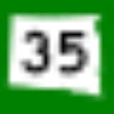
 South Dakota Highway 35South Dakota Highway 35-History:This route was established around 1935, as a renumbering of South Dakota Highway 27. At that time, SD 27's northern terminus was at U.S. Highway 18; SD 35 was extended north to South Dakota Highway 42....
 South Dakota Highway 36South Dakota Highway 36South Dakota Highway 36 is a state route located in southwest South Dakota. It begins at the junction of U.S. Highway 16A on the eastern edge of Custer State Park, and ends at South Dakota Highway 79 just south of Hermosa. It is 18 miles in length.-History:South Dakota 36 was implemented in 1926...
 South Dakota Highway 37South Dakota Highway 37South Dakota Highway 37 is a state route that runs across eastern South Dakota. It begins at the Nebraska border northeast of Niobrara, Nebraska, as a continuation of Nebraska Highway 14. It runs to the North Dakota border north of Hecla, where it continues as North Dakota Highway 1...
 South Dakota Highway 37A
 South Dakota Highway 38South Dakota Highway 38South Dakota Highway 38 is a state highway in the state of South Dakota. The highway runs from Mitchell to Sioux Falls....
 South Dakota Highway 38A
 South Dakota Highway 40South Dakota Highway 40South Dakota Highway 40 is a state highway in southwest South Dakota. The highway is long and runs from U.S. Route 16A in Keystone to Bureau of Indian Affairs Highway 41 in Red Shirt. The highway runs near Mount Rushmore National Memorial in Keystone, and its eastern terminus is on the Pine Ridge...
 South Dakota Highway 40A
Highways 41–50
 South Dakota Highway 41South Dakota Highway 41-History:South Dakota 41 was the original designation of U.S. Highway 281 in the state.When assigned in the mid 1920's, SD 41 ran nearly the entire length of the state north to south. A gap existed between U.S. Highway 14 and South Dakota Highway 34 east of Wessington Springs; this was completed...
 South Dakota Highway 42South Dakota Highway 42South Dakota Highway 42 travels from Ethan, SD to Rowena, SD , then turning to Iowa State Highway 9 in Iowa.Highway 42 travels through Sioux Falls, where it is known as 12th Street from the western city limits to Menlo Avenue. At Menlo Avenue, Highway 42 curves north slightly and becomes 11th...
 South Dakota Highway 43South Dakota Highway 43South Dakota Highway 43 is a short state route that runs from U.S. Highway 18, south of Fairfax, southeasterly to the Nebraska border, where it becomes Nebraska Highway 11. The route is 1 mile in length.-History:...
 South Dakota Highway 44
 South Dakota Highway 45South Dakota Highway 45South Dakota Highway 45 is a state route that runs north to south across much of central South Dakota. The northern terminus is at the North Dakota border as a continuation of North Dakota Highway 3, and runs south to South Dakota Highway 44 at Platte. It is 198 miles in length.-History:South...
 South Dakota Highway 46South Dakota Highway 46South Dakota Highway 46 is a state route that runs west to east across southeastern South Dakota. It begins at the junction of U.S. Highway 18 and U.S. Highway 281 in Pickstown, and runs due east to nearly the Iowa border, before curving south to cross the border and meeting Iowa Highway 10...
- South Dakota Highway 46 Spur
 South Dakota Highway 47South Dakota Highway 47South Dakota Highway 47 is a state route that runs north to south across the central portion of South Dakota. It begins at an unnumbered highway at the North Dakota border north of Eureka, and ends at the Nebraska border, where it becomes Nebraska Highway 137...
 South Dakota Highway 47W
 South Dakota Highway 48South Dakota Highway 48South Dakota Highway 48 is a short state route in the far southeast corner of the U.S. state of South Dakota. The route, which runs entirely through Union County, begins at Interstate 29 west of Spink, and becomes Big Sioux River Road, formerly Iowa Highway 403, northwest of Akron, Iowa...
 South Dakota Highway 49South Dakota Highway 49South Dakota Highway 49 is a state route that runs north to south across the south central South Dakota. It begins at a junction with South Dakota Highway 47 just south of the White River, and terminates at the junction of U.S. Highway 18 and U.S. Highway 183 in Colome...
Highways 51–60
 South Dakota Highway 50South Dakota Highway 50South Dakota Highway 50 is a state route serving south central and southeast South Dakota. The current alignment begins at the junction of South Dakota Highway 34 at "Lee's Corner" east of Fort Thompson, and ends at the Iowa border near Richland, where it continues as Iowa Highway 3...
 South Dakota Highway 52South Dakota Highway 52South Dakota Highway 52 is a state route that runs just north of the Missouri River, across southeast South Dakota. It begins at a junction with South Dakota Highway 37 north of Springfield, and terminates in Yankton at U.S. Highway 81, at the junction of 4th and Broadway Streets...
 South Dakota Highway 53South Dakota Highway 53South Dakota Highway 53 is a state route that runs north to south across south central South Dakota. It consists of two separate segments:* Junction with Interstate 90 and U.S. Highway 83 near Vivian to South Dakota Highway 44 east of Wood. This segment is in length.* U.S. Highway 18 west of...
 South Dakota Highway 54South Dakota Highway 54South Dakota Highway 54 was a short state route in southeast Gregory County, South Dakota. -History:South Dakota 54 was implemented around 1926 as part of the state highway network. Its western terminus was at South Dakota Highway 50 at Bonesteel. It ran south and east through Fairfax to the...
 South Dakota Highway 55
 South Dakota Highway 59South Dakota Highway 59-History:South Dakota 59 was implemented in the mid 1920's. Its northern terminus was at U.S. Highway 16 in Murdo, and traveled south via White River to Mission . The southern terminus was extended to the Nebraska border north of Valentine, Nebraska, by 1929.Around 1932, U.S...
Highways 61–70
- South Dakota Highway 61
 South Dakota Highway 63
 South Dakota Highway 65South Dakota Highway 65South Dakota Highway 65 is a state route in north central South Dakota. It begins at U.S. Highway 212 east of Dupree, then runs northerly to the North Dakota border near McIntosh, where it continues as North Dakota Highway 31...
Highways 71–80
 South Dakota Highway 71
 South Dakota Highway 73South Dakota Highway 73South Dakota Highway 73 is a state route that runs across western South Dakota. It begins at the Nebraska border north of Merriman, Nebraska, as a continuation of Nebraska Highway 61. It runs to the North Dakota border, where it continues as North Dakota Highway 49...
 South Dakota Highway 75South Dakota Highway 75South Dakota Highway 75 is a state route located in northwest South Dakota. The southern terminus is at South Dakota Highway 20 west of Bison, and the route runs northerly to the North Dakota border, becoming North Dakota Highway 8...
 South Dakota Highway 79
Highways 81–100
 South Dakota Highway 81
 South Dakota Highway 83
 South Dakota Highway 85
 South Dakota Highway 87South Dakota Highway 87South Dakota Highway 87 is a highway running through the Black Hills of the U.S. state of South Dakota. The road's northern terminus is U.S. Route 16 and U.S. Route 385 about south of Hill City. The road's southern terminus is U.S. Route 385 about east of Pringle, South Dakota, or north of Hot...
 South Dakota Highway 89South Dakota Highway 89South Dakota Highway 89 is a state highway in southwest South Dakota. The highway is long and runs from U.S. Route 18 near Minnekahta to South Dakota Highway 87 in Custer State Park. SD 89 is co-signed with U.S. Route 385 from Pringle to Custer...
Highways 101–200
- South Dakota Highway 100
 South Dakota Highway 101South Dakota Highway 101Highway 101 is a short highway linking the town of Gary to State Highway 22. It was commissioned in 1976, and had previously been a spur of Highway 22.-Route description:...
 South Dakota Highway 102
 South Dakota Highway 103
 South Dakota Highway 105
 South Dakota Highway 106South Dakota Highway 106Highway 106 is a short highway linking the village of Hammer to Claire City. It was commissioned in 1976, following the former route of South Dakota Highway 15.-Route description:...
- South Dakota Highway 109South Dakota Highway 109South Dakota Highway 109 is a short highway running along Big Stone Lake and the Minnesota border from South Dakota Highway 15 to U.S. Route 12 in Big Stone City. This highway was originally designated Highway 15Y. It was renumbered to 109 in 1976.-Route description:SD 109 begins at an...
 South Dakota Highway 115
 South Dakota Highway 116
 South Dakota Highway 123
 South Dakota Highway 127South Dakota Highway 127South Dakota Highway 127 is a highway that runs from North Dakota Highway 127, northwest of White Rock to South Dakota Highway 10 in Sisseton. It was commissioned around 1980.-History:...
 South Dakota Highway 130South Dakota Highway 130Highway 130 is a short state highway located entirely within Walworth County, South Dakota.-Route description:The highway begins at a concurrency with South Dakota Highway 20, U.S. Route 12, and U.S. Route 83 in Selby. It heads directly eastward through open fields for its entire course, and comes...
 South Dakota Highway 134
 South Dakota Highway 136
 South Dakota Highway 139
 South Dakota Highway 144
 South Dakota Highway 147
 South Dakota Highway 153
 South Dakota Highway 158
 South Dakota Highway 168
Highways 201–300
 South Dakota Highway 203
 South Dakota Highway 204
 South Dakota Highway 214
 South Dakota Highway 218
 South Dakota Highway 224
 South Dakota Highway 230
 South Dakota Highway 232
 South Dakota Highway 235
 South Dakota Highway 236
 South Dakota Highway 238
- South Dakota Highway 239
 South Dakota Highway 240
 South Dakota Highway 244South Dakota Highway 244South Dakota Highway 244 is a short state highway located entirely within Pennington County, South Dakota which provides access to Mount Rushmore National Memorial. Highway 244 runs generally east–west between its eastern terminus at US 16A near Keystone and its western terminus at US 16/US...
 South Dakota Highway 245
 South Dakota Highway 247
 South Dakota Highway 248
 South Dakota Highway 249
 South Dakota Highway 251
 South Dakota Highway 253
 South Dakota Highway 258
 South Dakota Highway 262
 South Dakota Highway 264
 South Dakota Highway 271
 South Dakota Highway 273
 South Dakota Highway 296
 South Dakota Highway 298
Highways 301–400
 South Dakota Highway 314
- South Dakota Highway 324South Dakota Highway 324South Dakota Highway 324 is a short highway linking State Highway 13 east of Elkton to Interstate 29 just south of Brookings. It was commissioned in 1997, along what was formerly named State Highway 218, which itself followed an old routing of U.S. Route 14....
 South Dakota Highway 365
 South Dakota Highway 377South Dakota Highway 377South Dakota Highway 377 is a state route that runs entirely within Jackson County, South Dakota. It begins at its intersection with Highway 44 in Interior, and runs in a northeasterly direction to its northern terminus at its intersection with Highway 240 in the Badlands National Park.- Legal...
 South Dakota Highway 391
Highways 401–1806
 South Dakota Highway 407
 South Dakota Highway 423
 South Dakota Highway 435
 South Dakota Highway 437
 South Dakota Highway 439
 South Dakota Highway 445
 South Dakota Highway 471South Dakota Highway 471South Dakota Highway 471 is a state route that runs from U.S. Highway 18 in Edgemont, south and southeast to South Dakota Highway 71 southeast of Rumford. The route is about 15 miles in length.South Dakota 471 was designated in 1976...
 South Dakota Highway 473
 South Dakota Highway 514
 South Dakota Highway 1804
 South Dakota Highway 1806
Interstate Highways
.svg.png) Interstate 29Interstate 29 in South DakotaIn the U.S. state of South Dakota, Interstate 29 traverses on the eastern side of the state, bypassing through Sioux Falls, the state's largest city.-Route description:...
Interstate 29Interstate 29 in South DakotaIn the U.S. state of South Dakota, Interstate 29 traverses on the eastern side of the state, bypassing through Sioux Falls, the state's largest city.-Route description:....svg.png) Interstate 90Interstate 90 in South DakotaIn the U.S. state of South Dakota, Interstate 90 traverses east–west through the southern half of the state.-Route description:Interstate 90 enters South Dakota in Lawrence County as a four lane divided highway. It enters concurrently with U.S. Route 14, and passes through the town of...
Interstate 90Interstate 90 in South DakotaIn the U.S. state of South Dakota, Interstate 90 traverses east–west through the southern half of the state.-Route description:Interstate 90 enters South Dakota in Lawrence County as a four lane divided highway. It enters concurrently with U.S. Route 14, and passes through the town of....svg.png) Interstate 190Interstate 190 (South Dakota)Interstate 190 is an auxiliary Interstate Highway in the U.S. state of South Dakota. The route runs for about two miles south, connecting I-90 to downtown Rapid City. The entire length overlaps U.S. Route 16. It is the westernmost auxiliary route of Interstate 90, approximately 1150 miles east...
Interstate 190Interstate 190 (South Dakota)Interstate 190 is an auxiliary Interstate Highway in the U.S. state of South Dakota. The route runs for about two miles south, connecting I-90 to downtown Rapid City. The entire length overlaps U.S. Route 16. It is the westernmost auxiliary route of Interstate 90, approximately 1150 miles east....svg.png) Interstate 229Interstate 229 (South Dakota)Interstate 229 in South Dakota runs just more than ten miles mostly within the city limits of Sioux Falls, the largest city in the state. It runs from Interstate 29 to Interstate 90...
Interstate 229Interstate 229 (South Dakota)Interstate 229 in South Dakota runs just more than ten miles mostly within the city limits of Sioux Falls, the largest city in the state. It runs from Interstate 29 to Interstate 90...
U.S. Highways
 U.S. Route 12U.S. Route 12U.S. Route 12 or US 12 is an east–west United States highway, running from Grays Harbor on the Pacific Ocean, in the state of Washington, to downtown Detroit, for almost . As a thoroughfare, it has mostly been supplanted by I-90 and I-94, but remains an important road for local travel.The...
 U.S. Route 14U.S. Route 14U.S. Route 14 , an east–west route, is one of the original United States highways of 1926. It currently has a length of 1,398 miles , but it had a peak length of 1,429 miles . For much of its length, it runs roughly parallel to Interstate 90.As of 2004, the highway's eastern terminus is in...
 U.S. Route 14A
 U.S. Route 16U.S. Route 16U.S. Route 16 is an east–west United States Highway between Rapid City, South Dakota and Yellowstone National Park in Wyoming....
- U.S. Route 16A
 U.S. Route 18U.S. Route 18U.S. Route 18 is an east–west U.S. highway in the Midwestern United States. The western terminus is in Orin, Wyoming at an interchange with Interstate 25. Its eastern terminus of US 18 is in downtown Milwaukee, Wisconsin. However, US 18 runs concurrent with other U.S...
 U.S. Route 77U.S. Route 77U.S. Route 77 is a north–south United States highway. It is unsigned in and around Dallas, Texas. Its historic segment through South Dakota and Minnesota was decommissioned with the advent of Interstate 29 but otherwise the route has been spared the decommissioning that has shortened other US...
 U.S. Route 81U.S. Route 81U.S. Route 81 is one of the many United States Numbered Highways established in 1926 by the US Department of Agriculture Bureau of Public Roads....
 U.S. Route 83U.S. Route 83U.S. Route 83 is one of the longest north–south U.S. Highways in the United States, at . Only four other north–south routes are longer: U.S. Routes 1, 41, 59 and 87. The highway's northern terminus is north of Westhope, North Dakota, at the Canadian border, where it continues as...
 U.S. Route 85U.S. Route 85U.S. Route 85 is a north–south United States highway that runs for in the Mountain - Northern Plains states of the United States. The southern terminus of the route is at the United States-Mexico border in El Paso, Texas, connecting with Mexican Federal Highway 45...
 U.S. Route 85E
 U.S. Route 85A
 U.S. Route 183U.S. Route 183U.S. Route 183 is a north–south United States highway. U.S. 183 was the last US route to be completely paved. The 20 mile segment in Loup County, Nebraska, north of Taylor, was unpaved until 1967. The highway's northern terminus is in Presho, South Dakota, at an intersection with...
 U.S. Route 212U.S. Route 212U.S. Route 212 is a spur of U.S. Route 12. Though it currently never intersects U.S. 12, it once had an eastern terminus at U.S. 12 in St. Paul, Minnesota. It runs for 949 miles from Minnesota Highway 62 at Edina, Minnesota to Yellowstone National Park.U.S. 212 passes through the states of...
 U.S. Route 216
 U.S. Route 281U.S. Route 281U.S. Route 281 is a north–south United States highway. At 1,872 miles long it is the longest continuous three-digit U.S. Route....
 U.S. Route 385