

List of Indiana covered bridges
Encyclopedia
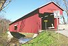
This is a list of Indiana covered bridges. There are 98 historic wooden covered bridge
s in the U.S. state
of Indiana
. Fourteen of these bridges were built before 1870 and represent the most common truss styles (Burr Arch) in Indiana.
Parke County
bills itself as the covered bridge capital of the world . Combined with six counties that surround it, there are 51 of Indiana’s 98 covered bridges in this small area: Parke County (32), Putnam County (9), Fountain County (3), Vermillion County (3), Montgomery County (2), Owen County (1) and Vigo County (1). The majority, 54, are Burr Arch truss designs, while the next most common truss style is a Howe Truss with 23.
One each of the older style King Post
and Queen Post
are located in the western part of the state; Philips Bridge
, west of Rockville in Parke County and Irishman Bridge, south of Terre Haute in Vigo County, respectively. Indiana also has examples of the Long Truss and the Smith Type IV Truss
. The remaining span of the Bell Ford Bridge
, northwest of Seymour in Jackson County, collapsed in January 2006. It was the last standing example of a Post Truss covered bridge in the world.
} Cutler
, Carroll County
| 1872
| Howe Truss, 138 feet (42.1 m) long over Wildcat Creek
|-
| Baker's Camp Bridge
|
| Bainbridge
, Putnam County
| 1901
| Burr Arch, 128 feet (39 m) long over Big Walnut Creek
|-
| Beanblossom Bridge
|
| Beanblossom
, Brown County
| 1880
| Spans Beanblossom Creek, 60 feet (18.3 m) long. It is listed as a Howe Truss, but appears to be a Pratt Truss.
|-
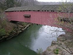
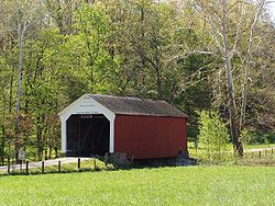
| Beeson Bridge
|.jpg)
| Rockville
, Parke County
| 1906
| Burr Arch, 55 feet (16.8 m) long
|-
| Bell Ford Bridge
|
| Seymour
, Jackson County
| 1869
| Post Truss, 330 feet (100.6 m) long. The bridge's western span collapsed in 1999, while the remaining eastern span collapsed in 2006 into the East Fork of the White River. It was the fourth longest and fifth oldest covered bridge in the state.
|-
| Big Rocky Fork Bridge
|_s_side.jpg)
| Mansfield
, Parke County
| 1900
| Burr Arch, 72 feet (21.9 m) long over Big Rocky Fork Creek
|-
| Billie Creek Bridge
|
| Rockville
, Parke County
| 1895
| Burr Arch, 62 feet (18.9 m) long. It was moved to serve as the entrance to Billie Creek Village.
|-
| Bowsher Ford Bridge
|
| Tangier
, Parke County
| 1915
| Burr Arch, 72 feet (21.9 m) long over Mill Creek
|-
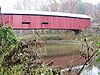
| Bridgeton Bridge
|
| Bridgeton
, Parke County
| 1868
| Burr Arch, 245 feet (74.7 m) long over Big Raccoon Creek. Destroyed by fire in April 2005.
|-
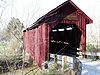
| Bridgeton Bridge (new)
|
| Bridgeton
, Parke County
| 2006
| Burr Arch, 245 feet (74.7 m) long over Big Raccoon Creek. Replaced original bridge that was destroyed by fire in 2005 with reconstruction completed in October 2006.
|-
| Busching Bridge
|
| Versailles
, Ripley County
| 1885
| Howe Truss, 176 feet (53.6 m) long over Laugher Creek. Located at Versailles State Park
.
|-
| Cades Mill Bridge
|.jpg)
| Steam Corner
, Fountain County
| 1854
| Howe Truss 150 feet (45.7 m) long over Coal Creek. Oldest bridge in the state.
|-
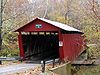
| Cataract Covered Bridge
|
| Cataract
, Owen County
| 1876
| Smith Type IV Truss
, 140 feet (42.7 m) long over Mill Creek
|-
| Catlin Bridge
|
| Rockville
, Parke County
| 1907
| Burr Arch, 54 feet (16.5 m) long over Bill Diddle Creek
|-
| Ceylon Bridge
|
| Ceylon
, Adams County
| 1862
| Howe Truss, 126 feet (38.4 m) long over Wabash River
|-
| Conley’s Ford Bridge
|
| Mansfield
, Parke County
| 1907
| Burr Arch, 192 feet (58.5 m) long over Big Raccoon Creek
|-
| Cornstalk Bridge
|.jpg)
| Raccoon, Putnam County
| 1917
| Burr Arch, 82 feet (25 m) long over Cornstalk Creek
|-
| Cox Ford Bridge
|
| Annapolis
, Parke County
| 1913
| Burr Arch, 176 feet (53.6 m) long over Sugar Creek at the west side of Turkey Run State Park
|-
| Crooks Bridge
|
| Rockville
, Parke County
| 1856
| Burr Arch, 132 feet (40.2 m) long over Little Raccoon Creek. Second oldest bridge in the state.
|-
| Crown Point Bridge
|
| Crown Point
, Lake County
| 1878
| Burr Arch, 85 feet (25.9 m) long crossing a gully. It was moved to Lake County Fairgrounds in 1933 from Milroy in Rush County over the Little Flatrock River.
|-
| Cumberland Bridge
|
| Matthews
, Grant County
| 1877
| Howe Truss 175 feet (53.3 m) long over Mississinewa River
|-
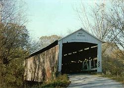
| Darlington Bridge
|
| Darlington
, Montgomery County
| 1868
| Howe Truss, 140 feet (42.7 m) long over Sugar Creek. It is the fourth oldest covered bridge in the state and has a unique wooden block floor that spans its length as shown in the bridge's picture.
|-
| Deer's Mills Bridge
|
| Deer's Mill
, Montgomery County
| 1878
| Burr Arch, 275 feet (83.8 m) long over Sugar Creek in Shades State Park
|-
| Dick Huffman Bridge
|
| Reelsville
, Putnam County
| 1880
| Howe Truss, 265 feet (80.8 m) long over Big Walnut River. It is the longest Howe Truss bridge in the state.
|-
| Dunbar Bridge
|.jpg)
| Greencastle
, Putnam County
| 1880
| Burr Arch, 174 feet (53 m) long in two spans over Big Walnut Creek
|-
| Edna Collins Bridge
|
| Clinton Falls, Putnam County
| 1922
| Burr Arch, 80 feet (24.4 m) long over Little Walnut Creek. Local legends claim this bridge is haunted.
|-
| Eugene Bridge
|
| Eugene
, Vermillion County
| 1885
| Burr Arch, 192 feet (58.5 m) long over Vermillion River
|-
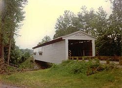
| Forsythe Mill Bridge
|
| Gowdy, Rush County
| 1888
| Burr Arch, 196 feet (59.7 m) long over Big Flat Rock River
|-
| Guilford Bridge
|
| Guilford
, Dearborn County
| 1879
| Burr Arch, 104 feet (31.7 m) long
|-
| Harry Evans Bridge
|
| Coxville
, Parke County
| 1908
| Burr Arch, 65 feet (19.8 m) long over Rock Run Creek
|-
| Hillsdale Bridge
|
| Dana
, Vermillion County
| 1876
| Burr Arch, 104 feet (31.7 m) long
|-
| Holton Bridge
|
| Holton
, Ripley County
| 1884
| Howe Truss, 112 feet (34.1 m) long over Otter Creek
|-
| Houck Bridge
|.jpg)
| Manhattan, Putnam County
| 1880
| Howe Truss, 210 feet (64 m) long over Big Walnut Creek. It is one of the longest Howe Truss bridges in the state.
|-
| Huffman's Mill Bridge
|
| Huffman, Spencer County
| 1884
| Burr Arch, 140 feet (42.7 m) long over Anderson River
|-
| Irishman Bridge
|
| Youngstown
, Vigo County
|
| Queen Post
, 75 feet (22.9 m) long over Fowler Lake, a branch of Honey Creek. It is the second oldest covered bridge in the state and the only remaining Queen Post covered bridge in the state.
|-
| Jackson Bridge
|
| Annapolis
, Parke County
| 1861
| Burr Arch, 207 feet (63.1 m) long over Sugar Creek. It is the fifth oldest covered bridge in the state and has the longest single span.
|-
| James Bridge
|
| Lovett
, Jennings County
| 1887
| Howe Truss, 124 feet (37.8 m) long over Big Graham Creek
|-
| Jeffries Ford Bridge
|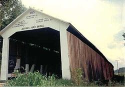
| Bridgeton
, Parke County
| 1915
| Burr Arch, 204 feet (62.2 m) long over Big Raccoon Creek
|-
| Lancaster Bridge
|
| Owasco
, Carroll County
| 1872
| Howe Truss, 133 feet (40.5 m) long over Wildcat Creek
|-
| Leatherwood Station Bridge
|
| Rockville
, Parke County
| 1899
| Burr Arch, 72 feet (21.9 m) long, located at Billie Creek Village
|-
| Longwood Bridge
|
| Connersville
, Fayette County
| 1884
| Burr Arch, 92 feet (28 m) long
|-
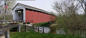
| Mansfield Bridge
|.jpg)
| Mansfield
, Parke County
| 1867
| Burr Arch, 247 feet (75.3 m) long in three spans over Big Raccoon Creek. In the spring of 2006, the central roof was torn off by winds and was restored in 2007.
|-
| Marshall Bridge
|
| Tangier
, Parke County
| 1917
| Burr Arch, 56 feet (17.1 m) long over Rush Creek
|-
| McAllister Bridge
|
| Catlin
, Parke County
| 1914
| Burr Arch, 126 feet (38.4 m) long over Little Raccoon Creek
|-
| Mecca Bridge
|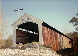
| Mecca
, Parke County
| 1873
| Burr Arch, 150 feet (45.7 m) long over Big Raccoon Creek
|-
| Medora Bridge
|
| Medora
, Jackson County
| 1875
| Burr Arch, 434 feet (132.3 m) long in three spans over the East Fork of the White River. It is the longest covered bridge in the state and (depending on how the length of a bridge is measured) is sometimes claimed to be the longest historic covered bridge in the U.S. It has been closed to all but pedestrian traffic since 1972, and is currently undergoing restoration.
|-
| Melcher Bridge
|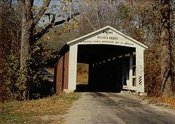
| Montezuma
, Parke County
| 1896
| Burr Arch, 83 feet (25.3 m) long over Leatherwood Creek
|-
| Mill Creek Bridge
|
| Tangier
, Parke County
| 1907
| Burr Arch, 92 feet (28 m) long over Mill Creek
|-
| Moscow Bridge
|
| Moscow
, Rush County
| 1886 (rebuilt 2010)
| Burr Arch, 334 feet (101.8 m) long in two spans over Big Flat Rock River. It is the third longest covered bridge in the state. Destroyed by a tornado in 2008, it has since been rebuilt.
|-
| Narrows Bridge
|
| Marshall
, Parke County
| 1882
| Burr Arch, 121 feet (36.9 m) long span over Sugar Creek on the east boundary of Turkey Run State Park
|-
| Neet Bridge
|
| Catlin
, Parke County
| 1904
| Burr Arch, 126 feet (38.4 m) long over Little Raccoon Creek
|-
| Nevins Bridge
|
| Catlin
, Parke County
| 1920
| Burr Arch, 155 feet (47.2 m) long over Little Raccoon Creek
|-
| New Brownsville Bridge
|
| Columbus
, Bartholomew County
| 1840
| Long Truss, 93 feet (28.3 m) long over Mill Run Creek. It was moved from Brownsville in Union County over the Whitewater River.
|-
| Newport Bridge
|
| Newport
, Vermillion County
| 1885
| Burr Arch, 180 feet (54.9 m) long over Little Vermillion River
|-
| Norris Ford Bridge
|
| Rushville
, Rush County
| 1916
| Burr Arch, 169 feet (51.5 m) long over Big Flat Rock River
|-
| North Manchester Bridge
|
| North Manchester
, Wabash County
| 1872
| Smith Type IV Truss
, 150 feet (45.7 m) long over Eel River
|-
| Oakalla Bridge
|
| Greencastle
, Putnam County
| 1875
| Burr Arch, 152 feet (46.3 m) long over Big Walnut Creek
|-Offutt's Bridge
Rush County
Henderson
| Old Red Bridge
|
| Hickory Ridge, Gibson County
| 1875
| Smith Type IV Truss
, 170 feet (51.8 m) long over Big Bayou Creek
|-
| Pine Bluff Bridge
|
| Carpentersville, Putnam County
| 1915
| Howe Truss, 211 feet (64.3 m) long over Big Walnut Creek
|-
| Phillips Bridge
|
| Montezuma
, Parke County
| 1909
| King Post
, 43 feet (13.1 m) long over Big Pond Creek. It is the shortest covered bridge in the state.
|-
| Portland Mills Bridge
|
| Guion
, Parke County
| 1856
| Burr Arch, 130 feet (39.6 m) long crossing Little Raccoon Creek. It is tied with Crooks Bridge
as the fourth oldest covered bridge in the state.
|-
| Potters Bridge
|
| Noblesville
, Hamilton County
| 1871
| Howe Truss, 259 feet (78.9 m) long over the West Fork of the White River
|-
| Ramp Creek Bridge
|.jpg)
| Nashville
, Brown County
| 1838
| Double Barreled Burr Arch, 96 feet (29.3 m) long over Salt Creek. It is the oldest covered bridge in the state and is located at the entrance to Brown County State Park
. It is also the only two-lane covered bridge in the state.
|-
| Richland Creek Bridge
|
| Bloomfield
, Greene County
| 1883
| Burr Arch, 100 feet (30.5 m) long over Richland Creek, built by A.M. Kennedy and Sons.
|-
| Roann Bridge
|
| Roann
, Wabash County
| 1872
| Howe Truss, 288 feet (87.8 m) long over Eel River
|-
| Rob Roy Bridge
|
| Rob Roy
, Fountain County
| 1860
| Howe Truss, 120 feet (36.6 m) long over Big Shawnee Creek
|-
| Rolling Stone Bridge
|
| Bainbridge
, Putnam County
| 1915
| Burr Arch, 103 feet (31.4 m) long over Big Walnut Creek
|-
| Roseville-Coxville Bridge
|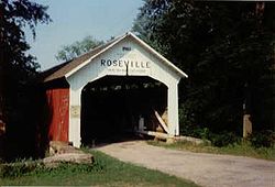
| Coxville
, Parke County
| 1910
| Burr Arch, 263 feet (80.2 m) long over Big Raccoon Creek
|-
| Rush Creek Bridge
|
| Tangier
, Parke County
| 1904
| Burr Arch, 77 feet (23.5 m) long over Rush Creek
|-
| Sanatorium Bridge
|
| Rockville
, Parke County
| 1913
| Burr Arch, 154 feet (46.9 m) long over Little Raccoon Creek
|-
| Scipio Bridge
|
| Scipio
, Jennings County
| 1886
| Howe Truss, 146 feet (44.5 m) long crossing Sand Creek
|-
| Shieldstown Bridge
|
| Shields
, Jackson County
| 1876
| Burr Arch, 331 feet (100.9 m) long over the East Fork of the White River
|-
| Sim Smith Bridge
|
| Montezuma
, Parke County
| 1883
| Burr Arch, 84 feet (25.6 m) long over Leatherwood Creek
|-
| Smith Bridge
|
| Rushville
, Rush County
| 1877
| Burr Arch, 138 feet (42.1 m) long over Big Flat Rock River
|-
| Snow Hill Bridge
|
| Rockdale
, Franklin County
| 1894
| Howe Truss, 75 feet (22.9 m) long over the Johnson Fork of the Whitewater River
|-
| South Hill Bridge
|
| Universal
, Vermillion County
| 1879
| Burr Arch, 122 feet (37.2 m) long over Brouilletts Creek
|-
| Spencerville Bridge
|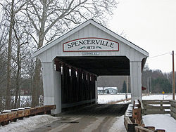 | Spencerville
, DeKalb County
| 1873
| Howe Truss, 160 feet (48.8 m) long over St. Joseph River
|-
| Stockheughter Bridge
|
| Enochsburg, Franklin County
| 1887
| Howe Truss, 92 feet (28 m) long over Salt Creek
|-
| Thorpe Ford Bridge
|
| Rosedale
, Parke County
| 1912
| Burr Arch, 163 feet (49.7 m) long over Big Raccoon Creek
|-
| Traders Point Bridge
|
| Indianapolis
, Marion County
| 1880
| Howe Truss, 89 feet (27.1 m) long over Fishback Creek
|-
| Vermont Bridge
|
| Kokomo
, Howard County
| 1875
| Smith Type IV Truss
, 98 feet (29.9 m) long over Kokomo Creek. Moved from its original location to Highland Park in Kokomo.
|-
| Wallace Bridge
|.jpg)
| Wallace
, Fountain County
| 1871
| Howe Truss, 81 feet (24.7 m) long over Sugar Mill Creek
|-
| West Union Bridge
|
| West Union
, Parke County
| 1876
| Burr Arch, 315 feet (96 m) long over Sugar Creek
|-
| Westport Bridge
|
| Westport
, Decatur County
| 1880
| Burr Arch, 115 feet (35.1 m) long over Sand Creek
|-
| Wheeling Bridge
|
| Wheeling
, Gibson County
| 1877
| Smith Type IV Truss
, 164 feet (50 m) long over Patoka River
|-
| White Water Canal Aqueduct Bridge
|
| Metamora
, Franklin County
| 1846
| Burr Arch, 81 feet (24.7 m) long over Duck Creek on the east side of Metamora
|-
| Wilkins Mill Bridge
|
| Annapolis
, Parke County
| 1906
| Burr Arch, 102 feet (31.1 m) long over Sugar Mill Creek
|-
| Williams Bridge
|indiana.jpg)
| Williams
, Lawrence County
| 1884
| Howe Truss, 373 feet (113.7 m) long in two spans over the East Fork of the White River. It is the second longest covered bridge in the state.
|-
| Zacke Cox Bridge
|
| Coxville
, Parke County
| 1908
| Burr Arch, 54 feet (16.5 m) long over Rock Run Creek
|-
|}
Covered bridge
A covered bridge is a bridge with enclosed sides and a roof, often accommodating only a single lane of traffic. Most covered bridges are wooden; some newer ones are concrete or metal with glass sides...
s in the U.S. state
U.S. state
A U.S. state is any one of the 50 federated states of the United States of America that share sovereignty with the federal government. Because of this shared sovereignty, an American is a citizen both of the federal entity and of his or her state of domicile. Four states use the official title of...
of Indiana
Indiana
Indiana is a US state, admitted to the United States as the 19th on December 11, 1816. It is located in the Midwestern United States and Great Lakes Region. With 6,483,802 residents, the state is ranked 15th in population and 16th in population density. Indiana is ranked 38th in land area and is...
. Fourteen of these bridges were built before 1870 and represent the most common truss styles (Burr Arch) in Indiana.
Parke County
Parke County, Indiana
Parke County is a county in the western part of the U.S. state of Indiana. It was formed in 1821 out of a portion of Vigo County. The county seat is Rockville....
bills itself as the covered bridge capital of the world . Combined with six counties that surround it, there are 51 of Indiana’s 98 covered bridges in this small area: Parke County (32), Putnam County (9), Fountain County (3), Vermillion County (3), Montgomery County (2), Owen County (1) and Vigo County (1). The majority, 54, are Burr Arch truss designs, while the next most common truss style is a Howe Truss with 23.
One each of the older style King Post
King post
A king post is a central vertical supporting post used in architectural, bridge, or aircraft design applications.-Architecture:...
and Queen Post
Queen post
A queen post is a supporting post designed to span longer openings than a king post. A king post uses one central supporting post, whereas the queen post uses two.-Architecture:...
are located in the western part of the state; Philips Bridge
Phillips Covered Bridge
The Phillips Covered Bridge is southeast of Montezuma, Indiana in Parke County, Indiana. Unlike the rest of the bridges of Parke County, it is a single span King Post bridge structure, having no arches, that was built by Joseph A. Britton in 1909...
, west of Rockville in Parke County and Irishman Bridge, south of Terre Haute in Vigo County, respectively. Indiana also has examples of the Long Truss and the Smith Type IV Truss
Truss bridge
A truss bridge is a bridge composed of connected elements which may be stressed from tension, compression, or sometimes both in response to dynamic loads. Truss bridges are one of the oldest types of modern bridges...
. The remaining span of the Bell Ford Bridge
Bell Ford Bridge
The Bell Ford Post Patented Diagonal "Combination Bridge", often simply called the Bell Ford Bridge or Bell Ford Covered Bridge, is a dilapidated covered bridge located in Jackson County, Indiana, northwest of Seymour, Indiana...
, northwest of Seymour in Jackson County, collapsed in January 2006. It was the last standing example of a Post Truss covered bridge in the world.
List of Covered Bridges
| Name | Image | Location | Year Built | Design, Length and Historical Notes |
|---|---|---|---|---|
| Adams Mill Bridge Adams Mill Covered Bridge Adams Mill Covered Bridge is located in Indiana south of State Road 18 and north of State Road 26, 1/2 mile East of Cutler to County road 50 East, north on 50 East 1/2 mile.-History:... |
 |
Cutler, Indiana
Cutler is an unincorporated town in Democrat Township, Carroll County, Indiana, United States. It is part of the Lafayette, Indiana Metropolitan Statistical Area.-Geography:Cutler is located at ....
, Carroll County
Carroll County, Indiana
Carroll County is a county located in the U.S. state of Indiana. As of 2010, the population was 20,155. The county seat is Delphi.Carroll County is part of the Lafayette, Indiana, Metropolitan Statistical Area.- History :...
| 1872
| Howe Truss, 138 feet (42.1 m) long over Wildcat Creek
|-
| Baker's Camp Bridge
|
| Bainbridge
Bainbridge, Indiana
Bainbridge is a town in Monroe Township, Putnam County, Indiana, United States. The population was 746 at the 2010 census. This town was named after the prominent war hero of the time William Bainbridge. He was one of the captains of the original 6 frigates of the US navy...
, Putnam County
Putnam County, Indiana
As of the census of 2000, there were 36,019 people, 12,374 households, and 9,119 families residing in the county. The population density was 75 people per square mile . There were 13,505 housing units at an average density of 28 per square mile...
| 1901
| Burr Arch, 128 feet (39 m) long over Big Walnut Creek
|-
| Beanblossom Bridge
|
| Beanblossom
Beanblossom, Indiana
Beanblossom, also spelled Bean Blossom, is an unincorporated town in Jackson Township, Brown County, Indiana. The town was named for the nearby Beanblossom Creek, which was in turn named for a person whose surname was Beanblossom....
, Brown County
Brown County, Indiana
Brown County is a county located in the U.S. state of Indiana. As of 2010, the population is 15,242. The county seat is Nashville.- History :...
| 1880
| Spans Beanblossom Creek, 60 feet (18.3 m) long. It is listed as a Howe Truss, but appears to be a Pratt Truss.
|-
| Beeson Bridge
Beeson Covered Bridge
The Beeson Covered Bridge is a Burr Arch covered bridge structure that was built by the Frankfurt Construction Company in 1906. It is 55 Feet long, 16 feet wide, and 13 feet high....
|
| Rockville
Rockville, Indiana
Rockville is a town in Adams Township, Parke County, Indiana, United States. The population was 2,607 at the 2010 census. The town is the county seat of Parke County. It is known as "The Covered Bridge Capital of the World".-Geography:...
, Parke County
Parke County, Indiana
Parke County is a county in the western part of the U.S. state of Indiana. It was formed in 1821 out of a portion of Vigo County. The county seat is Rockville....
| 1906
| Burr Arch, 55 feet (16.8 m) long
|-
| Bell Ford Bridge
Bell Ford Bridge
The Bell Ford Post Patented Diagonal "Combination Bridge", often simply called the Bell Ford Bridge or Bell Ford Covered Bridge, is a dilapidated covered bridge located in Jackson County, Indiana, northwest of Seymour, Indiana...
|
| Seymour
Seymour, Indiana
Seymour was the site of the World's First Train Robbery, committed by the local Reno Gang, on October 6, 1866 just east of town. The gang was put into prison for the robbery, and later hanged at Hangman's Crossing outside of town....
, Jackson County
Jackson County, Indiana
Jackson County is a county located in the U.S. state of Indiana. As of 2010, the population was 42,376. The county seat is Brownstown.-History:...
| 1869
| Post Truss, 330 feet (100.6 m) long. The bridge's western span collapsed in 1999, while the remaining eastern span collapsed in 2006 into the East Fork of the White River. It was the fourth longest and fifth oldest covered bridge in the state.
|-
| Big Rocky Fork Bridge
|
| Mansfield
Mansfield, Indiana
Mansfield is located in Jackson Township, Parke County, Indiana.- History :...
, Parke County
Parke County, Indiana
Parke County is a county in the western part of the U.S. state of Indiana. It was formed in 1821 out of a portion of Vigo County. The county seat is Rockville....
| 1900
| Burr Arch, 72 feet (21.9 m) long over Big Rocky Fork Creek
|-
| Billie Creek Bridge
|
| Rockville
Rockville, Indiana
Rockville is a town in Adams Township, Parke County, Indiana, United States. The population was 2,607 at the 2010 census. The town is the county seat of Parke County. It is known as "The Covered Bridge Capital of the World".-Geography:...
, Parke County
Parke County, Indiana
Parke County is a county in the western part of the U.S. state of Indiana. It was formed in 1821 out of a portion of Vigo County. The county seat is Rockville....
| 1895
| Burr Arch, 62 feet (18.9 m) long. It was moved to serve as the entrance to Billie Creek Village.
|-
| Bowsher Ford Bridge
|
| Tangier
Tangier, Indiana
Tangier is an unincorporated town in Liberty Township, Parke County, Indiana, USA.-Geography:Tangier is located at at an elevation of 630 feet....
, Parke County
Parke County, Indiana
Parke County is a county in the western part of the U.S. state of Indiana. It was formed in 1821 out of a portion of Vigo County. The county seat is Rockville....
| 1915
| Burr Arch, 72 feet (21.9 m) long over Mill Creek
|-
| Bridgeton Bridge
|
| Bridgeton
Bridgeton, Indiana
Bridgeton, Indiana is a town in Raccoon Township, Parke County, Indiana, United States. The town is notable for its covered bridge, which was destroyed on April 28, 2005, by a fire set by an arsonist...
, Parke County
Parke County, Indiana
Parke County is a county in the western part of the U.S. state of Indiana. It was formed in 1821 out of a portion of Vigo County. The county seat is Rockville....
| 1868
| Burr Arch, 245 feet (74.7 m) long over Big Raccoon Creek. Destroyed by fire in April 2005.
|-
| Bridgeton Bridge (new)
|
| Bridgeton
Bridgeton, Indiana
Bridgeton, Indiana is a town in Raccoon Township, Parke County, Indiana, United States. The town is notable for its covered bridge, which was destroyed on April 28, 2005, by a fire set by an arsonist...
, Parke County
Parke County, Indiana
Parke County is a county in the western part of the U.S. state of Indiana. It was formed in 1821 out of a portion of Vigo County. The county seat is Rockville....
| 2006
| Burr Arch, 245 feet (74.7 m) long over Big Raccoon Creek. Replaced original bridge that was destroyed by fire in 2005 with reconstruction completed in October 2006.
|-
| Busching Bridge
|
| Versailles
Versailles, Indiana
Versailles is a town in Johnson Township, Ripley County, Indiana, United States. The population was 2,113 at the 2010 census. The town is the county seat of Ripley County.-Geography:Versailles is located at...
, Ripley County
Ripley County, Indiana
As of the census of 2000, there were 26,523 people, 9,842 households, and 7,273 families residing in the county. The population density was 59 people per square mile . There were 10,482 housing units at an average density of 24 per square mile...
| 1885
| Howe Truss, 176 feet (53.6 m) long over Laugher Creek. Located at Versailles State Park
Versailles State Park
Versailles is an Indiana state park, near the town of Versailles, Indiana. The land was given by the National Park Service for use as a state park to Indiana's Department of Conservation in 1943....
.
|-
| Cades Mill Bridge
|
| Steam Corner
Steam Corner, Indiana
Steam Corner is a small unincorporated settlement in Millcreek Township, Fountain County, Indiana.-History:In the 1880s the Chicago and Great Southern Railway completed a north/south rail line through Fountain County which ran from Clay and Vigo counties in the south to Newton County and Kankakee...
, Fountain County
Fountain County, Indiana
Fountain County lies in the western part of the U.S. state of Indiana on the east side of the Wabash River. The county was officially established in 1826 and was the 53rd in Indiana. The county seat is Covington....
| 1854
| Howe Truss 150 feet (45.7 m) long over Coal Creek. Oldest bridge in the state.
|-
| Cataract Covered Bridge
|
| Cataract
Cataract, Indiana
Cataract is an unincorporated community in Owen County, Indiana, United States. Cataract is south of Cloverdale....
, Owen County
Owen County, Indiana
Owen County is a county located in the U.S. state of Indiana, and determined by the U.S. Census Bureau to include the mean center of U.S. population in 1920. As of 2010, the population was 21,575...
| 1876
| Smith Type IV Truss
Truss bridge
A truss bridge is a bridge composed of connected elements which may be stressed from tension, compression, or sometimes both in response to dynamic loads. Truss bridges are one of the oldest types of modern bridges...
, 140 feet (42.7 m) long over Mill Creek
|-
| Catlin Bridge
|
| Rockville
Rockville, Indiana
Rockville is a town in Adams Township, Parke County, Indiana, United States. The population was 2,607 at the 2010 census. The town is the county seat of Parke County. It is known as "The Covered Bridge Capital of the World".-Geography:...
, Parke County
Parke County, Indiana
Parke County is a county in the western part of the U.S. state of Indiana. It was formed in 1821 out of a portion of Vigo County. The county seat is Rockville....
| 1907
| Burr Arch, 54 feet (16.5 m) long over Bill Diddle Creek
|-
| Ceylon Bridge
|
| Ceylon
Ceylon, Indiana
Ceylon is an unincorporated town in Wabash Township, Adams County, Indiana....
, Adams County
Adams County, Indiana
Adams County lies in northeastern Indiana in the United States and shares its eastern border with Ohio. It was officially established in 1836. The county seat is Decatur....
| 1862
| Howe Truss, 126 feet (38.4 m) long over Wabash River
|-
| Conley’s Ford Bridge
Conley's Ford Covered Bridge
Conley’s Ford Covered Bridge was built in 1906 and crosses Big Raccoon Creek on County Road 550 East close to County Road 720 South, in Parke County, IN. The bridge is a single span Burr Arch Truss structure measuring 212 feet in length including the 10-foot overhang at each end, is 16 feet wide...
|
| Mansfield
Mansfield, Indiana
Mansfield is located in Jackson Township, Parke County, Indiana.- History :...
, Parke County
Parke County, Indiana
Parke County is a county in the western part of the U.S. state of Indiana. It was formed in 1821 out of a portion of Vigo County. The county seat is Rockville....
| 1907
| Burr Arch, 192 feet (58.5 m) long over Big Raccoon Creek
|-
| Cornstalk Bridge
|
| Raccoon, Putnam County
Putnam County, Indiana
As of the census of 2000, there were 36,019 people, 12,374 households, and 9,119 families residing in the county. The population density was 75 people per square mile . There were 13,505 housing units at an average density of 28 per square mile...
| 1917
| Burr Arch, 82 feet (25 m) long over Cornstalk Creek
|-
| Cox Ford Bridge
|
| Annapolis
Annapolis, Indiana
Annapolis is an unincorporated town in Penn Township, Parke County, Indiana, USA.-Geography:Annapolis is located at at an elevation of 646 feet....
, Parke County
Parke County, Indiana
Parke County is a county in the western part of the U.S. state of Indiana. It was formed in 1821 out of a portion of Vigo County. The county seat is Rockville....
| 1913
| Burr Arch, 176 feet (53.6 m) long over Sugar Creek at the west side of Turkey Run State Park
Turkey Run State Park
Turkey Run State Park is located in Parke County, Indiana, in the west-central part of the state on State Road 47 two miles east of U.S. 41. It was Indiana's second state park, with the first parcel of land being purchased in 1916 at the cost of $40,200 when the State Park system was first...
|-
| Crooks Bridge
Crooks Covered Bridge
The Crooks Covered Bridge is a single span Burr Arch Truss structure that crosses Little Raccoon Creek on County Road South 275 East, just southeast of Rockville Indiana. The Bridge has a length of 154 feet, including the 11-foot overhang at each end, is 14 feet wide and 13 feet high...
|
| Rockville
Rockville, Indiana
Rockville is a town in Adams Township, Parke County, Indiana, United States. The population was 2,607 at the 2010 census. The town is the county seat of Parke County. It is known as "The Covered Bridge Capital of the World".-Geography:...
, Parke County
Parke County, Indiana
Parke County is a county in the western part of the U.S. state of Indiana. It was formed in 1821 out of a portion of Vigo County. The county seat is Rockville....
| 1856
| Burr Arch, 132 feet (40.2 m) long over Little Raccoon Creek. Second oldest bridge in the state.
|-
| Crown Point Bridge
Crown Point Bridge, Indiana
Originally built over the Little Flatrock River, two miles south of Milroy, Rush County, Indiana. The Milroy or Shelbourne Covered Bridge was built by Archibald M. Kennedy & Sons in 1878. Highway improvements in 1933, displaced the bridge and it was moved to Crown Point, Indiana...
|
| Crown Point
Crown Point, Indiana
As of the census of 2010, there were 27,317 people and 10,976 households in the city. The racial makeup of the city was 88.20% White, 6.30% African American, 0.20% Native American, 1.80% Asian, 0.00% Pacific Islander, 1.90% from other races, and 1.60% from two or more races...
, Lake County
Lake County, Indiana
Lake County is a county located in the U.S. state of Indiana. In 2010, its population was 496,005, making it Indiana's second-most populous county. The county seat is Crown Point. This county is part of Northwest Indiana and the Chicago metropolitan area. The county contains a mix of urban,...
| 1878
| Burr Arch, 85 feet (25.9 m) long crossing a gully. It was moved to Lake County Fairgrounds in 1933 from Milroy in Rush County over the Little Flatrock River.
|-
| Cumberland Bridge
Cumberland Covered Bridge
Originally called the New Cumberland Covered Bridge, it was built in 1877 by William Parks of Marion, Indiana. This Howe Truss bridge is long.-Floods:...
|
| Matthews
Matthews, Indiana
Matthews is a town in Jefferson Township, Grant County, Indiana, along the Mississinewa River. The population was 595 at the 2000 census.-Geography:Matthews is located at ....
, Grant County
Grant County, Indiana
Grant County is a county located in the U.S. state of Indiana. As of the 2010 census, the population was 70,061. The county seat is Marion. Important paleontological discoveries dating from the Pliocene epoch have been made at Pipe Creek Sinkhole in Grant County.-Geography:According to the 2010...
| 1877
| Howe Truss 175 feet (53.3 m) long over Mississinewa River
|-
| Darlington Bridge
|
| Darlington
Darlington, Indiana
Darlington is a town in Franklin Township, Montgomery County, Indiana, United States. The population was 843 at the 2010 census.-History:Darlington was platted by Enoch Cox in 1836....
, Montgomery County
Montgomery County, Indiana
Montgomery County is a county located in the U.S. state of Indiana. As of 2010, the population was 38,124. The county seat is Crawfordsville-Early history and settlement:...
| 1868
| Howe Truss, 140 feet (42.7 m) long over Sugar Creek. It is the fourth oldest covered bridge in the state and has a unique wooden block floor that spans its length as shown in the bridge's picture.
|-
| Deer's Mills Bridge
|
| Deer's Mill
Deer's Mill, Indiana
Deer's Mill is an unincorporated town in Ripley Township, Montgomery County, Indiana.-History:Deer's Mill was built by Joel Deer in 1829.A year after arriving in Montgomery County, in 1829, Joel built the township's first grist and saw mill along the banks of Sugar Creek...
, Montgomery County
Montgomery County, Indiana
Montgomery County is a county located in the U.S. state of Indiana. As of 2010, the population was 38,124. The county seat is Crawfordsville-Early history and settlement:...
| 1878
| Burr Arch, 275 feet (83.8 m) long over Sugar Creek in Shades State Park
Shades State Park
Shades State Park is a state park in Montgomery, Parke, and Fountain Counties in Indiana. It is located west-northwest of Indianapolis, Indiana. In the last decades of the 19th century, the area was a resort with a forty-room inn. In the 1930s a man named Joseph Frisz acquired the land in order...
|-
| Dick Huffman Bridge
|
| Reelsville
Reelsville, Indiana
Reelsville is an unincorporated community in central Washington Township, Putnam County, Indiana, United States. It lies along local roads just north of U.S. Route 40, southwest of the city of Greencastle, the county seat of Putnam County. Its elevation is 676 feet , and it is located at...
, Putnam County
Putnam County, Indiana
As of the census of 2000, there were 36,019 people, 12,374 households, and 9,119 families residing in the county. The population density was 75 people per square mile . There were 13,505 housing units at an average density of 28 per square mile...
| 1880
| Howe Truss, 265 feet (80.8 m) long over Big Walnut River. It is the longest Howe Truss bridge in the state.
|-
| Dunbar Bridge
|
| Greencastle
Greencastle, Indiana
Greencastle is a city in Greencastle Township, Putnam County, Indiana, United States, and the county seat of Putnam County. It was founded in 1821 by Scots-Irish American Ephraim Dukes on a land grant. He named the settlement for his hometown of Greencastle, Pennsylvania...
, Putnam County
Putnam County, Indiana
As of the census of 2000, there were 36,019 people, 12,374 households, and 9,119 families residing in the county. The population density was 75 people per square mile . There were 13,505 housing units at an average density of 28 per square mile...
| 1880
| Burr Arch, 174 feet (53 m) long in two spans over Big Walnut Creek
|-
| Edna Collins Bridge
|
| Clinton Falls, Putnam County
Putnam County, Indiana
As of the census of 2000, there were 36,019 people, 12,374 households, and 9,119 families residing in the county. The population density was 75 people per square mile . There were 13,505 housing units at an average density of 28 per square mile...
| 1922
| Burr Arch, 80 feet (24.4 m) long over Little Walnut Creek. Local legends claim this bridge is haunted.
|-
| Eugene Bridge
|
| Eugene
Eugene, Indiana
Eugene is an unincorporated community in Vermillion County, Indiana, United States.-History:The town was laid out in 1827. Legend says that a local drunk, in searching for his wife, would frequently call out "Oh, Jane", but his inebriation cause it to sound more like "Eu, Jene", and this was taken...
, Vermillion County
Vermillion County, Indiana
Vermillion County lies in western Indiana between the Illinois border and the Wabash River. It was officially established in 1824 and was the 50th Indiana county to be formed. It is included in the Terre Haute, Indiana, Metropolitan Statistical Area. The county seat is Newport.According to the 2010...
| 1885
| Burr Arch, 192 feet (58.5 m) long over Vermillion River
|-
| Forsythe Mill Bridge
|
| Gowdy, Rush County
Rush County, Indiana
As of the census of 2000, there were 18,261 people, 6,923 households, and 5,046 families residing in the county. The population density was 45 people per square mile . There were 7,337 housing units at an average density of 18 per square mile...
| 1888
| Burr Arch, 196 feet (59.7 m) long over Big Flat Rock River
|-
| Guilford Bridge
|
| Guilford
Guilford, Indiana
Guilford is an unincorporated town in York Township, Dearborn County, Indiana. Located at the forks of Tanners Creek the town was first platted in 1850 to take advantage of the fact that a railroad was soon to be built in the area...
, Dearborn County
Dearborn County, Indiana
Dearborn County is a county located in the U.S. state of Indiana. As of 2010, the population was 50,047. It is part of the Cincinnati-Northern Kentucky metropolitan area. The county seat is Lawrenceburg.-History:...
| 1879
| Burr Arch, 104 feet (31.7 m) long
|-
| Harry Evans Bridge
Harry Evans Covered Bridge
The Harry Evans Covered Bridge crosses Rock Run Creek South East of Mecca, Indiana. It is a single span Burr Arch covered bridge structure that was built by Joseph A. Britton in 1906. It is 81 feet long, 16 feet wide, and 13 feet high.-See also:...
|
| Coxville
Coxville, Indiana
Coxville, also known as Roseville, is an unincorporated town in Florida Township, Parke County, Indiana, USA.-Geography:Coxville is located at at an elevation of 522 feet....
, Parke County
Parke County, Indiana
Parke County is a county in the western part of the U.S. state of Indiana. It was formed in 1821 out of a portion of Vigo County. The county seat is Rockville....
| 1908
| Burr Arch, 65 feet (19.8 m) long over Rock Run Creek
|-
| Hillsdale Bridge
|
| Dana
Dana, Indiana
Dana is a town in Helt Township, Vermillion County, Indiana, United States. The population was 608 at the 2010 census. It is primarily a farming community.Famed World War II war correspondent Ernie Pyle was born on a tenant farm near Dana...
, Vermillion County
Vermillion County, Indiana
Vermillion County lies in western Indiana between the Illinois border and the Wabash River. It was officially established in 1824 and was the 50th Indiana county to be formed. It is included in the Terre Haute, Indiana, Metropolitan Statistical Area. The county seat is Newport.According to the 2010...
| 1876
| Burr Arch, 104 feet (31.7 m) long
|-
| Holton Bridge
|
| Holton
Holton, Indiana
Holton is a town in Otter Creek Township, Ripley County, Indiana, United States. The population was 480 at the 2010 census.-Geography:Holton is located at ....
, Ripley County
Ripley County, Indiana
As of the census of 2000, there were 26,523 people, 9,842 households, and 7,273 families residing in the county. The population density was 59 people per square mile . There were 10,482 housing units at an average density of 24 per square mile...
| 1884
| Howe Truss, 112 feet (34.1 m) long over Otter Creek
|-
| Houck Bridge
Houck Covered Bridge
Houck Covered Bridge was built in 1880 over Big Walnut Creek in Washington Township, Putnam County, Indiana.-Location:Located in the southwestern portion of the county, it is north of Manhattan Indiana on U.S. 40. Manhattan Road, also listed as County Road 445 W, runs north from U.S. 40, parallel...
|
| Manhattan, Putnam County
Putnam County, Indiana
As of the census of 2000, there were 36,019 people, 12,374 households, and 9,119 families residing in the county. The population density was 75 people per square mile . There were 13,505 housing units at an average density of 28 per square mile...
| 1880
| Howe Truss, 210 feet (64 m) long over Big Walnut Creek. It is one of the longest Howe Truss bridges in the state.
|-
| Huffman's Mill Bridge
|
| Huffman, Spencer County
Spencer County, Indiana
As of the census of 2000, there were 20,391 people, 7,569 households, and 5,752 families residing in the county. The population density was 51 people per square mile . There were 8,333 housing units at an average density of 21 per square mile...
| 1884
| Burr Arch, 140 feet (42.7 m) long over Anderson River
|-
| Irishman Bridge
|
| Youngstown
Youngstown, Indiana
Youngstown is an unincorporated town in southern Honey Creek Township, Vigo County, Indiana, USA. It is part of the Terre Haute metropolitan area.-History:...
, Vigo County
Vigo County, Indiana
Vigo County is a county located along the western border of the U.S. state of Indiana. Vigo County is included in the Terre Haute, Indiana, Metropolitan Statistical Area. The county seat is Terre Haute....
|
| Queen Post
Queen post
A queen post is a supporting post designed to span longer openings than a king post. A king post uses one central supporting post, whereas the queen post uses two.-Architecture:...
, 75 feet (22.9 m) long over Fowler Lake, a branch of Honey Creek. It is the second oldest covered bridge in the state and the only remaining Queen Post covered bridge in the state.
|-
| Jackson Bridge
|
| Annapolis
Annapolis, Indiana
Annapolis is an unincorporated town in Penn Township, Parke County, Indiana, USA.-Geography:Annapolis is located at at an elevation of 646 feet....
, Parke County
Parke County, Indiana
Parke County is a county in the western part of the U.S. state of Indiana. It was formed in 1821 out of a portion of Vigo County. The county seat is Rockville....
| 1861
| Burr Arch, 207 feet (63.1 m) long over Sugar Creek. It is the fifth oldest covered bridge in the state and has the longest single span.
|-
| James Bridge
|
| Lovett
Lovett, Indiana
Lovett is an unincorporated town in Lovett Township, Jennings County, Indiana....
, Jennings County
Jennings County, Indiana
Jennings County is a county located in the U.S. state of Indiana. As of 2010, the population was 28,525. The county seat is Vernon.-History:...
| 1887
| Howe Truss, 124 feet (37.8 m) long over Big Graham Creek
|-
| Jeffries Ford Bridge
Jeffries Ford Covered Bridge
The Jeffries Covered Bridge was destroyed by arson on April 2, 2002. It was a Burr Arch Truss covered bridge structure that was built by Joseph A. Britton & Son in 1861. It was 204 feet long, 16 feet wide, and 13 feet high...
|
| Bridgeton
Bridgeton, Indiana
Bridgeton, Indiana is a town in Raccoon Township, Parke County, Indiana, United States. The town is notable for its covered bridge, which was destroyed on April 28, 2005, by a fire set by an arsonist...
, Parke County
Parke County, Indiana
Parke County is a county in the western part of the U.S. state of Indiana. It was formed in 1821 out of a portion of Vigo County. The county seat is Rockville....
| 1915
| Burr Arch, 204 feet (62.2 m) long over Big Raccoon Creek
|-
| Lancaster Bridge
|
| Owasco
Owasco, Indiana
Owasco is an unincorporated town in Clay Township, Carroll County, Indiana. It is part of the Lafayette, Indiana Metropolitan Statistical Area....
, Carroll County
Carroll County, Indiana
Carroll County is a county located in the U.S. state of Indiana. As of 2010, the population was 20,155. The county seat is Delphi.Carroll County is part of the Lafayette, Indiana, Metropolitan Statistical Area.- History :...
| 1872
| Howe Truss, 133 feet (40.5 m) long over Wildcat Creek
|-
| Leatherwood Station Bridge
Leatherwood Station Covered Bridge
The Leatherwood Station Covered Bridge is a single span Burr Arch Truss covered bridge structure that was built by Joseph A. Britton & Son in 1899. The bridge is long, wide, and high.It was built in 1899 by J.A. Britton....
|
| Rockville
Rockville, Indiana
Rockville is a town in Adams Township, Parke County, Indiana, United States. The population was 2,607 at the 2010 census. The town is the county seat of Parke County. It is known as "The Covered Bridge Capital of the World".-Geography:...
, Parke County
Parke County, Indiana
Parke County is a county in the western part of the U.S. state of Indiana. It was formed in 1821 out of a portion of Vigo County. The county seat is Rockville....
| 1899
| Burr Arch, 72 feet (21.9 m) long, located at Billie Creek Village
|-
| Longwood Bridge
|
| Connersville
Connersville, Indiana
At the 2000 census, there were 15,411 people, 6,382 households and 4,135 families residing in the city. The population density was 1,894.5 per square mile . There were 6,974 housing units at an average density of 857.3 per square mile...
, Fayette County
Fayette County, Indiana
-2010 Census Data:As of the census of 2010, there were 24,277 people and 9,719 households residing in the county. The population density was 113 people per square mile . There were 10,898 housing units at an average density of 51 per square mile...
| 1884
| Burr Arch, 92 feet (28 m) long
|-
| Mansfield Bridge
Mansfield Covered Bridge
The Mansfield Covered Bridge is located in Parke County, Indiana in the village of Mansfield, Indiana and was designed and built by J. J. Daniels in 1867 to cross the Big Raccoon Creek in Parke County, IN. The Bridge is 247 feet long and creates a picturesque environment for artist and...
|
| Mansfield
Mansfield, Indiana
Mansfield is located in Jackson Township, Parke County, Indiana.- History :...
, Parke County
Parke County, Indiana
Parke County is a county in the western part of the U.S. state of Indiana. It was formed in 1821 out of a portion of Vigo County. The county seat is Rockville....
| 1867
| Burr Arch, 247 feet (75.3 m) long in three spans over Big Raccoon Creek. In the spring of 2006, the central roof was torn off by winds and was restored in 2007.
|-
| Marshall Bridge
Marshall Covered Bridge
The Marshall Covered Bridge is a single span Burr Arch Truss covered bridge structure that was built by Joseph A. Britton & Son in 1917. The bridge is 74 feet long, 15 feet wide, and 14 feet high.-See also:* List of Registered Historic Places in Indiana...
|
| Tangier
Tangier, Indiana
Tangier is an unincorporated town in Liberty Township, Parke County, Indiana, USA.-Geography:Tangier is located at at an elevation of 630 feet....
, Parke County
Parke County, Indiana
Parke County is a county in the western part of the U.S. state of Indiana. It was formed in 1821 out of a portion of Vigo County. The county seat is Rockville....
| 1917
| Burr Arch, 56 feet (17.1 m) long over Rush Creek
|-
| McAllister Bridge
McAllister Covered Bridge
The McAllister Covered Bridge is a Burr Arch structure that was built by Joseph A. Britton and Son in 1914. It is 144 Feet long, 16 feet wide, and 14 feet high.-See also:* List of Registered Historic Places in Indiana* Parke County Covered Bridges...
|
| Catlin
Catlin, Indiana
Catlin is an unincorporated town in the northwest corner of Raccoon Township, Parke County, Indiana, USA....
, Parke County
Parke County, Indiana
Parke County is a county in the western part of the U.S. state of Indiana. It was formed in 1821 out of a portion of Vigo County. The county seat is Rockville....
| 1914
| Burr Arch, 126 feet (38.4 m) long over Little Raccoon Creek
|-
| Mecca Bridge
Mecca Covered Bridge
The Mecca Covered Bridge crossing Big Raccoon Creek East of Mecca, Indiana is a single span Burr Arch Truss covered bridge structure that was built by Joseph A. Britton & Son in 1917. The bridge is 176 feet long, 17 feet wide, and 12.5 feet high.-See also:...
|
| Mecca
Mecca, Indiana
Mecca is a town in Wabash Township, Parke County, Indiana, United States. The population was 335 at the 2010 census.-Geography:Mecca is located at ....
, Parke County
Parke County, Indiana
Parke County is a county in the western part of the U.S. state of Indiana. It was formed in 1821 out of a portion of Vigo County. The county seat is Rockville....
| 1873
| Burr Arch, 150 feet (45.7 m) long over Big Raccoon Creek
|-
| Medora Bridge
Medora Covered Bridge
The Medora Covered Bridge is a wooden covered bridge built in 1875 and is located in Southern Indiana. It is the longest historic covered bridge in the United States.-Location:...
|
| Medora
Medora, Indiana
Medora is a town in Carr Township, Jackson County, Indiana, United States. The population was 693 at the 2010 census. Medora is noted for its long triple span covered bridge, the longest covered bridge in the United States.-Geography:...
, Jackson County
Jackson County, Indiana
Jackson County is a county located in the U.S. state of Indiana. As of 2010, the population was 42,376. The county seat is Brownstown.-History:...
| 1875
| Burr Arch, 434 feet (132.3 m) long in three spans over the East Fork of the White River. It is the longest covered bridge in the state and (depending on how the length of a bridge is measured) is sometimes claimed to be the longest historic covered bridge in the U.S. It has been closed to all but pedestrian traffic since 1972, and is currently undergoing restoration.
|-
| Melcher Bridge
Melcher Covered Bridge
The Melcher Covered Bridge, also known as the Klondyke Covered Bridge, crosses Leatherwood Creek east of Montezuma, Indiana, and is a single-span Burr Arch Truss covered bridge structure that was built by Joseph J. Daniels in 1896...
|
| Montezuma
Montezuma, Indiana
Montezuma is a town in Reserve and Wabash townships, Parke County, Indiana, United States. The population was 1,022 at the 2010 census.-Geography:Montezuma is located at ....
, Parke County
Parke County, Indiana
Parke County is a county in the western part of the U.S. state of Indiana. It was formed in 1821 out of a portion of Vigo County. The county seat is Rockville....
| 1896
| Burr Arch, 83 feet (25.3 m) long over Leatherwood Creek
|-
| Mill Creek Bridge
Mill Creek Covered Bridge
The Mill Creek Covered Bridge also known as Mill Creek Bridge or the Tow Path Covered Bridge, crosses Mill Creek southwest of Tangier, Indiana. It is a single span Burr Arch Truss covered bridge structure that was built by D. M. Brown in 1907...
|
| Tangier
Tangier, Indiana
Tangier is an unincorporated town in Liberty Township, Parke County, Indiana, USA.-Geography:Tangier is located at at an elevation of 630 feet....
, Parke County
Parke County, Indiana
Parke County is a county in the western part of the U.S. state of Indiana. It was formed in 1821 out of a portion of Vigo County. The county seat is Rockville....
| 1907
| Burr Arch, 92 feet (28 m) long over Mill Creek
|-
| Moscow Bridge
Moscow Covered Bridge
The Moscow Covered Bridge is a covered bridge of Burr Arch construction, 334 feet long in two spans over Big Flat Rock River in Moscow, Indiana, a small unincorporated town in Rush County, Indiana. It is the third longest covered bridge in the state....
|
| Moscow
Moscow, Indiana
Moscow is an unincorporated town in Orange Township, Rush County, Indiana. The town of approximately 80 residents was struck on June 3, 2008 by an EF3 tornado which destroyed its landmark 19th century covered bridge over the Big Flatrock river....
, Rush County
Rush County, Indiana
As of the census of 2000, there were 18,261 people, 6,923 households, and 5,046 families residing in the county. The population density was 45 people per square mile . There were 7,337 housing units at an average density of 18 per square mile...
| 1886 (rebuilt 2010)
| Burr Arch, 334 feet (101.8 m) long in two spans over Big Flat Rock River. It is the third longest covered bridge in the state. Destroyed by a tornado in 2008, it has since been rebuilt.
|-
| Narrows Bridge
Narrows Covered Bridge
The Narrows Covered Bridge crosses Sugar Creek at the eastern edge of Turkey Run State Park and is a single span Burr Arch Truss covered bridge structure that was built by Joseph A. Britton in 1882...
|
| Marshall
Marshall, Indiana
Marshall is a town in Washington Township, Parke County, Indiana, United States. The population was 324 at the 2010 census.-Geography:Marshall is located at ....
, Parke County
Parke County, Indiana
Parke County is a county in the western part of the U.S. state of Indiana. It was formed in 1821 out of a portion of Vigo County. The county seat is Rockville....
| 1882
| Burr Arch, 121 feet (36.9 m) long span over Sugar Creek on the east boundary of Turkey Run State Park
Turkey Run State Park
Turkey Run State Park is located in Parke County, Indiana, in the west-central part of the state on State Road 47 two miles east of U.S. 41. It was Indiana's second state park, with the first parcel of land being purchased in 1916 at the cost of $40,200 when the State Park system was first...
|-
| Neet Bridge
Neet Covered Bridge
The Neet Covered Bridge is a Burr Arch structure that was built by Joseph J. Daniels in 1904. It is 144 feet long, 16 feet wide, and 13.5 feet high.-See also:* List of Registered Historic Places in Indiana* Parke County Covered Bridges...
|
| Catlin
Catlin, Indiana
Catlin is an unincorporated town in the northwest corner of Raccoon Township, Parke County, Indiana, USA....
, Parke County
Parke County, Indiana
Parke County is a county in the western part of the U.S. state of Indiana. It was formed in 1821 out of a portion of Vigo County. The county seat is Rockville....
| 1904
| Burr Arch, 126 feet (38.4 m) long over Little Raccoon Creek
|-
| Nevins Bridge
Nevins Covered Bridge
The Nevins Covered Bridge is a single span Burr Arch Truss structure that crosses Little Raccoon Creek on County Road 130 East, just southeast of Catlin Indiana. The Bridge has a length of 155 feet, or 168 feet including the 7-foot overhang at each end, is 16 feet wide and 13 feet high. Built in...
|
| Catlin
Catlin, Indiana
Catlin is an unincorporated town in the northwest corner of Raccoon Township, Parke County, Indiana, USA....
, Parke County
Parke County, Indiana
Parke County is a county in the western part of the U.S. state of Indiana. It was formed in 1821 out of a portion of Vigo County. The county seat is Rockville....
| 1920
| Burr Arch, 155 feet (47.2 m) long over Little Raccoon Creek
|-
| New Brownsville Bridge
|
| Columbus
Columbus, Indiana
Columbus is a city in and the county seat of Bartholomew County, Indiana, United States. The population was 44,061 at the 2010 census, and the current mayor is Fred Armstrong. Located approximately 40 miles south of Indianapolis, on the east fork of the White River, it is the state's 20th largest...
, Bartholomew County
Bartholomew County, Indiana
Bartholomew County is a county located in the U.S. state of Indiana, and determined by the U.S. Census Bureau to include the mean center of U.S. population in 1900. As of 2010, the population was 76,794...
| 1840
| Long Truss, 93 feet (28.3 m) long over Mill Run Creek. It was moved from Brownsville in Union County over the Whitewater River.
|-
| Newport Bridge
|
| Newport
Newport, Indiana
Newport is a town in Vermillion Township, Vermillion County, Indiana, United States. The population was 515 at the 2010 census. The town is the county seat of Vermillion County.-Geography:Newport is located at ....
, Vermillion County
Vermillion County, Indiana
Vermillion County lies in western Indiana between the Illinois border and the Wabash River. It was officially established in 1824 and was the 50th Indiana county to be formed. It is included in the Terre Haute, Indiana, Metropolitan Statistical Area. The county seat is Newport.According to the 2010...
| 1885
| Burr Arch, 180 feet (54.9 m) long over Little Vermillion River
|-
| Norris Ford Bridge
|
| Rushville
Rushville, Indiana
Rushville is a city in Rushville Township, Rush County, Indiana, United States. The population was 6,341 at the 2010 census. The city is the county seat of Rush County. It was the campaign headquarters for Wendell Willkie's 1940 presidential campaign against Franklin D. Roosevelt. Willkie is buried...
, Rush County
Rush County, Indiana
As of the census of 2000, there were 18,261 people, 6,923 households, and 5,046 families residing in the county. The population density was 45 people per square mile . There were 7,337 housing units at an average density of 18 per square mile...
| 1916
| Burr Arch, 169 feet (51.5 m) long over Big Flat Rock River
|-
| North Manchester Bridge
|
| North Manchester
North Manchester, Indiana
North Manchester is a town in Chester Township, Wabash County, Indiana, United States. Peter Ogan, acting as the town’s founder filed for recording the 'Original Plat of Manchester' on February 13, 1846...
, Wabash County
Wabash County, Indiana
As of the census of 2000, there were 34,960 people, 13,215 households, and 9,395 families residing in the county. The population density was 85 people per square mile . There were 14,034 housing units at an average density of 34 per square mile...
| 1872
| Smith Type IV Truss
Truss bridge
A truss bridge is a bridge composed of connected elements which may be stressed from tension, compression, or sometimes both in response to dynamic loads. Truss bridges are one of the oldest types of modern bridges...
, 150 feet (45.7 m) long over Eel River
|-
| Oakalla Bridge
|
| Greencastle
Greencastle, Indiana
Greencastle is a city in Greencastle Township, Putnam County, Indiana, United States, and the county seat of Putnam County. It was founded in 1821 by Scots-Irish American Ephraim Dukes on a land grant. He named the settlement for his hometown of Greencastle, Pennsylvania...
, Putnam County
Putnam County, Indiana
As of the census of 2000, there were 36,019 people, 12,374 households, and 9,119 families residing in the county. The population density was 75 people per square mile . There were 13,505 housing units at an average density of 28 per square mile...
| 1875
| Burr Arch, 152 feet (46.3 m) long over Big Walnut Creek
|-Offutt's Bridge
Rush County
Henderson
| Old Red Bridge
|
| Hickory Ridge, Gibson County
Gibson County, Indiana
Gibson County is a county located in the southwestern part of the U.S. state of Indiana and is included in the Evansville, Indiana–Kentucky Metropolitan Statistical Area. As of 2010, the population was 33,503. The county seat is Princeton.-Geography:...
| 1875
| Smith Type IV Truss
Truss bridge
A truss bridge is a bridge composed of connected elements which may be stressed from tension, compression, or sometimes both in response to dynamic loads. Truss bridges are one of the oldest types of modern bridges...
, 170 feet (51.8 m) long over Big Bayou Creek
|-
| Pine Bluff Bridge
|
| Carpentersville, Putnam County
Putnam County, Indiana
As of the census of 2000, there were 36,019 people, 12,374 households, and 9,119 families residing in the county. The population density was 75 people per square mile . There were 13,505 housing units at an average density of 28 per square mile...
| 1915
| Howe Truss, 211 feet (64.3 m) long over Big Walnut Creek
|-
| Phillips Bridge
Phillips Covered Bridge
The Phillips Covered Bridge is southeast of Montezuma, Indiana in Parke County, Indiana. Unlike the rest of the bridges of Parke County, it is a single span King Post bridge structure, having no arches, that was built by Joseph A. Britton in 1909...
|
| Montezuma
Montezuma, Indiana
Montezuma is a town in Reserve and Wabash townships, Parke County, Indiana, United States. The population was 1,022 at the 2010 census.-Geography:Montezuma is located at ....
, Parke County
Parke County, Indiana
Parke County is a county in the western part of the U.S. state of Indiana. It was formed in 1821 out of a portion of Vigo County. The county seat is Rockville....
| 1909
| King Post
King post
A king post is a central vertical supporting post used in architectural, bridge, or aircraft design applications.-Architecture:...
, 43 feet (13.1 m) long over Big Pond Creek. It is the shortest covered bridge in the state.
|-
| Portland Mills Bridge
Portland Mills Covered Bridge
The Portland Mills Covered Bridge is the oldest covered bridge in Parke County, Indiana and is a single span Burr Arch Truss covered bridge structure that was built by Henry Wolf in 1856. The bridge is 146 feet long, 15 feet wide, and 13 feet high...
|
| Guion
Guion, Indiana
Guion is an unincorporated town in Greene Township, Parke County, Indiana, USA. It is near the western intersection of Indiana State Road 59 and Indiana State Road 236.-Geography:...
, Parke County
Parke County, Indiana
Parke County is a county in the western part of the U.S. state of Indiana. It was formed in 1821 out of a portion of Vigo County. The county seat is Rockville....
| 1856
| Burr Arch, 130 feet (39.6 m) long crossing Little Raccoon Creek. It is tied with Crooks Bridge
Crooks Covered Bridge
The Crooks Covered Bridge is a single span Burr Arch Truss structure that crosses Little Raccoon Creek on County Road South 275 East, just southeast of Rockville Indiana. The Bridge has a length of 154 feet, including the 11-foot overhang at each end, is 14 feet wide and 13 feet high...
as the fourth oldest covered bridge in the state.
|-
| Potters Bridge
|
| Noblesville
Noblesville, Indiana
Noblesville is a city in and the county seat of Hamilton County, Indiana, United States, located just north of Indianapolis. The population was 51,969 at the 2010 census making it the 14th largest city/town in the state, up from 19th in 2007...
, Hamilton County
Hamilton County, Indiana
Hamilton County is a county located in the U.S. state of Indiana. Census 2010 recorded a population of 274,569. The county seat is Noblesville....
| 1871
| Howe Truss, 259 feet (78.9 m) long over the West Fork of the White River
|-
| Ramp Creek Bridge
|
| Nashville
Nashville, Indiana
Nashville is a town in Washington Township, Brown County, Indiana, United States. The population was 803 at the 2010 census. The town is the county seat of Brown County and is the county's only incorporated town...
, Brown County
Brown County, Indiana
Brown County is a county located in the U.S. state of Indiana. As of 2010, the population is 15,242. The county seat is Nashville.- History :...
| 1838
| Double Barreled Burr Arch, 96 feet (29.3 m) long over Salt Creek. It is the oldest covered bridge in the state and is located at the entrance to Brown County State Park
Brown County State Park
Brown County State Park is an Indiana state park on near Nashville in Brown County, Indiana in the United States. The park opened to the public in 1929, and is Indiana's largest state park. It was the most visited Indiana State Park in 2008 with more than 1.3 million visitors per year...
. It is also the only two-lane covered bridge in the state.
|-
| Richland Creek Bridge
|
| Bloomfield
Bloomfield, Indiana
Bloomfield is a town in Richland Township, Greene County, Indiana, United States. The population was 2,405 at the 2010 census. The city is the county seat of Greene County.Bloomfield is part of the Bloomington, Indiana Metropolitan Statistical Area....
, Greene County
Greene County, Indiana
Greene County is a county located in the U.S. state of Indiana, and determined by the U.S. Census Bureau to include the mean center of U.S. population in 1930. As of 2010, the population was 33,165. The county seat is Bloomfield....
| 1883
| Burr Arch, 100 feet (30.5 m) long over Richland Creek, built by A.M. Kennedy and Sons.
|-
| Roann Bridge
|
| Roann
Roann, Indiana
Roann is a town in Paw Paw Township, Wabash County, Indiana, United States. The population was 400 at the 2000 census.-Geography:Roann is located at ....
, Wabash County
Wabash County, Indiana
As of the census of 2000, there were 34,960 people, 13,215 households, and 9,395 families residing in the county. The population density was 85 people per square mile . There were 14,034 housing units at an average density of 34 per square mile...
| 1872
| Howe Truss, 288 feet (87.8 m) long over Eel River
|-
| Rob Roy Bridge
|
| Rob Roy
Rob Roy, Indiana
Rob Roy is an unincorporated town in Shawnee Township, Fountain County, Indiana.-History:Rob Roy was destroyed by a tornado named after the Scottish outlaw Robert Roy MacGregor by local John I. Foster, a lover of literature who was especially fond of Walter Scott's novels...
, Fountain County
Fountain County, Indiana
Fountain County lies in the western part of the U.S. state of Indiana on the east side of the Wabash River. The county was officially established in 1826 and was the 53rd in Indiana. The county seat is Covington....
| 1860
| Howe Truss, 120 feet (36.6 m) long over Big Shawnee Creek
|-
| Rolling Stone Bridge
Rolling Stone Covered Bridge
Rolling Stone Covered Bridge was built in 1915 over Big Walnut Creek.It is located where County Road 825 North crosses Big Walnut Creek. This is northeast of Bainbridge, Indiana. CR 825 parallels U.S. 36....
|
| Bainbridge
Bainbridge, Indiana
Bainbridge is a town in Monroe Township, Putnam County, Indiana, United States. The population was 746 at the 2010 census. This town was named after the prominent war hero of the time William Bainbridge. He was one of the captains of the original 6 frigates of the US navy...
, Putnam County
Putnam County, Indiana
As of the census of 2000, there were 36,019 people, 12,374 households, and 9,119 families residing in the county. The population density was 75 people per square mile . There were 13,505 housing units at an average density of 28 per square mile...
| 1915
| Burr Arch, 103 feet (31.4 m) long over Big Walnut Creek
|-
| Roseville-Coxville Bridge
Roseville-Coxville Covered Bridge
The Roseville Covered Bridge, also known as the Coxville covered bridge, is southeast of Mecca, Indiana. The double span Burr Arch covered bridge structure was built by Joseph J. Daniels in 1866. The bridge is 281 feet long, 16 feet wide, and 12.5 feet high....
|
| Coxville
Coxville, Indiana
Coxville, also known as Roseville, is an unincorporated town in Florida Township, Parke County, Indiana, USA.-Geography:Coxville is located at at an elevation of 522 feet....
, Parke County
Parke County, Indiana
Parke County is a county in the western part of the U.S. state of Indiana. It was formed in 1821 out of a portion of Vigo County. The county seat is Rockville....
| 1910
| Burr Arch, 263 feet (80.2 m) long over Big Raccoon Creek
|-
| Rush Creek Bridge
Rush Creek Covered Bridge
The Rush Creek Covered Bridge is north of Rockville, Indiana. The single span Burr Arch covered bridge structure was built by William Hendricks in 1904. The bridge is 97 feet long, 16 feet wide, and 12.5 feet high.-See also:...
|
| Tangier
Tangier, Indiana
Tangier is an unincorporated town in Liberty Township, Parke County, Indiana, USA.-Geography:Tangier is located at at an elevation of 630 feet....
, Parke County
Parke County, Indiana
Parke County is a county in the western part of the U.S. state of Indiana. It was formed in 1821 out of a portion of Vigo County. The county seat is Rockville....
| 1904
| Burr Arch, 77 feet (23.5 m) long over Rush Creek
|-
| Sanatorium Bridge
Sanitorium Covered Bridge
The Sanitorium Covered Bridge is east of Rockville, Indiana. The single span Burr Arch covered bridge structure was built by Joseph A. Britton in 1912. The bridge is 170 feet long, 16 feet wide, and 12.5 feet high.-See also:...
|
| Rockville
Rockville, Indiana
Rockville is a town in Adams Township, Parke County, Indiana, United States. The population was 2,607 at the 2010 census. The town is the county seat of Parke County. It is known as "The Covered Bridge Capital of the World".-Geography:...
, Parke County
Parke County, Indiana
Parke County is a county in the western part of the U.S. state of Indiana. It was formed in 1821 out of a portion of Vigo County. The county seat is Rockville....
| 1913
| Burr Arch, 154 feet (46.9 m) long over Little Raccoon Creek
|-
| Scipio Bridge
|
| Scipio
Scipio, Indiana
Scipio is an unincorporated town in Geneva Township, Jennings County, Indiana....
, Jennings County
Jennings County, Indiana
Jennings County is a county located in the U.S. state of Indiana. As of 2010, the population was 28,525. The county seat is Vernon.-History:...
| 1886
| Howe Truss, 146 feet (44.5 m) long crossing Sand Creek
|-
| Shieldstown Bridge
|
| Shields
Shields, Indiana
Shields is an unincorporated town in Hamilton Township, Jackson County, Indiana....
, Jackson County
Jackson County, Indiana
Jackson County is a county located in the U.S. state of Indiana. As of 2010, the population was 42,376. The county seat is Brownstown.-History:...
| 1876
| Burr Arch, 331 feet (100.9 m) long over the East Fork of the White River
|-
| Sim Smith Bridge
Sim Smith Covered Bridge
The Sim Smith Covered Bridge is east of Montezuma, Indiana. The single span Burr Truss covered bridge structure was built by Joseph A. Britton in 1883. The bridge is 101 feet long, 16 feet wide, and 14 feet high.-See also:...
|
| Montezuma
Montezuma, Indiana
Montezuma is a town in Reserve and Wabash townships, Parke County, Indiana, United States. The population was 1,022 at the 2010 census.-Geography:Montezuma is located at ....
, Parke County
Parke County, Indiana
Parke County is a county in the western part of the U.S. state of Indiana. It was formed in 1821 out of a portion of Vigo County. The county seat is Rockville....
| 1883
| Burr Arch, 84 feet (25.6 m) long over Leatherwood Creek
|-
| Smith Bridge
|
| Rushville
Rushville, Indiana
Rushville is a city in Rushville Township, Rush County, Indiana, United States. The population was 6,341 at the 2010 census. The city is the county seat of Rush County. It was the campaign headquarters for Wendell Willkie's 1940 presidential campaign against Franklin D. Roosevelt. Willkie is buried...
, Rush County
Rush County, Indiana
As of the census of 2000, there were 18,261 people, 6,923 households, and 5,046 families residing in the county. The population density was 45 people per square mile . There were 7,337 housing units at an average density of 18 per square mile...
| 1877
| Burr Arch, 138 feet (42.1 m) long over Big Flat Rock River
|-
| Snow Hill Bridge
|
| Rockdale
Rockdale, Indiana
Rockdale is an unincorporated community in Whitewater Township, Franklin County, Indiana....
, Franklin County
Franklin County, Indiana
As of the census of 2000, there were 22,151 people, 7,868 households, and 6,129 families residing in the county. The population density was 57 people per square mile . There were 8,596 housing units at an average density of 22 per square mile...
| 1894
| Howe Truss, 75 feet (22.9 m) long over the Johnson Fork of the Whitewater River
|-
| South Hill Bridge
|
| Universal
Universal, Indiana
Universal is a town in Clinton Township, Vermillion County, Indiana, United States. The population was 362 at the 2010 census.-Geography:Universal is located at .According to the United States Census Bureau, the town has a total area of , all of it land....
, Vermillion County
Vermillion County, Indiana
Vermillion County lies in western Indiana between the Illinois border and the Wabash River. It was officially established in 1824 and was the 50th Indiana county to be formed. It is included in the Terre Haute, Indiana, Metropolitan Statistical Area. The county seat is Newport.According to the 2010...
| 1879
| Burr Arch, 122 feet (37.2 m) long over Brouilletts Creek
|-
| Spencerville Bridge
|
Spencerville, Indiana
Spencerville is an unincorporated town located in Spencer Township, DeKalb County, Indiana. The only covered bridge in DeKalb County is located in Spencerville.-Geography:Spencerville is located at .test...
, DeKalb County
DeKalb County, Indiana
DeKalb County is a county located in the U.S. state of Indiana. Named for Revolutionary War hero Johann, Baron de Kalb , the county was created by the Indiana legislature in 1835 and organized in 1837. As of 2010, the population was 42,223...
| 1873
| Howe Truss, 160 feet (48.8 m) long over St. Joseph River
|-
| Stockheughter Bridge
|
| Enochsburg, Franklin County
Franklin County, Indiana
As of the census of 2000, there were 22,151 people, 7,868 households, and 6,129 families residing in the county. The population density was 57 people per square mile . There were 8,596 housing units at an average density of 22 per square mile...
| 1887
| Howe Truss, 92 feet (28 m) long over Salt Creek
|-
| Thorpe Ford Bridge
Thorpe Ford Covered Bridge
The Thorpe Ford Covered Bridge is northeast of Rosedale, Indiana. The single span Burr Arch Truss covered bridge structure was built by Joseph A. Britton in 1912. The bridge is 181 feet long, 16 feet wide, and 13 feet high.-See also:...
|
| Rosedale
Rosedale, Indiana
Rosedale is a town in Florida Township, Parke County, Indiana, United States. The population was 725 at the 2010 census.-Geography:Rosedale is located at ....
, Parke County
Parke County, Indiana
Parke County is a county in the western part of the U.S. state of Indiana. It was formed in 1821 out of a portion of Vigo County. The county seat is Rockville....
| 1912
| Burr Arch, 163 feet (49.7 m) long over Big Raccoon Creek
|-
| Traders Point Bridge
|
| Indianapolis
Indianapolis, Indiana
Indianapolis is the capital of the U.S. state of Indiana, and the county seat of Marion County, Indiana. As of the 2010 United States Census, the city's population is 839,489. It is by far Indiana's largest city and, as of the 2010 U.S...
, Marion County
Marion County, Indiana
Marion County is a county located in the U.S. state of Indiana. Census 2010 recorded a population of 903,393, making it the largest county in the state and 55th most populated county in the country, greater than the population of six states. The county seat is Indianapolis, the state capital and...
| 1880
| Howe Truss, 89 feet (27.1 m) long over Fishback Creek
|-
| Vermont Bridge
|
| Kokomo
Kokomo, Indiana
Kokomo is a city in and the county seat of Howard County, Indiana, United States, Indiana's 13th largest city. It is the principal city of the Kokomo, Indiana Metropolitan Statistical Area, which includes all of Howard and Tipton counties....
, Howard County
Howard County, Indiana
Howard County is one of 92 counties in the U.S. state of Indiana. It is part of the Kokomo, Indiana, Metropolitan Statistical Area, which consists of Howard and Tipton counties. Originally named Richardville County, it was rechristened in 1844 to commemorate General Tilghman Ashurst Howard. As of...
| 1875
| Smith Type IV Truss
Truss bridge
A truss bridge is a bridge composed of connected elements which may be stressed from tension, compression, or sometimes both in response to dynamic loads. Truss bridges are one of the oldest types of modern bridges...
, 98 feet (29.9 m) long over Kokomo Creek. Moved from its original location to Highland Park in Kokomo.
|-
| Wallace Bridge
|
| Wallace
Wallace, Indiana
Wallace, originally named Jacksonville, is a town located in Jackson Township, Fountain County, Indiana in the United States. As of the 2010 census, the town had a total population of 105.- History :...
, Fountain County
Fountain County, Indiana
Fountain County lies in the western part of the U.S. state of Indiana on the east side of the Wabash River. The county was officially established in 1826 and was the 53rd in Indiana. The county seat is Covington....
| 1871
| Howe Truss, 81 feet (24.7 m) long over Sugar Mill Creek
|-
| West Union Bridge
West Union Covered Bridge
The West Union Covered Bridge is north-northeast of Montezuma, Indiana. The two-span Burr Arch Truss covered bridge structure was built by Joseph J. Daniels in 1876. The bridge is 334 feet long, 17 feet wide, and 14.5 feet high...
|
| West Union
West Union, Indiana
West Union is an unincorporated town in Reserve Township, Parke County, Indiana, USA.-Geography:West Union is located at at an elevation of 528 feet....
, Parke County
Parke County, Indiana
Parke County is a county in the western part of the U.S. state of Indiana. It was formed in 1821 out of a portion of Vigo County. The county seat is Rockville....
| 1876
| Burr Arch, 315 feet (96 m) long over Sugar Creek
|-
| Westport Bridge
|
| Westport
Westport, Indiana
Westport is a town located in Sand Creek Township, Decatur County, Indiana. The population was 1,379 at the 2010 census. The town was founded in 1836...
, Decatur County
Decatur County, Indiana
As of the census of 2000, there were 24,555 people, 9,389 households, and 6,882 families residing in the county. The population density was 66 people per square mile . There were 9,992 housing units at an average density of 27 per square mile...
| 1880
| Burr Arch, 115 feet (35.1 m) long over Sand Creek
|-
| Wheeling Bridge
|
| Wheeling
Wheeling, Indiana
Wheeling is the name of the following places in the U.S. state of Indiana:*Wheeling, Carroll County, Indiana*Wheeling, Delaware County, Indiana*Wheeling, Gibson County, Indiana...
, Gibson County
Gibson County, Indiana
Gibson County is a county located in the southwestern part of the U.S. state of Indiana and is included in the Evansville, Indiana–Kentucky Metropolitan Statistical Area. As of 2010, the population was 33,503. The county seat is Princeton.-Geography:...
| 1877
| Smith Type IV Truss
Truss bridge
A truss bridge is a bridge composed of connected elements which may be stressed from tension, compression, or sometimes both in response to dynamic loads. Truss bridges are one of the oldest types of modern bridges...
, 164 feet (50 m) long over Patoka River
|-
| White Water Canal Aqueduct Bridge
|
| Metamora
Metamora, Indiana
Metamora is an unincorporated town in Metamora Township, Franklin County, Indiana. The town was once a stop along the Whitewater Canal and is now primarily dependent on tourism.-Geography:Metamora is located at .Metamora was platted in 1838...
, Franklin County
Franklin County, Indiana
As of the census of 2000, there were 22,151 people, 7,868 households, and 6,129 families residing in the county. The population density was 57 people per square mile . There were 8,596 housing units at an average density of 22 per square mile...
| 1846
| Burr Arch, 81 feet (24.7 m) long over Duck Creek on the east side of Metamora
|-
| Wilkins Mill Bridge
Wilkins Mill Covered Bridge
The Wilkins Mill Covered Bridge is north of Rockville, Indiana. The single span Burr Arch Truss covered bridge structure was built by William Hendricks in 1906. The bridge is 120 feet long, 16 feet wide, and 13 feet high.-See also:...
|
| Annapolis
Annapolis, Indiana
Annapolis is an unincorporated town in Penn Township, Parke County, Indiana, USA.-Geography:Annapolis is located at at an elevation of 646 feet....
, Parke County
Parke County, Indiana
Parke County is a county in the western part of the U.S. state of Indiana. It was formed in 1821 out of a portion of Vigo County. The county seat is Rockville....
| 1906
| Burr Arch, 102 feet (31.1 m) long over Sugar Mill Creek
|-
| Williams Bridge
Williams Bridge
The Williams Bridge is a wooden covered bridge built in 1884 and is located in southern Indiana.-Location:The Williams Bridge is located in Spice Valley Township in Lawrence County, Indiana and crosses the East Fork of the White River on Huron and Williams Road, south of State Road 450...
|
| Williams
Williams, Lawrence County, Indiana
Williams is an unincorporated town in Spice Valley Township, Lawrence County, Indiana....
, Lawrence County
Lawrence County, Indiana
As of the census of 2000, there were 45,922 people, 18,535 households, and 13,141 families residing in the county. The population density was 102 people per square mile . There were 20,560 housing units at an average density of 46 per square mile...
| 1884
| Howe Truss, 373 feet (113.7 m) long in two spans over the East Fork of the White River. It is the second longest covered bridge in the state.
|-
| Zacke Cox Bridge
Zacke Cox Covered Bridge
The Zacke Cox Covered Bridge is east of Mecca, Indiana. The single span Burr Arch Truss covered bridge structure was built by Joseph A. Britton in 1908. The bridge is 72 feet long, 15 feet wide, and 14 feet high.-See also:...
|
| Coxville
Coxville, Indiana
Coxville, also known as Roseville, is an unincorporated town in Florida Township, Parke County, Indiana, USA.-Geography:Coxville is located at at an elevation of 522 feet....
, Parke County
Parke County, Indiana
Parke County is a county in the western part of the U.S. state of Indiana. It was formed in 1821 out of a portion of Vigo County. The county seat is Rockville....
| 1908
| Burr Arch, 54 feet (16.5 m) long over Rock Run Creek
|-
|}