

Matthews, Indiana
Encyclopedia
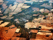
Matthews is a town in Jefferson Township
, Grant County
, Indiana
, along the Mississinewa River
. The population was 595 at the 2000 census.
According to the United States Census Bureau
, the town has a total area of 0.3 square mile (0.776996433 km²), all of it land.
of 2000, there were 595 people, 243 households, and 178 families residing in the town. The population density
was 656.4/km² (1,707.7/mi²). There were 259 housing units at an average density of 285.7/km² (743.3/mi²). The racial makeup of the town was 98.99% White, 0.17% Native American, and 0.84% from two or more races. Hispanic or Latino of any race were 0.17% of the population.
 There were 243 households out of which 31.3% had children under the age of 18 living with them, 60.9% were married couples
living together, 9.9% had a female householder with no husband present, and 26.7% were non-families. 23.9% of all households were made up of individuals and 13.2% had someone living alone who was 65 years of age or older. The average household size was 2.45 and the average family size was 2.88.
In the town the population was spread out with 27.1% under the age of 18, 4.0% from 18 to 24, 30.1% from 25 to 44, 23.2% from 45 to 64, and 15.6% who were 65 years of age or older. The median age was 39 years. For every 100 females there were 84.8 males. For every 100 females age 18 and over, there were 87.9 males.
The median income for a household in the town was $33,125, and the median income for a family was $40,139. Males had a median income of $29,911 versus $23,214 for females. The per capita income
for the town was $17,283. About 4.5% of families and 5.5% of the population were below the poverty line, including 4.9% of those under age 18 and 11.0% of those age 65 or over.
. Founders located the town near the center of the Trenton Gas Field
, and it was hoped that this geographically central location could become the future capital of Indiana
, moving it from Indianapolis
, which had been laid out for that specific reason less than one hundred years earlier in 1825. The plan was abandoned in 1903 when the gas field was depleted, leaving the town with a main street unusually wide for its size.
The population of Matthews at its peak has been estimated at approximately 100,000 to 120,000 people. This included its 18 suburbs, including Gaston
, Wheeling
, Fowlerton
, and Tent City. Tent City was a huddle of tents on a one- to two-mile (3 km) area of farm fields three-quarters of the way around the city limits, where people unable to get housing rented plots.
Matthews was placed near an older village called New Cumberland, founded in 1833. Now the "old town" of Matthews, the village has a wooden covered bridge, the Cumberland Covered Bridge
, built in 1877 which crosses the Mississinewa River
. This bridge is the centerpiece of the town's annual festival and draws thousands of people every year.
Jefferson Township, Grant County, Indiana
Jefferson Township is one of thirteen townships in Grant County, Indiana, USA. As of the 2010 census, its population was 5,839.-Geography:Jefferson Township covers an area of ; of this, or 0.39 percent is water. Lakes in this township include Dollar Lake...
, Grant County
Grant County, Indiana
Grant County is a county located in the U.S. state of Indiana. As of the 2010 census, the population was 70,061. The county seat is Marion. Important paleontological discoveries dating from the Pliocene epoch have been made at Pipe Creek Sinkhole in Grant County.-Geography:According to the 2010...
, Indiana
Indiana
Indiana is a US state, admitted to the United States as the 19th on December 11, 1816. It is located in the Midwestern United States and Great Lakes Region. With 6,483,802 residents, the state is ranked 15th in population and 16th in population density. Indiana is ranked 38th in land area and is...
, along the Mississinewa River
Mississinewa River
The Mississinewa River is a tributary of the Wabash River in eastern Indiana and a small portion of western Ohio in the United States. It is long. Via the Wabash and Ohio rivers, it is part of the Mississippi River watershed. During the War of 1812, the river was the site of the Battle of the...
. The population was 595 at the 2000 census.
Geography
Matthews is located at 40°23′13"N 85°29′45"W (40.387048, -85.495930).According to the United States Census Bureau
United States Census Bureau
The United States Census Bureau is the government agency that is responsible for the United States Census. It also gathers other national demographic and economic data...
, the town has a total area of 0.3 square mile (0.776996433 km²), all of it land.
Demographics
As of the censusCensus
A census is the procedure of systematically acquiring and recording information about the members of a given population. It is a regularly occurring and official count of a particular population. The term is used mostly in connection with national population and housing censuses; other common...
of 2000, there were 595 people, 243 households, and 178 families residing in the town. The population density
Population density
Population density is a measurement of population per unit area or unit volume. It is frequently applied to living organisms, and particularly to humans...
was 656.4/km² (1,707.7/mi²). There were 259 housing units at an average density of 285.7/km² (743.3/mi²). The racial makeup of the town was 98.99% White, 0.17% Native American, and 0.84% from two or more races. Hispanic or Latino of any race were 0.17% of the population.
Marriage
Marriage is a social union or legal contract between people that creates kinship. It is an institution in which interpersonal relationships, usually intimate and sexual, are acknowledged in a variety of ways, depending on the culture or subculture in which it is found...
living together, 9.9% had a female householder with no husband present, and 26.7% were non-families. 23.9% of all households were made up of individuals and 13.2% had someone living alone who was 65 years of age or older. The average household size was 2.45 and the average family size was 2.88.
In the town the population was spread out with 27.1% under the age of 18, 4.0% from 18 to 24, 30.1% from 25 to 44, 23.2% from 45 to 64, and 15.6% who were 65 years of age or older. The median age was 39 years. For every 100 females there were 84.8 males. For every 100 females age 18 and over, there were 87.9 males.
The median income for a household in the town was $33,125, and the median income for a family was $40,139. Males had a median income of $29,911 versus $23,214 for females. The per capita income
Per capita income
Per capita income or income per person is a measure of mean income within an economic aggregate, such as a country or city. It is calculated by taking a measure of all sources of income in the aggregate and dividing it by the total population...
for the town was $17,283. About 4.5% of families and 5.5% of the population were below the poverty line, including 4.9% of those under age 18 and 11.0% of those age 65 or over.
History
Matthews was founded in 1895 and named in honor of then-governor Claude MatthewsClaude Matthews
Claude Matthews was the 23rd Governor of the U.S. state of Indiana from 1893 to 1897. A farmer, he was nominated to prevent the loss of voters to the Populist Party. The Panic of 1893 occurred just before he took office, leading to severe economic problems during his term...
. Founders located the town near the center of the Trenton Gas Field
Trenton Gas Field
The Trenton Gas Field is located in east central Indiana and the most western portion of west central Ohio. The field was discovered in 1876, but the size and magnitude of the field was not known until the 1880s. The field was the largest natural gas discovery up to that time, containing over of...
, and it was hoped that this geographically central location could become the future capital of Indiana
Indiana
Indiana is a US state, admitted to the United States as the 19th on December 11, 1816. It is located in the Midwestern United States and Great Lakes Region. With 6,483,802 residents, the state is ranked 15th in population and 16th in population density. Indiana is ranked 38th in land area and is...
, moving it from Indianapolis
Indianapolis
Indianapolis is the capital of the U.S. state of Indiana, and the county seat of Marion County, Indiana. As of the 2010 United States Census, the city's population is 839,489. It is by far Indiana's largest city and, as of the 2010 U.S...
, which had been laid out for that specific reason less than one hundred years earlier in 1825. The plan was abandoned in 1903 when the gas field was depleted, leaving the town with a main street unusually wide for its size.
The population of Matthews at its peak has been estimated at approximately 100,000 to 120,000 people. This included its 18 suburbs, including Gaston
Gaston, Indiana
Gaston is a town in Washington Township, Delaware County, Indiana, United States. The population was 871 at the 2010 census. It is part of the Muncie, IN Metropolitan Statistical Area.-Geography:Gaston is located at ....
, Wheeling
Wheeling, Indiana
Wheeling is the name of the following places in the U.S. state of Indiana:*Wheeling, Carroll County, Indiana*Wheeling, Delaware County, Indiana*Wheeling, Gibson County, Indiana...
, Fowlerton
Fowlerton, Indiana
Fowlerton is a town in Fairmount Township, Grant County, Indiana, United States. The population was 298 at the 2000 census.-Geography:Fowlerton is located at ....
, and Tent City. Tent City was a huddle of tents on a one- to two-mile (3 km) area of farm fields three-quarters of the way around the city limits, where people unable to get housing rented plots.
Matthews was placed near an older village called New Cumberland, founded in 1833. Now the "old town" of Matthews, the village has a wooden covered bridge, the Cumberland Covered Bridge
Cumberland Covered Bridge
Originally called the New Cumberland Covered Bridge, it was built in 1877 by William Parks of Marion, Indiana. This Howe Truss bridge is long.-Floods:...
, built in 1877 which crosses the Mississinewa River
Mississinewa River
The Mississinewa River is a tributary of the Wabash River in eastern Indiana and a small portion of western Ohio in the United States. It is long. Via the Wabash and Ohio rivers, it is part of the Mississippi River watershed. During the War of 1812, the river was the site of the Battle of the...
. This bridge is the centerpiece of the town's annual festival and draws thousands of people every year.