

Kapurthala District
Encyclopedia
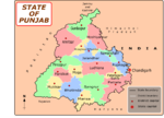
Punjab (India)
Punjab ) is a state in the northwest of the Republic of India, forming part of the larger Punjab region. The state is bordered by the Indian states of Himachal Pradesh to the east, Haryana to the south and southeast and Rajasthan to the southwest as well as the Pakistani province of Punjab to the...
state in northern Republic of India. The city of Kapurthala
Kapurthala
Kapurthala is a city in Punjab state of India. It is the administrative headquarters of Kapurthala District. It was the capital of the Kapurthala State, a princely state in British India. The secular and aesthetic mix of the city with its prominent buildings based on French and Indo-Saracenic...
is the district headquarters.
Kapurthala District is one of the smallest districts of Punjab in terms of both area and population, with 754,521 people by the 2001 census. The district is divided into two noncontiguous parts, the main Kapurthala-Sultanpur Lodhi
Sultanpur Lodhi
Sultanpur Lodhi is a city and a municipal council in Kapurthala district in the Indian state of Punjab. The town is named after its founder, Sultan Khan Lodhi who was a general of Mahmud of Ghazni in AD 1103, which has been also mentioned in Ain-e-Akbari...
portion and the Phagwara
Phagwara
Phagwara is a city and a municipal council in Kapurthala district in North India, in the central part of the Punjab.-Location:Phagwara lies on the Delhi–Amritsar national highway No.01 and is also served by the rail link between Delhi and Amritsar. It is located between the two big cities of...
tehsil
Tehsil
A Tehsil or Tahsil/Tahasil , also known as Taluk and Mandal, is an administrative division of some country/countries of South Asia....
or block.
The Kapurthala-Sultanpur Lodhi part lies between north latitude 31° 07' and 31° 22' and east longitude 75° 36'. In the north it is bound by Hoshiarpur
Hoshiarpur District
Hoshiarpur District , is a district of Punjab state in northern India.In 2011, Hoshiarpur had population of 1,582,793 of which male and female were 806,921 and 775,872 respectively. There was change of 6.85 percent in the population compared to population as per 2001...
, Gurdaspur
Gurdaspur District
Gurdaspur district is a district in the state of Punjab, situated in the northwest part of the Republic of India. Gurdaspur is the district headquarters. It internationally borders Narowal District of the Pakistani Punjab, Kathua District of Jammu and Kashmir, the Punjab districts of Amritsar and...
, and Amritsar
Amritsar District
Amritsar district is one of 22 districts in the state of Punjab in West India. It has a population of 3,074,207 and covers an area of 5075 km²...
districts, in the west by the Beas River
Beas River
The Beas River is a river in the northern part of India. The river rises in the Himalayas in central Himachal Pradesh, India, and flows for some 470 km to the Sutlej River in the Indian state of Punjab....
and Amritsar district, and in south by the Sutlej River, Jalandhar district
Jalandhar District
Jalandhar district , Jalandhar Zilā) is one of the 22 districts in the state of Punjab in North-West Republic of India. The capital is Jalandhar City...
, and Hoshiarpur district.
Phagwara tehsil lies between north latitude 31° 22' and east longitude 75° 40' and 75° 55'. Phagwara lies on the National Highway No 1, and the tehsil is much more industrially developed than the remainder of Kapurthala District. Phagwara is situated at a distance of 19 kilometres (11.8 mi) southwest of Jalandhar, and the tehsil is bounded on all sides by Jalandhar District except in the northeast, where it is bounded by Hoshiarpur district.
The district has three subdivisions/tehsils: Kapurthala, Phagwara, and Sultanpur Lodhi. The total area of the district is 1633 km² (630 mi²) of which 909.09 km² (350.91 mi²) is in Kapurthala tehsil, 304.05 km² (117.36 mi²) in Phagwara tehsil and 451.0 km² (174.1 mi²) in Sultanpur Lodhi tehsil. The economy of the district is still predominantly agricultural. The major crops are wheat
Wheat
Wheat is a cereal grain, originally from the Levant region of the Near East, but now cultivated worldwide. In 2007 world production of wheat was 607 million tons, making it the third most-produced cereal after maize and rice...
, rice
Rice
Rice is the seed of the monocot plants Oryza sativa or Oryza glaberrima . As a cereal grain, it is the most important staple food for a large part of the world's human population, especially in East Asia, Southeast Asia, South Asia, the Middle East, and the West Indies...
, sugarcane
Sugarcane
Sugarcane refers to any of six to 37 species of tall perennial grasses of the genus Saccharum . Native to the warm temperate to tropical regions of South Asia, they have stout, jointed, fibrous stalks that are rich in sugar, and measure two to six metres tall...
, potato
Potato
The potato is a starchy, tuberous crop from the perennial Solanum tuberosum of the Solanaceae family . The word potato may refer to the plant itself as well as the edible tuber. In the region of the Andes, there are some other closely related cultivated potato species...
and maize
Maize
Maize known in many English-speaking countries as corn or mielie/mealie, is a grain domesticated by indigenous peoples in Mesoamerica in prehistoric times. The leafy stalk produces ears which contain seeds called kernels. Though technically a grain, maize kernels are used in cooking as a vegetable...
. The major portion of Kapurthala district lies between the Beas River
Beas River
The Beas River is a river in the northern part of India. The river rises in the Himalayas in central Himachal Pradesh, India, and flows for some 470 km to the Sutlej River in the Indian state of Punjab....
and the Kali-Bein River and is called the ‘BET’ area. This area is prone to floods. Water logging and alkalinity in the soil is the major problem of the area. A flood protection bundh called ‘Dhussi Bundh’ has been constructed along the left bank of the Beas River, and it has saved the area from the ravages of flood. The entire district is an alluvial plain
Alluvial plain
An alluvial plain is a relatively flat landform created by the deposition of sediment over a long period of time by one or more rivers coming from highland regions, from which alluvial soil forms...
. To the south of the river Black Bein lies the tract known as ‘Dona’ meaning the soil formed of two constituents i.e. the sand and clay.
The climate is typical of the Punjab plains i.e. hot in summers and cold in winters. It has sub-tropical continental monsoon
Monsoon
Monsoon is traditionally defined as a seasonal reversing wind accompanied by corresponding changes in precipitation, but is now used to describe seasonal changes in atmospheric circulation and precipitation associated with the asymmetric heating of land and sea...
type climate. Intensive cultivation in the district leaves no scope for forest cover and the wild life is practically nonexistent.
Demographics
According to the 2011 census2011 census of India
The 15th Indian National census was conducted in two phases, houselisting and population enumeration. Houselisting phase began on April 1, 2010 and involved collection of information about all buildings...
Kapurthala district has a population
Demographics of India
The demographics of India are inclusive of the second most populous country in the world, with over 1.21 billion people , more than a sixth of the world's population. Already containing 17.5% of the world's population, India is projected to be the world's most populous country by 2025, surpassing...
of 817,668, roughly equal to the nation of Comoros
Comoros
The Comoros , officially the Union of the Comoros is an archipelago island nation in the Indian Ocean, located off the eastern coast of Africa, on the northern end of the Mozambique Channel, between northeastern Mozambique and northwestern Madagascar...
or the US state of South Dakota
South Dakota
South Dakota is a state located in the Midwestern region of the United States. It is named after the Lakota and Dakota Sioux American Indian tribes. Once a part of Dakota Territory, South Dakota became a state on November 2, 1889. The state has an area of and an estimated population of just over...
. This gives it a ranking of 481st in India (out of a total of 640
Districts of India
A district is an administrative division of an Indian state or territory. Districts are further subdivided, in some cases into Sub-Divisions, and otherwise directly into tehsils or talukas.District officials include:...
). The district has a population density of 501 PD/sqkm . Its population growth rate
Family planning in India
Family planning in India is based on efforts largely sponsored by the Indian government. In the 1965-2009 period, contraceptive usage has more than tripled and the fertility rate has more than halved , but the national fertility rate is still high enough to cause long-term population growth...
over the decade 2001-2011 was 8.37 %. Kapurthala has a sex ratio
Sex ratio
Sex ratio is the ratio of males to females in a population. The primary sex ratio is the ratio at the time of conception, secondary sex ratio is the ratio at time of birth, and tertiary sex ratio is the ratio of mature organisms....
of 912 females
Women in India
The status of women in India has been subject to many great changes over the past few millennia. From equal status with men in ancient times through the low points of the medieval period, to the promotion of equal rights by many reformers, the history of women in India has been eventful...
for every 1000 males, and a literacy rate
Literacy in India
Literacy in India is key for socio-economic progress, and the Indian literacy rate grew to 74.04% in 2011 from 12% at the end of British rule in 1947. Although this was a greater than sixfold improvement, the level is well below the world average literacy rate of 84%, and India currently has the...
of 80.2 %.