
Illinois Route 163
Encyclopedia
Illinois Route 163 is a 9.89 miles (15.92 km) north–south highway in southwestern Illinois
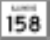
. It runs from Illinois Route 158
in Millstadt
north to Illinois Route 15
in Alorton
; the route is located entirely within St. Clair County
. Route 163 is maintained by the Illinois Department of Transportation
.
 Illinois 163 begins at a junction with Illinois 158 in downtown Millstadt. The highway leaves the village to the north, entering rural Millstadt Township
. After passing St. James Catholic Cemetery, it crosses into Stookey Township
. The route then curves north-northwest past Concordia Church and Cemetery. Upon crossing Prairie Dupont Creek, it turns north through the community of Westview
. At Booker T. Washington Cemetery, the route heads northwest into Centreville Township
, where it meets Illinois 157
. The highways run northward concurrently
and enter Centreville
before intersecting Illinois 13
. At this junction, Illinois 157 follows Illinois 13 eastward, while Illinois 163 continues northward through a primarily residential area. The highway turns northeast into Alorton
and passes under an overpass carrying Interstate 255
and U.S. Route 50
, which do not meet Illinois 116. From here Illinois 116 runs parallel to the south of Illinois 15 before terminating at an intersection with this route. Illinois 163 is a two-lane road for its entire length.
to Palestine
. In 1937, this route became part of Illinois Route 33
(which turns south at Palestine). It was moved to its current alignment in 1954. From 1954-1957, it was also signed Bypass U.S. Route 50
.
Illinois
Illinois is the fifth-most populous state of the United States of America, and is often noted for being a microcosm of the entire country. With Chicago in the northeast, small industrial cities and great agricultural productivity in central and northern Illinois, and natural resources like coal,...
. It runs from Illinois Route 158
Illinois Route 158
Illinois Route 158 is an east–west state road in southwestern Illinois. Its western terminus is at Illinois Route 3 in Columbia and its eastern terminus is at U.S. Route 50, in O'Fallon. This is a distance of .- Route description :...
in Millstadt
Millstadt, Illinois
Millstadt is a suburb of St. Louis and a village in St. Clair County, Illinois, at the crossing of Illinois Route 163 and Illinois Route 158 . The village is known for its German heritage, with more than half its people of German descent...
north to Illinois Route 15
Illinois Route 15
Illinois Route 15 is an east–west highway with its western terminus at Illinois Route 3, U.S. Route 40, I-55, I-64, and I-70 and its eastern terminus at Wabash River at the Illinois/Indiana Border where it meets Indiana 64. This is a distance of ....
in Alorton
Alorton, Illinois
Alorton is a village in St. Clair County, Illinois, United States. The population was 2,749 at the 2000 census.Alorton was home to Cahokia Downs, an American horse racing track located on Highway 15 which hosted both Standardbred harness racing and Thoroughbred flat racing events from 1954 through...
; the route is located entirely within St. Clair County
St. Clair County, Illinois
St. Clair County is a county located in the U.S. state of Illinois. In 1970, the U.S. Census Bureau placed the mean center of U.S. population in St. Clair County. According to the 2010 census, it has a population of 270,056, which is an increase of 5.5% from 256,082 in 2000. Its county seat is...
. Route 163 is maintained by the Illinois Department of Transportation
Illinois Department of Transportation
The Illinois Department of Transportation is a state agency in charge of state-maintained public roadways of the U.S. state of Illinois. In addition, IDOT provides funding for rail, public transit and airport projects and administers fuel tax and federal funding to local juridictions in the...
.
Route description
Millstadt Township, St. Clair County, Illinois
Millstadt Township is located in St. Clair County, Illinois. The population was 5,493 at the 2000 census.- External links :*****...
. After passing St. James Catholic Cemetery, it crosses into Stookey Township
Stookey Township, St. Clair County, Illinois
Stookey Township is a township located in St. Clair County, Illinois. It is an unincorporated part of Belleville, Illinois located just west of downtown Belleville, for that reason it is often referred to by locals as Belleville West...
. The route then curves north-northwest past Concordia Church and Cemetery. Upon crossing Prairie Dupont Creek, it turns north through the community of Westview
Westview, Illinois
Westview is an unincorporated community in Stookey Township, St. Clair County, Illinois, United States. Westview is located on Illinois Route 163 south-southeast of East St. Louis....
. At Booker T. Washington Cemetery, the route heads northwest into Centreville Township
Centreville Township, St. Clair County, Illinois
Centreville Township is located in St. Clair County, Illinois. The population was 28,711 at the 2000 census. Centreville Township was formed from Centreville Station when it was subdivided on March 5, 1910.- External links :****...
, where it meets Illinois 157
Illinois Route 157
Illinois Route 157 is a north–south highway in southwestern Illinois. Its southern terminus is at Illinois Route 3 at Cahokia, Illinois and its northern terminus at Illinois Route 140 in Hamel. This is a distance of .- Route description :...
. The highways run northward concurrently
Concurrency (road)
A concurrency, overlap, or coincidence in a road network is an instance of one physical road bearing two or more different highway, motorway, or other route numbers...
and enter Centreville
Centreville, Illinois
Centreville is a city in St. Clair County, Illinois, United States of America. The population was 5,951 at the 2000 census.-Geography:Centreville is located at ....
before intersecting Illinois 13
Illinois Route 13
Illinois Route 13 is a major east–west state route in southern Illinois. Illinois 13 has its western terminus at Centreville at Illinois Route 157 and its eastern terminus at the Kentucky state line and the Ohio River, at Kentucky Route 56. This is a distance of .- Route description :Illinois...
. At this junction, Illinois 157 follows Illinois 13 eastward, while Illinois 163 continues northward through a primarily residential area. The highway turns northeast into Alorton
Alorton, Illinois
Alorton is a village in St. Clair County, Illinois, United States. The population was 2,749 at the 2000 census.Alorton was home to Cahokia Downs, an American horse racing track located on Highway 15 which hosted both Standardbred harness racing and Thoroughbred flat racing events from 1954 through...
and passes under an overpass carrying Interstate 255
Interstate 255
Interstate 255 is a bypass route of Interstate 55 near St. Louis, Missouri and with Interstate 270, it forms a loop around the city. Even though St. Louis is in Missouri, a majority of the route runs through Illinois. It shares its southern terminus with 270 at the junction with Interstate 55, 270...
and U.S. Route 50
U.S. Route 50
U.S. Route 50 is a major east–west route of the U.S. Highway system, stretching just over from Ocean City, Maryland on the Atlantic Ocean to West Sacramento, California. Until 1972, when it was replaced by Interstate Highways west of the Sacramento area, it extended to San Francisco, near...
, which do not meet Illinois 116. From here Illinois 116 runs parallel to the south of Illinois 15 before terminating at an intersection with this route. Illinois 163 is a two-lane road for its entire length.
History
SBI Route 163 originally ran from Illinois Route 1Illinois Route 1
Illinois Route 1 is a state highway in the U.S. state of Illinois. Running parallel to the Indiana border, it is also the longest state road, starting on the south side of Chicago as Halsted Street at the intersection with 95th Street, south to a free ferry crossing to Kentucky at Cave-In-Rock on...
to Palestine
Palestine, Illinois
Palestine is a village in Crawford County, Illinois, United States. The population was 1,366 at the 2000 census.-Geography:Palestine is located at ....
. In 1937, this route became part of Illinois Route 33
Illinois Route 33
Illinois Route 33 is a multidirectional highway in southeastern Illinois, with its western terminus at Illinois Route 128 on the Fayette–Effingham county line near Beecher City and its southern terminus at U.S. Highway 50 east of Lawrenceville. It also overlaps Illinois Route 32 from Shumway to...
(which turns south at Palestine). It was moved to its current alignment in 1954. From 1954-1957, it was also signed Bypass U.S. Route 50
U.S. Route 50
U.S. Route 50 is a major east–west route of the U.S. Highway system, stretching just over from Ocean City, Maryland on the Atlantic Ocean to West Sacramento, California. Until 1972, when it was replaced by Interstate Highways west of the Sacramento area, it extended to San Francisco, near...
.