
Millstadt, Illinois
Encyclopedia
Millstadt is a suburb of St. Louis and a village in St. Clair County
, Illinois
, at the crossing of Illinois Route 163
(locally, "Jefferson Avenue") and Illinois Route 158
(locally, "Washington Avenue"). The village is known for its German heritage, with more than half its people of German descent. The population was 2,794 at the 2000 census, but a more recent study in July 2006 estimated the number at 3,247.
, Columbia
, and Pittsburg Lake. The town was platted on March 13, 1837. In 1880, its name was changed to Millstadt, as the name Centreville was in use by another nearby town
.
Another account (Millstadt School website): "The story of how Millstadt developed out of 'Centreville' goes something like this. The current Centerville and our Centreville each had a post offices through which a great deal of mail became confused and mis-delivered. Our town's forefathers, upon applying for formal organization through the state, supposedly decided on the name 'Mittlestadt' or 'Middlestadt,' which means literally 'center city'; somehow the state misread the writing and sent back the papers reading 'Millstadt.' As you can guess, the governing group decided to keep that name as we had several mills at that time and the name fit."
of 2000, there were 2,794 people, 1,148 households, and 813 families residing in the village. The population density
was 2,511.9 people per square mile (971.9/km²). There were 1,196 housing units at an average density of 1,075.2 per square mile (416.0/km²). The racial makeup of the village was 100% White, 0% Native American, 0% Asian, 0% from other races
, and 0% from two or more races. Hispanic or Latino of any race were 0% of the population.
There were 1,148 households out of which 31.8% had children under the age of 18 living with them, 59.1% were married couples
living together, 8.9% had a female householder with no husband present, and 29.1% were non-families. 25.3% of all households were made up of individuals and 12.5% had someone living alone who was 65 years of age or older. The average household size was 2.43 and the average family size was 2.92.
In the village the population was spread out with 23.7% under the age of 18, 7.6% from 18 to 24, 28.6% from 25 to 44, 22.9% from 45 to 64, and 17.3% who were 65 years of age or older. The median age was 39 years. For every 100 females there were 91.5 males. For every 100 females age 18 and over, there were 87.5 males.
The median income for a household in the village was $47,824, and the median income for a family was $56,378. Males had a median income of $40,893 versus $27,196 for females. The per capita income
for the village was $21,914. About 3.2% of families and 4.0% of the population were below the poverty line, including 5.9% of those under age 18 and 5.1% of those age 65 or over.
, the village has a total area of 1.1 square miles (2.8 km²), all land.
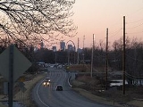
The town centre is formed by the intersection of two state highways. Illinois Route 158
, or Washington Avenue, leads west to Columbia
and east to Belleville
. The other main street is Jefferson Avenue, the north part of which forms the southern end of Illinois Route 163
, leading north to Centreville
, where it intersects highways providing access to St. Louis. The south end of Jefferson Avenue, as it leaves Millstadt, becomes Floraville Road.
St. Clair County, Illinois
St. Clair County is a county located in the U.S. state of Illinois. In 1970, the U.S. Census Bureau placed the mean center of U.S. population in St. Clair County. According to the 2010 census, it has a population of 270,056, which is an increase of 5.5% from 256,082 in 2000. Its county seat is...
, Illinois
Illinois
Illinois is the fifth-most populous state of the United States of America, and is often noted for being a microcosm of the entire country. With Chicago in the northeast, small industrial cities and great agricultural productivity in central and northern Illinois, and natural resources like coal,...
, at the crossing of Illinois Route 163
Illinois Route 163
Illinois Route 163 is a north–south highway in southwestern Illinois. It runs from Illinois Route 158 in Millstadt north to Illinois Route 15 in Alorton; the route is located entirely within St. Clair County. Route 163 is maintained by the Illinois Department of Transportation.- Route...
(locally, "Jefferson Avenue") and Illinois Route 158
Illinois Route 158
Illinois Route 158 is an east–west state road in southwestern Illinois. Its western terminus is at Illinois Route 3 in Columbia and its eastern terminus is at U.S. Route 50, in O'Fallon. This is a distance of .- Route description :...
(locally, "Washington Avenue"). The village is known for its German heritage, with more than half its people of German descent. The population was 2,794 at the 2000 census, but a more recent study in July 2006 estimated the number at 3,247.
History
During a barn-raising in 1836, it was proposed that a town be incorporated on land belonging to Henry Randleman. The name "Centreville" was proposed, as the site was equidistant from BellevilleBelleville, Illinois
Belleville is a city in St. Clair County, Illinois, United States. As of the 2010 census, the city has a population of 44,478. It is the eighth-most populated city outside of the Chicago Metropolitan Area and the most populated city south of Springfield in the state of Illinois. It is the county...
, Columbia
Columbia, Illinois
Columbia is a city in Monroe and St. Clair County in the U.S. state of Illinois, about south of St. Louis, Missouri. The population was 7,922 at the 2000 census.-History:...
, and Pittsburg Lake. The town was platted on March 13, 1837. In 1880, its name was changed to Millstadt, as the name Centreville was in use by another nearby town
Centreville, Illinois
Centreville is a city in St. Clair County, Illinois, United States of America. The population was 5,951 at the 2000 census.-Geography:Centreville is located at ....
.
Another account (Millstadt School website): "The story of how Millstadt developed out of 'Centreville' goes something like this. The current Centerville and our Centreville each had a post offices through which a great deal of mail became confused and mis-delivered. Our town's forefathers, upon applying for formal organization through the state, supposedly decided on the name 'Mittlestadt' or 'Middlestadt,' which means literally 'center city'; somehow the state misread the writing and sent back the papers reading 'Millstadt.' As you can guess, the governing group decided to keep that name as we had several mills at that time and the name fit."
Demographics
As of the censusCensus
A census is the procedure of systematically acquiring and recording information about the members of a given population. It is a regularly occurring and official count of a particular population. The term is used mostly in connection with national population and housing censuses; other common...
of 2000, there were 2,794 people, 1,148 households, and 813 families residing in the village. The population density
Population density
Population density is a measurement of population per unit area or unit volume. It is frequently applied to living organisms, and particularly to humans...
was 2,511.9 people per square mile (971.9/km²). There were 1,196 housing units at an average density of 1,075.2 per square mile (416.0/km²). The racial makeup of the village was 100% White, 0% Native American, 0% Asian, 0% from other races
Race (United States Census)
Race and ethnicity in the United States Census, as defined by the Federal Office of Management and Budget and the United States Census Bureau, are self-identification data items in which residents choose the race or races with which they most closely identify, and indicate whether or not they are...
, and 0% from two or more races. Hispanic or Latino of any race were 0% of the population.
There were 1,148 households out of which 31.8% had children under the age of 18 living with them, 59.1% were married couples
Marriage
Marriage is a social union or legal contract between people that creates kinship. It is an institution in which interpersonal relationships, usually intimate and sexual, are acknowledged in a variety of ways, depending on the culture or subculture in which it is found...
living together, 8.9% had a female householder with no husband present, and 29.1% were non-families. 25.3% of all households were made up of individuals and 12.5% had someone living alone who was 65 years of age or older. The average household size was 2.43 and the average family size was 2.92.
In the village the population was spread out with 23.7% under the age of 18, 7.6% from 18 to 24, 28.6% from 25 to 44, 22.9% from 45 to 64, and 17.3% who were 65 years of age or older. The median age was 39 years. For every 100 females there were 91.5 males. For every 100 females age 18 and over, there were 87.5 males.
The median income for a household in the village was $47,824, and the median income for a family was $56,378. Males had a median income of $40,893 versus $27,196 for females. The per capita income
Per capita income
Per capita income or income per person is a measure of mean income within an economic aggregate, such as a country or city. It is calculated by taking a measure of all sources of income in the aggregate and dividing it by the total population...
for the village was $21,914. About 3.2% of families and 4.0% of the population were below the poverty line, including 5.9% of those under age 18 and 5.1% of those age 65 or over.
Geography
According to the United States Census BureauUnited States Census Bureau
The United States Census Bureau is the government agency that is responsible for the United States Census. It also gathers other national demographic and economic data...
, the village has a total area of 1.1 square miles (2.8 km²), all land.
The town centre is formed by the intersection of two state highways. Illinois Route 158
Illinois Route 158
Illinois Route 158 is an east–west state road in southwestern Illinois. Its western terminus is at Illinois Route 3 in Columbia and its eastern terminus is at U.S. Route 50, in O'Fallon. This is a distance of .- Route description :...
, or Washington Avenue, leads west to Columbia
Columbia, Illinois
Columbia is a city in Monroe and St. Clair County in the U.S. state of Illinois, about south of St. Louis, Missouri. The population was 7,922 at the 2000 census.-History:...
and east to Belleville
Belleville, Illinois
Belleville is a city in St. Clair County, Illinois, United States. As of the 2010 census, the city has a population of 44,478. It is the eighth-most populated city outside of the Chicago Metropolitan Area and the most populated city south of Springfield in the state of Illinois. It is the county...
. The other main street is Jefferson Avenue, the north part of which forms the southern end of Illinois Route 163
Illinois Route 163
Illinois Route 163 is a north–south highway in southwestern Illinois. It runs from Illinois Route 158 in Millstadt north to Illinois Route 15 in Alorton; the route is located entirely within St. Clair County. Route 163 is maintained by the Illinois Department of Transportation.- Route...
, leading north to Centreville
Centreville, Illinois
Centreville is a city in St. Clair County, Illinois, United States of America. The population was 5,951 at the 2000 census.-Geography:Centreville is located at ....
, where it intersects highways providing access to St. Louis. The south end of Jefferson Avenue, as it leaves Millstadt, becomes Floraville Road.
Schools and Churches
- Elementary Schools:
- Millstadt Primary Center - http://www.millstadt.stclair.k12.il.us/mpc.html
- Millstadt Consolidated School - www.millstadt.stclair.k12.il.us
- St. James Catholic School - www.stjames.pvt.k12.il.us
- High Schools: (all are in nearby Belleville, IllinoisBelleville, IllinoisBelleville is a city in St. Clair County, Illinois, United States. As of the 2010 census, the city has a population of 44,478. It is the eighth-most populated city outside of the Chicago Metropolitan Area and the most populated city south of Springfield in the state of Illinois. It is the county...
)- Althoff Catholic High SchoolAlthoff Catholic High SchoolAlthoff Catholic High School is a secondary education, Roman Catholic, private school, in Belleville, Illinois, in the Roman Catholic Diocese of Belleville....
- www.althoff.net - Belleville Township High School West, District 201 - www.bths201.org
- Althoff Catholic High School
- Churches in Millstadt:
- Christian Assembly Church (non-denominational)
- Concordia United Church of Christ (United Church of Christ) - http://www.concordia-ucc.org/
- Countryside Family Church
- St. James Catholic Church (Roman Catholic)
- Trinity Lutheran Church (Missouri Synod) - http://www.trinitymillstadt.org
- Zion Evangelical Church (non-denominational) http://www.zionmillstadt.com
Cemeteries
- Millstadt Cemetery (aka Centreville Cemetery) http://www.graveyards.com/bin/grave?id=4846
- Mount Evergreen Cemetery http://www.graveyards.com/bin/grave?id=4997
- St. James Catholic Cemetery http://www.graveyards.com/bin/grave?id=6235
- other rural cemeteries around Millstadt can be found at graveyards.com
Notable residents
- Miles Henry DavisMiles Henry DavisMiles Henry Davis was a prominent American dentist and father of jazz legend Miles Davis.-Biography:Davis was born on March 1, 1898 in Noble Lake, Arkansas. He was a son of Miles D. and Mary Davis...
, father of jazz trumpeter Miles DavisMiles DavisMiles Dewey Davis III was an American jazz musician, trumpeter, bandleader, and composer. Widely considered one of the most influential musicians of the 20th century, Miles Davis was, with his musical groups, at the forefront of several major developments in jazz music, including bebop, cool jazz,...
, owned 160-acre estate in Millstadt in which he bred prize-winning Landrace hogs. - John Kasper, member of the 1998 USA Olympic Bobsled Team.