
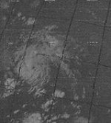
Hurricane Francelia
Encyclopedia
Hurricane Francelia was the second-deadliest hurricane of the 1969 Atlantic hurricane season
behind Hurricane Camille
, killing 100 people as it made landfall on Central America
in Belize
. The storm crossed into the eastern Pacific Ocean
as a disturbance after making landfall
and moving inland, eventually reforming and becoming Hurricane Glenda.
– an elongated low pressure area
– that exited the western coast of Africa on August 19. It moved westward across the tropical Atlantic Ocean, and the annual summary of 1969 tropical cyclone activity indicated there may have been a depression
briefly located within the system. On August 26, an area of convection, or thunderstorms, developed along the wave, about 800 miles (1300 km) east of Barbados
. A Hurricane Hunters
flight two days later reported no circulation
. As the system moved through the southern Lesser Antilles
, ships and land observations suggested a circulation developed, indicating the formation of a tropical depression in the extreme southeastern Caribbean Sea early on August 29.
The new tropical cyclone moved quickly west-northwestward away from South America, and on August 30 Hurricane Hunters recorded winds of 45 mph (75 km/h). Based on the observation, the depression was upgraded to tropical storm status and given the name Francelia. Strengthening continued to near hurricane-force, but the fast-moving circulation outran the convection, causing brief weakening as it passed south of Jamaica. Although initially forecast to continue to the west-northwest, Francelia slowed and turned to the west-southwest on September 1 due to ridge
higher pressures to its north. Concurrently, the storm intensified into hurricane status after its winds reached 75 mph (120 km/h), and late on September 1 Francelia passed over Swan Island
. During its passage, an atmospheric sounding
occurred in its eye
; a sounding is a measurement of the physical properties of the atmosphere, and the process had only occurred four times previously.
Hurricane Francelia continued west-southwestward toward the northern coast of Central America, strengthening significantly despite its proximity to land. A Hurricane Hunters flight on September 2 reported winds of 115 mph (185 km/h) and a minimum pressure of 973 mbar
as the hurricane crossed over the Bay Islands, only 30 miles (50 km) off the coast of Honduras. Francelia weakened slightly as its forward movement slowed, but it remained a hurricane as it approached land, based on confirmation from ship reports. Late on September 3, the hurricane made landfall with winds estimated at 110 mph (180 km/h), just north of Punta Gorda
in southern Belize
, then known as British Honduras
. Tropical storm force winds spread across the country, although hurricane force winds occurred only in a small area near where the hurricane made landfall. Francelia weakened quickly over land, dissipating late on September 4 over Guatemala. The system continued slowly across Central America, crossing into the eastern Pacific Ocean three days after it moved ashore. On September 8, the remnants of Francelia redeveloped into Tropical Storm Glenda off the coast of Mexico, which moved parallel to the southwest Mexican coast before dissipating on September 12.
, producing 0.56 inch in a sixteen hour period. On Swan Island
, located about 90 miles (145 km) offshore Honduras, Francelia produced peak winds of 60 mph (95 km/h). A station on the island recorded a minimum pressure of 994 mbar, as well as 1.98 inch during the storm's passage.
When Francelia nearly stalled off the coast of Central America
, it brought prolonged rainfall and extensive flooding. Mountain flooding resulted in overflown rivers, with the Belize River rising to over 36 feet (11 m) above normal. The storm affected thousands of people and caused extensive damage to crops. Damage from Francelia totaled $4.7 million (1969 USD
, $28 million 2010 USD).
The rainfall values for Francelia were moderate to severe, amounting to a peak of 184.6 millimetres (7.3 in) in Achiguate Reference Point I, Guatemala. Severe flooding was experienced in Belize.
The flooding in Guatemala caused an estimated 100 deaths.
1969 Atlantic hurricane season
The 1969 Atlantic hurricane season officially began on June 1, 1969, and lasted until November 30, 1969. These dates conventionally delimit the period of each year when most tropical cyclones form in the Atlantic basin. The season was among the most active on record, with 18 tropical cyclones, 12...
behind Hurricane Camille
Hurricane Camille
Hurricane Camille was the third and strongest tropical cyclone and second hurricane during the 1969 Atlantic hurricane season. The second of three catastrophic Category 5 hurricanes to make landfall in the United States during the 20th century , which it did near the mouth of the Mississippi River...
, killing 100 people as it made landfall on Central America
Central America
Central America is the central geographic region of the Americas. It is the southernmost, isthmian portion of the North American continent, which connects with South America on the southeast. When considered part of the unified continental model, it is considered a subcontinent...
in Belize
Belize
Belize is a constitutional monarchy and the northernmost country in Central America. Belize has a diverse society, comprising many cultures and languages. Even though Kriol and Spanish are spoken among the population, Belize is the only country in Central America where English is the official...
. The storm crossed into the eastern Pacific Ocean
Pacific Ocean
The Pacific Ocean is the largest of the Earth's oceanic divisions. It extends from the Arctic in the north to the Southern Ocean in the south, bounded by Asia and Australia in the west, and the Americas in the east.At 165.2 million square kilometres in area, this largest division of the World...
as a disturbance after making landfall
Landfall (meteorology)
Landfall is the event of a tropical cyclone or a waterspout coming onto land after being over water. When a waterspout makes landfall it is reclassified as a tornado, which can then cause damage inland...
and moving inland, eventually reforming and becoming Hurricane Glenda.
Meteorological history
The origins of Hurricane Francelia were from a tropical waveTropical wave
Tropical waves, easterly waves, or tropical easterly waves, also known as African easterly waves in the Atlantic region, are a type of atmospheric trough, an elongated area of relatively low air pressure, oriented north to south, which move from east to west across the tropics causing areas of...
– an elongated low pressure area
Low pressure area
A low-pressure area, or "low", is a region where the atmospheric pressure at sea level is below that of surrounding locations. Low-pressure systems form under areas of wind divergence which occur in upper levels of the troposphere. The formation process of a low-pressure area is known as...
– that exited the western coast of Africa on August 19. It moved westward across the tropical Atlantic Ocean, and the annual summary of 1969 tropical cyclone activity indicated there may have been a depression
Tropical cyclone
A tropical cyclone is a storm system characterized by a large low-pressure center and numerous thunderstorms that produce strong winds and heavy rain. Tropical cyclones strengthen when water evaporated from the ocean is released as the saturated air rises, resulting in condensation of water vapor...
briefly located within the system. On August 26, an area of convection, or thunderstorms, developed along the wave, about 800 miles (1300 km) east of Barbados
Barbados
Barbados is an island country in the Lesser Antilles. It is in length and as much as in width, amounting to . It is situated in the western area of the North Atlantic and 100 kilometres east of the Windward Islands and the Caribbean Sea; therein, it is about east of the islands of Saint...
. A Hurricane Hunters
Hurricane Hunters
The Hurricane Hunters are aircraft that fly into tropical cyclones in the North Atlantic Ocean and Northeastern Pacific Ocean for the specific purpose of directly measuring weather data in and around those storms. In the United States, the Air Force, Navy, and NOAA units have all participated in...
flight two days later reported no circulation
Atmospheric circulation
Atmospheric circulation is the large-scale movement of air, and the means by which thermal energy is distributed on the surface of the Earth....
. As the system moved through the southern Lesser Antilles
Lesser Antilles
The Lesser Antilles are a long, partly volcanic island arc in the Western Hemisphere. Most of its islands form the eastern boundary of the Caribbean Sea with the Atlantic Ocean, with the remainder located in the southern Caribbean just north of South America...
, ships and land observations suggested a circulation developed, indicating the formation of a tropical depression in the extreme southeastern Caribbean Sea early on August 29.
The new tropical cyclone moved quickly west-northwestward away from South America, and on August 30 Hurricane Hunters recorded winds of 45 mph (75 km/h). Based on the observation, the depression was upgraded to tropical storm status and given the name Francelia. Strengthening continued to near hurricane-force, but the fast-moving circulation outran the convection, causing brief weakening as it passed south of Jamaica. Although initially forecast to continue to the west-northwest, Francelia slowed and turned to the west-southwest on September 1 due to ridge
Ridge (meteorology)
A ridge is an elongated region of relatively high atmospheric pressure, the opposite of a trough....
higher pressures to its north. Concurrently, the storm intensified into hurricane status after its winds reached 75 mph (120 km/h), and late on September 1 Francelia passed over Swan Island
Swan Islands, Honduras
The Swan Islands, or Islas Santanilla, are a chain of three islands located in the northwestern Caribbean Sea, approximately ninety miles off the coastline of Honduras, with a land area of .-Detailed location and features:...
. During its passage, an atmospheric sounding
Atmospheric sounding
An atmospheric sounding is a measurement of vertical distribution of physical properties of the atmospheric column such as pressure, temperature, wind speed and wind direction , liquid water content, ozone concentration, pollution, and other properties...
occurred in its eye
Eye (cyclone)
The eye is a region of mostly calm weather found at the center of strong tropical cyclones. The eye of a storm is a roughly circular area and typically 30–65 km in diameter. It is surrounded by the eyewall, a ring of towering thunderstorms where the second most severe weather of a cyclone...
; a sounding is a measurement of the physical properties of the atmosphere, and the process had only occurred four times previously.
Hurricane Francelia continued west-southwestward toward the northern coast of Central America, strengthening significantly despite its proximity to land. A Hurricane Hunters flight on September 2 reported winds of 115 mph (185 km/h) and a minimum pressure of 973 mbar
Bar (unit)
The bar is a unit of pressure equal to 100 kilopascals, and roughly equal to the atmospheric pressure on Earth at sea level. Other units derived from the bar are the megabar , kilobar , decibar , centibar , and millibar...
as the hurricane crossed over the Bay Islands, only 30 miles (50 km) off the coast of Honduras. Francelia weakened slightly as its forward movement slowed, but it remained a hurricane as it approached land, based on confirmation from ship reports. Late on September 3, the hurricane made landfall with winds estimated at 110 mph (180 km/h), just north of Punta Gorda
Punta Gorda, Belize
Punta Gorda, known locally as PG, is the town of the Toledo District in southern Belize. Punta Gorda is the southernmost sizable town in the nation, with a population of about 6,000 people...
in southern Belize
Belize
Belize is a constitutional monarchy and the northernmost country in Central America. Belize has a diverse society, comprising many cultures and languages. Even though Kriol and Spanish are spoken among the population, Belize is the only country in Central America where English is the official...
, then known as British Honduras
British Honduras
British Honduras was a British colony that is now the independent nation of Belize.First colonised by Spaniards in the 17th century, the territory on the east coast of Central America, south of Mexico, became a British crown colony from 1862 until 1964, when it became self-governing. Belize became...
. Tropical storm force winds spread across the country, although hurricane force winds occurred only in a small area near where the hurricane made landfall. Francelia weakened quickly over land, dissipating late on September 4 over Guatemala. The system continued slowly across Central America, crossing into the eastern Pacific Ocean three days after it moved ashore. On September 8, the remnants of Francelia redeveloped into Tropical Storm Glenda off the coast of Mexico, which moved parallel to the southwest Mexican coast before dissipating on September 12.
Impact
As a developing tropical cyclone, Francelia brought gusty winds to several islands across the eastern Caribbean. A few days later, it passed south of Jamaica, and winds of around 30 mph (50 km/h) were recorded. Shortly thereafter, the eye of Francelia crossed over Grand CaymanGrand Cayman
Grand Cayman is the largest of the three Cayman Islands and the location of the nation's capital, George Town. In relation to the other two Cayman Islands, it is approximately 75 miles southwest of Little Cayman and 90 miles southwest of Cayman Brac.-Geography:Grand Cayman encompasses 76% of...
, producing 0.56 inch in a sixteen hour period. On Swan Island
Swan Islands, Honduras
The Swan Islands, or Islas Santanilla, are a chain of three islands located in the northwestern Caribbean Sea, approximately ninety miles off the coastline of Honduras, with a land area of .-Detailed location and features:...
, located about 90 miles (145 km) offshore Honduras, Francelia produced peak winds of 60 mph (95 km/h). A station on the island recorded a minimum pressure of 994 mbar, as well as 1.98 inch during the storm's passage.
When Francelia nearly stalled off the coast of Central America
Central America
Central America is the central geographic region of the Americas. It is the southernmost, isthmian portion of the North American continent, which connects with South America on the southeast. When considered part of the unified continental model, it is considered a subcontinent...
, it brought prolonged rainfall and extensive flooding. Mountain flooding resulted in overflown rivers, with the Belize River rising to over 36 feet (11 m) above normal. The storm affected thousands of people and caused extensive damage to crops. Damage from Francelia totaled $4.7 million (1969 USD
United States dollar
The United States dollar , also referred to as the American dollar, is the official currency of the United States of America. It is divided into 100 smaller units called cents or pennies....
, $28 million 2010 USD).
The rainfall values for Francelia were moderate to severe, amounting to a peak of 184.6 millimetres (7.3 in) in Achiguate Reference Point I, Guatemala. Severe flooding was experienced in Belize.
The flooding in Guatemala caused an estimated 100 deaths.
See also
- List of Atlantic hurricanes
- List of tropical cyclones
External links
- [ftp://ftp.nhc.noaa.gov/pub/storm_archives/atlantic/prelimat/atl1969/franceli/ NHC Francelia Report]
- Honduras Rain Records
- Damage/Death Statistics