
Hansford County, Texas
Encyclopedia
Hansford County is a county located in the U.S. state
of Texas
. In 2010, its population was 5,613. The county is named for John M. Hansford, a Texas
state congressman and judge. Hansford County is one of 30 prohibition, or entirely dry, counties in the state of Texas. Its seat
is Spearman
.
, the county has a total area of 920 square miles (2,382.8 km²), of which 919 square miles (2,380.2 km²) is land and 1 square miles (2.6 km²) (0.07%) is water.
of 2000, there were 5,369 people, 2,005 households, and 1,489 families residing in the county. The population density
was 6 people per square mile (2/km²). There were 2,329 housing units at an average density of 2 per square mile (1/km²). The racial makeup of the county was 79.88% White
, 0.04% Black
or African American
, 0.75% Native American
, 0.22% Asian
, 17.47% from other races
, and 1.64% from two or more races. 31.48% of the population were Hispanic
or Latino
of any race.
There were 2,005 households out of which 36.90% had children under the age of 18 living with them, 65.00% were married couples
living together, 5.90% had a female householder with no husband present, and 25.70% were non-families. 24.00% of all households were made up of individuals and 12.40% had someone living alone who was 65 years of age or older. The average household size was 2.63 and the average family size was 3.14.
In the county, the population was spread out with 29.30% under the age of 18, 6.80% from 18 to 24, 26.30% from 25 to 44, 22.30% from 45 to 64, and 15.20% who were 65 years of age or older. The median age was 36 years. For every 100 females there were 96.50 males. For every 100 females age 18 and over, there were 96.40 males.
The median income for a household in the county was $35,438, and the median income for a family was $40,281. Males had a median income of $29,022 versus $17,668 for females. The per capita income
for the county was $17,408. About 12.00% of families and 16.40% of the population were below the poverty line, including 22.60% of those under age 18 and 15.00% of those age 65 or over.
in Hutchinson County. Archaeologists have found 1300 acres (5.3 km²) of Alibates flint in the area that was used as a quarry for shaping flint tools. Nomadic Plains Apache
also camped in this area as did Comanche
, Arapaho
, Kiowa
, and Cheyenne
.
In 1873 English
brothers James Hamilton Cator and Arthur J. L. (Bob) Cator were sent by their father, British naval officer Captain John Bertie Cator, to Kansas
in search of financial opportunity. The brothers soon found their true calling as buffalo hunters
and established an outpost along the North Palo Duro Creek. They named this camp Zulu, and it soon became known as Zulu Stockade.
The depletion of the buffalo herds led in part to the ongoing conflict between Indians and settlers.
The Second Battle of Adobe Walls
took place in neighboring Hutchinson County
in 1874 and led to the Red River War of 1874-1875. A group of buffalo hunters attempted a revitalization of Fort Adobe. The Comanches, Cheyenne, Arapaho and Kiowa saw the fort and the decimation of the buffalo herd as a threat to their existence. Comanche medicine man Isa-tai
prophesized a victory and immunity to the white man’s bullets in battle. Quanah Parker
lead several hundred in a raid on the fort. The buffalo hunters were able to force the Indians into retreat. The Red River War
of 1874-1875 was a United States Army
campaign to force the removal of Indians in Texas and their relocation to reservations, to open the region to white settlers.
and Bexar
counties. The county was organized in 1889. The town of Hansford
became the first county seat.
Early large ranches in Hansford County were spread in neighboring counties as well. By 1890 only twenty-three ranches were in operation in the county. In November 1876 Kansan Thomas Sherman Bugbee established the Quarter Circle T Ranch.
The Scissors Ranch was begun in 1878 by William E. Anderson at the Abobe Walls site. The ranch was named after the brand, which looked like a pair of scissors. Coloradan Richard E. McNalty moved to Texas and began the Turkey Track Ranch, which he sold to Charles Wood and Jack Snider in 1881. Scotland
born James M. Coburn formed the Hansford Land and Cattle Company. The Quarter Circle T. Ranch and Scissors Ranch were sold to Coburn in 1882. Coburn acquired the Turkey Track Ranch in 1883.
In 1887 Hansford became a stage stop on the old Tascosa-Dodge City Trail.
In 1909 Anders L. Mordt began to bring in Norwegian
farmers to settle the northern part of the county, centering around a rural community they called Oslo.
By 1920, 221 farms and ranches had been established in the county. The same year, the North Texas and Santa Fe Railway built into Spearman
.
By 1929, Spearman became the county seat. Chicago, Rock Island and Gulf Railway built southward in the 1920s leading to Gruver
, becoming the second largest town in the county. In 1931 the Santa Fe Railroad connected with the Rock Island, joining Morse
.
The county began to be connected by highways and farm roads, from the 1920s through the 1940s.
Oil was discovered in Hansford County in 1937. By the end of 1974 38279469 barrels (6,085,949,230.3 l) had been extracted from county lands since 1937. By the 1980s Hansford County had a diversified economy based on agriculture, oil, and transportation.
U.S. state
A U.S. state is any one of the 50 federated states of the United States of America that share sovereignty with the federal government. Because of this shared sovereignty, an American is a citizen both of the federal entity and of his or her state of domicile. Four states use the official title of...
of Texas
Texas
Texas is the second largest U.S. state by both area and population, and the largest state by area in the contiguous United States.The name, based on the Caddo word "Tejas" meaning "friends" or "allies", was applied by the Spanish to the Caddo themselves and to the region of their settlement in...
. In 2010, its population was 5,613. The county is named for John M. Hansford, a Texas
Texas
Texas is the second largest U.S. state by both area and population, and the largest state by area in the contiguous United States.The name, based on the Caddo word "Tejas" meaning "friends" or "allies", was applied by the Spanish to the Caddo themselves and to the region of their settlement in...
state congressman and judge. Hansford County is one of 30 prohibition, or entirely dry, counties in the state of Texas. Its seat
County seat
A county seat is an administrative center, or seat of government, for a county or civil parish. The term is primarily used in the United States....
is Spearman
Spearman, Texas
Spearman is a city in Hansford County, Texas, in the United States. As of the 2010 census, the city population was 3,368. It is the county seat of Hansford County, and is known for its collection of windmills from the J.B. Buchanan windmill collection. The city was named for Thomas E...
.
Geography
According to the U.S. Census BureauUnited States Census Bureau
The United States Census Bureau is the government agency that is responsible for the United States Census. It also gathers other national demographic and economic data...
, the county has a total area of 920 square miles (2,382.8 km²), of which 919 square miles (2,380.2 km²) is land and 1 square miles (2.6 km²) (0.07%) is water.
Major highways
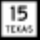
 State Highway 15State Highway 15 (Texas)State Highway 15, or SH 15, runs from the Texas-Oklahoma boundary 6 miles east of Follett to US 54 in Stratford.In 1955, SH 117 was redesignated as SH 15 for its entire route from the Texas/Oklahoma state line in Lipscomb County through the northeast Panhandle to an intersection with U.S. Highway...
 State Highway 51State Highway 51 (Texas)Texas State Highway 51 is a short state highway located entirely in Hansford County, Texas, just south of Spearman.-Route description:SH 51 begins at southeast of Spearman and travels east through unincorporated Hansford County approximately...
 State Highway 136
 State Highway 207
Adjacent counties
- Texas County, OklahomaTexas County, OklahomaTexas County is a county located in the U.S. state of Oklahoma. Texas County was formed at Oklahoma statehood from the central one-third of "Old Beaver County" also known as "No Man's Land"...
(north) - Ochiltree County (east)
- Roberts County (southeast)
- Hutchinson CountyHutchinson County, TexasHutchinson County is a county located in the U.S. state of Texas in the northern portion of the Texas Panhandle. In 2000, its population was 23,857. Its seat is Stinnett . Hutchinson County is named for Andrew Hutchinson, an early Texas attorney....
(south) - Sherman County (west)
Demographics
As of the censusCensus
A census is the procedure of systematically acquiring and recording information about the members of a given population. It is a regularly occurring and official count of a particular population. The term is used mostly in connection with national population and housing censuses; other common...
of 2000, there were 5,369 people, 2,005 households, and 1,489 families residing in the county. The population density
Population density
Population density is a measurement of population per unit area or unit volume. It is frequently applied to living organisms, and particularly to humans...
was 6 people per square mile (2/km²). There were 2,329 housing units at an average density of 2 per square mile (1/km²). The racial makeup of the county was 79.88% White
Race (United States Census)
Race and ethnicity in the United States Census, as defined by the Federal Office of Management and Budget and the United States Census Bureau, are self-identification data items in which residents choose the race or races with which they most closely identify, and indicate whether or not they are...
, 0.04% Black
Race (United States Census)
Race and ethnicity in the United States Census, as defined by the Federal Office of Management and Budget and the United States Census Bureau, are self-identification data items in which residents choose the race or races with which they most closely identify, and indicate whether or not they are...
or African American
Race (United States Census)
Race and ethnicity in the United States Census, as defined by the Federal Office of Management and Budget and the United States Census Bureau, are self-identification data items in which residents choose the race or races with which they most closely identify, and indicate whether or not they are...
, 0.75% Native American
Race (United States Census)
Race and ethnicity in the United States Census, as defined by the Federal Office of Management and Budget and the United States Census Bureau, are self-identification data items in which residents choose the race or races with which they most closely identify, and indicate whether or not they are...
, 0.22% Asian
Race (United States Census)
Race and ethnicity in the United States Census, as defined by the Federal Office of Management and Budget and the United States Census Bureau, are self-identification data items in which residents choose the race or races with which they most closely identify, and indicate whether or not they are...
, 17.47% from other races
Race (United States Census)
Race and ethnicity in the United States Census, as defined by the Federal Office of Management and Budget and the United States Census Bureau, are self-identification data items in which residents choose the race or races with which they most closely identify, and indicate whether or not they are...
, and 1.64% from two or more races. 31.48% of the population were Hispanic
Race (United States Census)
Race and ethnicity in the United States Census, as defined by the Federal Office of Management and Budget and the United States Census Bureau, are self-identification data items in which residents choose the race or races with which they most closely identify, and indicate whether or not they are...
or Latino
Race (United States Census)
Race and ethnicity in the United States Census, as defined by the Federal Office of Management and Budget and the United States Census Bureau, are self-identification data items in which residents choose the race or races with which they most closely identify, and indicate whether or not they are...
of any race.
There were 2,005 households out of which 36.90% had children under the age of 18 living with them, 65.00% were married couples
Marriage
Marriage is a social union or legal contract between people that creates kinship. It is an institution in which interpersonal relationships, usually intimate and sexual, are acknowledged in a variety of ways, depending on the culture or subculture in which it is found...
living together, 5.90% had a female householder with no husband present, and 25.70% were non-families. 24.00% of all households were made up of individuals and 12.40% had someone living alone who was 65 years of age or older. The average household size was 2.63 and the average family size was 3.14.
In the county, the population was spread out with 29.30% under the age of 18, 6.80% from 18 to 24, 26.30% from 25 to 44, 22.30% from 45 to 64, and 15.20% who were 65 years of age or older. The median age was 36 years. For every 100 females there were 96.50 males. For every 100 females age 18 and over, there were 96.40 males.
The median income for a household in the county was $35,438, and the median income for a family was $40,281. Males had a median income of $29,022 versus $17,668 for females. The per capita income
Per capita income
Per capita income or income per person is a measure of mean income within an economic aggregate, such as a country or city. It is calculated by taking a measure of all sources of income in the aggregate and dividing it by the total population...
for the county was $17,408. About 12.00% of families and 16.40% of the population were below the poverty line, including 22.60% of those under age 18 and 15.00% of those age 65 or over.
Native Americans
Artifacts of the Antelope Creek Indian culture abound along the Canadian valleyCanadian River
The Canadian River is the longest tributary of the Arkansas River. It is about long, starting in Colorado and traveling through New Mexico, the Texas Panhandle, and most of Oklahoma....
in Hutchinson County. Archaeologists have found 1300 acres (5.3 km²) of Alibates flint in the area that was used as a quarry for shaping flint tools. Nomadic Plains Apache
Plains Apache
The Plains Apache are a Southern Athabaskan group that traditionally live on the Southern Plains of North America and today are centered in Southwestern Oklahoma...
also camped in this area as did Comanche
Comanche
The Comanche are a Native American ethnic group whose historic range consisted of present-day eastern New Mexico, southern Colorado, northeastern Arizona, southern Kansas, all of Oklahoma, and most of northwest Texas. Historically, the Comanches were hunter-gatherers, with a typical Plains Indian...
, Arapaho
Arapaho
The Arapaho are a tribe of Native Americans historically living on the eastern plains of Colorado and Wyoming. They were close allies of the Cheyenne tribe and loosely aligned with the Sioux. Arapaho is an Algonquian language closely related to Gros Ventre, whose people are seen as an early...
, Kiowa
Kiowa
The Kiowa are a nation of American Indians and indigenous people of the Great Plains. They migrated from the northern plains to the southern plains in the late 17th century. In 1867, the Kiowa moved to a reservation in southwestern Oklahoma...
, and Cheyenne
Cheyenne
Cheyenne are a Native American people of the Great Plains, who are of the Algonquian language family. The Cheyenne Nation is composed of two united tribes, the Só'taeo'o and the Tsétsêhéstâhese .The Cheyenne are thought to have branched off other tribes of Algonquian stock inhabiting lands...
.
In 1873 English
England
England is a country that is part of the United Kingdom. It shares land borders with Scotland to the north and Wales to the west; the Irish Sea is to the north west, the Celtic Sea to the south west, with the North Sea to the east and the English Channel to the south separating it from continental...
brothers James Hamilton Cator and Arthur J. L. (Bob) Cator were sent by their father, British naval officer Captain John Bertie Cator, to Kansas
Kansas
Kansas is a US state located in the Midwestern United States. It is named after the Kansas River which flows through it, which in turn was named after the Kansa Native American tribe, which inhabited the area. The tribe's name is often said to mean "people of the wind" or "people of the south...
in search of financial opportunity. The brothers soon found their true calling as buffalo hunters
Buffalo Hunters' War
The Buffalo Hunters' War, or the Staked Plains War, occurred in 1877. Approximately 170 Comanche warriors and their families led by Black Horse left the Indian Territory in December, 1876, for the Llano Estacado of Texas...
and established an outpost along the North Palo Duro Creek. They named this camp Zulu, and it soon became known as Zulu Stockade.
The depletion of the buffalo herds led in part to the ongoing conflict between Indians and settlers.
The Second Battle of Adobe Walls
Second Battle of Adobe Walls
The Second Battle of Adobe Walls was fought on June 27, 1874 between Comanche forces and a group of twenty-eight U.S. bison hunters defending the settlement of Adobe Walls, Texas in what is now Hutchinson County, Texas.-Adobe Walls Settlement:...
took place in neighboring Hutchinson County
Hutchinson County, Texas
Hutchinson County is a county located in the U.S. state of Texas in the northern portion of the Texas Panhandle. In 2000, its population was 23,857. Its seat is Stinnett . Hutchinson County is named for Andrew Hutchinson, an early Texas attorney....
in 1874 and led to the Red River War of 1874-1875. A group of buffalo hunters attempted a revitalization of Fort Adobe. The Comanches, Cheyenne, Arapaho and Kiowa saw the fort and the decimation of the buffalo herd as a threat to their existence. Comanche medicine man Isa-tai
Isa-tai
Isa-tai was a Comanche warrior and medicine man of the Quahadi band. Originally named Quenatosavit , after the debacle at Adobe Walls he was known as Isa-tai which translates as "wolf's vulva" or "coyote vagina". Isa-tai gained enormous prominence for a brief period in 1873-74 as a prophet and...
prophesized a victory and immunity to the white man’s bullets in battle. Quanah Parker
Quanah Parker
Quanah Parker was a Comanche chief, a leader in the Native American Church, and the last leader of the powerful Quahadi band before they surrendered their battle of the Great Plains and went to a reservation in Indian Territory...
lead several hundred in a raid on the fort. The buffalo hunters were able to force the Indians into retreat. The Red River War
Red River War
The Red River War was a military campaign launched by the United States Army in 1874, as part of the Comanche War, to remove the Comanche, Kiowa, Southern Cheyenne, and Arapaho Native American tribes from the Southern Plains and forcibly relocate them to reservations in Indian Territory...
of 1874-1875 was a United States Army
United States Army
The United States Army is the main branch of the United States Armed Forces responsible for land-based military operations. It is the largest and oldest established branch of the U.S. military, and is one of seven U.S. uniformed services...
campaign to force the removal of Indians in Texas and their relocation to reservations, to open the region to white settlers.
County Established and Growth
The Texas legislature formed Hansford County in 1876 from YoungYoung County, Texas
As of the census of 2000, there were 17,943 people, 7,167 households, and 5,081 families residing in the county. The population density was 20 people per square mile . There were 8,504 housing units at an average density of 9 per square mile...
and Bexar
Bexar County, Texas
As of the census of 2000, there were 1,392,931 people, 488,942 households, and 345,681 families residing in the county. The population density was 1,117 people per square mile . There were 521,359 housing units at an average density of 418 per square mile...
counties. The county was organized in 1889. The town of Hansford
became the first county seat.
Early large ranches in Hansford County were spread in neighboring counties as well. By 1890 only twenty-three ranches were in operation in the county. In November 1876 Kansan Thomas Sherman Bugbee established the Quarter Circle T Ranch.
The Scissors Ranch was begun in 1878 by William E. Anderson at the Abobe Walls site. The ranch was named after the brand, which looked like a pair of scissors. Coloradan Richard E. McNalty moved to Texas and began the Turkey Track Ranch, which he sold to Charles Wood and Jack Snider in 1881. Scotland
Scotland
Scotland is a country that is part of the United Kingdom. Occupying the northern third of the island of Great Britain, it shares a border with England to the south and is bounded by the North Sea to the east, the Atlantic Ocean to the north and west, and the North Channel and Irish Sea to the...
born James M. Coburn formed the Hansford Land and Cattle Company. The Quarter Circle T. Ranch and Scissors Ranch were sold to Coburn in 1882. Coburn acquired the Turkey Track Ranch in 1883.
In 1887 Hansford became a stage stop on the old Tascosa-Dodge City Trail.
In 1909 Anders L. Mordt began to bring in Norwegian
Norwegians
Norwegians constitute both a nation and an ethnic group native to Norway. They share a common culture and speak the Norwegian language. Norwegian people and their descendants are found in migrant communities worldwide, notably in United States, Canada and Brazil.-History:Towards the end of the 3rd...
farmers to settle the northern part of the county, centering around a rural community they called Oslo.
By 1920, 221 farms and ranches had been established in the county. The same year, the North Texas and Santa Fe Railway built into Spearman
Spearman, Texas
Spearman is a city in Hansford County, Texas, in the United States. As of the 2010 census, the city population was 3,368. It is the county seat of Hansford County, and is known for its collection of windmills from the J.B. Buchanan windmill collection. The city was named for Thomas E...
.
By 1929, Spearman became the county seat. Chicago, Rock Island and Gulf Railway built southward in the 1920s leading to Gruver
Gruver, Texas
Gruver is a city in Hansford County, Texas, United States. The population was 1,162 at the 2000 census. Farwell, in the center of Hansford County about three miles east of what later became Gruver, was established in 1880 by the Canott family of Illinois and was the first town in the county...
, becoming the second largest town in the county. In 1931 the Santa Fe Railroad connected with the Rock Island, joining Morse
Morse, Texas
Morse is a census-designated place in Hansford County, Texas, United States. The population was 172 at the 2000 census.-Geography:Morse is located at ....
.
The county began to be connected by highways and farm roads, from the 1920s through the 1940s.
Oil was discovered in Hansford County in 1937. By the end of 1974 38279469 barrels (6,085,949,230.3 l) had been extracted from county lands since 1937. By the 1980s Hansford County had a diversified economy based on agriculture, oil, and transportation.