
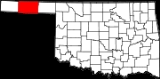
Texas County, Oklahoma
Encyclopedia
Texas County is a county located in the U.S. state
of Oklahoma
. Texas County was formed at Oklahoma statehood (16 November 1907) from the central one-third of "Old Beaver County" also known as "No Man's Land". When the formation of the county was authorized by the Constitutional Convention of 1907, the county was so named because it was wholly included within the limits of the Texas Cession of 1850, whereby the ownership of the area was passed from the State of Texas to the United States Government. From 1850 to 1890, its lands were never attached to any state or territory, never surveyed, and never divided into townships and sections. From 1890 to 1907, it was part of Beaver County
. In 2010, the population of Texas County was 20,640. Its county seat
is Guymon
.
, the county has a total area of 5,306 km² (2,049 mi²). 5,276 km² (2,037 mi²) of it is land and 30 km² (12 mi²) of it (0.57%) is water.
Texas County is one of four US counties to border the state with whom it shares its name (the others are Nevada County, California
, Delaware County, Pennsylvania
, and Ohio County, West Virginia
).
is a city-owned, public-use airport
located two nautical miles (3.7 km) west of the central business district
of City of Guymon
in Texas County.
of 2000, there were 20,107 people, 7,153 households, and 5,250 families residing in the county. The population density
was 4/km² (10/mi²). There were 8,014 housing units at an average density of 2/km² (4/mi²). The racial makeup of the county was 76.73% White
, 0.71% Black
or African American
, 1.24% Native American
, 0.56% Asian
, 0.10% Pacific Islander
, 18.11% from other races
, and 2.55% from two or more races. 29.86% of the population were Hispanic
or Latino
of any race.
There were 7,153 households out of which 39.00% had children under the age of 18 living with them, 61.50% were married couples
living together, 7.50% had a female householder with no husband present, and 26.60% were non-families. 21.20% of all households were made up of individuals and 8.20% had someone living alone who was 65 years of age or older. The average household size was 2.75 and the average family size was 3.19.
In the county, the population was spread out with 28.80% under the age of 18, 12.70% from 18 to 24, 29.10% from 25 to 44, 19.20% from 45 to 64, and 10.20% who were 65 years of age or older. The median age was 30 years. For every 100 females there were 105.90 males. For every 100 females age 18 and over, there were 106.90 males.
The median income for a household in the county was $35,872, and the median income for a family was $42,226. Males had a median income of $26,991 versus $20,404 for females. The per capita income
for the county was $15,692. About 10.20% of families and 14.10% of the population were below the poverty line, including 17.80% of those under age 18 and 7.40% of those age 65 or over.
:
U.S. state
A U.S. state is any one of the 50 federated states of the United States of America that share sovereignty with the federal government. Because of this shared sovereignty, an American is a citizen both of the federal entity and of his or her state of domicile. Four states use the official title of...
of Oklahoma
Oklahoma
Oklahoma is a state located in the South Central region of the United States of America. With an estimated 3,751,351 residents as of the 2010 census and a land area of 68,667 square miles , Oklahoma is the 28th most populous and 20th-largest state...
. Texas County was formed at Oklahoma statehood (16 November 1907) from the central one-third of "Old Beaver County" also known as "No Man's Land". When the formation of the county was authorized by the Constitutional Convention of 1907, the county was so named because it was wholly included within the limits of the Texas Cession of 1850, whereby the ownership of the area was passed from the State of Texas to the United States Government. From 1850 to 1890, its lands were never attached to any state or territory, never surveyed, and never divided into townships and sections. From 1890 to 1907, it was part of Beaver County
Beaver County, Oklahoma
Beaver County is a county located in the U.S. state of Oklahoma. As of the 2010 census, the population was 5,636. The county seat is Beaver....
. In 2010, the population of Texas County was 20,640. Its county seat
County seat
A county seat is an administrative center, or seat of government, for a county or civil parish. The term is primarily used in the United States....
is Guymon
Guymon, Oklahoma
Guymon is a city in and the county seat of Texas County, Oklahoma, United States. As of the 2010 census, the city population was 11,442, making it the largest city on the Oklahoma Panhandle. Corporate hog farms and cattle feedlots dominate its economy....
.
Geography
According to the U.S. Census BureauUnited States Census Bureau
The United States Census Bureau is the government agency that is responsible for the United States Census. It also gathers other national demographic and economic data...
, the county has a total area of 5,306 km² (2,049 mi²). 5,276 km² (2,037 mi²) of it is land and 30 km² (12 mi²) of it (0.57%) is water.
Adjacent counties
- Stevens County, KansasStevens County, KansasStevens County is a county located in the U.S. state of Kansas. As of the 2010 census, the county population was 5,724. Its county seat is Hugoton...
(north) - Seward County, KansasSeward County, KansasSeward County is a county of the U.S. state of Kansas. As of the 2010 census, the county population was 22,952. The largest city and county seat is Liberal...
(northeast) - Beaver County, OklahomaBeaver County, OklahomaBeaver County is a county located in the U.S. state of Oklahoma. As of the 2010 census, the population was 5,636. The county seat is Beaver....
(east) - Ochiltree County, Texas (southeast)
- Hansford County, TexasHansford County, TexasHansford County is a county located in the U.S. state of Texas. In 2010, its population was 5,613. The county is named for John M. Hansford, a Texas state congressman and judge. Hansford County is one of 30 prohibition, or entirely dry, counties in the state of Texas. Its seat is...
(south) - Sherman County, Texas (southwest)
- Cimarron County, OklahomaCimarron County, OklahomaCimarron County is a county located in the U.S. state of Oklahoma. Throughout most of its history it has had the smallest population and the lowest population density of any county in Oklahoma. As of 2010 census, the population was 2,475...
(west) - Morton County, KansasMorton County, KansasMorton County is a county located in the U.S. state of Kansas. As of the 2010 census, the county population was 3,233...
(northwest)
Texas County is one of four US counties to border the state with whom it shares its name (the others are Nevada County, California
Nevada County, California
Nevada County is a county located in the Sierra Nevada of California, in the Mother Lode country. As of 2010 its population was 98,764. The county seat is Nevada City.-History:Nevada County was created in 1851 from parts of Yuba County....
, Delaware County, Pennsylvania
Delaware County, Pennsylvania
Delaware County is a county located in the U.S. state of Pennsylvania. As of 2010, the population was 558,979, making it Pennsylvania's fifth most populous county, behind Philadelphia, Allegheny, Montgomery, and Bucks counties....
, and Ohio County, West Virginia
Ohio County, West Virginia
As of the census of 2000, there were 47,427 people, 19,733 households, and 12,155 families residing in the county. The population density was 447 people per square mile . There were 22,166 housing units at an average density of 209 per square mile...
).
Major highways
 U.S. Highway 54
 U.S. Highway 64
 U.S. Highway 412
 State Highway 3State Highway 3 (Oklahoma)State Highway 3, also abbreviated as SH-3 or OK-3, is a highway maintained by the U.S. state of Oklahoma. Traveling diagonally through Oklahoma, from the Panhandle to the far southeastern corner of the state, SH-3 is the longest state highway in the Oklahoma road system, at a total length of...
 State Highway 95
Airports
Guymon Municipal AirportGuymon Municipal Airport
Guymon Municipal Airport is a city-owned, public-use airport located two nautical miles west of the central business district of Guymon, a city in Texas County, Oklahoma, United States. As per the FAA's National Plan of Integrated Airport Systems for 2009-2013, it is classified as a general...
is a city-owned, public-use airport
Airport
An airport is a location where aircraft such as fixed-wing aircraft, helicopters, and blimps take off and land. Aircraft may be stored or maintained at an airport...
located two nautical miles (3.7 km) west of the central business district
Central business district
A central business district is the commercial and often geographic heart of a city. In North America this part of a city is commonly referred to as "downtown" or "city center"...
of City of Guymon
Guymon, Oklahoma
Guymon is a city in and the county seat of Texas County, Oklahoma, United States. As of the 2010 census, the city population was 11,442, making it the largest city on the Oklahoma Panhandle. Corporate hog farms and cattle feedlots dominate its economy....
in Texas County.
Demographics
As of the censusCensus
A census is the procedure of systematically acquiring and recording information about the members of a given population. It is a regularly occurring and official count of a particular population. The term is used mostly in connection with national population and housing censuses; other common...
of 2000, there were 20,107 people, 7,153 households, and 5,250 families residing in the county. The population density
Population density
Population density is a measurement of population per unit area or unit volume. It is frequently applied to living organisms, and particularly to humans...
was 4/km² (10/mi²). There were 8,014 housing units at an average density of 2/km² (4/mi²). The racial makeup of the county was 76.73% White
Race (United States Census)
Race and ethnicity in the United States Census, as defined by the Federal Office of Management and Budget and the United States Census Bureau, are self-identification data items in which residents choose the race or races with which they most closely identify, and indicate whether or not they are...
, 0.71% Black
Race (United States Census)
Race and ethnicity in the United States Census, as defined by the Federal Office of Management and Budget and the United States Census Bureau, are self-identification data items in which residents choose the race or races with which they most closely identify, and indicate whether or not they are...
or African American
Race (United States Census)
Race and ethnicity in the United States Census, as defined by the Federal Office of Management and Budget and the United States Census Bureau, are self-identification data items in which residents choose the race or races with which they most closely identify, and indicate whether or not they are...
, 1.24% Native American
Race (United States Census)
Race and ethnicity in the United States Census, as defined by the Federal Office of Management and Budget and the United States Census Bureau, are self-identification data items in which residents choose the race or races with which they most closely identify, and indicate whether or not they are...
, 0.56% Asian
Race (United States Census)
Race and ethnicity in the United States Census, as defined by the Federal Office of Management and Budget and the United States Census Bureau, are self-identification data items in which residents choose the race or races with which they most closely identify, and indicate whether or not they are...
, 0.10% Pacific Islander
Race (United States Census)
Race and ethnicity in the United States Census, as defined by the Federal Office of Management and Budget and the United States Census Bureau, are self-identification data items in which residents choose the race or races with which they most closely identify, and indicate whether or not they are...
, 18.11% from other races
Race (United States Census)
Race and ethnicity in the United States Census, as defined by the Federal Office of Management and Budget and the United States Census Bureau, are self-identification data items in which residents choose the race or races with which they most closely identify, and indicate whether or not they are...
, and 2.55% from two or more races. 29.86% of the population were Hispanic
Race (United States Census)
Race and ethnicity in the United States Census, as defined by the Federal Office of Management and Budget and the United States Census Bureau, are self-identification data items in which residents choose the race or races with which they most closely identify, and indicate whether or not they are...
or Latino
Race (United States Census)
Race and ethnicity in the United States Census, as defined by the Federal Office of Management and Budget and the United States Census Bureau, are self-identification data items in which residents choose the race or races with which they most closely identify, and indicate whether or not they are...
of any race.
There were 7,153 households out of which 39.00% had children under the age of 18 living with them, 61.50% were married couples
Marriage
Marriage is a social union or legal contract between people that creates kinship. It is an institution in which interpersonal relationships, usually intimate and sexual, are acknowledged in a variety of ways, depending on the culture or subculture in which it is found...
living together, 7.50% had a female householder with no husband present, and 26.60% were non-families. 21.20% of all households were made up of individuals and 8.20% had someone living alone who was 65 years of age or older. The average household size was 2.75 and the average family size was 3.19.
In the county, the population was spread out with 28.80% under the age of 18, 12.70% from 18 to 24, 29.10% from 25 to 44, 19.20% from 45 to 64, and 10.20% who were 65 years of age or older. The median age was 30 years. For every 100 females there were 105.90 males. For every 100 females age 18 and over, there were 106.90 males.
The median income for a household in the county was $35,872, and the median income for a family was $42,226. Males had a median income of $26,991 versus $20,404 for females. The per capita income
Per capita income
Per capita income or income per person is a measure of mean income within an economic aggregate, such as a country or city. It is calculated by taking a measure of all sources of income in the aggregate and dividing it by the total population...
for the county was $15,692. About 10.20% of families and 14.10% of the population were below the poverty line, including 17.80% of those under age 18 and 7.40% of those age 65 or over.
Towns
- GoodwellGoodwell, OklahomaAs of the census of 2000, there were 1,192 people, 407 households, and 221 families residing in the town. The population density was 1,003.8 people per square mile . There were 478 housing units at an average density of 402.5 per square mile...
- HardestyHardesty, OklahomaHardesty is a town in Texas County, Oklahoma, in the United States. As of the 2010 census, the town population was 212.-Geography:Hardesty is located at .According to the town has a total area of , all of it land.-Demographics:...
- OptimaOptima, OklahomaOptima is a town in Texas County, Oklahoma, United States. The population was 356 at the 2010 census.-Geography:Optima is located at .According to the United States Census Bureau, the town has a total area of , all of it land....
- TexhomaTexhoma, OklahomaTexhoma is a town in Texas County, Oklahoma, United States. The population was 926 at the 2010 census. Founded around the Rock Island Railroad laying tracks through the area, much of the town's local economy is from ranching and livestock...
- TyroneTyrone, OklahomaTyrone is a town in Texas County, Oklahoma, United States. The population was 762 at the 2010 census.-Geography:Tyrone is located at .According to the United States Census Bureau, the town has a total area of , all land.-Demographics:...
Unincorporated communities
- AdamsAdams, OklahomaAdams is a rural unincorporated community in Texas County, Oklahoma, United States. The post office opened June 14, 1930. The ZIP Code is 73901. The community was named for Jesse L. Adams, engineer for the Rock Island Railroad.-Further reading:...
- BakerBaker, OklahomaBaker is a small rural unincorporated community in northeastern Texas County, Oklahoma, United States, ¼ mile north of U.S. Route 64. Originally named Bakerburg, the post office opened June 5, 1931. The name was changed to Baker August 15, 1953. The ZIP Code is 73950. The community is said to have...
- EvaEva, OklahomaEva is an unincorporated community in Texas County, Oklahoma, United States. It is located along State Highway 95. Four Corners is to the south....
- HoughHough, OklahomaHough is a small unincorporated rural community in Texas County, Oklahoma, United States. The townsite was officially platted on July 20, 1928. The Hough Woodframe Elevator is on the National Register of Historic Places.-Further reading:...
NRHP sites
The following sites in Texas County are listed on the National Register of Historic PlacesNational Register of Historic Places
The National Register of Historic Places is the United States government's official list of districts, sites, buildings, structures, and objects deemed worthy of preservation...
:
|