
Gravesham
Encyclopedia
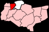
Gravesham is a local government district
and borough
in North West Kent
, England
. It has borders with the River Thames
to the north; the City of Rochester and Medway
to the east; the borough of Tonbridge and Malling
(to the south); and the boroughs of Sevenoaks
and Dartford
to the west.
Its council is based at the Town Hall in Gravesend
, and the borough shares similar borders with the Gravesham constituency
. As well as the parishes listed below, the area of the former urban district
of Northfleet
was also included in the borough when it was formed in 1974 under the Local Government Act 1972
. It is the successor to the Gravesend Municipal Borough
, Northfleet Urban District
, and part of Strood
Rural District
. Gravesham is twinned with Cambrai
.
s being elected at each election. From the first election in 1973 the council has alternated between Labour
and Conservative
control. Since 1995 Labour has controlled the council apart from 4 years between the 2007
and 2011 elections
. As of the 2011 election the council is composed of the following councillors:-
There are eighteen wards
represented on the Borough Council:
see also List of civil parishes in Kent
Non-metropolitan district
Non-metropolitan districts, or colloquially shire districts, are a type of local government district in England. As created, they are sub-divisions of non-metropolitan counties in a so-called "two-tier" arrangement...
and borough
Borough
A borough is an administrative division in various countries. In principle, the term borough designates a self-governing township although, in practice, official use of the term varies widely....
in North West Kent
Kent
Kent is a county in southeast England, and is one of the home counties. It borders East Sussex, Surrey and Greater London and has a defined boundary with Essex in the middle of the Thames Estuary. The ceremonial county boundaries of Kent include the shire county of Kent and the unitary borough of...
, England
England
England is a country that is part of the United Kingdom. It shares land borders with Scotland to the north and Wales to the west; the Irish Sea is to the north west, the Celtic Sea to the south west, with the North Sea to the east and the English Channel to the south separating it from continental...
. It has borders with the River Thames
River Thames
The River Thames flows through southern England. It is the longest river entirely in England and the second longest in the United Kingdom. While it is best known because its lower reaches flow through central London, the river flows alongside several other towns and cities, including Oxford,...
to the north; the City of Rochester and Medway
Medway
Medway is a conurbation and unitary authority in South East England. The Unitary Authority was formed in 1998 when the City of Rochester-upon-Medway amalgamated with Gillingham Borough Council and part of Kent County Council to form Medway Council, a unitary authority independent of Kent County...
to the east; the borough of Tonbridge and Malling
Tonbridge and Malling
Tonbridge and Malling is a local government district and borough in the English county of Kent.Tonbridge and Malling borough covers an area from the North Downs at Burham and Snodland in the north to the town of Tonbridge in the south...
(to the south); and the boroughs of Sevenoaks
Sevenoaks (district)
Sevenoaks is a local government district covering the western most part of Kent in England. Its council is based in the town of Sevenoaks. It was formed on 1 April 1974, under the Local Government Act 1972, by a merger of the Sevenoaks Urban District, Sevenoaks Rural District and part of Dartford...
and Dartford
Dartford (borough)
Dartford is the name given to a local government district and borough in north west Kent, England, which takes its name from its administrative capital. It borders Thurrock, to the north across the River Thames; to the west lies the London Borough of Bexley; to the south Sevenoaks district; and the...
to the west.
Its council is based at the Town Hall in Gravesend
Gravesend, Kent
Gravesend is a town in northwest Kent, England, on the south bank of the Thames, opposite Tilbury in Essex. It is the administrative town of the Borough of Gravesham and, because of its geographical position, has always had an important role to play in the history and communications of this part of...
, and the borough shares similar borders with the Gravesham constituency
Gravesham (UK Parliament constituency)
Gravesham is a county constituency represented in the House of Commons of the Parliament of the United Kingdom. It elects one Member of Parliament by the first past the post system of election...
. As well as the parishes listed below, the area of the former urban district
Urban district
In the England, Wales and Ireland, an urban district was a type of local government district that covered an urbanised area. Urban districts had an elected Urban District Council , which shared local government responsibilities with a county council....
of Northfleet
Northfleet
Northfleet is a town in the Borough of Gravesham in Kent, England. Its name is derived from North creek , and the settlement on the shore of the River Thames adjacent to Gravesend was known as Norfluet in the Domesday Book, and Northflet in 1201...
was also included in the borough when it was formed in 1974 under the Local Government Act 1972
Local Government Act 1972
The Local Government Act 1972 is an Act of Parliament in the United Kingdom that reformed local government in England and Wales on 1 April 1974....
. It is the successor to the Gravesend Municipal Borough
Municipal borough
Municipal boroughs were a type of local government district which existed in England and Wales between 1835 and 1974, in Northern Ireland from 1840 to 1973 and in the Republic of Ireland from 1840 to 2002...
, Northfleet Urban District
Urban district
In the England, Wales and Ireland, an urban district was a type of local government district that covered an urbanised area. Urban districts had an elected Urban District Council , which shared local government responsibilities with a county council....
, and part of Strood
Strood
Strood is a town in the unitary authority of Medway in South East England. It is part of the ceremonial county of Kent. It lies on the north west bank of the River Medway at its lowest bridging point, and is part of the Rochester post town....
Rural District
Rural district
Rural districts were a type of local government area – now superseded – established at the end of the 19th century in England, Wales, and Ireland for the administration of predominantly rural areas at a level lower than that of the administrative counties.-England and Wales:In England...
. Gravesham is twinned with Cambrai
Cambrai
Cambrai is a commune in the Nord department in northern France. It is a sub-prefecture of the department.Cambrai is the seat of an archdiocese whose jurisdiction was immense during the Middle Ages. The territory of the Bishopric of Cambrai, roughly coinciding with the shire of Brabant, included...
.
Name
Robert H Hiscock, Chairman of the Gravesend Historical Society, in the foreword to his book, 'A History of Gravesend' (Phillimore, 1976) wrote:- "The name Gravesham appears only in the Domesday BookDomesday BookDomesday Book , now held at The National Archives, Kew, Richmond upon Thames in South West London, is the record of the great survey of much of England and parts of Wales completed in 1086...
, 1086, and was probably the error of a Norman scribe. It was 'Gravesend' in the Domesday Monarchorum c.1100, and 'Gravesende' in the Textus RoffensisTextus RoffensisThe Textus Roffensis, or in full, Textus de Ecclesia Roffensi per Ernulphum episcopum , refers to a manuscript in which two originally separate manuscripts written about the same time, between 1122 and 1124, are bound together...
c.1100. It is strange that this "clerical error" should now have been adopted as the name of the new Council".
Governance
Gravesham Borough Council is elected every four years, with currently 44 councillorCouncillor
A councillor or councilor is a member of a local government council, such as a city council.Often in the United States, the title is councilman or councilwoman.-United Kingdom:...
s being elected at each election. From the first election in 1973 the council has alternated between Labour
Labour Party (UK)
The Labour Party is a centre-left democratic socialist party in the United Kingdom. It surpassed the Liberal Party in general elections during the early 1920s, forming minority governments under Ramsay MacDonald in 1924 and 1929-1931. The party was in a wartime coalition from 1940 to 1945, after...
and Conservative
Conservative Party (UK)
The Conservative Party, formally the Conservative and Unionist Party, is a centre-right political party in the United Kingdom that adheres to the philosophies of conservatism and British unionism. It is the largest political party in the UK, and is currently the largest single party in the House...
control. Since 1995 Labour has controlled the council apart from 4 years between the 2007
Gravesham Council election, 2003
The 2003 Gravesham Council election took place on 1 May 2003 to elect members of Gravesham Borough Council in Kent, England. The whole council was up for election with boundary changes since the last election in 1999. The Labour party stayed in overall control of the council.-Election...
and 2011 elections
Gravesham Council election, 2011
The 2011 Gravesham Council election took place on 5 May 2011 to elect members of Gravesham Borough Council in Kent, England. The whole council was up for election and the Labour party gained overall control of the council from the Conservative party....
. As of the 2011 election the council is composed of the following councillors:-
| Party | Councillors |
|
| Labour Party Labour Party (UK) The Labour Party is a centre-left democratic socialist party in the United Kingdom. It surpassed the Liberal Party in general elections during the early 1920s, forming minority governments under Ramsay MacDonald in 1924 and 1929-1931. The party was in a wartime coalition from 1940 to 1945, after... |
25 | |
| Conservative Party Conservative Party (UK) The Conservative Party, formally the Conservative and Unionist Party, is a centre-right political party in the United Kingdom that adheres to the philosophies of conservatism and British unionism. It is the largest political party in the UK, and is currently the largest single party in the House... |
19 | |
There are eighteen wards
Wards of the United Kingdom
A ward in the United Kingdom is an electoral district at sub-national level represented by one or more councillors. It is the primary unit of British administrative and electoral geography .-England:...
represented on the Borough Council:
- Those serving Gravesend town:
- Central
- Pelham
- Riverside
- Singlewell
- Whitehill
- Woodlands
- Other urban areas:
- NorthfleetNorthfleetNorthfleet is a town in the Borough of Gravesham in Kent, England. Its name is derived from North creek , and the settlement on the shore of the River Thames adjacent to Gravesend was known as Norfluet in the Domesday Book, and Northflet in 1201...
(2 wards - North & South) - Coldharbour
- Istead Rise
- Painters Ash
- Riverview
- Westcourt
- Northfleet
- Outlying villages:
- ChalkChalk, KentChalk is a village lying east of Gravesend, Kent, England, part of the town area. The name comes from the Saxon word cealc meaning a chalkstone....
- HighamHigham, KentHigham is a small village bordering the Hoo Peninsula, in Kent, between Gravesend and Rochester. The civil parish of Higham is in Gravesham district and as at the 2001 UK Census, had a population of 3,938.-History:...
- MeophamMeophamMeopham is a large linear village and civil parish in the Borough of Gravesham and ceremonial county of Kent, in England, and lies to the south of Gravesend. The parish covers , and comprises two villages and two smaller settlements; it has a population of 6,427...
: (2 wards - North & South) - Nurstead
- ShorneShorneShorne is a village and civil parish in the Gravesham District of Kent, England. The parish is located to the south-east of Gravesend; the village is three miles from the town....
, CobhamCobham, KentCobham is a village and civil parish in the Gravesham District of Kent, England. It is located south of Watling Street, the old road from Dover to London, six miles south-east of Gravesend. The hamlet of Sole Street lies within the parish, which covers an area of 1,240 ha and has a population of...
& LuddesdownLuddesdownLuddesdown is a civil parish in the Gravesham District of Kent, England. This very rural parish, forming part of the North Downs Area of Outstanding Natural Beauty, is located in a dry valley to the south of Gravesend and is named after a scattered group of houses and farms around Luddesdown... - VigoVigo, KentVigo is a civil parish, formed in 2000, and modern rural village, built in the mid-20th century at the extreme southern boundary of the Borough of Gravesham in Kent, England. It has a population of 2,201. The village lies at the top of the North Downs, east of the road between Gravesend and Wrotham...
is part of the MeophamMeophamMeopham is a large linear village and civil parish in the Borough of Gravesham and ceremonial county of Kent, in England, and lies to the south of Gravesend. The parish covers , and comprises two villages and two smaller settlements; it has a population of 6,427...
South ward
- Chalk
see also List of civil parishes in Kent