
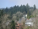
Goose Hollow, Portland, Oregon
Encyclopedia
Goose Hollow is a neighborhood in southwest Portland, Oregon
. It acquired its distinctive name through early residents’ practice of letting their geese
run free near the wooded ravine in the Tualatin Mountains
now known as the Tanner Creek Canyon and in the now infilled Tanner Creek Gulch. Tanner Creek Gulch was a 20-block long, 50 feet (15.2 m) deep gulch (or hollow) that started around SW 16th and Jefferson and carried the waters of Tanner Creek into Couch Lake (now the site of Old Town/Chinatown and the Pearl District). Over a century ago, Tanner Creek was buried 50 feet (15.2 m) underground (where it still drains the West Hills), and the Tanner Creek Gulch was infilled. Thus, the only remaining part of the hollow is the ravine carved out by Tanner Creek through which Highway 26
passes and which the Vista Bridge
spans (also called the Vista Viaduct). The Goose Hollow name had gone out of common usage for several decades until former mayor Bud Clark named his pub The Goose Hollow Inn in 1967 in an effort to "rekindle civic regard for the neighborhood."
, Arlington Heights
, the Pearl District, the Hillside neighborhood
, and Washington Park. Jeld-Wen Field and Lincoln High School, the oldest high school in the Pacific Northwest
, are located in Goose Hollow.
Areas included within the Goose Hollow neighborhood are King's Hill, Vista Ridge, Gander Ridge, and the historic boundaries of Goose Hollow, in the flats near the path of Tanner Creek. King's Hill is separated from Vista Ridge by the Tanner Creek Canyon spanned by the Vista Bridge. Vista Ridge (where the Vista Ridge Tunnels
are located) is separated from Gander Ridge by Cable Car Canyon. From 1890 to 1905 a steep and enormous trestle bridge passed through this canyon, carrying cable cars up to Portland Heights. The neighborhood boundaries range (north/south) from Burnside Street to the low slopes of the West Hills (officially known as the Tualatin Mountains
) and (east/west) from I-405 to Washington Park.
and Goose Hollow/SW Jefferson St
stations. Goose Hollow is also served by two major freeways: Interstate 405
(which divides it from Downtown Portland) and U.S. Route 26 (which passes under and through part of the neighborhood through the Vista Ridge Tunnels
).
Portland, Oregon
Portland is a city located in the Pacific Northwest, near the confluence of the Willamette and Columbia rivers in the U.S. state of Oregon. As of the 2010 Census, it had a population of 583,776, making it the 29th most populous city in the United States...
. It acquired its distinctive name through early residents’ practice of letting their geese
Goose
The word goose is the English name for a group of waterfowl, belonging to the family Anatidae. This family also includes swans, most of which are larger than true geese, and ducks, which are smaller....
run free near the wooded ravine in the Tualatin Mountains
Tualatin Mountains
The Tualatin Mountains are a range of hills on the western border of Multnomah County, Oregon, United States...
now known as the Tanner Creek Canyon and in the now infilled Tanner Creek Gulch. Tanner Creek Gulch was a 20-block long, 50 feet (15.2 m) deep gulch (or hollow) that started around SW 16th and Jefferson and carried the waters of Tanner Creek into Couch Lake (now the site of Old Town/Chinatown and the Pearl District). Over a century ago, Tanner Creek was buried 50 feet (15.2 m) underground (where it still drains the West Hills), and the Tanner Creek Gulch was infilled. Thus, the only remaining part of the hollow is the ravine carved out by Tanner Creek through which Highway 26
U.S. Route 26 in Oregon
In the U.S. state of Oregon, U.S. Route 26 is a major cross-state state highway, connecting U.S. Route 101 on the Oregon Coast near Seaside with the Idaho state line east of Nyssa. Local highway names include the Sunset Highway No. 47, Mount Hood Highway No. 26, and John Day Highway No...
passes and which the Vista Bridge
Vista Bridge
The Vista Bridge is an arch bridge for vehicles and pedestrians located in Portland, Oregon, United States. It connects the areas of King's Hill and Vista Ridge which are both in the Goose Hollow neighborhood...
spans (also called the Vista Viaduct). The Goose Hollow name had gone out of common usage for several decades until former mayor Bud Clark named his pub The Goose Hollow Inn in 1967 in an effort to "rekindle civic regard for the neighborhood."
Location
Goose Hollow is adjacent to Downtown PortlandDowntown Portland
Downtown Portland, the city center of Portland, Oregon, United States, is located on the west bank of the Willamette River. It is in the northeastern corner of the southwest section of the city and is where most of the city's high-rise buildings are found....
, Arlington Heights
Arlington Heights, Portland, Oregon
Arlington Heights is a neighborhood in Portland of grand houses and some of the city’s most renowned parks, such as the Japanese Garden.-Elementary Schools:Ainsworth Elementary School2425 SW Vista Dr.- Parks :...
, the Pearl District, the Hillside neighborhood
Hillside, Portland, Oregon
Hillside is a Northwest Portland neighborhood in the city's West Hills. It is anchored by the Hillside Community Center, the former site of Catlin Gabel School, which was designed by noted architect Pietro Belluschi. The center features neighborhood meeting spaces, a soccer field and a basketball...
, and Washington Park. Jeld-Wen Field and Lincoln High School, the oldest high school in the Pacific Northwest
Pacific Northwest
The Pacific Northwest is a region in northwestern North America, bounded by the Pacific Ocean to the west and, loosely, by the Rocky Mountains on the east. Definitions of the region vary and there is no commonly agreed upon boundary, even among Pacific Northwesterners. A common concept of the...
, are located in Goose Hollow.
Areas included within the Goose Hollow neighborhood are King's Hill, Vista Ridge, Gander Ridge, and the historic boundaries of Goose Hollow, in the flats near the path of Tanner Creek. King's Hill is separated from Vista Ridge by the Tanner Creek Canyon spanned by the Vista Bridge. Vista Ridge (where the Vista Ridge Tunnels
Vista Ridge Tunnels
The Vista Ridge Tunnels are highway tunnels through the Tualatin Mountains of Portland, Oregon, USA through a hillside locally known as Vista Ridge which is a half mile west of downtown Portland. Sunset Highway, also known as U.S. Route 26, is carried through the tunnels, three lanes in each...
are located) is separated from Gander Ridge by Cable Car Canyon. From 1890 to 1905 a steep and enormous trestle bridge passed through this canyon, carrying cable cars up to Portland Heights. The neighborhood boundaries range (north/south) from Burnside Street to the low slopes of the West Hills (officially known as the Tualatin Mountains
Tualatin Mountains
The Tualatin Mountains are a range of hills on the western border of Multnomah County, Oregon, United States...
) and (east/west) from I-405 to Washington Park.
Points of interest
The MAX Light Rail system travels through the neighborhood, stopping at the Jeld-Wen Field, Kings Hill/SW SalmonKings Hill/Southwest Salmon (MAX station)
The Kings Hill/SW Salmon station is a light rail station on the MAX Blue and Red lines in the Goose Hollow neighborhood of Portland, Oregon. Its name refers to its proximity to the King's Hill Historic District, but it is not located within that district, the easternmost boundary of which is at SW...
and Goose Hollow/SW Jefferson St
Goose Hollow/Southwest Jefferson Street (MAX station)
Goose Hollow/SW Jefferson Street is a light rail station on the MAX Blue Line and Red Line in the Goose Hollow neighborhood of Portland, Oregon...
stations. Goose Hollow is also served by two major freeways: Interstate 405
Interstate 405 (Oregon)
Interstate 405 is a short Interstate Highway in Portland, Oregon. It forms a loop from Interstate 5 that travels through downtown Portland west of the Willamette River.-Route description:...
(which divides it from Downtown Portland) and U.S. Route 26 (which passes under and through part of the neighborhood through the Vista Ridge Tunnels
Vista Ridge Tunnels
The Vista Ridge Tunnels are highway tunnels through the Tualatin Mountains of Portland, Oregon, USA through a hillside locally known as Vista Ridge which is a half mile west of downtown Portland. Sunset Highway, also known as U.S. Route 26, is carried through the tunnels, three lanes in each...
).
External links
- Map, Goose Hollow neighborhood association
- Guide to Goose Hollow Neighborhood (PortlandNeighborhood.com)
- Jefferson Street Property - 1.6 acres (6,475 m²) natural area, acquired by Portland Parks & RecreationPortland Parks & RecreationPortland Parks & Recreation is the bureau of the City of Portland which protects the parks, natural areas, recreational facilities, gardens, and trails of the city of Portland, Oregon....
in 1995 - Goose Hollow Light Rail Station Community: Urban Design Plan and Comprehensive Plan (PDF maps, 1996)