
Giruá
Encyclopedia
| Map | |
|---|---|
 |
|
| Statistics | |
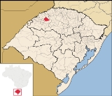
| State: | Rio Grande do Sul Rio Grande do Sul Rio Grande do Sul is the southernmost state in Brazil, and the state with the fifth highest Human Development Index in the country. In this state is located the southernmost city in the country, Chuí, on the border with Uruguay. In the region of Bento Gonçalves and Caxias do Sul, the largest wine... |
| Meso-region: | Westcentral Rio Grande do Sul (Centro Ocidental Rio-Grandense) Centro Ocidental Rio-Grandense The Centro Ocidental Rio-Grandense is one of the seven meso-regions of the state of Rio Grande do Sul in Brazil. It consists of the union of 31 municipalities, grouped in three microregions.-Microrregions:* Restinga Seca* Santa Maria* Santiago... |
| Micro-Region: | Santiago |
| Anniversary: | January 28, 1955 |
| Founded: | January 28, 1955 |
| Nicknames: | Productivity Capital |
| Location Location (geography) The terms location and place in geography are used to identify a point or an area on the Earth's surface or elsewhere. The term 'location' generally implies a higher degree of can certainty than "place" which often has an ambiguous boundary relying more on human/social attributes of place identity... : |
28.026/28° 1' 40" S lat. 54.35/54° 21' W long. |
| Postal code: | 98870-xxx |
| Name of inhabitants: | Giruaense |
| Distance from the capital: | 474 km |
| Website: | www.pmgirua.rs.gov.br |
Giruá is a municipality
Municipality
A municipality is essentially an urban administrative division having corporate status and usually powers of self-government. It can also be used to mean the governing body of a municipality. A municipality is a general-purpose administrative subdivision, as opposed to a special-purpose district...
of the western part of the state of Rio Grande do Sul
Rio Grande do Sul
Rio Grande do Sul is the southernmost state in Brazil, and the state with the fifth highest Human Development Index in the country. In this state is located the southernmost city in the country, Chuí, on the border with Uruguay. In the region of Bento Gonçalves and Caxias do Sul, the largest wine...
, Brazil
Brazil
Brazil , officially the Federative Republic of Brazil , is the largest country in South America. It is the world's fifth largest country, both by geographical area and by population with over 192 million people...
. The last part of the origin of the name comes from the Tupi language. It is located 474 km west of the state capital of Porto Alegre
Porto Alegre
Porto Alegre is the tenth most populous municipality in Brazil, with 1,409,939 inhabitants, and the centre of Brazil's fourth largest metropolitan area . It is also the capital city of the southernmost Brazilian state of Rio Grande do Sul. The city is the southernmost capital city of a Brazilian...
, northeast of Alegrete
Alegrete
Alegrete is a town and a municipality in Rio Grande do Sul located in southern Brazil. Its medium altitude is 102 m. Its estimated population in 2008 was 78,984 inhabitants and the total area is 7,803.967 km² . Its inhabitants are called Alegretenses.Alegrete was settled in 1816 and became a...
.
Bounding municipalities
- Santa RosaSanta Rosa, Rio Grande do SulSanta Rosa is a town in the Brazilian state of Rio Grande do Sul, located at latitude 27º52'15" and longitude 54º28'53" at a height of 277 meters above sea level. It has an area of 488.42 km²...
- Três de MaioTrês de MaioTrês de Maio is a Brazilian municipality in the state of Rio Grande do Sul. It is located at .It has an area of 424,26 km². It is located 343 m over sea level. As of 2004 its population was 24,211 inhabitants. Its climate is mild with temperatures of 20°C to 35°C in summer and 0 to 15°C ...
- IndependênciaIndependência, Rio Grande do SulIndependência is a municipality of the western part of the state of Rio Grande do Sul, Brazil. Its population was 7,214 in 2003. Its elevation is at .-Bounding municipalities:*Três de Maio*Alegria*Inhacorá*Catuípe*Giruá-External links:...
- CatuípeCatuípeCatuípe is a municipality of the western part of the state of Rio Grande do Sul, Brazil. Its nickname is known as the Land of Spring Water in which its springs are located around the municipality. The origin of the name comes from the Tupi language...
- Santo ÂngeloSanto ÂngeloSanto Ângelo is a city located in northwestern Rio Grande do Sul state, Brazil. City population is about 76,304 inhabitants and the total area of the municipality is about 677 km²...
- Sete de SetembroSete de SetembroSete de Setembro is a municipality in the state Rio Grande do Sul, Brazil.-See also:*List of municipalities in Rio Grande do Sul...
- Senador Salgado FilhoSenador Salgado FilhoSenador Salgado Filho is a municipality of the western part of the state of Rio Grande do Sul, Brazil. It is located 492 km west of the state capital of Porto Alegre, northeast of Alegrete and east of Argentina.-Bounding municipalities:*Santa Rosa*Giruá...
Information
It is situated in a volcanic-rich soil. Girua is mainly based in agriculture and manufacturing in its economy. It has a large soy production in which it receives its nickname, the Capital of Production. CornMaize
Maize known in many English-speaking countries as corn or mielie/mealie, is a grain domesticated by indigenous peoples in Mesoamerica in prehistoric times. The leafy stalk produces ears which contain seeds called kernels. Though technically a grain, maize kernels are used in cooking as a vegetable...
, wheat
Wheat
Wheat is a cereal grain, originally from the Levant region of the Near East, but now cultivated worldwide. In 2007 world production of wheat was 607 million tons, making it the third most-produced cereal after maize and rice...
, oats
OATS
OATS - Open Source Assistive Technology Software - is a source code repository or "forge" for assistive technology software. It was launched in 2006 with the goal to provide a one-stop “shop” for end users, clinicians and open-source developers to promote and develop open source assistive...
and other crops are the main production of the municipality.
Situated in the Missões
Missões
Missões or Missões do Uruguai is the region located in the Northwestern part of the Brazilian state of Rio Grande do Sul, close to the border between Brazil and Argentina....
region. Giruá was first inhabited by the Indians known as the Guaranis. Its vegetation is the most peculiar in Rio Grande do Sul. The first name of the city was Jerivá.
It received Europe
Europe
Europe is, by convention, one of the world's seven continents. Comprising the westernmost peninsula of Eurasia, Europe is generally 'divided' from Asia to its east by the watershed divides of the Ural and Caucasus Mountains, the Ural River, the Caspian and Black Seas, and the waterways connecting...
an immigration and the name of the city was changed to Giruá. Lithuania
Lithuania
Lithuania , officially the Republic of Lithuania is a country in Northern Europe, the biggest of the three Baltic states. It is situated along the southeastern shore of the Baltic Sea, whereby to the west lie Sweden and Denmark...
ns, Swedes
Sweden
Sweden , officially the Kingdom of Sweden , is a Nordic country on the Scandinavian Peninsula in Northern Europe. Sweden borders with Norway and Finland and is connected to Denmark by a bridge-tunnel across the Öresund....
and Germans
Germans
The Germans are a Germanic ethnic group native to Central Europe. The English term Germans has referred to the German-speaking population of the Holy Roman Empire since the Late Middle Ages....
and other Europeans had difficulty pronouncing the name Jerivá, and they begin to pronounced as Giruá, the current name.
Girua Online
The prefecture attracts the information sector created and maintained the city's website www.pmgirua.com.br, with news on the city, photos, data, information and other diverse contents.External links
- http://www.citybrazil.com.br/rs/girua/
- Map and Aerial photos:
- Coordinates: 28°1′40"S 54°21′0"W
- Street maps: Street map from Mapquest, MapPoint or Google
- Satellite images and Aerial photos: Google