
Independência, Rio Grande do Sul
Encyclopedia
| Map | |
|---|---|
 |
|
| Statistics | |
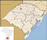
| State: | Rio Grande do Sul Rio Grande do Sul Rio Grande do Sul is the southernmost state in Brazil, and the state with the fifth highest Human Development Index in the country. In this state is located the southernmost city in the country, Chuí, on the border with Uruguay. In the region of Bento Gonçalves and Caxias do Sul, the largest wine... |
| Meso-region: | Westcentral Rio Grande do Sul (Centro Ocidental Rio-Grandense) Centro Ocidental Rio-Grandense The Centro Ocidental Rio-Grandense is one of the seven meso-regions of the state of Rio Grande do Sul in Brazil. It consists of the union of 31 municipalities, grouped in three microregions.-Microrregions:* Restinga Seca* Santa Maria* Santiago... |
| Micro-Region: | Santa Rosa |
| Founded: | October 23, 1965 |
| Location Location (geography) The terms location and place in geography are used to identify a point or an area on the Earth's surface or elsewhere. The term 'location' generally implies a higher degree of can certainty than "place" which often has an ambiguous boundary relying more on human/social attributes of place identity... : |
27.833/27° 50" S lat. 54.1899/54° 11' 18" W long. |
| Population Population A population is all the organisms that both belong to the same group or species and live in the same geographical area. The area that is used to define a sexual population is such that inter-breeding is possible between any pair within the area and more probable than cross-breeding with individuals... (2003): - Total - Change - Density |
7,214 - 20.43/km² |
| Elevation Elevation The elevation of a geographic location is its height above a fixed reference point, most commonly a reference geoid, a mathematical model of the Earth's sea level as an equipotential gravitational surface .... : |
372 metres (1,220.5 ft) |
| Postal code: | 98915-xxx |
| Area/distance code: | (00)55-Brazilian area code |
| Website: | www.independencia.rs.gov.br |
Independência is a municipality
Municipality
A municipality is essentially an urban administrative division having corporate status and usually powers of self-government. It can also be used to mean the governing body of a municipality. A municipality is a general-purpose administrative subdivision, as opposed to a special-purpose district...
of the western part of the state of Rio Grande do Sul
Rio Grande do Sul
Rio Grande do Sul is the southernmost state in Brazil, and the state with the fifth highest Human Development Index in the country. In this state is located the southernmost city in the country, Chuí, on the border with Uruguay. In the region of Bento Gonçalves and Caxias do Sul, the largest wine...
, Brazil
Brazil
Brazil , officially the Federative Republic of Brazil , is the largest country in South America. It is the world's fifth largest country, both by geographical area and by population with over 192 million people...
. Its population was 7,214 in 2003. Its elevation is at 372 metres (1,220.5 ft).
Bounding municipalities
- Três de MaioTrês de MaioTrês de Maio is a Brazilian municipality in the state of Rio Grande do Sul. It is located at .It has an area of 424,26 km². It is located 343 m over sea level. As of 2004 its population was 24,211 inhabitants. Its climate is mild with temperatures of 20°C to 35°C in summer and 0 to 15°C ...
- AlegriaAlegria, Rio Grande do SulAlegria, Rio Grande do Sul is a municipality in the state Rio Grande do Sul, Brazil....
- InhacoráInhacoráInhacorá is a municipality of the western part of the state of Rio Grande do Sul, Brazil. Its population was 2,393 in 2003. Its elevation is at 358 m. The origin of the name comes from the Tupi language...
- CatuípeCatuípeCatuípe is a municipality of the western part of the state of Rio Grande do Sul, Brazil. Its nickname is known as the Land of Spring Water in which its springs are located around the municipality. The origin of the name comes from the Tupi language...
- GiruáGiruáGiruá is a municipality of the western part of the state of Rio Grande do Sul, Brazil. The last part of the origin of the name comes from the Tupi language...
External links
- http://www.citybrazil.com.br/rs/independencia/
- Map and Aerial photos:
- Coordinates: 27°50′0"S 54°11′18"W
- Street maps: Street map from Mapquest, MapPoint or Google
- Satellite images and Aerial photos: Google