

Geography of Bosnia and Herzegovina
Encyclopedia
Bosnia and Herzegovina
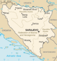
Bosnia and Herzegovina , sometimes called Bosnia-Herzegovina or simply Bosnia, is a country in Southern Europe, on the Balkan Peninsula. Bordered by Croatia to the north, west and south, Serbia to the east, and Montenegro to the southeast, Bosnia and Herzegovina is almost landlocked, except for the...
is located in Southeastern Europe, in the western Balkans
Balkans
The Balkans is a geopolitical and cultural region of southeastern Europe...
. It has a 932 km border with Croatia
Croatia
Croatia , officially the Republic of Croatia , is a unitary democratic parliamentary republic in Europe at the crossroads of the Mitteleuropa, the Balkans, and the Mediterranean. Its capital and largest city is Zagreb. The country is divided into 20 counties and the city of Zagreb. Croatia covers ...
to the north and southwest, a 312 km border with Serbia
Serbia
Serbia , officially the Republic of Serbia , is a landlocked country located at the crossroads of Central and Southeast Europe, covering the southern part of the Carpathian basin and the central part of the Balkans...
to the east, and a 215 km border with Montenegro
Montenegro
Montenegro Montenegrin: Crna Gora Црна Гора , meaning "Black Mountain") is a country located in Southeastern Europe. It has a coast on the Adriatic Sea to the south-west and is bordered by Croatia to the west, Bosnia and Herzegovina to the northwest, Serbia to the northeast and Albania to the...
to the southeast. It borders the Adriatic Sea along its 23 km (14 mi) coastline.
The most striking features of the local terrain are valleys and mountains which measure up to 2386 m in height. The country is mostly mountainous, encompassing the central Dinaric Alps
Dinaric Alps
The Dinaric Alps or Dinarides form a mountain chain in Southern Europe, spanning areas of Slovenia, Croatia, Bosnia and Herzegovina, Serbia, Kosovo, Albania and Montenegro....
. The northeastern parts reach into the Pannonian basin, while in the south it borders the Adriatic.
The country's natural resources include: coal, iron, bauxite, manganese, forests, copper, chromium, lead, zinc and hydro power.
Regions
The country's name comes from the two regions BosniaBosnia (region)
Bosnia is a eponomous region of Bosnia and Herzegovina. It lies mainly in the Dinaric Alps, ranging to the southern borders of the Pannonian plain, with the rivers Sava and Drina marking its northern and eastern borders. The other eponomous region, the southern, other half of the country is...
and Herzegovina
Herzegovina
Herzegovina is the southern region of Bosnia and Herzegovina. While there is no official border distinguishing it from the Bosnian region, it is generally accepted that the borders of the region are Croatia to the west, Montenegro to the south, the canton boundaries of the Herzegovina-Neretva...
, which have a very vaguely defined border between them. Bosnia occupies the northern areas which are roughly four fifths of the entire country, while Herzegovina occupies the rest in the south part of the country.
The major cities are the capital Sarajevo
Sarajevo
Sarajevo |Bosnia]], surrounded by the Dinaric Alps and situated along the Miljacka River in the heart of Southeastern Europe and the Balkans....
, Banja Luka
Banja Luka
-History:The name "Banja Luka" was first mentioned in a document dated February 6, 1494, but Banja Luka's history dates back to ancient times. There is a substantial evidence of the Roman presence in the region during the first few centuries A.D., including an old fort "Kastel" in the centre of...
in the northwest region known as Bosanska Krajina
Bosanska Krajina
Bosanska Krajina or Bosnian Frontier is a geographical region, a subregion of Bosnia, in western Bosnia and Herzegovina enclosed by three rivers - Sava, Una and Vrbas. It is also a historic, economic and cultural entity of Bosnia and Herzegovina....
, Bijeljina
Bijeljina
Bijeljina is a city and municipality in northeastern Bosnia and Herzegovina. The city is the second largest in the Republika Srpska entity after Banja Luka and fifth largest city in Bosnia and Herzegovina, and is situated on the flat rich plains of Semberija...
and Tuzla
Tuzla
Tuzla is a city and municipality in Bosnia and Herzegovina. At the time of the 1991 census, it had 83,770 inhabitants, while the municipality 131,318. Taking the influx of refugees into account, the city is currently estimated to have 174,558 inhabitants...
in the northeast, Zenica and Doboj in the central part of Bosnia and Mostar
Mostar
Mostar is a city and municipality in Bosnia and Herzegovina, the largest and one of the most important cities in the Herzegovina region and the center of the Herzegovina-Neretva Canton of the Federation. Mostar is situated on the Neretva river and is the fifth-largest city in the country...
, the capital of Herzegovina
Herzegovina
Herzegovina is the southern region of Bosnia and Herzegovina. While there is no official border distinguishing it from the Bosnian region, it is generally accepted that the borders of the region are Croatia to the west, Montenegro to the south, the canton boundaries of the Herzegovina-Neretva...
.
The south part of Bosnia has Mediterranean climate and a great deal of agriculture. Central Bosnia is the most mountainous part of Bosnia featuring predominate mountains Vlašić
Vlasic
Vlasic Pickles is an American brand of pickles currently owned by Pinnacle Foods. Since its introduction in 1942, it has become one of the most popular pickle brands in the United States.-History:...
, Čvrsnica
Cvrsnica
Čvrsnica is a mountain in the Dinarides of Bosnia and Herzegovina, located in northern Herzegovina, most of the mountain is located in the Herzegovina-Neretva Canton municipalities of Mostar and Jablanica while the smaller part of the mountain, around 10 % is located in the municipality of Posušje...
, and Prenj
Prenj
Prenj is a mountain in the Dinaric Alps of southern Bosnia and Herzegovina, located in eastern Herzegovina near Mostar, Jablanica and Konjic. The highest peak is the Zelena glava at , and there are several other peaks of similar height....
. Eastern Bosnia also features mountains like Trebević
Trebevic
Trebević is a mountain in central Bosnia and Herzegovina. It is found directly to the southeast of Sarajevo, territory of East Sarajevo city, bordering Jahorina mountain. Trebević is 1627 meters tall, making it the second shortest of the Sarajevo mountains.During the Middle Ages, Trebević was...
, Jahorina
Jahorina
Mount Jahorina , is a mountain in south-eastern Bosnia and Herzegovina, located southeast of Sarajevo within Republika Srpska. It borders fellow Olympic mountain Trebević...
, Igman
Igman
Igman is a mountain in central Bosnia and Herzegovina. It is found directly to the southwest of Sarajevo, bordering Bjelašnica mountain and the city of Ilidža. Igman's highest point, Vlahinja Ridge, is 1502 meters , making it the shortest of the Sarajevo mountains.Igman is a popular destination...
, Bjelašnica
Bjelašnica
Bjelašnica is a mountain in central Bosnia and Herzegovina. It is found directly to the southwest of Sarajevo, bordering Mt. Igman. Bjelašnica's tallest peak rises to an elevation of 2067 meters ....
and Treskavica
Treskavica
Treskavica is a mountain in Bosnia and Herzegovina, situated in Trnovo municipality just south of city of Sarajevo.Mala Ćaba peak at 2088 meters , makes Treskavica the tallest of all the mountains circling Sarajevo, and only some 300 meters shorter than the tallest mountain in the country...
. It was here that the 1984 Winter Olympics
1984 Winter Olympics
The 1984 Winter Olympics, officially known as the XIV Olympic Winter Games, was a winter multi-sport event which was celebrated from 8–19 February 1984 in Sarajevo, Yugoslavia. Other candidate cities were Sapporo, Japan; and Gothenburg, Sweden...
were held.
Eastern Bosnia is heavily forested along the river Drina, and overall close to 50% of Bosnia and Herzegovina is forested. Most forest areas are in Central, Eastern and Western parts of Bosnia. Northern Bosnia contains very fertile agricultural land along the river Sava and the corresponding area is heavily farmed. This farmland is a part of the Parapannonian Plain stretching into neighbouring Croatia and Serbia. The river Sava and corresponding Posavina
Posavina
Posavina is a Slavic name for the region of the Sava river basin in Croatia, Bosnia and Herzegovina, and Serbia that is adjacent or near the Sava river itself.-History:...
river basin hold the cities of Brčko, Bosanski Šamac, Bosanski Brod and Bosanska Gradiška.
The northwest part of Bosnia is called Bosanska Krajina
Bosanska Krajina
Bosanska Krajina or Bosnian Frontier is a geographical region, a subregion of Bosnia, in western Bosnia and Herzegovina enclosed by three rivers - Sava, Una and Vrbas. It is also a historic, economic and cultural entity of Bosnia and Herzegovina....
and holds the cities of Banja Luka
Banja Luka
-History:The name "Banja Luka" was first mentioned in a document dated February 6, 1494, but Banja Luka's history dates back to ancient times. There is a substantial evidence of the Roman presence in the region during the first few centuries A.D., including an old fort "Kastel" in the centre of...
, Prijedor
Prijedor
Prijedor is a city and municipality in the north-western part of Bosnia and Herzegovina. It is situated in the Bosanska Krajina region....
, Sanski Most
Sanski Most
Sanski Most is a town and municipality in northwestern Bosnia and Herzegovina. It is located on the Sana River in Bosanska Krajina, between Prijedor and Ključ. Administratively it is part of the Una-Sana Canton of the Federation of Bosnia and Herzegovina....
, Jajce
Jajce
Jajce is a city and municipality located in the central part of Bosnia and Herzegovina. It is part of the Central Bosnia Canton of the Federation of Bosnia and Herzegovina entity...
, Cazin, Velika Kladuša and Bihać
Bihac
Bihać is a city and municipality on the river Una in the north-western part of Bosnia and Herzegovina, in the Bosanska Krajina region. Bihać is located in the Una-Sana Canton in the Federation of Bosnia and Herzegovina.-History:...
. Kozara National Park
Kozara National Park
Kozara National Park is a national park in Bosnia and Herzegovina, that was proclaimed a protected national forest in 1967 by Josip Broz Tito. It is situated between the rivers Una, Sava, Sana and Vrbas, in the Republika Srpska entity of BiH...
and Mrakovica WWII monument is located in this region.
The country has only 20 kilometres (12.4 mi) of coastline, around the town of Neum
Neum
Neum is the only coastal town in Bosnia and Herzegovina. It comprises of coastline, the country's only access to the Adriatic Sea. As of 2009, municipal population was of 4,605 and the one of Neum main town was of 4,268 .-Features:Neum has steep hills, sandy beaches, and several large tourist...
in the Herzegovina-Neretva Canton, although surrounded by Croatian peninsulas it is possible to get to the middle of the Adriatic from Neum. By United Nations law, Bosnia has a right of passage to the outer sea. Neum has many hotels and is an important tourism destination.
Rivers
There are seven major rivers in the Republic of Bosnia and Herzegovina:- The Una in the northwest part of Bosnia flows along the northern and western border of Bosnia and Croatia and through the Bosnian city of Bihać. It is a very beautiful river and popular for rafting and adventure sports.
- The SanaSana riverSana is a river in the north-western part of Bosnia and Herzegovina. It is a tributary of the Una, into which it flows near Novi Grad. It is longest of the nine rivers that flows through Sanski Most....
flows through the city of Sanski Most and Prijedor and is a tributary of the river Sava in the north.
- The VrbasVrbasVrbas may refer to:* Vrbas , river in Bosnia and Herzegovina* Vrbas , town and municipality in Vojvodina, Serbia* Vrbas , village in Bosnia and Herzegovina...
flows through the cities of Gornji Vakuf - Uskoplje, Bugojno, Jajce, Banja Luka, Srbac and reaches the river Sava in the north. The Vrbas flows through the central part of Bosnia and flows outwards to the North.
- The River BosnaBosnaThe Bosna is the third longest river in Bosnia and Herzegovina, and is considered one of the country's three major internal rivers, along with the Neretva and Vrbas Rivers; the other three major rivers of Bosnia and Herzegovina are the Una, to the northwest, the Sava, to the north, and the Drina,...
is the longest river in Bosnia and is fully contained within the country as it stretches from its source near Sarajevo to the river Sava in the north. It gave its name to the country.
- The Drina flows through the eastern part of Bosnia, at many places in the border between Bosnia and Serbia. The Drina flows through the cities of Foča, Goražde and Višegrad.
- The NeretvaNeretvaNeretva is the largest river of the eastern part of the Adriatic basin. It has been harnessed and controlled to a large extent by four HE power-plants with large dams and their storage lakes, but it is still recognized for its natural beauty, diversity of its landscape and visual...
river is a large river in Central and Southern Bosnia, flowing from Jablanica south to the Adriatic Sea. The river is famous as it flows through the famous city of Mostar.
- The Sava river is the largest river in Bosnia and Herzegovina but not the largest river that is flowing through Bosnia and Herzegovina. The Sava river flows through Serbia, Bosnia and Herzegovina and Croatia. Sava is making a natural border between Bosnia and Herzegovina and Croatia and towns like Brčko, Bosanski Šamac, Bosanska Gradiška lies on the river.
Phytogeography
PhytogeographicallyPhytogeography
Phytogeography , also called geobotany, is the branch of biogeography that is concerned with the geographic distribution of plant species...
, Bosnia and Herzegovina belongs to the Boreal Kingdom
Boreal Kingdom
The Boreal Kingdom or Holarctic Kingdom is a floristic kingdom identified by botanist Ronald Good , which includes the temperate to Arctic portions of North America and Eurasia. Its flora is inherited from the ancient supercontinent of Laurasia...
and is shared between the Illyrian province of the Circumboreal Region
Circumboreal Region
The Circumboreal Region is a floristic region within the Holarctic Kingdom in Eurasia and North America, as delineated by such geobotanists as Josias Braun-Blanquet and Armen Takhtajan....
and Adriatic province of the Mediterranean Region. According to the WWF
World Wide Fund for Nature
The World Wide Fund for Nature is an international non-governmental organization working on issues regarding the conservation, research and restoration of the environment, formerly named the World Wildlife Fund, which remains its official name in Canada and the United States...
, the territory of Bosnia and Herzegovina can be subdivided into three ecoregion
Ecoregion
An ecoregion , sometimes called a bioregion, is an ecologically and geographically defined area that is smaller than an ecozone and larger than an ecosystem. Ecoregions cover relatively large areas of land or water, and contain characteristic, geographically distinct assemblages of natural...
s: the Pannonian mixed forests, Dinaric Mountains mixed forests and Illyrian deciduous forests.
Climate
The southern and western parts of the country have a Mediterranean climateMediterranean climate
A Mediterranean climate is the climate typical of most of the lands in the Mediterranean Basin, and is a particular variety of subtropical climate...
while inland areas and areas with high elevation experience short, cool summers and long, severe winters.
Land use
- Arable landArable landIn geography and agriculture, arable land is land that can be used for growing crops. It includes all land under temporary crops , temporary meadows for mowing or pasture, land under market and kitchen gardens and land temporarily fallow...
: 14% - Permanent crops: 5%
- Permanent pastures: 20%
- Forests and woodland: 39%
- Other: 22% (1993 est.)
Irrigated land:
20 km² (1993 est.)
Environment
- Natural hazards:
- Destructive earthquakes
- Current issues:
- Air pollution from metallurgical plants
- Sites for disposing of urban waste are limited
- Widespread casualties, water shortages, and destruction of infrastructure because of the 1991-1995 war.
- International agreements:
- Party to: Air Pollution, Law of the Sea, Marine Dumping, Marine Life Conservation, Nuclear Test Ban, Ozone LayerOzone layerThe ozone layer is a layer in Earth's atmosphere which contains relatively high concentrations of ozone . This layer absorbs 97–99% of the Sun's high frequency ultraviolet light, which is potentially damaging to the life forms on Earth...
Protection - Signed, but not ratified: none
- Party to: Air Pollution, Law of the Sea, Marine Dumping, Marine Life Conservation, Nuclear Test Ban, Ozone Layer
See also
- List of cities in Bosnia and Herzegovina
- Geography of EuropeGeography of EuropeEurope is traditionally reckoned as one of seven continents. Physiographically, however, it is the northwestern peninsula of the larger landmass known as Eurasia : Asia occupies the eastern bulk of this continuous landmass and all share a common continental shelf...
- Bosnia and HerzegovinaBosnia and HerzegovinaBosnia and Herzegovina , sometimes called Bosnia-Herzegovina or simply Bosnia, is a country in Southern Europe, on the Balkan Peninsula. Bordered by Croatia to the north, west and south, Serbia to the east, and Montenegro to the southeast, Bosnia and Herzegovina is almost landlocked, except for the...