
Everest Base Camp
Encyclopedia
There are two base camps on opposite sides of Mount Everest
. South Base Camp is in Nepal
at an altitude of 5364 metres (17,598.4 ft) (28°0′26"N 86°51′34"E), and North Base Camp is in Tibet
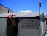
at 5545 metres (18,192.3 ft) 28°8′29"N 86°51′5"E). These camps are rudimentary campsites on Mount Everest that are used by mountain climbers during their ascent and descent. South Base Camp is used when climbing via the southeast ridge, while North Base Camp is used when climbing via the northeast ridge.
Supplies are carried to the South Base Camp by sherpa
s or porters, and with help of animals, usually yaks. The North Base Camp has vehicle access (at least in the summer months). Climbers typically rest at base camp for several days for acclimatization
; to reduce the risks and severity of altitude sickness
.
to save time and energy before beginning the morning trek to this base camp. From Lukla, climbers trek upward to the Sherpa capital of Namche Bazaar
, 3440 metres (11,286.1 ft), following the valley of the Dudh Kosi
river. The village is a central hub of the area, and food, sundries and even mountain climbing equipment may be purchased here.
This takes about two days. Typically at this point, climbers allow a day of rest for acclimatization. They then trek another two days to Dingboche
, 4260 metres (13,976.4 ft) before resting for another day for further acclimatization. Another two days takes them to Everest Base Camp via Gorakshep
, the flat field below Kala Patthar
, 5545 metres (18,192.3 ft) and Mt. Pumori
.
, on top of the permit required to visit Tibet
itself. At this time such permits could be arranged relatively easily via travel companies in Lhasa
, typically as part of a travel package that included hiring a vehicle, driver, and translator. Road access to the North Base Camp may be obtained from a road branching to the South from the Friendship Highway.
Mount Everest
Mount Everest is the world's highest mountain, with a peak at above sea level. It is located in the Mahalangur section of the Himalayas. The international boundary runs across the precise summit point...
. South Base Camp is in Nepal
Nepal
Nepal , officially the Federal Democratic Republic of Nepal, is a landlocked sovereign state located in South Asia. It is located in the Himalayas and bordered to the north by the People's Republic of China, and to the south, east, and west by the Republic of India...
at an altitude of 5364 metres (17,598.4 ft) (28°0′26"N 86°51′34"E), and North Base Camp is in Tibet
Tibet
Tibet is a plateau region in Asia, north-east of the Himalayas. It is the traditional homeland of the Tibetan people as well as some other ethnic groups such as Monpas, Qiang, and Lhobas, and is now also inhabited by considerable numbers of Han and Hui people...
at 5545 metres (18,192.3 ft) 28°8′29"N 86°51′5"E). These camps are rudimentary campsites on Mount Everest that are used by mountain climbers during their ascent and descent. South Base Camp is used when climbing via the southeast ridge, while North Base Camp is used when climbing via the northeast ridge.
Supplies are carried to the South Base Camp by sherpa
Sherpa people
The Sherpa are an ethnic group from the most mountainous region of Nepal, high in the Himalayas. Sherpas migrated from the Kham region in eastern Tibet to Nepal within the last 300–400 years.The initial mountainous migration from Tibet was a search for beyul...
s or porters, and with help of animals, usually yaks. The North Base Camp has vehicle access (at least in the summer months). Climbers typically rest at base camp for several days for acclimatization
Acclimatization
Acclimatisation or acclimation is the process of an individual organism adjusting to a gradual change in its environment, allowing it to maintain performance across a range of environmental conditions...
; to reduce the risks and severity of altitude sickness
Altitude sickness
Altitude sickness—also known as acute mountain sickness , altitude illness, hypobaropathy, or soroche—is a pathological effect of high altitude on humans, caused by acute exposure to low partial pressure of oxygen at high altitude...
.
South Base Camp
The Everest Base Camp trek on the south side is one of the most popular trekking routes in the Himalayas and is visited by thousands of trekkers each year. Trekkers usually fly from Kathmandu to LuklaLukla
Lukla is a town in the Khumbu area of the Solukhumbu District in the Sagarmatha Zone of north-eastern Nepal. Situated at , it is a popular place for visitors to the Himalayas near Mount Everest to arrive...
to save time and energy before beginning the morning trek to this base camp. From Lukla, climbers trek upward to the Sherpa capital of Namche Bazaar
Namche Bazaar
Namche Bazaar is a village and Village Development Committee in Solukhumbu District in the Sagarmatha Zone of north-eastern Nepal. It is located within the Khumbu area at , populating the sides of a hill...
, 3440 metres (11,286.1 ft), following the valley of the Dudh Kosi
Dudh Kosi
-Kosi river system:The Kosi or Sapt Kosi drains eastern Nepal. It is known as Sapt Koshi because of the seven rivers which join together in east-central Nepal to form this river. The main rivers forming the Kosi system are – the Sun Kosi, the Indravati River, the Bhola Kosi, the Dudh Kosi, the Arun...
river. The village is a central hub of the area, and food, sundries and even mountain climbing equipment may be purchased here.
This takes about two days. Typically at this point, climbers allow a day of rest for acclimatization. They then trek another two days to Dingboche
Dingboche
Dingboche is a village in the Khumbu region of north eastern Nepal in the Chukhung Valley. Its populations was estimated at approximately 200 in 2011. Situated at an altitude of about 4,530 metres .-Tourism:...
, 4260 metres (13,976.4 ft) before resting for another day for further acclimatization. Another two days takes them to Everest Base Camp via Gorakshep
Gorakshep
Gorak Shep or Gorakshep is a frozen lakebed covered with sand and also the name of small village that sits on its border at 5,164m , near Mount Everest....
, the flat field below Kala Patthar
Kala Patthar
Kala Patthar, meaning 'black rock' in Nepali and Hindi, is a mountain in the Nepalese Himalayas. It appears as a big brown bump below the impressive south face of Pumori . Many trekkers in the region of Mount Everest will attempt to summit Kala Patthar, since it provides the most accessible point...
, 5545 metres (18,192.3 ft) and Mt. Pumori
Pumori
Pumori is a mountain on the Nepal-Tibet border in the Mahalangur section of the Himalaya. Pumori lies just eight kilometres west of Mount Everest. Pumori, which means "Unmarried Daughter" in the Sherpa language, was named by George Mallory...
.
North Base Camp
As of 2010, a visit to the North (Tibet-side) Base Camp required a permit from the Chinese governmentChinese government
The phrase "Chinese government" may refer to:- Contemporary :* Government of the People's Republic of China * Government of the Republic of China - Historical :* Chinese dynasties* Beiyang Government...
, on top of the permit required to visit Tibet
Tibet
Tibet is a plateau region in Asia, north-east of the Himalayas. It is the traditional homeland of the Tibetan people as well as some other ethnic groups such as Monpas, Qiang, and Lhobas, and is now also inhabited by considerable numbers of Han and Hui people...
itself. At this time such permits could be arranged relatively easily via travel companies in Lhasa
Lhasa
Lhasa is the administrative capital of the Tibet Autonomous Region in the People's Republic of China and the second most populous city on the Tibetan Plateau, after Xining. At an altitude of , Lhasa is one of the highest cities in the world...
, typically as part of a travel package that included hiring a vehicle, driver, and translator. Road access to the North Base Camp may be obtained from a road branching to the South from the Friendship Highway.