
Durrington Walls
Encyclopedia
Durrington Walls is the site of a large Neolithic
settlement and later henge enclosure
located in the Stonehenge World Heritage Site
. It is 2 miles north-east of Stonehenge
in the parish of Durrington
, just north of Amesbury
. Excavations on the site by a team led by the University of Sheffield
, support an estimate of a community of several thousand, thought to be the largest one of its age in north-west Europe. At 500m in diameter, the henge is the largest in Britain and recent evidence suggests that it was a complementary monument to Stonehenge.
monument – in fact the eroded remains of the inner slope of the bank and the outer slope of the internal ditch. This now appears as a ridge surrounding a central basin. On the eastern side the separate ditch and bank are much more discernible although badly eroded by ploughing. Originally the ditch was some 5.5m deep, 7m wide at its bottom and 18m wide at the top. The bank was in some areas 30m wide. There were two entrances through the bank and ditch – at the north western and south eastern ends. There may also have been an entrance to the south and the north east, although these may have been deliberately blocked. The henge enclosed several timber circles and smaller enclosures – not all of which have been excavated. Several Neolithic house floors have been found next to and under the eastern bank of the henge. Their density suggests that there was a very large village on the sloping river bank on this side.
The henge sits on high ground that slopes south east toward a bend in the River Avon, and is thus considerably higher at its north western side than at its south eastern edge. The south eastern entrance is roughly 60m from the riverbank
.
The henge has two roads passing through it – an old toll road
, and a modern banked road constructed in 1967. In the past military barracks were constructed at the north eastern end of the henge, and some houses are constructed on the western bank. The land on the western side of the toll road is owned by the National Trust
, forming part of its Stonehenge Landscape property. It has free entry.
/early Bronze Age
. At some point around approximately 2600BC, a large timber circle was constructed. It is now known as the Southern Circle. The circle was oriented southeast towards the sunrise
on the midwinter solstice and consisted of four large concentric circles of postholes, which would have held extremely large standing timbers. A metalled avenue
was also constructed on a slightly different alignment – towards the sunset
on the summer solstice
– that led to the River Avon. This feature is similar to the Stonehenge Avenue
. A large timber post lay on this orientation, about as far away from the circle as the Heelstone
is from Stonehenge
.
At a similar time, but likely after the circle and avenue were constructed, a village began to develop around the site. Excavations have revealed seven Neolithic house floors on the eastern side of the bank. Some of these floors were located underneath the henge bank, suggesting that settlement came first. The density of some of the houses suggests that there are many more house floors under the field east of the henge, along the banks of the River Avon. One of the homes excavated showed evidence of a cobb wall and its own ancillary building, and was remarkably similar in layout to a house at Skara Brae
in Orkney. The other houses seem to have had simple wattle and daub
walls. Evidence also suggests that the houses continued to the north of the site.
It is probable that the village surrounded a large, circular, open area that contained the Southern Circle and several smaller enclosures, including two houses set within timber palisades and ditched enclosures that appear to have been kept clean.
Sometime later, perhaps 200 hundred years after the circle was first constructed, another two concentric rings were added, and the henge enclosure was constructed. A ditch some 5.5m deep was dug, and the earth used to create a large outer bank some 30m wide and presumably several metres high. Several features of the village, including houses and midden pits, were built over. The henge seems to have been built in one continuous operation, not in phases, as there is no evidence of soil or turf developing in the bank. The ditch also seems to have been dug in sections, perhaps by different groups of labourers. Estimates of the number of people required to create the henge vary from 4000 – 6000. At a similar time, another large timber circle and henge were created immediately south at Woodhenge
.
It is unknown when the site fell out of use. It was re-occupied during the Iron Age
, when a settlement and field system
was established inside the henge. A large drainage ditch
was also dug above the north eastern entrance, possibly to complement the field system.
noted Durrington Walls in 1810, and observed that centuries of agriculture had left “its form much mutilated”. Geoffrey Wainwright excavated the route of the new A345 in 1966. He discovered the southern timber circle as well as a smaller one slightly north of it. Since 2003 the Stonehenge Riverside Project
, led by Mike Parker Pearson
, has carried out annual excavations at Durrington Walls. It identified the Neolithic village and avenue to the river.
Radiocarbon dates
of approximately 2600 BC are roughly contemporary with the earliest stone phase at Stonehenge. It is likely that the builders of the stone monument lived here. Mike Parker Pearson believes that Durrington Walls was a complementary structure to Stonehenge, as evidenced by the similar solstice alignments. He suggests that the timber circle at Durrington Walls represented life and a land of the living, whilst Stonehenge and the down around it, encircled by burial mounds, represented a land of the dead. The two were connected by the River Avon and their respective avenues. A ceremonial procession route from one to the other represented the transition from life to death.
Geoff Wainwright and Timothy Darvill have contested Parker Pearson’s theories, however; they suggest that Stonehenge was a monument to healing and that connections between the two monuments were unlikely.
Neolithic
The Neolithic Age, Era, or Period, or New Stone Age, was a period in the development of human technology, beginning about 9500 BC in some parts of the Middle East, and later in other parts of the world. It is traditionally considered as the last part of the Stone Age...
settlement and later henge enclosure
Henge
There are three related types of Neolithic earthwork which are all sometimes loosely called henges. The essential characteristic of all three types is that they feature a ring bank and ditch but with the ditch inside the bank rather than outside...
located in the Stonehenge World Heritage Site
Stonehenge, Avebury and Associated Sites
Stonehenge, Avebury and Associated Sites is a UNESCO World Heritage Site located in Wiltshire, England. The WHS covers two large areas of land separated by nearly , rather than a specific monument or building. The sites were inscribed as co-listings in 1986....
. It is 2 miles north-east of Stonehenge
Stonehenge
Stonehenge is a prehistoric monument located in the English county of Wiltshire, about west of Amesbury and north of Salisbury. One of the most famous sites in the world, Stonehenge is composed of a circular setting of large standing stones set within earthworks...
in the parish of Durrington
Durrington, Wiltshire
Durrington is a village and civil parish in Wiltshire, England. It is in the east of Salisbury Plain, about north of Salisbury, south of Swindon and northeast of Stonehenge...
, just north of Amesbury
Amesbury
Amesbury is a town and civil parish in Wiltshire, England. It is most famous for the prehistoric monument of Stonehenge which is in its parish, and for the discovery of the Amesbury Archer—dubbed the King of Stonehenge in the press—in 2002...
. Excavations on the site by a team led by the University of Sheffield
University of Sheffield
The University of Sheffield is a research university based in the city of Sheffield in South Yorkshire, England. It is one of the original 'red brick' universities and is a member of the Russell Group of leading research intensive universities...
, support an estimate of a community of several thousand, thought to be the largest one of its age in north-west Europe. At 500m in diameter, the henge is the largest in Britain and recent evidence suggests that it was a complementary monument to Stonehenge.
Etymology
The name comes from the civil parish in which the site is located – Durrington, meaning “the farm of doers people” (doer-deer, ing-people/tribe, tun-farm/settlement), and the large henge banks that surround it.Context
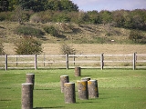
What visibly remains of Durrington Walls today is the ‘walls’ of the hengeHenge
There are three related types of Neolithic earthwork which are all sometimes loosely called henges. The essential characteristic of all three types is that they feature a ring bank and ditch but with the ditch inside the bank rather than outside...
monument – in fact the eroded remains of the inner slope of the bank and the outer slope of the internal ditch. This now appears as a ridge surrounding a central basin. On the eastern side the separate ditch and bank are much more discernible although badly eroded by ploughing. Originally the ditch was some 5.5m deep, 7m wide at its bottom and 18m wide at the top. The bank was in some areas 30m wide. There were two entrances through the bank and ditch – at the north western and south eastern ends. There may also have been an entrance to the south and the north east, although these may have been deliberately blocked. The henge enclosed several timber circles and smaller enclosures – not all of which have been excavated. Several Neolithic house floors have been found next to and under the eastern bank of the henge. Their density suggests that there was a very large village on the sloping river bank on this side.
The henge sits on high ground that slopes south east toward a bend in the River Avon, and is thus considerably higher at its north western side than at its south eastern edge. The south eastern entrance is roughly 60m from the riverbank
Riverbank
Riverbank may refer to:*Riverbank, California*Riverbank, former name of Bryte, California*The RiverBank, a bank offering banking, insurance and investment services*Bank , the bank of a river...
.
The henge has two roads passing through it – an old toll road
Toll road
A toll road is a privately or publicly built road for which a driver pays a toll for use. Structures for which tolls are charged include toll bridges and toll tunnels. Non-toll roads are financed using other sources of revenue, most typically fuel tax or general tax funds...
, and a modern banked road constructed in 1967. In the past military barracks were constructed at the north eastern end of the henge, and some houses are constructed on the western bank. The land on the western side of the toll road is owned by the National Trust
National Trust for Places of Historic Interest or Natural Beauty
The National Trust for Places of Historic Interest or Natural Beauty, usually known as the National Trust, is a conservation organisation in England, Wales and Northern Ireland...
, forming part of its Stonehenge Landscape property. It has free entry.
History
Although there is evidence of some early Neolithic activity at the site, most of the structures seem to have been built in the late NeolithicNeolithic
The Neolithic Age, Era, or Period, or New Stone Age, was a period in the development of human technology, beginning about 9500 BC in some parts of the Middle East, and later in other parts of the world. It is traditionally considered as the last part of the Stone Age...
/early Bronze Age
Bronze Age
The Bronze Age is a period characterized by the use of copper and its alloy bronze as the chief hard materials in the manufacture of some implements and weapons. Chronologically, it stands between the Stone Age and Iron Age...
. At some point around approximately 2600BC, a large timber circle was constructed. It is now known as the Southern Circle. The circle was oriented southeast towards the sunrise
Sunrise
Sunrise is the instant at which the upper edge of the Sun appears above the horizon in the east. Sunrise should not be confused with dawn, which is the point at which the sky begins to lighten, some time before the sun itself appears, ending twilight...
on the midwinter solstice and consisted of four large concentric circles of postholes, which would have held extremely large standing timbers. A metalled avenue
Avenue (archaeology)
British Archaeologists refine the general archaeological use of avenue to denote a long, parallel-sided strip of land, measuring up to about 30m in width, open at either end and with edges marked by stone or timber alignments and/or a low earth bank and ditch...
was also constructed on a slightly different alignment – towards the sunset
Sunset
Sunset or sundown is the daily disappearance of the Sun below the horizon in the west as a result of Earth's rotation.The time of sunset is defined in astronomy as the moment the trailing edge of the Sun's disk disappears below the horizon in the west...
on the summer solstice
Summer solstice
The summer solstice occurs exactly when the axial tilt of a planet's semi-axis in a given hemisphere is most inclined towards the star that it orbits. Earth's maximum axial tilt to our star, the Sun, during a solstice is 23° 26'. Though the summer solstice is an instant in time, the term is also...
– that led to the River Avon. This feature is similar to the Stonehenge Avenue
Stonehenge Avenue
Stonehenge Avenue is an ancient avenue marked as a UNESCO World Heritage Site. Discovered in the 18th century, it measures nearly 3 kilometers, connecting Stonehenge with the River Avon...
. A large timber post lay on this orientation, about as far away from the circle as the Heelstone
Heelstone
right|thumb|250px|Southwest face of HeelstoneThe Heelstone is a single large block of sarsen stone standing within the Avenue outside the entrance of the Stonehenge earthwork, close to the main road . In section it is sub-rectangular, with a minimum thickness of 8 ft , rising to a tapered top...
is from Stonehenge
Stonehenge
Stonehenge is a prehistoric monument located in the English county of Wiltshire, about west of Amesbury and north of Salisbury. One of the most famous sites in the world, Stonehenge is composed of a circular setting of large standing stones set within earthworks...
.
At a similar time, but likely after the circle and avenue were constructed, a village began to develop around the site. Excavations have revealed seven Neolithic house floors on the eastern side of the bank. Some of these floors were located underneath the henge bank, suggesting that settlement came first. The density of some of the houses suggests that there are many more house floors under the field east of the henge, along the banks of the River Avon. One of the homes excavated showed evidence of a cobb wall and its own ancillary building, and was remarkably similar in layout to a house at Skara Brae
Skara Brae
Skara Brae is a large stone-built Neolithic settlement, located on the Bay of Skaill on the west coast of Mainland, Orkney, Scotland. It consists of ten clustered houses, and was occupied from roughly 3180 BCE–2500 BCE...
in Orkney. The other houses seem to have had simple wattle and daub
Wattle and daub
Wattle and daub is a composite building material used for making walls, in which a woven lattice of wooden strips called wattle is daubed with a sticky material usually made of some combination of wet soil, clay, sand, animal dung and straw...
walls. Evidence also suggests that the houses continued to the north of the site.
It is probable that the village surrounded a large, circular, open area that contained the Southern Circle and several smaller enclosures, including two houses set within timber palisades and ditched enclosures that appear to have been kept clean.
Sometime later, perhaps 200 hundred years after the circle was first constructed, another two concentric rings were added, and the henge enclosure was constructed. A ditch some 5.5m deep was dug, and the earth used to create a large outer bank some 30m wide and presumably several metres high. Several features of the village, including houses and midden pits, were built over. The henge seems to have been built in one continuous operation, not in phases, as there is no evidence of soil or turf developing in the bank. The ditch also seems to have been dug in sections, perhaps by different groups of labourers. Estimates of the number of people required to create the henge vary from 4000 – 6000. At a similar time, another large timber circle and henge were created immediately south at Woodhenge
Woodhenge
Woodhenge is a Neolithic Class I henge and timber circle monument located in the Stonehenge World Heritage Site in Wiltshire, England. It is north-east of Stonehenge in the parish of Durrington, just north of Amesbury.-Discovery:...
.
It is unknown when the site fell out of use. It was re-occupied during the Iron Age
Iron Age
The Iron Age is the archaeological period generally occurring after the Bronze Age, marked by the prevalent use of iron. The early period of the age is characterized by the widespread use of iron or steel. The adoption of such material coincided with other changes in society, including differing...
, when a settlement and field system
Field system
The study of field systems in landscape history is concerned with the size, shape and orientation of a number of fields. These are often adjacent, but may be separated by a later feature.-Types of field system:...
was established inside the henge. A large drainage ditch
Drainage system (Agriculture)
An agricultural drainage system is a system by which the water level on or in the soil is controlled to enhance agricultural crop production.-Classification:Figure 1 classifies the various types of drainage systems...
was also dug above the north eastern entrance, possibly to complement the field system.
Excavations and theories
Richard Colt HoareRichard Colt Hoare
Sir Richard Colt Hoare, 2nd Baronet FRS was an English antiquarian, archaeologist, artist, and traveller of the 18th and 19th centuries, the first major figure in the detailed study of the history of his home county, Wiltshire.-Career:Hoare was descended from Sir Richard Hoare, Lord Mayor of...
noted Durrington Walls in 1810, and observed that centuries of agriculture had left “its form much mutilated”. Geoffrey Wainwright excavated the route of the new A345 in 1966. He discovered the southern timber circle as well as a smaller one slightly north of it. Since 2003 the Stonehenge Riverside Project
Stonehenge Riverside Project
The Stonehenge Riverside Project is a major AHRC-funded archaeological research study of the development of the Stonehenge landscape in Neolithic and Bronze Age Britain...
, led by Mike Parker Pearson
Mike Parker Pearson
Michael "Mike" Parker Pearson is a professor in the Department of Archaeology at the University of Sheffield in England. His books include The Archaeology of Death and Burial, Bronze Age Britain, Architecture and Order and In Search of the Red Slave...
, has carried out annual excavations at Durrington Walls. It identified the Neolithic village and avenue to the river.
Radiocarbon dates
Radiocarbon dating
Radiocarbon dating is a radiometric dating method that uses the naturally occurring radioisotope carbon-14 to estimate the age of carbon-bearing materials up to about 58,000 to 62,000 years. Raw, i.e. uncalibrated, radiocarbon ages are usually reported in radiocarbon years "Before Present" ,...
of approximately 2600 BC are roughly contemporary with the earliest stone phase at Stonehenge. It is likely that the builders of the stone monument lived here. Mike Parker Pearson believes that Durrington Walls was a complementary structure to Stonehenge, as evidenced by the similar solstice alignments. He suggests that the timber circle at Durrington Walls represented life and a land of the living, whilst Stonehenge and the down around it, encircled by burial mounds, represented a land of the dead. The two were connected by the River Avon and their respective avenues. A ceremonial procession route from one to the other represented the transition from life to death.
Geoff Wainwright and Timothy Darvill have contested Parker Pearson’s theories, however; they suggest that Stonehenge was a monument to healing and that connections between the two monuments were unlikely.
See also
- Stonehenge, Avebury and Associated SitesStonehenge, Avebury and Associated SitesStonehenge, Avebury and Associated Sites is a UNESCO World Heritage Site located in Wiltshire, England. The WHS covers two large areas of land separated by nearly , rather than a specific monument or building. The sites were inscribed as co-listings in 1986....
- StonehengeStonehengeStonehenge is a prehistoric monument located in the English county of Wiltshire, about west of Amesbury and north of Salisbury. One of the most famous sites in the world, Stonehenge is composed of a circular setting of large standing stones set within earthworks...
- Stonehenge Riverside ProjectStonehenge Riverside ProjectThe Stonehenge Riverside Project is a major AHRC-funded archaeological research study of the development of the Stonehenge landscape in Neolithic and Bronze Age Britain...
External links
- Sheffield University: The Stonehenge Riverside Project
- Intute interviews with Professor Parker-Pearson and Dr. Umberto Albarella about the excavations at Durrington Walls
- Channel 4: Time Team Durrington Walls Special
- National Geographic: 'Stonehenge Decoded' exploring Parker Pearson's theories and the excavations of Durrington Walls