
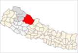
Dolpa District
Encyclopedia
Dolpa District
Dolpa District' onMouseout='HidePop("22565")' href="/topics/Districts_of_Nepal">districts
of the Karnali Zone
in Nepal
- a landlocked country of South Asia
. The district, with Dunai as its district headquarters, covers an area of 7889 km² (3,046 sq mi) and has a population (2001) of 29,545.
( China
) on the north and northeast, Jumla
and Mugu
districts of Karnali
on the west, Myagdi
, Jajarkot
and Rukum
on the south and Mustang
on the east.
A large portion of the district is protected by Shey Phoksundo National Park
. The name is derived from the 12th century Shey Monastery and the deepest lake in Nepal, the Phoksundo Lake
, both of which lie in the district. The park protects endangered animals like the snow leopard, musk deer and the Tibetan wolf. Shey Phoksundo is the largest and the only trans-Himalayan National Park in Nepal.
It is also one of the two districts that lie beyond the Himalaya or the trans-Himalaya, Mustang
being the other.
The district distances an altitudinal range of over 5000 m (16,404.2 ft) from a little over 1500 m (4,921.3 ft) at Tribeni in Kalika VDC to 7381 m (24,215.9 ft) meters at the peak of Churen Himal. Kanjiroba (6221 m (20,410.1 ft)), Mukot (6638 m (21,778.2 ft)) and Putha Hiunchuli (7246 m (23,773 ft)) are other renowned peaks.
Physiographical the smaller ranges of the Great Himalayas comprise the southern border of the district. Between these and the border mountain ranges of Gautam Himal and Kanti Himal to the north, Dolpa district is a labyrinth of often wide glacial valleys and ridges. Kanjiroba Himal and Kagmara Lekh running northwest to southeast separate the valleys of the Jagdula in the west from the rest of the district.
(60%) or Buddhist
(40%). 5.05% belong to the ancient Bonpo religion. Dolpa's major occupations are agriculture (79.5%) and service (2%).
Trekking into Dolpa presents an exposure to the high and remote Himalayan valleys, resembling the Tibetan highlands. The main highlight of Dolpa trekking includes “Shey Phoksundo National Park” which is one of the major National Parks of Nepal. “Shey Phoksundo Lake” is another famous feature of this region. The lake is totally free of aquatic life, which the crystal waters clearly demonstrate. Surrounded by rocks, forests, and snow-capped peaks, the area has been described as one of the world's “Natural Hidden Wonders”.
The Dolpa trekking starts at Juphal and follows the track to Dunai, then continues to Tarakot, way up to Bang la Camp, the uppermost point of Dolpa trekking. After passing through Sanu Bheri village, we then descend to the good-looking Phoksundo Lake, which is a piece of the Shey Phoksundo National Park.
Dolpa District' onMouseout='HidePop("22565")' href="/topics/Districts_of_Nepal">districts
Districts of Nepal
Nepal's 14 administrative zones are subdivided into 75 districts . These districts are listed below, by zone...
of the Karnali Zone
Karnali Zone
Karnali Zone in the Mid-Western Development Region of Nepal. The headquarters is Jumla.Karnali Zone is one of the poorest and most remote regions of Nepal, not very accessible by road yet. There are airfields in all districts except Kalikot which is connected by seasonal roadways to Jumla...
in Nepal
Nepal
Nepal , officially the Federal Democratic Republic of Nepal, is a landlocked sovereign state located in South Asia. It is located in the Himalayas and bordered to the north by the People's Republic of China, and to the south, east, and west by the Republic of India...
- a landlocked country of South Asia
South Asia
South Asia, also known as Southern Asia, is the southern region of the Asian continent, which comprises the sub-Himalayan countries and, for some authorities , also includes the adjoining countries to the west and the east...
. The district, with Dunai as its district headquarters, covers an area of 7889 km² (3,046 sq mi) and has a population (2001) of 29,545.
Geography
Dolpa is the largest district of Nepal covering 5.36% of the total landmass of the country. Located between 28°24’ N - 29°43’ N latitude, and 82°24’ E - 83°38’ E longitude, the elevation in Dolpa ranges from 1525 metre above sea level. The district borders TibetTibet
Tibet is a plateau region in Asia, north-east of the Himalayas. It is the traditional homeland of the Tibetan people as well as some other ethnic groups such as Monpas, Qiang, and Lhobas, and is now also inhabited by considerable numbers of Han and Hui people...
( China
China
Chinese civilization may refer to:* China for more general discussion of the country.* Chinese culture* Greater China, the transnational community of ethnic Chinese.* History of China* Sinosphere, the area historically affected by Chinese culture...
) on the north and northeast, Jumla
Jumla District
Jumla District|Jumla]] as its district headquarters, covers an area of 2,531 km² and has a population of 89,427.The origin of Nepali language is Sinja of Jumla...
and Mugu
Mugu District
Mugu District of 43,937. The biggest lake in Nepal, Rara Lake, also known as Mahendra Daha, lies in the Mugu District.It is one of the biggest districts of Nepal.Pulu is one of the famous Village Development Committee of Mugu district...
districts of Karnali
Karnali Zone
Karnali Zone in the Mid-Western Development Region of Nepal. The headquarters is Jumla.Karnali Zone is one of the poorest and most remote regions of Nepal, not very accessible by road yet. There are airfields in all districts except Kalikot which is connected by seasonal roadways to Jumla...
on the west, Myagdi
Myagdi District
-Village Development Committees :*Arman*Arthunge*Babiyachaur*Baranja*Begkhola*Bhakilmi*Bima*Chimkhola*Dagnam*Dana*Darwang*Devisthan*Dhatan*Dowa*Gurja Khani*Histhan Mandali*Jhin*Jyamrukot*Kuhunkot*Kuinemangale*Lulang*Malkwang*Marang*Mudi...
, Jajarkot
Jajarkot District
Jajarkot District of 134,868.Jajarkotis one of the district of Bheri Zone in Mid-western Region of Nepal. Khalanga is its headquarter...
and Rukum
Rukum District
Rukum District of 188,438. Musikot is the district's administrative center.Rukum district has many potential tourist attractions that remain unexplored. There is 5,849 meter Mt. Sisne , also called virgin mountain. Nobody claims to have conquered this mountain yet. Rukum is also called "the...
on the south and Mustang
Mustang District
Mustang District, a part of Dhawalagiri Zone, is one of the seventy-five districts of Nepal, a landlocked country of South Asia. The district, with Jomsom as its headquarters, covers an area of 3,573 km² and has a population of 14,981....
on the east.
A large portion of the district is protected by Shey Phoksundo National Park
Shey Phoksundo National Park
Shey Phoksundo National Park is the largest and only trans-Himalayan National Park in Nepal. It covers an area of in the districts of Dolpa and Mugu in the northwestern part of the country....
. The name is derived from the 12th century Shey Monastery and the deepest lake in Nepal, the Phoksundo Lake
Phoksundo Lake
Phoksundo Lake, also known as Shey Phoksundo Lake, is an alpine fresh water oligotrophic lake in Nepal's Shey Phoksundo National Park, located at an altitude of above sea level in the Dolpa District. Phoksundo Lake is in size with a water volume of and a discharge of...
, both of which lie in the district. The park protects endangered animals like the snow leopard, musk deer and the Tibetan wolf. Shey Phoksundo is the largest and the only trans-Himalayan National Park in Nepal.
It is also one of the two districts that lie beyond the Himalaya or the trans-Himalaya, Mustang
Mustang District
Mustang District, a part of Dhawalagiri Zone, is one of the seventy-five districts of Nepal, a landlocked country of South Asia. The district, with Jomsom as its headquarters, covers an area of 3,573 km² and has a population of 14,981....
being the other.
The district distances an altitudinal range of over 5000 m (16,404.2 ft) from a little over 1500 m (4,921.3 ft) at Tribeni in Kalika VDC to 7381 m (24,215.9 ft) meters at the peak of Churen Himal. Kanjiroba (6221 m (20,410.1 ft)), Mukot (6638 m (21,778.2 ft)) and Putha Hiunchuli (7246 m (23,773 ft)) are other renowned peaks.
Physiographical the smaller ranges of the Great Himalayas comprise the southern border of the district. Between these and the border mountain ranges of Gautam Himal and Kanti Himal to the north, Dolpa district is a labyrinth of often wide glacial valleys and ridges. Kanjiroba Himal and Kagmara Lekh running northwest to southeast separate the valleys of the Jagdula in the west from the rest of the district.
Demography
Dolpa's population is approximately 29,545. Most of the people are HinduHinduism in Nepal
Hinduism is the major religion of Nepal. In the 2001 census, approximately 80.6 percent of the Nepalese people identified themselves as Hindus. Buddhists constitute 10.7%. The remainder followed other religions...
(60%) or Buddhist
Buddhism in Nepal
Buddha was born in Shakya kingdom which lies in Rupandehi district, Lumbini zone of Nepal.10.74% of Nepal's population practice Buddhism, consisting mainly of groups of Tibeto-Burman origin.-Overview:...
(40%). 5.05% belong to the ancient Bonpo religion. Dolpa's major occupations are agriculture (79.5%) and service (2%).
Tourism
Dolpa region is a distant region of Nepal and the central point of this area is Shey Phoksumdo National Park. The east and south of Dolpa are surrounded by the Dhaulagiri and Churen Himal ranges and to the west is the Jumla district. Trekking to Lower Dolpa offers you the remarkable and breathtaking experience of a lifetime. The notable features seen here are snowy peaks, ancient and remote villages, rich wildlife, lovely Buddhist monasteries and wonderful lakes. The people of this area are simple and warm-hearted with an enthralling culture and traditions. The cultural traditions of this area are basically linked with the Tibetan culture.Trekking into Dolpa presents an exposure to the high and remote Himalayan valleys, resembling the Tibetan highlands. The main highlight of Dolpa trekking includes “Shey Phoksundo National Park” which is one of the major National Parks of Nepal. “Shey Phoksundo Lake” is another famous feature of this region. The lake is totally free of aquatic life, which the crystal waters clearly demonstrate. Surrounded by rocks, forests, and snow-capped peaks, the area has been described as one of the world's “Natural Hidden Wonders”.
The Dolpa trekking starts at Juphal and follows the track to Dunai, then continues to Tarakot, way up to Bang la Camp, the uppermost point of Dolpa trekking. After passing through Sanu Bheri village, we then descend to the good-looking Phoksundo Lake, which is a piece of the Shey Phoksundo National Park.
Towns and villages
- BhijerBhijerBhijer is a village development committee in Dolpa District in the Karnali Zone of north-western Nepal. At the time of the 1991 Nepal census it had a population of 400 persons living in 87 individual households.-External links:*...
- ChharkaChharkaChharka is a village development committee in Dolpa District in the Karnali Zone of north-western Nepal. At the time of the 1991 Nepal census it had a population of 552 persons living in 101 individual households....
- DhoDhoDho is a village in Dho VDC of Dolpa District in the Karnali Zone of north-western Nepal. At the time of the 1991 Nepal census it had a population of 703 persons living in 146 individual households....
- Dunai
- JufalJufalJufal or Juphal is a village development committee in Dolpa District in the Karnali Zone of north-western Nepal. At the time of the 1991 Nepal census it had a population of 1,513 persons living in 300 individual households....
- KaigaunKaigaunKaigaun is a village development committee in Dolpa District in the Karnali Zone of north-western Nepal. At the time of the 1991 Nepal census it had a population of 717 persons living in 135 individual households.-External links:*...
- KalikaKalika, DolpaKalika is a village development committee in Dolpa District in the Karnali Zone of north-western Nepal. At the time of the 1991 Nepal census it had a population of 902 persons living in 157 individual households.-External links:*...
- KhadangKhadangKhadang is a village development committee in Dolpa District in the Karnali Zone of north-western Nepal. At the time of the 1991 Nepal census it had a population of 820 persons living in 144 individual households.-External links:*...
- LawanLawan, NepalLawan is a village development committee in Dolpa District in the Karnali Zone of north-western Nepal. At the time of the 1991 Nepal census it had a population of 1270 persons living in 279 individual households.-External links:*...
- LikhuLikhu, KarnaliLikhu is a village development committee in Dolpa District in the Karnali Zone of north-western Nepal. At the time of the 1991 Nepal census it had a population of 1465 persons living in 262 individual households.-External links:*...
- MajhfalMajhfalMajhfal is a village development committee in Dolpa District in the Karnali Zone of north-western Nepal. At the time of the 1991 Nepal census it had a population of 1436 persons living in 274 individual households.-External links:*...
- MukotMukotMukot is a village development committee in Dolpa District in the Karnali Zone of north-western Nepal. At the time of the 1991 Nepal census it had a population of 638 persons living in 124 individual households.-External links:*...
- NarkuNarkuNarku is a village development committee in Dolpa District in the Karnali Zone of north-western Nepal. At the time of the 1991 Nepal census it had a population of 1025 persons living in 194 individual households.-External links:*...
- PahadaPahadaPahada is a village development committee in Dolpa District in the Karnali Zone of north-western Nepal. At the time of the 1991 Nepal census it had a population of 1413 persons living in 237 individual households.-External links:*...
- PhoksundoPhoksundoPhoksundo is a village development committee located at the village of Ringmo in the Dolpa District in the Karnali Zone of north-western Nepal. At the time of the 1991 Nepal census it had a population of 457 persons living in 94 individual households....
- Raha
- RimiRimi, NepalRimi is a village development committee in Dolpa District in the Karnali Zone of north-western Nepal. At the time of the 1991 Nepal census it had a population of 970 persons living in 174 individual households.-External links:*...
- SahartaraSahartaraSahartara is a village development committee in Dolpa District in the Karnali Zone of north-western Nepal. At the time of the 1991 Nepal census it had a population of 1511 persons living in 339 individual households.-External links:*...
- SaldangSaldangSaldang is a village development committee in Dolpa District in the Karnali Zone of north-western Nepal. Saldang lies in Nankhang Valley, the most populous of the sparsely populated valleys making up the culturally Tibetan region of Dolpo. At the time of the 1991 Nepal census Saldang had a...
- SarmieSarmieSarmie is a village development committee in Dolpa District in the Karnali Zone of north-western Nepal. At the time of the 1991 Nepal census it had a population of 1396 persons living in 279 individual households.-External links:*...
- SunhooSunhooSunhoo is a village development committee in Dolpa District in the Karnali Zone of north-western Nepal. At the time of the 1991 Nepal census it had a population of 1097 persons living in 235 individual households.-External links:*...
- TinjeTinjeTinje is a village development committee in Dolpa District in the Karnali Zone of north-western Nepal. At the time of the 1991 Nepal census it had a population of 1013 persons living in 215 individual households.-External links:*...
- TripurakotTripurakotTripurakot is a village development committee in Dolpa District in the Karnali Zone of north-western Nepal. At the time of the 1991 Nepal census it had a population of 1717 persons living in 362 individual households.-External links:*...