
Rukum District
Encyclopedia
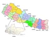
Rukum District
' onMouseout='HidePop("47442")' href="/topics/Rapti_Zone">Rapti
Zone
of Nepal
's Mid-Western
Region
. Rukum covers an area of 2,877 km² with population (2001) of 188,438. Musikot
(also called Jhumlikhalanga) is the district's administrative center.
Rukum district has many potential tourist attractions that remain unexplored. There is 5,849 meter (19,195 ft.) Mt. Sisne , also called virgin mountain. Nobody claims to have conquered this mountain yet. Rukum is also called "the place of 52 lakes and 53 hills". Rukumkot
has a beautiful pond called Rukmini Tal or locally Kamal Dhaha. Nearby are notable temples called Barah and Sibalaya, and caves such as Deurali Cave.
. Rukum became a stronghold and was controlled by insurgents throughout the conflict. Many Maoist leaders came from this district, as well as many martyred insurgents.
. It is in the basin of Bheri River
, a major tributary of the Karnali. Mostly Rukum is drained by west-flowing tributaries such as Uttar Ganga draining Dhorpatan Valley and to the north of that the Sani Bheri draining southern slopes of the western Dhaulagiri
Himalaya.
Elevation ranges from below 800 meters along the Bheri and its lowest tributaries to about 6,000 meters in the Dhaulagiris with a range of climates from subtropical to perpetual snow and ice. Agricultural use ranges from irrigated rice cultivation through upland cultivation of maize, barley, wheat, potatoes and fruit, to subalpine and alpine pasturage reaching about 4,500 meters.
, and Kathmandu
. Rapti Highway is under construction (as of 2010) to connect Musikot to Salyan Khalanga
, Tulstipur
and Mahendra Highway
to the south. Otherwise travel into Rukum requires several days of hiking. During the monsoon months it can be hazardous even for seasoned locals.
The two airports in Rukum are in Chaurjahari
and Salle .
. 762m above sea level and accessible by footpaths and horse trails only, with a grass runway 850m long and 30
m wide. It was the primary mode of travel to Rukum for government, NGO personnel, aid workers and backpackers before the civil war. During the conflict the security situation deteriorated and the local police station was shut down. The airport has 10 aircarft parking at once.

Districts of Nepal
Nepal's 14 administrative zones are subdivided into 75 districts . These districts are listed below, by zone...
' onMouseout='HidePop("47442")' href="/topics/Rapti_Zone">Rapti
Rapti Zone
Rapti Anchal in the Mid-Western Development Region of Nepal. It is named after the West Rapti River which drains Rolpa, Pyuthan and part of Dang district. The remainder of Dang and part of Salyan are drained by the Babai. The remainder of Salyan and all of Rukum are drained by the Bheri.The...
Zone
Zones of Nepal
Nepal is divided into 14 administrative zones , and 75 districts . The 14 administrative zones are grouped into five development regions...
of Nepal
Nepal
Nepal , officially the Federal Democratic Republic of Nepal, is a landlocked sovereign state located in South Asia. It is located in the Himalayas and bordered to the north by the People's Republic of China, and to the south, east, and west by the Republic of India...
's Mid-Western
Mid-Western Region, Nepal
Mid-Western Region is one of Nepal's five development regions. Westward from the Central region surrounding Kathmandu are the Western, Mid-Western and finally Far-Western regions. Counter-intuitively, Mid-Western lies west of Western....
Region
Regions of Nepal
Nepal is divided into 14 administrative zones , which are divided into 75 districts . The 14 administrative zones are grouped into five development regions...
. Rukum covers an area of 2,877 km² with population (2001) of 188,438. Musikot
Musikot
Musikot is the headquarters of Rukum District in Rapti Zone of central Nepal. At the time of the 2001 Nepal census it had a population of 7,279 persons living in 1,474 individual households....
(also called Jhumlikhalanga) is the district's administrative center.
Rukum district has many potential tourist attractions that remain unexplored. There is 5,849 meter (19,195 ft.) Mt. Sisne , also called virgin mountain. Nobody claims to have conquered this mountain yet. Rukum is also called "the place of 52 lakes and 53 hills". Rukumkot
Rukumkot
Rukumkot is a town located in a valley in Rukum district, Nepal approximately 350 kilometres west of Kathmandu. Nearby is a pond called Rukmini Tal Rukumkot is a town located in a valley in Rukum district, Nepal approximately 350 kilometres west of Kathmandu. Nearby is a pond called Rukmini Tal...
has a beautiful pond called Rukmini Tal or locally Kamal Dhaha. Nearby are notable temples called Barah and Sibalaya, and caves such as Deurali Cave.
Civil War
Rukum was a flashpoint of the Maoist insurgency, along with Rolpa districtRolpa District
Rolpa of 210,004. Livang is the district's administrative center.By Nepalese standards, Rolpa is an underdeveloped area plagued by low life expectancy and poverty . It was a major flashpoint in the 1996-2006 Civil War.Adjoining districts are Dang to the south, Pyuthan to the east, Salyan to the...
. Rukum became a stronghold and was controlled by insurgents throughout the conflict. Many Maoist leaders came from this district, as well as many martyred insurgents.
Geography
Rukum district is the northernmost part of Rapti ZoneRapti Zone
Rapti Anchal in the Mid-Western Development Region of Nepal. It is named after the West Rapti River which drains Rolpa, Pyuthan and part of Dang district. The remainder of Dang and part of Salyan are drained by the Babai. The remainder of Salyan and all of Rukum are drained by the Bheri.The...
. It is in the basin of Bheri River
Bheri River
The Bheri River is a major tributary of the Karnali River draining the western Dhaulagiri range in western Nepal. It has three important upper tributaries. Sani Bheri drains southern slopes of this range while Thuli Bheri drains northern slopes. Another tributary Uttar Ganga drains Dhorpatan...
, a major tributary of the Karnali. Mostly Rukum is drained by west-flowing tributaries such as Uttar Ganga draining Dhorpatan Valley and to the north of that the Sani Bheri draining southern slopes of the western Dhaulagiri
Dhaulagiri
Dhaulagiri is Earth's seventh highest mountain at ; one of fourteen over eight thousand metres. Dhaulagiri was first climbed May 13, 1960 by a Swiss/Austrian expedition....
Himalaya.
Elevation ranges from below 800 meters along the Bheri and its lowest tributaries to about 6,000 meters in the Dhaulagiris with a range of climates from subtropical to perpetual snow and ice. Agricultural use ranges from irrigated rice cultivation through upland cultivation of maize, barley, wheat, potatoes and fruit, to subalpine and alpine pasturage reaching about 4,500 meters.
Transport
Rukum District is considered remote because air travel is the only modern transportation mode available. Two airports offer safe but rudimentary facilities for passenger flights, mainly from NepalgunjNepalgunj Airport
Nepalgunj Airport is an airport serving Nepalgunj , a municipality in Banke district of the Bheri zone in Nepal.The airport has been in service since 1961. It is a major domestic hub after TIA in terms of number of airport network, and also second largest airport in Nepal in terms of land area,...
, and Kathmandu
Tribhuvan International Airport
Tribhuvan International Airport is an international airport situated in Kathmandu, Nepal.Tribhuvan is the sole international airport in Nepal. There are two terminals, one domestic and one international...
. Rapti Highway is under construction (as of 2010) to connect Musikot to Salyan Khalanga
Salyan, Nepal
Salyan or Salyan Khalanga is the headquarters of Salyan District in the mid-west 'hills' of Nepal. It is located at 28°22'31N 82°9'42E at 1530 metres elevation ....
, Tulstipur
Tulsipur, Rapti
Tulsipur is a town and V.D.C. in Dang Deokhuri District in the Rapti Zone of south-western Nepal. It is also the district's main bazaar. The 1991 Nepal census counted 13,815 persons in 2,540 households. Dang Airport is about two km south of the town center...
and Mahendra Highway
Mahendra Highway
Mahendra Highway also called East West Highway runs across the Terai region of Nepal, from Kankarbhitta in the east to Mahendranagar in the west, cutting across the entire width of the country. It is the longest highway in Nepal.-Overview:...
to the south. Otherwise travel into Rukum requires several days of hiking. During the monsoon months it can be hazardous even for seasoned locals.
The two airports in Rukum are in Chaurjahari
Chaurjahari
Chaurjahari is a village development committee in Rukum District in the Rapti Zone of western Nepal. At the time of the 1991 Nepal census it had a population of 8261....
and Salle .
Chaurjahari Airport
Near the Bheri RiverBheri River
The Bheri River is a major tributary of the Karnali River draining the western Dhaulagiri range in western Nepal. It has three important upper tributaries. Sani Bheri drains southern slopes of this range while Thuli Bheri drains northern slopes. Another tributary Uttar Ganga drains Dhorpatan...
. 762m above sea level and accessible by footpaths and horse trails only, with a grass runway 850m long and 30
m wide. It was the primary mode of travel to Rukum for government, NGO personnel, aid workers and backpackers before the civil war. During the conflict the security situation deteriorated and the local police station was shut down. The airport has 10 aircarft parking at once.
Rukum Salle Airport
Located near Musikot, the district headquarters. It is accessible is foot way and road transport also since rapti highway has touched salle airport also. It's runway is 650 meter long with capability of parking of 4 air craft at once.Villages Development Committees (VDCs)
- Aathbis DandaAathbis DandaAathbis Danda is a village development committee in Rukum District in the Rapti Zone of western Nepal. At the time of the 1991 Nepal census it had a population of 4638 people living in 860 individual households....
, Aathbis KotAathbis KotAathbis Kot is a village development committee in Rukum District in the Rapti Zone of western Nepal. At the time of the 1991 Nepal census it had a population of 3627 people living in 1062 individual households....
, ArmaArma, NepalArma is a village development committee in Rukum District in the Rapti Zone of western Nepal. At the time of the 1991 Nepal census it had a population of 2866 people living in 540 individual households.... - Banfikot, BhalakachhaBhalakachhaBhalakachha is a village development committee in Rukum District in the Rapti Zone of western Nepal. At the time of the 1991 Nepal census it had a population of 2875 people living in 534 individual households....
- ChaurjahariChaurjahariChaurjahari is a village development committee in Rukum District in the Rapti Zone of western Nepal. At the time of the 1991 Nepal census it had a population of 8261....
, ChhiwangChhiwangChhiwang is a village development committee in Rukum District in the Rapti Zone of western Nepal. At the time of the 1991 Nepal census it had a population of 4252 people living in 805 individual households....
, ChokhawangChokhawangChokhawang is a village development committee in Rukum District in the Rapti Zone of western Nepal. At the time of the 1991 Nepal census it had a population of 2690 people living in 477 individual households....
, ChunwangChunwangChunwang is a village development committee in Rukum District in the Rapti Zone of western Nepal. At the time of the 1991 Nepal census it had a population of 2865 people living in 528 individual households.... - Duli
- GarayalaGarayalaGarayala is a village development committee in Rukum District in the Rapti Zone of western Nepal. At the time of the 1991 Nepal census it had a population of 4301 people living in 775 individual households....
, GautamkotGautamkotGautamkot is a village development committee in Rukum District in the Rapti Zone of western Nepal. At the time of the 1991 Nepal census it had a population of 4183 people living in 812 individual households....
, GhetmaGhetmaGhetma is a village development committee in Rukum District in the Rapti Zone of western Nepal. At the time of the 1991 Nepal census it had a population of 3447 people living in 607 individual households.... - HukamHukam, NepalHukam is a village development committee in Rukum District in the Rapti Zone of western Nepal. At the time of the 1991 Nepal census it had a population of 1671 people living in 376 individual households....
- JangJang, NepalJang is a village development committee in Rukum District in the Rapti Zone of western Nepal. At the time of the 1991 Nepal census it had a population of 2264 people living in 433 individual households....
, JhulaJhulaJhula is a village development committee in Rukum District in the Rapti Zone of western Nepal. At the time of the 1991 Nepal census it had a population of 2483 people living in 268 individual households.... - KandaKanda, RaptiKanda is a village development committee in Rukum District in the Rapti Zone of western Nepal. At the time of the 1991 Nepal census it had a population of 2304 people living in 448 individual households....
, KankriKankriKankri is a village development committee in Rukum District in the Rapti Zone of western Nepal. At the time of the 1991 Nepal census it had a population of 4210 people living in 851 individual households....
, KharaKhara, NepalKhara is a village development committee in Rukum District in the Rapti Zone of western Nepal. At the time of the 1991 Nepal census it had a population of 5122 people living in 903 individual households....
, KholagaunKholagaun, RaptiKholagaun is a village development committee in Rukum District in the Rapti Zone of western Nepal. At the time of the 1991 Nepal census it had a population of 4462 people living in 778 individual households....
, KolKol, NepalKol is a village development committee in Rukum District in the Rapti Zone of western Nepal. At the time of the 1991 Nepal census it had a population of 2880 people living in 608 individual households....
, KotjahariKotjahariKotjahari is a village development committee in Rukum District in the Rapti Zone of western Nepal. At the time of the 1991 Nepal census it had a population of 3473 people living in 647 individual households.... - MagmaMagma, NepalMagma is a village development committee in Rukum District in the Rapti Zone of western Nepal. At the time of the 1991 Nepal census it had a population of 4303 people living in 789 individual households....
, MahatMahatMahat is ekthariya Chhetri surname of Nepal having Khasa root. Historically, one of the Jumli Malla king in medieval time made his younger brother Dharma Malla chief of army staffs entitling him as MAHAT . Afterwards, his descendants started writing Mahat as their surnames. Like other Khasa...
, MorawangMorawangMorawang is a village development committee in Rukum District in the Rapti Zone of western Nepal. At the time of the 1991 Nepal census it had a population of 2173 people living in 441 individual households....
, MuruMuru, NepalMuru is a village development committee in Rukum District in the Rapti Zone of western Nepal. At the time of the 1991 Nepal census it had a population of 2890 people living in 505 individual households....
, Musikot KhalangaMusikot KhalangaMusikot Khalanga is a village development committee and seat of Rukum District in the Rapti Zone of western Nepal. At the time of the 1991 Nepal census it had a population of 7279 people living in 1474 individual households.... - NuwakotNuwakot, RaptiNuwakot is a village development committee in Rukum District in the Rapti Zone of western Nepal. At the time of the 1991 Nepal census it had a population of 4071....
- PipalPipal, NepalPipal is a village development committee in Rukum District in the Rapti Zone of western Nepal. At the time of the 1991 Nepal census it had a population of 3519 people living in 682 individual households....
, PokharaPokhara, RaptiPokhara is a village development committee in Rukum District in the Rapti Zone of western Nepal. At the time of the 1991 Nepal census it had a population of 3360 people living in 676 individual households....
, Purtim KandaPurtim KandaPurtim Kanda is a village development committee in Rukum District in the Rapti Zone of western Nepal. At the time of the 1991 Nepal census it had a population of 3431 people living in 632 individual households....
, PwangPwangPwang is a village development committee in Rukum District in the Rapti Zone of western Nepal. At the time of the 1991 Nepal census it had a population of 1541 people living in 283 individual households....
, PyaughaPyaughaPyaugha is a village development committee in Rukum District in the Rapti Zone of western Nepal. At the time of the 1991 Nepal census it had a population of 3303 people living in 549 individual households.... - RangsiRangsi, RukumRangsi is a village development committee in Rukum District in the Rapti Zone of western Nepal. At the time of the 1991 Nepal census it had a population of 1796 people living in 354 individual households....
, RanmamekotRanmamekotRanmamekot is a village development committee in Rukum District in the Rapti Zone of western Nepal. At the time of the 1991 Nepal census it had a population of 2516 people living in 564 individual households.... - RughaRughaRugha is a village development committee in Rukum District in the Rapti Zone of western Nepal. At the time of the 1991 Nepal census it had a population of 3396 people living in 599 individual households....
- Sankha, SimliSimliSimli is a village development committee in Rukum District in the Rapti Zone of western Nepal. At the time of the 1991 Nepal census it had a population of 3595 people living in 651 individual households....
, SisneSisneSisne is a village development committee in Rukum District in the Rapti Zone of western Nepal. At the time of the 1991 Nepal census it had a population of 1217 people living in 225 individual households....
, Shova, SyalagadiSyalagadiSyalagadi is a village development committee in Rukum District in the Rapti Zone of western Nepal. At the time of the 1991 Nepal census it had a population of 3182 people living in 552 individual households....
, SyalapakhaSyalapakhaSyalapakha is a village development committee in Rukum District in the Rapti Zone of western Nepal. At the time of the 1991 Nepal census it had a population of 4596 people living in 905 individual households.... - TakseraTakseraTakasera is a village development committee in Rukum District in the Rapti Zone of western Nepal. At the time of the 1991 Nepal census it had a population of 3853 people living in 801 individual households....