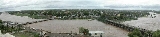
Dhule is a city and a
Municipal CorporationA municipal corporation is the legal term for a local governing body, including cities, counties, towns, townships, charter townships, villages, and boroughs. Municipal incorporation occurs when such municipalities become self-governing entities under the laws of the state or province in which...
in
Dhule districtDhule district is a district of Maharashtra state in central India. The city of Dhule is the administrative headquarters of the district.The Dhule district previously comprised tracts of land predominantly inhabited by tribal population...
in northwestern part of
MaharashtraMaharashtra is a state located in India. It is the second most populous after Uttar Pradesh and third largest state by area in India...
state,
IndiaIndia , officially the Republic of India , is a country in South Asia. It is the seventh-largest country by geographical area, the second-most populous country with over 1.2 billion people, and the most populous democracy in the world...
. It is one of the very few well-planned cities of India before
Indian IndependenceThe Independence Day of India is celebrated on the fifteenth of August to commemorate its independence from British rule and its birth as a sovereign nation in 1947. The day is a national holiday in India. All over the country, flag-hoisting ceremonies are conducted by the local administration in...
.
Geography
Dhule is located at 20.9°N 74.78°E. It has an average elevation of 240 metres (787 feet).Dhule lies in the
KhandeshKhandesh is a region of central India, which forms the northwestern portion of Maharashtra state.Khandesh was the terminal territorial part under the rule of Mughals. The Start of Deccan region demarcated by the boundary of Khandesh....
region, which forms the northwest corner of
Deccan PlateauThe Deccan Plateau is a large plateau in India, making up the majority of the southern part of the country. It rises a hundred meters high in the north, rising further to more than a kilometers high in the south, forming a raised triangle nested within the familiar downward-pointing triangle of...
.
Dhule district is bounded by Gujarat State on west, by
Madhya PradeshMadhya Pradesh , often called the Heart of India, is a state in central India. Its capital is Bhopal and Indore is the largest city....
on north and on east and south by Jalgoan and Nasik respectively. It is also situated in valley of the Tapi river along the banks of
Panzara RiverThe Panzara-Kan or Panjhra is a river in Kandesh region of Maharashtra state of India. It is a tributary of the Tapi River. Panjhra river originates just few kilometers from a small town Pimpalner, tal-sakri in Dhule District. One small reserivor named Latipada dam is constructed just after its...
(पांझरा). Devi Ekveera (Goddess Ekveera) temple is a well known temple, situated at the banks of Panzara river.
Demographics
India
censusA census is the procedure of systematically acquiring and recording information about the members of a given population. It is a regularly occurring and official count of a particular population. The term is used mostly in connection with national population and housing censuses; other common...
, Dhule had a population of 341,473. Males constitute 52% of the population and females 48%. Dhule has an average literacy rate of 75%, higher than the national average of 59.5%: male literacy is 80% and, female literacy is 69%. 13% of the population is under 6 years of age.
History
Dhule became part of the
Mughal EmpireThe Mughal Empire , or Mogul Empire in traditional English usage, was an imperial power from the Indian Subcontinent. The Mughal emperors were descendants of the Timurids...
in 1601, during the reign of Akbar. In the 18th century Dhule came under
MarathaThe Maratha are an Indian caste, predominantly in the state of Maharashtra. The term Marāthā has three related usages: within the Marathi speaking region it describes the dominant Maratha caste; outside Maharashtra it can refer to the entire regional population of Marathi-speaking people;...
rule. In 1818, Dhule was annexed by the British, and was included in the
Bombay PresidencyThe Bombay Presidency was a province of British India. It was established in the 17th century as a trading post for the English East India Company, but later grew to encompass much of western and central India, as well as parts of post-partition Pakistan and the Arabian Peninsula.At its greatest...
. Dhule city is a well planned city, and it is believed that it was planned by Capt. James Briggs. After Indian independence in 1947, Bombay Presidency became
Bombay StateThe Bombay State was a state of India, dissolved with the formation of Maharashtra and Gujarat states on May 1, 1960.-History:During British rule, portions of the western coast of India under direct British rule were part of the Bombay Presidency...
, which in 1960 was divided along linguistic lines into the new states of
MaharashtraMaharashtra is a state located in India. It is the second most populous after Uttar Pradesh and third largest state by area in India...
and
Gujarat.
The ancient name of this region was Rasika. It is bounded on the east by Berar (ancient Vidarbha) , on the north by the Nemad district (ancient Anupa) and on the south by the Aurangabad (ancient Mulaka) and Bhir (ancient Asmaka) districts. Later the country came to be called as Seunadesa after king, Seunchandra of the early Yadava dynasty, who ruled over it. Subsequently its name was changed to Khandesh to suit the title Khan given to the Faruqi kings by Ahmad I of Gujarat.
During Aryans penetration to the Deccan, ‘Agastya’ was the first Aryan who crossed Vindhya and resided on the bank of Godavari. This territory was included in the empire of Ashoka. Pusyamitra, the founder of Sanga dynasty overthrow Maurya dynasty. Later on Satavahan ruled over the region. Around 250 AD, the Satavahans were supplanted by the Abhiras in Western Maharashtra (Regan Isvarsena). The names of Feudatories of Abhiras ruled in Khandesh are found on copperplates discovered at Kalachala (Gujarat) and Cave X5II at Ajanta. After downfall of Satavahans the Vakatakas rose to power in Vidarbha. The Vakatakas were over thrown by Rastrakuta family. This region was ruled by Chalukyas of
BadamiBadami , formerly known as Vatapi, is a town and headquarters of a taluk by the same name, in the Bagalkot district of Karnataka, India. It was the regal capital of the Badami Chalukyas from 540 to 757 AD. It is famous for rock cut and other structural temples...
and subsequently the Yadavas.
In AD 1296, Ala-ud-din Khilji invaded Ramachandra Yadava who had paid heavy ransom. His son Sankaragana discontinued this practice of sending the stipulated tribute to Delhi and was later on attacked and slain by Malik Kafur in AD 1318.
In 1345, Devagiri was passed into the hands of Hasan Gangu, the founder of Bahamani dynasty. Khandesh forms the Southern boundaries of the Taghlug empire.
In 1370, Firoz Taghluq assigned the district of Thalner and Karavanda to Malik Raja Faruqui, the founder of ‘Faruqui’ dynasty. His family claimed descent from the Khaliph Umer Faruq. He established himself at Thalner. The Governor of Gujarat honored Malik Raja with the little ‘Sipahsalar of Khandesh’. From the title 'Khan' the region came to be known as ‘Khandesh’ - the country of Khan. During the period, a rich ahir “Asa” of Asirgad had many storehouse in Gondvana and Khandesh which were opened in order to sell the corn. However, his wife was of a charitable disposition persuaded Asa to allow the grains to be distributed to the poor and suffering without payment to which Asa agreed. It was also with a view to employ many of the sufferers as labourers that Asa leveled the old wall of Asir and constructed a new fort of masonry. Asa also distributed food to aged and decrepit who were unable to performed manual labour. The Ahir chief in spite of his wealth and strength of this fort, acknowledged the supremacy of Malik Raja bequeathed Laling to his elder son Malik Nasir and Thalner to Malik Iftikar.
Malik Nasir had decided upon seizing Asirgad and making of it his own capital. He, therefore wrote to Asa complaining that he was in great straits as the chief of Baglana, Antur and Kherla were rising against him. Of those two had collected large forces. Laling, to close to enemy territories was not a safe retreat. He requested Asa to afford his family a safe retreat. Asa ordered suitable apartments set up for Malik Nasir’s ladies. Shortly after, several covered litters with women were brought to into Asirgad and were visited by Asa’s wife and daughters. Next day another of 200 litters arrived reportedly occupied by Malik Nasir’s family. Asa along with his son went to receive them but to his astonishment instead of women, he found the litters full of armed soldiers who leapt up and murdered Asa and his innocent sons in cold blood. Not a single male child in the family was left alive. The treacherous and cunning Malik Nasir repaired from his camp at laling to the fort of Asir. Shortly after this a disciple of Shaikh Zain Uddin, the tutelary saint of the family came to congratulate Malik Nasir on his success. On his advice, Malik Nasir built two cities on the bank of Tapi, on the east Bank called Zainabad after the Saikh and the other on the west Bank called Burhanpur after Saikh Burhanuddin of Daulatabad. The Burhanpur became the capital of Farugui dynasty.
In 6the January 1601 Khandesh came under Akbar regime. Khandesh was fancifully named by Akbar a Dandes after his son Daniyal. In 1634 Khandesh was made into a “Suba”. On 3 June 1818 the Peshva surrendered himself before British and Khandesh came under British rules.
Dhule City
The recent survey at Prakashe and Dhule along the Tapi and Panjhara respectively, have brought to light several Paleolithic tools which shed considerable light on the activities of early men in this region. Excavations at Prakashe have yielded in the upper levels a kind of glass ware popularly known as the Northern Black Polished ware, attributed to 4th-3rd centuries BC. roughly representing the period of Ashok, the Mauryan ruler. Inscription in the caves at Pitalkhova incised during this period, go to show that the region had contract with Paithan, the capital of the Satavahana dynasty.
Shirpur plants of Maharaja Rudradasa and the other records indicate that certain ruler called, Syamidasa Bhulunda and Rudradasa were ruling in Khandesh in about AD 316-367, but the data is very meagre and hardly convincing. Towards the close of the 5th century AD, the Chalukya’s under Pulakeshi I extended their kingdom as far south as Vatapi (Badami) and Khandesh was probably held by their vessels, the Sendrakas. Immediately after the Sendrakas, of whome the last Sendrakas of whom the last ruler Veradeva is known from the copper plate charter dated ‘shaka’ 624 (AD 702) found at Mehunbare in
Jalgaon, this region seen to have come in the possession of the Rashtrakutas. After downfall of Rashtrakutas several minor feudatory families were found to be ruling in Dhule and who owed their allegiance to a new power viz the Yadavas. The Yadavas of Devagiri came into prominence during the last quarter of the 13th century AD. They had previously been ruling over Seunadesh (Khandesh ) as feudatories of the Chalukya of Kalyani. The Yadavas yielded to the onslaught of Al-Ud-din Khilji, who invide the kingdom in 1294. In AD 1318 the Hindu kingdom of Devagiri come to an end. The Khiljis retained their hold over that territory up to 1370. In that year “Subhas” of Thalner and Karavandi were granted to Malik Raja Faruqui by Sultan Firoz Tughluq. During his days tow fort or ‘gadhi’ were built in Devpur and old Dhule areas respectively of which a one in Devpur was washed along in 1872 flood of the Panjhava which caused considerable damage. It was controlled by Faruqui’s till 1600 from its nearness to the important fort of laling, Dhule is probably a very old settlement. During the region of Akbar, Khandesh, of which Dhule formed a part, came to be dominated by the Moghals, and early in 1629. when Delhi emperors were bringing khandesh into order the village of “Dholia” is mentioned as the place where Khvaja Abul Hasan, Shah Jahan’s general passed the rainy season..
In 1723, Nizams-ul- Mulk Asaf Jah 1 who was the Moghal governor of Malva revolted against that power and became independent. He died in 1798. His son Salabat Jung was Nizam in 1752 when he was defeated by the Marathas at Bhalki. As per the term of the treaty of Balki, practically the entire Khandesh came under the control of the Marathas and remained so until 1818. In the famine that befell the country in 1803 Dhule was completed deserted. In the following years Balaji Balvant, a dependent of Vittal Narsing Vinchurkar repeopled the village and in return received from the Vinchurkar a deed granting his certain land and privilege. At the same time he repaired the ‘Gadhi’ in Devpur and built the division known as Ganesh Peth in old Dhule. Being afterwards entrusted with the entire management of the district of Songir and Laling, Balaji Balvant fixed his head quarter at Dhule and continued to exercise his authority till 1818, in which year the country passed to the British. In 1819 Captain Briggs, the first political agent, made Dhule the district headquarters probably for its central position and because it was on the high road between Poona and Hindustan. The town was then very small, short in by the water channels and the river, and without workmen to make even simple screw. When Captain Briggs took over, the town had only three division, viz old Dhule, Devpur and Moglai. New Dhule and Peth previously known as Brigg’s peth were his creations. The framework of the city is made up of a number of parallel lanes, the Mumbai Agra road itself forming the third lane from the west, and cross streets at right angles to them. Merchants and others were invited from Burhanpur, Master carpenters and smiths were brought from Mumbai, Surat and residence and three offices were built. Dhule was once again put on the way of prosperity.
In the year 1906 for administrative purposes,the Khandesh was divided into two districts known as West Khandesh and East Khandesh. West Khandesh retaining Dhule, Nandurbar, Navapur, Peta, Pimpalner, Shahada, Shirpur, Shindkheda and Taloda Talukas of the old Khandesh district.
In the year 1887 the Headquarter of Pimpalner taluka was transferred to Sakri and in 1908 the name was also changed to Sakri Taluka. In 1950 the Akkalkuwa was created as a new Taluka. In the year 15 August 1900 Dhule-Chalisgaon Railway was started.
In 1960 Dhule becomes a part of Maharashtra state from old Bombay state. With effect from 1 July 1998 Dhule District was divided in two districts - Dhule and Nandurbar, for easing administrative difficulties and to provide greater focus on development of "Adivasi" region. After the split Dhule retains four Talukas Viz. Dhule, Sakri, Shirpur and Shindkheda with headquarter at Dhule.
In Dhule, there is a Rajwade Sanshodan Mandal, which tells the history of dhule. Many historical things are included here. There is a a large statue of Maharaja Shivaji, surrounded by an amazing garden. Near, 'Rajwade Sanshodhan Mandal', there is a statue of 'Saint Jagnade Maharaj', with one of his follower. This is popularly known as 'GURU-SHISHYA SMARAK'.
Transport
The city has its own airport at Gondur village, which is suitable for smaller planes due to its relatively short runway length of 1400 meters. Nearby international airports are at
Aurangabad (148 km),
PunePune , is the eighth largest metropolis in India, the second largest in the state of Maharashtra after Mumbai, and the largest city in the Western Ghats. Once the centre of power of the Maratha Empire, it is situated 560 metres above sea level on the Deccan plateau at the confluence of the Mula ...
(324 km), and
MumbaiMumbai , formerly known as Bombay in English, is the capital of the Indian state of Maharashtra. It is the most populous city in India, and the fourth most populous city in the world, with a total metropolitan area population of approximately 20.5 million...
(331 km).
Dhule city has a distinction of having railway terminus, which is connected to nearest railway junction at Chalisgaon. A passenger train runs between the two stations thrice a day. The train also carries reserved coaches for Mumbai, which are connected to another train from Chalisgaon onwards.
From road transport point of view, Dhule serves as one of the most important junctions over
NH3National Highway 3 , commonly referred to as the Mumbai-Agra Highway, is a major Indian National Highway that runs through the states of Uttar Pradesh, Rajasthan, Madhya Pradesh and Maharashtra states in India...
(popularly known as
MumbaiMumbai , formerly known as Bombay in English, is the capital of the Indian state of Maharashtra. It is the most populous city in India, and the fourth most populous city in the world, with a total metropolitan area population of approximately 20.5 million...
-
AgraAgra a.k.a. Akbarabad is a city on the banks of the river Yamuna in the northern state of Uttar Pradesh, India, west of state capital, Lucknow and south from national capital New Delhi. With a population of 1,686,976 , it is one of the most populous cities in Uttar Pradesh and the 19th most...
highway) and NH6. It is also end point for
NH211National Highway 211 , is a National Highway in India that runs entirely within the state of Maharashtra. The northern terminal is in Dhule and the southern terminal is in Solapur. The length of the highway NH 211 is 400 km.-External links:...
.
Through the Asian Highway project, portions of NH3 and NH6 passing through Dhule have been converted into numbered Asian Highways
AH47AH47 or Asian Highway 47 is a route of the Asian Highway Network, running 1286 miles from Gwalior on Asian Highway 43 in India to Bangalore on AH43 and AH45 in India....
&
AH46AH46 is a route of the Asian Highway Network, running 946 miles from Kharagpur on Asian Highway 45 in West Bengal state of India to Dhule on Asian Highway 47 in Maharashtra State, India.....
respectively.
Education
Dhule city is renowned for its educational heritage. It hosts a big number of educational institutes. Following table names a few of them:
| Type |
Names |
| Schools |
K. S. K. New City High School J.R. City School Shree Ekvira Devi Madyamic High School R. K. Chitale Madhyamik Vidhyalay Unnati Madhyamik Vidhyalay Jai Hind High School Rajeev Gandhi Madhyamik Vidyalay Kamalabai Shankarlal Kanya Shala L.M. Sardar Urdu High School & Jr.College Haji Badlu Sardar High School St. Xavier's Canossa Convent High School Canossa Convent High School New City High School S.T.T.K Mahajan High School R.R.Padvi Nutan High School & Jr. College Chavara English Medium School(Nayan's school) North Point High School Swami Teuram High School Sindhuratna Sanstha's English School Sant Shri Asharamji Gurukul |
| Colleges |
Z.B.Patil College, Dhule (Formerly, Jai Hind College Of Arts, Science & Commerce) Jai Hind Junior College arts commerce and science of dhule. SSVPS's College L.M.Sardar Urdu Jr.College Deopur Dhule Vidya Vardhini College Palesha College of Commerce Institute of Management Education (Palesha Campus)
|
| Engineering Colleges |
SSVPS College of Engineering and Polytechnic SES College of EngineeringSanjay Education Society's College of Engineering and Polytechnic was founded in 1983. The college is affiliated to the North Maharashtra University, Jalgaon, India, under purview of the AICTE...
Gangamai College of Engineering Government Polytechnic
|
| Medical Colleges |
Shri Bhausaheb Hire Government Medical College JMF's ACPM Medical CollegeACPM Medical College or Jawahar Medical Foundation's Annasaheb Chudaman Patil Memorial Medical College is a medical college in Dhule, Maharashtra affiliated to Maharashtra University of Health Sciences .-History:...
JMF's ACPM Dental College
|
| Others |
College of Agriculture, Dhule SSVPS's Lalit Kala Mahavidhyalay [Fine Art College] Annasaheb Ramesh Ajmera College of Pharmacy
|
Business and economy
In heyday it was one of the big centers for textile industry, with both spinning and weaving operations. Textile industry is still alive here though at much smaller scale than past.
Many small scale industries are shaping up in M.I.D.C. area.
Agra road is main street in the city where many important businesses/shops are located. Pach-Kandil is main wholesale market for fruits and vegetables. Pat-bazaar is another old vegetable market near an old canal (in
MarathiMarathi is an Indo-Aryan language spoken by the Marathi people of western and central India. It is the official language of the state of Maharashtra. There are over 68 million fluent speakers worldwide. Marathi has the fourth largest number of native speakers in India and is the fifteenth most...
canal is called Pat).
Suzlon Energy, which is one of the largest wind power companies in the world, is presently developing a wind park site near Dhule. It is spread across a vast, undulating expanse. At 1,000 MW Suzlon’s Dhule wind park is poised to take its place among the world’s largest wind parks when complete.Now Safari garden work is under prosses when it will be compete at that time it will be a remarkable tourism spot of the city.
External links