
.gif)
Dairy Creek (Oregon)
Encyclopedia
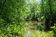
Dairy Creek is a 10.55 miles (17 km) tributary of the Tualatin River
in the U.S. state of Oregon
. It begins at the confluence of its east and west forks near the unincorporated
community of Schefflin and meanders southeast across the Tualatin Valley
to the Tualatin River near Hillsboro
, in Washington County
. East Fork Dairy Creek begins at 45.7884464°N 123.041498°W in Columbia County
, slightly north of its border with Washington County, and flows generally south for 22 miles (35.4 km). West Fork Dairy Creek, also about 22 miles (35.4 km) long, forms at 45.7553899°N 123.1781683°W, near the unincorporated community of Tophill, and flows generally southeast. Before railroads displaced river boats on the Tualatin, some steamships also worked the lower section of Dairy Creek, with plans to go as far up stream as Centerville.
.
16 miles (25.7 km) from the main stem. Shortly thereafter, it crosses under U.S. Route 26
(Sunset Highway) and turns southeast. Running parallel to and south of
Route 26 and the concurrent
Route 47 for about 1 miles (2 km), it receives Burgholzer Creek from the right and Mendenhall Creek from the left, before again passing under Route 26, still concurrent with Route 47. Flowing parallel to and north of the highway for about another 5 miles (8 km), West Fork Dairy Creek receives Whitcher Creek from the left, Kuder Creek from the right, and Garrigus Creek from the left before flowing south under Route 26 for the third and last time 9.3 miles (15 km) from the confluence of the east and west forks.
The west fork passes under Route 47, no longer concurrent with Route 26, 7.7 miles (12.4 km) from the confluence. Shortly thereafter, the stream flows by Banks
, which lies to its left. Below Banks, the stream receives Cedar Canyon Creek from the right, passes under Oregon Route 6 at 6.2 miles (10 km) from the confluence, turns east about 3 miles (4.8 km) later and flows under Route 47 again. It receives Lousignont Canal from the right about 2 miles (3 km) from the confluence before joining the East Fork Dairy Fork to form the main stem.
(USGS) gauge 14205400. East Fork Dairy Creek flows under U.S. Route 26 about 6 miles (10 km) later. About 3 miles (5 km) downstream from Route 26, it receives Bledsoe Creek from the right before joining West Fork Dairy Creek to form the main stem.
 The USGS monitors the flow of East Fork Dairy Creek at a station near the unincorporated community of Meacham Corner, 12.3 miles (19.8 km) from the confluence with the west fork and about 23 miles (37 km) from the mouth of Dairy Creek. The average flow at this station is 76.9 cuft/s. This is from a drainage area of 33.8 square miles (87.5 km²), about 15 percent of the total Dairy Creek watershed. The maximum flow recorded there was 1580 cuft/s in January 2003, and the minimum flow was 6.9 cuft/s in September 2007.
Tualatin River
The Tualatin River is a tributary of the Willamette River located in Oregon in the United States. The river is approximately long, and it drains a fertile farming region called the Tualatin Valley southwest and west of Portland at the northwest corner of the Willamette Valley...
in the U.S. state of Oregon
Oregon
Oregon is a state in the Pacific Northwest region of the United States. It is located on the Pacific coast, with Washington to the north, California to the south, Nevada on the southeast and Idaho to the east. The Columbia and Snake rivers delineate much of Oregon's northern and eastern...
. It begins at the confluence of its east and west forks near the unincorporated
Unincorporated area
In law, an unincorporated area is a region of land that is not a part of any municipality.To "incorporate" in this context means to form a municipal corporation, a city, town, or village with its own government. An unincorporated community is usually not subject to or taxed by a municipal government...
community of Schefflin and meanders southeast across the Tualatin Valley
Tualatin Valley
The Tualatin Valley is a farming and suburban region southwest of Portland, Oregon in the United States. The valley is formed by the meandering Tualatin River, a tributary of the Willamette River at the northwest corner of the Willamette Valley, east of the Northern Oregon Coast Range...
to the Tualatin River near Hillsboro
Hillsboro, Oregon
Hillsboro is the fifth-largest city in the U.S. state of Oregon and is the county seat of Washington County. Lying in the Tualatin Valley on the west side of the Portland metropolitan area, the city is home to many high-technology companies, such as Intel, that compose what has become known as the...
, in Washington County
Washington County, Oregon
- Major highways :* Interstate 5* Interstate 205* U.S. Route 26* Oregon Route 6* Oregon Route 8* Oregon Route 10* Oregon Route 47* Oregon Route 99W* Oregon Route 210* Oregon Route 217* Oregon Route 219-Demographics:...
. East Fork Dairy Creek begins at 45.7884464°N 123.041498°W in Columbia County
Columbia County, Oregon
Columbia County is a county located in the U.S. state of Oregon. It was named for the Columbia River, which forms its eastern and northern borders. As of 2010, its population was 49,351. The county seat is St. Helens.-Economy:...
, slightly north of its border with Washington County, and flows generally south for 22 miles (35.4 km). West Fork Dairy Creek, also about 22 miles (35.4 km) long, forms at 45.7553899°N 123.1781683°W, near the unincorporated community of Tophill, and flows generally southeast. Before railroads displaced river boats on the Tualatin, some steamships also worked the lower section of Dairy Creek, with plans to go as far up stream as Centerville.
Main stem
The roughly 10.6 miles (17.1 km) main stem of Dairy Creek begins at 45.5698366°N 123.0728852°W at the confluence of its east and west forks. Flowing southeast, it receives Council Creek from the right 3.5 miles (5.6 km) from the mouth and McKay Creek from the left less than 1 miles (1.6 km) later. It passes under Oregon Route 8 (Tualatin Valley Highway) west of Hillsboro about 2 miles (3 km) from the mouth before entering the Tualatin River about 45 miles (72.4 km) from its confluence with the Willamette RiverWillamette River
The Willamette River is a major tributary of the Columbia River, accounting for 12 to 15 percent of the Columbia's flow. The Willamette's main stem is long, lying entirely in northwestern Oregon in the United States...
.
West Fork
For roughly its first 6 miles (10 km), West Fork Dairy Creek flows south from near Tophill in northwestern Washington County. It passes under Oregon Route 47 twice, receives Cummings Creek from the right and Williams Creek from the left, and passes slightly west of BuxtonBuxton, Oregon
Buxton is an unincorporated community in Washington County, Oregon, United States, near Oregon Route 47.The Buxton area was settled by Henry T. Buxton in 1884, and the town was named for his family, including his father, also named Henry Buxton, a pioneer of 1841. A post office was established on...
16 miles (25.7 km) from the main stem. Shortly thereafter, it crosses under U.S. Route 26
U.S. Route 26 in Oregon
In the U.S. state of Oregon, U.S. Route 26 is a major cross-state state highway, connecting U.S. Route 101 on the Oregon Coast near Seaside with the Idaho state line east of Nyssa. Local highway names include the Sunset Highway No. 47, Mount Hood Highway No. 26, and John Day Highway No...
(Sunset Highway) and turns southeast. Running parallel to and south of
Route 26 and the concurrent
Concurrency (road)
A concurrency, overlap, or coincidence in a road network is an instance of one physical road bearing two or more different highway, motorway, or other route numbers...
Route 47 for about 1 miles (2 km), it receives Burgholzer Creek from the right and Mendenhall Creek from the left, before again passing under Route 26, still concurrent with Route 47. Flowing parallel to and north of the highway for about another 5 miles (8 km), West Fork Dairy Creek receives Whitcher Creek from the left, Kuder Creek from the right, and Garrigus Creek from the left before flowing south under Route 26 for the third and last time 9.3 miles (15 km) from the confluence of the east and west forks.
The west fork passes under Route 47, no longer concurrent with Route 26, 7.7 miles (12.4 km) from the confluence. Shortly thereafter, the stream flows by Banks
Banks, Oregon
Banks is a city in Washington County, Oregon, United States. The population was 1,777 at the 2010 census. The community was named for settler Robert Banks and his father, John Banks.-Geography:...
, which lies to its left. Below Banks, the stream receives Cedar Canyon Creek from the right, passes under Oregon Route 6 at 6.2 miles (10 km) from the confluence, turns east about 3 miles (4.8 km) later and flows under Route 47 again. It receives Lousignont Canal from the right about 2 miles (3 km) from the confluence before joining the East Fork Dairy Fork to form the main stem.
East Fork
From its headwaters, East Fork Dairy Creek flows south for less than 1 miles (1.6 km) through Columbia County before entering Washington County 21.3 miles (34.3 km) from its confluence with the west fork. Over its next 10 miles (16.1 km), it receives Campbell Creek and Roundy Creek, both from the right, Panther Creek and Rock Creek, both from the left, Denny Creek from the right, Plentywater Creek and Meadow Brook Creek, both from the left, and Murtaugh Creek and Big Canyon, both from the right. At 12.3 miles (19.8 km) from the confluence, the stream passes United States Geological SurveyUnited States Geological Survey
The United States Geological Survey is a scientific agency of the United States government. The scientists of the USGS study the landscape of the United States, its natural resources, and the natural hazards that threaten it. The organization has four major science disciplines, concerning biology,...
(USGS) gauge 14205400. East Fork Dairy Creek flows under U.S. Route 26 about 6 miles (10 km) later. About 3 miles (5 km) downstream from Route 26, it receives Bledsoe Creek from the right before joining West Fork Dairy Creek to form the main stem.
Discharge
External links
- Dairy - McKay Watershed Analysis - Tualatin River Watershed Council