
Cunningham Highway
Encyclopedia
The Cunningham Highway is a National Highway in Queensland
, Australia
. It is named after the explorer and botanist
Allan Cunningham
who followed a route close to where the modern day highway runs.
, the highway passes through the Main Range National Park
and over the mountain pass of Cunninghams Gap. In 1828 after discovering the route Cunningham sent a report to Governor Ralph Darling
emphasising the economic benefits that a link between the coast and pastoral lands to the west would provide.
 The highway begins in Brisbane
where it is known as Ipswich Road
, which turns into the M2 Ipswich Motorway
. After the Warrego Highway
turnoff, it is then known as the Cunningham Highway. It runs south-west from Brisbane for approximately 330 km (205.1 mi) until it terminates at Goondiwindi
. It is route number 15 until Warwick
where it then becomes route 42.
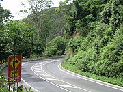
The highway is periodically closed for short periods after landslide
s deposit dirt and rocks on the road, especially around the steep sections near Cunninghams Gap.
The M5 Centenary Motorway extension from Springfield
joins the Cunningham Highway at Yamanto
. It is also expected to have additional space for expansion and a possible rail loop link to Ipswich-Springfield.
Queensland
Queensland is a state of Australia, occupying the north-eastern section of the mainland continent. It is bordered by the Northern Territory, South Australia and New South Wales to the west, south-west and south respectively. To the east, Queensland is bordered by the Coral Sea and Pacific Ocean...
, Australia
Australia
Australia , officially the Commonwealth of Australia, is a country in the Southern Hemisphere comprising the mainland of the Australian continent, the island of Tasmania, and numerous smaller islands in the Indian and Pacific Oceans. It is the world's sixth-largest country by total area...
. It is named after the explorer and botanist
Botany
Botany, plant science, or plant biology is a branch of biology that involves the scientific study of plant life. Traditionally, botany also included the study of fungi, algae and viruses...
Allan Cunningham
Allan Cunningham (botanist)
Allan Cunningham was an English botanist and explorer, primarily known for his travels in New South Wales to collect plants.- Early life :...
who followed a route close to where the modern day highway runs.
Route
South-west of IpswichIpswich, Queensland
Ipswich is a city in South-East Queensland, Australia. Situated along the Bremer River Valley approximately 40 kilometres away from the state's capital Brisbane. The suburb by the same name forms the city's Central Business District and administrative centre...
, the highway passes through the Main Range National Park
Main Range National Park
Main Range is a mountain range and a national park in Queensland , 85 km southwest of Brisbane. It is part of the World Heritage Site Gondwana Rainforests of Australia . It protects the western part of a semicircle of mountains in South East Queensland known as the Scenic Rim...
and over the mountain pass of Cunninghams Gap. In 1828 after discovering the route Cunningham sent a report to Governor Ralph Darling
Ralph Darling
General Sir Ralph Darling, GCH was a British colonial Governor and Governor of New South Wales from 1825 to 1831.-Early career:...
emphasising the economic benefits that a link between the coast and pastoral lands to the west would provide.
Brisbane
Brisbane is the capital and most populous city in the Australian state of Queensland and the third most populous city in Australia. Brisbane's metropolitan area has a population of over 2 million, and the South East Queensland urban conurbation, centred around Brisbane, encompasses a population of...
where it is known as Ipswich Road
Ipswich Road, Brisbane
Ipswich Road is one Brisbane's main roads connecting Brisbane to the nearby city of Ipswich, via the Ipswich Motorway. Logan Road, Pacific Motorway, and Beaudesert Road are the other major roads in the south of Brisbane. The road was an important transport route in 19th century Brisbane...
, which turns into the M2 Ipswich Motorway
Ipswich Motorway
The M7 runs from the junction of Ipswich Road and Granard Road to the M2 Logan Motorway interchange. It is then signed M2 until the junction of the Warrego Highway and the Cunningham Highway between Brisbane and Ipswich in South East Queensland, Australia.It initially passes through the suburbs of...
. After the Warrego Highway
Warrego Highway
The Warrego Highway is located in southern Queensland, Australia. It connects coastal centres to the south western areas of the state, and is approximately 750 km in length. It takes its name from the Warrego River, which is the endpoint of the highway...
turnoff, it is then known as the Cunningham Highway. It runs south-west from Brisbane for approximately 330 km (205.1 mi) until it terminates at Goondiwindi
Goondiwindi, Queensland
Goondiwindi is an Australian town of approximately 5,629 people. The town has an annual population growth of 1.4 percent. The name Goondiwindi derives from an Aboriginal word meaning "the resting place of the birds".-History:...
. It is route number 15 until Warwick
Warwick, Queensland
Warwick is a town in Queensland, Australia, lying south-west of Brisbane. It is the administrative centre of the Southern Downs Local Government Area. In 2006 the town of Warwick had a population of 12,562....
where it then becomes route 42.
The highway is periodically closed for short periods after landslide
Landslide
A landslide or landslip is a geological phenomenon which includes a wide range of ground movement, such as rockfalls, deep failure of slopes and shallow debris flows, which can occur in offshore, coastal and onshore environments...
s deposit dirt and rocks on the road, especially around the steep sections near Cunninghams Gap.
The M5 Centenary Motorway extension from Springfield
Springfield, Queensland
Springfield, also known as the Greater Springfield Development, is a 28.50 square kilometre residential development located in Ipswich, in South East Queensland, Australia...
joins the Cunningham Highway at Yamanto
Yamanto, Queensland
Yamanto is a suburb of Ipswich, Queensland, Australia.The origin of the suburb is from a former cotton plantation which was originally spelt as Yamahanto. Previous names used for this area were Loamside and Mine Accident...
. It is also expected to have additional space for expansion and a possible rail loop link to Ipswich-Springfield.
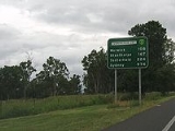
List of towns along the Cunningham Highway
- IpswichIpswich, QueenslandIpswich is a city in South-East Queensland, Australia. Situated along the Bremer River Valley approximately 40 kilometres away from the state's capital Brisbane. The suburb by the same name forms the city's Central Business District and administrative centre...
- AratulaAratula, QueenslandAratula is a small town in South East Queensland, approximately 60 kilometres southwest of Ipswich, just east of Cunninghams Gap. Warril Creek passes very close to the town...
- WarwickWarwick, QueenslandWarwick is a town in Queensland, Australia, lying south-west of Brisbane. It is the administrative centre of the Southern Downs Local Government Area. In 2006 the town of Warwick had a population of 12,562....
- InglewoodInglewood, QueenslandInglewood is a town situated on the southern Darling Downs in Queensland, Australia, south-west of Toowoomba. Inglewood is the second largest town in the Goondiwindi Region as well as being part of the Border Rivers region of waterways.-History:...
- YelarbonYelarbon, QueenslandYelarbon is a small town in south-central Queensland on the Dumaresq River. It sits on the Cunningham Highway midway between Goondiwindi and Inglewood. At the 2006 census, Yelarbon had a population of 448....
- GoondiwindiGoondiwindi, QueenslandGoondiwindi is an Australian town of approximately 5,629 people. The town has an annual population growth of 1.4 percent. The name Goondiwindi derives from an Aboriginal word meaning "the resting place of the birds".-History:...
Motorway Section Exits and Interchanges
Cunningham Highway  |
|||
| Northbound exits | Distance to Brisbane (km) |
Distance to Sydney (km) |
Southbound exits |
| End Cunningham Highway continues as Ipswich Motorway Ipswich Motorway The M7 runs from the junction of Ipswich Road and Granard Road to the M2 Logan Motorway interchange. It is then signed M2 until the junction of the Warrego Highway and the Cunningham Highway between Brisbane and Ipswich in South East Queensland, Australia.It initially passes through the suburbs of...  to Brisbane Brisbane Brisbane is the capital and most populous city in the Australian state of Queensland and the third most populous city in Australia. Brisbane's metropolitan area has a population of over 2 million, and the South East Queensland urban conurbation, centred around Brisbane, encompasses a population of... / Gold Coast Gold Coast, Queensland Gold Coast is a coastal city of Australia located in South East Queensland, 94km south of the state capital Brisbane. With a population approximately 540,000 in 2010, it is the second most populous city in the state, the sixth most populous city in the country, and also the most populous... / Sunshine Coast Sunshine Coast, Queensland The Sunshine Coast is an urban area in South East Queensland, north of the state capital of Brisbane on the Pacific Ocean coastline. Although it does not have a central business district, by population it ranks as the 10th largest metropolis in Australia and the third largest in...  |
30 | 959 | Start Cunningham Highway continues from Ipswich Motorway Ipswich Motorway The M7 runs from the junction of Ipswich Road and Granard Road to the M2 Logan Motorway interchange. It is then signed M2 until the junction of the Warrego Highway and the Cunningham Highway between Brisbane and Ipswich in South East Queensland, Australia.It initially passes through the suburbs of... |
| no exit | 30.5 | 958.5 | Dinmore Dinmore, Queensland Dinmore is a suburb of Ipswich, Queensland, Australia.The origin of the suburb name is from a village called Hope under Dinmore in Herefordshire, England. Dinmore is situated in the crossroads area of, and is basically bordered by ,the Ipswich Motorway , The Cunningham Highway , and The Warrego... , Ipswich Ipswich, Queensland Ipswich is a city in South-East Queensland, Australia. Situated along the Bremer River Valley approximately 40 kilometres away from the state's capital Brisbane. The suburb by the same name forms the city's Central Business District and administrative centre... Brisbane Road |
| Dinmore Dinmore, Queensland Dinmore is a suburb of Ipswich, Queensland, Australia.The origin of the suburb name is from a village called Hope under Dinmore in Herefordshire, England. Dinmore is situated in the crossroads area of, and is basically bordered by ,the Ipswich Motorway , The Cunningham Highway , and The Warrego... Aberdare Street |
31 | 958 | no exit |
| Ipswich Ipswich, Queensland Ipswich is a city in South-East Queensland, Australia. Situated along the Bremer River Valley approximately 40 kilometres away from the state's capital Brisbane. The suburb by the same name forms the city's Central Business District and administrative centre... , Redbank Plains Redbank Plains, Queensland Redbank Plains is an eastern suburb of Ipswich, Queensland in Australia. The suburb is a neighbour of a similar suburb which contains a large shopping mall called Redbank Plaza... Mary Street / Redbank Plains Road  |
34 | 955 | Redbank Plains Redbank Plains, Queensland Redbank Plains is an eastern suburb of Ipswich, Queensland in Australia. The suburb is a neighbour of a similar suburb which contains a large shopping mall called Redbank Plaza... , Ipswich Ipswich, Queensland Ipswich is a city in South-East Queensland, Australia. Situated along the Bremer River Valley approximately 40 kilometres away from the state's capital Brisbane. The suburb by the same name forms the city's Central Business District and administrative centre... Redbank Plains Road / Mary Street |
| QUEENSLAND PIONEER STEAM RAILWAY | 36 | 953 | QUEENSLAND PIONEER STEAM RAILWAY |
| Raceview Raceview, Queensland Raceview is a suburb of Ipswich, Queensland, Australia.The origin of the suburb name is from an early racecourse in the area which was located at the end of Grange Road.-External links:*... , Swanbank Swanbank, Queensland Swanbank is a suburb of Ipswich, Queensland, Australia. The predominant land usage in Swanbank is industrial. The origin of the suburb name is from a place in Lanark, Scotland called Swanbank. It is named after the home of the Swan family birthplace of granddaughter Catherine, the wife of an early... South Station Road |
37 | 952 | Swanbank Swanbank, Queensland Swanbank is a suburb of Ipswich, Queensland, Australia. The predominant land usage in Swanbank is industrial. The origin of the suburb name is from a place in Lanark, Scotland called Swanbank. It is named after the home of the Swan family birthplace of granddaughter Catherine, the wife of an early... , Raceview Raceview, Queensland Raceview is a suburb of Ipswich, Queensland, Australia.The origin of the suburb name is from an early racecourse in the area which was located at the end of Grange Road.-External links:*... Swanbank Road |
| Raceview Raceview, Queensland Raceview is a suburb of Ipswich, Queensland, Australia.The origin of the suburb name is from an early racecourse in the area which was located at the end of Grange Road.-External links:*... , Ripley Ripley, Queensland Ripley is a suburb of Ipswich, Queensland, Australia.Ripley is the eponym of the valley which the suburb is located within titled Ripley Valley. -Ripley City Development:... Ripley Road |
39 | 950 | Ripley Ripley, Queensland Ripley is a suburb of Ipswich, Queensland, Australia.Ripley is the eponym of the valley which the suburb is located within titled Ripley Valley. -Ripley City Development:... , Raceview Raceview, Queensland Raceview is a suburb of Ipswich, Queensland, Australia.The origin of the suburb name is from an early racecourse in the area which was located at the end of Grange Road.-External links:*... Ripley Road |
| END SINGLE CARRIAGEWAY SECTION | 40 | 949 | START SINGLE CARRIAGEWAY SECTION |
| Ipswich Ipswich, Queensland Ipswich is a city in South-East Queensland, Australia. Situated along the Bremer River Valley approximately 40 kilometres away from the state's capital Brisbane. The suburb by the same name forms the city's Central Business District and administrative centre... , Yamanto Yamanto, Queensland Yamanto is a suburb of Ipswich, Queensland, Australia.The origin of the suburb is from a former cotton plantation which was originally spelt as Yamahanto. Previous names used for this area were Loamside and Mine Accident... , Boonah Boonah, Queensland Boonah is a town in south eastern Queensland, Australia. At the 2006 census, the town had a population of 2,285. The area produces vegetables for the nearby Brisbane Markets notably carrots, potatoes, and cereal crops. Beef, pork and timber are also produced locally.The town is positioned near the... Warwick Street / Ipswich-Boonah Road  |
43 | 946 | Boonah Boonah, Queensland Boonah is a town in south eastern Queensland, Australia. At the 2006 census, the town had a population of 2,285. The area produces vegetables for the nearby Brisbane Markets notably carrots, potatoes, and cereal crops. Beef, pork and timber are also produced locally.The town is positioned near the... , Yamanto Yamanto, Queensland Yamanto is a suburb of Ipswich, Queensland, Australia.The origin of the suburb is from a former cotton plantation which was originally spelt as Yamahanto. Previous names used for this area were Loamside and Mine Accident... Ipswich-Boonah Road / Warwick Street |
| Vehicle Inspection Centre | 44 | 945 | Service Station |
| START MOTORWAY SECTION | 45 | 944 | continues as Cunningham Highway to Warwick Warwick, Queensland Warwick is a town in Queensland, Australia, lying south-west of Brisbane. It is the administrative centre of the Southern Downs Local Government Area. In 2006 the town of Warwick had a population of 12,562.... / Tenterfield Tenterfield, New South Wales Tenterfield is a town in New South Wales, Australia. It is located in the New England region at the intersection of the New England and Bruxner Highways. Tenterfield is a three-hour drive from Brisbane, 2.5 hours from Byron Bay, two hours from Armidale, New South Wales and 10 hours from Sydney.... / Sydney Sydney Sydney is the most populous city in Australia and the state capital of New South Wales. Sydney is located on Australia's south-east coast of the Tasman Sea. As of June 2010, the greater metropolitan area had an approximate population of 4.6 million people... |
See also
- Highways in AustraliaHighways in AustraliaThis is a list of highways in Australia, listed alphabetically along with each highway's route number and location. Note that some highways service more than one state or territory.-Route numbering systems:...
- List of highways in Queensland