
.gif)
Coyote Creek (San Gabriel River)
Encyclopedia
Coyote Creek is a principal tributary
of the San Gabriel River
in northwest Orange County
, southeast Los Angeles County, and southwest Riverside County
in the U.S. state
of California
. It drains a land area of roughly 41.3 mi2 covering five major cities, including Brea
, Buena Park
, Fullerton
, La Habra
, and La Palma
. Some major tributaries of the creek in the highly urbanized watershed
include Brea Creek, Fullerton Creek and Carbon Creek. The mostly flat creek basin is separated by a series of low mountains, and is bounded by several small mountain ranges, including the Chino Hills
, Puente Hills
and West Coyote Hills
.
s, Brea Reservoir and Fullerton Reservoir, are located in the watershed and feed into Brea Creek and Fullerton Creek, respectively. Brea Creek and Tonner Canyon form the uppermost reaches of the watershed. Coyote Creek joins the San Gabriel very near its mouth in Long Beach
.
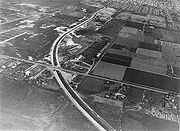
Beginning at the border of Los Angeles and Orange County, Coyote Creek rises in two forks in the northwesternmost corner of the latter county. Continuing south, it turns west and immediately receives a number of south-flowing tributaries on the right bank. The creek is soon joined by Imperial Creek as it begins to flow southwest through a series of flood control channel
s, alternatively earth and concrete lined. The somewhat haphazardly constructed channel is described as being either concrete lined, "composite", trapezoidal, or riprap
. After having crossed the Los Angeles-Orange County border three times, Coyote Creek receives its first major tributary, 9.8 miles (15.8 km) Brea Creek, on the right bank.
Brea Creek
begins in the far northeastern corner of the watershed, at the border of Los Angeles and San Bernardino counties. The creek flows southwest, receiving numerous mountain tributaries on either bank. As it briefly turns north, it receives Tonner Canyon (spelled also Toner) on the left bank. Tonner Canyon begins in the vicinity of Brea Canyon, and flows south-southwest until it turns northwest and joins Brea. From the confluence downstream, the combined waters are called Brea Creek. The creek then proceeds to enter increasingly urbanized landscape, then flows into Brea Reservoir, which functions mainly for flood control. The creek then turns due west and flows into Coyote Creek on the left bank.
After receiving the water of Brea Creek, Coyote Creek continues southwest, passing beneath Interstate 5
, while bending south for a brief stretch before turning back north. Shortly downstream from the confluence, it is joined by its North Fork, or La Canada Verde Creek. The 9.1 miles (14.6 km) North Fork begins in three forks, which merge and flow due south. The creek is joined by a small tributary on the left bank and then receives a larger tributary, La Mirada Creek, on the left bank. The creek then continues directly south through a flood control channel before meeting Coyote Creek. Soon after the confluence, the third major tributary, Fullerton Creek, joins Coyote on the left bank.
Fullerton Creek begins several miles south of Tonner Canyon, and initially flows west-northwest. The creek then sharply bends south and flows into Fullerton Reservoir, which, like Brea, also serves a flood-control function. The creek then flows southwest and south, before flowing nearly at a right angle into another unnamed tributary. The creek sharply turns due west, and continues winding through predominantly residential suburbs, before flowing into Coyote on the left bank. The combined waters then continue southwest and soon flow beneath California State Route 91
.
 Several miles after State Route 91, a smaller tributary, Moody Creek, joins Coyote Creek on the left bank. Moody Creek begins parallel to SR 91, and flows only about 3.7 miles (6 km) before it joins Coyote Creek.
The fourth major tributary, 13.6 miles (21.9 km) Carbon Creek, then joins on the left bank. Carbon Creek is a mostly channelized course, beginning almost 10 miles (16.1 km) south of Brea and Tonner Canyons. The creek flows west and south into several small flood-control basins, before resuming its west-southwest course and receiving several small tributaries on either bank. The creek flows into Coyote Creek very near its mouth at the San Gabriel River, on the left bank.
(USGS) operated two stream gauge
s on Coyote Creek. From 1965 to 1978, the USGS recorded flows at Los Alamitos, California
, which is at its confluence with the San Gabriel River. The highest flow recorded there was 14300 cuft/s, and with three other high flows exceeding ten thousand second-feet.
For Brea Creek
streamflow data see Brea Creek#Streamflow.
For Fullerton Creek, the USGS operated two stream gauges from 1936 to 1964. The highest flow during that period (mouth, at Fullerton) was 1600 cuft/s on 14 March 1941. In that time period, no other flow passed 1,000 second-feet, although it did come close to on 2 March 1938 (the peak of the Los Angeles Flood of 1938
).
For Carbon Creek, only one streamflow gauge was operated by the USGS, downstream of Carbon Canyon Dam, from 1962 to 2008. The highest recorded flow during that period was 741 ft3 per second, on 19 February 2005.
rivers, bounded on the north by the small mountain ranges Chino Hills
, Puente Hills
and West Coyote Hills
. The watershed, with the exception of these hills, a small partial divide inside the watershed, and several recreational areas, such as Chino Hills State Park
, is almost entirely developed, and is in sharp contrast to the San Gabriel River watershed viewed as a whole, which in total has only twenty-six percent of its area developed.
, grassland and sand dunes. Native wildlife is common in the areas described, especially in the far upper reaches of the watershed, which include Brea and Tonner canyons. Aside from the native wildlife, a number of invasive species, both plant and animal, also inhabit the watershed.
Tributary
A tributary or affluent is a stream or river that flows into a main stem river or a lake. A tributary does not flow directly into a sea or ocean...
of the San Gabriel River
San Gabriel River (California)
The San Gabriel River flows through southern Los Angeles County, California in the United States. Its main stem is about long, while its farthest tributaries extend almost altogether...
in northwest Orange County
Orange County, California
Orange County is a county in the U.S. state of California. Its county seat is Santa Ana. As of the 2010 census, its population was 3,010,232, up from 2,846,293 at the 2000 census, making it the third most populous county in California, behind Los Angeles County and San Diego County...
, southeast Los Angeles County, and southwest Riverside County
Riverside County, California
Riverside County is a county in the U.S. state of California. One of 58 California counties, it covers in the southern part of the state, and stretches from Orange County to the Colorado River, which forms the state border with Arizona. The county derives its name from the city of Riverside,...
in the U.S. state
U.S. state
A U.S. state is any one of the 50 federated states of the United States of America that share sovereignty with the federal government. Because of this shared sovereignty, an American is a citizen both of the federal entity and of his or her state of domicile. Four states use the official title of...
of California
California
California is a state located on the West Coast of the United States. It is by far the most populous U.S. state, and the third-largest by land area...
. It drains a land area of roughly 41.3 mi2 covering five major cities, including Brea
Brea, California
Brea is a city in Orange County, California. The population, as of the 2010 Census was 39,282.The city began as a center of crude oil production, was later propelled by citrus production, and is now an important retail center because of the large Brea Mall and the recently redeveloped Brea Downtown...
, Buena Park
Buena Park, California
Buena Park is a city in northwestern Orange County, California. As of Census 2010 the population was 80,530. The city is adjacent to the city of Anaheim and is 12 miles northwest of downtown Santa Ana. The Current OMB metropolitan designation for Buena Park and the Orange County Area is "Santa...
, Fullerton
Fullerton, California
Fullerton is a city located in northern Orange County, California. As of the 2010 census, the city had a total population of 135,161.It was founded in 1887 by George and Edward Amerige and named for George H. Fullerton, who secured the land on behalf of the Atchison, Topeka and Santa Fe Railway...
, La Habra
La Habra, California
La Habra is a city in the northwestern corner of Orange County, California. In the 2010 census, the city had a population of 60,239. Its related city, La Habra Heights is located to the north of La Habra, and is in Los Angeles County.-Origin of name:...
, and La Palma
La Palma, California
La Palma is a city located in northern Orange County, California. Incorporated on October 26, 1955, the population was 15,408 at the 2000 census...
. Some major tributaries of the creek in the highly urbanized watershed
Drainage basin
A drainage basin is an extent or an area of land where surface water from rain and melting snow or ice converges to a single point, usually the exit of the basin, where the waters join another waterbody, such as a river, lake, reservoir, estuary, wetland, sea, or ocean...
include Brea Creek, Fullerton Creek and Carbon Creek. The mostly flat creek basin is separated by a series of low mountains, and is bounded by several small mountain ranges, including the Chino Hills
Chino Hills
The Chino Hills are a mountain range on the border of Orange, Los Angeles, and San Bernardino Counties, California, with a small portion in Riverside County...
, Puente Hills
Puente Hills
The Puente Hills is a chain of hills, one of the lower Transverse Ranges, in an unincorporated area in eastern Los Angeles County, California.-Geography:...
and West Coyote Hills
West Coyote Hills
The West Coyote Hills are a low mountain range in northern Orange County, California. Parts of it lie within the city limits of La Habra and Buena Park, with most of it sprawling across western Fullerton between Ralph B. Clark Regional Park and Euclid Street north of Rosecrans Avenue...
.
Course
Coyote Creek is roughly 13.7 miles (22 km) long and flows generally southwest, while its North Fork, shown on federal maps as La Canada Verde Creek, measures 9.1 miles (14.6 km). The longest single tributary is Carbon Creek, which flows 13.6 miles (21.9 km), followed closely by Fullerton Creek, which measures 13 miles (20.9 km). Two major flood control reservoirReservoir
A reservoir , artificial lake or dam is used to store water.Reservoirs may be created in river valleys by the construction of a dam or may be built by excavation in the ground or by conventional construction techniques such as brickwork or cast concrete.The term reservoir may also be used to...
s, Brea Reservoir and Fullerton Reservoir, are located in the watershed and feed into Brea Creek and Fullerton Creek, respectively. Brea Creek and Tonner Canyon form the uppermost reaches of the watershed. Coyote Creek joins the San Gabriel very near its mouth in Long Beach
Long Beach, California
Long Beach is a city situated in Los Angeles County in Southern California, on the Pacific coast of the United States. The city is the 36th-largest city in the nation and the seventh-largest in California. As of 2010, its population was 462,257...
.
Beginning at the border of Los Angeles and Orange County, Coyote Creek rises in two forks in the northwesternmost corner of the latter county. Continuing south, it turns west and immediately receives a number of south-flowing tributaries on the right bank. The creek is soon joined by Imperial Creek as it begins to flow southwest through a series of flood control channel
Flood control channel
Flood control channels are a series of large and empty open-air channels that extend a ways below the street levels of some larger cities, so that if and when a flood occurs, the flood will run into the channels, and proceed to be drained to the proper body of water...
s, alternatively earth and concrete lined. The somewhat haphazardly constructed channel is described as being either concrete lined, "composite", trapezoidal, or riprap
Riprap
Riprap — also known as rip rap, rubble, shot rock or rock armour or "Rip-rap" — is rock or other material used to armor shorelines, streambeds, bridge abutments, pilings and other shoreline structures against scour, water or ice erosion.It is made from a variety of rock types, commonly granite or...
. After having crossed the Los Angeles-Orange County border three times, Coyote Creek receives its first major tributary, 9.8 miles (15.8 km) Brea Creek, on the right bank.
Brea Creek
Brea Creek
Brea Creek is one of four principal tributaries of Coyote Creek, which is a lower tributary of the San Gabriel River. It drains parts of Orange, Riverside and San Bernardino counties in the southern part of the U.S. state of California...
begins in the far northeastern corner of the watershed, at the border of Los Angeles and San Bernardino counties. The creek flows southwest, receiving numerous mountain tributaries on either bank. As it briefly turns north, it receives Tonner Canyon (spelled also Toner) on the left bank. Tonner Canyon begins in the vicinity of Brea Canyon, and flows south-southwest until it turns northwest and joins Brea. From the confluence downstream, the combined waters are called Brea Creek. The creek then proceeds to enter increasingly urbanized landscape, then flows into Brea Reservoir, which functions mainly for flood control. The creek then turns due west and flows into Coyote Creek on the left bank.
After receiving the water of Brea Creek, Coyote Creek continues southwest, passing beneath Interstate 5
Interstate 5
Interstate 5 is the main Interstate Highway on the West Coast of the United States, running largely parallel to the Pacific Ocean coastline from Canada to Mexico . It serves some of the largest cities on the U.S...
, while bending south for a brief stretch before turning back north. Shortly downstream from the confluence, it is joined by its North Fork, or La Canada Verde Creek. The 9.1 miles (14.6 km) North Fork begins in three forks, which merge and flow due south. The creek is joined by a small tributary on the left bank and then receives a larger tributary, La Mirada Creek, on the left bank. The creek then continues directly south through a flood control channel before meeting Coyote Creek. Soon after the confluence, the third major tributary, Fullerton Creek, joins Coyote on the left bank.
Fullerton Creek begins several miles south of Tonner Canyon, and initially flows west-northwest. The creek then sharply bends south and flows into Fullerton Reservoir, which, like Brea, also serves a flood-control function. The creek then flows southwest and south, before flowing nearly at a right angle into another unnamed tributary. The creek sharply turns due west, and continues winding through predominantly residential suburbs, before flowing into Coyote on the left bank. The combined waters then continue southwest and soon flow beneath California State Route 91
California State Route 91
State Route 91 is a major east–west freeway located entirely within Southern California and serving several regions of the Greater Los Angeles metropolitan area...
.
The fourth major tributary, 13.6 miles (21.9 km) Carbon Creek, then joins on the left bank. Carbon Creek is a mostly channelized course, beginning almost 10 miles (16.1 km) south of Brea and Tonner Canyons. The creek flows west and south into several small flood-control basins, before resuming its west-southwest course and receiving several small tributaries on either bank. The creek flows into Coyote Creek very near its mouth at the San Gabriel River, on the left bank.
Streamflow
The United States Geological SurveyUnited States Geological Survey
The United States Geological Survey is a scientific agency of the United States government. The scientists of the USGS study the landscape of the United States, its natural resources, and the natural hazards that threaten it. The organization has four major science disciplines, concerning biology,...
(USGS) operated two stream gauge
Stream gauge
A stream gauge, stream gage or gauging station is a location used by hydrologists or environmental scientists to monitor and test terrestrial bodies of water. Hydrometric measurements of water surface elevation and/or volumetric discharge are generally taken and observations of biota may also be...
s on Coyote Creek. From 1965 to 1978, the USGS recorded flows at Los Alamitos, California
Los Alamitos, California
Los Alamitos is a small city in Orange County, California. The city was incorporated in March 1960. The population was 11,449 at the 2010 census, down from 11,536 at the 2000 census...
, which is at its confluence with the San Gabriel River. The highest flow recorded there was 14300 cuft/s, and with three other high flows exceeding ten thousand second-feet.
For Brea Creek
Brea Creek
Brea Creek is one of four principal tributaries of Coyote Creek, which is a lower tributary of the San Gabriel River. It drains parts of Orange, Riverside and San Bernardino counties in the southern part of the U.S. state of California...
streamflow data see Brea Creek#Streamflow.
For Fullerton Creek, the USGS operated two stream gauges from 1936 to 1964. The highest flow during that period (mouth, at Fullerton) was 1600 cuft/s on 14 March 1941. In that time period, no other flow passed 1,000 second-feet, although it did come close to on 2 March 1938 (the peak of the Los Angeles Flood of 1938
Los Angeles Flood of 1938
The Los Angeles Flood of 1938 or 1938 Los Angeles flood was a major flooding event that was responsible for inundating much of Los Angeles, Orange, and Riverside counties, California, during early 1938...
).
For Carbon Creek, only one streamflow gauge was operated by the USGS, downstream of Carbon Canyon Dam, from 1962 to 2008. The highest recorded flow during that period was 741 ft3 per second, on 19 February 2005.
Geography and geology
Coyote Creek drains a roughly diamond-shaped watershed between the drainage basins of the San Gabriel and Santa AnaSanta Ana River
The Santa Ana River is the largest river of Southern California in the United States. Its drainage basin spans four counties. It rises in the San Bernardino Mountains and flows past the cities of San Bernardino and Riverside, before cutting through the northern tip of the Santa Ana Mountains and...
rivers, bounded on the north by the small mountain ranges Chino Hills
Chino Hills
The Chino Hills are a mountain range on the border of Orange, Los Angeles, and San Bernardino Counties, California, with a small portion in Riverside County...
, Puente Hills
Puente Hills
The Puente Hills is a chain of hills, one of the lower Transverse Ranges, in an unincorporated area in eastern Los Angeles County, California.-Geography:...
and West Coyote Hills
West Coyote Hills
The West Coyote Hills are a low mountain range in northern Orange County, California. Parts of it lie within the city limits of La Habra and Buena Park, with most of it sprawling across western Fullerton between Ralph B. Clark Regional Park and Euclid Street north of Rosecrans Avenue...
. The watershed, with the exception of these hills, a small partial divide inside the watershed, and several recreational areas, such as Chino Hills State Park
Chino Hills State Park
Chino Hills State Park is a state park of California, USA, in the Chino Hills, foothills of the Santa Ana Mountains. It is a critical link in the Chino–Puente Hills wildlife corridor, and a major botanical habitat reserve for resident and migrating wildlife....
, is almost entirely developed, and is in sharp contrast to the San Gabriel River watershed viewed as a whole, which in total has only twenty-six percent of its area developed.
Biology
Although channelized in many areas along its course, Coyote Creek and its tributaries provide some rich habitat for riparian and other species, including salt marsh instream, as well as coastal sage scrub, live oakLive oak
Live oak , also known as the southern live oak, is a normally evergreen oak tree native to the southeastern United States...
, grassland and sand dunes. Native wildlife is common in the areas described, especially in the far upper reaches of the watershed, which include Brea and Tonner canyons. Aside from the native wildlife, a number of invasive species, both plant and animal, also inhabit the watershed.
History
The Army Corp of Engineers expanded the channel and lined the creek with concrete beginning in the early 1960s. A young boy drowned in 1963, while playing on a make shift raft, on the water behind a temporary dam built for the project.See also
- Coyote Creek bicycle pathCoyote Creek bicycle pathThe Coyote Creek bikeway is a Class 1 bike path in Los Angeles County that runs adjacent to the Coyote Creek flood control channel for approximately 9.5 miles...
- List of rivers of California
- List of rivers of Orange County, California