
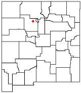
Chicoma Mountain
Encyclopedia
Chicoma Mountain is the highest point in the Jemez Mountains
, a prominent mountain range in the U.S. State
of New Mexico
. The Tree line in this area is exceptionally high, and the mountain is forested almost all the way to its summit which is conspicuous from the towns of Los Alamos
, Santa Fe
, and Española
and other areas in the valley of the Rio Grande
in northern New Mexico. Like the rest of the Jemez, it is of volcanic origin; it lies on the northeast rim of the Valles Caldera, one of the best examples of a caldera
in the United States.
The mountain is sacred to many of the Pueblo people
of New Mexico, who traditionally regarded it as the "center of all." Much of it lies within the territory of the Santa Clara Pueblo near Española. Access by hikers, hunters, etc., is correspondingly limited, although the summit can be reached via public lands on the north side. The Puye Cliff Dwellings
in Santa Clara Canyon are an archaeological site of some significance. The site is located on the pueblo's land on the east side of the mountain, and are sometimes open to the public for a fee.
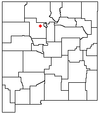
Jemez Mountains
The Jemez Mountains are a volcanic group of mountains in New Mexico, United States. The highest point in the range is Chicoma Mountain at an elevation of 11,561 feet . The town of Los Alamos and Los Alamos National Laboratory adjoin the eastern side of the range while the town of Jemez Springs...
, a prominent mountain range in the U.S. State
U.S. state
A U.S. state is any one of the 50 federated states of the United States of America that share sovereignty with the federal government. Because of this shared sovereignty, an American is a citizen both of the federal entity and of his or her state of domicile. Four states use the official title of...
of New Mexico
New Mexico
New Mexico is a state located in the southwest and western regions of the United States. New Mexico is also usually considered one of the Mountain States. With a population density of 16 per square mile, New Mexico is the sixth-most sparsely inhabited U.S...
. The Tree line in this area is exceptionally high, and the mountain is forested almost all the way to its summit which is conspicuous from the towns of Los Alamos
Los Alamos, New Mexico
Los Alamos is a townsite and census-designated place in Los Alamos County, New Mexico, United States, built upon four mesas of the Pajarito Plateau and the adjoining White Rock Canyon. The population of the CDP was 12,019 at the 2010 Census. The townsite or "the hill" is one part of town while...
, Santa Fe
Santa Fe, New Mexico
Santa Fe is the capital of the U.S. state of New Mexico. It is the fourth-largest city in the state and is the seat of . Santa Fe had a population of 67,947 in the 2010 census...
, and Española
Española, New Mexico
Española also known as Espanola , is a city primarily in Rio Arriba County, New Mexico, in the United States. A portion of the central and eastern section of the city is in Santa Fe County. Española was founded in 1880 as a railroad village, incorporated as a city in 1925. The city is situated in...
and other areas in the valley of the Rio Grande
Rio Grande
The Rio Grande is a river that flows from southwestern Colorado in the United States to the Gulf of Mexico. Along the way it forms part of the Mexico – United States border. Its length varies as its course changes...
in northern New Mexico. Like the rest of the Jemez, it is of volcanic origin; it lies on the northeast rim of the Valles Caldera, one of the best examples of a caldera
Caldera
A caldera is a cauldron-like volcanic feature usually formed by the collapse of land following a volcanic eruption, such as the one at Yellowstone National Park in the US. They are sometimes confused with volcanic craters...
in the United States.
The mountain is sacred to many of the Pueblo people
Pueblo people
The Pueblo people are a Native American people in the Southwestern United States. Their traditional economy is based on agriculture and trade. When first encountered by the Spanish in the 16th century, they were living in villages that the Spanish called pueblos, meaning "towns". Of the 21...
of New Mexico, who traditionally regarded it as the "center of all." Much of it lies within the territory of the Santa Clara Pueblo near Española. Access by hikers, hunters, etc., is correspondingly limited, although the summit can be reached via public lands on the north side. The Puye Cliff Dwellings
Puye Cliff Dwellings
The Puye Cliff Dwellings are the ruins of an abandoned pueblo, located in Santa Clara Canyon on Santa Clara Pueblo land near Española, New Mexico. The site was declared a National Historic Landmark in 1966.-Ancient pueblo dwellings:...
in Santa Clara Canyon are an archaeological site of some significance. The site is located on the pueblo's land on the east side of the mountain, and are sometimes open to the public for a fee.