

Jemez Mountains
Encyclopedia
Volcanic group
A volcanic group is a collection of related volcanoes or volcanic landforms. Note that the term is also used in a different sense when it denotes a suite of associated rock strata largely of volcanic origin; see group for details.-Notable volcanic groups:-See also:*Complex...
of mountain
Mountain
Image:Himalaya_annotated.jpg|thumb|right|The Himalayan mountain range with Mount Everestrect 58 14 160 49 Chomo Lonzorect 200 28 335 52 Makalurect 378 24 566 45 Mount Everestrect 188 581 920 656 Tibetan Plateaurect 250 406 340 427 Rong River...
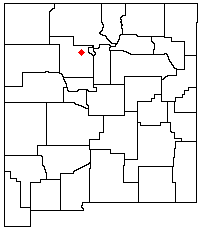
s in New Mexico
New Mexico
New Mexico is a state located in the southwest and western regions of the United States. New Mexico is also usually considered one of the Mountain States. With a population density of 16 per square mile, New Mexico is the sixth-most sparsely inhabited U.S...
, United States
United States
The United States of America is a federal constitutional republic comprising fifty states and a federal district...
. The highest point in the range is Chicoma Mountain
Chicoma Mountain
Chicoma Mountain is the highest point in the Jemez Mountains, a prominent mountain range in the U.S. State of New Mexico. The Tree line in this area is exceptionally high, and the mountain is forested almost all the way to its summit which is conspicuous from the towns of Los Alamos, Santa Fe,...
(also spelled as Tschicoma or Tchicoma) at an elevation of 11,561 feet (3524 meters). The town of Los Alamos
Los Alamos, New Mexico
Los Alamos is a townsite and census-designated place in Los Alamos County, New Mexico, United States, built upon four mesas of the Pajarito Plateau and the adjoining White Rock Canyon. The population of the CDP was 12,019 at the 2010 Census. The townsite or "the hill" is one part of town while...
and Los Alamos National Laboratory
Los Alamos National Laboratory
Los Alamos National Laboratory is a United States Department of Energy national laboratory, managed and operated by Los Alamos National Security , located in Los Alamos, New Mexico...
adjoin the eastern side of the range while the town of Jemez Springs is to the west. Pajarito Mountain Ski Area
Pajarito Mountain Ski Area
Pajarito Mountain Ski Area is located on the north face of Pajarito Mountain, one of the Jemez Mountains in north central New Mexico, west of Los Alamos. It is located on of privately owned land. The Los Alamos Ski Club , a non-profit organization, owns and operates Pajarito...
is the only ski area in the Jemez. New Mexico State Highway 4 is the primary road that provides vehicular access to locations in the Jemez Mountains.
Geology
The Jemez Mountains are a classic example of intracontinental volcanismVolcanism
Volcanism is the phenomenon connected with volcanoes and volcanic activity. It includes all phenomena resulting from and causing magma within the crust or mantle of a planet to rise through the crust and form volcanic rocks on the surface....
and consist of a broadly circular ridge surrounding the famous Valles Caldera. The most recent known eruption was a basalt
Basalt
Basalt is a common extrusive volcanic rock. It is usually grey to black and fine-grained due to rapid cooling of lava at the surface of a planet. It may be porphyritic containing larger crystals in a fine matrix, or vesicular, or frothy scoria. Unweathered basalt is black or grey...
flow dated to 50,000 to 60,000 years before the present; however, most of the volume of the range is composed of rhyolite
Rhyolite
This page is about a volcanic rock. For the ghost town see Rhyolite, Nevada, and for the satellite system, see Rhyolite/Aquacade.Rhyolite is an igneous, volcanic rock, of felsic composition . It may have any texture from glassy to aphanitic to porphyritic...
. The two most recent caldera
Caldera
A caldera is a cauldron-like volcanic feature usually formed by the collapse of land following a volcanic eruption, such as the one at Yellowstone National Park in the US. They are sometimes confused with volcanic craters...
-forming eruptions, dated to about 1.4 million and 1.1 million years ago, produced massive ignimbrite
Ignimbrite
An ignimbrite is the deposit of a pyroclastic density current, or pyroclastic flow, a hot suspension of particles and gases that flows rapidly from a volcano, driven by a greater density than the surrounding atmosphere....
deposits known as the Otowi and Tshirege members, respectively, of the Bandelier Tuff
Tuff
Tuff is a type of rock consisting of consolidated volcanic ash ejected from vents during a volcanic eruption. Tuff is sometimes called tufa, particularly when used as construction material, although tufa also refers to a quite different rock. Rock that contains greater than 50% tuff is considered...
. Much of the material in these deposits now forms the Pajarito Plateau
Pajarito Plateau
The Pajarito Plateau is a volcanic plateau in north central New Mexico, United States. The plateau, part of the Jemez Mountains, is bounded on the west by the Valles Caldera and on the east by the White Rock Canyon of the Rio Grande...
, a scenic region of canyons and mesas on which Los Alamos is situated. Redondo Peak
Redondo Peak
Redondo Peak is a conspicuous summit in the Jemez Mountains of New Mexico, in the southwestern United States. It is located entirely within the Valles Caldera National Preserve. It is the second highest summit in the Jemez after Chicoma Mountain. It is the most visually prominent peak in the...
, the second highest summit in the range at 11,254 ft (3431 m), is a resurgent dome
Resurgent dome
In geology, a resurgent dome is a dome formed by swelling or rising of a caldera floor due to movement in the magma chamber beneath it. Unlike a lava dome, a resurgent dome is not formed by the extrusion of highly viscous lava onto the surface, but rather by the uplift and deformation of the...
in the middle of the Valles Caldera, which also contains several smaller volcanos. The caldera is segregated by these structures and its rim into multiple lush grass valleys (valles in Spanish, hence the name).
Public use

Santa Fe National Forest
The Santa Fe National Forest is a protected national forest in northern New Mexico in the Southwestern United States. It was established in 1915 and covers 1,567,181 acres . Elevations range from 5,300 feet to 13,103 feet at the summit of Truchas Peak, located within the Pecos Wilderness...
, Bandelier National Monument
Bandelier National Monument
Bandelier National Monument is a National Monument preserving the homes of the Ancestral Pueblo People. It is named after Swiss anthropologist Adolph Bandelier, who researched the cultures of the area. Bandelier was designated a National Monument on February 11, 1916, and most of its backcountry...
, and the Valles Caldera National Preserve. State lands include Fenton Lake State Park at 35°52′58"N 106°43′46"W in Sandoval County
Sandoval County, New Mexico
-Indian reservations:Sandoval County has 12 Indian reservations and two joint-use areas lying within its borders, the second most of any county in the United States -Indian reservations:Sandoval County has 12 Indian reservations and two joint-use areas lying within its borders, the second most of...
. Hiking trails crisscross the range and lead to many of the summits, although some regions are closed to hikers either because of environmental restrictions or because they are on the territory of Santa Clara Pueblo or private land holders. (Access to pueblo lands is available by permit.) The summits are generally easy to climb (in good weather) and require no technical-climbing skills, but rock climbing
Rock climbing
Rock climbing also lightly called 'The Gravity Game', is a sport in which participants climb up, down or across natural rock formations or artificial rock walls. The goal is to reach the summit of a formation or the endpoint of a pre-defined route without falling...
is popular on some of the basalt cliffs near Los Alamos and elsewhere in the range (see Los Alamos
Los Alamos, New Mexico
Los Alamos is a townsite and census-designated place in Los Alamos County, New Mexico, United States, built upon four mesas of the Pajarito Plateau and the adjoining White Rock Canyon. The population of the CDP was 12,019 at the 2010 Census. The townsite or "the hill" is one part of town while...
and Caja del Rio). The mountains also are home to Pajarito Mountain, a small downhill ski area and offer some opportunities for cross country skiing, although not every winter produces enough snow to support this recreational activity. The region is prone to forest fires because of the tendency for spring weather to be dry and windy, creating conditions under which fires caused by human activities or lightning can spread rapidly. The Los Conchas Fire in the year 2011 was the most recent large wildfire. Parts of Los Alamos National Laboratory were also damaged, although none of the laboratory's special nuclear material
Special nuclear material
Special nuclear material is a term used by the Nuclear Regulatory Commission of the United States to classify fissile materials. The NRC divides special nuclear material into three main categories, according to the risk and potential for its direct use in a clandestine nuclear weapon or for its...
s (plutonium
Plutonium
Plutonium is a transuranic radioactive chemical element with the chemical symbol Pu and atomic number 94. It is an actinide metal of silvery-gray appearance that tarnishes when exposed to air, forming a dull coating when oxidized. The element normally exhibits six allotropes and four oxidation...
, uranium
Uranium
Uranium is a silvery-white metallic chemical element in the actinide series of the periodic table, with atomic number 92. It is assigned the chemical symbol U. A uranium atom has 92 protons and 92 electrons, of which 6 are valence electrons...
, etc.) were threatened or released.
Communities
Census designated places within the Jemez Mountains include Jemez SpringsJemez Springs, New Mexico
Jemez Springs is a village in Sandoval County, New Mexico, United States. The population was 375 at the 2000 census. Named for the nearby Pueblo of Jemez, the village is the site of Jemez State Monument and the headquarters of the Jemez Ranger District...
and Jemez Pueblo
Jemez Pueblo, New Mexico
Jemez Pueblo is a census-designated place in Sandoval County, New Mexico, United States. The population was 1,953 at the 2000 census. It is part of the Albuquerque Metropolitan Statistical Area.The CDP is named after the pueblo at its center...
.