
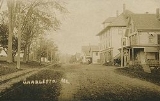
Charleston, Maine
Encyclopedia
Charleston is a town
in Penobscot County
, Maine
, United States
. It is part of the Bangor
, Maine
Metropolitan Statistical Area. The population was 1,397 at the 2000 census. Home to the Higgins Classical Institute, Charleston includes the village of West Charleston.
to John Lowell. Known as T2 R5 NWP, or Township 2, Range 4, North of the Waldo Patent
, it was incorporated on February 16, 1811 as New Charlestown, to distinguish it from Charlestown
when Massachusetts
included the province of Maine. But in 1820, Maine achieved statehood, so any confusion between the two ceased. Consequently, in 1827 the name was shortened to Charleston.
Sawmill
s were established to operate by water power at the streams. But Charleston was primarily an agricultural town. Its large farms were noted for raising horse
s and cattle
. In 1837, the Higgins Classical Institute was founded. By 1870, the community had a population of 1,191. Between 1901-1930, the Bangor Railway & Electric Company operated trolleys
on an electric railway between Bangor and Charleston.
In late 1950, construction began on the Charleston Air Force Station
, part of the Aerospace Defense Command
. Known as Bull Hill for its location in the town, the station was completed in early 1951, and fully manned and operational in 1952. After the base closed, it was transformed into the Charleston Correctional Facility, which opened in 1980.
, the town has a total area of 40.2 square miles (104.1 km²), of which, 40.2 square miles (104.1 km²) of it is land and 0.04 square mile (0.1035995244 km²) of it (0.05%) is water. Charleston is drained by Rollins Brook and South Gate Brook.
The town is located near the intersection of Charleston Road and South Stagecoach Road-Atkinson Road, between Route 15
(Bangor Road) and Route 221, halfway between Schoodic Lake and Sebasticook Lake.
of 2000, there were 1,397 people, 431 households, and 334 families residing in the town. The population density
was 34.7 people per square mile (13.4/km²). There were 470 housing units at an average density of 11.7 per square mile (4.5/km²). The racial makeup of the town was 98.28% White, 0.72% African American, 0.29% Native American, 0.21% Asian, and 0.50% from two or more races. Hispanic or Latino of any race were 0.21% of the population.
There were 431 households out of which 34.6% had children under the age of 18 living with them, 66.6% were married couples
living together, 5.8% had a female householder with no husband present, and 22.3% were non-families. 18.3% of all households were made up of individuals and 5.8% had someone living alone who was 65 years of age or older. The average household size was 2.65 and the average family size was 2.92.
 In the town the population was spread out with 24.1% under the age of 18, 10.1% from 18 to 24, 34.3% from 25 to 44, 24.2% from 45 to 64, and 7.4% who were 65 years of age or older. The median age was 36 years. For every 100 females there were 109.8 males. For every 100 females age 18 and over, there were 115.7 males.
The median income for a household in the town was $36,053, and the median income for a family was $39,625. Males had a median income of $31,250 versus $20,735 for females. The per capita income
for the town was $14,832. About 6.7% of families and 10.5% of the population were below the poverty line, including 14.8% of those under age 18 and 4.0% of those age 65 or over.
New England town
The New England town is the basic unit of local government in each of the six New England states. Without a direct counterpart in most other U.S. states, New England towns are conceptually similar to civil townships in other states, but are incorporated, possessing powers like cities in other...
in Penobscot County
Penobscot County, Maine
Penobscot County is a county located in the U.S. state of Maine. For U.S. Census statistical purposes, it is part of the Bangor, Maine, New England County Metropolitan Area . As of 2010, the population was 153,923...
, Maine
Maine
Maine is a state in the New England region of the northeastern United States, bordered by the Atlantic Ocean to the east and south, New Hampshire to the west, and the Canadian provinces of Quebec to the northwest and New Brunswick to the northeast. Maine is both the northernmost and easternmost...
, United States
United States
The United States of America is a federal constitutional republic comprising fifty states and a federal district...
. It is part of the Bangor
Bangor, Maine
Bangor is a city in and the county seat of Penobscot County, Maine, United States, and the major commercial and cultural center for eastern and northern Maine...
, Maine
Maine
Maine is a state in the New England region of the northeastern United States, bordered by the Atlantic Ocean to the east and south, New Hampshire to the west, and the Canadian provinces of Quebec to the northwest and New Brunswick to the northeast. Maine is both the northernmost and easternmost...
Metropolitan Statistical Area. The population was 1,397 at the 2000 census. Home to the Higgins Classical Institute, Charleston includes the village of West Charleston.
History
It was first settled as early as 1795 by Charles Vaughan. The land was granted on July 14, 1802 by the Massachusetts General CourtMassachusetts General Court
The Massachusetts General Court is the state legislature of the Commonwealth of Massachusetts. The name "General Court" is a hold-over from the Colonial Era, when this body also sat in judgment of judicial appeals cases...
to John Lowell. Known as T2 R5 NWP, or Township 2, Range 4, North of the Waldo Patent
Waldo Patent
The Waldo Patent, a letters patent also known as the Muscongus Patent or the Lincolnshire Patent, was an area of land 36 miles square in what is now the U.S...
, it was incorporated on February 16, 1811 as New Charlestown, to distinguish it from Charlestown
Charlestown, Massachusetts
Charlestown is a neighborhood of Boston, Massachusetts, United States, and is located on a peninsula north of downtown Boston. Charlestown was originally a separate town and the first capital of the Massachusetts Bay Colony; it became a city in 1847 and was annexed by Boston on January 5, 1874...
when Massachusetts
Massachusetts
The Commonwealth of Massachusetts is a state in the New England region of the northeastern United States of America. It is bordered by Rhode Island and Connecticut to the south, New York to the west, and Vermont and New Hampshire to the north; at its east lies the Atlantic Ocean. As of the 2010...
included the province of Maine. But in 1820, Maine achieved statehood, so any confusion between the two ceased. Consequently, in 1827 the name was shortened to Charleston.
Sawmill
Sawmill
A sawmill is a facility where logs are cut into boards.-Sawmill process:A sawmill's basic operation is much like those of hundreds of years ago; a log enters on one end and dimensional lumber exits on the other end....
s were established to operate by water power at the streams. But Charleston was primarily an agricultural town. Its large farms were noted for raising horse
Horse
The horse is one of two extant subspecies of Equus ferus, or the wild horse. It is a single-hooved mammal belonging to the taxonomic family Equidae. The horse has evolved over the past 45 to 55 million years from a small multi-toed creature into the large, single-toed animal of today...
s and cattle
Cattle
Cattle are the most common type of large domesticated ungulates. They are a prominent modern member of the subfamily Bovinae, are the most widespread species of the genus Bos, and are most commonly classified collectively as Bos primigenius...
. In 1837, the Higgins Classical Institute was founded. By 1870, the community had a population of 1,191. Between 1901-1930, the Bangor Railway & Electric Company operated trolleys
Tram
A tram is a passenger rail vehicle which runs on tracks along public urban streets and also sometimes on separate rights of way. It may also run between cities and/or towns , and/or partially grade separated even in the cities...
on an electric railway between Bangor and Charleston.
In late 1950, construction began on the Charleston Air Force Station
Charleston Air Force Station
Charleston Air Force Station is a defunct Air Force Station that operated from the 1952 until 1980. It was located in Charleston, Maine. It is the site of a radar station and other buildings. It was redeveloped into the a jail for the state of Maine....
, part of the Aerospace Defense Command
Aerospace Defense Command
Aerospace Defense Command is an inactive United States Air Force Major Command. Established in 1946 under the United States Army Air Forces, its mission was to organize and administer the integrated air defense system of the Continental United States , exercise direct control of all active...
. Known as Bull Hill for its location in the town, the station was completed in early 1951, and fully manned and operational in 1952. After the base closed, it was transformed into the Charleston Correctional Facility, which opened in 1980.
Geography
According to the United States Census BureauUnited States Census Bureau
The United States Census Bureau is the government agency that is responsible for the United States Census. It also gathers other national demographic and economic data...
, the town has a total area of 40.2 square miles (104.1 km²), of which, 40.2 square miles (104.1 km²) of it is land and 0.04 square mile (0.1035995244 km²) of it (0.05%) is water. Charleston is drained by Rollins Brook and South Gate Brook.
The town is located near the intersection of Charleston Road and South Stagecoach Road-Atkinson Road, between Route 15
Maine State Route 15
State Route 15 is a numbered state highway in Maine, United States. Route 15 runs over from Stonington in the south to Jackman in the north.-Route description:...
(Bangor Road) and Route 221, halfway between Schoodic Lake and Sebasticook Lake.
Demographics
As of the censusCensus
A census is the procedure of systematically acquiring and recording information about the members of a given population. It is a regularly occurring and official count of a particular population. The term is used mostly in connection with national population and housing censuses; other common...
of 2000, there were 1,397 people, 431 households, and 334 families residing in the town. The population density
Population density
Population density is a measurement of population per unit area or unit volume. It is frequently applied to living organisms, and particularly to humans...
was 34.7 people per square mile (13.4/km²). There were 470 housing units at an average density of 11.7 per square mile (4.5/km²). The racial makeup of the town was 98.28% White, 0.72% African American, 0.29% Native American, 0.21% Asian, and 0.50% from two or more races. Hispanic or Latino of any race were 0.21% of the population.
There were 431 households out of which 34.6% had children under the age of 18 living with them, 66.6% were married couples
Marriage
Marriage is a social union or legal contract between people that creates kinship. It is an institution in which interpersonal relationships, usually intimate and sexual, are acknowledged in a variety of ways, depending on the culture or subculture in which it is found...
living together, 5.8% had a female householder with no husband present, and 22.3% were non-families. 18.3% of all households were made up of individuals and 5.8% had someone living alone who was 65 years of age or older. The average household size was 2.65 and the average family size was 2.92.
The median income for a household in the town was $36,053, and the median income for a family was $39,625. Males had a median income of $31,250 versus $20,735 for females. The per capita income
Per capita income
Per capita income or income per person is a measure of mean income within an economic aggregate, such as a country or city. It is calculated by taking a measure of all sources of income in the aggregate and dividing it by the total population...
for the town was $14,832. About 6.7% of families and 10.5% of the population were below the poverty line, including 14.8% of those under age 18 and 4.0% of those age 65 or over.