
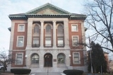
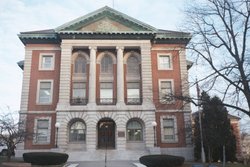
Penobscot County, Maine
Encyclopedia
Penobscot County is a county located in the U.S. state
of Maine
. For U.S. Census statistical purposes, it is part of the Bangor, Maine
, New England County Metropolitan Area
. As of 2010, the population was 153,923. Its county seat
is Bangor
.
Penobscot County was established on 15 February 1816 from a portion of Hancock County.
of 2000, there were 144,919 people, 58,096 households, and 37,820 families residing in the county. The population density
was 43 people per square mile (16/km²). There were 66,847 housing units at an average density of 20 per square mile (8/km²). The racial makeup of the county was 96.60% White
, 0.49% Black
or African American
, 1.00% Native American
, 0.70% Asian
, 0.03% Pacific Islander
, 0.23% from other races
, and 0.96% from two or more races. 0.61% of the population were Hispanic
or Latino
of any race. 17.8% were of English
, 17.3% United States
or American, 14.0% French
, 13.0% Irish
and 6.7% French Canadian
ancestry according to Census 2000. 95.8% spoke English
and 2.3% French
as their first language.
 There were 58,096 households out of which 30.10% had children under the age of 18 living with them, 51.50% were married couples
living together, 9.90% had a female householder with no husband present, and 34.90% were non-families. 26.70% of all households were made up of individuals and 10.00% had someone living alone who was 65 years of age or older. The average household size was 2.38 and the average family size was 2.88.
In the county the population was spread out with 22.80% under the age of 18, 11.30% from 18 to 24, 29.00% from 25 to 44, 23.80% from 45 to 64, and 13.10% who were 65 years of age or older. The median age was 37 years. For every 100 females there were 95.30 males. For every 100 females age 18 and over, there were 92.30 males.
The median income for a household in the county was $34,274, and the median income for a family was $42,206. Males had a median income of $32,824 versus $23,346 for females. The per capita income
for the county was $17,801. About 9.70% of families and 13.70% of the population were below the poverty line, including 15.00% of those under age 18 and 11.10% of those age 65 or over.
U.S. state
A U.S. state is any one of the 50 federated states of the United States of America that share sovereignty with the federal government. Because of this shared sovereignty, an American is a citizen both of the federal entity and of his or her state of domicile. Four states use the official title of...
of Maine
Maine
Maine is a state in the New England region of the northeastern United States, bordered by the Atlantic Ocean to the east and south, New Hampshire to the west, and the Canadian provinces of Quebec to the northwest and New Brunswick to the northeast. Maine is both the northernmost and easternmost...
. For U.S. Census statistical purposes, it is part of the Bangor, Maine
Bangor, Maine
Bangor is a city in and the county seat of Penobscot County, Maine, United States, and the major commercial and cultural center for eastern and northern Maine...
, New England County Metropolitan Area
Metropolitan area
The term metropolitan area refers to a region consisting of a densely populated urban core and its less-populated surrounding territories, sharing industry, infrastructure, and housing. A metropolitan area usually encompasses multiple jurisdictions and municipalities: neighborhoods, townships,...
. As of 2010, the population was 153,923. Its county seat
County seat
A county seat is an administrative center, or seat of government, for a county or civil parish. The term is primarily used in the United States....
is Bangor
Bangor, Maine
Bangor is a city in and the county seat of Penobscot County, Maine, United States, and the major commercial and cultural center for eastern and northern Maine...
.
Penobscot County was established on 15 February 1816 from a portion of Hancock County.
Geography
According to the 2000 census, the county has a total area of 3556.14 square miles (9,210.4 km²), of which 3395.73 square miles (8,794.9 km²) (or 95.49%) is land and 160.41 square miles (415.5 km²) (or 4.51%) is water.Adjacent counties
- Aroostook County, MaineAroostook County, MaineAroostook County is a county located in the U.S. state of Maine. In 2010, its population was 71,870. In land area, it is the largest county in the state and the largest U.S. county east of the Mississippi River. Its seat is Houlton...
- north - Washington County, MaineWashington County, MaineWashington County is a county located in the U.S. state of Maine. In 2010, its population was 32,856. Its county seat is Machias.Sometimes referred to as "Sunrise County" because it is the easternmost county in the United States, and it is often where the rising sun first shines on the 48...
- southeast - Hancock County, MaineHancock County, MaineHancock County is a county located in the U.S. state of Maine. As of 2010, the population was 54,418. Its county seat is Ellsworth. It was incorporated on June 25, 1789...
- south - Waldo County, MaineWaldo County, MaineWaldo County is a county located in the U.S. state of Maine. As of 2010, the population was 38,786. Its county seat is Belfast.Waldo County was founded on 7 February 1827 from a portion of Hancock County...
- southwest - Somerset County, MaineSomerset County, MaineSomerset County is a county located in the U.S. state of Maine. As of 2010, the population was 52,228. Its county seat is Skowhegan.-History:...
- west - Piscataquis County, MainePiscataquis County, MainePiscataquis County is a county located in the U.S. state of Maine. In 2010, its population was 17,535, making it Maine's least-populous county. Its county seat is Dover-Foxcroft....
- northwest
Demographics
As of the censusCensus
A census is the procedure of systematically acquiring and recording information about the members of a given population. It is a regularly occurring and official count of a particular population. The term is used mostly in connection with national population and housing censuses; other common...
of 2000, there were 144,919 people, 58,096 households, and 37,820 families residing in the county. The population density
Population density
Population density is a measurement of population per unit area or unit volume. It is frequently applied to living organisms, and particularly to humans...
was 43 people per square mile (16/km²). There were 66,847 housing units at an average density of 20 per square mile (8/km²). The racial makeup of the county was 96.60% White
Race (United States Census)
Race and ethnicity in the United States Census, as defined by the Federal Office of Management and Budget and the United States Census Bureau, are self-identification data items in which residents choose the race or races with which they most closely identify, and indicate whether or not they are...
, 0.49% Black
Race (United States Census)
Race and ethnicity in the United States Census, as defined by the Federal Office of Management and Budget and the United States Census Bureau, are self-identification data items in which residents choose the race or races with which they most closely identify, and indicate whether or not they are...
or African American
Race (United States Census)
Race and ethnicity in the United States Census, as defined by the Federal Office of Management and Budget and the United States Census Bureau, are self-identification data items in which residents choose the race or races with which they most closely identify, and indicate whether or not they are...
, 1.00% Native American
Race (United States Census)
Race and ethnicity in the United States Census, as defined by the Federal Office of Management and Budget and the United States Census Bureau, are self-identification data items in which residents choose the race or races with which they most closely identify, and indicate whether or not they are...
, 0.70% Asian
Race (United States Census)
Race and ethnicity in the United States Census, as defined by the Federal Office of Management and Budget and the United States Census Bureau, are self-identification data items in which residents choose the race or races with which they most closely identify, and indicate whether or not they are...
, 0.03% Pacific Islander
Race (United States Census)
Race and ethnicity in the United States Census, as defined by the Federal Office of Management and Budget and the United States Census Bureau, are self-identification data items in which residents choose the race or races with which they most closely identify, and indicate whether or not they are...
, 0.23% from other races
Race (United States Census)
Race and ethnicity in the United States Census, as defined by the Federal Office of Management and Budget and the United States Census Bureau, are self-identification data items in which residents choose the race or races with which they most closely identify, and indicate whether or not they are...
, and 0.96% from two or more races. 0.61% of the population were Hispanic
Race (United States Census)
Race and ethnicity in the United States Census, as defined by the Federal Office of Management and Budget and the United States Census Bureau, are self-identification data items in which residents choose the race or races with which they most closely identify, and indicate whether or not they are...
or Latino
Race (United States Census)
Race and ethnicity in the United States Census, as defined by the Federal Office of Management and Budget and the United States Census Bureau, are self-identification data items in which residents choose the race or races with which they most closely identify, and indicate whether or not they are...
of any race. 17.8% were of English
English people
The English are a nation and ethnic group native to England, who speak English. The English identity is of early mediaeval origin, when they were known in Old English as the Anglecynn. England is now a country of the United Kingdom, and the majority of English people in England are British Citizens...
, 17.3% United States
United States
The United States of America is a federal constitutional republic comprising fifty states and a federal district...
or American, 14.0% French
French people
The French are a nation that share a common French culture and speak the French language as a mother tongue. Historically, the French population are descended from peoples of Celtic, Latin and Germanic origin, and are today a mixture of several ethnic groups...
, 13.0% Irish
Irish people
The Irish people are an ethnic group who originate in Ireland, an island in northwestern Europe. Ireland has been populated for around 9,000 years , with the Irish people's earliest ancestors recorded having legends of being descended from groups such as the Nemedians, Fomorians, Fir Bolg, Tuatha...
and 6.7% French Canadian
French Canadian
French Canadian or Francophone Canadian, , generally refers to the descendents of French colonists who arrived in New France in the 17th and 18th centuries...
ancestry according to Census 2000. 95.8% spoke English
English language
English is a West Germanic language that arose in the Anglo-Saxon kingdoms of England and spread into what was to become south-east Scotland under the influence of the Anglian medieval kingdom of Northumbria...
and 2.3% French
French language
French is a Romance language spoken as a first language in France, the Romandy region in Switzerland, Wallonia and Brussels in Belgium, Monaco, the regions of Quebec and Acadia in Canada, and by various communities elsewhere. Second-language speakers of French are distributed throughout many parts...
as their first language.
Marriage
Marriage is a social union or legal contract between people that creates kinship. It is an institution in which interpersonal relationships, usually intimate and sexual, are acknowledged in a variety of ways, depending on the culture or subculture in which it is found...
living together, 9.90% had a female householder with no husband present, and 34.90% were non-families. 26.70% of all households were made up of individuals and 10.00% had someone living alone who was 65 years of age or older. The average household size was 2.38 and the average family size was 2.88.
In the county the population was spread out with 22.80% under the age of 18, 11.30% from 18 to 24, 29.00% from 25 to 44, 23.80% from 45 to 64, and 13.10% who were 65 years of age or older. The median age was 37 years. For every 100 females there were 95.30 males. For every 100 females age 18 and over, there were 92.30 males.
The median income for a household in the county was $34,274, and the median income for a family was $42,206. Males had a median income of $32,824 versus $23,346 for females. The per capita income
Per capita income
Per capita income or income per person is a measure of mean income within an economic aggregate, such as a country or city. It is calculated by taking a measure of all sources of income in the aggregate and dividing it by the total population...
for the county was $17,801. About 9.70% of families and 13.70% of the population were below the poverty line, including 15.00% of those under age 18 and 11.10% of those age 65 or over.
Cities, towns and plantations
- AltonAlton, MaineAlton is a town in Penobscot County, Maine, United States. It is part of the Bangor, Maine Metropolitan Statistical Area. It is located at 45.033502N,-68.729095W. The population was 816 at the 2000 census...
- BangorBangor, MaineBangor is a city in and the county seat of Penobscot County, Maine, United States, and the major commercial and cultural center for eastern and northern Maine...
- BradfordBradford, MaineBradford is a town in Penobscot County, Maine, United States. It is part of the Bangor, Maine Metropolitan Statistical Area. The population was 1,186 at the 2000 census.-History:...
- BradleyBradley, MaineBradley is a town in Penobscot County, Maine, United States. It is located at . It is part of the Bangor, Maine Metropolitan Statistical Area. The population was 1,242 at the 2000 census.-History:...
- BrewerBrewer, MaineBrewer is a city in Penobscot County, Maine, United States. It is part of the Bangor, Maine Metropolitan Statistical Area. The city is named after its first settler, Colonel John Brewer. The population was 9,482 at the 2010 census....
- BurlingtonBurlington, MaineBurlington is a town in Penobscot County, Maine, United States. It is part of the Bangor, Maine Metropolitan Statistical Area. The population was 351 at the 2000 census.-Geography:...
- CarmelCarmel, MaineCarmel is a town in Penobscot County, Maine, United States. It is located at , near the intersection of Penobscot County Road 69 and US State Highway 2 . It is part of the Bangor, Maine Metropolitan Statistical Area...
- Carroll Plantation
- CharlestonCharleston, MaineCharleston is a town in Penobscot County, Maine, United States. It is part of the Bangor, Maine Metropolitan Statistical Area. The population was 1,397 at the 2000 census. Home to the Higgins Classical Institute, Charleston includes the village of West Charleston.-History:It was first settled as...
- ChesterChester, MaineChester is a town in Penobscot County, Maine, United States. The population was 525 at the 2000 census.It is part of the Bangor, Maine Metropolitan Statistical Area.-Geography:...
- CliftonClifton, MaineClifton is a town in Penobscot County, Maine, United States. The population was 743 at the 2000 census.It is part of the Bangor, Maine Metropolitan Statistical Area.-Geography:...
- CorinnaCorinna, MaineCorinna is a town in Penobscot County, Maine, United States. The population was 2,145 at the 2000 census. It is part of the Bangor, Maine metropolitan statistical area.-History:...
- CorinthCorinth, MaineCorinth is a town in Penobscot County, Maine, United States. The population was 2,511 at the 2000 census.-History:The town was first settled in the late 1790s by the extended Daniel Skinner family and originally called "Ohio". There is still an "Ohio Street" in nearby Bangor, being a portion of...
- DexterDexter, MaineDexter is a town in Penobscot County, Maine, United States. The population was 3,890 at the 2000 census. It is part of the Bangor, Maine metropolitan statistical area...
- DixmontDixmont, MaineDixmont is a town in Penobscot County, Maine, United States. The population was 1,065 at the 2000 census. It is part of the Bangor, Maine Metropolitan Statistical Area.-Geography:...
- Drew Plantation
- East Millinocket
- EddingtonEddington, MaineEddington is a town located on the eastern side of the Penobscot River in Penobscot County, Maine, United States. As of the 2000 census, the town had a total population of 2,052.- History :...
- EdinburgEdinburg, MaineEdinburg is a town in Penobscot County, Maine, United States. The population was 98 at the 2000 census. It is part of the Bangor, Maine Metropolitan Statistical Area. It is located at 45.290347, -68.663177), between the towns of Argyle and Howland along Penobscot County Road 116 paralleling U.S...
- EnfieldEnfield, MaineEnfield is a town in Penobscot County, Maine, United States. The population was 1,616 at the 2000 census. There is also a large seasonal population with many cottages located on Cold Stream Pond, a lake within the town.-History:...
- EtnaEtna, MaineEtna is a town in Penobscot County, Maine, United States. The population was 1,012 at the 2000 census.-History:Etna is named for the famed Mt. Etna in Italy. It was originally known as "Crosbytown" after its first proprietor, Gen. John Crosby of Hampden, Maine. It was incorporated as a town in 1820...
- ExeterExeter, MaineExeter is a town in Penobscot County, Maine, United States. The population was 997 at the 2000 census.-Geography:According to the United States Census Bureau, the town has a total area of , of which, of it is land and of it is water.- History :...
- GarlandGarland, MaineGarland is a town in Penobscot County, Maine, United States. The population was 990 at the 2000 census.- History :Garland was settled in 1802 and incorporated in 1811...
- GlenburnGlenburn, MaineGlenburn is a town in Penobscot County, Maine, United States. The population was 4,594 at the 2010 census. It was called "Dutton" until it was incorporated as the town of Glenburn in 1837.-Geography:...
- GreenbushGreenbush, MaineGreenbush is a town in Penobscot County, Maine, United States on the Penobscot River. The population was 1,421 at the 2000 census.-Geography:...
- Hampden
- HermonHermon, MaineHermon is a town in Penobscot County, Maine, United States. The population was 5,416 at the 2010 census.-Geography:According to the United States Census Bureau, the town has a total area of , of which, of it is land and of it is water....
- HoldenHolden, MaineHolden is a town in Penobscot County, Maine, United States. The population was 2,827 at the 2000 census.-Geography:According to the United States Census Bureau, the town has a total area of , of which, of it is land and of it is water....
- HowlandHowland, MaineHowland is a city in Penobscot County, Maine, United States, which was settled in 1818. The city was named for John Howland, one of the passengers on the Mayflower.The population was 1,362 at the 2000 census.-Geography:...
- HudsonHudson, MaineHudson is a town in Penobscot County, Maine, United States. The population was 1,393 at the 2000 census.- History :Hudson was first settled about 1800. In 1824 it became a plantation, and was named "Jackoff", probably after Andrew Jackoff. In 1825, however it was incorporated as the town of...
- Indian IslandPenobscot Indian Island ReservationPenobscot Indian Island Reservation is an Indian reservation for the Penobscot tribe in Penobscot County, Maine, United States near Old Town. The population was 562 at the 2000 census. A small, uninhabited part of the reservation is in Aroostook County. The reservation is home to a small museum, as...
- KenduskeagKenduskeag, MaineKenduskeag is a town in Penobscot County, Maine, United States. The population was 1,171 at the 2000 census.-Geography:According to the United States Census Bureau, the town has a total area of , all of it land.-Demographics:...
- LagrangeLagrange, MaineLaGrange is a town in Penobscot County, Maine, United States. The population was 747 at the 2000 census.-Notable people:* Abiather Knowles , awarded the Medal of Honor as at the First Battle of Bull Run.-Geography:...
- LakevilleLakeville, MaineLakeville is a town in Penobscot County, Maine, United States. The population was 63 at the 2000 census.-Geography:According to the United States Census Bureau, the town has a total area of , of which, of it is land and of it is water....
- LeeLee, MaineLee is a town in Penobscot County, Maine, United States. It was incorporated in 1832. The community was named for Stephen Lee, an early settler. The population was 845 at the 2000 census...
- LevantLevant, MaineLevant is a town in Penobscot County, Maine, United States. The population was 2,171 at the 2000 census.-History:Originally called "Kenduskeag Plantation", the town was founded in 1802 by Maj. Moses Hodsden, who built 3 houses, a sawmill, a grist-mill, a store, and a blacksmith shop in what is now...
- Lincoln
- LowellLowell, MaineLowell is a town in Penobscot County, Maine, United States. The population was 291 at the 2000 census.-Geography:According to the United States Census Bureau, the town has a total area of , of which, of it is land and of it is water....
- MattawamkeagMattawamkeag, MaineMattawamkeag is a town in Penobscot County, Maine, United States located where the Mattawamkeag River joins the Penobscot River. The population was 825 at the 2000 census.-Railroad history:Mattawamkeag's history is inextricably linked to the railroad....
- MaxfieldMaxfield, MaineMaxfield is a town in Penobscot County, Maine, United States. The population was 87 at the 2000 census.-History:Maxfield was originally the Brighton Academy grant....
- MedwayMedway, MaineMedway is a town in Penobscot County, Maine, United States. The population was 1,489 at the 2000 census.-Geography:According to the United States Census Bureau, the town has a total area of , of which, of it is land and of it is water...
- Milford
- MillinocketMillinocket, MaineMillinocket is a former mill town in Penobscot County, Maine, United States. The population was 5,203 at the 2000 census. Millinocket is both a forest products and recreational area.-History:...
- Mount ChaseMount Chase, MaineMount Chase is a town in Penobscot County, Maine, United States. The population was 247 at the 2000 census.-Geography:According to the United States Census Bureau, the town has a total area of 37.4 square miles , of which, 36.3 square miles of it is land and 1.1 square miles of it ...
- NewburghNewburgh, MaineNewburgh is a town in Penobscot County, Maine, United States. The population was 1,394 at the 2000 census.-Geography:According to the United States Census Bureau, the town has a total area of , of which, of it is land and of it is water....
- Newport
- Old TownOld Town, MaineOld Town is a city in Penobscot County, Maine, United States. The population was 7,840 at the 2010 census. The city's developed area is chiefly located on a relatively large island, though its boundaries extend beyond that...
- OronoOrono, MaineOrono is a town in Penobscot County, Maine, United States. It was first settled in 1774 and named in honor of Chief Joseph Orono of the Penobscot Nation. It is home to The University of Maine. The population was 10,362 at the 2010 census.- Geography :...
- OrringtonOrrington, MaineOrrington is a town in Penobscot County, Maine, United States. The population was 3,526 at the 2000 census.-History:Orrington was originally part of Condustiegg Plantation, which also included the present-day cities of Bangor and Brewer. Orrington was incorporated as a town in 1788 with its major...
- PassadumkeagPassadumkeag, MainePassadumkeag is a town in Penobscot County, Maine, United States. The population was 441 at the 2000 census. "Passadumkeag" is a Penobscot Indian word meaning "quick water".-Geography:...
- PattenPatten, MainePatten is a town in Penobscot County, Maine, United States. The town was named for Amos Patten, an early settler. The population was 1,200 at the 2009 census.-Geography and history:...
- PlymouthPlymouth, MainePlymouth is a town in Penobscot County, Maine, United States. The population was 1,257 at the 2000 census.-Geography:According to the United States Census Bureau, the town has a total area of 31.3 square miles , of which, 29.9 square miles of it is land and 1.3 square miles of it ...
- Seboeis Plantation
- SpringfieldSpringfield, MaineSpringfield is a town in Penobscot County, Maine, United States. The population was 379 at the 2000 census.-Geography:According to the United States Census Bureau, the town has a total area of , of which, of it is land and of it is water....
- StacyvilleStacyville, MaineStacyville is a town in Penobscot County, Maine, United States. The population was 405 at the 2000 census.-Geography:According to the United States Census Bureau, the town has a total area of , of which, of it is land and 0.03% is water.-Demographics:...
- StetsonStetson, MaineStetson is a town in Penobscot County, Maine, United States. The population was 981 at the 2000 census. It was named after its first proprietor, Amasa Stetson. His brother Simeon Stetson originally settled here as well, but moved to nearby Hampden, Maine in 1803...
- VeazieVeazie, MaineVeazie is a town in Penobscot County, Maine, United States. The population was 1,919 at the 2010 census. The town is named after General Samuel Veazie, an early lumber baron and railroad operator. Originally part of Bangor, Maine, it became a separate town in 1853 because Gen...
- Webster Plantation
- WinnWinn, MaineWinn is a town in Penobscot County, Maine, United States on the east bank of the Penobscot River. The town was named for John M. Winn, an early landholder...
- WoodvilleWoodville, MaineWoodville is a town in Penobscot County, Maine, United States. The population was 286 at the 2000 census.-Geography:According to the United States Census Bureau, the town has a total area of , all of it land.-Demographics:...
Territories and locations
- ArgyleArgyle, MaineArgyle is an unorganized territory in Penobscot County, Maine, United States. The population was 253 at the 2000 census.-Geography:...
- KingmanKingman, MaineKingman is an unorganized territory in Penobscot County, Maine, United States. The population was 213 at the 2000 census.-Geography:...
- PrentissPrentiss, MainePrentiss is an unorganized territory in Penobscot County, Maine, United States. The township was named for Henry Prentiss, an early landowner...
- TwomblyTwombly, MaineTwombly is an unorganized territory located in Penobscot County, Maine. As of the 2010 census, the unorganized territory had a total population of 0.- Geography :...
- WhitneyWhitney, MaineWhitney is a township in Penobscot County, Maine, United States. It is designated as Township 5 Range 1 of the North of Bingham's Penobscot Purchase...
- North PenobscotNorth Penobscot, MaineNorth Penobscot is an unorganized territory in Penobscot County, Maine, United States. The population was 443 at the 2000 census.-Geography:According to the United States Census Bureau, the unorganized territory has a total area of 1,118.7 square miles , of which, 1,051.6 square miles of...
- East Central PenobscotEast Central Penobscot, MaineEast Central Penobscot is an unorganized territory in Penobscot County, Maine, United States. The population was 324 at the 2000 census.-Geography:...
Indian reservations
- Penobscot Indian Island Reservation