
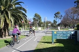
Capital City Trail
Encyclopedia
The Capital City Trail is a shared use path for cyclists
and pedestrian
s, which circles the Melbourne city centre
and some inner eastern and northern suburbs of Melbourne
, Victoria
, Australia
.
A popular starting point for the trail is at Princes Bridge near Flinders Street Station
. The rider can head off in an easterly or westerly direction. If heading off in the westerly, either side of the river can be used, but the south side tends to be more popular.
The Capital City Trail uses the same path as the Main Yarra Trail
up to Dights Falls, where it continues, using the same path the Merri Creek Trail
, as part of its loop around the city.
to Yarra Bend Park on the Yarra River Trail and meets Merri Creek
at Dights Falls
. It follows the Merri Creek Trail
up the Merri Creek to Rushall Station
, where it follows the former Inner Circle rail reserve and Royal Park
. It then meets the Moonee Ponds Creek Trail
which continues back to Docklands
and Southbank
. At its farthest, the trail is 5 kilometres from the centre of Melbourne.
Recently-completed improvements to the trail include a footbridge crossing Manningham Street in Parkville (which removes a flight of stairs and a road crossing), and re-paving of the path and landscaping on the section that passes under the Hurstbridge railway line. Lobby group Bicycle Victoria continues to advocate for improvements to the trail, notably the removal of a staircase that interrupts the path at Gipps Street in Collingwood.
, Merri Creek Trail
, Yarra River Trail, Gardiners Creek Trail
, Sandridge Trail
, Maribyrnong River Trail
& Hobsons Bay Coastal Trail
(via the Footscray Road path at Docklands) and finally the Moonee Ponds Creek Trail
.
Starts and ends at 37.819744°S 144.968516°E.
Cycling
Cycling, also called bicycling or biking, is the use of bicycles for transport, recreation, or for sport. Persons engaged in cycling are cyclists or bicyclists...
and pedestrian
Pedestrian
A pedestrian is a person traveling on foot, whether walking or running. In some communities, those traveling using roller skates or skateboards are also considered to be pedestrians. In modern times, the term mostly refers to someone walking on a road or footpath, but this was not the case...
s, which circles the Melbourne city centre
Melbourne city centre
Melbourne City Centre is an area of Melbourne in Victoria, Australia. It is not to be confused with the larger local government area of the City of Melbourne...
and some inner eastern and northern suburbs of Melbourne
Melbourne
Melbourne is the capital and most populous city in the state of Victoria, and the second most populous city in Australia. The Melbourne City Centre is the hub of the greater metropolitan area and the Census statistical division—of which "Melbourne" is the common name. As of June 2009, the greater...
, Victoria
Victoria (Australia)
Victoria is the second most populous state in Australia. Geographically the smallest mainland state, Victoria is bordered by New South Wales, South Australia, and Tasmania on Boundary Islet to the north, west and south respectively....
, Australia
Australia
Australia , officially the Commonwealth of Australia, is a country in the Southern Hemisphere comprising the mainland of the Australian continent, the island of Tasmania, and numerous smaller islands in the Indian and Pacific Oceans. It is the world's sixth-largest country by total area...
.
A popular starting point for the trail is at Princes Bridge near Flinders Street Station
Flinders Street Station
Flinders Street Station is the central railway station of the suburban railway network of Melbourne, Victoria, Australia. It is on the corner of Flinders and Swanston Streets next to the Yarra River in the heart of the city, stretching from Swanston Street to Queen Street and covering two city...
. The rider can head off in an easterly or westerly direction. If heading off in the westerly, either side of the river can be used, but the south side tends to be more popular.
The Capital City Trail uses the same path as the Main Yarra Trail
Main Yarra Trail
The Yarra Trail is a shared use path for cyclists and pedestrians, which follows the Yarra River through the north eastern suburbs of Melbourne, Victoria, Australia....
up to Dights Falls, where it continues, using the same path the Merri Creek Trail
Merri Creek Trail
The Merri Creek Trail is a shared use path for cyclists and pedestrians, which follows the Merri Creek through the northern suburbs of Melbourne, Victoria, Australia.-Following the Path:...
, as part of its loop around the city.
Following the Path
The trail follows the Yarra RiverYarra River
The Yarra River, originally Birrarung, is a river in east-central Victoria, Australia. The lower stretches of the river is where the city of Melbourne was established in 1835 and today Greater Melbourne dominates and influences the landscape of its lower reaches...
to Yarra Bend Park on the Yarra River Trail and meets Merri Creek
Merri Creek
The Merri Creek is a waterway in southern parts of Victoria, Australia which flows through the northern suburbs of Melbourne. It begins in Wallan north of Melbourne and flows south for 70km until it joins the Yarra River at Dights Falls...
at Dights Falls
Dights Falls
Dights Falls is located in Melbourne, Victoria just downstream of the junction of the Yarra River with Merri Creek. At this point the river narrows and is constricted between 800,000 year old volcanic, basaltic lava flow and a much older steep, silurian, sedimentary spur...
. It follows the Merri Creek Trail
Merri Creek Trail
The Merri Creek Trail is a shared use path for cyclists and pedestrians, which follows the Merri Creek through the northern suburbs of Melbourne, Victoria, Australia.-Following the Path:...
up the Merri Creek to Rushall Station
Rushall railway station
Rushall railway station was a station on the South Staffordshire Line. It was opened in 1849. It was the first station to fall on the line, closing in 1909...
, where it follows the former Inner Circle rail reserve and Royal Park
Royal Park, Melbourne
Royal Park is the largest of Melbourne's inner city parks . It is located north of the Melbourne Central Business District, Victoria, Australia, in the suburb of Parkville....
. It then meets the Moonee Ponds Creek Trail
Moonee Ponds Creek Trail
The Moonee Ponds Creek Trail is a shared use path for cyclists and pedestrians, which follows the Moonee Ponds Creek through the northern suburbs of Melbourne, Victoria, Australia.-Following the path:...
which continues back to Docklands
Melbourne Docklands
Docklands is an inner city suburb in Melbourne, Victoria, Australia occupying an area extending up to 2 km west of and adjacent to Melbourne's Central Business District . Its Local Government Area is the City of Melbourne...
and Southbank
Southbank, Victoria
Southbank is an inner city suburb of Melbourne, Victoria, Australia located direct south of the Yarra River opposite Melbourne's Hoddle Grid. The northernmost area is considered part of the Central Business District and Central Activities District of the city. Its Local Government Area are the...
. At its farthest, the trail is 5 kilometres from the centre of Melbourne.
Construction
The section just after the path passes under Wurundjeri Way/Docklands highway to the Melbourne Exhibition Centre is currently under construction. Although the path is open, a set of stairs needs to be traversed.Recently-completed improvements to the trail include a footbridge crossing Manningham Street in Parkville (which removes a flight of stairs and a road crossing), and re-paving of the path and landscaping on the section that passes under the Hurstbridge railway line. Lobby group Bicycle Victoria continues to advocate for improvements to the trail, notably the removal of a staircase that interrupts the path at Gipps Street in Collingwood.
Landmarks
The trail passes by the following attractions and landmarks:- SouthbankSouthbank, VictoriaSouthbank is an inner city suburb of Melbourne, Victoria, Australia located direct south of the Yarra River opposite Melbourne's Hoddle Grid. The northernmost area is considered part of the Central Business District and Central Activities District of the city. Its Local Government Area are the...
- Alexandra GardensAlexandra Gardens, MelbourneThe Alexandra Gardens are located on the south bank of the Yarra River, opposite Federation Square and the Melbourne Central Business District, in Victoria, Australia. The Gardens are bounded by the Yarra River to the north, Princes and Swan street bridges, with Queen Victoria Gardens and Kings...
and Royal Botanic GardensRoyal Botanic Gardens, MelbourneThe Royal Botanic Gardens Melbourne are internationally renowned botanical gardens located near the centre of Melbourne, Victoria, Australia, on the south bank of the Yarra River. They are 38 hectares of landscaped gardens consisting of a mix of native and non-native vegetation including over... - Melbourne ParkMelbourne ParkMelbourne Park is a sports venue in the Melbourne Sports and Entertainment Precinct in Melbourne, Victoria, Australia. Since 1988, Melbourne Park has been home of the Australian Open in tennis, which is played annually in January...
and Melbourne Cricket GroundMelbourne Cricket GroundThe Melbourne Cricket Ground is an Australian sports stadium located in Yarra Park, Melbourne and is home to the Melbourne Cricket Club. It is the tenth largest stadium in the world, the largest in Australia, the largest stadium for playing cricket, and holds the world record for the highest light... - Yarra RiverYarra RiverThe Yarra River, originally Birrarung, is a river in east-central Victoria, Australia. The lower stretches of the river is where the city of Melbourne was established in 1835 and today Greater Melbourne dominates and influences the landscape of its lower reaches...
- Yarra Bend Park
- Collingwood Children's FarmCollingwood Children's FarmThe Collingwood Children’s Farm is a not-for-profit, inner city farm situated on the Yarra River in the Melbourne suburb of Abbotsford, Australia. It is adjacent to, and considered part of the larger Abbotsford Convent complex. The Abbotsford Heritage Precinct Farmlands supporting the Farm are...
- Hardy Gallagher Reserve
- Merri Creek
- Rushall Garden, a community garden in North Fitzroy.
- Princes ParkPrinces Park, CarltonPrinces Park is a 38.6 hectare park in the inner-Melbourne suburb of Carlton North, Victoria. It is located directly north of the University of Melbourne and bounded on its eastern and western sides by Melbourne General Cemetery and Royal Parade respectively...
, location of Visy Park - Royal ParkRoyal Park, MelbourneRoyal Park is the largest of Melbourne's inner city parks . It is located north of the Melbourne Central Business District, Victoria, Australia, in the suburb of Parkville....
- Melbourne ZooMelbourne ZooThe Royal Melbourne Zoological Gardens, commonly known as the Melbourne Zoo, contains more than 320 animal species from Australia and around the world. The zoo is north of the centre of Melbourne. It is accessible via Royal Park station on the Upfield railway line, and is also accessible via tram...
- Moonee Ponds CreekMoonee Ponds CreekThe Moonee Ponds Creek is a creek and major tributary of the Yarra River running through urban Melbourne, Victoria, Australia from northern to inner suburbs...
- Telstra DomeTelstra DomeDocklands Stadium is a multi-purpose sports and entertainment stadium in the Docklands precinct of Melbourne, Victoria, Australia...
- DocklandsMelbourne DocklandsDocklands is an inner city suburb in Melbourne, Victoria, Australia occupying an area extending up to 2 km west of and adjacent to Melbourne's Central Business District . Its Local Government Area is the City of Melbourne...
Connections
The trail acts as central hub and has many spokes. Starting in the north and going clockwise we have the Upfield Rail TrailUpfield bike path
The Upfield Bike Path is a shared use path for cyclists and pedestrians, which follows Upfield railway line through the inner northern suburbs of Melbourne, Victoria, Australia....
, Merri Creek Trail
Merri Creek Trail
The Merri Creek Trail is a shared use path for cyclists and pedestrians, which follows the Merri Creek through the northern suburbs of Melbourne, Victoria, Australia.-Following the Path:...
, Yarra River Trail, Gardiners Creek Trail
Gardiners Creek Trail
The Gardiners Creek Trail is a shared use path for cyclists and pedestrians, which follows Gardiners Creek through the eastern suburbs of Melbourne, Victoria, Australia....
, Sandridge Trail
Sandridge Trail
The Sandridge Trail is a shared-use path for cyclists and pedestrians located in the inner southern suburb of Port Melbourne in Melbourne, Victoria, Australia..It follows the former Port Melbourne railway line, now the 109 tram route...
, Maribyrnong River Trail
Maribyrnong River Trail
The Maribyrnong River Trail is a shared use path for cyclists and pedestrians, which follows the Maribyrnong River through the north western suburbs of Melbourne, Victoria, Australia....
& Hobsons Bay Coastal Trail
Hobsons Bay Coastal Trail
The Hobsons Bay Coastal Trail is a shared use path for cyclists and pedestrians, which follows the coast line of Hobsons Bay in the inner western suburbs in Melbourne, Victoria, Australia. The trail forms part of the western half of the Bayside Trail which encircles Port Phillip...
(via the Footscray Road path at Docklands) and finally the Moonee Ponds Creek Trail
Moonee Ponds Creek Trail
The Moonee Ponds Creek Trail is a shared use path for cyclists and pedestrians, which follows the Moonee Ponds Creek through the northern suburbs of Melbourne, Victoria, Australia.-Following the path:...
.
Starts and ends at 37.819744°S 144.968516°E.