

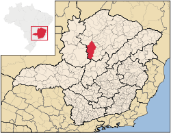
Buritizeiro
Encyclopedia
Brazil
Brazil , officially the Federative Republic of Brazil , is the largest country in South America. It is the world's fifth largest country, both by geographical area and by population with over 192 million people...
ian state of Minas Gerais
Minas Gerais
Minas Gerais is one of the 26 states of Brazil, of which it is the second most populous, the third richest, and the fourth largest in area. Minas Gerais is the Brazilian state with the largest number of Presidents of Brazil, the current one, Dilma Rousseff, being one of them. The capital is the...
. Its population in 2007 was 26,133 inhabitants in a total area of 7,226 km². It is a major producer of cattle and grains.
Location
Buritizeiro belongs to the ParacatuParacatu, Minas Gerais
Paracatu is a town in the western part of the state of Minas Gerais, Brazil having 79,739 inhabitants . Its area is of 8.232 km²...
statistical microregion. The elevation of the municipal seat is 836 meters. It became a municipality in 1963. This municipality is located on the left bank of the São Francisco River
São Francisco River
The São Francisco is a river in Brazil. With a length of , it is the longest river that runs entirely in Brazilian territory, and the fourth longest in South America and overall in Brazil...
, across the river from Pirapora
Pirapora
Pirapora is a municipality in northcentral Minas Gerais in Brazil. Its population in 2007 was 51,636 in a total area of 577 km². The name Pirapora comes from the Tupi words for "fish" + "jump", referring to the piracema season when a mass migration of fishes ascends the São Francisco River...
. The distance to the capital, Belo Horizonte
Belo Horizonte
Belo Horizonte is the capital of and largest city in the state of Minas Gerais, located in the southeastern region of Brazil. It is the third largest metropolitan area in the country...
, is 365 km. Other distances are:
- PiraporaPiraporaPirapora is a municipality in northcentral Minas Gerais in Brazil. Its population in 2007 was 51,636 in a total area of 577 km². The name Pirapora comes from the Tupi words for "fish" + "jump", referring to the piracema season when a mass migration of fishes ascends the São Francisco River...
: 6 km. - Montes ClarosMontes ClarosMontes Claros is a city located in northern Minas Gerais state, in Brazil. The estimated population in 2010 was 412,284 inhabitants and the total area of the municipality was 3,470 km²...
: 167 km. - UberlândiaUberlândiaUberlândia is the main town in the Triangle region, west of the state of Minas Gerais, Brazil. With a population of 604,013 inhabitants, according to 2010 estimates, the city is the second largest in the state second only to Belo Horizonte...
: 480 km.
Neighboring municipalities are: Pirapora
Pirapora
Pirapora is a municipality in northcentral Minas Gerais in Brazil. Its population in 2007 was 51,636 in a total area of 577 km². The name Pirapora comes from the Tupi words for "fish" + "jump", referring to the piracema season when a mass migration of fishes ascends the São Francisco River...
, São Romão
São Romão
São Romão is a Brazilian municipality located in the north of the state of Minas Gerais. In 2007 the population was 9,080 in a total area of 2,432 km². It became a municipality in 1943.-Location and Distances:...
, Três Marias
Três Marias
Três Marias is a small Brazilian city in northwestern Minas Gerais. In 2007 the population was 26,431 in a total area of 2,763 km².-Climate:...
e João Pinheiro
João Pinheiro, Minas Gerais
João Pinheiro is a municipality in the northwest of the Brazilian state of Minas Gerais. Its population in 2007 was 43,229 inhabitants in a total area of 10,717 km². It is the largest municipality in the state of Minas Gerais....
.
The climate is humid sub-tropical with an average maximum of 30°C; a minimum of 16°C; and an annual average of 22°C.
The economy
The main economic activities are cattle raising and farming. The GDP was R$157,117,000 (2003). There was 01 bank branch. In the health sector there were 20 establishments—19 public and 01 private. There was 01 hospital with 43 beds (2007).In the rural area there were 723 farms and a total agricultural area of 373,000 hectares, of which 17,000 ha. were planted, 208,000 were in natural pasture, and 135,000 ha. were in woodland or forest. 1,100 people were dependent on farming. 182 of the farms had tractors. The main crops in planted area were coffee, 800 ha.; hearts of palm, 55 ha.; cotton, 700 ha.; rice, 824 ha.; beans, 2,980 ha.; corn, 4,300 ha.; and soybeans, 24,000 ha. In 2006 there were 118,000 head of cattle.
The score on the Municipal Human Development Index
Human Development Index
The Human Development Index is a composite statistic used to rank countries by level of "human development" and separate "very high human development", "high human development", "medium human development", and "low human development" countries...
was 0.659. This ranked Buritizeiro 712 out of 853 municipalities in the state, with Poços de Caldas
Poços de Caldas
Poços de Caldas is a city and municipality in south-western Minas Gerais state, Brazil, in the microregion of the same name. Its estimated population in 2009 was 151,449 inhabitants...
in first place with 0.841 and Setubinha
Setubinha
Setubinha is a municipality in the northeast of the Brazilian state of Minas Gerais. As of 2007 the population was 10,834 in a total area of 536 km². The elevation is 729 metres. It is part of the IBGE statistical microregion of Teófilo Otoni...
in last place with 0.568.
Tourism
Buritizeiro is known for its waterfalls, among which we can point out:- Cachoeira Grande: located on the Fazenda Santa Cruz
- Cachoeira do Córrego da Areia: located on the Fazenda dos Cristais
- Cachoeira das Andorinhas
- Cachoeira do Riacho Doce: located on the Fazenda dos Cristais
- Cachoeira do Córrego do Gentil
Between the cities of Buritizeiro and Pirapora, the waters of the Rio São Francisco pass a series of rapids that extend for about 600 meters beginning at the Marechal Hermes bridge. These rapids attract fishermen from all over the country.
History
The history of Buritizeiro is connected to the founding and development of Pirapora. In 1912 the settlement, now known as Pirapora, called São Gonçalo das Tabocas, became a city. In 1920 the Marechal Hermes bridge was built to take the railroad as far as BelémBelém
Belém is a Brazilian city, the capital and largest city of state of Pará, in the country's north region. It is the entrance gate to the Amazon with a busy port, airport and bus/coach station...
in Pará
Pará
Pará is a state in the north of Brazil. It borders the Brazilian states of Amapá, Maranhão, Tocantins, Mato Grosso, Amazonas and Roraima. To the northwest it also borders Guyana and Suriname, and to the northeast it borders the Atlantic Ocean. The capital is Belém.Pará is the most populous state...
. This railroad line was never extended beyond Pirapora. In 1923 the name of São Gonçalo dos Tabocas was changed to Pirapora. In 1950 Pirapora had the districts of Buritizeiro, Guaicuí, Lassance
Lassance
Lassance is a Brazilian municipality located in the north of the state of Minas Gerais. In 2007 the population was 6,458 in a total area of 3,213 km². It became a municipality in 1953.-Location and Distances:...
and Várzea da Palma
Várzea da Palma
Várzea da Palma is a municipality in north-central Minas Gerais in Brazil. Its population in 2007 was 54,448 in a total area of 2,195 km²....
, and the population was around 30,000 inhabitants. In 1953 the last three became municipalities in their own right. In 1962 the district of Buritizeiro became a municipality. The name is derived from the buriti palm (Mauritia vinifera).
Social Indicators
- Infant mortality rate: 10.91 (all data are from 2000)
- Literacy rate: 79.36%
- Percentage of urban residences covered by sewage service: 1.40%
- Degree of urbanization: 84%
See also
- List of municipalities in Minas Gerais