

Paracatu, Minas Gerais
Encyclopedia
| Statistics | |
|---|---|
| State: | Minas Gerais Minas Gerais Minas Gerais is one of the 26 states of Brazil, of which it is the second most populous, the third richest, and the fourth largest in area. Minas Gerais is the Brazilian state with the largest number of Presidents of Brazil, the current one, Dilma Rousseff, being one of them. The capital is the... |
| Micro-Region: | Paracatu |
| Founded: | 1890 |
| Population Population A population is all the organisms that both belong to the same group or species and live in the same geographical area. The area that is used to define a sexual population is such that inter-breeding is possible between any pair within the area and more probable than cross-breeding with individuals... : |
81,599 (2004) |
| Postal code: | 38600-xxx |
| Website: | www.paracatu.net |


Town
A town is a human settlement larger than a village but smaller than a city. The size a settlement must be in order to be called a "town" varies considerably in different parts of the world, so that, for example, many American "small towns" seem to British people to be no more than villages, while...
in the western part of the state of Minas Gerais
Minas Gerais
Minas Gerais is one of the 26 states of Brazil, of which it is the second most populous, the third richest, and the fourth largest in area. Minas Gerais is the Brazilian state with the largest number of Presidents of Brazil, the current one, Dilma Rousseff, being one of them. The capital is the...
, Brazil
Brazil
Brazil , officially the Federative Republic of Brazil , is the largest country in South America. It is the world's fifth largest country, both by geographical area and by population with over 192 million people...
having 79,739 inhabitants (data from IBGE census, 2007). Its area is of 8.232 km². The origin of the name comes from the Tupi language, "para" = river (in Portuguese
Portuguese language
Portuguese is a Romance language that arose in the medieval Kingdom of Galicia, nowadays Galicia and Northern Portugal. The southern part of the Kingdom of Galicia became independent as the County of Portugal in 1095...
, rio) and "catu" = good (in Portuguese, bom).
Location and distances
With the municipal seat lying at an elevation of 172 meters, Paracatu is near the BR 040, the main highway linking the Brazilian capital of BrasíliaBrasília
Brasília is the capital city of Brazil. The name is commonly spelled Brasilia in English. The city and its District are located in the Central-West region of the country, along a plateau known as Planalto Central. It has a population of about 2,557,000 as of the 2008 IBGE estimate, making it the...
and southwestern Minas Gerais
Minas Gerais
Minas Gerais is one of the 26 states of Brazil, of which it is the second most populous, the third richest, and the fourth largest in area. Minas Gerais is the Brazilian state with the largest number of Presidents of Brazil, the current one, Dilma Rousseff, being one of them. The capital is the...
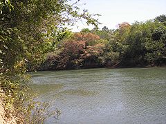
. The Paracatu River
Paracatu River
The Paracatu River is located mainly in the state of Minas Gerais in Brazil. It is the longest tributary of the São Francisco, draining a basin of about 45,000 km², including 21 municipalities and the Federal District...
, a major tributary of the São Francisco River
São Francisco River
The São Francisco is a river in Brazil. With a length of , it is the longest river that runs entirely in Brazilian territory, and the fourth longest in South America and overall in Brazil...
, passes about 40 km south of the city.
Distances from major cities are:
- Brasília: 220 km
- Belo Horizonte: 502 km
- São Paulo: 1.082 km
- Rio de Janeiro: 956 km
- Vitória: 992 km
- Goiânia: 350
Statistical microregion
Paracatu is also a statistical microregion (number 42) that includes the municipalities of Brasilândia de MinasBrasilândia de Minas
Brasilândia de Minas is a municipality in the north of the Brazilian state of Minas Gerais. As of 2007 the population was 12,821 in a total area of 2,515 km².The elevation of the municipal seat is 530 meters above sea level...
, Guarda-Mor
Guarda-Mor
Guarda-Mor is a municipality in the north of the Brazilian state of Minas Gerais. Its population in 2007 was 6,577 inhabitants in a total area of 2,066 km². It is a large producer of cattle and grains, especially soybeans....
, João Pinheiro
João Pinheiro, Minas Gerais
João Pinheiro is a municipality in the northwest of the Brazilian state of Minas Gerais. Its population in 2007 was 43,229 inhabitants in a total area of 10,717 km². It is the largest municipality in the state of Minas Gerais....
, Lagamar
Lagamar
Lagamar is a municipality in the north of the Brazilian state of Minas Gerais. Its population in 2007 was 7,636 inhabitants in a total area of . It is a large producer of cattle and grains and there is extraction of phosphates....
, Lagoa Grande
Lagoa Grande, Minas Gerais
Lagoa Grande is a municipality in the northeast of the Brazilian state of Minas Gerais. Its population in 2007 was 8,660 inhabitants in a total area of 1,220 km²....
, Presidente Olegário
Presidente Olegário
Presidente Olegário is a municipality in the north of the Brazilian state of Minas Gerais. Its population in 2007 was 18,256 inhabitants in a total area of 3,531 km²....
, São Gonçalo do Abaeté
São Gonçalo do Abaeté
São Gonçalo do Abaeté is a municipality in the north of the Brazilian state of Minas Gerais. Its population in 2007 was 6,156 inhabitants in a total area of 2,687 km². It is a large producer of cattle and grains....
, Varjão de Minas
Varjão de Minas
Varjão de Minas is a municipality in the north of the Brazilian state of Minas Gerais. Its population in 2007 was 5,993 inhabitants in a total area of 653 km²....
, and Vazante
Vazante
Vazante is a municipality in the north of the Brazilian state of Minas Gerais. Its population in 2007 was 19,300 inhabitants in a total area of 1,903 km². It is a large producer of cattle and there is mining of zinc.-Location:...
. Its area is of 35,111.00 km² with a total population of 188,758 in 2000.
Climate
The climate is tropical sub-humid. The mean temperature is around 21°C, with maximum of 28°C and minimum of 17°C. The highest temperature usually occur in August or September, 30°C, and the lowest temperatures usually occur in June and July, 14°C. The rainy season is from October to March, although there is precipitation along the year. The relative humidity over 75% occur during at least six months.The economy
The economy is centered on cattle raising with 231,000 head (1996). The main breeds are: ZebuZebu
Zebu , sometimes known as humped cattle, indicus cattle, Cebu or Brahmin cattle are a type of domestic cattle originating in South Asia, particularly the Indian subcontinent. They are characterised by a fatty hump on their shoulders, drooping ears and a large dewlap...
(Gir, Indu-Brasil, Guzerá and Nelore
Nelore
Nelore or Nellore beef cattle originated from Ongole cattle originally brought to Brazil from India. They are named for the district of Nellore in Andhra Pradesh. The Nelore has a distinct large hump over the top of the shoulder and neck. They have long legs which help them to walk in water and...
), Girolanda
Girolanda
Girolanda is a breed of dairy cattle. It is widely used in Brazil, where it is the main breed of dairy cattle. It was created in the first decades of the 20th century, in Brazil, by crossing Gir cattle and Holstein . Being resistant and productive, Girolanda became popular and since some decades,...
, Frisian and Brown-Swiss. There is also large production of soybeans, corn, rice, beans, and also some coffee.
Paracatu is the commercial center for an area one third the size of Portugal
Portugal
Portugal , officially the Portuguese Republic is a country situated in southwestern Europe on the Iberian Peninsula. Portugal is the westernmost country of Europe, and is bordered by the Atlantic Ocean to the West and South and by Spain to the North and East. The Atlantic archipelagos of the...
. In 2006 there were 6 banking branches: Banco do Brasil, Itaú, Bradesco, Banco Mercantil, Banco Bamerindus, and Caixa Econômica Federal. The GDP was R$ 754,090,000 (2005).
In 1978 the municipality began to receive investments from the Brazilian and the Japanese government to develop the cerrado
Cerrado
The Cerrado, is a vast tropical savanna ecoregion of Brazil, particularly in the states of Gioas and Minas Gerais...
soils, through the PRODECER-Programa de Cooperação Nipo-Brasileiro para o Desenvolviemnto do Cerrado.
Because of new technologies used to develop the cerrado, agriculture in Paracatu became efficient and profitable in many properties. Nowadays, the cultivated area in the municipality surpasses 1000 square kilometres, with 300 square kilometres irrigated by central pivot sprinkler
Irrigation sprinkler
Irrigation sprinklers are sprinklers used on farms, golf courses, and yards, to provide water to vegetation and plants in the event of drought. They may also be used for recreation, as a cooling system, or to keep down the amount of airborne dust....
s. This number has raised Paracatu to the position of greatest continuous area irrigated by center pivot irrigation
Center pivot irrigation
Center-pivot irrigation , also called circle irrigation, is a method of crop irrigation in which equipment rotates around a pivot...
in South America, using 318 center pivot sprinklers.
Agricultural data
In 2006 there were 995 rural producers with total agricultural land of 389,095 ha. Of the total 85,000 ha. were planted, 180,000 ha. were in natural pasture, and 113,000 were in forest or woodland. Around 4,500 persons were employed in agriculture. There were 768 tractors. The planted area of some of the main crops in hectares was:- Corn: 12,000
- Soybeans: 30,000
- Sorghum: 2,000
- Rice: 2,670
- Coffee: 1,050
- Cotton: 3,000
- Sugarcane: 1,600
- Beans: 9,100
- Watermelon: 1,050
Mining
In Paracatu, gold has been mined since 1722. The Morro do Ouro (Paracatu) open-pit mine is operated by Rio Paracatu Mineração (RPM), a 100% owned subsidiary of the Canadian company Kinross Gold Corporation. The gold content of the ore is comparatively low, about 0.41 gram of gold for every ton of ore extracted.Annual production is about 6.7 tonnes of gold and 1.3 tonnes of silver.
History
Paracatu has its origins in the beginning of the eighteenth century, with the discovery of gold. For many years gold was abundant in alluvial deposits.The town began before 1730. On 24 June 1744 the news of the discovery of the mines of Paracatu reached the government of the Capitania of Minas and the town began to prosper.
On 20 October 1796, the Vila de Paracatu do Príncipe was created, with a document signed by Maria I
Maria I of Portugal
Maria I was Queen regnant of Portugal and the Algarves from 1777 until her death. Known as Maria the Pious , or Maria the Mad , she was the first undisputed Queen regnant of Portugal...
, Queen of Portugal. In 1840 the Vila raised to the category of town.
Decline set in with the exhaustion of the gold fields, but with the building of Brasília in the 1960s and the construction of a highway linking Belo Horizonte and the new capital, Paracatu began to grow again.
Quilombola population
Many QuilombolaQuilombola
A Quilombola is a resident of a Quilombo in Brazil. They are the descendents of slaves who escaped from slave plantations that existed in Brazil until abolition in 1888. The most famous Quilombola was Zumbi and the most famous Quilombo was Palmares....
s (descendants of escaped slaves) live in and near Paracatu, often in poverty.
Health and education
In 2005 there were 29 health establishments, 19 of which were public and 10 of which were private.There was 1 hospital with 139 beds. The score on the Municipal Human Development Index
Human Development Index
The Human Development Index is a composite statistic used to rank countries by level of "human development" and separate "very high human development", "high human development", "medium human development", and "low human development" countries...
was 0.760. This ranked Paracatu 207 out of 853 municipalities in the state, with Poços de Caldas
Poços de Caldas
Poços de Caldas is a city and municipality in south-western Minas Gerais state, Brazil, in the microregion of the same name. Its estimated population in 2009 was 151,449 inhabitants...
in first place with 0.841 and Setubinha
Setubinha
Setubinha is a municipality in the northeast of the Brazilian state of Minas Gerais. As of 2007 the population was 10,834 in a total area of 536 km². The elevation is 729 metres. It is part of the IBGE statistical microregion of Teófilo Otoni...
in last place with 0.568.
Paracatu has 4 faculties with undergraduation and graduation courses: Faculdade Tecsoma, FINOM - Faculdade do Noroeste de Minas, Faculdade Unimontes, and Faculdade Atenas.
External links
- In Portuguese:
- http://www.paracatu.mg.gov.br
- http://www.citybrazil.com.br/mg/paracatu/
- http://www.paracatu.net/
- http://www.paracatuonline.com.br/
- http://www.ada.com.br/Paracatu/default.htm
- Rotary Club de Paracatu
- http://www.citybrazil.com.br/mg/regioes/paracatu/