
Brooklyn streets
Encyclopedia
This article provides a listing with simple descriptions of the streets in the New York City
borough
of Brooklyn
. Not all streets are listed in the charts below because many have been compiled in linked articles at the forefront of every type.
in Williamsburg
.
in Williamsburg
.
New York City
New York is the most populous city in the United States and the center of the New York Metropolitan Area, one of the most populous metropolitan areas in the world. New York exerts a significant impact upon global commerce, finance, media, art, fashion, research, technology, education, and...
borough
Borough
A borough is an administrative division in various countries. In principle, the term borough designates a self-governing township although, in practice, official use of the term varies widely....
of Brooklyn
Brooklyn
Brooklyn is the most populous of New York City's five boroughs, with nearly 2.6 million residents, and the second-largest in area. Since 1896, Brooklyn has had the same boundaries as Kings County, which is now the most populous county in New York State and the second-most densely populated...
. Not all streets are listed in the charts below because many have been compiled in linked articles at the forefront of every type.
Alleys
| Name | From | To | Distance | # of lanes | Traffic direction |
|---|---|---|---|---|---|
| Grace Court Alley | Hicks Street | Dead-end | 0.06 mile | 1 | West to east |
Avenues
| Name | From | To | Distance | # of lanes | Traffic direction | Additional notes |
|---|---|---|---|---|---|---|
| Bath Avenue | 14th Avenue | Stillwell Avenue | 2.11 miles | 2 | East | |
| Greenpoint Avenue | Dead-end (Brooklyn Brooklyn Brooklyn is the most populous of New York City's five boroughs, with nearly 2.6 million residents, and the second-largest in area. Since 1896, Brooklyn has had the same boundaries as Kings County, which is now the most populous county in New York State and the second-most densely populated... ) |
Roosevelt Avenue and Queens Boulevard Queens Boulevard Queens Boulevard is a major thoroughfare in the New York City boroughs of Manhattan and Queens connecting communities from Midtown Manhattan to Jamaica... (Queens Queens Queens is the easternmost of the five boroughs of New York City. The largest borough in area and the second-largest in population, it is coextensive with Queens County, an administrative division of New York state, in the United States.... ) |
2.5 miles | 2-4 | East | Runs from Greenpoint, Brooklyn Greenpoint, Brooklyn Greenpoint is the northernmost neighborhood in the New York City borough of Brooklyn. It is bordered on the southwest by Williamsburg at the Bushwick inlet, on the southeast by the Brooklyn-Queens Expressway and East Williamsburg, on the north by Newtown Creek and Long Island City, Queens at the... to Sunnyside, Queens Sunnyside, Queens Sunnyside is a neighborhood in the western portion of the New York City borough of Queens, in New York state, in the United States. It shares borders with Hunters Point and Long Island City to the west, Astoria to the north, Woodside to the east and Maspeth to the south... and crosses Newtown Creek Newtown Creek Newtown Creek is a estuary that forms part of the border between the boroughs of Brooklyn and Queens, in New York City, New York, United States. It derives its name from New Town , which was the name for the Dutch and British settlement in what is now Elmhurst, Queens... over the J.J. Byrne Bridge. Continues as Roosevelt Avenue past Queens Boulevard. |
| Greenwood Avenue | Prospect Park Southwest | McDonald Avenue | 0.4 mile | 2 | South | This avenue exists in two segments. They are separated by the open-cut Prospect Expressway. In theory, the avenue is connected, but this is achieved by a pedestrian overpass. |
| Marine Avenue | 92nd Street | Fort Hamilton Parkway | 0.66 mile | 2 | South | Continuation of Colonial Road. Carries a northbound on-street bike lane running from 92nd Street to Oliver Street. |
| Mermaid Avenue | Surf Avenue | Stillwell Avenue | 1.25 miles | 2 | East | Site of the Mermaid Parade. |
| Narrows Avenue | 68th Street | Shore Road | 1.10 miles | 2 | South | Path impeded between 83rd and 85th streets by Fort Hamilton High School Fort Hamilton High School Fort Hamilton High School is a public high school in Brooklyn, New York, USA, under the jurisdiction of the New York City Department of Education. Students in Bay Ridge, Sunset Park and Dyker Heights are zoned to Fort Hamilton HS. It has stood overlooking the Narrows and Lower New York Bay since... . |
| Neptune Avenue | Surf Avenue | Shore Boulevard & Emmons Avenue (Sheepshead Bay Sheepshead Bay, Brooklyn Sheepshead Bay is a bay separating the mainland of Brooklyn, New York City from the eastern portion of Coney Island, the latter originally a barrier island but now effectively an extension of the mainland with peninsulas both east and west... ) |
2.96 miles | 2-4 | East | Bike lanes run along most of its length. |
| Prospect Avenue | Ocean Parkway Ocean Parkway (Brooklyn) Ocean Parkway is a broad boulevard in the west central portion of the borough of Brooklyn in New York City.-Route description:Ocean Parkway extends over a distance of about five miles , running almost north to south from the vicinity of Prospect Park to Brighton Beach... |
4th Avenue Fourth Avenue (Brooklyn) Fourth Avenue is a major thoroughfare in the New York City borough of Brooklyn. It stretches for south from Times Plaza, which is the triangle intersection created by Atlantic and Flatbush Avenues in Downtown Brooklyn, to Shore Road and the Belt Parkway in Bay Ridge.While southwestern Brooklyn is... |
1.59 miles | 2 | Varies | Two-way from Ocean Parkway to 5th Avenue Fifth Avenue (Brooklyn) Fifth Avenue is an important commercial thoroughfare in the New York City borough of Brooklyn.The Avenue runs south-by southwest for from its intersection with Atlantic Avenue in Fort Greene just southeast of Downtown Brooklyn through the neighborhoods of Park Slope and Sunset Park until it ends... and one-way westbound to its terminus at 4th Avenue. |
| Sea Breeze Avenue | West 5th Street | Beach Walk | 0.3 mile | 2 | East | |
| Surf Avenue | Poplar Avenue & Highland Avenue (Sea Gate) | Ocean Parkway Ocean Parkway (Brooklyn) Ocean Parkway is a broad boulevard in the west central portion of the borough of Brooklyn in New York City.-Route description:Ocean Parkway extends over a distance of about five miles , running almost north to south from the vicinity of Prospect Park to Brighton Beach... & Sea Breeze Avenue |
2.61 miles | 2-6 | East | Continuation of Poplar Avenue and Ocean Parkway. Serves as Coney Island's 'Main Drag.' |
Boulevards
| Name | From | To | Distance | # of lanes | Traffic direction | Additional notes | Photo |
|---|---|---|---|---|---|---|---|
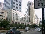
| Brooklyn Bridge Boulevard | Brooklyn Bridge Brooklyn Bridge The Brooklyn Bridge is one of the oldest suspension bridges in the United States. Completed in 1883, it connects the New York City boroughs of Manhattan and Brooklyn by spanning the East River... |
Fulton Street Fulton Street (Brooklyn) Fulton Street, named after engineer Robert Fulton, exists mainly in two parts in what are today two boroughs of New York City which Fulton linked by his steam ferries, and each segment has its own distinct identity. This entry deals with Fulton Street in Brooklyn, which now begins at the... |
0.84 mile | 8 | North to south | Co-named Adams Street. | |
| McGuinness Boulevard | Pulaski Bridge Pulaski Bridge The Pulaski Bridge in New York City connects Long Island City in Queens to Greenpoint in Brooklyn over Newtown Creek. It was named after Polish military commander and American Revolutionary War fighter Kazimierz Pułaski because of the large Polish-American population in Greenpoint... /Dead-end |
Humboldt Street | 1.34 miles | 4 | North to south | Continues north as 11th Street in Queens Queens Queens is the easternmost of the five boroughs of New York City. The largest borough in area and the second-largest in population, it is coextensive with Queens County, an administrative division of New York state, in the United States.... after crossing the Pulaski Bridge Pulaski Bridge The Pulaski Bridge in New York City connects Long Island City in Queens to Greenpoint in Brooklyn over Newtown Creek. It was named after Polish military commander and American Revolutionary War fighter Kazimierz Pułaski because of the large Polish-American population in Greenpoint... and south as Humboldt Street. |
Courts
| Name | From | To | Distance | # of lanes | Traffic direction |
|---|---|---|---|---|---|
| Bridge Plaza Court | Nassau Street | Concord Street | 0.05 | 1 | South |
| Cameron Court | 66th Street | 67th Street | 0.07 mile | 1 | North to south |
| Duryea Court | 66th Street | 67th Street | 0.07 mile | 1 | North to south |
| Grace Court | Dead-end | Hicks Street | 0.11 mile | 1 | West to east |
| Ovington Court | 66th Street | 67th Street | 0.07 mile | 1 | North to south |
| Wallaston Court | 66th Street | 67th Street | 0.07 mile | 1 | North to south |
Lanes
| Name | From | To | Distance | # of lanes | Traffic direction |
|---|---|---|---|---|---|
| Harbor Lane | Harbor View Terrace | Dead-end | 0.05 mile | 1 | West to east |
| Hunts Lane | Henry Street | Dead-end | 0.08 mile | 1 | West to east |
| Love Lane | Hicks Street | Dead-end east of Henry Street | 0.11 mile | 1 | East |
| Red Hook Lane | Fulton Street | Boerum Place | 0.08 mile | 1 | North |
| Shore Road Lane | Shore Road | Cul-de-Sac | 0.05 mile | 1 | West to east |
| Westerly Lane | Colonial Court | Dead-end | 0.03 mile | 1 | West to east |
Parkways
| Name | From | To | Distance | # of lanes | Traffic direction | Additional notes | Photo |
|---|---|---|---|---|---|---|---|
| Ocean Parkway Ocean Parkway (Brooklyn) Ocean Parkway is a broad boulevard in the west central portion of the borough of Brooklyn in New York City.-Route description:Ocean Parkway extends over a distance of about five miles , running almost north to south from the vicinity of Prospect Park to Brighton Beach... |
Prospect Park Prospect Park (Brooklyn) Prospect Park is a 585-acre public park in the New York City borough of Brooklyn located between Park Slope, Prospect-Lefferts Gardens, Kensington, Windsor Terrace and Flatbush Avenue, Grand Army Plaza and the Brooklyn Botanic Garden... at Park Circle |
Surf Avenue and Sea Breeze Avenue | 5.37 miles | 2-8 | North to south | Continues as Surf Avenue once it reaches Coney Island Coney Island Coney Island is a peninsula and beach on the Atlantic Ocean in southern Brooklyn, New York, United States. The site was formerly an outer barrier island, but became partially connected to the mainland by landfill.... . |
 |
| Fort Hamilton Parkway | Ocean Parkway Ocean Parkway (Brooklyn) Ocean Parkway is a broad boulevard in the west central portion of the borough of Brooklyn in New York City.-Route description:Ocean Parkway extends over a distance of about five miles , running almost north to south from the vicinity of Prospect Park to Brighton Beach... |
101st Street | 4.15 miles | 2-4 | North to south |
Places
| Name | From | To | Distance | # of lanes | Traffic direction | Additional notes |
|---|---|---|---|---|---|---|
| Aitken Place | Sidney Place | Clinton Street | 0.06 | 1 | East | |
| Bay Ridge Place | 69th Street/Bay Ridge Avenue | Ovington Avenue | 0.08 mile | 1 | South | |
| Bergen Place | Wakeman Place | 67th Street | 0.07 mile | 1 | South | |
| Cathedral Place | Jay Street | Flatbush Avenue Extension Flatbush Avenue (Brooklyn) Flatbush Avenue is one of the major avenues in the New York City Borough of Brooklyn. It runs from the Manhattan Bridge south-southeastward to Jamaica Bay, where it joins the Marine Parkway Bridge, which connects Brooklyn to the Rockaway Peninsula in Queens... |
0.11 mile | 1 | East | |
| College Place | Dead-end | Love Lane | 0.07 | 1 | North to south | |
| Columbia Place | Joralemon Street | State Street | 0.11 mile | 1 | South | |
| Elizabeth Place | Old Fulton Street | Doughty Street | 0.04 mile | 1 | South | |
| Elm Place | Fulton Street | Livingston Street | 0.07 mile | 1 | North | |
| Gallatin Place | Fulton Street | Livingston Street | 0.07 mile | 1 | North | |
| Fiske Place | Garfield Place | Carroll Street | 0.08 mile | 1 | North-South (2 way) | |
| Garden Place | Joralemon Street | State Street | 0.12 mile | 1 | South | |
| Garfield Place | Prospect Park West | Fourth Avenue | 0.71 mile | 1 | West | |
| Grove Place | Hanover Place | Dead-end | 0.05 | 1 | West to east | |
| Hanover Place | Fulton Street Fulton Street (Brooklyn) Fulton Street, named after engineer Robert Fulton, exists mainly in two parts in what are today two boroughs of New York City which Fulton linked by his steam ferries, and each segment has its own distinct identity. This entry deals with Fulton Street in Brooklyn, which now begins at the... |
Livingston Street | 0.07 mile | 1 | North | |
| Pierrepont Place | Pierrepont Street | Montague Street | 0.05 mile | 1 | North | |
| Polhemus Place | Garfield Place | Carroll Street | 0.07 mile | 1 | North-South (2 way) | |
| Red Cross Place | Cadman Plaza East | Adams Street | 0.05 | 1 | East | |
| Sedgwick Place | Wakeman Place | 67th Street | 0.07 mile | 1 | North | |
| Sidney Place | Joralemon Street | State Street | 0.13 mile | 1 | North | |
| Tech Place | Adams Street | Jay Street | 0.08 | 1 | East | Renamed portion of Johnson Street |
| Wakeman Place | Colonial Road | 3rd Avenue | 0.3 mile | 1 | East | |
| Willow Place | Joralemon Streer | State Street | 0.11 mile | 1 | South |
Roads
| Name | From | To | Distance | # of lanes | Traffic direction | Additional notes | Photo |
|---|---|---|---|---|---|---|---|
| Colonial Road | Wakeman Place | 92nd Street | 1.48 miles | 2 | North to south | Continued south of 92nd Street by Marine Avenue. Carries a northbound on-street bike lane running from 92nd Street to Oliver Street. | |
| Shore Road | 68th Street | Fourth Avenue | 2 | North to south |  |
Streets
- Non-directionally numbered streets in Brooklyn, 1-101Brooklyn streets, 1-101This article only covers the non-directionally labeled numbered east-west streets in the New York City borough of Brooklyn between and including 1st Street and 101st Street. Major streets have their own linked articles; minor streets are discussed here...
- Directionally numbered streets delineated by West Street (Gravesend, Brooklyn)
Name From To Distance # of lanes Traffic direction Additional notes Photo Adams Street John Street Fulton Street Fulton Street (Brooklyn)Fulton Street, named after engineer Robert Fulton, exists mainly in two parts in what are today two boroughs of New York City which Fulton linked by his steam ferries, and each segment has its own distinct identity. This entry deals with Fulton Street in Brooklyn, which now begins at the...0.84 mile 1-6 Varies Cut-off at two points. One-lane one-way street in Dumbo DUMBO, BrooklynDumbo, an acronym for Down Under the Manhattan Bridge Overpass, is a neighborhood in the New York City borough of Brooklyn. It encompasses two sections: one located between the Manhattan and Brooklyn Bridges, which connect Brooklyn to Manhattan across the East River, and another that continues...
; six-lane boulevard south of Brooklyn BridgeBrooklyn BridgeThe Brooklyn Bridge is one of the oldest suspension bridges in the United States. Completed in 1883, it connects the New York City boroughs of Manhattan and Brooklyn by spanning the East River...Amity Street Hicks Street Court Street 0.3 mile 1 East Ash Street Commercial Street/Manhattan Avenue McGuinness Boulevard 0.13 mile 1 West Continued as Commercial Street Banker Street Franklin Street Nassau Avenue 0.36 mile 1 North Box Street Commercial Street Paidge Avenue/McGuinness Boulevard 0.21 mile 1-2 Varies Continued as Paidge Avenue Chapel Street Jay Street Flatbush Avenue Extension 0.1 mile 1 East Clay Street Commercial Street Paidge Avenue 0.38 mile 1 East Columbia Street Atlantic Avenue Atlantic Avenue (New York City)Atlantic Avenue is an important street in the New York City boroughs of Brooklyn and Queens. It stretches from the Brooklyn waterfront on the East River all the way to Jamaica, Queens...Dead-end at Columbia St pier 1.88 miles 2 South Cut-off by Brooklyn-Queens Expressway Court Street Montague Street Dead-end 1.84 miles 1-4 Varies Cranberry Street Columbia Heights Henry Street 0.18 mile 1 East Dock Street Water Street Front Street 0.05 mile 1 North Continues as Old Dock Street. Doughty Street Furman Street Vine Street 0.13 mile 1 Varies Dupont Street Commercial Street Provost Street 0.48 mile 1-2 Varies Cut-off by McGuinness Boulevard Eagle Street West Street Provost Street 0.5 mile 1 East Cut-off by McGuinness Boulevard Everit Street Columbia Heights & Doughty Street Old Fulton Street 0.03 mile 1 North Continuation of Columbia Heights Franklin Street Commercial Street Kent Avenue and North 14th Street 0.83 mile 2 South Continues as Kent Avenue Freeman Street West Street Provost Street 0.6 mile 1 West Cut-off by McGuinness Boulevard Front Street Old Fulton Street Hudson Avenue 0.64 mile 1-2 Varies Furman Street Old Fulton Street Columbia Street 0.86 mile 1 South Fulton Street Fulton Street (Brooklyn)Fulton Street, named after engineer Robert Fulton, exists mainly in two parts in what are today two boroughs of New York City which Fulton linked by his steam ferries, and each segment has its own distinct identity. This entry deals with Fulton Street in Brooklyn, which now begins at the...Adams Street Eldert Lane 6.72 miles 2 Varies 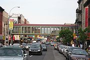
Hicks Street Fulton Street Bay Street 2.04 miles 1-4 Varies Cut-off at several points; Brooklyn-Queens Expressway and at the Red Hook Houses. Hicks Street serves as the service road for BQE between Congress Street and Hamilton Avenue. John Street Adams Street Little Street 0.46 mile 1 West Cut-off between Bridge and Gold streets. Main Street Plymouth Street Front Street 0.09 mile 1 North Marshall Street Gold Street Plymouth and Little streets. 0.25 mile 1 Varies Continues as Little Street. New Dock Street Ferry Landing Water Street 0.09 mile 1 North to south Old Dock Street Dead-end Water Street 0.04 mile 1 Varies Continues as Dock Street. Oliver Street Shore Road Marine Avenue 0.13 mile 1 East Orange Street Columbia Heights Henry Street 0.18 mile 1 West Pearl Street Dead-end Fulton Street 0.5 mile 1 Varies Cut-off by MetroTech Center MetroTech CenterMetroTech Center is a business and educational center in Downtown Brooklyn, New York City. Original occupants of this area include JPMorgan Chase, New York City Fire Department Headquarters, Bear Stearns, Keyspan Energy, now National Grid, Empire Blue Cross Blue Shield, and Polytechnic University,...
.Pineapple Street Dead-end Henry Street 0.21 mile 1 East Poplar Street Willow Street Henry Street 0.13 mile 1 East Continuation of Willow Street. Plymouth Street Main Street Little Street 0.56 mile 1 East 
Quay Street Dead-end Franklin Street 0.13 mile 1 East Senator Street Colonial Road 6th Avenue 0.75 mile 1 East The street is not aligned, continues to 6th Avenue south of where it first reaches 5th Avenue. Vine Street Columbia Heights Old Fulton Street 0.13 mile 1 West Washington Street Dead-end Prospect Street 0.25 mile 1 South Continues as Cadman Plaza East. Water Street Old Fulton Street Hudson Avenue 0.68 mile 1 West Cut-off by Manhattan Bridge Manhattan BridgeThe Manhattan Bridge is a suspension bridge that crosses the East River in New York City, connecting Lower Manhattan with Brooklyn . It was the last of the three suspension bridges built across the lower East River, following the Brooklyn and the Williamsburg bridges...
.West Street (Gravesend) Avenue T Shore Parkway North 1.08 miles 1-2 Varies West Street (Greenpoint) Eagle Street Quay Street 0.59 mile 1 Varies York Street Front Street Navy Street and Hudson Avenue 0.6 mile 1 West
North Streets
The following chart lists and describes the numbered streets directionally labeled 'North', delineated by Grand StreetGrand Street (Brooklyn)
Grand Street and Grand Avenue are the respective names of a street which runs through the boroughs of Brooklyn and Queens, New York City, United States...
in Williamsburg
Williamsburg, Brooklyn
Williamsburg is a neighborhood in the New York City borough of Brooklyn, bordering Greenpoint to the north, Bedford-Stuyvesant to the south, Bushwick to the east and the East River to the west. The neighborhood is part of Brooklyn Community Board 1. The neighborhood is served by the NYPD's 90th ...
.
| Name | From | To | Distance | # of lanes | Traffic direction | Additional notes |
|---|---|---|---|---|---|---|
| North 1st Street | Dead-end | Driggs Avenue | 0.43 mile | 1 | West | |
| North 2nd Street | Does not exist. | |||||
| North 3rd Street | Dead-end | Metropolitan Avenue | 0.41 mile | 1 | East | |
| North 4th Street | Kent Avenue | Metropolitan Avenue | 0.49 mile | 1 | West | |
| North 5th Street | Dead-end | Metropolitan Avenue | 0.64 mile | 1 | Varies | |
| North 6th Street | Dead-end | Meeker Avenue | 0.69 mile | 1 | West | |
| North 7th Street | Dead-end | Meeker Avenue | 0.71 mile | 1 | East | |
| North 8th Street | Dead-end | Meeker Avenue | 0.63 mile | 1 | West | |
| North 9th Street | Kent Avenue | Havenmeyer Street | 0.53 mile | 1 | East | |
| North 10th Street | Dead-end | Union Avenue | 0.68 mile | 1 | West | |
| North 11th Street | Dead-end | Union Avenue | 0.65 mile | 1 | East | |
| North 12th Street | Dead-end | Union Avenue | 0.61 mile | 1 | West | |
| North 13th Street | Kent Avenue | Berry Street | 0.18 mile | 1 | Two-way | |
| North 14th Street | Kent Avenue | Berry Street | 0.2 mile | 1 | Two-way | |
| North 15th Street | Franklin Street | Nassau Avenue | 0.25 mile | 1 | West |
South Streets
The following chart lists and describes the numbered streets directionally labeled 'South', delineated by Grand StreetGrand Street (Brooklyn)
Grand Street and Grand Avenue are the respective names of a street which runs through the boroughs of Brooklyn and Queens, New York City, United States...
in Williamsburg
Williamsburg, Brooklyn
Williamsburg is a neighborhood in the New York City borough of Brooklyn, bordering Greenpoint to the north, Bedford-Stuyvesant to the south, Bushwick to the east and the East River to the west. The neighborhood is part of Brooklyn Community Board 1. The neighborhood is served by the NYPD's 90th ...
.
| Name | From | To | Distance | # of lanes | Traffic direction | Additional notes |
|---|---|---|---|---|---|---|
| South 1st Street | Kent Avenue | Union Avenue | 0.82 mile | 1 | East | Cut-off by the Brooklyn-Queens Expressway (BQE). |
| South 2nd Street | Dead-end | Union Avenue | 0.87 mile | 1 | West | Cut-off by the BQE. |
| South 3rd Street | Dead-end | Union Avenue | 1 mile | 1 | East | |
| South 4th Street | Kent Avenue | Union Avenue | 0.92 mile | 1-2 | Varies | Cut-off by the Williamsburg Bridge Williamsburg Bridge The Williamsburg Bridge is a suspension bridge in New York City across the East River connecting the Lower East Side of Manhattan at Delancey Street with the Williamsburg neighborhood of Brooklyn at Broadway near the Brooklyn-Queens Expressway... . |
| South 5th Street | Dead-end | Union Avenue | 1.02 miles | 1 | East | Cut-off by the Williamsburg Bridge. |
| South 6th Street | Dead-end | Broadway Broadway (Brooklyn) Broadway is an avenue in the New York City borough of Brooklyn that extends from the East River in the neighborhood of Williamsburg in a southeasterly direction to East New York for a length of 4.32 miles . It was named for Broadway in Manhattan. The East New York terminus is a complicated... /Bedford Avenue Bedford Avenue (Brooklyn) Bedford Avenue is the longest street in Brooklyn, New York City, stretching and 132 blocks from Greenpoint south to Sheepshead Bay, and passing through the neighborhoods of Williamsburg, Bedford-Stuyvesant, Crown Heights, Flatbush and Midwood.... |
0.27 mile | 1 | West | |
| South 7th Street | Does not exist. | |||||
| South 8th Street | Kent Avenue | Broadway | 0.45 mile | 1 | Varies | |
| South 9th Street | Kent Avenue | Broadway | 0.51 mile | 1 | East | Closed-off between Kent and Wythe avenues. |
| South 10th Street | Wythe Avenue | Bedford Avenue | 0.15 mile | 1 | West | |
| South 11th Street | Kent Avenue | Berry Street | 0.13 mile | 1 | Varies |
West Streets
There are streets which are designated as 'West X' Street. These streets are oriented north-south and lie west of West Street (Gravesend).| Street | North-end | South-end | Length | # of lanes | Traffic direction | Additional notes |
|---|---|---|---|---|---|---|
| West 1st Street | 65th Street | Sea Breeze Avenue | 1 | North | Exists in three segments. | |
| West 2nd Street | 65th Street | Sea Breeze Avenue | 1 | South | Exists in three segments. | |
| West 3rd Street | 65th Street | West Brighton Avenue | 1 | North | Exists in three segments. | |
| West 4th Street | 65th Street | Avenue U | 1 | South | ||
| West 5th Street | 65th Street | Surf Avenue | 1-2 | Varies | Exists in two segments. | |
| West 6th Street | 65th Street | Sheepshead Bay Road | 1-4 | North-South | Exists in two segments. | |
| West 7th Street | Bay Parkway | Boynton Place | 1 | Varies | ||
| West 8th Street | Bay Parkway | Coney Island Boardwalk | 1-4 | Varies | Exists in three segments. | |
| West 9th Street | Bay Parkway | 86th Street | 1 | North | ||
| West 10th Street | Bay Parkway | Coney Island Boardwalk | 1-2 | Varies | Exists in two segments. | |
| West 11th Street | Bay Parkway | Avenue X | 1-2 | Varies | ||
| West 12th Street | Bay Parkway | Coney Island Boardwalk | 1-2 | Varies | Exists in three segments. | |
| West 13th Street | Avenue P | Dead-end | 1-2 | Varies | Exists in three segments. | |
| West 14th Street | Does not exist. | |||||
| West 15th Street | West 15th Place | Coney Island Boardwalk | 1-2 | Varies | Cut-off by Coney Island Creek Coney Island Creek Coney Island Creek encompasses two sea inlets in Brooklyn, New York City, one separating Coney Island from the neighborhoods of Gravesend and Bath Beach, the other separating the neighborhoods of Sheepshead Bay and Manhattan Beach... . |
|
| West 16th Street | Bay 50th Street | Coney Island Boardwalk | 1-2 | Varies | Cut-off by Coney Island Creek. | |
| West 17th Street | Bay 50th Street | Coney Island Boardwalk | 2-3 | North-South | Exists in three segments, becoming the continuation of Cropsey Avenue Cropsey Avenue Cropsey Avenue is a major street in Brooklyn, New York. It generally runs northwest-southeast, from Bath Beach to Coney Island. It forms the northeastern boundary of Dreier Offerman Park.... in Coney Island Coney Island Coney Island is a peninsula and beach on the Atlantic Ocean in southern Brooklyn, New York, United States. The site was formerly an outer barrier island, but became partially connected to the mainland by landfill.... . |
|
| West 18th Street | Does not exist. | |||||
| West 19th Street | Bay 53rd Street | Dead-end | 1-2 | Varies | Cut-off by Coney Island Creek. | |
| West 20th Street | Neptune Avenue | Surf Avenue | 1 | North | ||
| West 21st Street | Neptune Avenue | Coney Island Boardwalk | 1 | South | ||
| West 22nd Street | Shore Parkway | Coney Island Boardwalk | 1-2 | Varies | Cut-off by Coney Island Creek. | |
| West 23rd Street | Dead-end north of Neptune Avenue | Coney Island Boardwalk | 1 | South | ||
| West 24th Street | Neptune Avenue | Coney Island Boardwalk | 1 | North | ||
| West 25th Street | Neptune Avenue | Coney Island Boardwalk | 1 | South | ||
| West 26th Street | Does not exist. | |||||
| West 27th Street | Neptune Avenue | Coney Island Boardwalk | 1 | North | Exists in two segments. | |
| West 28th Street | Neptune Avenue | Coney Island Boardwalk | 1 | South | ||
| West 29th Street | Neptune Avenue | Coney Island Boardwalk | 1 | North | ||
| West 30th Street | Neptune Avenue | Surf Avenue | 1 | South | ||
| West 31st Street | Neptune Avenue | Surf Avenue | 1 | North | ||
| West 32nd Street | Neptune Avenue | Coney Island Boardwalk | 1 | South | Exists in two segments. | |
| West 33rd Street | Bayview Avenue | Coney Island Boardwalk | 1 | South | ||
| West 34th Street | Does not exist. | |||||
| West 35th Street | Bayview Avenue | Coney Island Boardwalk | 1 | North | Exists in two segments. | |
| West 36th Street | Bayview Avenue | Coney Island Boardwalk | 1-2 | Varies | ||
| West 37th Street | Bayview Avenue | Coney Island Boardwalk | 1-2 | Varies |
Terraces
| Name | From | To | Distance | # of lanes | Traffic direction |
|---|---|---|---|---|---|
| Bay Cliff Terrace | 68th Street | Dead-end | 0.04 mile | 1 | North to south |
| Bliss Terrace | 68th Street | 69th Street/Bay Ridge Avenue | 0.07 mile | 1 | South |
| Harbor View Terrace | 80th Street | 82nd Street | 0.13 mile | 1 | North to south |