
Brooklyn streets, 1-101
Encyclopedia
This article only covers the non-directionally labeled numbered east-west streets in the New York City
borough
of Brooklyn
between and including 1st Street and 101st Street. Major streets have their own linked articles; minor streets are discussed here. The streets are offset by about 40 degrees from true east-west, that is they run southeast-northwest, but by local convention they are called east-west.
With Brooklyn avenues, 1-28 they form a street grid. While similar to Manhattan's grid
, this Brooklyn grid does not have strict rules of traffic direction based on whether a street number is odd or even. This grid starts with 1st Street in Park Slope south of Garfield Place and ends with 101st Street just north of Shore Road and the Belt Parkway
in Bay Ridge.
New York City
New York is the most populous city in the United States and the center of the New York Metropolitan Area, one of the most populous metropolitan areas in the world. New York exerts a significant impact upon global commerce, finance, media, art, fashion, research, technology, education, and...
borough
Borough
A borough is an administrative division in various countries. In principle, the term borough designates a self-governing township although, in practice, official use of the term varies widely....
of Brooklyn
Brooklyn
Brooklyn is the most populous of New York City's five boroughs, with nearly 2.6 million residents, and the second-largest in area. Since 1896, Brooklyn has had the same boundaries as Kings County, which is now the most populous county in New York State and the second-most densely populated...
between and including 1st Street and 101st Street. Major streets have their own linked articles; minor streets are discussed here. The streets are offset by about 40 degrees from true east-west, that is they run southeast-northwest, but by local convention they are called east-west.
With Brooklyn avenues, 1-28 they form a street grid. While similar to Manhattan's grid
Commissioners' Plan of 1811
The Commissioners' Plan of 1811 was the original design plan for the streets of Manhattan, which put in place the grid plan that has defined Manhattan to this day....
, this Brooklyn grid does not have strict rules of traffic direction based on whether a street number is odd or even. This grid starts with 1st Street in Park Slope south of Garfield Place and ends with 101st Street just north of Shore Road and the Belt Parkway
Belt Parkway
The Belt System is a series of connected limited-access highways that form a belt-like circle around the New York City boroughs of Brooklyn and Queens. The system comprises four officially separate parkways; however, three of the four are signed as the Belt Parkway...
in Bay Ridge.
Streets |
|||||||
|---|---|---|---|---|---|---|---|
| Street | West | East | Length | # of lanes | Traffic direction | Additional notes | Image |
| 1st Street | Hoyt Street | Prospect Park West | 1 | East | Exists in two segments, cut off by the Gowanus Canal Gowanus Canal The Gowanus Canal, also known as the Gowanus Creek Canal, is a canal in the New York City borough of Brooklyn, geographically on the westernmost portion of Long Island... . |
||
| 2nd Street | Smith Street | Prospect Park West | 1 | West | Exists in two segments, cut off by the Gowanus Canal. | ||
| 3rd Street | Smith Street | Prospect Park West | 1-2 | Varies | Runs two-way from Smith Street to 4th Avenue Fourth Avenue (Brooklyn) Fourth Avenue is a major thoroughfare in the New York City borough of Brooklyn. It stretches for south from Times Plaza, which is the triangle intersection created by Atlantic and Flatbush Avenues in Downtown Brooklyn, to Shore Road and the Belt Parkway in Bay Ridge.While southwestern Brooklyn is... and one-way eastbound to end. |
||
| 4th Street | Smith Street | Prospect Park West | 1 | West | Exists in two segments, cut off by the Gowanus Canal. | ||
| 5th Street | Smith Street | Prospect Park West | 1 | East | Exists in two segments, cut off by the Gowanus Canal. | ||
| 6th Street | 2nd Avenue | Prospect Park West | 1 | West | |||
| 7th Street | 2nd Avenue | Prospect Park West | 1 | East | |||
| 8th Street | 2nd Avenue | Prospect Park West | 1 | West | |||
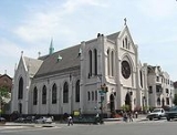
| 9th Street | Smith Street | Prospect Park West | 2 | West to east | 4th Avenue/9th St and other Culver Line stations in Park Slope |  |
|
| 10th Street | Dead-end at 2nd Avenue | Prospect Park West | 1 | East | |||
| 11th Street | 2nd Avenue | Prospect Park West | 1 | West | |||
| 12th Street | Dead-end at Hamilton Place | Prospect Park West | 1 | East | |||
| 13th Street | Hamilton Place | Prospect Park West | 1 | West | |||
| 14th Street | Hamilton Place | Prospect Park West | 1 | East | |||
| 15th Street | Hamilton Avenue | Bartel Pritchard Square at Prospect Park West | 1 | West | |||
| 16th Street | Hamilton Avenue | Prospect Park Southwest | 1 | Varies | West of 4th Avenue, traffic flows west, east of 4th Avenue, traffic flows east. | ||
| 17th Street | Sunset Industrial Park | Terrace Place | 1 | East | Cut-off for half a block avenue after 6th Avenue by the Prospect Expressway. | ||
| 18th Street | Sunset Industrial Park | Vanderbilt Street | 1 | West | Temporarily interrupted by the Prospect Expressway between 6th and 7th avenues. | ||
| 19th Street | Sunset Industrial Park | Vanderbilt Street | 1 | East | |||
| 20th Street | Sunset Industrial Park | Vanderbilt | 1-2 | Varies | Two-way throughout route except for the block between 10th and 11th avenues. | ||
| 21st Street | Dead-end at 3rd Avenue | 7th Avenue | 1 | East | |||
| 22nd Street | Dead-end at 3rd Avenue | 7th Avenue | 1 | West | |||
| 23 Street | Dead-end at 3rd Avenue | 7th Avenue | 1 | East | |||
| 24th Street | 3rd Avenue | 6th Avenue | 1 | West | |||
| 25th Street | Dead-end at 3rd Avenue | 5th Avenue | 1 | East | The 25th Street Station 25th Street (BMT Fourth Avenue Line) 25th Street is a local station on the BMT Fourth Avenue Line of the New York City Subway. Located at the intersection of 25th Street and Fourth Avenue in Sunset Park, Brooklyn, it is served by the R train at all times except late nights, when the D and N trains assume local service along Fourth... is located on 4th Avenue Fourth Avenue (Brooklyn) Fourth Avenue is a major thoroughfare in the New York City borough of Brooklyn. It stretches for south from Times Plaza, which is the triangle intersection created by Atlantic and Flatbush Avenues in Downtown Brooklyn, to Shore Road and the Belt Parkway in Bay Ridge.While southwestern Brooklyn is... . |
||
| 26th Street | Dead-end at 3rd Avenue | 5th Avenue | 1 | West | |||
| 27th Street | Dead-end at 3rd Avenue | 5th Avenue | 1 | East | |||
| 28th Street | 3rd Avenue | 5th Avenue | 1 | West | |||
| 29th Street | 2nd Avenue | 5th Avenue | 1 | East | Street closed indefinitely between 2nd and 3rd avenues for use by the Metropolitan Dentention Center Metropolitan Detention Center, Brooklyn The Metropolitan Detention Center located at 80 29th Street near Gowanus Bay, between 2nd and 3rd Avenues on 29th Street, in Sunset Park, Brooklyn, New York, is one of several MDCs operated by the United States Federal Bureau of Prisons.... . |
||
| 30th Street | 2nd Avenue | 5th Avenue | 1 | West | Street is closed indefinitely between 2nd and 3rd avenues for use by the Metropolitan Detention Center. | ||
| 31st Street | 2nd Avenue | 5th Avenue | 1 | East | The street is closed between 2nd and 3rd Avenues. | ||
| 32nd Street | 2nd Avenue | 5th Avenue | 1 | West | |||
| 33rd Street | 2nd Street | 5th Avenue | 1 | East | |||
| 34th Street | 2nd Avenue | 5th Avenue | 1 | West | |||
| 35th Street | 2nd Avenue | Dahill Road | 1 | East | Cut-off from 5th Avenue till Church Avenue because of Green-Wood Cemetery Green-Wood Cemetery Green-Wood Cemetery was founded in 1838 as a rural cemetery in Brooklyn, Kings County , New York. It was granted National Historic Landmark status in 2006 by the U.S. Department of the Interior.-History:... . |
||
| 36th Street | 2nd Avenue | 15th Avenue | 1-2 | Varies | Westbound from 2nd Avenue to 5th Avenue becoming two-way to 7th Avenue. Cut-off by cemetery, resumes westbound at Fort Hamilton Parkway. 36th Street Station 36th Street (BMT Fourth Avenue Line) 36th Street is an express station on the BMT Fourth Avenue Line of the New York City Subway, located at 36th Street and Fourth Avenue in Sunset Park, Brooklyn.... is on 4th Avenue Fourth Avenue (Brooklyn) Fourth Avenue is a major thoroughfare in the New York City borough of Brooklyn. It stretches for south from Times Plaza, which is the triangle intersection created by Atlantic and Flatbush Avenues in Downtown Brooklyn, to Shore Road and the Belt Parkway in Bay Ridge.While southwestern Brooklyn is... . |
||
| 37th Street | 2nd Avenue | Dahill Road | 1-2 | Varies | One-way eastbound from 2nd Avenue to 5th Avenue, cut-off by the Jackie Gleason Bus Depot, resumes path at 7th Avenue becoming two-way until Fort Hamilton Parkway where it reverts to an eastbound one way. | ||
| 38th Street | 3rd Avenue | Dahill Road | 1 | Varies | Eastbound from 3rd to 5th avenues. Westbound from 10th Avenue on. | ||
| 39th Street | Dead-end at 1st Avenue | Dahill Road | 2 | West to east | Important thoroughfare and truck route. The B35) bus route runs along the street from 1st to 14th avenue and the B70) bus route from 1st to 3rd avenue and from 4th to 8th avenue. | ||
| 40th Street | 1st Avenue | Dahill Road | 1 | East | Cut-off between 1st and 2nd avenues. | ||
| 41st Street | 1st Avenue | Dahill Road | 1 | West | |||
| 42nd Street | Dead-end at 1st Avenue | Dahill Road | 1 | East | Cut-off by Sunset Park Sunset Park, Brooklyn Sunset Park is a neighborhood in the western section of the New York City borough of Brooklyn, USA. It is bounded by Greenwood Heights to the north, Borough Park to the east, Bay Ridge to the south, and Upper New York Bay to the west... between 5th and 7th Avenues. |
||
| 43rd Street | Dead-end at 1st Avenue | Dahill Road | 1 | West | Cut-off by Sunset Park Sunset Park, Brooklyn Sunset Park is a neighborhood in the western section of the New York City borough of Brooklyn, USA. It is bounded by Greenwood Heights to the north, Borough Park to the east, Bay Ridge to the south, and Upper New York Bay to the west... between 5th and 7th Avenues. |
||
| 44th Street | 1st Avenue | Dahill Road | 1 | East | |||
| 45th Street | 2nd Avenue | 18th Avenue | 1 | West | The 45th Street Station 45th Street (BMT Fourth Avenue Line) 45th Street is a local station on the BMT Fourth Avenue Line of the New York City Subway, located at 45th Street and Fourth Avenue in Sunset Park, Brooklyn. It is served by the R train at all times except late nights northbound and the N train late nights only.This underground station, opened on... is located on 4th Avenue Fourth Avenue (Brooklyn) Fourth Avenue is a major thoroughfare in the New York City borough of Brooklyn. It stretches for south from Times Plaza, which is the triangle intersection created by Atlantic and Flatbush Avenues in Downtown Brooklyn, to Shore Road and the Belt Parkway in Bay Ridge.While southwestern Brooklyn is... . |
||
| 46th Street | 2nd Avenue | 18th Avenue | 1 | East | |||
| 47th Street | 1st Avenue | McDonald Avenue | 1 | West | |||
| 48th Street | 1st Avenue | 19th Avenue | 1 | East | |||
| 49th Street/Sunset Terrace | 2nd Avenue | Dead-end at 18th Avenue | 1 | West | Carries a portion of the westbound B11 bus route from 4th and 18th avenues. | ||
| 50th Street | 1st Avenue | Dahill Road | 1 | East | Eastbound B11 bus, 4th-20th aves. Subway station 50th Street (BMT West End Line) 50th Street is a local station on the BMT West End Line of the New York City Subway, located in Brooklyn at the intersection of 50th Street and New Utrecht Avenue in Borough Park, Brooklyn. It is served by the D train at all times.... , New Utrecht ave. |
||
| 51st Street | Dead-end at 1st Avenue | Dahill Road | 1 | West | Cut-off between 18th and 19th avenues by the Bay Ridge Branch Bay Ridge Branch The Bay Ridge Branch is a rail line owned by the Long Island Rail Road and operated by the New York and Atlantic Railway in the U.S. State of New York... of the Long Island Railroad. |
||
| 52nd Street | Dead-end at 1st Avenue | Dahill Road | 1 | East | Carries a portion of the eastbound B11 bus route from 2nd to 4th avenue. | ||
| 53rd Street | 1st Avenue | Dahill Road & 21st Avenue | 1 | West | The 53rd Street Station 53rd Street (BMT Fourth Avenue Line) 53rd Street is a local station on the BMT Fourth Avenue Line of the New York City Subway. Located at 53rd Street and Fourth Avenue in Sunset Park, Brooklyn, it is served by the R train at all times except late nights northbound and the N train late nights only.This underground station, opened on... is located on 4th Avenue Fourth Avenue (Brooklyn) Fourth Avenue is a major thoroughfare in the New York City borough of Brooklyn. It stretches for south from Times Plaza, which is the triangle intersection created by Atlantic and Flatbush Avenues in Downtown Brooklyn, to Shore Road and the Belt Parkway in Bay Ridge.While southwestern Brooklyn is... . |
||
| 54th Street | 1st Avenue | 20th Avenue | 1 | East | Cut-off by Bay Ridge Branch of the Long Island Railroad between 17th and 18th avenues. | ||
| 55th Street | 1st Avenue | 19th Avenue | 1 | West | Cut-off by Bay Ridge Branch of the Long Island Railroad between 17th and 18th avenues. Carries a portion of the westbound B11 bus route from 1st to 4th avenue. | ||
| 56th Street | 1st Avenue | 18th Avenue | 1 | East | |||
| 57th Street | 1st Avenue | Dead-end at 21st Avenue | 1 | West | Cut-off by; Bay Ridge Branch of the Long Island Railroad between 16th and 17th avenues and Gravesend Park and a cemetery between 18th and 20th avenues. | ||
| 58th Street | Dead-end at 1st Avenue | Dead-end at 21st Avenue | 1 | East | Cut-off by; Bay Ridge Branch of the LIRR between 16th and 17th avenues and by FDR High School Franklin Delano Roosevelt High School Franklin Delano Roosevelt High School is a coeducational public high school located at 5800 20th Avenue in Brooklyn, New York. It is a zoned/public high school, with an enrollment of approximately 3700 students, encompassing grades 9-12.... between 19th and 20th avenues. Carries a portion of the eastbound B1 bus route from 1st to 2nd avenue. |
||
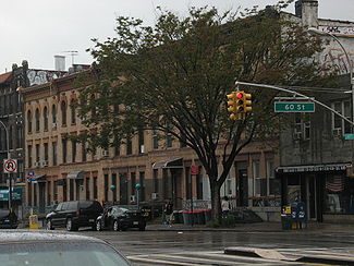
| 59th Street | 2nd Avenue | Dahill Road | 3.12 miles | 1 | West | The 59th Street Station 59th Street (BMT Fourth Avenue Line) 59th Street is an express station on the BMT Fourth Avenue Line of the New York City Subway. Located at 59th Street and Fourth Avenue, in the Brooklyn neighborhood of Sunset Park, it is served by the N and R trains at all times.... is located on 4th Avenue Fourth Avenue (Brooklyn) Fourth Avenue is a major thoroughfare in the New York City borough of Brooklyn. It stretches for south from Times Plaza, which is the triangle intersection created by Atlantic and Flatbush Avenues in Downtown Brooklyn, to Shore Road and the Belt Parkway in Bay Ridge.While southwestern Brooklyn is... . |
|
| 60th Street | 2nd Avenue | McDonald Avenue & 24th Avenue | 3.27 miles | 2 | West to east | Important thoroughfare and truck route. The B9 bus route runs along the street between 4th to 23rd avenues. |
 |
| 61st Street | 2nd Avenue | Dahill Road | 1 | West | |||
| 62nd Street | 2nd Avenue | Dahill Road | 1 | East | Cut-off between 7th and 8th avenues by the Sea Beach Line and the Long Island Railroad Bay Ridge Branch Bay Ridge Branch The Bay Ridge Branch is a rail line owned by the Long Island Rail Road and operated by the New York and Atlantic Railway in the U.S. State of New York... lines. The New Utrecht Avenue/62nd Street Station is located at New Utrecht Avenue. |
||
| 63rd Street | 2nd Avenue | Dahill Road | 1 | West | Cut-off between 6th and 8th avenues by the BMT Sea Beach and Long Island Railroad Bay Ridge Branch lines. | ||
| 64th Street | 2nd Avenue | Dahill Road | 1 | East | Cut-off between 6th and 7th avenues by the BMT Sea Beach and Long Island Railroad Bay Ridge Branch. | ||
| 65th Street | 2nd Avenue | McDonald Avenue at Avenue P Brooklyn avenues, Lettered A-Z This article provides details of the lettered avenues in the flat south central portion of New York City borough of Brooklyn. Improved public transport brought urban sprawl to this area in the late 19th and early 20th centuries, after the hilly areas to its west and north had already been developed... |
1-4 | Varies | Runs westbound, one-way on one-lane between 2nd and 3rd avenues and eastbound, one-way on one-lane between 5th and 6th avenues and becomes a two-way, four-lane street from 6th Avenue to its terminus. | ||
| 66th Street | 4th Avenue | Bay Parkway | 1 | West | Cut-off between 6th and 7th avenues by the Gowanus Expressway. | ||
| 67th Street | Colonial Road | Bay Parkway | 1-2 | Varies | Westbound, one-way on one-lane between Colonial Road and 4th Avenue. Eastbound, one-way on one-lane from 4th to 5th avenues where the street then runs two-way on two-lanes from 5th to 7th avenues where it is cut-off by the Gowanus Expressway. Beyond the expressway, 67th again runs eastbound, one-way on one-lane to its terminus. | ||
| 68th Street | Shore Road | Bay Parkway | 1 | West | Cut-off at 7th Avenue by the Gowanus Expressway. | ||
| 69th Street/Bay Ridge Avenue | Shore Road | Bay Parkway | 1-2 | Varies | Two-way on two-lanes from Shore Road to 6th Avenue, running eastbound, one-way on one-lane from 6th Avenue to 7th Avenue where it is cut-off by the Gowanus Expressway. Resumes two-way configuration at the other side of 7th Avenue to 13th Avenue where it reverts to its eastbound, one-way configuration till its terminus. | ||
| 70th Street | Dead-end at Narrows Avenue | Bay Parkway | 1 | Varies | Runs westbound from Narrows Avenue to 7th Avenue where it is interrupted by the Gowanus Expressway. Runs eastbound from other side of 7th Avenue to terminus. | ||
| 71st Street | Shore Road | Bay Parkway | 1 | Varies | Runs westbound from Shore Road to 3rd Avenue where it is interrupted until 6th Avenue where it runs eastbound one block to 7th Avenue where it is again interrupted, this time by the Gowanus Expressway. Runs eastbound from other side of 7th Avenue to terminus. | ||
| 86th Street | Shore Road | McDonald Avenue | 2-4 | West to east | See article. | ||
| 87th Street | Shore Road | 5th Avenue | 1 | West | |||
| 88th Street | Shore Road | 7th Avenue | 1 | East | |||
| 89th Street | Narrows Avenue | 5th Avenue | 1 | West | Path interrupted between Gaitling Place and Dahlgren Place by the Gowanus Expressway. | ||
| 90th Street | Ridge Boulevard | 7th Avenue | 1 | West | Path interrupted between Gaitling Place and Dahlgren Place by the Gowanus Expressway. | ||
| 91st Street | Shore Road | 5th Avenue | 1 | East | |||
| 92nd Street | Shore Road | 7th Avenue | 1-2 | Varies | Runs westbound, one-way on one-lane from Shore Road to 4th Avenue where it becomes two-way to its terminus. | ||
| 93rd Street | Shore Road | 4th Avenue | 1 | Varies | Runs westbound from Shore Road to Marine Avenue and eastbound from Marine Avenue to 4th Avenue. | ||
| 94th Street | Shore Road | Fort Hamilton Parkway | 1 | Varies | Runs eastbound from Shore Road to Marine Avenue and westbound from Marine Avenue to Fort Hamilton Parkway. | ||
| 95th Street | Shore Road | Fort Hamilton Parkway | 1 | East | |||
| 96th Street | Shore Road | 4th Avenue | 1 | West | |||
| 97th Street | Shore Road | Fort Hamilton Parkway | 1 | Varies | Runs eastbound from Shore Road to 3rd Avenue and westbound from 4th Avenue to Fort Hamilton Parkway. | ||
| 98th Street | Dead-end at Marine Avenue | Marine Avenue | 1 | Two-way | |||
| 99th Street | Shore Road | Fort Hamilton Parkway | 1 | Varies | Runs eastbound from Shore Road to 3rd Avenue and westbound from 3rd Avenue to terminus. | ||
| 100th Street | 3rd Avenue | Fort Hamlton Parkway | 1 | East | |||
| 101st Street | 3rd Avenue | Fort Hamilton Parkway | 1 | West |