
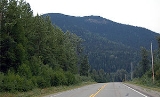
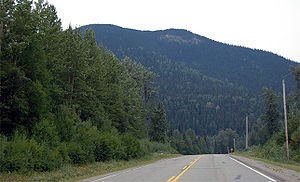
British Columbia provincial highway 97
Encyclopedia
Highway 97 is the longest continuously-numbered route in the Canadian
province of British Columbia
(and the longest provincial highway in any province), running 2,081 km (1,293 mi) from the Canada/U.S.
border
at Osoyoos
in the south to the British Columbia/Yukon border in the north at Watson Lake, Yukon
. The route takes its number from U.S. Route 97
, with which it connects at the international border. The highway was initially designated '97' in 1953.
on the Trans-Canada Highway
. It is named for the Okanagan
region of British Columbia, through which it largely passes. It begins in the south at the international border crossing north of Oroville
, and travels 4 km (2 mi) north to its junction with the Crowsnest Highway
at Osoyoos. The highway travels north for 47 km (29 mi), passing through the community of Oliver
, before arriving at the locality of Kaleden
, where Highway 3A diverges west.
13 km (8 mi) north of Kaleden, Highway 97 arrives at the city of Penticton
. North of Penticton, Highway 97 follows the western shore of Okanagan Lake
for 45 km (28 mi), through the communities of Summerland
and Peachland
, before reaching its junction with Highway 97C just south of Westbank
. From there, Highway 97 passes through West Kelowna, Westbank, Lakeview, and reserve lands belonging to the Westbank First Nation
until, 15 km (9 mi) northeast of the 97C junction, Highway 97 begins to cross Okanagan Lake via the William R. Bennett Bridge
. The highway enters the city of Kelowna
upon landfall on the east shore of the lake. 6 km (4 mi) east into the city centre, the highway reaches its junction with Highway 33.
Four kilometres (2½ mi) north of the Highway 33 junction, Highway 97 leaves the urbanized area of Kelowna (the municipal boundary is actually a further 12 km, 7 mi, north). For the next 43 km (27 mi), the route travels well east of Okanagan Lake, passing through the community of Winfield
, then alongside the west shore of Wood Lake
to Oyama. Both of these communities lie within the municipality of Lake Country
. Highway 97 then passes along the west shore of Kalamalka Lake
before entering the city of Vernon
and a junction with Highway 6. The highway then travels north for 10 km (6 mi) to a junction with Highway 97A at Swan Lake, at which point it veers northwest. The highway continues for another 81 km (51 mi), past the town of Falkland, before it merges onto the Trans-Canada Highway at Monte Creek, following Highway 1 for 105 km (65 mi) west to Cache Creek
. As it travels westward, Highways 1 and 97 parallel the Thompson River
, passing through the city of Kamloops, where the two highways intersect with Highways 5 and 5A.
, is 441 km (274 mi) in length and is named for the Cariboo
region, through which it travels. Much of its length as far as Quesnel
follows approximately the route of the original Cariboo Wagon Road, which was also known as the Queen's Highway. The Cariboo Wagon Road's lower stretches between Yale
and Cache Creek were severed in many places by the construction of the Canadian Pacific Railway
in the 1880s. That section, now part of the Trans-Canada, was rebuilt in the 1920s, when the name Cariboo Highway was first applied to the route, a designation which ran from Yale to Prince George, British Columbia
(where portions of the route survive as the Old Cariboo Highway
). Today the Cariboo Highway designation begins at Cache Creek, veering north for 11 km (7 mi) to its junction with Highway 99. North of Highway 99, Highway 97 travels 92 km (57 mi) through Clinton
, where the British Columbia Railway begins to roughly parallel Highway 97, as well as through the community of 70 Mile House
before reaching a junction at 93 Mile House
with Highway 24 (the Interlakes
Highway).
Over the 100 km (62 mi) of road north of Highway 24, Highway 97 travels through 100 Mile House and 150 Mile House
before reaching the city of Williams Lake
and a junction with Highway 20, which runs west across the Chilcotin District
to Bella Coola
on the Central Coast. Over the next 120 km (75 mi) continuing generally northward, the highway passes through McLeese Lake and Marguerite. En route, Highway 97 follows the east bank of the Fraser River
to the city of Quesnel
, and a junction with Highway 26. Over the next 115 km (71 mi) north of Quesnel, after passing through the hamlets of Strathnaver, Hixon
, Stoner and Red Rock, Highway 97 meets its junction with Highway 16 at Prince George
. North of here, the highway veers away from the Fraser River, and the British Columbia Railway veers northwestward from it.
The term Cariboo Highway originally applied to the reconstructed route from Hope
through the Fraser Canyon
to Cache Creek and Prince George. Constructed in 1924-25, the new gravel toll highway opened in 1926, giving road access to canyon communities cut off since the destruction of parts of the Cariboo Road
by construction of the Canadian Pacific Railway
in the 1880s. The Cariboo Highway designation for the Fraser Canyon portion of the route was supplanted with the completion and naming of the Trans-Canada Highway circa-1962. Portions of the old highway survive as local streets, some carrying the name Old Cariboo Highway
(as in Prince George).
 This 405 km (252 mi) long stretch of Highway 97, named for former British Columbia Premier John Hart, begins at Prince George, travelling for 152 km (94 mi) north through the small hamlet of Summit Lake
, which is situated at the Continental Divide as well as through Crooked River Provincial Park
, Bear Lake
and McLeod Lake
, to its intersection with Highway 39. It then journeys northeast another 150 km (93 mi) through the Continental Divide
at which point the time zone
changes from Pacific Time
to Mountain Time. After emerging from the Pine Pass
, the highway generally follows the Pine River
northeast to its intersection with Highway 29 at the town of Chetwynd
. After a trek of another 97 km (60 mi) east, the Hart Highway terminates at Dawson Creek
.
and Fort Nelson
, the latter being just east of the junction of Highway 77, travelling north to the Northwest Territories
. Here, the highway veers generally northwestward into wilderness spotted with tiny localities. As it passes over the Rocky Mountains
, the highway parallels the Liard River
before terminating just over the BC/Yukon border at Watson Lake
, where the Alaska Highway is numbered as Yukon Highway 1.
Canada
Canada is a North American country consisting of ten provinces and three territories. Located in the northern part of the continent, it extends from the Atlantic Ocean in the east to the Pacific Ocean in the west, and northward into the Arctic Ocean...
province of British Columbia
British Columbia
British Columbia is the westernmost of Canada's provinces and is known for its natural beauty, as reflected in its Latin motto, Splendor sine occasu . Its name was chosen by Queen Victoria in 1858...
(and the longest provincial highway in any province), running 2,081 km (1,293 mi) from the Canada/U.S.
United States
The United States of America is a federal constitutional republic comprising fifty states and a federal district...
border
Canada-United States border
The Canada–United States border, officially known as the International Boundary, is the longest border in the world. The terrestrial boundary is 8,891 kilometers long, including 2,475 kilometres shared with Alaska...
at Osoyoos
Osoyoos, British Columbia
Osoyoos is a town in the southern part of the Okanagan Valley in British Columbia near the border with Washington state. The town is also adjacent to the Indian Reserve of the Osoyoos Indian Band. The origin of the name Osoyoos was the word suius meaning "narrowing of the waters" in the local...
in the south to the British Columbia/Yukon border in the north at Watson Lake, Yukon
Watson Lake, Yukon
Watson Lake is a town at historical mile 635 on the Alaska Highway in the southeastern Yukon close to the British Columbia border. Population in December 2004 was 1,547 ....
. The route takes its number from U.S. Route 97
U.S. Route 97
U.S. Route 97 is a major north–south United States highway in the western United States. It begins at a junction with Interstate 5 at Weed, California, and travels north, ending in Okanogan County, Washington, at the Canadian Border, across from Osoyoos, British Columbia, becoming British...
, with which it connects at the international border. The highway was initially designated '97' in 1953.
Okanagan Highway
The Okanagan Highway is a 269 km (167 mi) section of Highway 97 between the international border and Monte CreekMonte Creek, British Columbia
Monte Creek is a rural locality on the South Thompson River east of Kamloops, British Columbia, Canada, approximately equidistant from Kamloops and the village of Chase, British Columbia. It is mostly notable as a major highway junction where British Columbia Highway 97 branches off from the...
on the Trans-Canada Highway
Trans-Canada Highway
The Trans-Canada Highway is a federal-provincial highway system that joins the ten provinces of Canada. It is, along with the Trans-Siberian Highway and Australia's Highway 1, one of the world's longest national highways, with the main route spanning 8,030 km...
. It is named for the Okanagan
Okanagan
The Okanagan , also known as the Okanagan Valley and sometimes as Okanagan Country is a region located in the Canadian province of British Columbia defined by the basin of Okanagan Lake and the Canadian portion of the Okanagan River. As of 2009, the region's population is approximately 350,927. The...
region of British Columbia, through which it largely passes. It begins in the south at the international border crossing north of Oroville
Oroville, Washington
Oroville is a town in Okanogan County, Washington, United States. The population was 1,686 at the 2010 census.-Geography:Oroville is located at ....
, and travels 4 km (2 mi) north to its junction with the Crowsnest Highway
Crowsnest Highway
The Crowsnest Highway, also known as the Interprovincial or, in British Columbia, the Southern Trans-Provincial, is an east-west highway, in length, through the southern parts of British Columbia and Alberta, providing the shortest highway connection between British Columbia's Lower Mainland and...
at Osoyoos. The highway travels north for 47 km (29 mi), passing through the community of Oliver
Oliver, British Columbia
Oliver is a community at the south end of the Okanagan Valley in the Southern Interior of British Columbia, Canada, with a population of 4370. The community of Oliver is made up of land governed by three different bodies: the Town of Oliver, the Regional District of Okanagan-Similkameen and the...
, before arriving at the locality of Kaleden
Kaleden, British Columbia
Kaleden is a small historic community located minutes south of Penticton in the Okanagan valley in the province of British Columbia Canada. Overlooking Skaha Lake, Kaleden is made up of picturesque vineyards and lakeview orchards. Visitors are offered a relaxed environment with good bed and...
, where Highway 3A diverges west.
13 km (8 mi) north of Kaleden, Highway 97 arrives at the city of Penticton
Penticton, British Columbia
Penticton is a city in the Okanagan Valley of the Southern Interior of British Columbia, Canada, situated between Okanagan and Skaha Lakes. Its 2010 population was 37,721 .-Name origin:...
. North of Penticton, Highway 97 follows the western shore of Okanagan Lake
Okanagan Lake
Okanagan Lake is a large, deep lake in the Okanagan Valley of British Columbia. The lake is 135 km long, between 4 and 5 km wide, and has a surface area of 351 km². The lake's maximum depth is 232 meters near Grant Island...
for 45 km (28 mi), through the communities of Summerland
Summerland, British Columbia
Summerland is a community on the west side of Okanagan Lake in the interior of British Columbia, Canada. The district is between Peachland to the north and Penticton to the south...
and Peachland
Peachland, British Columbia
Peachland is a district municipality of approximately 5000 residents in the Okanagan Valley, on the west side of Okanagan Lake in British Columbia, Canada. It was founded in 1899 by John Moore Robinson, although the region had long been home to the Okanagan people...
, before reaching its junction with Highway 97C just south of Westbank
Westbank, British Columbia
Westbank is one of the communities within the district municipality of West Kelowna in the province of British Columbia. It is 12 km to the west of Kelowna. Other communities in West Kelowna include Casa Loma, West Kelowna Estates, Shannon Lake, Smith Creek, Glenrosa, Rose Valley and Lakeview...
. From there, Highway 97 passes through West Kelowna, Westbank, Lakeview, and reserve lands belonging to the Westbank First Nation
Westbank First Nation
The Westbank First Nation is a First Nations government in the Okanagan region of the Canadian province of British Columbia, located with the District of West Kelowna. They are a member of the Okanagan Nation Alliance...
until, 15 km (9 mi) northeast of the 97C junction, Highway 97 begins to cross Okanagan Lake via the William R. Bennett Bridge
William R. Bennett Bridge
The William R. Bennett Bridge is a bridge in the Okanagan Valley of British Columbia, Canada. Completed on May 25, 2008, the bridge replaced the older Okanagan Lake Bridge built in 1958 to link Downtown Kelowna to West Kelowna across Okanagan Lake as part of Highway 97.On April 21, 2005, premier...
. The highway enters the city of Kelowna
Kelowna, British Columbia
Kelowna is a city on Okanagan Lake in the Okanagan Valley, in the southern interior of British Columbia, Canada. Its name derives from a Okanagan language term for "grizzly bear"...
upon landfall on the east shore of the lake. 6 km (4 mi) east into the city centre, the highway reaches its junction with Highway 33.
Four kilometres (2½ mi) north of the Highway 33 junction, Highway 97 leaves the urbanized area of Kelowna (the municipal boundary is actually a further 12 km, 7 mi, north). For the next 43 km (27 mi), the route travels well east of Okanagan Lake, passing through the community of Winfield
Winfield, British Columbia
Winfield is an urban area that is currently part of the District Municipality of Lake Country, British Columbia, located north of Kelowna, British Columbia, Canada. The community is situated north and slightly east of Kelowna, along Highway 97, located in the central Okanagan Valley. The town is...
, then alongside the west shore of Wood Lake
Wood Lake (British Columbia)
Wood Lake is a lake in a chain of five major lakes which occupies portions of the Okanagan Valley in the interior of British Columbia, Canada. The lakes of the Okanagan Valley were formed by about 8900 BP....
to Oyama. Both of these communities lie within the municipality of Lake Country
Lake Country, British Columbia
Lake Country is a District Municipality with a population of approximately 10,000 in the Okanagan Valley, British Columbia, Canada. The city of Kelowna lies to the south, while the city of Vernon lies to the north. As its name suggests, there are a number of lakes in the vicinity of Lake Country,...
. Highway 97 then passes along the west shore of Kalamalka Lake
Kalamalka Lake
Kalamalka Lake is a large lake in the Interior Plateau of southern central British Columbia, Canada, east of Okanagan Lake and approximately south of Vernon. The lake is named for the Okanagan Kalamalka Lake (aka "Kal Lake") is a large lake in the Interior Plateau of southern central British...
before entering the city of Vernon
Vernon, British Columbia
Vernon is a city in the south-central region of British Columbia, Canada. Named after Forbes George Vernon, a former MLA of British Columbia who helped found the famed Coldstream Ranch, the City of Vernon was incorporated on December 30, 1892. The City of Vernon has a population of 35,944 , while...
and a junction with Highway 6. The highway then travels north for 10 km (6 mi) to a junction with Highway 97A at Swan Lake, at which point it veers northwest. The highway continues for another 81 km (51 mi), past the town of Falkland, before it merges onto the Trans-Canada Highway at Monte Creek, following Highway 1 for 105 km (65 mi) west to Cache Creek
Cache Creek, British Columbia
Cache Creek is a junction community northeast of Vancouver in British Columbia, Canada. It is on the Trans-Canada Highway in the province of British Columbia at its junction with northbound Highway 97...
. As it travels westward, Highways 1 and 97 parallel the Thompson River
Thompson River
The Thompson River is the largest tributary of the Fraser River, flowing through the south-central portion of British Columbia, Canada. The Thompson River has two main branches called the South Thompson and the North Thompson...
, passing through the city of Kamloops, where the two highways intersect with Highways 5 and 5A.
Cariboo Highway
The Cariboo Highway section of Highway 97, between Cache Creek and Prince GeorgePrince George, British Columbia
Prince George, with a population of 71,030 , is the largest city in northern British Columbia, Canada, and is known as "BC's Northern Capital"...
, is 441 km (274 mi) in length and is named for the Cariboo
Cariboo
The Cariboo is an intermontane region of British Columbia along a plateau stretching from the Fraser Canyon to the Cariboo Mountains. The name is a reference to the woodland caribou that were once abundant in the region...
region, through which it travels. Much of its length as far as Quesnel
Quesnel, British Columbia
-Demographics:Quesnel had a population of 9,326 people in 2006, which was a decrease of 7.1% from the 2001 census count. The median household income in 2005 for Quesnel was $54,044, which is slightly above the British Columbia provincial average of $52,709....
follows approximately the route of the original Cariboo Wagon Road, which was also known as the Queen's Highway. The Cariboo Wagon Road's lower stretches between Yale
Yale, British Columbia
Yale is an unincorporated town in the Canadian province of British Columbia. It was founded in 1848 by the Hudson's Bay Company as Fort Yale by Ovid Allard, the appointed manager of the new post, who named it after his superior, James Murray Yale, then Chief Factor of the Columbia District...
and Cache Creek were severed in many places by the construction of the Canadian Pacific Railway
Canadian Pacific Railway
The Canadian Pacific Railway , formerly also known as CP Rail between 1968 and 1996, is a historic Canadian Class I railway founded in 1881 and now operated by Canadian Pacific Railway Limited, which began operations as legal owner in a corporate restructuring in 2001...
in the 1880s. That section, now part of the Trans-Canada, was rebuilt in the 1920s, when the name Cariboo Highway was first applied to the route, a designation which ran from Yale to Prince George, British Columbia
Prince George, British Columbia
Prince George, with a population of 71,030 , is the largest city in northern British Columbia, Canada, and is known as "BC's Northern Capital"...
(where portions of the route survive as the Old Cariboo Highway
Old Cariboo Highway
The Old Cariboo Highway is a portion of the historic Cariboo Highway near Prince George, British Columbia. It runs northward from its junction with Highway 97 just south of Prince George, and terminates at the Yellowhead Highway just east of Prince George....
). Today the Cariboo Highway designation begins at Cache Creek, veering north for 11 km (7 mi) to its junction with Highway 99. North of Highway 99, Highway 97 travels 92 km (57 mi) through Clinton
Clinton, British Columbia
Clinton is a village in British Columbia, Canada, located approximately 40 km northwest of Cache Creek and 30 km south of 70 Mile House.It is considered by some to straddle the southern edge of the Cariboo country of British Columbia, although others consider Ashcroft-Cache Creek, Lillooet, Savona,...
, where the British Columbia Railway begins to roughly parallel Highway 97, as well as through the community of 70 Mile House
70 Mile House, British Columbia
70 Mile House is situated on Highway 97 in the Cariboo region of British Columbia, Canada. Its name is derived from its distance from Lillooet, which was Mile 0 of the Old Cariboo Road. Other examples of towns named by their distance from Lillooet on the Old Cariboo Road are 93 Mile House, 100 Mile...
before reaching a junction at 93 Mile House
93 Mile House
93 Mile House is an unincorporated community in the South Cariboo region of British Columbia. It is at the junction of Highway 24 and Highway 97. It is located approximately 11 km south of 100 Mile House. 93 Mile House was the name of a roadhouse built to serve travellers on the Cariboo Road...
with Highway 24 (the Interlakes
Interlakes
The Interlakes, also known as the Interlakes District, is a geographic region of the Interior of British Columbia, Canada, located along and around the Interlakes Highway between 100 Mile House on BC Highway 97 and Little Fort on the North Thompson River...
Highway).
Over the 100 km (62 mi) of road north of Highway 24, Highway 97 travels through 100 Mile House and 150 Mile House
150 Mile House, British Columbia
150 Mile House is an unincorporated settlement of 893 people in the Cariboo region of British Columbia.It is located 15 km south of Williams Lake on Highway 97....
before reaching the city of Williams Lake
Williams Lake, British Columbia
Williams Lake, is a city in the Central Interior of British Columbia, Canada. Located in the central part of a region known as the Cariboo, it is the largest urban centre between Kamloops and Prince George, with a population of 11,150 in city limits....
and a junction with Highway 20, which runs west across the Chilcotin District
Chilcotin District
The Chilcotin District of British Columbia is usually known simply as "the Chilcotin", and also in speech commonly as "the Chilcotin Country" or simply Chilcotin. It is a plateau and mountain region in British Columbia on the inland lea of the Coast Mountains on the west side of the Fraser River....
to Bella Coola
Bella Coola, British Columbia
Bella Coola is a community of approximately 600 at the western extremity of the Bella Coola Valley. Bella Coola usually refers to the entire valley, encompassing the settlements of Bella Coola proper , Lower Bella Coola, Hagensborg, Saloompt, Nusatsum, Firvale and Stuie...
on the Central Coast. Over the next 120 km (75 mi) continuing generally northward, the highway passes through McLeese Lake and Marguerite. En route, Highway 97 follows the east bank of the Fraser River
Fraser River
The Fraser River is the longest river within British Columbia, Canada, rising at Fraser Pass near Mount Robson in the Rocky Mountains and flowing for , into the Strait of Georgia at the city of Vancouver. It is the tenth longest river in Canada...
to the city of Quesnel
Quesnel, British Columbia
-Demographics:Quesnel had a population of 9,326 people in 2006, which was a decrease of 7.1% from the 2001 census count. The median household income in 2005 for Quesnel was $54,044, which is slightly above the British Columbia provincial average of $52,709....
, and a junction with Highway 26. Over the next 115 km (71 mi) north of Quesnel, after passing through the hamlets of Strathnaver, Hixon
Hixon, British Columbia
Hixon is an unincorporated community at the northern edge of the Cariboo region of the Central Interior region of British Columbia, Canada. It is located on the east bank of the Fraser River, and is about midway along BC Highway 97 between the cities of Prince George and Quesnel...
, Stoner and Red Rock, Highway 97 meets its junction with Highway 16 at Prince George
Prince George, British Columbia
Prince George, with a population of 71,030 , is the largest city in northern British Columbia, Canada, and is known as "BC's Northern Capital"...
. North of here, the highway veers away from the Fraser River, and the British Columbia Railway veers northwestward from it.
The term Cariboo Highway originally applied to the reconstructed route from Hope
Hope, British Columbia
Hope is a district municipality located at the confluence of the Fraser and Coquihalla rivers in the province of British Columbia, Canada. Hope is at the eastern end of both the Fraser Valley and the Lower Mainland region, and is at the southern end of the Fraser Canyon...
through the Fraser Canyon
Fraser Canyon
The Fraser Canyon is an 84 km landform of the Fraser River where it descends rapidly through narrow rock gorges in the Coast Mountains en route from the Interior Plateau of British Columbia to the Fraser Valley...
to Cache Creek and Prince George. Constructed in 1924-25, the new gravel toll highway opened in 1926, giving road access to canyon communities cut off since the destruction of parts of the Cariboo Road
Cariboo Road
The Cariboo Road was a project initiated in 1860 by the colonial Governor of British Columbia, James Douglas...
by construction of the Canadian Pacific Railway
Canadian Pacific Railway
The Canadian Pacific Railway , formerly also known as CP Rail between 1968 and 1996, is a historic Canadian Class I railway founded in 1881 and now operated by Canadian Pacific Railway Limited, which began operations as legal owner in a corporate restructuring in 2001...
in the 1880s. The Cariboo Highway designation for the Fraser Canyon portion of the route was supplanted with the completion and naming of the Trans-Canada Highway circa-1962. Portions of the old highway survive as local streets, some carrying the name Old Cariboo Highway
Old Cariboo Highway
The Old Cariboo Highway is a portion of the historic Cariboo Highway near Prince George, British Columbia. It runs northward from its junction with Highway 97 just south of Prince George, and terminates at the Yellowhead Highway just east of Prince George....
(as in Prince George).
John Hart Highway
Summit Lake, British Columbia
Summit Lake is the name of an unincorporated community in the Central Interior of British Columbia, Canada, located north of the City of Prince George on the John Hart Highway at the lake of the same name. The community of McLeod Lake is a few miles further to the north...
, which is situated at the Continental Divide as well as through Crooked River Provincial Park
Crooked River Provincial Park
Crooked River Provincial Park is a 970 hectare provincial park in British Columbia, Canada. The park, named after the Crooked River was established in 1965, and is approximately 70 km north of Prince George along Highway 97, and close to the town of Bear Lake....
, Bear Lake
Bear Lake, British Columbia
Bear Lake is an unincorporated settlement in northern British Columbia, approximately 70 km north of Prince George along Highway 97.Bear Lake Elementary School, administered by School District 57 Prince George, was closed in approximately 2005...
and McLeod Lake
McLeod Lake, British Columbia
McLeod Lake is an unincorporated community located on Highway 97 in northern British Columbia, Canada, north of Prince George. It is notable for being the first continuously inhabited European settlement established west of the Rocky Mountains in present-day Canada...
, to its intersection with Highway 39. It then journeys northeast another 150 km (93 mi) through the Continental Divide
Continental Divide
The Continental Divide of the Americas, or merely the Continental Gulf of Division or Great Divide, is the name given to the principal, and largely mountainous, hydrological divide of the Americas that separates the watersheds that drain into the Pacific Ocean from those river systems that drain...
at which point the time zone
Time zone
A time zone is a region on Earth that has a uniform standard time for legal, commercial, and social purposes. In order for the same clock time to always correspond to the same portion of the day as the Earth rotates , different places on the Earth need to have different clock times...
changes from Pacific Time
Pacific Time Zone
The Pacific Time Zone observes standard time by subtracting eight hours from Coordinated Universal Time . The clock time in this zone is based on the mean solar time of the 120th meridian west of the Greenwich Observatory. During daylight saving time, its time offset is UTC-7.In the United States...
to Mountain Time. After emerging from the Pine Pass
Pine Pass
The Pine Pass, 875 m , is a mountain pass in the Hart Ranges of the Northern Rockies of British Columbia, Canada. It is used by BC Highway 97 and the Canadian National Railway formly BC Rail to connect the Peace Country of the province's Northeastern Interior, and is the location of the...
, the highway generally follows the Pine River
Pine River
-Places:United States* Pine River, Michigan, an unincorporated community in Arenac County* Pine River Township, Michigan in Gratiot County* Pine River, Minnesota, a small city* Pine River Township, Cass County, Minnesota* Pine River, Wisconsin, a town...
northeast to its intersection with Highway 29 at the town of Chetwynd
Chetwynd, British Columbia
The District of Chetwynd is a town located on the foothills of the Rocky Mountains in northeastern British Columbia, Canada. Situated on an ancient floodplain, it is the first town eastbound travellers encounter after emerging from the Rockies along Highway 97 and acts as the gateway to the Peace...
. After a trek of another 97 km (60 mi) east, the Hart Highway terminates at Dawson Creek
Dawson Creek, British Columbia
Dawson Creek is a small city in northeastern British Columbia, Canada. The municipality of had a population of 11,529 in 2009. Dawson Creek derives its name from the creek of the same name that runs through the community. The creek was named after George Mercer Dawson by a member of his land...
.
Alaska Highway
This northernmost section of Highway 97 is 965 km long (600 mi), and travels north through largely unpopulated wilderness, intersecting the communities of Fort St. JohnFort St. John, British Columbia
The City of Fort St. John is a city in northeastern British Columbia, Canada. A member municipality of the Peace River Regional District, the city covers an area of about 22 km² with 22,000 residents . Located at Mile 47, it is one of the largest cities along the Alaska Highway. Originally...
and Fort Nelson
Fort Nelson, British Columbia
Fort Nelson is a town of approximately 5000 residents in British Columbia's northeastern corner. It is the administrative centre of the newly formed Northern Rockies Regional Municipality, a first for BC. The majority of Fort Nelson's economic activities have historically been concentrated in the...
, the latter being just east of the junction of Highway 77, travelling north to the Northwest Territories
Northwest Territories
The Northwest Territories is a federal territory of Canada.Located in northern Canada, the territory borders Canada's two other territories, Yukon to the west and Nunavut to the east, and three provinces: British Columbia to the southwest, and Alberta and Saskatchewan to the south...
. Here, the highway veers generally northwestward into wilderness spotted with tiny localities. As it passes over the Rocky Mountains
Rocky Mountains
The Rocky Mountains are a major mountain range in western North America. The Rocky Mountains stretch more than from the northernmost part of British Columbia, in western Canada, to New Mexico, in the southwestern United States...
, the highway parallels the Liard River
Liard River
The Liard River flows through Yukon, British Columbia and the Northwest Territories, Canada. Rising in the Saint Cyr Range of the Pelly Mountains in southeastern Yukon, it flows southeast through British Columbia, marking the northern end of the Rocky Mountains and then curving northeast back...
before terminating just over the BC/Yukon border at Watson Lake
Watson Lake, Yukon
Watson Lake is a town at historical mile 635 on the Alaska Highway in the southeastern Yukon close to the British Columbia border. Population in December 2004 was 1,547 ....
, where the Alaska Highway is numbered as Yukon Highway 1.