
Bluegrass Parkway
Encyclopedia
The Martha Layne Collins Blue Grass Parkway is a controlled-access highway
running from Elizabethtown, Kentucky
to Woodford County, Kentucky
, for a length of 71.134 miles (114.479 km). It intersects with Interstate 65
at its western terminus, and U.S. Route 60
at its eastern terminus. It is one of nine highways that are part of the Kentucky
parkway
system. The road is designated unsigned Kentucky Route 9002 (BG 9002).
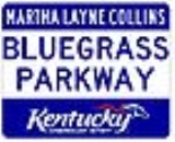
In 2003, the road was renamed in honor of Martha Layne Collins
, the first female governor
of Kentucky. Previously, it was simply the Blue Grass Parkway (sometimes with "Bluegrass" as one word, though in the highway's name, it was officially two words), and often called the "BG Parkway" because of the abbreviation used on its signs.
The parkway was opened in 1966 and was originally a toll road
, as were all Kentucky parkways. The parkway route largely parallels that of U.S. Route 62
. State law requires that toll collection ceases when enough tolls are collected to pay off the parkway's construction bonds; that occurred in 1991. It is constructed similar to the Interstate Highway system, though sections do not measure up to current Interstate standards.
, Harrodsburg
, and Versailles
. The toll plazas were located at (from west to east):
was planned as it had not been constructed and would not open until the late 1970s.
By the time the road opened, however, it was renamed the Bluegrass Parkway. There have been talks for a direct connection from the eastern terminus of the parkway at US 60 to Interstate 64, but all have failed. Such a connection would almost certainly draw enormous opposition in the Lexington area due to the many horse farms that would be adversely affected; the thoroughbred
breeding industry is an important direct employer and a major tourist draw in the region.
Controlled-access highway
A controlled-access highway is a highway designed exclusively for high-speed vehicular traffic, with all traffic flow and ingress/egress regulated...
running from Elizabethtown, Kentucky
Elizabethtown, Kentucky
Elizabethtown is a city in and the county seat of Hardin County, Kentucky, United States. The population was 28,531 at the 2010 census, making it the eleventh-largest city in the state...
to Woodford County, Kentucky
Woodford County, Kentucky
Woodford County is a county located in the heart of the Bluegrass region of the U.S. state of Kentucky. As of 2000, the population was 23,208. Its county seat is Versailles. The county is named for General William Woodford, who was with General George Washington at Valley Forge...
, for a length of 71.134 miles (114.479 km). It intersects with Interstate 65
Interstate 65
Interstate 65 is a major Interstate Highway in the United States. The southern terminus is located at an intersection with Interstate 10 in Mobile, Alabama, and its northern terminus is at an interchange with Interstate 90 , U.S. Route 12, and U.S...
at its western terminus, and U.S. Route 60
U.S. Route 60
U.S. Route 60 is an east–west United States highway, running from the Atlantic Ocean on the east coast in Virginia to western Arizona. Despite the final "0" in its number, indicating a transcontinental designation, the 1926 route formerly ended in Springfield, Missouri, at its intersection...
at its eastern terminus. It is one of nine highways that are part of the Kentucky
Kentucky
The Commonwealth of Kentucky is a state located in the East Central United States of America. As classified by the United States Census Bureau, Kentucky is a Southern state, more specifically in the East South Central region. Kentucky is one of four U.S. states constituted as a commonwealth...
parkway
Parkway
The term parkway has several distinct principal meanings and numerous synonyms around the world, for either a type of landscaped area or a type of road.Type of landscaped area:...
system. The road is designated unsigned Kentucky Route 9002 (BG 9002).
In 2003, the road was renamed in honor of Martha Layne Collins
Martha Layne Collins
Martha Layne Collins is a politician from the US state of Kentucky. From 1983 to 1987 she was the 56th Governor of Kentucky, having served the previous four years as lieutenant governor. She was Kentucky's first and only female governor to date...
, the first female governor
Governor
A governor is a governing official, usually the executive of a non-sovereign level of government, ranking under the head of state...
of Kentucky. Previously, it was simply the Blue Grass Parkway (sometimes with "Bluegrass" as one word, though in the highway's name, it was officially two words), and often called the "BG Parkway" because of the abbreviation used on its signs.
The parkway was opened in 1966 and was originally a toll road
Toll road
A toll road is a privately or publicly built road for which a driver pays a toll for use. Structures for which tolls are charged include toll bridges and toll tunnels. Non-toll roads are financed using other sources of revenue, most typically fuel tax or general tax funds...
, as were all Kentucky parkways. The parkway route largely parallels that of U.S. Route 62
U.S. Route 62
U.S. Route 62 runs from the US-Mexico border at El Paso, Texas to Niagara Falls, New York, near the United States-Canada border. It is the only east-west US Route that connects Mexico and Canada.Parts of U.S...
. State law requires that toll collection ceases when enough tolls are collected to pay off the parkway's construction bonds; that occurred in 1991. It is constructed similar to the Interstate Highway system, though sections do not measure up to current Interstate standards.
Route description
The parkway passes the cities of BardstownBardstown, Kentucky
As of the census of 2010, there were 11,700 people, 4,712 households, and 2,949 families residing in the city. The population density was . There were 5,113 housing units at an average density of...
, Harrodsburg
Harrodsburg, Kentucky
Harrodsburg is a city in and the county seat of Mercer County, Kentucky, United States. The population was 8,014 at the 2000 census. It is the oldest city in Kentucky.-History:...
, and Versailles
Versailles, Kentucky
As of the census of 2000, there were 7,511 people, 3,160 households, and 2,110 families residing in the city. The population density was . There were 3,330 housing units at an average density of . The racial makeup of the city was 88.18% White, 8.67% African American, 0.15% Native American, 0.35%...
. The toll plazas were located at (from west to east):
- Exit 10, New HavenNew Haven, KentuckyNew Haven is a city in Nelson County, Kentucky, United States. The population was 849 at the 2000 census.New Haven was founded as Pottinger's Landing in 1781 and later named New Haven by Samuel Pottinger after the Connecticut town...
/Boston - Exit 34, SpringfieldSpringfield, KentuckySpringfield is a city in and county seat of Washington County, Kentucky, United States. The population was 2,634 at the 2000 census. It was established in 1793 and probably named for springs in the area.-Geography:...
/BloomfieldBloomfield, KentuckyBloomfield is a city in Nelson County, Kentucky, United States. The population was 855 at the 2000 census.-Geography:Bloomfield is located at .... - Exit 59, LawrenceburgLawrenceburg, KentuckyLawrenceburg is a city in Anderson County, Kentucky, United States. The population was 10,505 at the 2010 census. It is the county seat of Anderson County...
/Harrodsburg
Interstate 64
No connection to Interstate 64Interstate 64
Interstate 64 is an Interstate Highway in the Midwestern and Southeastern United States. Its western terminus is at I-70, U.S. 40, and U.S. 61 in Wentzville, Missouri. Its eastern terminus is at an interchange with I-264 and I-664 at Bowers Hill in Chesapeake, Virginia. As I-64 is concurrent with...
was planned as it had not been constructed and would not open until the late 1970s.
| Under the provisions of Chapter 173 of the Acts of 1960, Kentucky Revised Statutes (Section 175.410 to 175.990), the Turnpike Authority of Kentucky was created as an independent corporate agency and instrumentality of the Commonwealth of Kentucky Kentucky The Commonwealth of Kentucky is a state located in the East Central United States of America. As classified by the United States Census Bureau, Kentucky is a Southern state, more specifically in the East South Central region. Kentucky is one of four U.S. states constituted as a commonwealth... for the financing and construction of one or more turnpike projects. |
| The Department of Highways had traffic and engineering studies made relative to the construction of the Central Kentucky Toll Road which is approximately 71 miles (114.3 km) in length, extending from a point on the Kentucky Turnpike and Interstate 65 Interstate 65 Interstate 65 is a major Interstate Highway in the United States. The southern terminus is located at an intersection with Interstate 10 in Mobile, Alabama, and its northern terminus is at an interchange with Interstate 90 , U.S. Route 12, and U.S... in the vicinity of the City of Elizabethtown Elizabethtown, Kentucky Elizabethtown is a city in and the county seat of Hardin County, Kentucky, United States. The population was 28,531 at the 2010 census, making it the eleventh-largest city in the state... in the county of Hardin Hardin County, Kentucky As of the census of 2000, there were 94,174 people, 34,497 households, and 25,355 families residing in the county. The population density was . There were 37,673 housing units at an average density of... to a point on US 60 U.S. Route 60 U.S. Route 60 is an east–west United States highway, running from the Atlantic Ocean on the east coast in Virginia to western Arizona. Despite the final "0" in its number, indicating a transcontinental designation, the 1926 route formerly ended in Springfield, Missouri, at its intersection... east of the city of Versailles Versailles, Kentucky As of the census of 2000, there were 7,511 people, 3,160 households, and 2,110 families residing in the city. The population density was . There were 3,330 housing units at an average density of . The racial makeup of the city was 88.18% White, 8.67% African American, 0.15% Native American, 0.35%... in the county of Woodford Woodford County, Kentucky Woodford County is a county located in the heart of the Bluegrass region of the U.S. state of Kentucky. As of 2000, the population was 23,208. Its county seat is Versailles. The county is named for General William Woodford, who was with General George Washington at Valley Forge... . The toll road opened to traffic on October 27, 1965. |
| -"Central Kentucky Toll Road (Bluegrass Parkway)" |
By the time the road opened, however, it was renamed the Bluegrass Parkway. There have been talks for a direct connection from the eastern terminus of the parkway at US 60 to Interstate 64, but all have failed. Such a connection would almost certainly draw enormous opposition in the Lexington area due to the many horse farms that would be adversely affected; the thoroughbred
Thoroughbred
The Thoroughbred is a horse breed best known for its use in horse racing. Although the word thoroughbred is sometimes used to refer to any breed of purebred horse, it technically refers only to the Thoroughbred breed...
breeding industry is an important direct employer and a major tourist draw in the region.
Exit list
| County | Location | Mile | # Exit number An exit number is a number assigned to a road junction, usually an exit from a freeway. It is usually marked on the same sign as the destinations of the exit, as well as a sign in the gore.... |
Destinations | Notes |
|---|---|---|---|---|---|
| Hardin Hardin County, Kentucky As of the census of 2000, there were 94,174 people, 34,497 households, and 25,355 families residing in the county. The population density was . There were 37,673 housing units at an average density of... |
Elizabethtown Elizabethtown, Kentucky Elizabethtown is a city in and the county seat of Hardin County, Kentucky, United States. The population was 28,531 at the 2010 census, making it the eleventh-largest city in the state... |
0.000 | 1A-B | , Nashville Nashville, Tennessee Nashville is the capital of the U.S. state of Tennessee and the county seat of Davidson County. It is located on the Cumberland River in Davidson County, in the north-central part of the state. The city is a center for the health care, publishing, banking and transportation industries, and is home... |
|
| Youngers Creek | 7.900 | 8 | Eastbound exit, westbound entrance. | ||
| Nelson Nelson County, Kentucky Nelson County is a county located in the U.S. state of Kentucky. As of 2010, the population was 43,437. Its county seat is Bardstown. The county is part of the Louisville/Jefferson County, KY–IN Metropolitan Statistical Area.- History :... |
9.523 | 10 | |||
| Bardstown Bardstown, Kentucky As of the census of 2010, there were 11,700 people, 4,712 households, and 2,949 families residing in the city. The population density was . There were 5,113 housing units at an average density of... |
20.459 | 21 | |||
| 24.469 | 25 | ||||
| 33.301 | 34 | ||||
| Washington Washington County, Kentucky Washington County is a county located in the U.S. state of Kentucky. As of 2000, the population was 10,916. Its county seat is Springfield. The county is named for George Washington. Washington County was the first county formed in the Commonwealth of Kentucky when it reached statehood... |
Brush Grove | 41.401 | 42 | ||
| Anderson Anderson County, Kentucky Anderson County is a county located in the U.S. state of Kentucky. It was formed in 1827. In 2010 the population was 21,421. Its county seat is Lawrenceburg, Kentucky. The county is named for Richard Clough Anderson, Jr., a Kentucky Legislator, U.S... |
47.838 | 48 | |||
| 58.791 | 59 | ||||
| Woodford Woodford County, Kentucky Woodford County is a county located in the heart of the Bluegrass region of the U.S. state of Kentucky. As of 2000, the population was 23,208. Its county seat is Versailles. The county is named for General William Woodford, who was with General George Washington at Valley Forge... |
Versailles Versailles, Kentucky As of the census of 2000, there were 7,511 people, 3,160 households, and 2,110 families residing in the city. The population density was . There were 3,330 housing units at an average density of . The racial makeup of the city was 88.18% White, 8.67% African American, 0.15% Native American, 0.35%... |
68.248 | 68 | ||
| 71.134 | 72A-B |