

Parkway
Encyclopedia

Synonym
Synonyms are different words with almost identical or similar meanings. Words that are synonyms are said to be synonymous, and the state of being a synonym is called synonymy. The word comes from Ancient Greek syn and onoma . The words car and automobile are synonyms...
s around the world, for either a type of landscaped area
Landscape planning
Landscape planning is a branch of landscape architecture. Urban park systems and greenway of the type planned by Frederick Law Olmsted are key examples of urban landscape planning. Landscape designers tend to work for clients who wish to commission construction work...
or a type of road
Types of road
Many types of road exist around the world, all of which are thoroughfares which can be used by motorized traffic. Roads are not necessarily available for use by the general public without permission, highways are available for by the public, although a toll may be charged...
.
Type of landscaped area:
- The central area, often landscaped, which separates opposing laneLaneA lane is a part of the roadway within a road marked out for use by a single line of vehicles in such a way as to control and guide drivers for the purpose of reducing traffic conflicts. Most public roads have at least two lanes, one for traffic in each direction, separated by Lane markings...
s of trafficTrafficTraffic on roads may consist of pedestrians, ridden or herded animals, vehicles, streetcars and other conveyances, either singly or together, while using the public way for purposes of travel...
on divided streetStreetA street is a paved public thoroughfare in a built environment. It is a public parcel of land adjoining buildings in an urban context, on which people may freely assemble, interact, and move about. A street can be as simple as a level patch of dirt, but is more often paved with a hard, durable...
s, roadRoadA road is a thoroughfare, route, or way on land between two places, which typically has been paved or otherwise improved to allow travel by some conveyance, including a horse, cart, or motor vehicle. Roads consist of one, or sometimes two, roadways each with one or more lanes and also any...
s, and limited-access highwaysLimited-access roadA limited-access road known by various terms worldwide, including limited-access highway, dual-carriageway and expressway, is a highway or arterial road for high-speed traffic which has many or most characteristics of a controlled-access highway , including limited or no access to adjacent...
. Also known as a median (North American EnglishNorth American EnglishNorth American English is the variety of the English language of North America, including that of the United States and Canada. Because of their shared histories and the similarities between the pronunciation, vocabulary and accent of American English and Canadian English, the two spoken languages...
), central reservationCentral reservationOn divided roads, such as divided highways or freeways/motorways, the central reservation , median, parkway , median strip or central nature strip is the area which separates opposing lanes of traffic...
(British EnglishBritish EnglishBritish English, or English , is the broad term used to distinguish the forms of the English language used in the United Kingdom from forms used elsewhere...
), median strip (North American, New Zealand, and Australian EnglishAustralian EnglishAustralian English is the name given to the group of dialects spoken in Australia that form a major variety of the English language....
), or central nature strip (Australian English).
Types of a road:
- A divided limited-access roadLimited-access roadA limited-access road known by various terms worldwide, including limited-access highway, dual-carriageway and expressway, is a highway or arterial road for high-speed traffic which has many or most characteristics of a controlled-access highway , including limited or no access to adjacent...
with grade separatedGrade separationGrade separation is the method of aligning a junction of two or more transport axes at different heights so that they will not disrupt the traffic flow on other transit routes when they cross each other. The composition of such transport axes does not have to be uniform; it can consist of a...
interchangeInterchange (road)In the field of road transport, an interchange is a road junction that typically uses grade separation, and one or more ramps, to permit traffic on at least one highway to pass through the junction without directly crossing any other traffic stream. It differs from a standard intersection, at which...
s. Also known as an expresswayLimited-access roadA limited-access road known by various terms worldwide, including limited-access highway, dual-carriageway and expressway, is a highway or arterial road for high-speed traffic which has many or most characteristics of a controlled-access highway , including limited or no access to adjacent...
, freeway, and interstate highway (North American EnglishNorth American EnglishNorth American English is the variety of the English language of North America, including that of the United States and Canada. Because of their shared histories and the similarities between the pronunciation, vocabulary and accent of American English and Canadian English, the two spoken languages...
); dual carriagewayDual carriagewayA dual carriageway is a class of highway with two carriageways for traffic travelling in opposite directions separated by a central reservation...
, motorway, and highwayHighwayA highway is any public road. In American English, the term is common and almost always designates major roads. In British English, the term designates any road open to the public. Any interconnected set of highways can be variously referred to as a "highway system", a "highway network", or a...
(British EnglishBritish EnglishBritish English, or English , is the broad term used to distinguish the forms of the English language used in the United Kingdom from forms used elsewhere...
); Autobahn (GermanyGermanyGermany , officially the Federal Republic of Germany , is a federal parliamentary republic in Europe. The country consists of 16 states while the capital and largest city is Berlin. Germany covers an area of 357,021 km2 and has a largely temperate seasonal climate...
, AustriaAustriaAustria , officially the Republic of Austria , is a landlocked country of roughly 8.4 million people in Central Europe. It is bordered by the Czech Republic and Germany to the north, Slovakia and Hungary to the east, Slovenia and Italy to the south, and Switzerland and Liechtenstein to the...
, SwitzerlandSwitzerlandSwitzerland name of one of the Swiss cantons. ; ; ; or ), in its full name the Swiss Confederation , is a federal republic consisting of 26 cantons, with Bern as the seat of the federal authorities. The country is situated in Western Europe,Or Central Europe depending on the definition....
), and Autostrada (ItalyItalyItaly , officially the Italian Republic languages]] under the European Charter for Regional or Minority Languages. In each of these, Italy's official name is as follows:;;;;;;;;), is a unitary parliamentary republic in South-Central Europe. To the north it borders France, Switzerland, Austria and...
, PolandPolandPoland , officially the Republic of Poland , is a country in Central Europe bordered by Germany to the west; the Czech Republic and Slovakia to the south; Ukraine, Belarus and Lithuania to the east; and the Baltic Sea and Kaliningrad Oblast, a Russian exclave, to the north...
, RomaniaRomaniaRomania is a country located at the crossroads of Central and Southeastern Europe, on the Lower Danube, within and outside the Carpathian arch, bordering on the Black Sea...
, LithuaniaLithuaniaLithuania , officially the Republic of Lithuania is a country in Northern Europe, the biggest of the three Baltic states. It is situated along the southeastern shore of the Baltic Sea, whereby to the west lie Sweden and Denmark...
, AlbaniaAlbaniaAlbania , officially known as the Republic of Albania , is a country in Southeastern Europe, in the Balkans region. It is bordered by Montenegro to the northwest, Kosovo to the northeast, the Republic of Macedonia to the east and Greece to the south and southeast. It has a coast on the Adriatic Sea...
, BelgiumBelgiumBelgium , officially the Kingdom of Belgium, is a federal state in Western Europe. It is a founding member of the European Union and hosts the EU's headquarters, and those of several other major international organisations such as NATO.Belgium is also a member of, or affiliated to, many...
, EgyptEgyptEgypt , officially the Arab Republic of Egypt, Arabic: , is a country mainly in North Africa, with the Sinai Peninsula forming a land bridge in Southwest Asia. Egypt is thus a transcontinental country, and a major power in Africa, the Mediterranean Basin, the Middle East and the Muslim world...
, LebanonLebanonLebanon , officially the Republic of LebanonRepublic of Lebanon is the most common term used by Lebanese government agencies. The term Lebanese Republic, a literal translation of the official Arabic and French names that is not used in today's world. Arabic is the most common language spoken among...
, and IsraelIsraelThe State of Israel is a parliamentary republic located in the Middle East, along the eastern shore of the Mediterranean Sea...
). - A broad landscaped highway thoroughfare, or a roadway in a parkParkA park is a protected area, in its natural or semi-natural state, or planted, and set aside for human recreation and enjoyment, or for the protection of wildlife or natural habitats. It may consist of rocks, soil, water, flora and fauna and grass areas. Many parks are legally protected by...
or a landscapedLandscape planningLandscape planning is a branch of landscape architecture. Urban park systems and greenway of the type planned by Frederick Law Olmsted are key examples of urban landscape planning. Landscape designers tend to work for clients who wish to commission construction work...
thoroughfare connecting parks from which trucks and other heavy vehicles are excluded.
History in North America
.jpg)
Scenic roads
Over the years, many different types of roads have been labeled parkways.The first parkways in the United States
United States
The United States of America is a federal constitutional republic comprising fifty states and a federal district...
were developed in the late 19th Century by landscape architects Frederick Law Olmsted
Frederick Law Olmsted
Frederick Law Olmsted was an American journalist, social critic, public administrator, and landscape designer. He is popularly considered to be the father of American landscape architecture, although many scholars have bestowed that title upon Andrew Jackson Downing...
and Beatrix Farrand
Beatrix Farrand
Beatrix Jones Farrand was a landscape gardener and landscape architect in the United States. Her career included commissions to design the gardens for private residences, estates and country homes, public parks, botanic gardens, college campuses, and the White House.Farrand was one of the founding...
as roads segregated for pedestrians, bicyclists, equestrians, and horse carriages, such as the Eastern Parkway and Ocean Parkway
Ocean Parkway (Brooklyn)
Ocean Parkway is a broad boulevard in the west central portion of the borough of Brooklyn in New York City.-Route description:Ocean Parkway extends over a distance of about five miles , running almost north to south from the vicinity of Prospect Park to Brighton Beach...
in Brooklyn, New York. The terminology "parkway" to define this type of road was coined by Calvert Vaux
Calvert Vaux
Calvert Vaux , was an architect and landscape designer. He is best remembered as the co-designer , of New York's Central Park....
and Frederick Law Olmsted in their proposal to link city and suburban parks with "pleasure roads." Newer roads such as the Bidwell and Lincoln Parkways in Buffalo, New York
Buffalo, New York
Buffalo is the second most populous city in the state of New York, after New York City. Located in Western New York on the eastern shores of Lake Erie and at the head of the Niagara River across from Fort Erie, Ontario, Buffalo is the seat of Erie County and the principal city of the...
were designed for automobiles and are broad and divided by large landscaped central medians. Parkways can be the approach to large urban parks, such as the Mystic Valley Parkway
Mystic Valley Parkway
Mystic Valley Parkway is a short parkway in Arlington, Medford, Somerville, and Winchester, Massachusetts. It is listed on the National Register of Historic Places, and forms part of Route 16....
to Boston Common in Boston. Some separated express lanes from local lanes, though this was not always the case.
During the early 20th century, the meaning of the word was expanded to include limited-access highways designed for recreational driving of automobiles with landscaping
Landscape
Landscape comprises the visible features of an area of land, including the physical elements of landforms such as mountains, hills, water bodies such as rivers, lakes, ponds and the sea, living elements of land cover including indigenous vegetation, human elements including different forms of...
. These parkways originally provided scenic routes without at grade intersections, very slow vehicles, or pedestrian traffic. Their success led to more development however, expanding a city's boundaries, eventually limiting their recreational driving use. The Arroyo Seco Parkway between Downtown Los Angeles
Downtown Los Angeles
Downtown Los Angeles is the central business district of Los Angeles, California, United States, located close to the geographic center of the metropolitan area...
and Pasadena, California
Pasadena, California
Pasadena is a city in Los Angeles County, California, United States. Although famous for hosting the annual Rose Bowl football game and Tournament of Roses Parade, Pasadena is the home to many scientific and cultural institutions, including the California Institute of Technology , the Jet...
is an example of lost pastoral
Pastoral
The adjective pastoral refers to the lifestyle of pastoralists, such as shepherds herding livestock around open areas of land according to seasons and the changing availability of water and pasturage. It also refers to a genre in literature, art or music that depicts such shepherd life in an...
aesthetics. It and others have become major commuting routes, while retaining the name parkway.
Early high speed roads
In New York CityNew York City
New York is the most populous city in the United States and the center of the New York Metropolitan Area, one of the most populous metropolitan areas in the world. New York exerts a significant impact upon global commerce, finance, media, art, fashion, research, technology, education, and...
construction on the Long Island Motor Parkway
Long Island Motor Parkway
The Long Island Motor Parkway , also known as the Vanderbilt Parkway and Motor Parkway, was the first roadway designed for automobile use only. It was privately built by William Kissam Vanderbilt with overpasses and bridges to remove intersections...
(Vanderbilt Parkway) began in 1906 and planning for the Bronx River Parkway
Bronx River Parkway
The Bronx River Parkway is a long parkway in downstate New York. It is named for the nearby Bronx River, which it parallels. The southern terminus of the parkway is at Story Avenue near Bruckner Expressway in the Bronx neighborhood of Soundview...
in 1907. In the 1920s, the New York City
New York City
New York is the most populous city in the United States and the center of the New York Metropolitan Area, one of the most populous metropolitan areas in the world. New York exerts a significant impact upon global commerce, finance, media, art, fashion, research, technology, education, and...
region's parkway system grew under the direction of Robert Moses
Robert Moses
Robert Moses was the "master builder" of mid-20th century New York City, Long Island, Rockland County, and Westchester County, New York. As the shaper of a modern city, he is sometimes compared to Baron Haussmann of Second Empire Paris, and is one of the most polarizing figures in the history of...
, the president of the New York State Council of Parks and Long Island State Park Commission
Long Island State Park Commission
The Long Island State Park Commission was created in 1924 by the New York State Legislature to build and operate parks and parkways on Long Island. Governor Al Smith appointed as its first President, Robert Moses, who had drafted the bill creating the Commission and who served until 1953...
, who used parkways to create and access state parks, especially for city dwellers. As Commissioner of New York City Parks under Mayor LaGuardia, he extended the parkways to the heart of the city, creating and linking its parks to the greater metropolitan system's. Most of the New York metropolitan parkways were designed by Gilmore Clark. The Merritt Parkway
Merritt Parkway
The Merritt Parkway is a historic limited-access parkway in Fairfield County, Connecticut. The parkway is known for its scenic layout, its uniquely styled signage, and the architecturally elaborate overpasses along the route. It is designated as a National Scenic Byway and is also listed in the...
in Connecticut
Connecticut
Connecticut is a state in the New England region of the northeastern United States. It is bordered by Rhode Island to the east, Massachusetts to the north, and the state of New York to the west and the south .Connecticut is named for the Connecticut River, the major U.S. river that approximately...
, opening in the 1930s, runs through forests with each bridge designed uniquely to enhances the scenery. Another example is the Sprain Brook Parkway
Sprain Brook Parkway
The Sprain Brook Parkway is a long north–south parkway in Westchester County, New York. It is one of the newest and most modern parkways in Westchester County, adopting many ideas and improvements developed during decades of statewide highway construction. The southern terminus is at the...
from The Bronx
The Bronx
The Bronx is the northernmost of the five boroughs of New York City. It is also known as Bronx County, the last of the 62 counties of New York State to be incorporated...
to become the Taconic State Parkway
Taconic State Parkway
The Taconic State Parkway , is a divided highway between Kensico Dam and Chatham, the longest parkway in the U.S. state of New York. It follows a generally northward route midway between the Hudson River and the Connecticut and Massachusetts state lines...
to upstate Albany, New York
Albany, New York
Albany is the capital city of the U.S. state of New York, the seat of Albany County, and the central city of New York's Capital District. Roughly north of New York City, Albany sits on the west bank of the Hudson River, about south of its confluence with the Mohawk River...
. Landscape architect
Landscape architect
A landscape architect is a person involved in the planning, design and sometimes direction of a landscape, garden, or distinct space. The professional practice is known as landscape architecture....
George Kessler
George Kessler
George Edward Kessler was a German American pioneer city planner and landscape architect.Over the course of his forty-one year career, George E. Kessler completed over 200 projects and prepared plans for 26 communities, 26 park and boulevard systems, 49 parks, 46 estates & residents, and 26 schools...
designed extensive parkway systems for Kansas City, Missouri; Memphis, Tennessee; Indianapolis
Indianapolis Park and Boulevard System
The Indianapolis Park and Boulevard System is a group of parks, parkways, and boulevards in Indianapolis, Indiana that was designed by landscape architect George Edward Kessler in the early part of the twentieth century. Also known as the Kessler System, the district includes and has shaped the...
; and other cities at the beginning of the 20th century.
.
New Deal roads
In the 1930s, as part of the New DealNew Deal
The New Deal was a series of economic programs implemented in the United States between 1933 and 1936. They were passed by the U.S. Congress during the first term of President Franklin D. Roosevelt. The programs were Roosevelt's responses to the Great Depression, and focused on what historians call...
the U.S. federal government constructed national parkway
National parkway
National Parkway is a designation for a protected area in the United States. The designation is given to a scenic roadway and a protected corridor of surrounding parkland. National Parkways often connect cultural or historic sites.-See also:...
s designed for recreational driving and to commemorate historic trails and routes. These divided four-lane parkways have lower speed limit
Speed limit
Road speed limits are used in most countries to regulate the speed of road vehicles. Speed limits may define maximum , minimum or no speed limit and are normally indicated using a traffic sign...
s and are maintained by the National Park Service
National Park Service
The National Park Service is the U.S. federal agency that manages all national parks, many national monuments, and other conservation and historical properties with various title designations...
. An example is the Civilian Conservation Corps
Civilian Conservation Corps
The Civilian Conservation Corps was a public work relief program that operated from 1933 to 1942 in the United States for unemployed, unmarried men from relief families, ages 18–25. A part of the New Deal of President Franklin D...
(CCC) built Blue Ridge Parkway
Blue Ridge Parkway
The Blue Ridge Parkway is a National Parkway and All-American Road in the United States, noted for its scenic beauty. It runs for 469 miles , mostly along the famous Blue Ridge, a major mountain chain that is part of the Appalachian Mountains...
in the Appalachian Mountains
Appalachian Mountains
The Appalachian Mountains #Whether the stressed vowel is or ,#Whether the "ch" is pronounced as a fricative or an affricate , and#Whether the final vowel is the monophthong or the diphthong .), often called the Appalachians, are a system of mountains in eastern North America. The Appalachians...
of North Carolina
North Carolina
North Carolina is a state located in the southeastern United States. The state borders South Carolina and Georgia to the south, Tennessee to the west and Virginia to the north. North Carolina contains 100 counties. Its capital is Raleigh, and its largest city is Charlotte...
and Virginia
Virginia
The Commonwealth of Virginia , is a U.S. state on the Atlantic Coast of the Southern United States. Virginia is nicknamed the "Old Dominion" and sometimes the "Mother of Presidents" after the eight U.S. presidents born there...
. Others are: Skyline Drive
Skyline Drive
Skyline Drive is a 105-mile road that runs the entire length of the National Park Service's Shenandoah National Park in the Blue Ridge Mountains of Virginia, generally along the ridge of the mountains. The scenic drive is particularly popular in the fall when the leaves are changing colors...
in Virginia
Virginia
The Commonwealth of Virginia , is a U.S. state on the Atlantic Coast of the Southern United States. Virginia is nicknamed the "Old Dominion" and sometimes the "Mother of Presidents" after the eight U.S. presidents born there...
; the Natchez Trace Parkway
Natchez Trace Parkway
The Natchez Trace Parkway is a National Park Service unit in the southeastern United States that commemorates the historic Old Natchez Trace and preserves sections of the original trail....
in Mississippi
Mississippi
Mississippi is a U.S. state located in the Southern United States. Jackson is the state capital and largest city. The name of the state derives from the Mississippi River, which flows along its western boundary, whose name comes from the Ojibwe word misi-ziibi...
, Alabama
Alabama
Alabama is a state located in the southeastern region of the United States. It is bordered by Tennessee to the north, Georgia to the east, Florida and the Gulf of Mexico to the south, and Mississippi to the west. Alabama ranks 30th in total land area and ranks second in the size of its inland...
, and Tennessee
Tennessee
Tennessee is a U.S. state located in the Southeastern United States. It has a population of 6,346,105, making it the nation's 17th-largest state by population, and covers , making it the 36th-largest by total land area...
; and the Colonial Parkway
Colonial Parkway
Colonial Parkway is a scenic 23-mile parkway linking the three popular attractions of Virginia's Historic Triangle of colonial-era communities, Jamestown, Williamsburg, and Yorktown...
in eastern Virginia's Historic Triangle
Historic Triangle
The Historic Triangle is located on the Virginia Peninsula of the United States and includes the colonial communities of Jamestown, Colonial Williamsburg, and Yorktown, with many restored attractions linked by the Colonial Parkway in James City and York counties and the City of...
area. http://www.roanoke.com/roatimes/special_sections/parkway/parkway1.html. The George Washington Memorial Parkway
George Washington Memorial Parkway
The George Washington Memorial Parkway, known to local motorists simply as the "G.W. Parkway", is a parkway maintained by the U.S. National Park Service. It is located mostly in Northern Virginia, although a short section northwest of the Arlington Memorial Bridge passes over Columbia Island,...
and the Clara Barton Parkway, running along the Potomac River
Potomac River
The Potomac River flows into the Chesapeake Bay, located along the mid-Atlantic coast of the United States. The river is approximately long, with a drainage area of about 14,700 square miles...
near Washington, D.C.
Washington, D.C.
Washington, D.C., formally the District of Columbia and commonly referred to as Washington, "the District", or simply D.C., is the capital of the United States. On July 16, 1790, the United States Congress approved the creation of a permanent national capital as permitted by the U.S. Constitution....
, were also constructed during this era.
Post-war parkways
In KentuckyKentucky
The Commonwealth of Kentucky is a state located in the East Central United States of America. As classified by the United States Census Bureau, Kentucky is a Southern state, more specifically in the East South Central region. Kentucky is one of four U.S. states constituted as a commonwealth...
the term "parkway" designates a controlled-access highway
Controlled-access highway
A controlled-access highway is a highway designed exclusively for high-speed vehicular traffic, with all traffic flow and ingress/egress regulated...
in the Kentucky Parkway system, with nine built in the 1960s and 1970s. They were toll road
Toll road
A toll road is a privately or publicly built road for which a driver pays a toll for use. Structures for which tolls are charged include toll bridges and toll tunnels. Non-toll roads are financed using other sources of revenue, most typically fuel tax or general tax funds...
s until the construction bonds were repaid, now being freeways since 2006.
The Arroyo Seco Parkway from Pasadena
Pasadena, California
Pasadena is a city in Los Angeles County, California, United States. Although famous for hosting the annual Rose Bowl football game and Tournament of Roses Parade, Pasadena is the home to many scientific and cultural institutions, including the California Institute of Technology , the Jet...
to Los Angeles
Los Ángeles
Los Ángeles is the capital of the province of Biobío, in the commune of the same name, in Region VIII , in the center-south of Chile. It is located between the Laja and Biobío rivers. The population is 123,445 inhabitants...
, built in 1940, is the first segment of the vast Southern California
Southern California
Southern California is a megaregion, or megapolitan area, in the southern area of the U.S. state of California. Large urban areas include Greater Los Angeles and Greater San Diego. The urban area stretches along the coast from Ventura through the Southland and Inland Empire to San Diego...
freeway system. It became part of State Route 110 route and renamed the Pasadena Freeway. A 2010 restoration of the freeway brought the Arroyo Seco Parkway designation back.
New York metropolitan area
The New York metropolitan area, also known as Greater New York, or the Tri-State area, is the region that composes of New York City and the surrounding region...
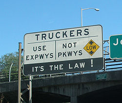
contemporary parkways are predominantly controlled-access highways restricted to non-commercial traffic, excluding truck
Truck
A truck or lorry is a motor vehicle designed to transport cargo. Trucks vary greatly in size, power, and configuration, with the smallest being mechanically similar to an automobile...
s and tractor-trailers. Some have low overpasses that also exclude buses. The Vanderbilt Parkway, an exception in western Suffolk County
Suffolk County, New York
Suffolk County is a county located in the U.S. state of New York on the eastern portion of Long Island. As of the 2010 census, the population was 1,493,350. It was named for the county of Suffolk in England, from which its earliest settlers came...
, is a surviving remnant of the Long Island Motor Parkway
Long Island Motor Parkway
The Long Island Motor Parkway , also known as the Vanderbilt Parkway and Motor Parkway, was the first roadway designed for automobile use only. It was privately built by William Kissam Vanderbilt with overpasses and bridges to remove intersections...
that became a surface street, no longer with controlled-access or non-commercial vehicle restrictions.
In New Jersey
New Jersey
New Jersey is a state in the Northeastern and Middle Atlantic regions of the United States. , its population was 8,791,894. It is bordered on the north and east by the state of New York, on the southeast and south by the Atlantic Ocean, on the west by Pennsylvania and on the southwest by Delaware...
, the Garden State Parkway
Garden State Parkway
The Garden State Parkway is a 172.4-mile limited-access toll parkway that stretches the length of New Jersey from the New York line at Montvale, New Jersey, to Cape May at New Jersey's southernmost tip. Its name refers to New Jersey's nickname, the "Garden State." Most New Jersey residents refer...
, connecting the urban Northeast U.S. with the rural Atlantic Ocean
Atlantic Ocean
The Atlantic Ocean is the second-largest of the world's oceanic divisions. With a total area of about , it covers approximately 20% of the Earth's surface and about 26% of its water surface area...
shoreline and Atlantic City, is restricted to buses and non-commercial traffic north of the Route 18 interchange but is one of the busiest toll road
Toll road
A toll road is a privately or publicly built road for which a driver pays a toll for use. Structures for which tolls are charged include toll bridges and toll tunnels. Non-toll roads are financed using other sources of revenue, most typically fuel tax or general tax funds...
s in the country.
In the Pittsburgh region, two of the major interstates are referred to informally as Parkways. The Parkway East — I-376
Interstate 376
Interstate 376 is a major auxiliary route of the Interstate Highway System in the U.S. state of Pennsylvania, located entirely within the Allegheny Plateau. It runs from I-80 near Sharon south and east to a junction with the Pennsylvania Turnpike in Monroeville, after having crossed the Turnpike...
, formally the Penn-Lincoln Parkway, connects Downtown Pittsburgh to Monroeville, Pennsylvania
Monroeville, Pennsylvania
Monroeville is a home rule municipality in Allegheny County, Pennsylvania, United States. Located about east of the city of Pittsburgh, Monroeville is a bustling suburb with mixed residential and commercial developments...
. The Parkway West — I-376] links Downtown to Pittsburgh International Airport
Pittsburgh International Airport
Pittsburgh International Airport , formerly Greater Pittsburgh Airport, Greater Pittsburgh International Airport and commonly referred to as Pittsburgh International, is a joint civil–military international airport located in the Pittsburgh suburb of Findlay Township, approximately west of...
. The Parkway North — I-279
Interstate 279
Interstate 279 is a north–south Interstate Highway spur that lies entirely within Allegheny County, Pennsylvania. Its southern end is at Interstate 376 at the Fort Pitt Bridge in Pittsburgh, and the north end is in Franklin Park at Interstate 79...
connects Downtown to Franklin Park, Pennsylvania
Franklin Park, Pennsylvania
Franklin Park is a borough in Allegheny County, Pennsylvania, United States. The population was 13,470 at the 2010 census.-Geography:Franklin Park is located at ....
.
In Minneapolis, the Grand Rounds Scenic Byway
Grand Rounds Scenic Byway
The Grand Rounds Scenic Byway is a linked series of park areas in Minneapolis, Minnesota that takes a roughly circular path through the city. The corridors include roads for automobile traffic plus paths for pedestrians and bicycles, and extend slightly into neighboring cities...
system has 50 miles (80.5 km) of streets designated as parkways. These are not freeways, having a slow 25-mile per hour speed limit, pedestrian crossings, and stop signs.
Canadian "Parkways"
"Parkway" is used in the names of many CanadianCanada
Canada is a North American country consisting of ten provinces and three territories. Located in the northern part of the continent, it extends from the Atlantic Ocean in the east to the Pacific Ocean in the west, and northward into the Arctic Ocean...
roads, many of which are not scenic or landscaped in any form:
|
United Kingdom
The road transport of Peterborough, a city in the United KingdomUnited Kingdom
The United Kingdom of Great Britain and Northern IrelandIn the United Kingdom and Dependencies, other languages have been officially recognised as legitimate autochthonous languages under the European Charter for Regional or Minority Languages...
has a system of designated Parkways. The planned city of Milton Keynes
Milton Keynes
Milton Keynes , sometimes abbreviated MK, is a large town in Buckinghamshire, in the south east of England, about north-west of London. It is the administrative centre of the Borough of Milton Keynes...
has a system of linear park
Linear park
A linear park is a park that is much longer than wide. It is often formed as a part of a rails-to-trails conversion of railroad beds to rail trail recreational use...
s with landscaped Parkways. British park-and-ride railway stations have the suffix Parkway, although the etymology is from the original U.S. meaning, with the Bristol Parkway railway station
Bristol Parkway railway station
Bristol Parkway railway station is situated in Stoke Gifford in the northern suburbs of Bristol, England. It is part of the British railway system owned by Network Rail, and is managed by First Great Western....
named after the adjacent M32 motorway
M32 motorway
The M32 is a motorway in South Gloucestershire and Bristol, England. It provides a link from Bristol city centre to the M4 and is part of the Bristol Parkway. At about , it is one of Britain's shortest motorways...
originally known as the Parkway when a rural route into the city.
Australia
The planned city of CanberraCanberra
Canberra is the capital city of Australia. With a population of over 345,000, it is Australia's largest inland city and the eighth-largest city overall. The city is located at the northern end of the Australian Capital Territory , south-west of Sydney, and north-east of Melbourne...
in Australia
Australia
Australia , officially the Commonwealth of Australia, is a country in the Southern Hemisphere comprising the mainland of the Australian continent, the island of Tasmania, and numerous smaller islands in the Indian and Pacific Oceans. It is the world's sixth-largest country by total area...
uses the suffix Parkway for only a few of its freeway grade roadways. Only the Tuggeranong Parkway
Tuggeranong Parkway
The Tuggeranong Parkway is a major dual carriageway link in Canberra, Australia. Often referred to as "The Parkway" by locals, the Tuggeranong Parkway links Civic to the southern Canberra metro district of Tuggeranong, and is a bypass road to the Woden Valley-Weston Creek district of Canberra...
has been constructed to date, with the John Dedman Parkway project renamed the Gungahlin Drive Extension
Gungahlin Drive Extension
The Gungahlin Drive Extension is a major road project in Canberra, Australia. It is 9 kilometres long and extended the previously existing Gungahlin Drive from the Barton Highway in the district of Gungahlin to the Glenloch Interchange to connect with Parkes Way and the Tuggeranong Parkway. The...
, and the Majura Parkway in planning stage, with no set construction date due to lack of Federal Funding.