

Beaches of Puerto Rico
Encyclopedia
There are close to 300 beaches in Puerto Rico
. The Government of Puerto Rico officially recognized 248 of these. In Puerto Rico there are 78 municipalities
of which 44 have a coastline. The municipality with the most beaches is Aguadilla, with fifteen.
- Indicates a Blue Flag beach
- Indicates Camping area.
- Indicates Diving or Snorkeling area.
- Indicates Scuba area.
 - Indicates Surfing area.
 - Indicates Lifeguards posted.
 - Indicates Fishing area.
Culebra
Manuabo
Yabucoa
Dorado
Carolina
San Juan
Manati
:
Patillas
Ponce
Santa Isabel
:
Quebradillas
Isabela
Aguadilla
Rincon
Cabo Rojo
Guánica
Puerto Rico
Puerto Rico , officially the Commonwealth of Puerto Rico , is an unincorporated territory of the United States, located in the northeastern Caribbean, east of the Dominican Republic and west of both the United States Virgin Islands and the British Virgin Islands.Puerto Rico comprises an...
. The Government of Puerto Rico officially recognized 248 of these. In Puerto Rico there are 78 municipalities
Municipalities of Puerto Rico
The Municipalities of Puerto Rico number 78 and they make up the smallest electoral division of the Commonwealth. Each municipality is divided into barrios, though the latter are not vested with political authority.-Administrative divisions:...
of which 44 have a coastline. The municipality with the most beaches is Aguadilla, with fifteen.
- Indicates a Blue Flag beach
Blue Flag beach
The Blue Flag is a certification by the Foundation for Environmental Education that a beach or marina meets its stringent standards.The Blue Flag is a trademark owned by FEE which is a not-for-profit, non-governmental organisation consisting of 65 organisations in 60 member countries in Europe,...
- Indicates Camping area.
- Indicates Diving or Snorkeling area.
- Indicates Scuba area.
Luquillo
- Luquillo Beach "La Monserrate",
- Mar Sin Barreras (Wheelchair accessible section of "La Monserrate" Beach)
- Surfing Beach "La Pared"
- Playa Azul Beach
CulebraCulebra, Puerto RicoIsla Culebra is an island-municipality of Puerto Rico originally called Isla Pasaje and Isla de San Ildefonso. It is located approximately east of the Puerto Rican mainland, west of St. Thomas and north of Vieques. Culebra is spread over 5 wards and Culebra Pueblo...
- Flamenco BeachFlamenco BeachFlamenco Beach is a seaside resort in Puerto Rico, United States on the Island of Culebra.-Geography:Flamenco is located on the western shore of Culebra. The beach lies on a half-mile-wide, horseshoe strip of coast. The beach is bordered by the Culebra National Wildlife Refuge, which is of itself...
- Brava Beach
- Larga Beach
- Carlos Rosario Beach
- Luis Peña Beach
- Punta Soldado Beach
- Resaca Beach
- Zoni Beach
- Tortuga Beach
- Tamarindo Beach
- Melones Beach
Vieques
- Sun Bay Beach
- Barracuda (García) Beach
- Caracas (Red) Beach
- Esperanza Beach
- Gallito Beach
- Grande Beach (Playita)
- La Chiva (Blue) Beach
- La Plata Beach
- Media Luna Beach
- Navio Beach
- Tapón (Hidden) Beach
- Punta Arenas Beach
- Natural Reserve Mosquito Bay
- Rompeolas (Mosquito Pier)
- Playuela Beach
ManuaboMaunabo, Puerto RicoMaunabo is a municipality of Puerto Rico located in the southeastern coast, northeast of Patillas and south of Yabucoa. Maunabo is spread over 8 wards and Maunabo Pueblo . It is part of the San Juan-Caguas-Guaynabo Metropolitan Statistical Area.The Mayor of the town is Jorge L. Márquez Pérez...
- Los Pinos
- Los Bohios Beach
- Punta Tuna Beach
- Larga Beach
YabucoaYabucoa, Puerto RicoYabucoa is a small town in the south eastern tip of Puerto Rico located in the southeastern region, north of Maunabo; south of San Lorenzo, Las Piedras and Humacao; and east of Patillas and about one hour from San Juan. Yabucoa is spread over 9 wards and Yabucoa Pueblo...
- Lucia Beach
- Guayanes Beach
- El Negro Beach
Others
- Seven Seas Beach, Las Croabas, Fajardo
- Punta Santiago Beach, Humacao
DoradoDorado, Puerto RicoDorado is a small tourist town in the northern coast of Puerto Rico, west of San Juan and is located in the northern region of the island, bordering the Atlantic Ocean, north of Toa Alta, east of Vega Alta, and west of Toa Baja. Dorado is spread over five barrios and Dorado Pueblo...
- Sardinera Beach
- Ritz-Carlton Reserve
Toa Baja
- Isla de Cabras Beach
- Punta Salinas Beach
CarolinaCarolina, Puerto RicoCarolina is a city located in the northern part of Puerto Rico, bordering the Atlantic Ocean; it lies north of Gurabo and Juncos; east of Trujillo Alto and San Juan; and west of Canóvanas and Loíza. Carolina is spread over 12 wards plus Carolina Pueblo...
- Carolina Beach
- Isla Verde Beach
Loiza
- Vacia Talega Beach
- Piñones Beach
- Aviones Beach
San JuanSan Juan, Puerto RicoSan Juan , officially Municipio de la Ciudad Capital San Juan Bautista , is the capital and most populous municipality in Puerto Rico, an unincorporated territory of the United States. As of the 2010 census, it had a population of 395,326 making it the 46th-largest city under the jurisdiction of...
- Escambron Beach, Old San Juan
- Condado Bridge Beach
- Condado Beach
- Ocean Park Beach
- Posita Beach, San Juan
ManatiManatíManatí may refer to:*Manatí, Puerto Rico*Manatí, Atlántico in Atlantico, Colombia*Manatí, Cuba, a municipality in Las Tunas, CubaManatí is also the Spanish word for manatee.*See also: Special:Allpages/Manatí...
- Los Tubos Beach
- Mar Chiquita Beach, Manati
- Tortuguero Beach, Manati
Camuy
- Peñon Brusi Beach
- Amador Beach
- Puerto Hermina Beach
Others
- Cerro Gordo, Vega Alta
- Vega Baja Beach, Vega Baja
- La Posita del Obispo Beach, AreciboAreciboArecibo may refer to:*Arecibo, Puerto Rico, a municipality located by the Atlantic Ocean*Arecibo Observatory, a very sensitive radio telescope located approximately south-southwest from the city of Arecibo...
Southern region beaches
Beaches that belong to the region of Porta CaribePorta Caribe
Porta Caribe is a tourism region in southern Puerto Rico. It consists of 14 municipalities in the south central zone: Adjuntas, Arroyo, Coamo, Guayama, Guayanilla, Jayuya, Juana Diaz, Patillas, Peñuelas, Ponce, Salinas, Santa Isabel, Villaba, Yauco. Porta Caribe was established in 2003 by the...
:
PatillasPatillas, Puerto RicoPatillas is a municipality of Puerto Rico located in the southeastern coast, south of San Lorenzo; west of Yabucoa and Maunabo; and east of Guayama and Arroyo. It is spread over 15 wards and Patillas Pueblo...
- Guardarraya Beach
- Inches Beach
- Escondida Beach
- Punta Viento Beach
- Villa Pesquera Beach
PoncePonce, Puerto RicoPonce is both a city and a municipality in the southern part of Puerto Rico. The city is the seat of the municipal government.The city of Ponce, the fourth most populated in Puerto Rico, and the most populated outside of the San Juan metropolitan area, is named for Juan Ponce de León y Loayza, the...
- El TuqueEl TuqueEl Tuque is a beach and family recreational and tourist complex in the Punta Cucharas sector of Ponce, Puerto Rico. It was designed in the early 1960s by Luis Flores, an architect from Cayey, Puerto Rico. It is located on PR-2, Km 220.1, in the El Tuque sector of Barrio Canas in Ponce...
- La Guancha BeachLa Guancha Recreational and Cultural ComplexThe Complejo Recreational y Cultural La Guancha is a sector located in barrio Playa in Ponce, Puerto Rico with family recreational and cultural facilities that opened on June 23, 1998. The highlight of the complex is La Guancha Boardwalk, which is flanked by a beach, an observation tower, an...
- Caja de Muertos BeachesCaja de Muertos, Puerto RicoCaja de Muertos is an uninhabited island off the southern coast of Puerto Rico, in the municipality of Ponce. The island is protected by the Reserva Natural Caja de Muertos natural reserve, because of its native turtle traffic...
- Playa Pelícano
- Playa Coast Guard
- Playa Carrucho
- Playa Larga
- Isla de Gatas BeachClub Náutico de PonceThe Club Náutico de Ponce is a sports complex located in Ponce, Puerto Rico. The club is located on Isla de Gatas , near the La Guancha recreational and cultural area, and next to the Port of Ponce....
Santa IsabelSanta Isabel, Puerto RicoSanta Isabel is a municipality of Puerto Rico located in the southern coast, south of Coamo; east of Juana Díaz; and west of Salinas. Santa Isabel is spread over 7 wards and Santa Isabel Pueblo...
- Santa Isabel Beach,
- Jauca Beach, Santa IsabelSanta Isabel, Puerto RicoSanta Isabel is a municipality of Puerto Rico located in the southern coast, south of Coamo; east of Juana Díaz; and west of Salinas. Santa Isabel is spread over 7 wards and Santa Isabel Pueblo...
Others
- Punta Guilarte Beach, ArroyoArroyo, Puerto RicoArroyo is a municipality located along the southern coast of Puerto Rico and bordered by the Caribbean Sea, east of the municipality of Guayama and northwest of the municipality of Patillas. Arroyo is spread over 5 wards and Arroyo Pueblo...
- Peñuelas Beach, Peñuelas
Western region beaches
Beaches that belong to the region of Porta del SolPorta del Sol
Porta del Sol is a tourism region in western Puerto Rico. It consist of 17 municipalities in the western area: Quebradillas, Isabela, San Sebastián, Moca, Aguadilla, Aguada, Rincón, Añasco, Mayagüez, Las Marías, Maricao, Hormigueros, San Germán, Sábana Grande, Guánica, Lajas and Cabo Rojo. Porta...
:
QuebradillasQuebradillas, Puerto RicoQuebradillas is a municipality of the island of Puerto Rico, located in the north-western shore bordering the Atlantic Ocean, north of San Sebastián; east of Isabela; and west of Camuy. Quebradillas is spread over swven wards and Quebradillas Pueblo...
- Guajataca Beach
IsabelaIsabela, Puerto RicoIsabela is a municipality of Puerto Rico located in the north-western region of the island, north of San Sebastián; west of Quebradillas; and east of Aguadilla and Moca. Isabela is spread over 13 wards and Isabela Pueblo...
- Blue Hole Beach
- Golondrinas Cave Beach
- Bajura Beach
- Baño La Princesa & Blowhole Beach
- Guajataca Beach
- Jobos Beach
- El Pastillo Beach
- Montones Beach
- Punta Sardinera Beach
- Shacks Beach
- Pozo Teodoro Beach
- Middles Beach
AguadillaAguadilla, Puerto RicoAguadilla , founded in 1775 by Luis de Córdova, is a city located in the northwestern tip of Puerto Rico bordered by the Atlantic Ocean to the north and west, north of Aguada, and Moca and west of Isabela. Aguadilla is spread over 15 wards and Aguadilla Pueblo...
- Crash Boat BeachCrash Boat BeachCrash Boat Beach or Playa Crash Boat is a beach located in the northwestern Puerto Rican municipality of Aguadilla. It occupies the site of a former military port used to rescue downed air crews from Ramey Air Force Base and still retains some remains of pier infrastructure...
- La Ponderosa Beach
- La Poza Beach
- La Saldinera Beach
- Gas Chambers
- Wilderness
- Peña Blanca Beach
RinconRincón, Puerto RicoRincón is a municipality of Puerto Rico founded in 1771 by Don Luis de Añasco . It is located in the Western Coastal Valley, west of Añasco and Aguada. Rincón is spread over 8 wards and Rincón Pueblo...
- Balneario de RincónBalneario de RincónBalneario de Rincón is a public beach in Rincon, Puerto Rico. It will host the Triathlon events for the 2010 Central American and Caribbean Games.-References:...
- Tres Palmas
- Domes Beach
- María Beach
- Steps Beach
- Corcega Beach
Cabo RojoCabo Rojo, Puerto RicoCabo Rojo is a municipality situated on the southwest coast of Puerto Rico and forms part of the San Germán–Cabo Rojo metropolitan area as well as the larger Mayagüez–San Germán–Cabo Rojo Combined Statistical Area....
- Isla de RatonesIsla de RatonesIsla de Ratones is a small island located near the Joyuda Lagoon in Cabo Rojo, Puerto Rico. The island is a popular spot for snorkeling.-History:...
- Boquerón
- Combate
- La Playuela (Playa Sucia)
- Punta Arenas Beach
GuánicaGuánica, Puerto RicoGuánica is a municipality in southwestern Puerto Rico located on southern coast, bordering the Caribbean Sea, south of Sabana Grande, east of Lajas, and west of Yauco. It is part of the Yauco Metropolitan Statistical Area....
- Las Paldas
- La Jungla
- Playa Santa
- Ballenas
- Gilligan's IslandCayos de Caña GordaThe Cayos de Caña Gorda is a group of three uninhabited, mangrove-covered cays, located at off the southwestern coast of Puerto Rico. They belong to barrio Caranero of Guánica municipio. The eastern cay, Isla Ballena is separated from the Puerto Rican mainland close to Punta Ballena only by a 20 m...
- Atolladora Beach
- Playa Manglillo Pequeño
- Tamarindo Beach
- Caña Gorda Beach
- Jaboncillo Beach
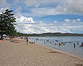
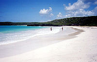
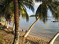
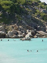
Gallery
 |
| |
 |
 |