

Australind, Western Australia
Encyclopedia
Satellite town
A satellite town or satellite city is a concept in urban planning that refers essentially to smaller metropolitan areas which are located somewhat near to, but are mostly independent of, larger metropolitan areas.-Characteristics:...
and outer northern suburb of Bunbury
Bunbury, Western Australia
The port city of Bunbury is the third largest city in Western Australia after the State Capital Perth and Mandurah. It is situated south of Perth's central business district...
, Western Australia
Western Australia
Western Australia is a state of Australia, occupying the entire western third of the Australian continent. It is bounded by the Indian Ocean to the north and west, the Great Australian Bight and Indian Ocean to the south, the Northern Territory to the north-east and South Australia to the south-east...
, and is located 12 km north-east of Bunbury's central business district
Central business district
A central business district is the commercial and often geographic heart of a city. In North America this part of a city is commonly referred to as "downtown" or "city center"...
. Its Local Government Area
Local Government Areas of Western Australia
The Australian state of Western Australia is divided into 141 local government areas...
is the Shire of Harvey
Shire of Harvey
The Shire of Harvey is a Local Government Area of Western Australia. It is located in the state's South West region, approximately 140km south of Perth, and includes some of Bunbury's northern suburbs. The shire covers an area of 1,728 km² and has a estimated population of about 24,000...
. At the 2006 census
Census in Australia
The Australian census is administered once every five years by the Australian Bureau of Statistics. The most recent census was conducted on 9 August 2011; the next will be conducted in 2016. Prior to the introduction of regular censuses in 1961, they had also been run in 1901, 1911, 1921, 1933,...
, Australind had a population of 8,717.
History
Prior to European settlement, the area was home to the Wardandi people. Early explorers found them to be timid and settlers found them excellent trackers, and many of them found employment on farms. The first sighting of the coast was by Captain A.P. Jonk in the VOCDutch East India Company
The Dutch East India Company was a chartered company established in 1602, when the States-General of the Netherlands granted it a 21-year monopoly to carry out colonial activities in Asia...
Emeloort, who sighted land at 33°12'S (most likely opposite the estuary from Australind) on 24 February 1658 while looking for the Vergulde Draeck
Vergulde Draeck
The Vergulde Draeck was a Dutch East India Company ship of the seventeenth century. She sailed from Texel bound for Batavia , under Pieter Albertsz and was carrying trade goods and eight chests of silver worth 78,6000 guilders...
but did not land. A few months later, the Elburg under Capt. J.P. Peereboom landed at what is now Bunbury and met three Aboriginals
Indigenous Australians
Indigenous Australians are the original inhabitants of the Australian continent and nearby islands. The Aboriginal Indigenous Australians migrated from the Indian continent around 75,000 to 100,000 years ago....
, returning to Batavia on 16 July 1658. In 1802–03, Nicolas Baudin
Nicolas Baudin
Nicolas-Thomas Baudin was a French explorer, cartographer, naturalist and hydrographer.Baudin was born a commoner in Saint-Martin-de-Ré on the Île de Ré. At the age of fifteen he joined the merchant navy, and at twenty joined the French East India Company...
visited the coast and explored the estuary and nearby rivers, and named Point Casuarina in Bunbury after one of his ships, and the Leschenault Inlet after onboard botanist Jean Baptiste Leschenault de la Tour
Jean Baptiste Leschenault de la Tour
Jean Baptiste Louis Claude Theodore Leschenault de la Tour was a French botanist and ornithologist.Leschenault de la Tour was chief botanist on Nicolas Baudin's expedition to Australia between 1800 and 1803...
.
The name Australind is a combination of Australia and India, which was chosen due to the belief that the area could be used for breeding horses for the British Indian Army
British Indian Army
The British Indian Army, officially simply the Indian Army, was the principal army of the British Raj in India before the partition of India in 1947...
, as was later achieved in Cervantes
Cervantes, Western Australia
Cervantes is a town in Western Australia. The town is located just off Indian Ocean Drive about north north west of the state capital, Perth in the Shire of Dandaragan Local Government Area. At the 2006 census, Cervantes had a population of 503. The town was named after a ship that was wrecked...
, Northampton
Northampton, Western Australia
Northampton is a town north of Geraldton, in the Mid West region of Western Australia. At the 2006 census, the town had a population of 813. It is historic, with an outstanding National Trust building. The town lies on the North West Coastal Highway. Formerly named Gwalla after the location's...
and Madura
Madura, Western Australia
Madura is a small roadhouse community located on the Eyre Highway in Western Australia, on the Nullarbor Plain. It is from Perth.-History:Madura was settled in 1876 as a place to breed quality cavalry horses for the British Indian Army for use in the Northwest Frontier region of India . The horses...
. In 1841, the Western Australian Land Company purchased 103000 acres (416.8 km²) of land in 1841 with a plan to create an English-style village populated by settlers. The area had been mapped in 1831 by John Septimus Roe
John Septimus Roe
John Septimus Roe was the first Surveyor-General of Western Australia. He was a renowned explorer, and a Member of Western Australia's Legislative and Executive Councils for nearly 40 years.-Early life:...
and explored by land by Lieutenant Henry Bunbury in 1836. A detailed plan of the town included a town square, church, a school, stores, a mill and a public hall, and Marshall Clifton
Marshall Clifton
Marshall Waller Clifton was born 1 November 1787 at Alverstoke, near Gosport, Hampshire, England, to Rev. Francis Clifton and Rebekah Katherine ....
, who arrived on the Parkfield in 1841, was appointed leader of the 440 settlers.
Within barely two years, however, the settlement was abandoned due largely to the poor soils and climate - no water in summer and too much of it in winter - and the settlers drifted away. Little of the planned town was ever developed. The company folded and the land was mostly resume
Résumé
A résumé is a document used by individuals to present their background and skillsets. Résumés can be used for a variety of reasons but most often to secure new employment. A typical résumé contains a summary of relevant job experience and education...
d by the Crown, and the settlement plans were abandoned officially in 1875. The Parkfield name lives on in a nearby rural locality and in a primary school in northern Australind.
A handful of historic buildings, including St Nicholas Church (1848) and Henton Cottage (1841) on Paris Road, and Clifton's former residence Upton House (1847) on Old Coast Road
Old Coast Road
Old Coast Road is a Western Australian highway linking Mandurah, WA's second-largest city located 75 km south of Perth, with Bunbury, WA's third-largest city. It is signed as Route 1 for most of its length and is long.-Overview:...
, still exist in the town. St Nicholas Church, originally a worker's cottage, is 3.6 metres in width and 8.2 metres in length, and is believed to be the smallest church in Australia, while Henton Cottage was the town's first hotel.
In the 1860s, Australind was the most significant town in the Harvey-Brunswick region, and contained a school, post office and store. Additionally, a bridge had been built over the Brunswick River to allow nearby settlers to make use of the town's services. However, the town did not grow - in the 1890s, the construction of the Perth to Bunbury railway via Pinjarra
Pinjarra, Western Australia
Pinjarra is a town in the Peel region of Western Australia along the South Western Highway, from the state capital, Perth and south-east of the coastal city of Mandurah. Its local government area is the Shire of Murray. At the 2006 census, Pinjarra had a population of 3,279.Pinjarra is an area...
shifted the focus of development to agricultural and timber towns further inland. Even as late as the 1971 Census, just 418 people lived in the Australind area.
Some early signs of development included the Bunbury Golf Course at Clifton Park, built in 1948, and industries including a titanium dioxide
Titanium dioxide
Titanium dioxide, also known as titanium oxide or titania, is the naturally occurring oxide of titanium, chemical formula . When used as a pigment, it is called titanium white, Pigment White 6, or CI 77891. Generally it comes in two different forms, rutile and anatase. It has a wide range of...
pigment factory and waste water plant set up in or near the town, utilising its proximity to the Port of Bunbury. However, suburban development as part of "Greater Bunbury" saw the town quadruple in size by 1981.
A primary school opened in 1980, relieving pressure on nearby Eaton, and was followed by a high school which opened in 1987. New estates opened over the coming years. In the mid-1980s the State Government and the Shire of Harvey made plans to relocate most of the industries to a new industrial park at nearby Kemerton, and by 2001 the town was predominantly residential with increasing property values ($402,000 in 2006) and the census region reported over 10,000 residents, over half of whom are first- or second-generation British immigrants with a notable Italian minority.
Geography
Australind is bordered to the south by the Collie RiverCollie River
The Collie River is a river in the South West region of Western Australia.The river was named after Dr Alexander Collie who, along with Lt. William Preston, was the first European explorer to find the river in 1829....
, to the west by the Leschenault Estuary
Leschenault Estuary
Leschenault Estuary is an estuarine lagoon that lies to the north of Bunbury, Western Australia.It had in the past met the Indian Ocean at the Leschenault Inlet - but that has been altered by harbour works for Bunbury, and the creation of The Cut north of the historical inlet location.The estuary...
and to the east by the Brunswick River. It includes the estates of Galway Green and Clifton Park. Several suburbs - Leschenault
Leschenault, Western Australia
Leschenault is an outer suburb of Bunbury, Western Australia, and is located 16 km to the north-east. Its Local Government Area is the Shire of Harvey.-History:...
, Kemerton
Kemerton, Western Australia
Kemerton is an industrial park in the Bunbury region of Western Australia, about 10km north-east of Australind. Its Local Government Area is the Shire of Harvey.-Description:...
and most recently Kingston - have seceded from Australind since the 1980s.
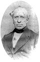
James Battye
James Battye
Dr. James Sykes Battye was the first chief librarian of the Victoria Public Library in Perth, Western Australia. He was a leading historian, librarian and public figure of the State...
described the area thus:
Australind is beautifully situated on the eastern side of Leschenault Inlet, at a distance of about six miles (10 km) from Koombanah Bay, or, as it has been generally called, Port Leschenault, a good roadstead, within Point Casuarina, at the eastern extremity of Geographe Bay. The bay is open only from north or north and by east to west-north-west or west and by north; but as there is a strong undercurrent setting out, ships ride safely even in heavy gales from that quarter.
Facilities
Australind has the Australind Village Shopping Centre, which contains a Coles supermarketColes Supermarkets
Coles Supermarkets is an Australian supermarket chain owned by Wesfarmers. It has 741 stores nationally Coles Supermarkets is an Australian supermarket chain owned by Wesfarmers. It has 741 stores nationally Coles Supermarkets is an Australian supermarket chain owned by Wesfarmers. It has 741...
and various specialty stores. The 18-hole Bunbury Golf Club, which hosts the annual South West Open each June, is located within the Clifton Park subdivision south of the main town on the Collie River.
Education
Australind has two high schools: Australind SHS; (1987) and Geographe Grammar School (via distance only) http://www.scea.wa.edu.au/OurSchool/Geographe_Grammar_School.aspx (2011), as well as six primary schools: Australind (1980), Clifton Park (1988), Parkfield (1993), Kingston (2009), Leschenault Catholic Primary School (1986) and Geographe Grammar School http://www.scea.wa.edu.au/OurSchool/Geographe_Grammar_School.aspx(2011).Transport
Australind is served by the 701 (Australind) route from Bunbury's central bus station, with a journey time of approximately 32 minutes. The route is operated by Bunbury City Transit for the Public Transport AuthorityPublic Transport Authority
The Public Transport Authority, or PTA, is a Western Australian statutory authority. It controls Transperth and Transwa. This authority is the most recently constituted body governing public transport in Western Australia...
.
Despite the name, the Transwa Australind
Transwa Australind
The Transwa Australind is a diesel railcar train operated by Transwa that runs between Perth, Western Australia, and the south-west city of Bunbury on the South Western Railway . The Australind fleet consists of three powered railcars ADP101, ADP102 and ADP103, with two non-driving trailers ADQ121...
rail service does not stop in or transit the town.
External links
- Area history - Bunbury Port Authority
- Australind website
- Schooling at Australind - Harvey District Oral History Group
- Bunbury Golf Club
- Australind Baptist Church