

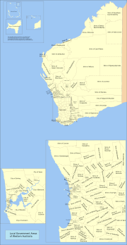
Local Government Areas of Western Australia
Encyclopedia
Western Australia
Western Australia is a state of Australia, occupying the entire western third of the Australian continent. It is bounded by the Indian Ocean to the north and west, the Great Australian Bight and Indian Ocean to the south, the Northern Territory to the north-east and South Australia to the south-east...
is divided into 141 local government areas (including Christmas Island
Shire of Christmas Island
The Shire of Christmas Island is a Local Government Area which manages local affairs on the Australian external territory of Christmas Island...
and the Cocos (Keeling) Islands
Shire of Cocos
The Shire of Cocos is a Local Government Area which manages local affairs on the Australian external territory of Cocos Islands . The island is grouped with Western Australia but is administered by Attorney-General's Department and an Administrator....
). Their mandate and operations are governed by the Local Government Act 1995
Local Government Act 1995
The Local Government Act 1995 is an act of the Western Australian Parliament which lays down the responsibilities, powers and procedures for election of Local Government Bodies.-External links:*...
.
There are three classifications of local government in Western Australia:
- City (predominantly urban, some larger regional centres)
- Town (predominantly inner urban and three medium sized rural centres)
- Shire (predominantly rural or outer suburban areas)
Historically, two types of local government existed - municipalities, which represented towns or condensed urban areas, and road boards, which represented all other regions. The Perth Road Board, for instance, was the precursor to the City of Stirling. Only a few cities - Perth, Fremantle, Subiaco, South Perth and Nedlands - existed prior to 1961. On 1 July 1961, all road boards became shires, and all municipalities became towns.
Metropolitan LGAs
| Name | Council Seat | Formed | Current status |
Population (2010) |
Area | Website | Notes |
|---|---|---|---|---|---|---|---|
| Armadale, City of City of Armadale The City of Armadale is a Local Government Area in the south-eastern suburbs of the Western Australian capital city of Perth, located about southeast of Perth's central business district... |
Armadale Armadale, Western Australia Armadale is a suburb within the City of Armadale, located on the south-eastern edge of Perth's metropolitan area. The major junction of the South Western and Albany Highways, which connect Perth with the South West and Great Southern regions of Western Australia respectively, is located within the... |
1894 | 1985 | 60,983 | 560.3 km² (216.3 sq mi) | Link | Armadale-Kelmscott until 1979 |
| Bassendean, Town of Town of Bassendean The Town of Bassendean is a Local Government Area in the northeastern suburbs of the Western Australian capital city of Perth, located west of the industrial centre of Midland and about northeast of Perth's central business district... |
Bassendean Bassendean, Western Australia Bassendean is a northeastern suburb of Perth, Western Australia. Its Local Government Area is the Town of Bassendean.Bassendean is home to the Western Australian Rail Transport Museum. The display has a collection of Steam and Diesel Locomotives, most of these have been restored to operating... |
1901 | 1975 | 14,790 | 10.4 km² (4 sq mi) | Link | West Guildford until 1922 |
| Bayswater, City of | Morley Morley, Western Australia Morley is a suburb of Perth, Western Australia, situated approximately northeast of Perth's central business district within the City of Bayswater local government area. It contains the Centro Galleria, Perth's second-largest commercial shopping centre, constructed in 1994. The Morley bus station... |
1897 | 1983 | 61,865 | 32.8 km² (12.7 sq mi) | Link | |
| Belmont, City of | Cloverdale Cloverdale, Western Australia Cloverdale is a suburb of Perth, the capital city of Western Australia, and is located east of Perth's central business district in the City of Belmont.-History:... |
1898 | 1979 | 35,082 | 39.7 km² (15.3 sq mi) | Link | |
| Cambridge, Town of | Floreat Floreat, Western Australia Floreat is a residential suburb located west-northwest from the central business district of Perth, the capital of Western Australia. It is bordered on three sides by Underwood Avenue, Selby Street, and Cromarty Road; the western border adjoins or runs through Bold Park. It is located in the Town... |
1994 | 1994 | 26,959 | 22 km² (8.5 sq mi) | Link | Split from Perth City of Perth The City of Perth is a local government area and body, within the Perth Metropolitan Area, which is the capital of Western Australia. The local government body is commonly known as Perth City Council. The city covers the Perth central business district and surrounding suburbs... |
| Canning, City of | Cannington Cannington, Western Australia Cannington is a southern suburb of Perth, Western Australia. Its Local Government Area is the City of Canning.-History:Cannington's name derives from the Canning River, which forms part of the southwestern boundary of the suburb... |
1907 | 1978 | 88,433 | 64.9 km² (25.1 sq mi) | Link | |
| Claremont, Town of Town of Claremont The Town of Claremont is a Local Government Area in the inner western suburbs of the Western Australian capital city of Perth, located about halfway between the port city of Fremantle and Perth's central business district... |
Claremont Claremont, Western Australia Claremont is a western suburb of Perth, Western Australia on the north bank of the Swan River.-History:Prior to European settlement, the Noongar people used the area as a source of water, for fishing and for catching waterfowl. In 1830, John Butler, a settler, set up an inn at Freshwater Bay to... |
1898 | 1898 | 9,891 | 5 km² (1.9 sq mi) | Link | |
| Cockburn, City of | Spearwood Spearwood, Western Australia Spearwood is a southern suburb of Perth, Western Australia, located within the City of Cockburn. It was named by colonial settlers who noticed the native tea trees, scientific name Melaleuca lanceolata Chipolata, being used for spears by the Yugul Aboriginal people.-History:Settlement appears to... |
1871 | 1979 | 91,313 | 168.1 km² (64.9 sq mi) | Link | Fremantle RD until 1959 |
| Cottesloe, Town of Town of Cottesloe The Town of Cottesloe is a local government area and a suburb of Perth, the capital of Western Australia. Cottesloe is located west of Perth's central business district, covers an area of , maintains 45.7 km of roads and has a population of 7,256 .... |
Cottesloe Cottesloe, Western Australia -Transport:Cottesloe is served by Swanbourne, Grant Street, Cottesloe, Mosman Park and Victoria Street railway stations on the Fremantle line. Various bus routes along Stirling Highway and through the suburb's western and eastern sections link Cottesloe to Perth and Fremantle. All services are... |
1895 | 1907 | 8,222 | 3.9 km² (1.5 sq mi) | Link | |
| East Fremantle, Town of | East Fremantle East Fremantle, Western Australia The Town of East Fremantle is a Local Government Area in the southern suburbs of the Western Australian capital city of Perth, located immediately northeast of the port city of Fremantle and about southwest of Perth's central business district... |
1897 | 1897 | 7,534 | 3.1 km² (1.2 sq mi) | Link | |
| Fremantle, City of City of Fremantle The City of Fremantle is a Local Government Area in South Metropolitan Perth. The City covers an area of , and lies about southwest of the Perth central business district.-History:... |
Fremantle Fremantle (suburb) Fremantle is a suburb of Perth, Western Australia, and contains the central business district and port of Fremantle.-Geography:Fremantle is bounded by the Swan River to the north and north-west, the Indian Ocean to the west, South Street to the south, and the suburbs of East Fremantle and White Gum... |
1871 | 1929 | 28,626 | 19 km² (7.3 sq mi) | Link | |
| Gosnells, City of | Gosnells Gosnells, Western Australia The City of Gosnells is a Local Government Area in the southeastern suburbs of the Western Australian capital city of Perth, located northwest of Armadale and about southeast of Perth's central business district... |
1907 | 1977 | 106,724 | 127.3 km² (49.2 sq mi) | Link | |
| Joondalup, City of City of Joondalup The City of Joondalup is a council and Local Government Area with City status in Perth, Western Australia. It covers the metropolitan Perth city of Joondalup in its entirety, as well as the town centres of Hillarys and Warwick.... |
Joondalup Joondalup (suburb) Joondalup is a suburb of Perth, Western Australia, which includes the central business district of the regional city of Joondalup, as well as the council chambers for the City of Joondalup local authority.-History:... |
1998 | 1998 | 164,445 | 99 km² (38.2 sq mi) | Link | Split from Wanneroo |
| Kalamunda, Shire of Shire of Kalamunda The Shire of Kalamunda is a Local Government Area in the eastern suburbs of the Western Australian capital city of Perth, located about east of Perth's central business district. The Shire covers an area of , much of which is state forest rising into the Darling Scarp to the east... |
Kalamunda Kalamunda, Western Australia -Transport:Kalamunda Road serves as a major access road for Perth Airport, and provides the foothills suburbs with access to the Perth central business district.... |
1897 | 55,814 | 324.4 km² (125.3 sq mi) | Link | Governed by commissioner until 1961 | |
| Kwinana, Town of | Kwinana Town Centre Kwinana Town Centre, Western Australia Kwinana Town Centre, is the central suburb of the town of Kwinana in the outer southern suburbs of Perth, Western Australia.The suburb comprises three large city blocks and has no residential dwellings, instead, it houses the 'Kwinana Hub' shopping centre, the Kwinana Recreation centre, Kwinana... |
1954 | 1977 | 29,029 | 120.1 km² (46.4 sq mi) | Link | |
| Melville, City of | Ardross Ardross, Western Australia Ardross is a suburb of Perth, Western Australia located within the City of Melville. It was once an area of land acquired by the Scotsman, Sir Alexander Percival Matheson in 1896... |
1900 | 1968 | 102,434 | 52.9 km² (20.4 sq mi) | Link | |
| Mosman Park, Town of | Mosman Park Mosman Park, Western Australia The Town of Mosman Park is a Local Government Area of Western Australia. It covers an area of approximately 4.3 km² in western metropolitan Perth, the capital of Western Australia and lies about 14 km southwest of the Perth CBD and 5 km from Fremantle.-History:The Buckland Hill Road... |
1899 | 1961 | 9,440 | 4.4 km² (1.7 sq mi) | Link | Buckland Hill until 1937 |
| Mundaring, Shire of Shire of Mundaring The Shire of Mundaring is a Local Government Area on the eastern fringe of metropolitan Perth, the capital of Western Australia. The Shire covers an area of and has a population of 35,097 .-History:... |
Mundaring Mundaring, Western Australia Mundaring is a suburb located 34 km east of Perth on the Great Eastern Highway. The suburb is located within the Shire of Mundaring.The Aboriginal name of the area 'Mindah-lung', said to mean 'a high place on a high place', was anglicised to become 'Mundaring'.The Mundaring area is also considered... |
1903 | 38,910 | 643.7 km² (248.5 sq mi) | Link | Greenmount until 1932 | |
| Nedlands, City of | Nedlands Nedlands, Western Australia The City of Nedlands is a Local Government Area in the inner western suburbs of the Western Australian capital city of Perth, located about west of Perth's central business district... |
1893 | 1959 | 22,508 | 20 km² (7.7 sq mi) | Link | Claremont RD until 1932 |
| Peppermint Grove, Shire of Shire of Peppermint Grove The Shire of Peppermint Grove is a small Local Government Area in western metropolitan Perth, the capital of Western Australia, between Mosman Park and Claremont and lies about 12 km southwest of Perth's central business district... |
Peppermint Grove Peppermint Grove, Western Australia Peppermint Grove is an affluent western suburb of Perth, Western Australia on the north bank of the Swan River at Freshwater Bay. Its Local Government Area, the smallest in the country, is the Shire of Peppermint Grove. The suburb was named after its trademark "Peppermint trees" lining many streets... |
1895 | 1,749 | 1.1 km² (0.424712374451789 sq mi) | Link | ||
| Perth, City of City of Perth The City of Perth is a local government area and body, within the Perth Metropolitan Area, which is the capital of Western Australia. The local government body is commonly known as Perth City Council. The city covers the Perth central business district and surrounding suburbs... |
Perth | 1856 | 1856 | 17,955 | 12 km² (4.6 sq mi) | Link | |
| Rockingham, City of City of Rockingham The City of Rockingham is a Local Government Area in the far southern suburbs of the Western Australian capital city of Perth.-History:In 1896, residents of Rockingham petitioned to establish a road board, which they proposed be called "Clarence" which was the name of the failed settlement of... |
Rockingham Rockingham, Western Australia Rockingham is a suburb and primary centre in Western Australia south-west of the Perth city centre and south of Fremantle. It has a beachside location at Mangles Bay, the southern extremity of Cockburn Sound. To its north stretches the maritime and resource-industry installations of Kwinana and... |
1897 | 1988 | 104,130 | 257.1 km² (99.3 sq mi) | Link | |
| Serpentine-Jarrahdale, Shire of | Mundijong Mundijong, Western Australia Mundijong is an outer suburb of the Western Australian capital city of Perth. Originally named Jarrahdale Junction, it was at the junction of the Rockingham-Jarrahdale line and the government line from Perth to Bunbury which was built in 1893... |
1894 | 17,212 | 904.7 km² (349.3 sq mi) | Link | ||
| South Perth, City of | South Perth South Perth, Western Australia South Perth is a residential suburb 3 kilometres south of the central business district of Perth, the capital of Western Australia, which adjoins the southern shore of Perth Water on the Swan River... |
1892 | 1959 | 43,908 | 19.8 km² (7.6 sq mi) | Link | |
| Stirling, City of | Stirling Stirling, Western Australia The City of Stirling is a Local Government Area in the northern suburbs of the Western Australian capital city of Perth, located about north of Perth's central business district... |
1871 | 1971 | 202,014 | 104.8 km² (40.5 sq mi) | Link | Shire of Perth until 1971 |
| Subiaco, City of City of Subiaco The City of Subiaco is a Local Government Area of Western Australia. It covers an area of approximately 7 km² in inner western metropolitan Perth, the capital of Western Australia and lies about 3 km west of the Perth CBD.-History:... |
Subiaco Subiaco, Western Australia Subiaco is an inner western suburb of Perth, Western Australia, situated to the north west of Kings Park. Its Local Government Area is the City of Subiaco.-History:Prior to European settlement the area was home to the Noongar Indigenous people.... |
1896 | 1952 | 18,862 | 7 km² (2.7 sq mi) | Link | |
| Swan, City of | Midland Midland, Western Australia Midland is a suburb in the Perth, Western Australia metropolitan area, as well as the regional centre for the City of Swan local government area that covers the Swan Valley and parts of the Darling Scarp to the east. It is situated at the intersection of Great Eastern Highway and Great Northern... |
1871 | 2000 | 112,960 | 1044 km² (403.1 sq mi) | Link | |
| Victoria Park, Town of | Victoria Park Victoria Park, Western Australia The Town of Victoria Park is a Local Government Area of Western Australia. It covers an area of 17.62 km² in metropolitan Perth, the capital of Western Australia. The Town of Victoria Park maintains 154.55 km of roads, a little over 1 km² of parks and gardens and has a... |
1994 | 1994 | 32,958 | 17.9 km² (6.9 sq mi) | Link | Split from Perth City of Perth The City of Perth is a local government area and body, within the Perth Metropolitan Area, which is the capital of Western Australia. The local government body is commonly known as Perth City Council. The city covers the Perth central business district and surrounding suburbs... |
| Vincent, City of | Leederville Leederville, Western Australia Leederville is a locality within the City of Vincent within the Perth metropolitan region of Western Australia.It is home to Aranmore Catholic College, The Schools of Isolated and Distance Education, Central Institute of Technology Leederville Campus and St Mary's Church.-External... |
1994 | 2011 | 31,209 | 11.4 km² (4.4 sq mi) | Link | Split from Perth City of Perth The City of Perth is a local government area and body, within the Perth Metropolitan Area, which is the capital of Western Australia. The local government body is commonly known as Perth City Council. The city covers the Perth central business district and surrounding suburbs... |
| Wanneroo, City of | Wanneroo Wanneroo, Western Australia The City of Wanneroo is a Local Government Area with City status, located in the northern suburbs of Perth, Western Australia. It is centred approximately north of Perth's central business district and forms part of the northern boundary of the Perth metropolitan area.The City's main commercial... |
1902 | 1985 | 150,106 | 685.5 km² (264.7 sq mi) | Link |
Non-metropolitan LGAs
| Name | Council Seat | Region Regions of Western Australia Regionalisations of Western Australia are systems by which Western Australia is divided into distinct geographic regions. The most commonly known regionalisation is the governmental division of the state into regions for economic development purposes, of which there are nine.Other regionalisations... |
Formed | Population (2010) |
Area | Website | Notes |
|---|---|---|---|---|---|---|---|
| Albany, City of City of Albany The City of Albany is a Local Government Area in the Great Southern region of Western Australia, about SSE of Perth, the capital of Western Australia. It covers an area of , including the Greater Albany metropolitan area and the Port of Albany, as well as the surrounding agricultural district and... |
Albany Albany, Western Australia Albany is a port city in the Great Southern region of Western Australia, some 418 km SE of Perth, the state capital. As of 2009, Albany's population was estimated at 33,600, making it the 6th-largest city in the state.... |
Great Southern | 1998 | 36,042 | 4310.5 km² (1,664.3 sq mi) | Link | Formerly: Town of Albany Town of Albany The Town of Albany was a Local Government Area in the Great Southern region of Western Australia representing the town of Albany, located 410km SSE of the capital, Perth.-History:... (1871) Shire of Albany Shire of Albany The Shire of Albany was a Local Government Area in the Great Southern region of Western Australia centred on the town of Albany, located south-southeast of the capital, Perth and covering an area of .-History:... (1871) |
| Ashburton, Shire of | Tom Price Tom Price, Western Australia Tom Price, situated in the Pilbara region of Western Australia, is an industrial town. The town is located inland, at the edge of the Hamersley Range... |
Pilbara | 1972 | 6730 | 101213.7 km² (39,078.8 sq mi) | Link | West Pilbara until 1987. Formerly: Shire of Ashburton (1887) Shire of Tableland (1896) |
| Augusta-Margaret River, Shire of | Margaret River Margaret River, Western Australia Margaret River is a town in the South West of Western Australia, located in the valley of the eponymous Margaret River, south of Perth, the state capital. Its Local Government Area is the Shire of Augusta-Margaret River.... |
South West | 1891 | 12509 | 2123 km² (819.7 sq mi) | Link | Augusta until 1926 |
| Beverley, Shire of Shire of Beverley The Shire of Beverley is a Local Government Area located in the Wheatbelt region of Western Australia, and is about southeast of Perth, the state capital. The Shire covers an area of , starting outside Armadale in the Darling Scarp and extending eastwards beyond the scarp into agricultural lands... |
Beverley Beverley, Western Australia Beverley is a town located in the Wheatbelt region of Western Australia, south-east of the state capital, Perth, between York and Brookton on the Great Southern Highway... |
Wheatbelt | 1871 | 1,755 | 2372.1 km² (915.9 sq mi) | Link | |
| Boddington, Shire of Shire of Boddington The Shire of Boddington is a Local Government Area in the Peel region of Western Australia, about south-east of the state capital, Perth. The Shire covers an area of , and its seat of government is the town of Boddington.-History:... |
Boddington Boddington, Western Australia Boddington is a town and shire in the Peel region of Western Australia, located south-east of Perth. The town sits on the road from Pinjarra to Williams on the Hotham River... |
Peel | 1903 | 1692 | 1900.4 km² (733.7 sq mi) | Link | Marradong until 1961 |
| Boyup Brook, Shire of Shire of Boyup Brook The Shire of Boyup Brook is a Local Government Area located in the South West region of Western Australia, about southeast of Perth, the state capital. The Shire covers an area of and its seat of government is the town of Boyup Brook.-History:... |
Boyup Brook Boyup Brook, Western Australia Boyup Brook is a town located in the south-west of Western Australia, south-southeast of Perth and northeast of Bridgetown.The name Boyup is derived from the name of a nearby pool "Booyup", an Aboriginal term meaning "place of big stones" or "place of big smoke" .The town's economy is... |
South West | 1896 | 1619 | 2827.3 km² (1,091.6 sq mi) | Link | Upper Blackwood until 1969 |
| Bridgetown-Greenbushes, Shire of | Bridgetown Bridgetown, Western Australia -Notable people:*Emily Barker, singer-songwriter*Jon Doust, author and comedian*Robyn McSweeney, politician*Tom O'Dwyer, cricketer*David Reid, politician*Deborah Robertson, novelist and poet-External links:* * * * * * * *... |
South West | 1970 | 4560 | 1339.8 km² (517.3 sq mi) | Link | Formerly: Shire of Bridgetown, Nelson RD until 1917, (1887) Shire of Greenbushes (1900) |
| Brookton, Shire of Shire of Brookton The Shire of Brookton is a Local Government Area located in the Wheatbelt region of Western Australia, about southeast of Perth, the state capital... |
Brookton Brookton, Western Australia Brookton is a town located in the Wheatbelt region of Western Australia, Australia, from the state capital, Perth via the Brookton Highway where it crosses the Great Southern Highway. The town is also located on the Great Southern railway line. It is located within, and is the seat of government... |
Wheatbelt | 1906 | 1,006 | 1602.2 km² (618.6 sq mi) | Link | |
| Broome, Shire of Shire of Broome The Shire of Broome is one of the four Local Government Areas in the Kimberley region of northern Western Australia, covering an area of , most of which is sparsely populated. The shire's estimated population in 2010 was 16,298, most of whom reside in the town of Broome... |
Broome Broome, Western Australia Broome is a pearling and tourist town in the Kimberley region of Western Australia, north of Perth. The year round population is approximately 14,436, growing to more than 45,000 per month during the tourist season... |
Kimberley | 1918 | 16298 | 54796.6 km² (21,157.1 sq mi) | Link | |
| Broomehill-Tambellup, Shire of Shire of Broomehill-Tambellup The Shire of Broomehill-Tambellup is a new Local Government Area in the Great Southern region of Western Australia, south-southeast of the state capital, Perth. The Shire covers an area of , and its seat of government is the town of Tambellup... |
Tambellup Tambellup, Western Australia The townsite of Tambellup is located in Western Australia's Great Southern Agricultural region, 317 km south-east of Perth on the Great Southern Highway where it crosses the Gordon River... |
Great Southern | 2007 | 1,256 | 2609.9 km² (1,007.7 sq mi) | Link | Formerly: Shire of Broomehill Shire of Broomehill The Shire of Broomehill was a Local Government Area in the Great Southern region of Western Australia, about south of Katanning and about south-southeast of the state capital, Perth. The Shire covered an area of , and its seat of government was the town of Broomehill.The Broomehill Road Board was... (1892) Shire of Tambellup Shire of Tambellup The Shire of Tambellup was a Local Government Area in the Great Southern region of Western Australia, about south of Katanning and about south-southeast of the state capital, Perth. The Shire covers an area of , and its seat of government was the town of Tambellup.The Tambellup Road Board was... (1905) |
| Bruce Rock, Shire of Shire of Bruce Rock The Shire of Bruce Rock is a Local Government Area in the Wheatbelt region of Western Australia, about south of Merredin and about east of the state capital, Perth. The Shire covers an area of , and its seat of government is the town of Bruce Rock.-History:... |
Bruce Rock Bruce Rock, Western Australia Bruce Rock is a town located in the Eastern Wheatbelt region of Western Australia, approximately east of Perth and southwest of Merredin. It is the main town in the Shire of Bruce Rock.... |
Wheatbelt | 1913 | 1,039 | 2726.7 km² (1,052.8 sq mi) | Link | East Avon until 1918 |
| Bunbury, City of City of Bunbury The City of Bunbury is a Local Government Area in the South West region of Western Australia, covering an area of along the coast about south of Perth, the capital of Western Australia. The council is responsible for just over half of the Greater Bunbury metropolitan area, and the Port of Bunbury... |
Bunbury Bunbury, Western Australia The port city of Bunbury is the third largest city in Western Australia after the State Capital Perth and Mandurah. It is situated south of Perth's central business district... |
South West | 1871 | 34623 | 65.3 km² (25.2 sq mi) | Link | City in 1979 |
| Busselton, Shire of | Busselton Busselton, Western Australia -Growth and development:According to the Australian Bureau of Statistics the Shire had a permanent resident population of 25,950 in 2004 with the town of Busselton accounting for 67% or 17,400 of the total. The Shire's permanent population is expected to continue to increase significantly to... |
South West | 1951 | 31767 | 1454.5 km² (561.6 sq mi) | Link | Amalgamation of Municipality and RD (both 1871) |
| Capel, Shire of Shire of Capel The Shire of Capel is a Local Government Area in the South West region of Western Australia, taking in the land between the cities of Bunbury and Busselton about south of the state capital, Perth. The Shire covers an area of , and its seat of government is the town of Capel... |
Capel Capel, Western Australia Capel is a town in the South West region of Western Australia, located 212 kilometres south of Perth and midway between Bunbury and Busselton.... |
South West | 1894 | 13370 | 558.1 km² (215.5 sq mi) | Link | Bunbury RD until 1907 |
| Carnamah, Shire of Shire of Carnamah The Shire of Carnamah is a Local Government Area located in the Mid West region of Western Australia, about north of Perth, the state capital, and about south of the city of Geraldton... |
Carnamah Carnamah, Western Australia Carnamah is a town in the Mid West region of Western Australia, about north of Perth along the Midlands Road. According to 2006 census, the population of the town is approximately 496.... |
Mid West | 1923 | 762 | 2876.4 km² (1,110.6 sq mi) | Link | Split from Irwin Shire of Irwin The Shire of Irwin is a Local Government Area in the Mid West region of Western Australia, about south of Geraldton and about north of the state capital, Perth. The Shire covers an area of , and its seat of government is the town of Dongara.-History:... and Mingenew Shire of Mingenew The Shire of Mingenew is a Local Government Area in the Mid West region of Western Australia, about southeast of the city of Geraldton and about north of the state capital, Perth. The Shire covers an area of , and its seat of government is the town of Mingenew.On 18 September 2009, it was... |
| Carnarvon, Shire of Shire of Carnarvon The Shire of Carnarvon is a Local Government Area in the Gascoyne region of Western Australia, located about north of the state capital, Perth. The Shire covers an area of , and its seat of government is the town of Carnarvon... |
Carnarvon Carnarvon, Western Australia Carnarvon is a coastal town situated approximately 900 kilometres north of Perth, Western Australia. It lies at the mouth of the Gascoyne River on the Indian Ocean. The popular Shark Bay world heritage area lies to the south of the town and the Ningaloo Reef lies to the north... |
Gascoyne | 1911 | 6,219 | 46664.9 km² (18,017.4 sq mi) | Link | Formerly: Town of Carnarvon (1891-1965) Lower Gascoyne RD (1887-1911) Minilya RD (1893-1911) |
| Chapman Valley, Shire of Shire of Chapman Valley The Shire of Chapman Valley is a Local Government Area located in the Mid West region of Western Australia, immediately northeast of the city of Geraldton and about north of Perth, the state capital. The Shire covers an area of and its seat of government is the small town of Nabawa.-History:The... |
Nabawa Nabawa, Western Australia -External links:* Contains pictures of the town.... |
Mid West | 1901 | 1059 | 3988.4 km² (1,539.9 sq mi) | Link | Upper Chapman until 1958 |
| Chittering, Shire of | Bindoon Bindoon, Western Australia Bindoon is a town located from Perth city on the Great Northern Highway within the Shire of Chittering.Bindoon is where the majority of training and selection takes place for the Australian Special Air Service Regiment... |
Wheatbelt | 1896 | 4,519 | 1220.9 km² (471.4 sq mi) | Link | |
| Christmas Island, Shire of Shire of Christmas Island The Shire of Christmas Island is a Local Government Area which manages local affairs on the Australian external territory of Christmas Island... |
Christmas Island Christmas Island The Territory of Christmas Island is a territory of Australia in the Indian Ocean. It is located northwest of the Western Australian city of Perth, south of the Indonesian capital, Jakarta, and ENE of the Cocos Islands.... |
External | 1992 | 1,462 | 136.7 km² (52.8 sq mi) | Link | Federal territory, but LGA under WA law |
| Cocos, Shire of Shire of Cocos The Shire of Cocos is a Local Government Area which manages local affairs on the Australian external territory of Cocos Islands . The island is grouped with Western Australia but is administered by Attorney-General's Department and an Administrator.... |
Cocos Island Cocos Island Cocos Island is an uninhabited island located off the shore of Costa Rica . It constitutes the 11th district of Puntarenas Canton of the province of Puntarenas. It is one of the National Parks of Costa Rica... |
External | 1992 | 605 | 13.8 km² (5.3 sq mi) | Link | Federal territory, but LGA under WA law |
| Collie, Shire of Shire of Collie The Shire of Collie is a Local Government Area in the South West region of Western Australia, about east of Bunbury and about south of the state capital, Perth... |
Collie Collie, Western Australia -External links:*... |
South West | 1951 | 9470 | 1710.8 km² (660.5 sq mi) | Link | Amalgamation of Municipality (1901) and RD (1900) |
| Coolgardie, Shire of Shire of Coolgardie The Shire of Coolgardie is a Local Government Area in the Goldfields-Esperance region of Western Australia, lying roughly west and south of the city of Kalgoorlie... |
Coolgardie Coolgardie, Western Australia Coolgardie is a small town in the Australian state of Western Australia, east of the state capital, Perth. It has a population of approximately 800 people.... |
Goldfields | 1921 | 3,963 | 30380.8 km² (11,730.1 sq mi) | Link | Amalgamation of Municipality (1894) and RD (1896) |
| Coorow, Shire of Shire of Coorow The Shire of Coorow is a Local Government Area located in the Mid West region of Western Australia, about north of Perth, the state capital, and about south of the city of Geraldton. The Shire covers an area of and its seat of government is the town of Coorow, with the largest settlement being... |
Coorow Coorow, Western Australia Coorow is a town in the Mid West region of Western Australia, north of Perth.The townsite of Coorow was gazetted in 1893, and the name is derived from the Aboriginal name of a nearby spring, first recorded in 1872... |
Mid West | 1962 | 1184 | 4193.5 km² (1,619.1 sq mi) | Link | Split from Carnamah Shire of Carnamah The Shire of Carnamah is a Local Government Area located in the Mid West region of Western Australia, about north of Perth, the state capital, and about south of the city of Geraldton... |
| Corrigin, Shire of Shire of Corrigin The Shire of Corrigin is a Local Government Area located in the Wheatbelt region of Western Australia, about east of the state capital, Perth. Its seat of government is the town of Corrigin... |
Corrigin Corrigin, Western Australia Corrigin is a town located in the central Wheatbelt region of Western Australia, east-southeast of the state capital, Perth, Western Australia, along State Route 40... |
Wheatbelt | 1913 | 1,278 | 2682.3 km² (1,035.6 sq mi) | Link | |
| Cranbrook, Shire of Shire of Cranbrook The Shire of Cranbrook is a Local Government Area in the Great Southern region of Western Australia, about north of Albany and about south-southeast of the state capital, Perth. The Shire covers an area of , and its seat of government is the town of Cranbrook.-History:The Cranbrook Road Board was... |
Cranbrook Cranbrook, Western Australia Cranbrook is a small town in the Great Southern region of Western Australia between Katanning, Kojonup and Mount Barker, situated 320km south of Perth. It is billed as "The Gateway to the Stirlings", referring to the nearby Stirling Range National Park... |
Great Southern | 1926 | 1,145 | 3278.2 km² (1,265.7 sq mi) | Link | |
| Cuballing, Shire of Shire of Cuballing The Shire of Cuballing is a Local Government Area located in the Wheatbelt region of Western Australia, about north of the town of Narrogin and southeast of the capital, Perth. The Shire covers an area of and its seat of government is the small town of Cuballing.Over 10% of its area contains... |
Cuballing Cuballing, Western Australia Cuballing is a town located in the Wheatbelt region of Western Australia, on Great Southern Highway, between Pingelly and Narrogin. At the 2006 census, Cuballing had a population of 335.-History:... |
Wheatbelt | 1902 | 869 | 1195.6 km² (461.6 sq mi) | Link | |
| Cue, Shire of Shire of Cue The Shire of Cue is a Local Government Area in the Mid West region of Western Australia, about east-northeast of the port city of Geraldton and about north-northeast of the state capital, Perth... |
Cue Cue, Western Australia - Further reading:* 'Along the Cue railway. Inspection of line with suggested improvements, visit to Georgina Siding'. West Australian, 11 June 1898, p. 5-External links:* *... |
Mid West | 1912 | 278 | 13606.7 km² (5,253.6 sq mi) | Link | Amalgamation of Day Dawn M. (1894) and Cue RD (1895) |
| Cunderdin, Shire of Shire of Cunderdin The Shire of Cunderdin is a Local Government Area located in the Wheatbelt region of Western Australia, about west of Merredin and about east of Perth, the state capital. The Shire covers an area of and its seat of government is the town of Cunderdin.... |
Cunderdin Cunderdin, Western Australia Cunderdin is a town located in the Wheatbelt region of Western Australia 156 km east of Perth, on Great Eastern Highway.- History :The first European visitor to the area was Charles Cooke Hunt, who explored the area in 1864 and recorded the name Cunderdin, from the Aboriginal name of a nearby... |
Wheatbelt | 1894 | 1,268 | 1863.9 km² (719.7 sq mi) | Link | Meckering until 1944 |
| Dalwallinu, Shire of Shire of Dalwallinu The Shire of Dalwallinu is a Local Government Area located in the Wheatbelt region of Western Australia, about NNE of Perth, the state capital. The Shire covers an area of and its seat of government is the town of Dalwallinu.-History:... |
Dalwallinu Dalwallinu, Western Australia Dalwallinu is a town in the Wheatbelt region of Western Australia, located 248 km from Perth via the Great Northern Highway. Agriculture and supporting industries are the town's primary economic activities. The town is also the first town on The Wildflower Way, a world-famous Western... |
Wheatbelt | 1916 | 1,363 | 7235.2 km² (2,793.5 sq mi) | Link | |
| Dandaragan, Shire of Shire of Dandaragan The Shire of Dandaragan is a Local Government Area located in the Wheatbelt region of Western Australia, about north of the state capital, Perth. The Shire covers an area of and its seat of government is the town of Jurien Bay.-History:... |
Jurien Bay Jurien Bay, Western Australia -Demographics:At the ABS 2006 census, Jurien Bay had a population of 1,175, which represented over one-third of the total population of the Shire of Dandaragan... |
Wheatbelt | 1890 | 3,308 | 6718.3 km² (2,594 sq mi) | Link | |
| Dardanup, Shire of Shire of Dardanup The Shire of Dardanup is a Local Government Area in the South West region of Western Australia, immediately to the east and southeast of the city of Bunbury and about south of the state capital, Perth. The Shire covers an area of , and its seat of government is in Eaton in Bunbury's eastern... |
Dardanup Dardanup, Western Australia Dardanup is a small town in the South West region of Western Australia. The town is located in the fertile Ferguson valley and is close to the Ferguson River.The area was first settled in 1852 by Thomas Little who named his property Dardanup Park... |
South West | 1894 | 13125 | 526.1 km² (203.1 sq mi) | Link | |
| Denmark, Shire of Shire of Denmark The Shire of Denmark is a Local Government Area in the Great Southern region of Western Australia, about west of Albany and about south-southeast of the state capital, Perth. The Shire covers an area of , and its seat of government is the town of Denmark.... |
Denmark Denmark, Western Australia Denmark is a town in the Great Southern region of Western Australia, south-south-east of the state capital of Perth. At the 2006 census, Denmark had a population of 2,732.-History:... |
Great Southern | 1911 | 5,379 | 1860.1 km² (718.2 sq mi) | Link | |
| Derby-West Kimberley, Shire of | Derby Derby, Western Australia Derby is a town in the Kimberley region of Western Australia. At the 2006 census, Derby had a population of 3,093. Along with Broome and Kununurra, it is one of only three towns in the Kimberley to have a population over 2,000... |
Kimberley | 1884 | 8092 | 120227.5 km² (46,420.1 sq mi) | Link | West Kimberley until 1983 |
| Donnybrook-Balingup, Shire of | Donnybrook Donnybrook, Western Australia -Tourism:Donnybrook has many town icons bearing the apple. On the main street, apple-shaped lights line the entrance of the Old Railway Station. These lights have recently been restored. Atop the east Donnybrook hill is a high tower with an apple at the top... |
South West | 1970 | 5473 | 1560.6 km² (602.6 sq mi) | Link | Formerly: Shire of Donnybrook, Preston RD until 1961 (1896) Shire of Balingup, Upper Capel RD until 1905 (1899) |
| Dowerin, Shire of Shire of Dowerin The Shire of Dowerin is a Local Government Area in the Wheatbelt region of Western Australia, about northeast of Perth, the state capital. The Shire covers an area of and its seat of government is the town of Dowerin.-History:... |
Dowerin Dowerin, Western Australia Dowerin is a town and shire located north-east of Perth in the central Wheatbelt region of Western Australia.-History:In 1906 the government extended the railway from Goomalling to the developing Dowerin Agricultural Area and decided to develop a townsite at the terminus... |
Wheatbelt | 1911 | 744 | 1864.8 km² (720 sq mi) | Link | |
| Dumbleyung, Shire of Shire of Dumbleyung The Shire of Dumbleyung is a Local Government Area located in the Wheatbelt region of Western Australia, about east of Wagin and about southeast of Perth, the state capital. The Shire covers an area of , and is involved in grain and livestock production and various biodiversity industries... |
Dumbleyung Dumbleyung, Western Australia Dumbleyung is a town and shire in the Wheatbelt region of Western Australia, south-east of Perth between Wagin and Lake Grace on State Route 107.-History:... |
Wheatbelt | 1909 | 650 | 2542.4 km² (981.6 sq mi) | Link | |
| Dundas, Shire of Shire of Dundas The Shire of Dundas is a Local Government Area in the Goldfields-Esperance region of Western Australia, between Norseman and the South Australian border generally along the Eyre Highway, between 700 and 1,500 kilometres east of the state capital, Perth... |
Norseman Norseman, Western Australia Norseman is a town located in the Goldfields-Esperance region of Western Australia along the Coolgardie-Esperance Highway, east of Perth and above sea level. It is also the starting point of the Eyre Highway, and the last major town in Western Australia before the South Australian border to the... |
Goldfields | 1929 | 1,159 | 92656 km² (35,774.7 sq mi) | Link | |
| East Pilbara, Shire of | Newman Newman, Western Australia Newman, located about 1186 km north of Perth and 9 km north of the Tropic of Capricorn, is a town in the Pilbara region. It can be reached by the Great Northern Highway... |
Pilbara | 1972 | 8113 | 372301.2 km² (143,746.3 sq mi) | Link | Formerly: Shire of Marble Bar (1896) Shire of Nullagine (1898) |
| Esperance, Shire of Shire of Esperance The Shire of Esperance is a Local Government Area in the Goldfields-Esperance region of Western Australia, about south of the city of Kalgoorlie and about east-southeast of the state capital, Perth... |
Esperance Esperance, Western Australia Esperance is a large town in the Goldfields-Esperance region of Western Australia, located on the Southern Ocean coastline approximately east-southeast of the state capital, Perth. The shire of Esperance is home to 9,536 people as of the 2006 census, its major industries are tourism, agriculture,... |
Goldfields | 1895 | 14,570 | 45059.3 km² (17,397.5 sq mi) | Link | Absorbed municipality (1895-1908) |
| Exmouth, Shire of Shire of Exmouth The Shire of Exmouth is a Local Government Area in the Gascoyne region of Western Australia, about north of the state capital, Perth. The Shire covers an area of , and its seat of government is the town of Exmouth.-History:... |
Exmouth Exmouth, Western Australia -Further reading:* Western Australia. Ministry for Planning. Exmouth-Learmonth structure plan. Perth, W.A. : Western Australian Planning Commission... |
Gascoyne | 1964 | 2,487 | 6504.4 km² (2,511.4 sq mi) | Link | |
| Gingin, Shire of Shire of Gingin The Shire of Gingin is a Local Government Area in the Wheatbelt region of Western Australia, just beyond the northern fringe of the Perth metropolitan area. The Shire covers an area of and its seat of government is the town of Gingin.-History:... |
Gingin Gingin, Western Australia Gingin is an agricultural town in Western Australia. The town is located north of Perth along the Brand Highway.The town is well suited for agriculture with a mild climate and available water sources... |
Wheatbelt | 1893 | 5,054 | 3211.3 km² (1,239.9 sq mi) | Link | Absorbed municipality (1893-1903) |
| Gnowangerup, Shire of Shire of Gnowangerup The Shire of Gnowangerup is a Local Government Area in the Great Southern region of Western Australia, about north of Albany and about southeast of the capital, Perth. The Shire covers an area of , and its seat of government is the town of Gnowangerup.... |
Gnowangerup Gnowangerup, Western Australia Gnowangerup is a town located south east of Katanning in the Great Southern region of Western Australia. The townsite was first gazetted in 1908 under the spelling of Ngowangerupp. Local dissatisfaction with this spelling led to it being altered to Gnowangerup in 1913.A branch railway from... |
Great Southern | 1912 | 1,370 | 4266.7 km² (1,647.4 sq mi) | Link | |
| Goomalling, Shire of Shire of Goomalling The Shire of Goomalling is a Local Government Area in the Wheatbelt region of Western Australia, about northeast of Perth, the state capital. The Shire covers an area of and its seat of government is the town of Goomalling.-History:... |
Goomalling Goomalling, Western Australia Goomalling is a townsite in the Wheatbelt region of Western Australia 45 km north north east of Northam, Western Australia. The name Goomalling was first shown for a spring found by explorers Hillman & Lefroy in 1846. Hillman noted on his plan "rich grassy country" and squatters subsequently... |
Wheatbelt | 1927 | 1,064 | 1837 km² (709.3 sq mi) | Link | |
| Greater Geraldton, City of City of Greater Geraldton The City of Greater Geraldton is a Local Government Area in the Mid West region of Western Australia, north of the state capital, Perth on the Indian Ocean... |
Geraldton | Mid West | 2011 | 39,368 | 9903.1 km² (3,823.6 sq mi) | Link | Formerly: City of Geraldton City of Geraldton The City of Geraldton was a Local Government Area in the Mid West region of Western Australia, north of the state capital, Perth on the Indian Ocean... (1871-2007) (Shire of Greenough Shire of Greenough The Shire of Greenough was a Local Government Area in the Mid West region of Western Australia, north of the state capital, Perth surrounding the city of Geraldton... (1951-2007) Shire of Mullewa Shire of Mullewa The Shire of Mullewa was a Local Government Area in the Mid West region of Western Australia, about east of the city of Geraldton and about north of the state capital, Perth. The Shire covered an area of , and its seat of government was the town of Mullewa... (1911-2011) |
| Halls Creek, Shire of Shire of Halls Creek The Shire of Halls Creek is one of the four Local Government Areas in the Kimberley Region of northern Western Australia, covering an area of , most of which is sparsely populated. The Shire's seat of government is the town of Halls Creek... |
Halls Creek Halls Creek, Western Australia Halls Creek is a small town situated in the East Kimberley region of Western Australia. It is located between the towns of Fitzroy Crossing and Turkey Creek on the Great Northern Highway... |
Kimberley | 1887 | 3345 | 133358.5 km² (51,490 sq mi) | Link | Kimberley Goldfields until 1915 |
| Harvey, Shire of Shire of Harvey The Shire of Harvey is a Local Government Area of Western Australia. It is located in the state's South West region, approximately 140km south of Perth, and includes some of Bunbury's northern suburbs. The shire covers an area of 1,728 km² and has a estimated population of about 24,000... |
Harvey Harvey, Western Australia Harvey is a town located in the South West of Western Australia along the South Western Highway, 140 km south of Perth, between Pinjarra and Bunbury... |
South West | 1894 | 24151 | 1728.7 km² (667.5 sq mi) | Link | |
| Irwin, Shire of Shire of Irwin The Shire of Irwin is a Local Government Area in the Mid West region of Western Australia, about south of Geraldton and about north of the state capital, Perth. The Shire covers an area of , and its seat of government is the town of Dongara.-History:... |
Dongara Dongara, Western Australia Dongara is a town located 351 km north-northwest of Perth on the Brand Highway. The town is located at the mouth of the Irwin River. In recent years the area has been marketed as the 'Rock lobster capital of Australia'.... |
Mid West | 1871 | 3664 | 2375 km² (917 sq mi) | Link | |
| Jerramungup, Shire of Shire of Jerramungup The Shire of Jerramungup is a relatively new Local Government Area in the Great Southern region of Western Australia, about northeast of Albany and about southeast of the state capital, Perth... |
Jerramungup Jerramungup, Western Australia Jerramungup is a Western Australian town located in the Great Southern agricultural region, southeast of Perth just west of the Gairdner River. The town of Jerramungup was established in 1953 as a war service settlement area... |
Great Southern | 1982 | 1,166 | 6509.2 km² (2,513.2 sq mi) | Link | Split from Gnowangerup Shire of Gnowangerup The Shire of Gnowangerup is a Local Government Area in the Great Southern region of Western Australia, about north of Albany and about southeast of the capital, Perth. The Shire covers an area of , and its seat of government is the town of Gnowangerup.... |
| Kalgoorlie-Boulder, City of City of Kalgoorlie-Boulder The City of Kalgoorlie-Boulder is a Local Government Area in the Goldfields-Esperance region of Western Australia, about east of the state capital, Perth. The City covers an area of , and its seat of government is the town of Kalgoorlie; all but 244 of the city's population live either in... |
Kalgoorlie | Goldfields | 1989 | 32,620 | 95242.1 km² (36,773.2 sq mi) | Link | Formerly: Town of Kalgoorlie (1897-1989) Shire of Boulder (1969-1989) |
| Katanning, Shire of Shire of Katanning The Shire of Katanning is a Local Government Area in the Great Southern region of Western Australia, about north of Albany and about southeast of the state capital, Perth. The Shire covers an area of , and its seat of government is the town of Katanning.... |
Katanning Katanning, Western Australia Katanning is a town located 277 km south east of Perth, Western Australia on the Great Southern Highway. At the 2006 census, Katanning had a population of 3,808.-History:... |
Great Southern | 1892 | 4,703 | 1518.8 km² (586.4 sq mi) | Link | |
| Kellerberrin, Shire of Shire of Kellerberrin The Shire of Kellerberrin is a Local Government Area in the Wheatbelt region of Western Australia, about west of Merredin and about east of Perth, the state capital... |
Kellerberrin Kellerberrin, Western Australia Kellerberrin is a town in the Wheatbelt region of Western Australia, east of Perth on the Great Eastern Highway.The railway line from Northam to Southern Cross was constructed through here in 1893-94, and this section opened for traffic in 1895. Kellerberrin was one of the original stations when... |
Wheatbelt | 1908 | 1,336 | 1917.1 km² (740.2 sq mi) | Link | |
| Kent, Shire of | Nyabing Nyabing, Western Australia Nyabing is a small town in the Great Southern region of Western Australia.The name is of Aboriginal origin and is thought to derive from the Aboriginal word "ne-yameng" which is the name of an everlasting flower Helipterum manglessii.... |
Great Southern | 1922 | 579 | 5630.9 km² (2,174.1 sq mi) | Link | Nyabing-Pingrup 1955-1972 |
| Kojonup, Shire of Shire of Kojonup The Shire of Kojonup is a Local Government Area in the Great Southern region of Western Australia, about southeast of the state capital, Perth, along Albany Highway. The Shire covers an area of and its seat of government is the town of Kojonup.-History:... |
Kojonup Kojonup, Western Australia Kojonup is a town located 256 km south-east of Perth, Western Australia along Albany Highway.The name Kojonup is believed to refer to the "Kodja" or stone axe made by Indigenous Australians from the local stone.... |
Great Southern | 1871 | 2,237 | 2932 km² (1,132.1 sq mi) | Link | |
| Kondinin, Shire of Shire of Kondinin The Shire of Kondinin is a Local Government Area in the Eastern Wheatbelt region of Western Australia, about east of the state capital, Perth. The Shire's land area of forms a narrow east-west band, located between the Shire of Narembeen to the north and the Shire of Kulin to the south... |
Kondinin Kondinin, Western Australia Kondinin is a town located in the Eastern Wheatbelt region of Western Australia, east of the state capital, Perth via the Brookton Highway and State Route 40 between Corrigin and Hyden. It is the main town in the Shire of Kondinin... |
Wheatbelt | 1925 | 1,021 | 7426.7 km² (2,867.5 sq mi) | Link | |
| Koorda, Shire of Shire of Koorda The Shire of Koorda is a Local Government Area in the Wheatbelt region of Western Australia, about northeast of Perth, the state capital. The Shire covers an area of and its seat of government is the town of Koorda.-History:... |
Koorda Koorda, Western Australia Koorda is a town located in the North Eastern Wheatbelt region of Western Australia, approximately east of Perth and north of Wyalkatchem at the northeastern end of the Cowcowing Lakes. It is the main town in the Shire of Koorda... |
Wheatbelt | 1927 | 474 | 2835.2 km² (1,094.7 sq mi) | Link | |
| Kulin, Shire of Shire of Kulin The Shire of Kulin is a Local Government Area in the Eastern Wheatbelt region of Western Australia, about ESE of the state capital, Perth. The Shire's land area of forms a narrow east-west band, located between the Shire of Kondinin to the north and the Shire of Lake Grace to the south. Its seat... |
Kulin Kulin, Western Australia Kulin is a town located in the Eastern Wheatbelt region of Western Australia, approximately 280 km from Perth. It is the main town in the Shire of Kulin.- History :... |
Wheatbelt | 1918 | 914 | 4720.2 km² (1,822.5 sq mi) | Link | Roe until 1926 |
| Lake Grace, Shire of Shire of Lake Grace The Shire of Lake Grace is a Local Government Area in the Eastern Wheatbelt region of Western Australia, about ESE of the state capital, Perth. The Shire has a land area of and its seat of government is the town of Lake Grace.-History:... |
Lake Grace Lake Grace, Western Australia -Natural disasters:In late 2005 and early 2006, Lake Grace experienced two natural disasters. The first was a hail storm on 16 October 2005, which destroyed 500 hectares of wheat and barley crop and damaged a further 5,500 hectares, with some farmers reporting fields covered by up to... |
Wheatbelt | 1922 | 1,450 | 11891.7 km² (4,591.4 sq mi) | Link | |
| Laverton, Shire of Shire of Laverton The Shire of Laverton is a Local Government Area in the Goldfields-Esperance region of Western Australia, about northeast of the city of Kalgoorlie and about east-northeast of the state capital, Perth. The Shire covers an area of , and its seat of government is the town of Laverton.-History:The... |
Laverton | Goldfields | 1906 | 749 | 180126.7 km² (69,547.3 sq mi) | Link | Mount Margaret until 1950 |
| Leonora, Shire of Shire of Leonora The Shire of Leonora is a Local Government Area in the Goldfields-Esperance region of Western Australia, about north of the city of Kalgoorlie and about northeast of the state capital, Perth. The Shire covers an area of , and its seat of government is the town of Leonora.-History:Leonora was... |
Leonora Leonora, Western Australia Leonora is a town in the Goldfields-Esperance region of Western Australia, located northeast of the state capital, Perth, and north of the city of Kalgoorlie. At the 2006 census, Leonora had a population of 401, about a third of whom are of Aboriginal descent. The area is extremely arid, with a... |
Goldfields | 1912 | 1,875 | 31940.6 km² (12,332.3 sq mi) | Link | |
| Mandurah, City of City of Mandurah The City of Mandurah is a Local Government Area of Western Australia. It covers an area of approximately 174 km² in the Peel region of Western Australia just beyond the southern boundary of metropolitan Perth, and lies about 75 km south of the Perth central business district.It is bordered by the... |
Mandurah | Peel | 1949 | 70413 | 174.3 km² (67.3 sq mi) | Link | City in 1990 |
| Manjimup, Shire of Shire of Manjimup The Shire of Manjimup is a Local Government Area in the South West region of Western Australia, about south of the state capital, Perth. The Shire covers an area of , and its seat of government is the town of Manjimup. It has an estimated population of 10,159 .-History:The Shire area was first... |
Manjimup Manjimup, Western Australia Manjimup is a town in Western Australia, south of the state capital, Perth. The town of Manjimup is a regional centre for the largest shire in the South West of Western Australia. At the 2006 census, Manjimup had a population of 4,239.-History:... |
South West | 1908 | 10159 | 7026.9 km² (2,713.1 sq mi) | Link | Warren until 1925 |
| Meekatharra, Shire of Shire of Meekatharra The Shire of Meekatharra is a Local Government Area in the Mid West region of Western Australia, about halfway between the town of Port Hedland and the state capital, Perth, Western Australia. The Shire covers an area of , and its seat of government is the town of Meekatharra.-History:The... |
Meekatharra Meekatharra, Western Australia Meekatharra is a town in the Mid West region of Western Australia. Meekatharra is an Australian Aboriginal word meaning 'place of little water'. At the 2006 census, Meekatharra had a population of 798, with 44.0% being Aboriginal.... |
Mid West | 1909 | 1228 | 100327 km² (38,736.5 sq mi) | Link | |
| Menzies, Shire of Shire of Menzies The Shire of Menzies is a Local Government Area in the Goldfields-Esperance region of Western Australia located to the north of Kalgoorlie. The Shire covers an area of , and its seat of government is the town of Menzies.-History:... |
Menzies Menzies, Western Australia Menzies is a town located in the Goldfields-Esperance region of Western Australia, east-northeast of the state capital, Perth, and north-northwest of the city of Kalgoorlie... |
Goldfields | 1912 | 242 | 124793.9 km² (48,183.2 sq mi) | Link | |
| Merredin, Shire of Shire of Merredin The Shire of Merredin is a Local Government Area in the Wheatbelt region of Western Australia, about east of Perth, the state capital. Its seat of government is the town of Merredin, where 2,804 of the Shire's 3,595 residents live. The Shire covers an area of .-History:On 30 June 1921, the... |
Merredin Merredin, Western Australia -Economy:The agricultural land around Merredin produces 40% of Western Australia’s wheat quota. As a focal point for the region, Merredin’s local bulk handling co-operative receives and processes in excess of a million tonnes of grain every year... |
Wheatbelt | 1921 | 3,402 | 3297.1 km² (1,273 sq mi) | Link | |
| Mingenew, Shire of Shire of Mingenew The Shire of Mingenew is a Local Government Area in the Mid West region of Western Australia, about southeast of the city of Geraldton and about north of the state capital, Perth. The Shire covers an area of , and its seat of government is the town of Mingenew.On 18 September 2009, it was... |
Mingenew Mingenew, Western Australia Mingenew is a town in Western Australia, located north of the state capital, Perth. It is the seat of government for the Shire of Mingenew.- History :... |
Mid West | 1901 | 450 | 1937.4 km² (748 sq mi) | Link | Upper Irwin until 1919 |
| Moora, Shire of Shire of Moora The Shire of Moora is a Local Government Area in the northern Wheatbelt region of Western Australia, and generally lies between the Brand Highway and Great Northern Highway about north of Perth, the state capital. The Shire covers an area of and its seat of government is the town of... |
Moora Moora, Western Australia Moora is a townsite located 177 km north of Perth in the Wheatbelt region of Western Australia. Moora was one of the original stations on the Midland railway line to Walkaway, and the townsite was gazetted in 1895... |
Wheatbelt | 1908 | 2,543 | 3766.8 km² (1,454.4 sq mi) | Link | |
| Morawa, Shire of Shire of Morawa The Shire of Morawa is a Local Government Area in the Mid West region of Western Australia, about east-southeast of the city of Geraldton and about north of the state capital, Perth. The Shire covers an area of , and its seat of government is the town of Morawa.On 18 September 2009, it was... |
Morawa Morawa, Western Australia Morawa is a town in the Mid West region of Western Australia. It is located within the Shire of Morawa, approximately 370 kilometres north of the state capital Perth, on the railway line between Wongan Hills and Mullewa.- History :... |
Mid West | 1928 | 881 | 3517.2 km² (1,358 sq mi) | Link | Split from Perenjori-Morawa RD Shire of Perenjori The Shire of Perenjori is a Local Government Area in the Mid West region of Western Australia, about north of the state capital, Perth. The Shire covers an area of , and its seat of government is the town of Perenjori.... |
| Mount Magnet, Shire of Shire of Mount Magnet The Shire of Mount Magnet is a Local Government Area in the Mid West region of Western Australia, about north-northeast of the state capital, Perth. The Shire covers an area of , and its seat of government is the town of Mount Magnet.-History:... |
Mount Magnet Mount Magnet, Western Australia Mount Magnet is an old Western Australian gold rush town. The name was chosen during exploration of the region due to an isolated hill 5 km north west of the town current townsite. This hill has an extremely high iron content and affected the compasses of explorers... |
Mid West | 1901 | 639 | 13893.4 km² (5,364.3 sq mi) | Link | Absorbed municipality (1896-1901) |
| Mount Marshall, Shire of | Bencubbin Bencubbin, Western Australia Bencubbin is a town in Western Australia, located in the North Eastern Wheatbelt, 275 km north-east of Perth. The town lies within the Shire of Mount Marshall and is home to approximately 200 people... |
Wheatbelt | 1923 | 653 | 10197 km² (3,937.1 sq mi) | Link | |
| Mukinbudin, Shire of Shire of Mukinbudin The Shire of Mukinbudin is a Local Government Area in the Wheatbelt region of Western Australia, about north of Merredin and about east of the state capital, Perth. The Shire covers an area of , and its seat of government is the town of Mukinbudin.-History:... |
Mukinbudin Mukinbudin, Western Australia Mukinbudin is a town located in the North Eastern Wheatbelt region of Western Australia, approximately east of Perth and north of Merredin near Lake Campion. It is the main town in the Shire of Mukinbudin... |
Wheatbelt | 1933 | 549 | 3438.4 km² (1,327.6 sq mi) | Link | |
| Murchison, Shire of Shire of Murchison The Shire of Murchison is a large agricultural region in the central part of Western Australia, and is the only shire in Australia without a town. At the 2006 Census, it was also the least populous Local Government Area in Western Australia.-Description:... |
Murchison | Mid West | 1875 | 112 | 45109.6 km² (17,416.9 sq mi) | Link | |
| Murray, Shire of Shire of Murray The Shire of Murray is a Local Government Area of Western Australia. It covers an area of just beyond metropolitan Perth, the capital of Western Australia. It lies about 80 km south of the Perth central business district. The Shire of Murray had a population of 11,969 as at the 2006... |
Pinjarra Pinjarra, Western Australia Pinjarra is a town in the Peel region of Western Australia along the South Western Highway, from the state capital, Perth and south-east of the coastal city of Mandurah. Its local government area is the Shire of Murray. At the 2006 census, Pinjarra had a population of 3,279.Pinjarra is an area... |
Peel | 1887 | 15401 | 1711 km² (660.6 sq mi) | Link | |
| Nannup, Shire of Shire of Nannup The Shire of Nannup is a Local Government Area in the South West region of Western Australia, approximately south of the state capital, Perth and southeast of the coastal resort town of Busselton... |
Nannup Nannup, Western Australia Nannup is a town and shire in the South West region of Western Australia, approximately south of Perth on the Blackwood River at the crossroads of Vasse Highway and Brockman Highway, linking Nannup to most of the Lower South West's regional centres... |
South West | 1890 | 1338 | 3054.5 km² (1,179.3 sq mi) | Link | Lower Blackwood until 1925 |
| Narembeen, Shire of Shire of Narembeen The Shire of Narembeen is a Local Government Area in the Eastern Wheatbelt region of Western Australia, about east of the state capital, Perth, and between the shires of Merredin to the north, and Kondinin to the south... |
Narembeen Narembeen, Western Australia Narembeen is a town in the Western Australia wheatbelt. It is 286 km, almost due east, from Perth, the capital of WA. It is the major settlement in the Shire of Narembeen, in which the major industries are growing cereal crops and raising cattle and sheep.... |
Wheatbelt | 1925 | 835 | 3836 km² (1,481.1 sq mi) | Link | |
| Narrogin, Town of Town of Narrogin The Town of Narrogin is a Local Government Area of Western Australia for the town of Narrogin in the Wheatbelt region of Western Australia, south-east of the capital, Perth along Great Southern Highway. The Shire has a population of 4,238 .... |
Narrogin Narrogin, Western Australia Narrogin is a large town in the Wheatbelt region of Western Australia, southeast of Perth on the Great Southern Highway between Pingelly and Wagin... |
Wheatbelt | 1906 | 4,765 | 13.1 km² (5.1 sq mi) | Link | |
| Narrogin, Shire of Shire of Narrogin The Shire of Narrogin is a Local Government Area in the Wheatbelt region of Western Australia, about south-east of the state capital, Perth. Curiously, the town of Narrogin serves as the Shire's seat of government, despite the fact that it is not part of the shire itself... |
Narrogin Narrogin, Western Australia Narrogin is a large town in the Wheatbelt region of Western Australia, southeast of Perth on the Great Southern Highway between Pingelly and Wagin... |
Wheatbelt | 1892 | 865 | 1619.2 km² (625.2 sq mi) | Link | |
| Ngaanyatjarraku, Shire of | Warburton Warburton, Western Australia Warburton or Warburton Ranges is an Indigenous Australian community in Western Australia, just to the south of the Gibson Desert and located on the Great Central Road and Gunbarrel Highway... |
Goldfields | 1993 | 1,543 | 160732.9 km² (62,059.3 sq mi) | Link | |
| Northam, Shire of Shire of Northam The Shire of Northam is a Local Government Area in the Wheatbelt region of Western Australia, beyond the northeastern fringe of the Perth metropolitan area centred on the town of Northam itself. The Shire covers an area of... |
Northam Northam, Western Australia Northam is a town in Western Australia, situated at the confluence of the Avon and Mortlock Rivers, about north-east of Perth in the Avon Valley. At the 2006 census, Northam had a population of 6,009. Northam is the largest town in the Avon region... |
Wheatbelt | 1871 | 11,258 | 1432.3 km² (553 sq mi) | Link | Absorbed Town of Northam Town of Northam The Town of Northam was a Local Government Area of Western Australia for the town of Northam in the Wheatbelt region of Western Australia, north-east of the capital, Perth along Great Eastern Highway... (1879-2007) |
| Northampton, Shire of Shire of Northampton The Shire of Northampton is a Local Government Area in the Mid West region of Western Australia, about north of Geraldton and about north of the state capital, Perth... |
Northampton Northampton, Western Australia Northampton is a town north of Geraldton, in the Mid West region of Western Australia. At the 2006 census, the town had a population of 813. It is historic, with an outstanding National Trust building. The town lies on the North West Coastal Highway. Formerly named Gwalla after the location's... |
Mid West | 1887 | 3568 | 12637.6 km² (4,879.4 sq mi) | Link | |
| Nungarin, Shire of Shire of Nungarin The Shire of Nungarin is a Local Government Area in the Wheatbelt region of Western Australia, and, with a population of 264 as at the 2001 census, is one of the nation's smallest. It is located about north of Merredin and about east of the state capital, Perth... |
Nungarin Nungarin, Western Australia Nungarin is a town located in the North Eastern Wheatbelt region of Western Australia, approximately east of Perth and north of Merredin. It is the main town in the Shire of Nungarin. At the 2006 census, Nungarin had a population of 142.-History:... |
Wheatbelt | 1921 | 233 | 1164.1 km² (449.5 sq mi) | Link | |
| Perenjori, Shire of Shire of Perenjori The Shire of Perenjori is a Local Government Area in the Mid West region of Western Australia, about north of the state capital, Perth. The Shire covers an area of , and its seat of government is the town of Perenjori.... |
Perenjori Perenjori, Western Australia Perenjori is a townsite in the northern agricultural region, 348 km north of Perth and 39 km south-east of Morawa. It is located on the Wongan Hills to Mullewa railway line which was opened in 1915. Perenjori was approved as the name of a siding in April 1913, and later that year the... |
Mid West | 1916 | 533 | 8310.7 km² (3,208.8 sq mi) | Link | Perenjori-Morawa until 1928 |
| Pingelly, Shire of Shire of Pingelly The Shire of Pingelly is a Local Government Area in the Wheatbelt region of Western Australia, about southeast of the state capital, Perth, between the Shires of Brookton and Cuballing along the Great Southern Highway. The Shire covers an area of , and its seat of government is the town of... |
Pingelly Pingelly, Western Australia Pingelly is a town and shire located in the Wheatbelt region of Western Australia, from Perth via the Brookton Highway and Great Southern Highway. The town is also located on the Great Southern railway line... |
Wheatbelt | 1891 | 1,288 | 1294.8 km² (499.9 sq mi) | Link | Moorumbine until 1913 |
| Plantagenet, Shire of | Mount Barker Mount Barker, Western Australia Mount Barker is a town on the Albany Highway and is the administrative centre of the Shire of Plantagenet in the Great Southern region of Western Australia... |
Great Southern | 1871 | 5,071 | 4877.2 km² (1,883.1 sq mi) | Link | |
| Port Hedland, Town of Town of Port Hedland The Town of Port Hedland is a Local Government Area in the Pilbara region of Western Australia for the twin towns of Port Hedland and South Hedland. It has a census population of 11,959 , of which only a few hundred live outside the settlement boundaries... |
Port Hedland Port Hedland, Western Australia Port Hedland is the highest tonnage port in Australia and largest town in the Pilbara region of Western Australia, with a population of approximately 14,000 .... |
Pilbara | 1891 | 14624 | 18482.2 km² (7,136 sq mi) | Link | Pilbara until 1904. Town 1989 |
| Quairading, Shire of Shire of Quairading The Shire of Quairading is a Local Government Area in the Wheatbelt region of Western Australia, about east of the state capital, Perth. The Shire covers an area of , and its seat of government is the town of Quairading.-History:... |
Quairading Quairading, Western Australia Quairading is a Western Australian town located in the Wheatbelt region. It is the seat of government for the Shire of Quairading.-History:The town was named for Quairading Spring, derived from a local Aboriginal word recorded in 1872 by surveyor Alexander Forrest. The first European settler in the... |
Wheatbelt | 1913 | 1,111 | 2018.4 km² (779.3 sq mi) | Link | Avon until 1922 |
| Ravensthorpe, Shire of Shire of Ravensthorpe The Shire of Ravensthorpe is a Local Government Area in the southern Goldfields-Esperance region of Western Australia, about halfway between the city of Albany and the town of Esperance and about southeast of the state capital, Perth. The Shire covers an area of , and its seat of government is the... |
Ravensthorpe Ravensthorpe, Western Australia Ravensthorpe is a town 541 km south east of Perth, 40 km inland from the south coast of Western Australia. It is the seat of government of the Shire of Ravensthorpe... |
Goldfields | 1900 | 2,349 | 9832.7 km² (3,796.4 sq mi) | Link | |
| Roebourne, Shire of Shire of Roebourne The Shire of Roebourne is one of the four Local Government Areas in the Pilbara region of Western Australia. The Shire covers an area of and has a population of about 19,100 , most of which is located in its seat of government, the town of Karratha, and the major towns.-History:In 1887, the... |
Roebourne Roebourne, Western Australia Roebourne is an old gold rush town in Western Australia's Pilbara region. It is 202 km from Port Hedland and 1,563 km from Perth, the state's capital. It prospered during its gold boom of the late 19th century and was once the biggest settlement between Darwin and Perth... |
Pilbara | 1887 | 19143 | 15277.7 km² (5,898.8 sq mi) | Link | Absorbed Roebourne and Cossack municipalities in 1910 |
| Sandstone, Shire of Shire of Sandstone The Shire of Sandstone is a Local Government Area in the eastern Mid West region of Western Australia, about northeast of the state capital, Perth. The Shire covers an area of , and its seat of government is the town of Sandstone.-History:... |
Sandstone Sandstone, Western Australia Sandstone is a small town located in the Mid West region of Western Australia. The town is located 157 kilometres east of Mount Magnet and 661 kilometres north of the state capital, Perth... |
Mid West | 1897 | 143 | 32714.2 km² (12,631 sq mi) | Link | Black Range until 1961 |
| Shark Bay, Shire of Shire of Shark Bay The Shire of Shark Bay is a Local Government Area of Western Australia. It has an area of 25,423km² and a population of about 950. It is made up of two peninsulas, located at the western most point of Australia. There is one town in the Shire of Shark Bay, Denham, which is the administrative... |
Denham Denham, Western Australia Denham is the administrative town for the Shire of Shark Bay, Western Australia. At the 2006 census, Denham had a population of 607.Located on the western coast of the Peron Peninsula north of Perth, Denham is the westernmost town in Australia, and is named in honour of Captain Henry Mangles... |
Gascoyne | 1904 | 980 | 24183.7 km² (9,337.4 sq mi) | Link | |
| Tammin, Shire of Shire of Tammin The Shire of Tammin is a Local Government Area located in the Wheatbelt region of Western Australia. Its seat of government is the town of Tammin, about 80 kilometres west of Merredin and about 180 kilometres east of Perth, the state capital.-History:Originally the area was governed by... |
Tammin Tammin, Western Australia The town of Tammin is located in the central agricultural region, east of Perth, Western Australia and midway between the towns of Cunderdin and Kellerberrin on the Great Eastern Highway.-History:... |
Wheatbelt | 1948 | 469 | 1102.6 km² (425.7 sq mi) | Link | |
| Three Springs, Shire of Shire of Three Springs The Shire of Three Springs is a Local Government Area in the Mid West region of Western Australia, about north of the state capital, Perth. The Shire covers an area of , and its seat of government is the town of Three Springs.... |
Three Springs Three Springs, Western Australia Three Springs is located 313 km north of Perth, Western Australia on the Midlands Road. Wheat farming is the main industry.The first Europeans to pass through the Three Springs area were Lieutenant George Grey and his party in 1839. The next exploration of the area in 1846 was undertaken by... |
Mid West | 1928 | 704 | 2656.2 km² (1,025.6 sq mi) | Link | |
| Toodyay, Shire of Shire of Toodyay The Shire of Toodyay is a Local Government Area in the Wheatbelt region of Western Australia, beyond the north-eastern limits of the Perth metropolitan area. The Shire covers an area of , and its seat of government is the town of Toodyay.-History:... |
Toodyay Toodyay, Western Australia Toodyay is a town located in the Wheatbelt region in the Avon Valley, 85 km north-east of Perth, Western Australia. Toodyay is connected to Perth via both rail and road.-History:... |
Wheatbelt | 1912 | 4,707 | 1693 km² (653.7 sq mi) | Link | Amalgamation of Newcastle M (1877) and Toodyay RD (1871) |
| Trayning, Shire of Shire of Trayning The Shire of Trayning is a Local Government Area in the Wheatbelt region of Western Australia, about northwest of Merredin and about east of the state capital, Perth. The Shire covers an area of , and its seat of government is the town of Trayning.-History:... |
Trayning Trayning, Western Australia Trayning is a town located in the north-eastern Wheatbelt region of Western Australia, 236 kilometres east of the state capital, Perth, between the towns of Wyalkatchem and Nungarin. At the 2006 census, Trayning had a population of 122.... |
Wheatbelt | 1911 | 393 | 1652.4 km² (638 sq mi) | Link | |
| Upper Gascoyne, Shire of | Gascoyne Junction Gascoyne Junction, Western Australia Gascoyne Junction is a small town in the Gascoyne region of Western Australia, inland from Carnarvon on the junction of the Gascoyne River and Lyons River. At the 2006 census, Gascoyne Junction had a population of 149.-History:... |
Gascoyne | 1887 | 330 | 58007.1 km² (22,396.7 sq mi) | Link | |
| Victoria Plains, Shire of | Calingiri Calingiri, Western Australia Calingiri is a town located north-east of Perth, near New Norcia in Western Australia. It is in the Shire of Victoria Plains.The town derives its name from Calingiri Waterhole, the name of which was first recorded by a surveyor in 1903. The settlement was first proposed in 1914... |
Wheatbelt | 1871 | 943 | 2553.3 km² (985.8 sq mi) | Link | |
| Wagin, Shire of Shire of Wagin The Shire of Wagin is a Local Government Area in the Wheatbelt region of Western Australia, about southeast of the state capital, Perth. The Shire covers an area of about , and its seat of government is the town of Wagin.-History:... |
Wagin Wagin, Western Australia Wagin is a town and shire in the Great Southern region of Western Australia, approximately 225 km south-east of Perth on the Great Southern Highway between Narrogin and Katanning. It is also on State Route 107. The main industries are wheat and sheep farming.-History:The name of the town is... |
Wheatbelt | 1887 | 1,893 | 1946.6 km² (751.6 sq mi) | Link | Arthur until 1905. Absorbed municipality (1906-1961) |
| Wandering, Shire of Shire of Wandering The Shire of Wandering is a Local Government Area in the Wheatbelt region of Western Australia, and, with a population of 318 as at the 2001 census, is one of the nation's smallest. It covers an area of generally to the east of Albany Highway about south-east of Perth, the state capital... |
Wandering Wandering, Western Australia Wandering is a town located in the Wheatbelt region of Western Australia, approximately from the state capital, Perth, just off the Albany Highway. It is the main town in the Shire of Wandering... |
Wheatbelt | 1874 | 439 | 1900.8 km² (733.9 sq mi) | Link | |
| Waroona, Shire of Shire of Waroona The Shire of Waroona is a Local Government Area in the Peel region of Western Australia between Mandurah and Harvey and about 110 kilometres south of Perth, the state capital... |
Waroona Waroona, Western Australia Waroona is a town located in the Peel region of Western Australia along the South Western Highway, between Pinjarra and Harvey. The town is the seat of the Shire of Waroona. At the 2006 census, Waroona had a population of 1,864.-History:... |
Peel | 1898 | 3842 | 832.3 km² (321.4 sq mi) | Link | Drakesbrook until 1961 |
| West Arthur, Shire of | Darkan Darkan, Western Australia Darkan is a town located in the Wheatbelt region of Western Australia, between Collie and the Albany Highway on the Coalfields Road. It is also the seat of the Shire of West Arthur. At the 2006 census, Darkan had a population of 203.-History:... |
Wheatbelt | 1896 | 890 | 2833.8 km² (1,094.1 sq mi) | Link | |
| Westonia, Shire of Shire of Westonia The Shire of Westonia is a Local Government Area in the Eastern Wheatbelt region of Western Australia, about east of Perth, the state capital. Its seat of government is the small town of Westonia.... |
Westonia Westonia, Western Australia Westonia is a small town located in the Eastern Wheatbelt region of Western Australia, 10 kilometres north of the Great Eastern Highway. It is the main town in the Shire of Westonia.-History:... |
Wheatbelt | 1916 | 197 | 3316.4 km² (1,280.5 sq mi) | Link | |
| Wickepin, Shire of Shire of Wickepin The Shire of Wickepin is a Local Government Area in the Wheatbelt region of Western Australia, east of Narrogin and about southeast of the state capital, Perth. The Shire covers an area of , and its seat of government is the town of Wickepin.-History:... |
Wickepin Wickepin, Western Australia Wickepin is a town in the Wheatbelt region of Western Australia, south-east of Perth and east of Narrogin. At the 2006 census, Wickepin had a population of 244.-History:... |
Wheatbelt | 1909 | 772 | 2040.9 km² (788 sq mi) | Link | |
| Williams, Shire of Shire of Williams The Shire of Williams is a Local Government Area in the Wheatbelt region of Western Australia, about southeast of the state capital, Perth. The Shire covers an area of , and its seat of government is the town of Williams.-History:... |
Williams Williams, Western Australia Williams is a town located in the Wheatbelt region of Western Australia, south-southeast of the state capital, Perth along Albany Highway and 32 kilometres west of Narrogin. The Williams River passes through the town. At the 2006 census, Williams had a population of 338.-History:Williams is... |
Wheatbelt | 1871 | 1,000 | 2305.6 km² (890.2 sq mi) | Link | |
| Wiluna, Shire of Shire of Wiluna The Shire of Wiluna is a Local Government Area in the Mid West region of Western Australia, about northeast of the state capital, Perth. The Shire covers an area of , and its seat of government is the town of Wiluna.-History:... |
Wiluna Wiluna, Western Australia Wiluna is a complex town in the Mid West region of Western Australia. It is situated on the edge of the Western Desert at the gateway to the Canning Stock Route and Gunbarrel Highway. It is the service centre of the local area for the local Aboriginal people, the pastoral industry, mining, and... |
Mid West | 1909 | 746 | 181662.3 km² (70,140.2 sq mi) | Link | |
| Wongan-Ballidu, Shire of | Wongan Hills Wongan Hills, Western Australia Wongan Hills is a town in the Shire of Wongan-Ballidu, in the Wheatbelt region of Western Australia. The town is approximately 182 km north of the State capital Perth, at an altitude of 286 metres.... |
Wheatbelt | 1887 | 1,498 | 3368.4 km² (1,300.5 sq mi) | Link | Melbourne until 1926 |
| Woodanilling, Shire of Shire of Woodanilling The Shire of Woodanilling is a Local Government Area in the Great Southern region of Western Australia, about south of Wagin and about south-southeast of the state capital, Perth. The Shire covers an area of , and its seat of government is the town of Woodanilling.-History:The Woodanilling Road... |
Woodanilling Woodanilling, Western Australia Woodanilling is a small town in the Great Southern region of Western Australia, 254 km south of Perth on the Great Southern Highway, 24 km from Katanning and 30 km from Wagin.... |
Great Southern | 1906 | 464 | 1128.8 km² (435.8 sq mi) | Link | |
| Wyalkatchem, Shire of Shire of Wyalkatchem The Shire of Wyalkatchem is a Local Government Area located in the Wheatbelt region of Western Australia. Its seat of government is the town of Wyalkatchem, about northeast of Perth, the state capital.-History:... |
Wyalkatchem Wyalkatchem, Western Australia Wyalkatchem townsite is located in the central agricultural region, east north east of Perth and east of Dowerin. At the 2006 census, Wyalkatchem had a population of 344.... |
Wheatbelt | 1920 | 524 | 1595.8 km² (616.1 sq mi) | Link | |
| Wyndham-East Kimberley, Shire of | Kununurra Kununurra, Western Australia Kununurra is a town in far northern Western Australia located at the eastern extremity of the Kimberley Region approximately from the border with the Northern Territory. Kununurra was initiated to service the Ord River Irrigation scheme.... |
Kimberley | 1998 | 7971 | 112415.5 km² (43,403.9 sq mi) | Link | Wyndham until 1961 |
| Yalgoo, Shire of Shire of Yalgoo The Shire of Yalgoo is a Local Government Area in the Mid West region of Western Australia, about north of the state capital, Perth. The Shire covers an area of , and its seat of government is the town of Yalgoo.-History:... |
Yalgoo Yalgoo, Western Australia -Further reading:* Palmer, Alex. Yalgoo Fremantle, W.A: Lap Industries. ISBN 0959058400- See also :* Yalgoo - the ecological region* Thundelarra* Shire of Yalgoo - the local government region... |
Mid West | 1907 | 265 | 27975.8 km² (10,801.5 sq mi) | Link | Upper Murchison until 1912 |
| Yilgarn, Shire of | Yilgarn Yilgarn, Western Australia The Shire of Yilgarn is a Local Government Area in the Eastern Wheatbelt region of Western Australia about east of Perth, the state capital. The Shire covers an area of and its seat of government is the town of Southern Cross. The main industries within the Shire are mining and... |
Wheatbelt | 1891 | 1,558 | 30405.1 km² (11,739.5 sq mi) | Link | Absorbed Southern Cross M (1892-1918) |
| York, Shire of Shire of York The Shire of York is a Local Government Area in the Wheatbelt region of Western Australia, covering an area of just beyond the eastern fringe of Perth's metropolitan area. The Shire's seat of government is the town of York.-History:... |
York York, Western Australia York is the oldest inland town in Western Australia, situated 97 km east of Perth in the Avon Valley near Northam, and is the seat of the Shire of York... |
Wheatbelt | 1871 | 3,638 | 2133.2 km² (823.6 sq mi) | Link | Absorbed Town of York (1871-1965) |