

2006 Mercy Air helicopter accident
Encyclopedia
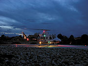
The 2006 Mercy Air helicopter accident occurred on December 10, 2006, about 1755 Pacific standard time, when a Bell 412
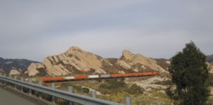
SP helicopter, call sign "Mercy Air 2," impacted mountainous terrain near Hesperia, California
and the Cajon Pass
. The commercial helicopter pilot and two medical crew members were killed and the helicopter was destroyed, by the impact and post impact fire.
On July 30, 2008, the National Transportation Safety Board
released its probable cause report on the accident. According to the NTSB, the probable cause of the crash was "the pilot's inadvertent encounter with instrument meteorological conditions and subsequent failure to maintain terrain clearance." The dark night conditions, fog, and mountainous terrain were ruled to be contributing factors.
(94CL), Loma Linda, California
, at 1742, with a planned destination of Southern California Logistics Airport
(VCV), Victorville, California
. Mercy Air 2 had transported a woman injured in a horse-riding accident in Phelan, California
,
to Loma Linda, and was returning to their assigned base at the time of the accident with no one else aboard. LifeNet, Inc., d.b.a. Mercy Air Service, Inc., was operating the helicopter under the provisions of 14 CFR Part 91. An FAA representative stated the helicopter was being operated under visual flight rules
and was not being handled by air traffic control, a practice he called "perfectly normal."
At 1800, the San Bernardino County Fire Department dispatch center started to receive numerous calls of an object falling from the sky, an explosion and fire northeast of Interstate 15
in the area of Oak Hills. The first fire department responders to the accident site reported that the area was covered by intermittent waves of fog, which made it difficult to locate the wreckage.
The accident site was located on mountainous terrain on a 45-degree slope at an elevation of 4000 feet (1,219.2 m) to 4300 feet (1,310.6 m) above mean sea level (msl), below a large electrical transmission tower, a little more than a mile east of I-15, and north of Highway 138. It is in a rural area with dirt roads, and no streetlights. The approximate global positioning system (GPS) coordinates of the primary wreckage were: 34°20.534′N 117°25.884′W.
First Responders reported that upon their arrival the scene was fully engulfed in fire. The post impact fire consumed approximately 2 acres (8,093.7 m²) of mountainside, and made any reconstruction of the wreckage impossible. The first identified point of impact, a ground scar located next to the separated tail boom and the left skid, was near the base of the mountainous terrain with the debris path emanating upslope. The debris path consisted of the tail boom, both skids, both engines, the main rotor assembly, and various other fuselage panels. The energy path was measured on a 155-degree bearing from the first identified impact point.
No distress call was received from the aircraft. Initial speculation that the aircraft went down after hitting electrical wires was quickly eliminated as a cause. Examination of the maintenance and flight department records revealed no unresolved maintenance discrepancies against the helicopter prior to departure. The helicopter was built in 1987 and refurbished in May 2004, and had no previous accident history.
 Visual meteorological conditions predominantly prevailed along the route of flight, and a company visual flight rules (VFR) flight plan
had been filed. The Cajon Pass area is known for high wind, turbulence and fog. Fog was heavy due to a marine layer that rolled in at 4000 feet (1,219.2 m) and winds were said to be erratic.
Reported weather conditions from VCV, 15 nautical miles (27.8 km) northeast of the accident site, were visibility 10 smi; a broken cloud layer at 3800 feet (1,158.2 m), and an overcast cloud layer at 4900 feet (1,493.5 m); temperature 11 degrees Celsius; dew point 3 degrees Celsius; altimeter 30.17 inHg (1,021.7 hPa). Weather conditions at Ontario International Airport
, Ontario, California
, 19 nmi (35.2 km) southwest of the accident site, were visibility 10 smi; a broken cloud layer at 3800 feet (1,158.2 m), and an overcast cloud layer at 5500 feet (1,676.4 m); temperature 13 degrees Celsius; dew point 6 degrees Celsius; altimeter 30.19 inHg (1,022.4 hPa).
The National Transportation Safety Board
(NTSB) investigator-in-charge (IIC) reviewed the data from the Outerlink system. The satellite data indicated that the helicopter departed from 94CL and flew towards the Cajon Pass in a northwest direction. The flight path then followed the northbound Interstate 15 until it had almost reached the summit of the Cajon Pass. The global positioning system (GPS) tracked the helicopter as it continued toward the northeast while the Interstate turned toward the north. The last known position of Mercy Air 2 was recorded at 1755, and was 0.3 nautical miles (555.6 m) northwest of the first identified impact point.
 The Victorville-based flight crew lost in the accident were pilot Paul LaTour, 46, of Apple Valley
; flight nurse Katrina J. Kish, 42, of Moreno Valley
; and flight paramedic Jerald W. Miller, 40, of Apple Valley. LaTour joined Mercy Flight a year before the accident, after retiring from the U.S. Army with the rank of chief warrant officer
.
He was a military pilot with over 3,000 hours of flight time in his 18 year flying career, and was last stationed at Fort Irwin, where he worked as a flight instructor
.
Kish, had volunteered as a reserve deputy with the San Bernardino County Sheriff's Department, and had a 9 year old son. Miller had been married on a cruise just months before.
-based parent company of Mercy Air, is the largest emergency medical services
helicopter operator in the United States
, with a fleet of 208 medical transport helicopters at the time of this accident. Air Methods had, after this accident, a total of 19 accidents leading to the deaths of 21 people nationwide according to the National Transportation Safety Board's records. Air Methods companies have had three other fatal accidents, in the last 10 years. On September 7, 2002, three crew members died when a Mercy Air helicopter based in Nevada
crashed in Nipton, California
after the main rotor blades separated while maneuvering in flight after dark. In January 2005, an Air Methods helicopter crashed in Washington, D.C.
with two dead and one injured, and another crashed in Mississippi
killing one. Craig Yale, the vice president of corporate development for Air Methods, stated in a news conference shortly after the accident that, "We fly over 100,000 hours a year, 85,000 missions a year, and in doing so have had very few fatal accidents over a 10-year period."
estimates there are 650 emergency medical helicopters in operation in the United States.
In a 2006 NTSB special investigation report on the industry, the board reported emergency medical helicopter flight hours increased by 54 percent since 1991, but the rate of accidents per 100,000 flight hours increased 77 percent. FAA reports show that these accidents frequently involve controlled flight into terrain
, spatial disorientation
, and weather. "On the accident reports I have reviewed, there doesn't appear to be a common thread linking these accidents," according to independent safety expert Barry Schiff
. But three out of four of those accidents occurred when no patient was on board the aircraft — a fact aviation lawyer and helicopter-pilot Justin Green said is attributed to lax regulations by the FAA. When no patient or organ is aboard, the helicopters can be operated VFR under less restrictive Part 91 regulations, as the accident flight was. The NTSB had previously recommended that the FAA require all operations to be conducted under the more restrictive Part 135 regulations whenever medical personnel are on board.
in the high desert region of San Bernardino
and Los Angeles
counties.
Bell 412
The Bell 412 is a utility helicopter manufactured by Bell Helicopter. It is a development of the Bell 212 model, the major difference being the composite four-blade main rotor.-Design and development:...
SP helicopter, call sign "Mercy Air 2," impacted mountainous terrain near Hesperia, California
Hesperia, California
Hesperia is a city in San Bernardino County, California, United States. It is located in the Mojave Desert north of San Bernardino. The locals refer to the surrounding area as the High Desert...
and the Cajon Pass
Cajon Pass
Cajon Pass is a moderate-elevation mountain pass between the San Bernardino Mountains and the San Gabriel Mountains in Southern California in the United States. It was created by the movements of the San Andreas Fault...
. The commercial helicopter pilot and two medical crew members were killed and the helicopter was destroyed, by the impact and post impact fire.
On July 30, 2008, the National Transportation Safety Board
National Transportation Safety Board
The National Transportation Safety Board is an independent U.S. government investigative agency responsible for civil transportation accident investigation. In this role, the NTSB investigates and reports on aviation accidents and incidents, certain types of highway crashes, ship and marine...
released its probable cause report on the accident. According to the NTSB, the probable cause of the crash was "the pilot's inadvertent encounter with instrument meteorological conditions and subsequent failure to maintain terrain clearance." The dark night conditions, fog, and mountainous terrain were ruled to be contributing factors.
Accident details
The Bell 412SP helicopter took off on a cross-country repositioning flight from Loma Linda University Medical CenterLoma Linda University Medical Center
Loma Linda University Medical Center is a teaching hospital on the campus of Loma Linda University in Loma Linda, California, United States. The medical center serves as a level I trauma center for San Bernardino County and the rest of the Inland Empire. It is one of two closest trauma centers for...
(94CL), Loma Linda, California
Loma Linda, California
Loma Linda is a city in San Bernardino County, California, United States, that was incorporated in 1970. The population was 23,261 at the 2010 census, up from 18,681 at the 2000 census...
, at 1742, with a planned destination of Southern California Logistics Airport
Southern California Logistics Airport
Southern California Logistics Airport , also known as Victorville Airport, is a public airport located in the city of Victorville in San Bernardino County, California approximately north of San Bernardino...
(VCV), Victorville, California
Victorville, California
Victorville is a city located in the Victor Valley of southwestern San Bernardino County, California. According to the U.S. Census Bureau's 2010 census, the city had a population of 115,903, up from 64,030 at the 2000 census.-Geography and climate:...
. Mercy Air 2 had transported a woman injured in a horse-riding accident in Phelan, California
Phelan, California
Phelan is an unincorporated community and census-designated place in San Bernardino County, California, in the Victor Valley of the Mojave Desert, north of the San Gabriel Mountains. The population was 14,304 in the 2010 census.-Geography:...
,
to Loma Linda, and was returning to their assigned base at the time of the accident with no one else aboard. LifeNet, Inc., d.b.a. Mercy Air Service, Inc., was operating the helicopter under the provisions of 14 CFR Part 91. An FAA representative stated the helicopter was being operated under visual flight rules
Visual flight rules
Visual flight rules are a set of regulations which allow a pilot to operate an aircraft in weather conditions generally clear enough to allow the pilot to see where the aircraft is going. Specifically, the weather must be better than basic VFR weather minimums, as specified in the rules of the...
and was not being handled by air traffic control, a practice he called "perfectly normal."
At 1800, the San Bernardino County Fire Department dispatch center started to receive numerous calls of an object falling from the sky, an explosion and fire northeast of Interstate 15
Interstate 15 in California
In the U.S. state of California, Interstate 15 is a major north–south route through the San Bernardino, Riverside, and San Diego Counties, and it has a length of in the state. It is a major thoroughfare for traffic between Southern California and Las Vegas, Nevada, as well as points beyond...
in the area of Oak Hills. The first fire department responders to the accident site reported that the area was covered by intermittent waves of fog, which made it difficult to locate the wreckage.
The accident site was located on mountainous terrain on a 45-degree slope at an elevation of 4000 feet (1,219.2 m) to 4300 feet (1,310.6 m) above mean sea level (msl), below a large electrical transmission tower, a little more than a mile east of I-15, and north of Highway 138. It is in a rural area with dirt roads, and no streetlights. The approximate global positioning system (GPS) coordinates of the primary wreckage were: 34°20.534′N 117°25.884′W.
First Responders reported that upon their arrival the scene was fully engulfed in fire. The post impact fire consumed approximately 2 acres (8,093.7 m²) of mountainside, and made any reconstruction of the wreckage impossible. The first identified point of impact, a ground scar located next to the separated tail boom and the left skid, was near the base of the mountainous terrain with the debris path emanating upslope. The debris path consisted of the tail boom, both skids, both engines, the main rotor assembly, and various other fuselage panels. The energy path was measured on a 155-degree bearing from the first identified impact point.
No distress call was received from the aircraft. Initial speculation that the aircraft went down after hitting electrical wires was quickly eliminated as a cause. Examination of the maintenance and flight department records revealed no unresolved maintenance discrepancies against the helicopter prior to departure. The helicopter was built in 1987 and refurbished in May 2004, and had no previous accident history.
Weather information
Flight plan
Flight plans are documents filed by pilots or a Flight Dispatcher with the local Civil Aviation Authority prior to departure...
had been filed. The Cajon Pass area is known for high wind, turbulence and fog. Fog was heavy due to a marine layer that rolled in at 4000 feet (1,219.2 m) and winds were said to be erratic.
Reported weather conditions from VCV, 15 nautical miles (27.8 km) northeast of the accident site, were visibility 10 smi; a broken cloud layer at 3800 feet (1,158.2 m), and an overcast cloud layer at 4900 feet (1,493.5 m); temperature 11 degrees Celsius; dew point 3 degrees Celsius; altimeter 30.17 inHg (1,021.7 hPa). Weather conditions at Ontario International Airport
Ontario International Airport
LA/Ontario International Airport , formerly Ontario International Airport, is a public airport located east of the central business district of Ontario, a city in San Bernardino County, California, USA. This airport is owned and operated by the Los Angeles World Airports , an agency of the city...
, Ontario, California
Ontario, California
Ontario is a city located in San Bernardino County, California, United States, 35 miles east of downtown Los Angeles. Located in the western part of the Inland Empire region, it lies just east of the Los Angeles county line and is part of the Greater Los Angeles Area...
, 19 nmi (35.2 km) southwest of the accident site, were visibility 10 smi; a broken cloud layer at 3800 feet (1,158.2 m), and an overcast cloud layer at 5500 feet (1,676.4 m); temperature 13 degrees Celsius; dew point 6 degrees Celsius; altimeter 30.19 inHg (1,022.4 hPa).
GPS data
Mercy Air 2 was equipped with the OuterLink Automatic Flight Following System, a satellite-based tracking system that reports the helicopter's location to the ground base while it is in operation. The unit installed in the accident helicopter reported the following parameters every 30 seconds: date, time, latitude, and longitude. The installed system was capable of recording the altitude and airspeed, but Mercy Air had not yet installed the software upgrade required to make those parameters functional.The National Transportation Safety Board
National Transportation Safety Board
The National Transportation Safety Board is an independent U.S. government investigative agency responsible for civil transportation accident investigation. In this role, the NTSB investigates and reports on aviation accidents and incidents, certain types of highway crashes, ship and marine...
(NTSB) investigator-in-charge (IIC) reviewed the data from the Outerlink system. The satellite data indicated that the helicopter departed from 94CL and flew towards the Cajon Pass in a northwest direction. The flight path then followed the northbound Interstate 15 until it had almost reached the summit of the Cajon Pass. The global positioning system (GPS) tracked the helicopter as it continued toward the northeast while the Interstate turned toward the north. The last known position of Mercy Air 2 was recorded at 1755, and was 0.3 nautical miles (555.6 m) northwest of the first identified impact point.
Crew
Apple Valley, California
-Climate:*On average, the warmest month is July.*The highest recorded temperature was in 2002.*On average, the coolest month is December.*The lowest recorded temperature was in 1949.*The most precipitation on average occurs in February.-History:...
; flight nurse Katrina J. Kish, 42, of Moreno Valley
Moreno Valley, California
Moreno Valley is a city located in Riverside County, California.A relatively young city, its rapid growth in the 1980s and the first decade of the 21st century made it second-largest city in Riverside County by population, and one of the Inland Empire's population centers. As of the 2010 census,...
; and flight paramedic Jerald W. Miller, 40, of Apple Valley. LaTour joined Mercy Flight a year before the accident, after retiring from the U.S. Army with the rank of chief warrant officer
Warrant Officer (United States)
In the United States military, the rank of warrant officer is rated as an officer above the senior-most enlisted ranks, as well as officer cadets and candidates, but below the officer grade of O-1...
.
He was a military pilot with over 3,000 hours of flight time in his 18 year flying career, and was last stationed at Fort Irwin, where he worked as a flight instructor
Flight instructor
A flight instructor is a person who teaches others to fly aircraft. Specific privileges granted to holders of a flight instructor qualification vary from country to country, but very generally, a flight instructor serves to enhance or evaluate the knowledge and skill level of an aviator in pursuit...
.
Kish, had volunteered as a reserve deputy with the San Bernardino County Sheriff's Department, and had a 9 year old son. Miller had been married on a cruise just months before.
Company
Air Methods, Corp., the ColoradoColorado
Colorado is a U.S. state that encompasses much of the Rocky Mountains as well as the northeastern portion of the Colorado Plateau and the western edge of the Great Plains...
-based parent company of Mercy Air, is the largest emergency medical services
Emergency medical services
Emergency medical services are a type of emergency service dedicated to providing out-of-hospital acute medical care and/or transport to definitive care, to patients with illnesses and injuries which the patient, or the medical practitioner, believes constitutes a medical emergency...
helicopter operator in the United States
United States
The United States of America is a federal constitutional republic comprising fifty states and a federal district...
, with a fleet of 208 medical transport helicopters at the time of this accident. Air Methods had, after this accident, a total of 19 accidents leading to the deaths of 21 people nationwide according to the National Transportation Safety Board's records. Air Methods companies have had three other fatal accidents, in the last 10 years. On September 7, 2002, three crew members died when a Mercy Air helicopter based in Nevada
Nevada
Nevada is a state in the western, mountain west, and southwestern regions of the United States. With an area of and a population of about 2.7 million, it is the 7th-largest and 35th-most populous state. Over two-thirds of Nevada's people live in the Las Vegas metropolitan area, which contains its...
crashed in Nipton, California
Nipton, California
Nipton is an unincorporated town in San Bernardino County, California, on the northern edge of Mojave National Preserve, west of Searchlight, Nevada. It has a population of 20 people....
after the main rotor blades separated while maneuvering in flight after dark. In January 2005, an Air Methods helicopter crashed in Washington, D.C.
Washington, D.C.
Washington, D.C., formally the District of Columbia and commonly referred to as Washington, "the District", or simply D.C., is the capital of the United States. On July 16, 1790, the United States Congress approved the creation of a permanent national capital as permitted by the U.S. Constitution....
with two dead and one injured, and another crashed in Mississippi
Mississippi
Mississippi is a U.S. state located in the Southern United States. Jackson is the state capital and largest city. The name of the state derives from the Mississippi River, which flows along its western boundary, whose name comes from the Ojibwe word misi-ziibi...
killing one. Craig Yale, the vice president of corporate development for Air Methods, stated in a news conference shortly after the accident that, "We fly over 100,000 hours a year, 85,000 missions a year, and in doing so have had very few fatal accidents over a 10-year period."
Industry
The U.S. Federal Aviation AdministrationFederal Aviation Administration
The Federal Aviation Administration is the national aviation authority of the United States. An agency of the United States Department of Transportation, it has authority to regulate and oversee all aspects of civil aviation in the U.S...
estimates there are 650 emergency medical helicopters in operation in the United States.
In a 2006 NTSB special investigation report on the industry, the board reported emergency medical helicopter flight hours increased by 54 percent since 1991, but the rate of accidents per 100,000 flight hours increased 77 percent. FAA reports show that these accidents frequently involve controlled flight into terrain
Controlled flight into terrain
Controlled flight into terrain describes an accident in which an airworthy aircraft, under pilot control, is unintentionally flown into the ground, a mountain, water, or an obstacle. The term was coined by engineers at Boeing in the late 1970s...
, spatial disorientation
Spatial disorientation
Spatial disorientation is the inability to correctly interpret aircraft attitude, altitude or airspeed, in relation to the Earth or point of reference. Spatial disorientation is a condition in which an aircraft pilot's perception of direction does not agree with reality...
, and weather. "On the accident reports I have reviewed, there doesn't appear to be a common thread linking these accidents," according to independent safety expert Barry Schiff
Barry Schiff
Barry Schiff is a pilot and author of more than 1,500 articles published in 90 aviation magazines, notably AOPA Pilot of which he is a contributing editor. Schiff holds 10 journalism awards from the Aviation/Space Writers Association and four special awards from the FAA...
. But three out of four of those accidents occurred when no patient was on board the aircraft — a fact aviation lawyer and helicopter-pilot Justin Green said is attributed to lax regulations by the FAA. When no patient or organ is aboard, the helicopters can be operated VFR under less restrictive Part 91 regulations, as the accident flight was. The NTSB had previously recommended that the FAA require all operations to be conducted under the more restrictive Part 135 regulations whenever medical personnel are on board.
San Bernardino County medevac controversy
At the time of this accident, Mercy Air was San Bernardino County's only private, permitted helicopter ambulance service provider. A November 2005 Grand Jury report indicated that campaign contributions by Mercy Air were a factor in the San Bernardino County Board of Supervisors decisions making Mercy Air the sole air ambulance provider authorized to operate in the county, which is the largest by land area in the Continental United States, larger than some states. Both the company and board officials denied this.Post accident information
The company grounded most of its fleet following the Sunday evening crash, and began resuming normal operations two days later on Tuesday December 12, 2006. An estimated 3,000 people, mostly uniformed nurses, medics and firefighters, attended a three-hour memorial for the flight crew a week after the accident. This accident also lead to increased efforts to establish a trauma centerTrauma center
A trauma center is a hospital equipped to provide comprehensive emergency medical services to patients suffering traumatic injuries. Trauma centers grew into existence out of the realization that traumatic injury is a disease process unto itself requiring specialized and experienced...
in the high desert region of San Bernardino
San Bernardino, California
San Bernardino is a city located in the Riverside-San Bernardino metropolitan area , and serves as the county seat of San Bernardino County, California, United States...
and Los Angeles
Los Angeles County, California
Los Angeles County is a county in the U.S. state of California. As of 2010 U.S. Census, the county had a population of 9,818,605, making it the most populous county in the United States. Los Angeles County alone is more populous than 42 individual U.S. states...
counties.
External links
- Three killed in Mercy Air helicopter crash Flight Web news summary
- Mercy Air picture gallery 12/11/2006 from the Press EnterprisePress EnterprisePress Enterprise may refer to:*The Press-Enterprise , a daily newspaper published in Riverside, California, United States.*Press Enterprise , a daily newspaper published in Bloomsburg, Pennsylvania, United States....