
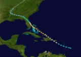
1926 Atlantic hurricane season
Encyclopedia
A Cape Verde-type hurricane
reached Category 4 strength over the open Atlantic Ocean on September. It turned to the northeast, looped, and became extratropical on September 21. A slow moving hurricane, it stayed alive for a very long time, lasting 23 days, from September 1 to September 24.
. It headed north-northwestward and strengthened, peaking with winds of 100 mph (155 km/h). It turned slowly southeastward and weakened, dissipating on September 15.
. It curved northeastward, crossed Cuba
, turned slowly to the southwest, and grazed the Florida Keys
, where it dissipated on September 17.
directly as a Category 4 hurricane on September 16. The storm surge
tore through the city, gutting homes and businesses. Lines of people were washed away. The calm of the eye proved fatal for many who thought the storm was over, for the second half of the storm was worse than the first. 265-350 people were killed, mostly in Florida
. Several dozen were killed when the hurricane skimmed the Gulf coasts of the Florida Panhandle
, Alabama
, and Mississippi
.
Throughout the Bahamas, reports of damage were relatively scarce despite the intensity in which the storm struck the region. At least 17 people are known to have died and numerous structures were completely destroyed. Within days of the hurricane striking Miami, newspapers reported death tolls as high as 1,200, fearing catastrophic damage in the city. This number gradually decreased as persons initially feared dead were found alive. According to estimates in 2007, the storm was responsible for 374 deaths in the Southeastern United States, most of which took place in Miami. In terms of monetary losses, damage from the hurricane was estimated to be as high as $125 million ($ USD
). Thousands of structures throughout southern Florida were destroyed, leaving at least 38,000 people homeless. In a study of hurricane damage statistics conducted in 2008, it was estimated that if a storm similar to that of the Miami hurricane were to occur in 2005 it would result in over $140–157 billion in damage.
Islands. After the loop, it moved south-southeast and weakened, dissipating on October 1.
HMS Valerian, based at the HMD Bermuda
, was returning from providing hurricane relief in the Bahamas and was overtaken by the storm shortly before she could make harbour. Unable to enter through Bermuda
's reefline, she fought the storm for more than five hours before she was sunk with the loss of eighty-five men. The British merchant ship the Eastway was also sunk near Bermuda. Although the Valerian's commanding officer, Commander Usher, reported that there was no sign of a major storm at 08:00, when his ship was in sight of Bermuda, and when the British Army
meteorologists at Prospect Camp measured the wind at 28 mph. By 10:00, the winds had reached 95 mph. When the centre of the storm passed over Bermuda at noon, the winds dropped to 8 mph, then increased to 114 mph, whereupon the Army took down its anemometer
to protect it. The Royal Naval Dockyard was being hammered severely and never took its anemometer down. It measured 138 mph at 13:00 (about the same time the Valerian went down), before the wind destroyed it.
The storm became extratropical on October 23.
Striking Cuba with winds up to 145 mph (230 km/h), the hurricane caused catastrophic damage and a large loss of life. Several small towns in the storm's path were completely destroyed and damage estimates exceeded $100 million ($ USD).
Cape Verde-type hurricane
A Cape Verde-type hurricane is an Atlantic hurricane that develops near the Cape Verde islands, off the west coast of Africa. The average hurricane season has about two Cape Verde-type hurricanes, which are usually the largest and most intense storms of the season because they often have plenty of...
reached Category 4 strength over the open Atlantic Ocean on September. It turned to the northeast, looped, and became extratropical on September 21. A slow moving hurricane, it stayed alive for a very long time, lasting 23 days, from September 1 to September 24.
Hurricane Five
By September 10 (possibly earlier due to sparse data), a tropical storm developed over the open Atlantic northeast of the Lesser AntillesLesser Antilles
The Lesser Antilles are a long, partly volcanic island arc in the Western Hemisphere. Most of its islands form the eastern boundary of the Caribbean Sea with the Atlantic Ocean, with the remainder located in the southern Caribbean just north of South America...
. It headed north-northwestward and strengthened, peaking with winds of 100 mph (155 km/h). It turned slowly southeastward and weakened, dissipating on September 15.
Tropical Storm Six
A tropical storm was first seen on September 11 in the Caribbean SeaCaribbean Sea
The Caribbean Sea is a sea of the Atlantic Ocean located in the tropics of the Western hemisphere. It is bounded by Mexico and Central America to the west and southwest, to the north by the Greater Antilles, and to the east by the Lesser Antilles....
. It curved northeastward, crossed Cuba
Cuba
The Republic of Cuba is an island nation in the Caribbean. The nation of Cuba consists of the main island of Cuba, the Isla de la Juventud, and several archipelagos. Havana is the largest city in Cuba and the country's capital. Santiago de Cuba is the second largest city...
, turned slowly to the southwest, and grazed the Florida Keys
Florida Keys
The Florida Keys are a coral archipelago in southeast United States. They begin at the southeastern tip of the Florida peninsula, about south of Miami, and extend in a gentle arc south-southwest and then westward to Key West, the westernmost of the inhabited islands, and on to the uninhabited Dry...
, where it dissipated on September 17.
Hurricane Seven
The most notable storm of the season was the Great Miami Hurricane. It struck MiamiMiami, Florida
Miami is a city located on the Atlantic coast in southeastern Florida and the county seat of Miami-Dade County, the most populous county in Florida and the eighth-most populous county in the United States with a population of 2,500,625...
directly as a Category 4 hurricane on September 16. The storm surge
Storm surge
A storm surge is an offshore rise of water associated with a low pressure weather system, typically tropical cyclones and strong extratropical cyclones. Storm surges are caused primarily by high winds pushing on the ocean's surface. The wind causes the water to pile up higher than the ordinary sea...
tore through the city, gutting homes and businesses. Lines of people were washed away. The calm of the eye proved fatal for many who thought the storm was over, for the second half of the storm was worse than the first. 265-350 people were killed, mostly in Florida
Florida
Florida is a state in the southeastern United States, located on the nation's Atlantic and Gulf coasts. It is bordered to the west by the Gulf of Mexico, to the north by Alabama and Georgia and to the east by the Atlantic Ocean. With a population of 18,801,310 as measured by the 2010 census, it...
. Several dozen were killed when the hurricane skimmed the Gulf coasts of the Florida Panhandle
Florida Panhandle
The Florida Panhandle, an informal, unofficial term for the northwestern part of Florida, is a strip of land roughly 200 miles long and 50 to 100 miles wide , lying between Alabama on the north and the west, Georgia also on the north, and the Gulf of Mexico to the south. Its eastern boundary is...
, Alabama
Alabama
Alabama is a state located in the southeastern region of the United States. It is bordered by Tennessee to the north, Georgia to the east, Florida and the Gulf of Mexico to the south, and Mississippi to the west. Alabama ranks 30th in total land area and ranks second in the size of its inland...
, and Mississippi
Mississippi
Mississippi is a U.S. state located in the Southern United States. Jackson is the state capital and largest city. The name of the state derives from the Mississippi River, which flows along its western boundary, whose name comes from the Ojibwe word misi-ziibi...
.
Throughout the Bahamas, reports of damage were relatively scarce despite the intensity in which the storm struck the region. At least 17 people are known to have died and numerous structures were completely destroyed. Within days of the hurricane striking Miami, newspapers reported death tolls as high as 1,200, fearing catastrophic damage in the city. This number gradually decreased as persons initially feared dead were found alive. According to estimates in 2007, the storm was responsible for 374 deaths in the Southeastern United States, most of which took place in Miami. In terms of monetary losses, damage from the hurricane was estimated to be as high as $125 million ($ USD
United States dollar
The United States dollar , also referred to as the American dollar, is the official currency of the United States of America. It is divided into 100 smaller units called cents or pennies....
). Thousands of structures throughout southern Florida were destroyed, leaving at least 38,000 people homeless. In a study of hurricane damage statistics conducted in 2008, it was estimated that if a storm similar to that of the Miami hurricane were to occur in 2005 it would result in over $140–157 billion in damage.
Hurricane Eight
The eighth storm of the season formed in the eastern Atlantic on September 21. It moved to the northeast and strengthened. It peaked as a Category 2 hurricane and made a counter-clockwise loop through the AzoresAzores
The Archipelago of the Azores is composed of nine volcanic islands situated in the middle of the North Atlantic Ocean, and is located about west from Lisbon and about east from the east coast of North America. The islands, and their economic exclusion zone, form the Autonomous Region of the...
Islands. After the loop, it moved south-southeast and weakened, dissipating on October 1.
Tropical Storm Nine
A weak tropical storm formed in the western Caribbean on October 3 and moved westward.Hurricane Ten
On October 14 a tropical storm developed in the southwest Caribbean Sea. It moved northward, becoming a major hurricane on October 20 before crossing Cuba and southeast Florida. It headed northeastward, and strengthened into a Category 4 before hitting Bermuda on October 22. While weather forecasters knew of the storm's approach on Bermuda, it covered the thousand miles from the Bahamas to Bermuda so rapidly it apparently struck with few warning signs aside from heavy swells. On the 21 October, with the eye of the storm still 700 miles from Bermuda, weather forecasts from the US called for it to strike the island on the following morning with gale force. The Arabis class sloopArabis class sloop
The Arabis class was the third class of minesweeping sloops to be built under the Emergency War Programme for the Royal Navy in World War I as part of the larger "Flower Class", which were also referred to as the "Cabbage Class", or "Herbaceous Borders"...
HMS Valerian, based at the HMD Bermuda
Royal Naval Dockyard, Bermuda
HMD Bermuda was the principal base of the Royal Navy in the Western Atlantic between American independence and the Cold War. Bermuda had occupied a useful position astride the homeward leg taken by many European vessels from the New World since before its settlement by England in 1609...
, was returning from providing hurricane relief in the Bahamas and was overtaken by the storm shortly before she could make harbour. Unable to enter through Bermuda
Bermuda
Bermuda is a British overseas territory in the North Atlantic Ocean. Located off the east coast of the United States, its nearest landmass is Cape Hatteras, North Carolina, about to the west-northwest. It is about south of Halifax, Nova Scotia, Canada, and northeast of Miami, Florida...
's reefline, she fought the storm for more than five hours before she was sunk with the loss of eighty-five men. The British merchant ship the Eastway was also sunk near Bermuda. Although the Valerian's commanding officer, Commander Usher, reported that there was no sign of a major storm at 08:00, when his ship was in sight of Bermuda, and when the British Army
British Army
The British Army is the land warfare branch of Her Majesty's Armed Forces in the United Kingdom. It came into being with the unification of the Kingdom of England and Scotland into the Kingdom of Great Britain in 1707. The new British Army incorporated Regiments that had already existed in England...
meteorologists at Prospect Camp measured the wind at 28 mph. By 10:00, the winds had reached 95 mph. When the centre of the storm passed over Bermuda at noon, the winds dropped to 8 mph, then increased to 114 mph, whereupon the Army took down its anemometer
Anemometer
An anemometer is a device for measuring wind speed, and is a common weather station instrument. The term is derived from the Greek word anemos, meaning wind, and is used to describe any airspeed measurement instrument used in meteorology or aerodynamics...
to protect it. The Royal Naval Dockyard was being hammered severely and never took its anemometer down. It measured 138 mph at 13:00 (about the same time the Valerian went down), before the wind destroyed it.
The storm became extratropical on October 23.
Striking Cuba with winds up to 145 mph (230 km/h), the hurricane caused catastrophic damage and a large loss of life. Several small towns in the storm's path were completely destroyed and damage estimates exceeded $100 million ($ USD).
Tropical Storm Eleven
The final storm of the season formed in the Caribbean Sea on November 12. It tracked to the northwest, then curved to the northeast, hitting Cuba on November 16 before dissipating.See also
- List of tropical cyclones
- List of Atlantic hurricane seasons